| NAD83 COORDINATES (1986 adj.): |
|---|
| X= 571436.19 Y= 170697.96 Z= 844.5 2/19/2010 RTK-VRS |
| 6/20/2013 | Found GM at sidewalk grade. |
| 2/19/2010 | Position on the GM established by RTK-VRS Elev. 844.5 ft. Photos taken. EDM ties placed using Sokkia Set 5. |
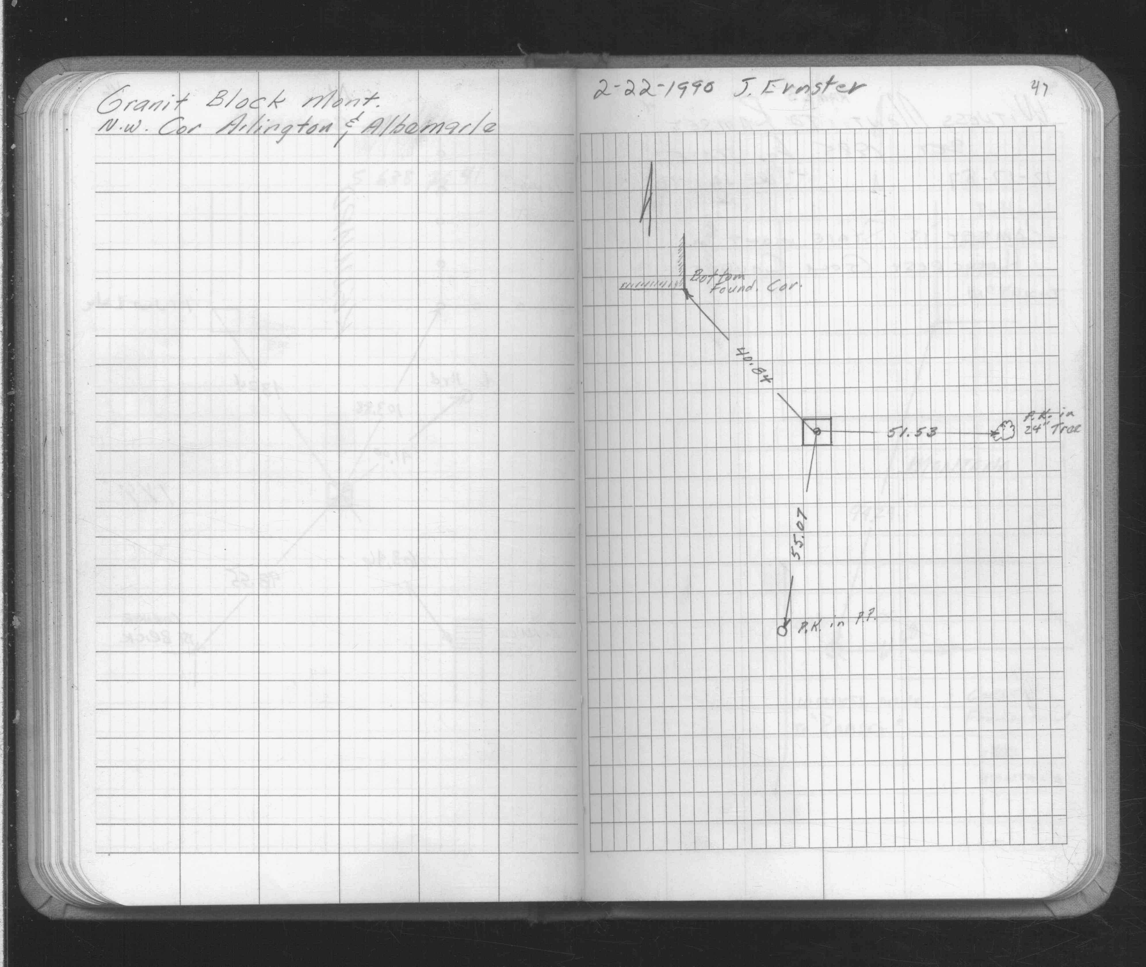
| 2/22/1990 | Fd GM, placed ties. See FB 1689 p.47 |
| 2/10/1892 | Monument set by J B Irvine |
Above is NOT an all inclusive history of this point. Please review all the links below.
| PLS NOTES | Field | Cross Section | Sewer | J.B. Irvine | Monument | River Survey |
|---|---|---|---|---|---|---|
| FB 1689p.47 |
| FILE | SURVEYOR | LIC. NO. | DATE SIGNED | DATE TIED |
|---|---|---|---|---|
| 6075-2530-A.pdf | Samuel D. Gibson | 44880 | March 16, 2010 | February 19, 2010 |
| FILE | PHOTO DATE | COMMENTS |
|---|---|---|
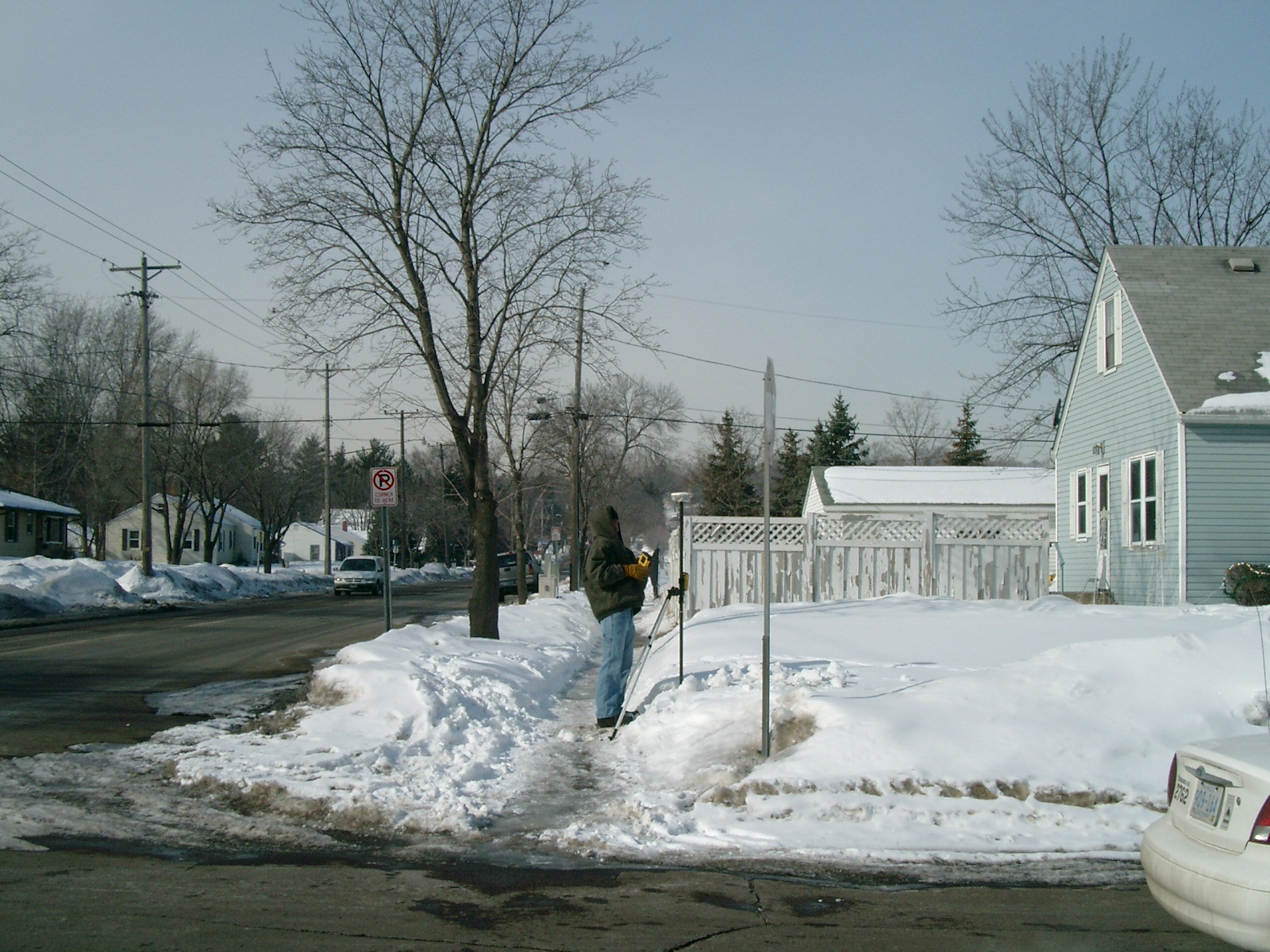
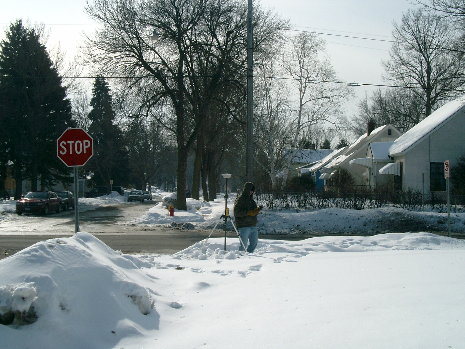
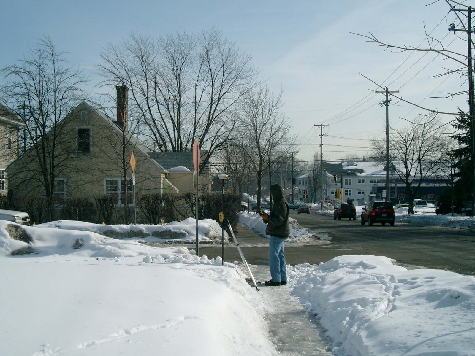
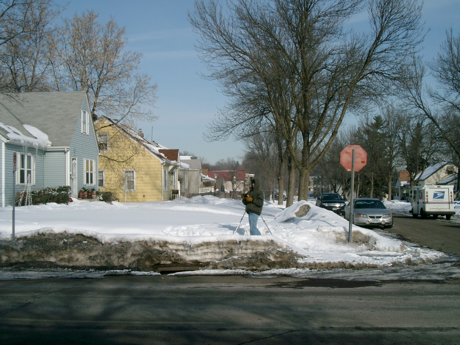
| 6075-2530-5.jpg | February 19, 2010 | Looking West along the North side of Arlington Ave. |
| 6075-2530-4.jpg | February 19, 2010 | Looking South along the West side of Albemarle St. |
| 6075-2530-3.jpg | February 19, 2010 | Looking East along the North side of Arlington Ave. |
| 6075-2530-2.jpg | February 19, 2010 | Looking North along the West side of Albemarle St. |
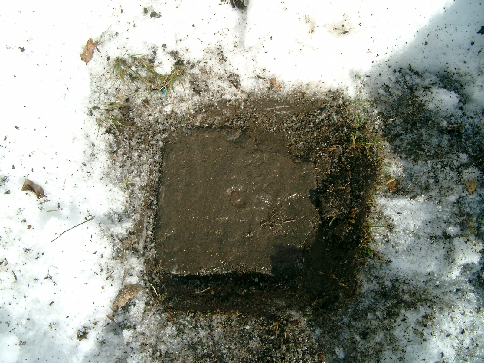
| 6075-2530-1.jpg | February 19, 2010 | Close-up of the GM. |