| 10/17/2013 | Probed 1.4 ft to possible monument. |
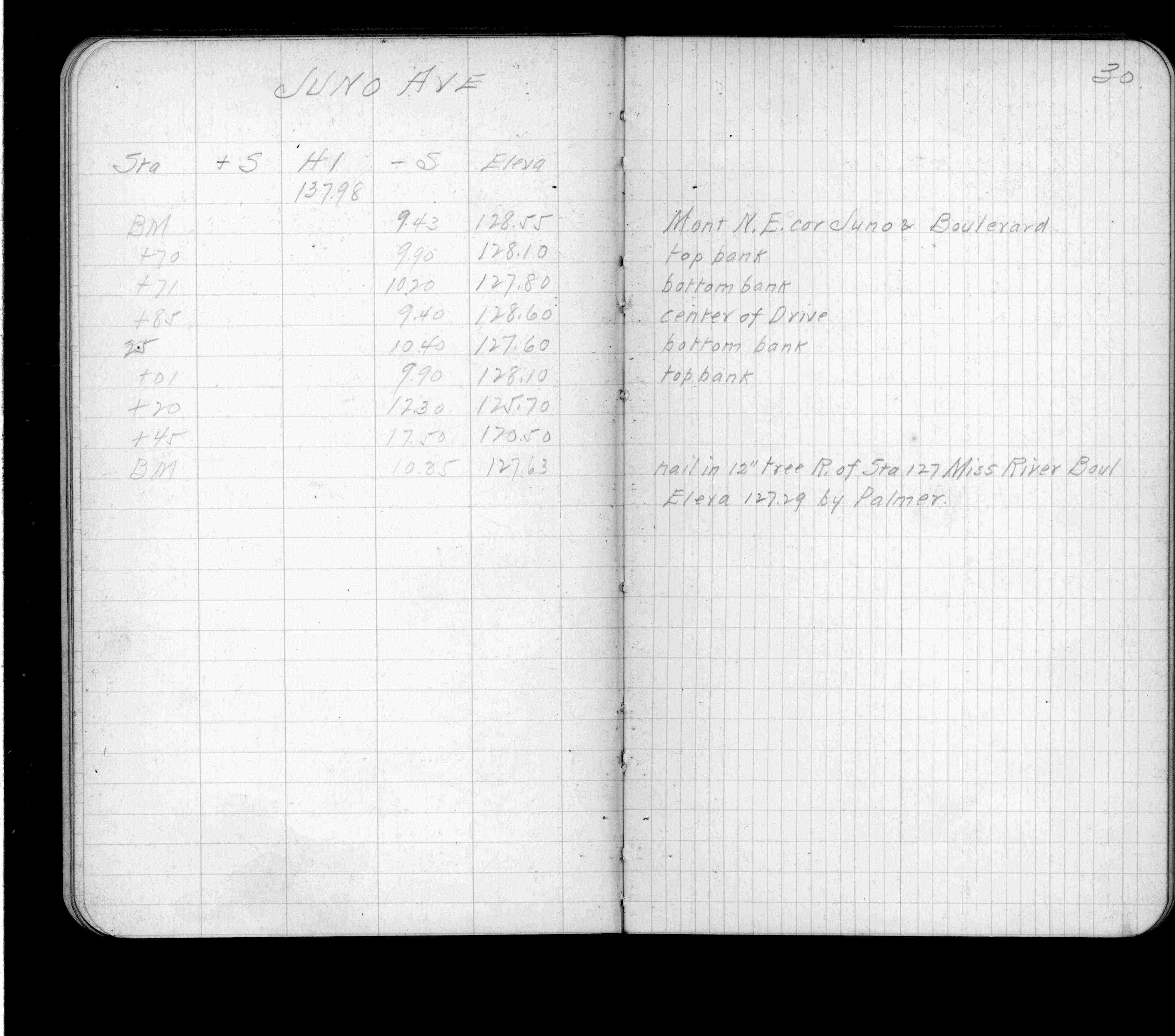
| 3/26/1912 | Elev 128.55 ft. See FB 697 p.30 |
| 2/1/1904 | (Unknown date Feb __, 1904 ) Monument set for Park Board by C F Scheunemann. |
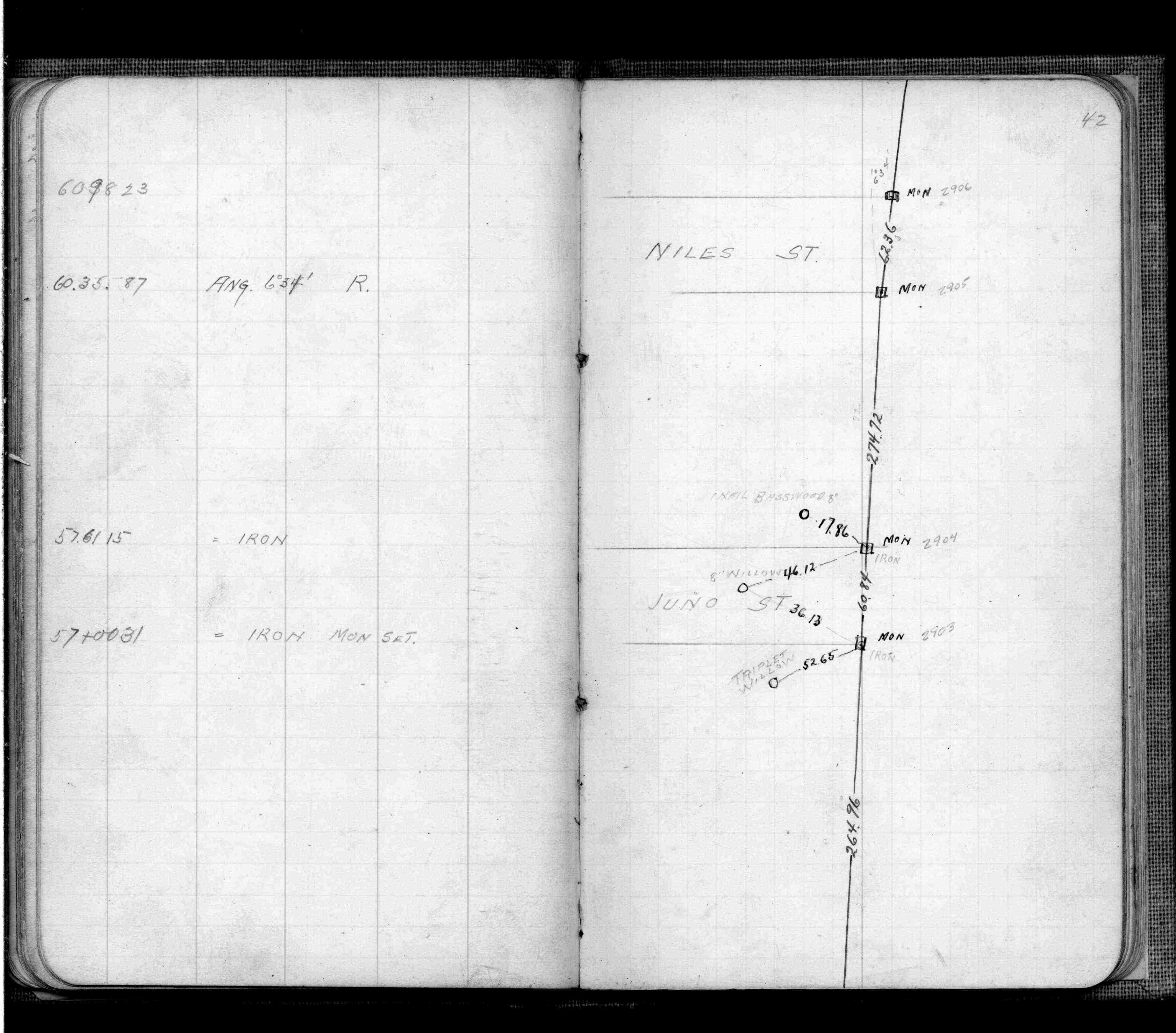
| 9/26/1902 | F OHara running out land lines in connection with Mississippi River Blvd. See FB 474 p.42 |
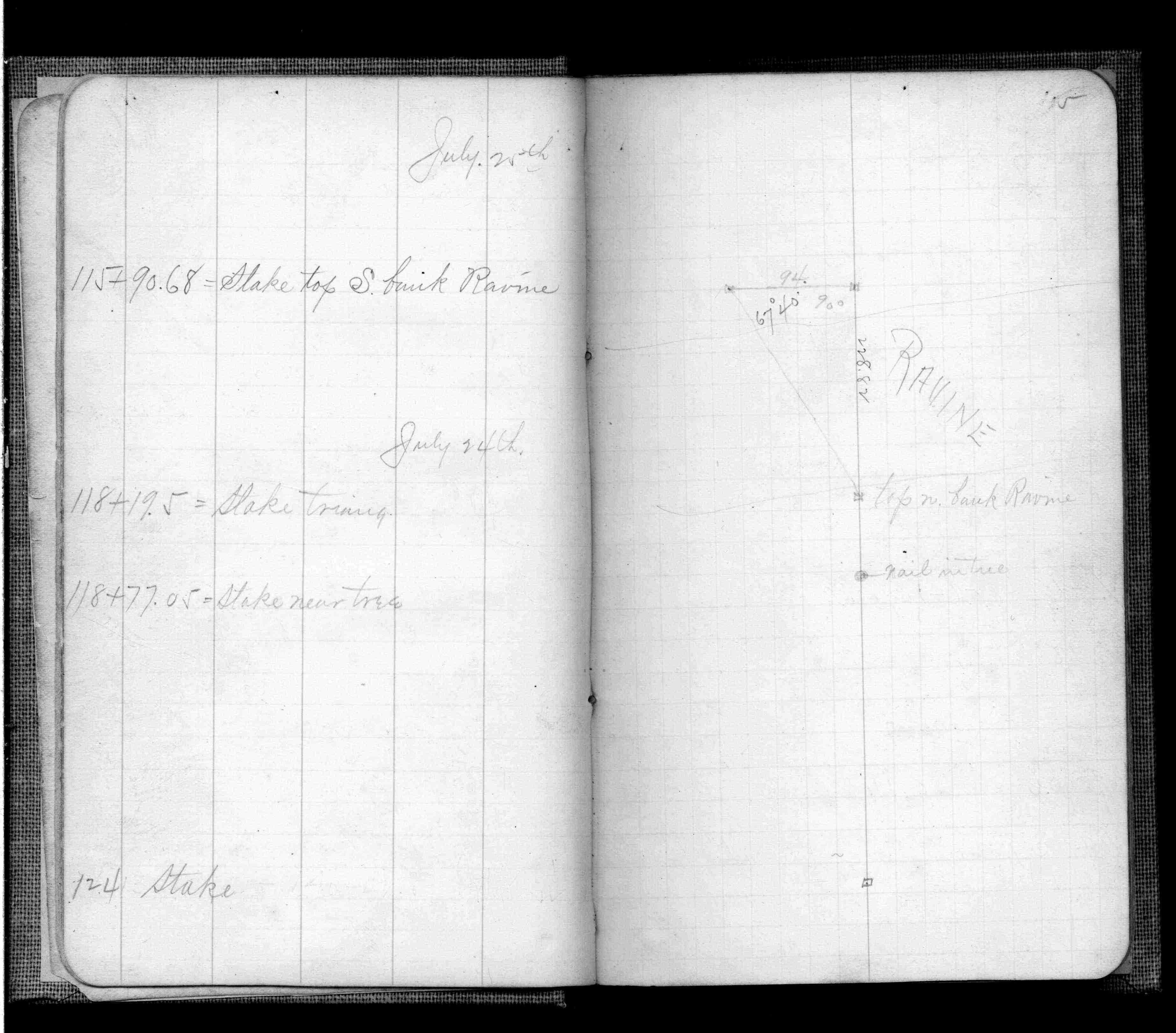
| 7/24/1902 | J B Irvine running out land lines in connection with Mississippi River Blvd. See FB 474 p.5 |
Above is NOT an all inclusive history of this point. Please review all the links below.
| PLS NOTES | Field | Cross Section | Sewer | J.B. Irvine | Monument | River Survey |
|---|---|---|---|---|---|---|
| FB 0474p. 05 ,42 | ||||||
| FB 0697p.30 |