| 10/17/2013 | Probed 1.6 ft to possible GM. |
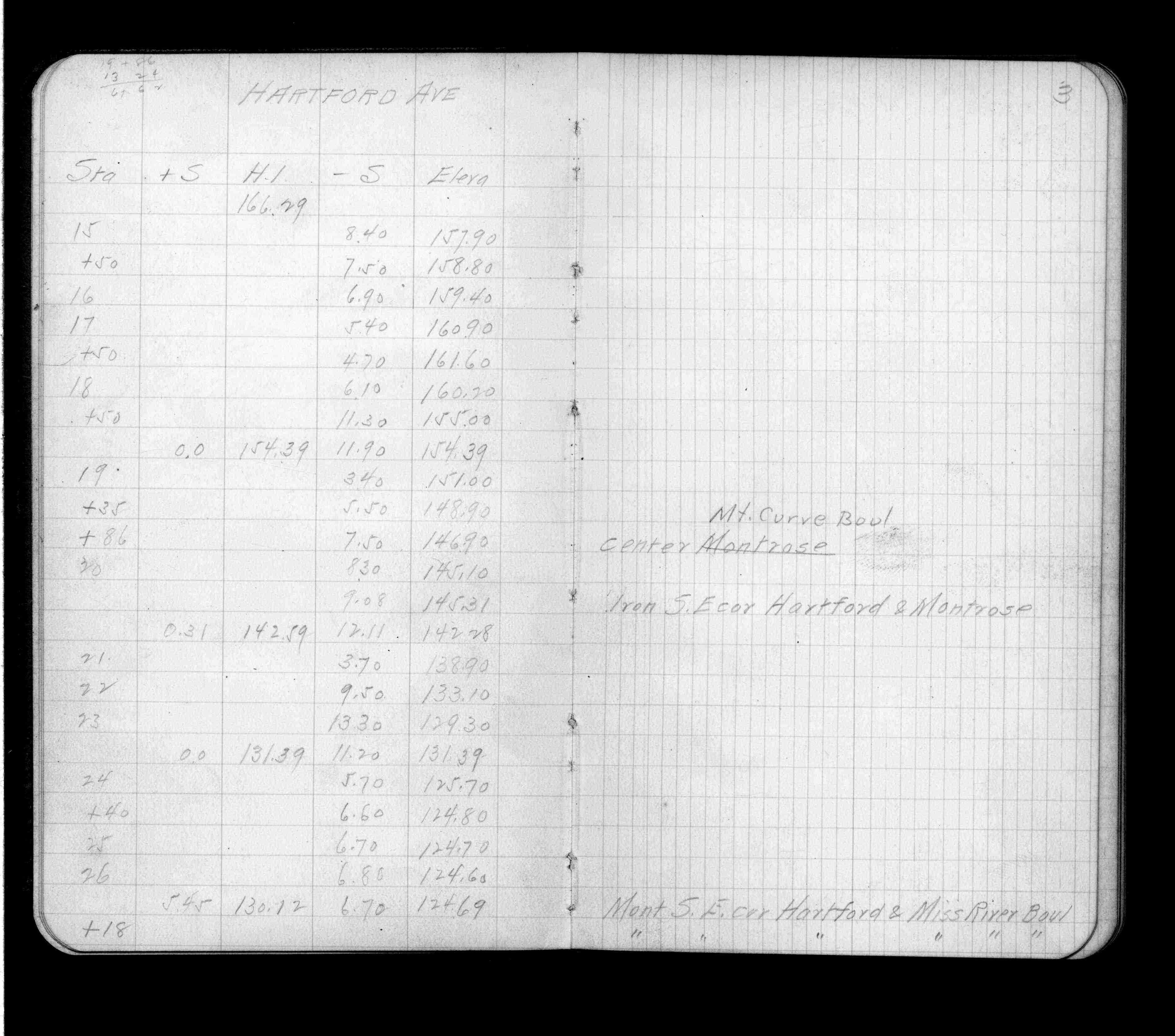
| 3/13/1912 | Elev 124.69 ft. See FB 697 p.3,10 |
| 1/1/1908 | (Unknown date ___ __, 1908 ) Monument set by C F Scheunemann |
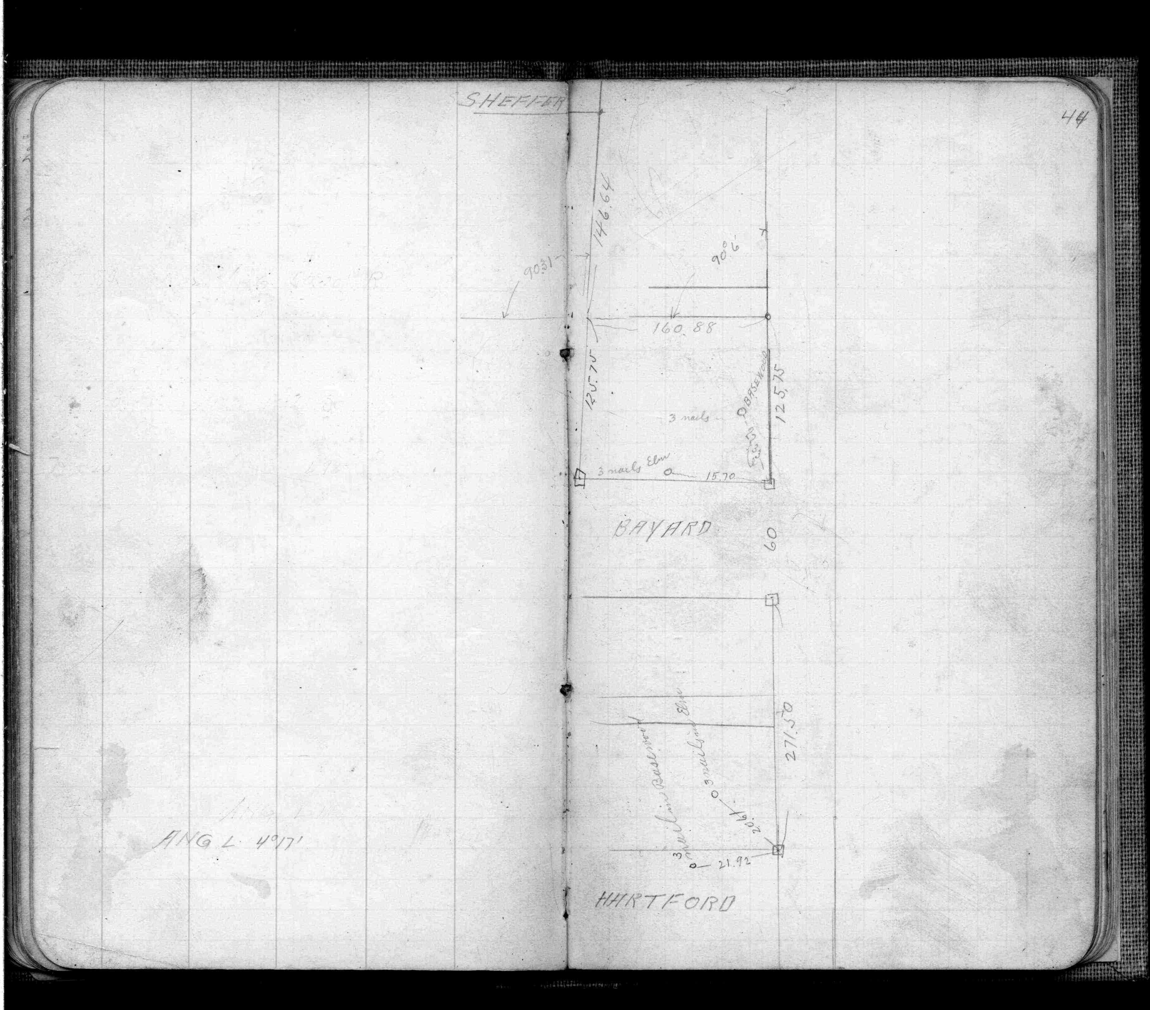
| 9/26/1902 | F OHara running out land lines in connection with Mississippi River Blvd. See FB 474 p.44 |
Above is NOT an all inclusive history of this point. Please review all the links below.
| PLS NOTES | Field | Cross Section | Sewer | J.B. Irvine | Monument | River Survey |
|---|---|---|---|---|---|---|
| FB 0474p.44 | ||||||
| FB 0697p. 03 ,10 |