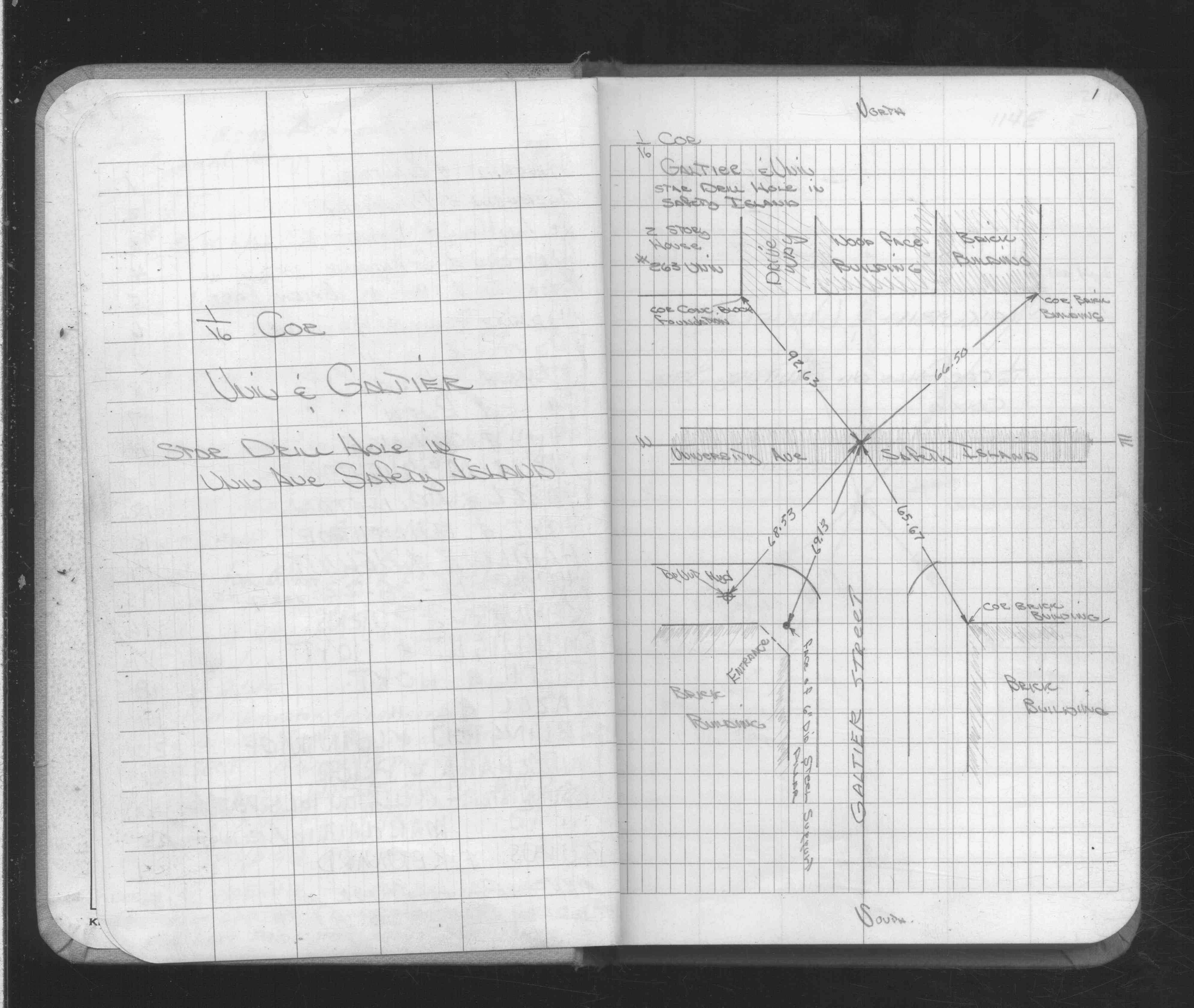
| 1/1/1900 | (Unknown date ___ __, ____ ) Placed ties on drill hole in island. See CofL 0115E-xxxx-A, copied from FB 1689 p.1 |
Above is NOT an all inclusive history of this point. Please review all the links below.
| PLS NOTES | Field | Cross Section | Sewer | J.B. Irvine | Monument | River Survey |
|---|---|---|---|---|---|---|
| FB 1689p.01 |
| FILE | SURVEYOR | LIC. NO. | DATE SIGNED | DATE TIED |
|---|---|---|---|---|
| 0115E-xxxx-A.tif | none | none | none | none |