| 10/17/2013 | Location obstructed by street lighting conduit; unable to probe |
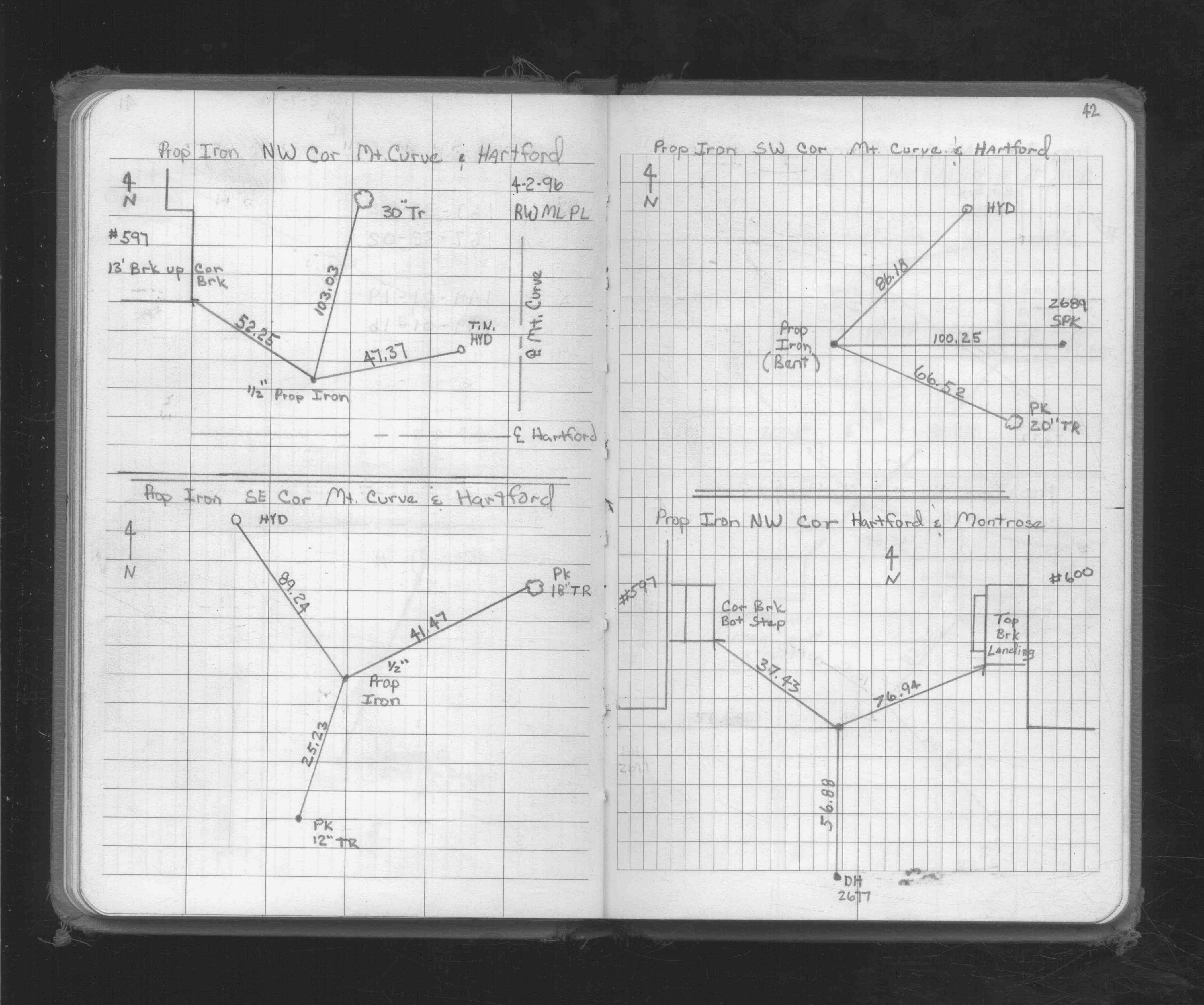
| 4/1/1996 | (Unknown date Apr __, 1996 ) Property Iron Ties. See FB 1719A p.42 |
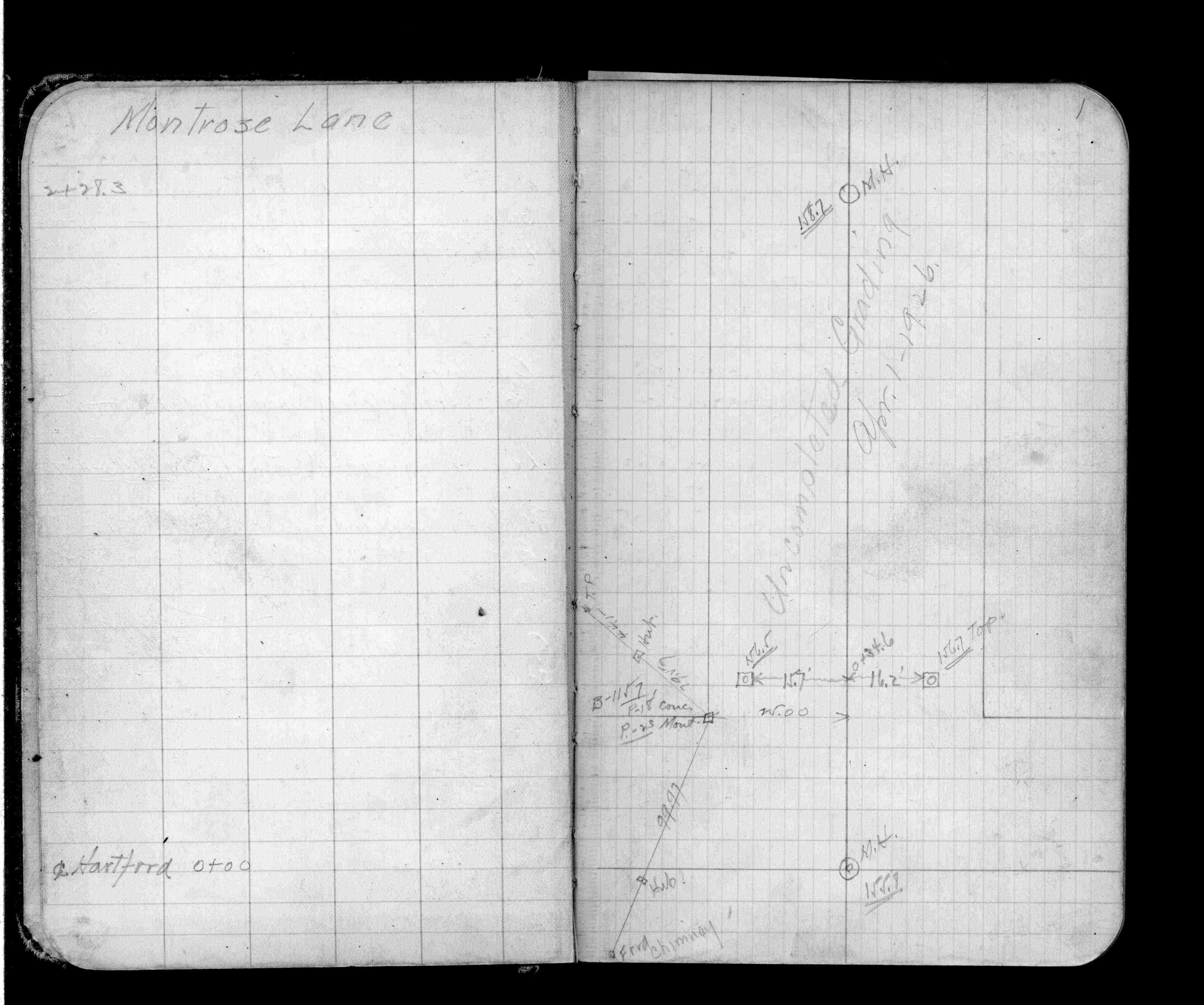
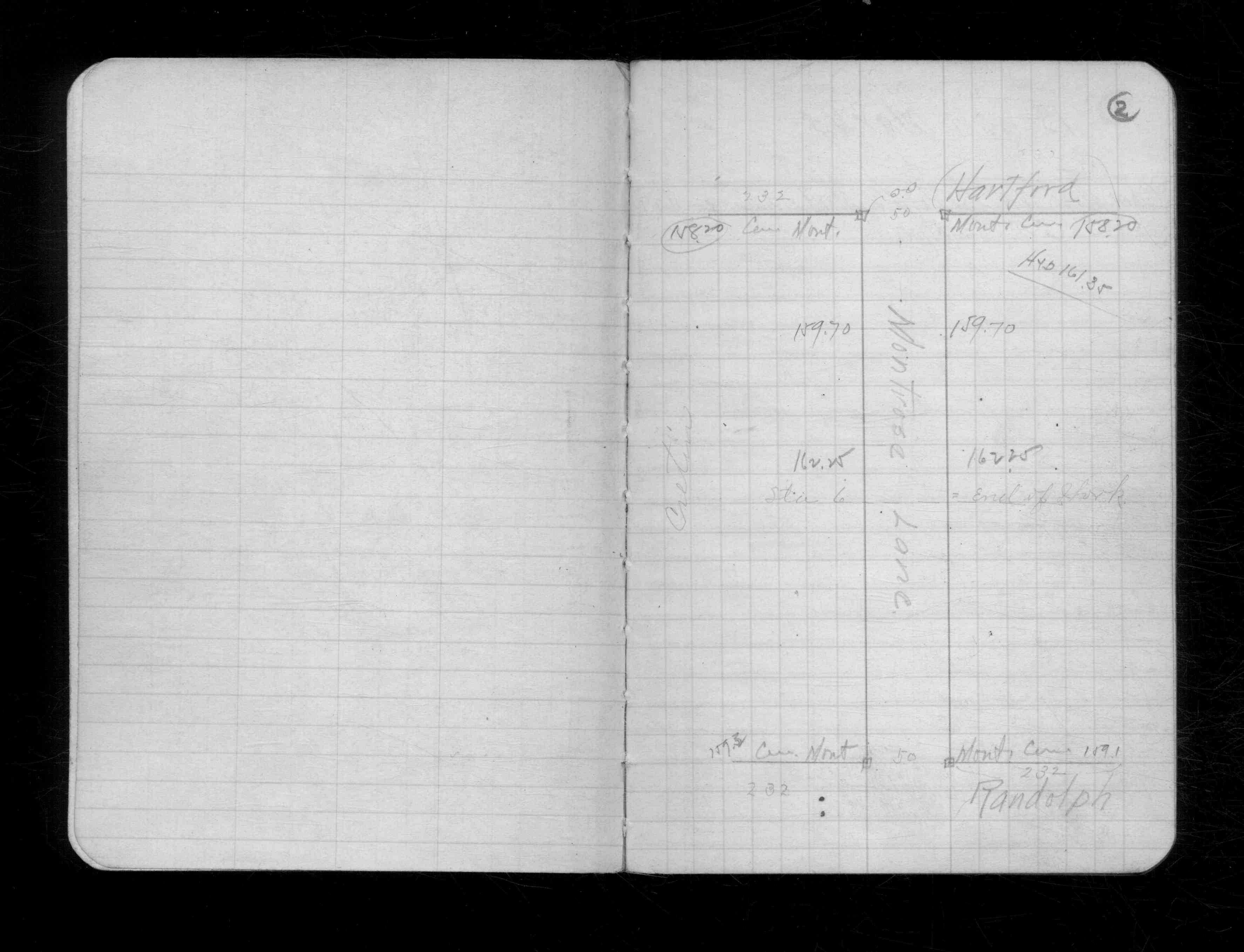
| 4/1/1926 | (Unknown date Apr __, 1926 ) Ties on concrete monument. See FB 1176 p.1 |
| 10/1/1919 | Monument located during a Montrose Lane survey. |
Above is NOT an all inclusive history of this point. Please review all the links below.
| PLS NOTES | Field | Cross Section | Sewer | J.B. Irvine | Monument | River Survey |
|---|---|---|---|---|---|---|
| FB 1176p.01 | CS 1798p.02 | |||||
| FB 1719Ap.42 |