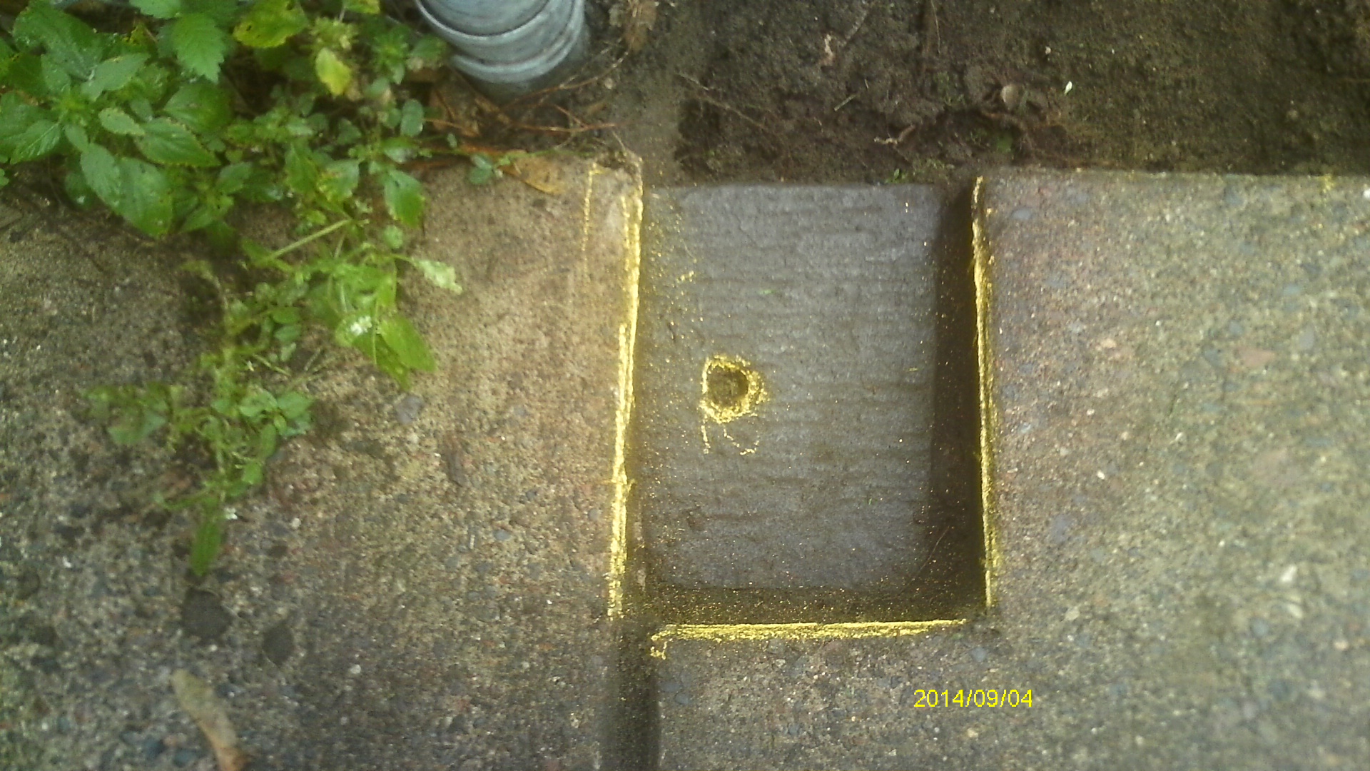
| 9/4/2014 | Found GM 0.3 ft below sidewalk grade. Monument covered by concrete cap. Photos taken and ties placed. |
| 8/1/1920 | Monument was located during a cross section survey on Fry St. |
| 5/4/1909 | Monument was located during a cross section survey on Lafond Ave. |
Above is NOT an all inclusive history of this point. Please review all the links below.
| PLS NOTES | Field | Cross Section | Sewer | J.B. Irvine | Monument | River Survey |
|---|---|---|---|---|---|---|
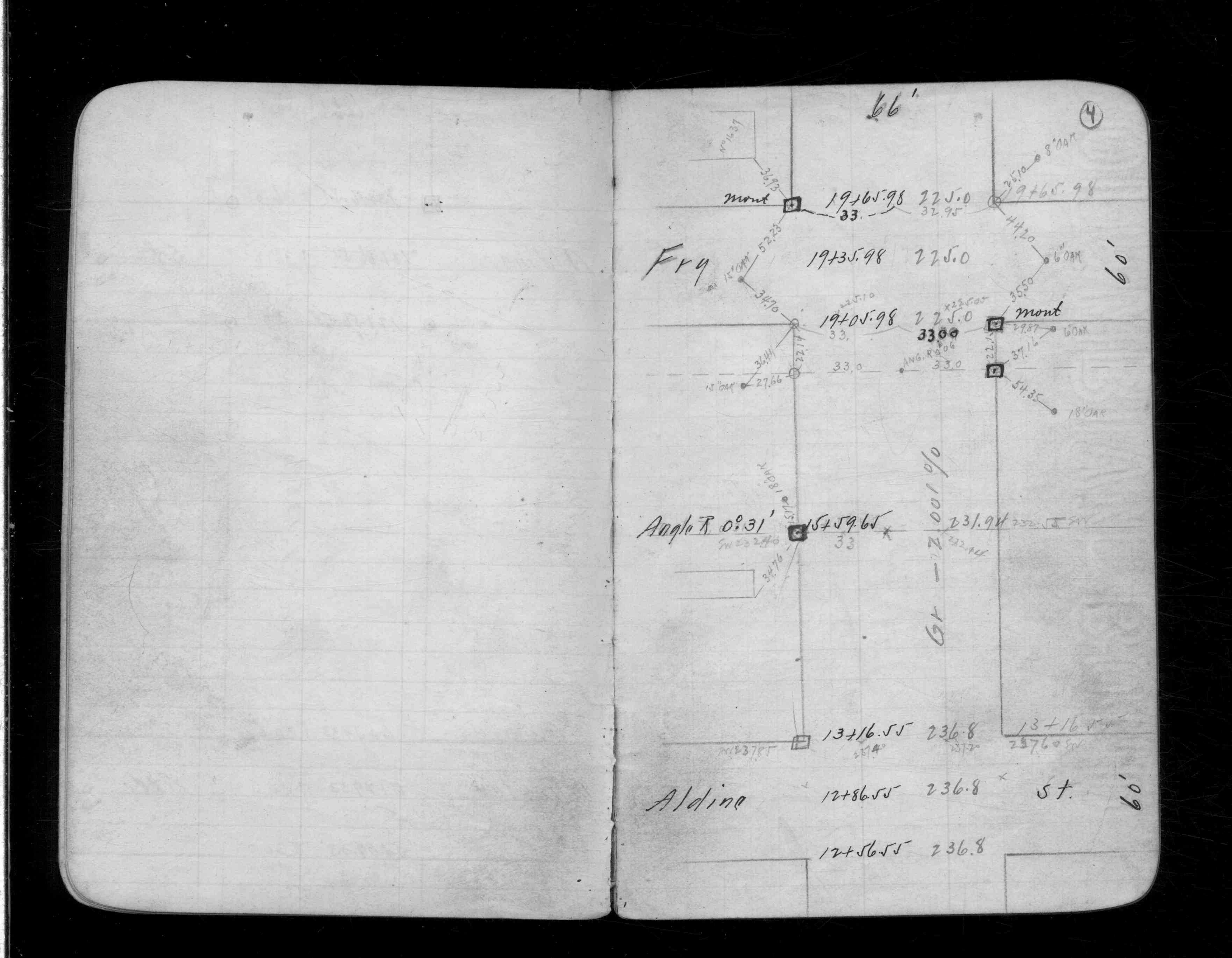
| CS 1323p.04 | ||||||
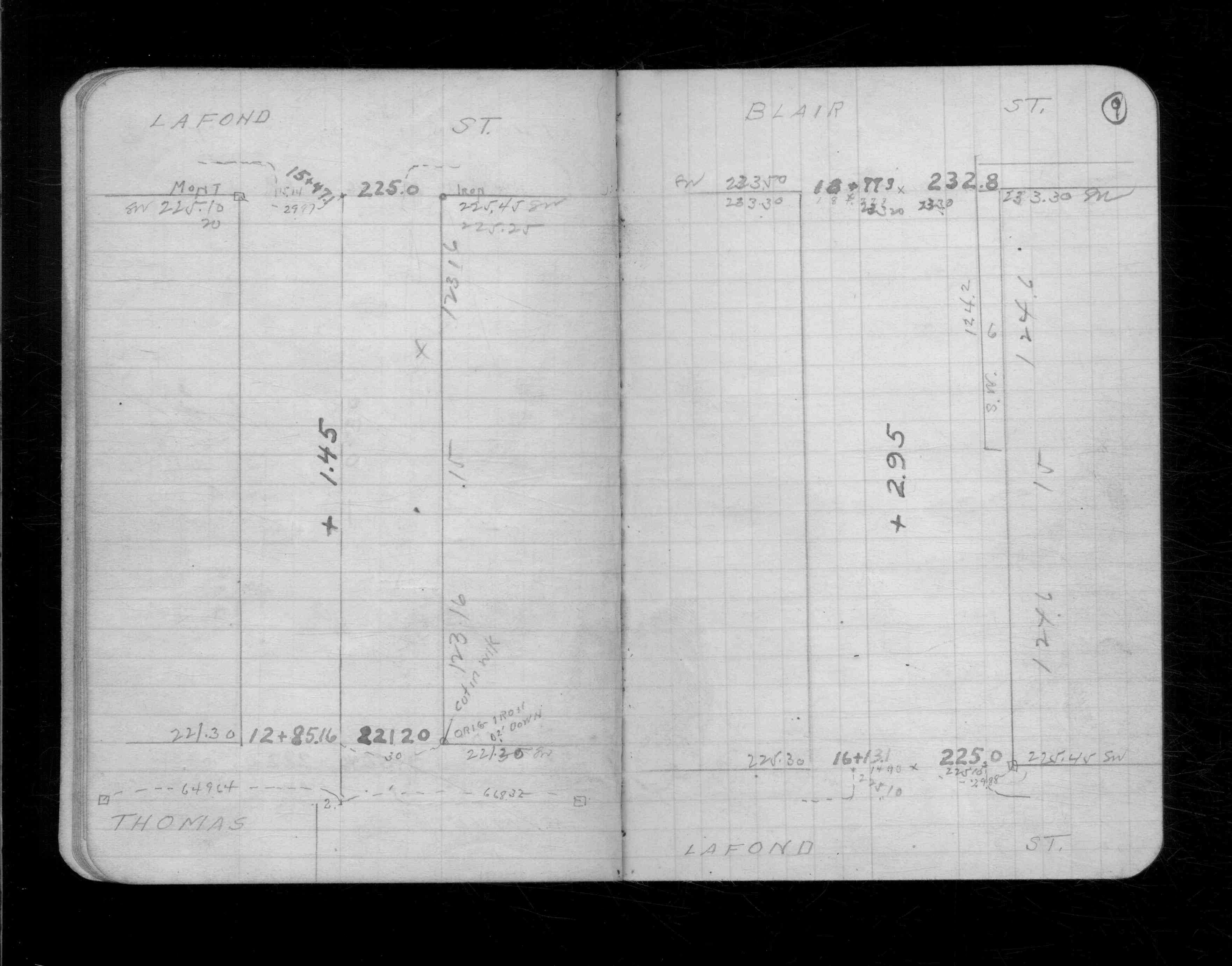
| CS 1834p.09 |
| FILE | SURVEYOR | LIC. NO. | DATE SIGNED | DATE TIED |
|---|---|---|---|---|
| 6669-__nw-A.pdf | Samuel Gibson | 44880 | May 21, 2015 | September 14, 2014 |
| FILE | PHOTO DATE | COMMENTS |
|---|---|---|
| 6669-__nw-6.jpg | September 4, 2014 | Looking west along Lafond Ave. |
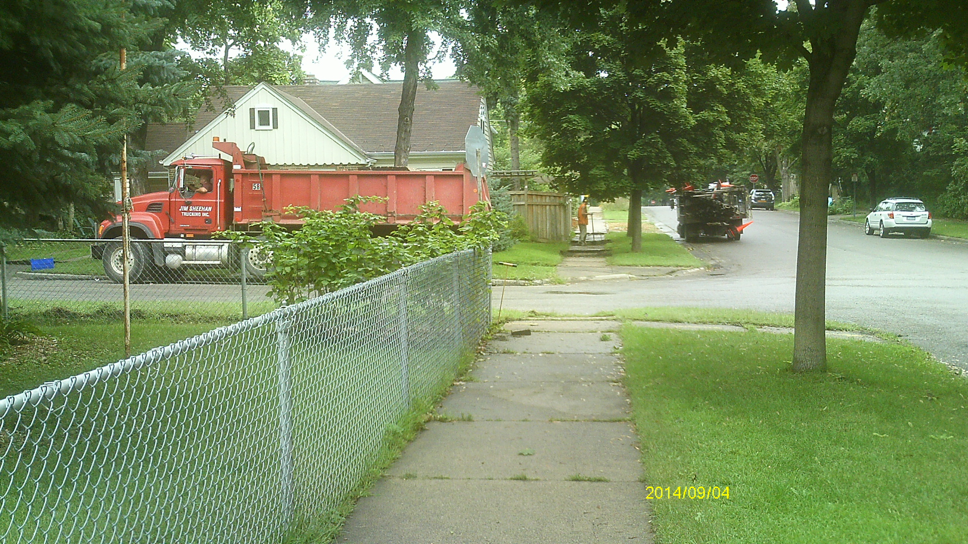
| 6669-__nw-5.jpg | September 4, 2014 | Looking south along Fry St. |
| 6669-__nw-4.jpg | September 4, 2014 | Looking east along Lafond Ave. |
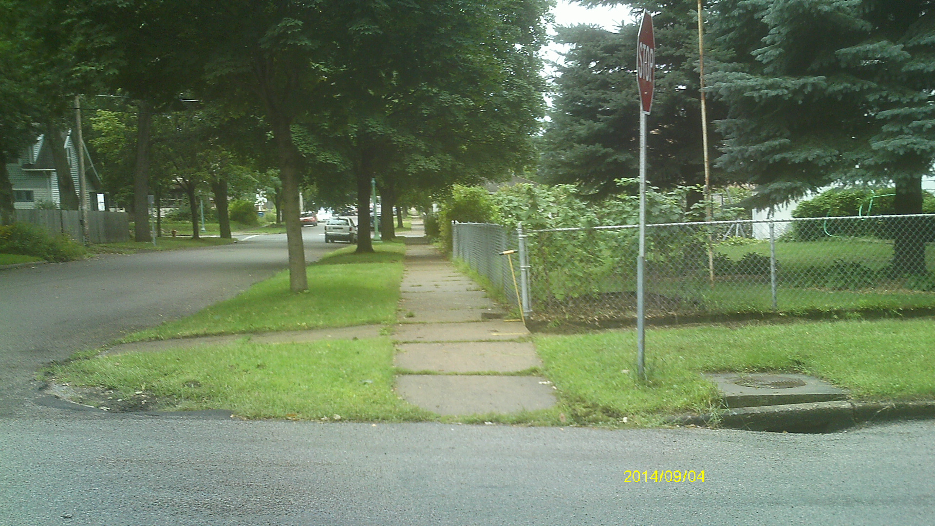
| 6669-__nw-3.jpg | September 4, 2014 | Looking north along Fry St. |
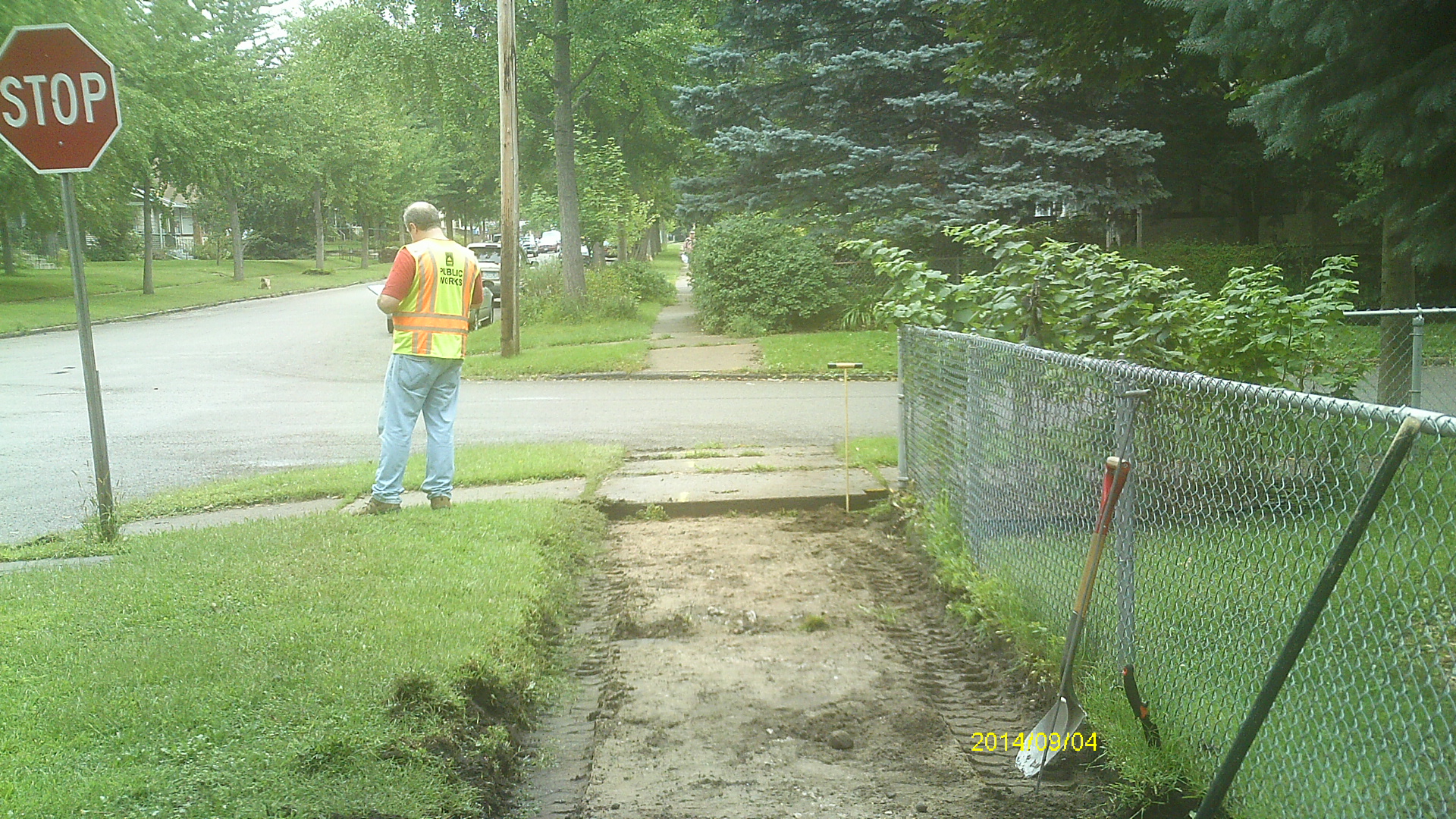
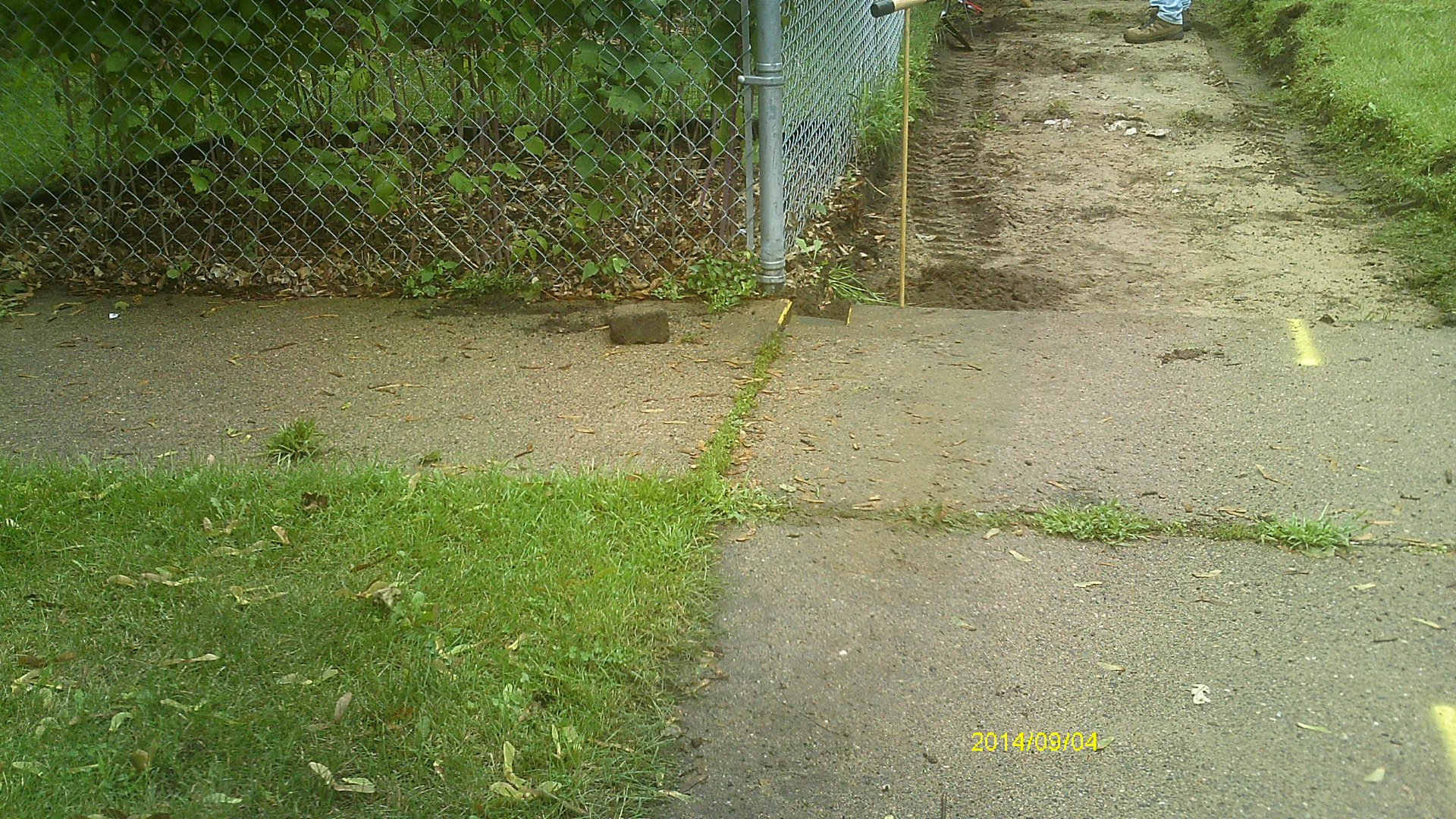
| 6669-__nw-2.jpg | September 4, 2014 | Close up of monument location. |
| 6669-__nw-1.jpg | September 4, 2014 | Close up of monument. |