| 11/5/2014 | Found GM at sidewalk grade. Photos taken. |
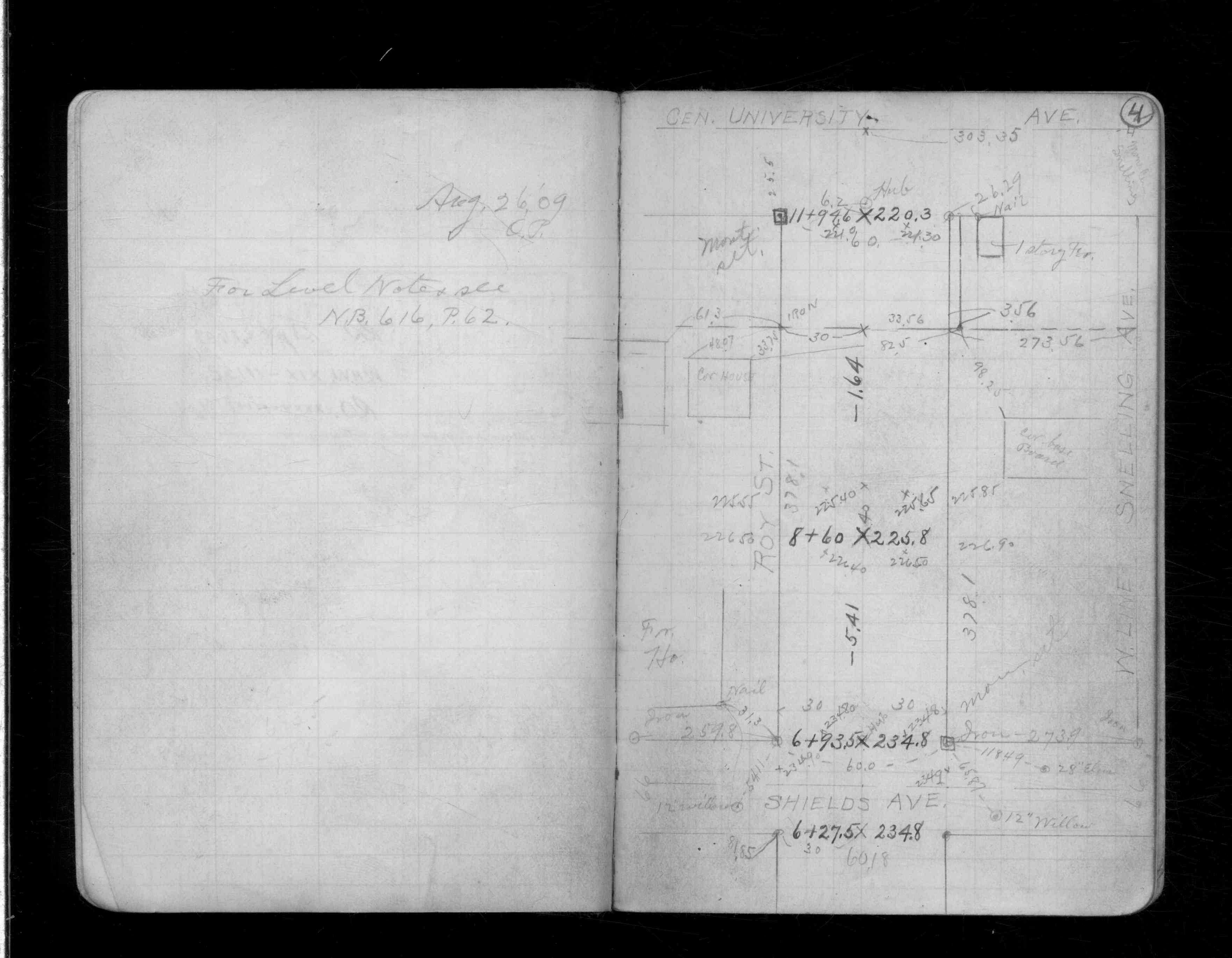
| 8/27/1909 | Placed ties on the monument. See CS 1338 p.4 |
Above is NOT an all inclusive history of this point. Please review all the links below.
| PLS NOTES | Field | Cross Section | Sewer | J.B. Irvine | Monument | River Survey |
|---|---|---|---|---|---|---|
| CS 1338p.04 |
| FILE | PHOTO DATE | COMMENTS |
|---|---|---|
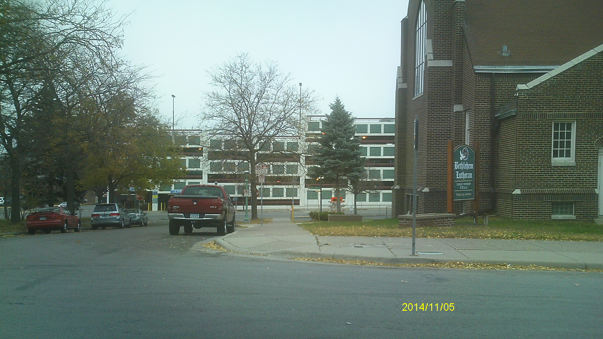
| 6700-__pc-6.jpg | November 5, 2014 | Looking west along Shields Ave. |
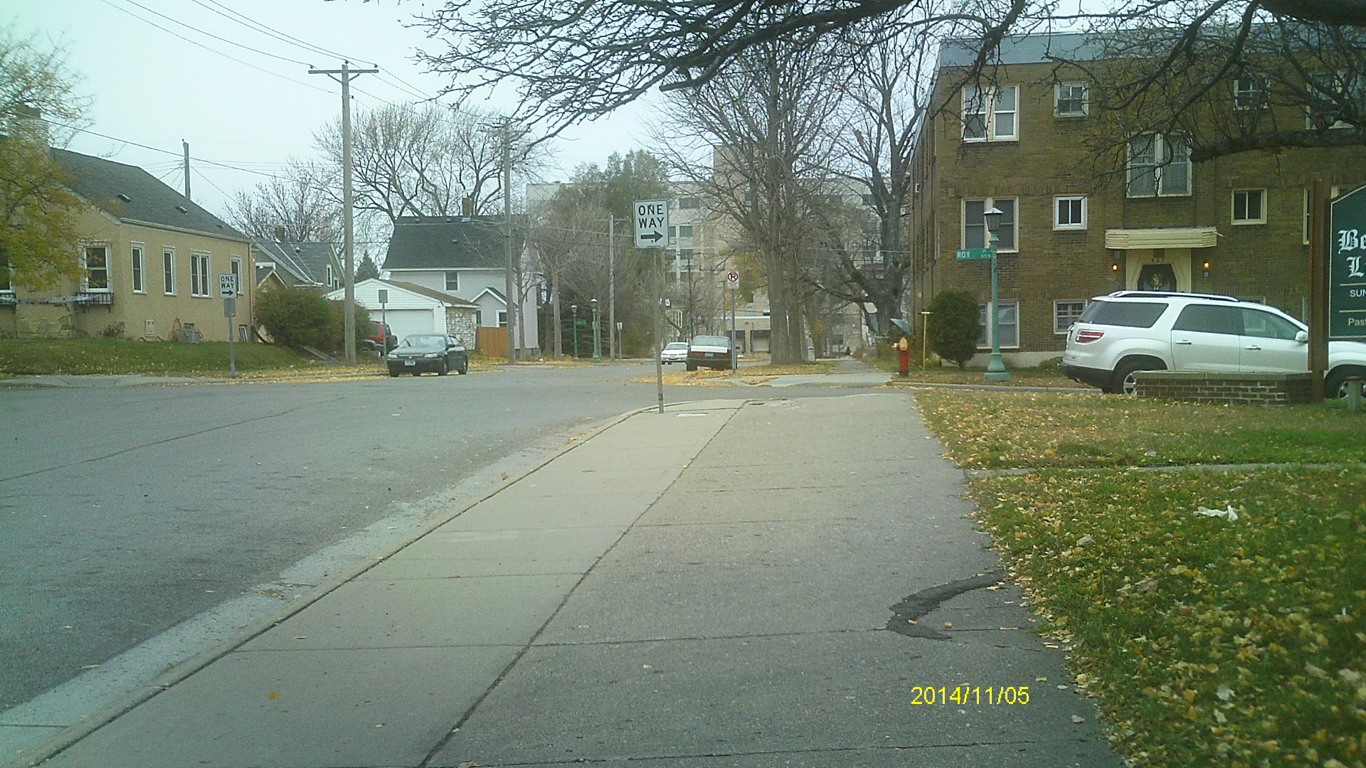
| 6700-__pc-5.jpg | November 5, 2014 | Looking south along Roy St. |
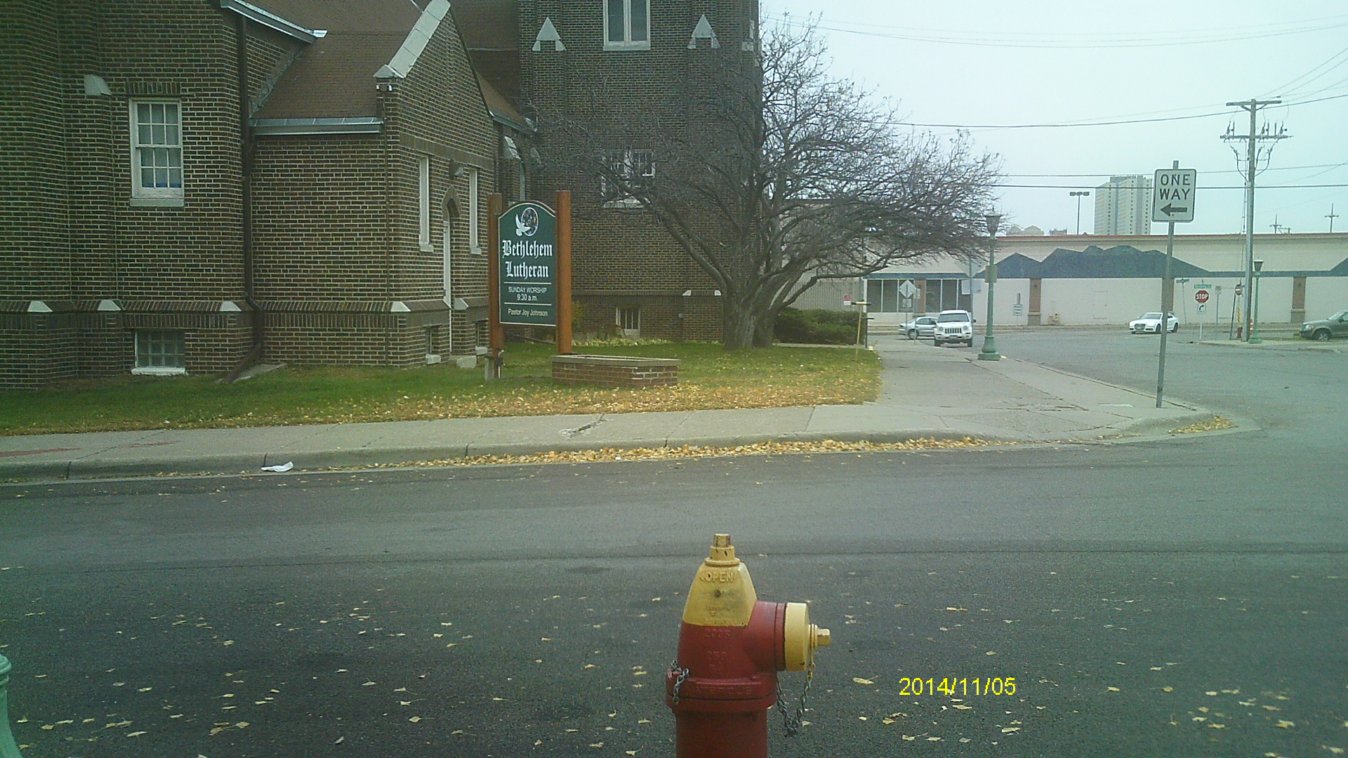
| 6700-__pc-4.jpg | November 5, 2014 | Looking east along Shields Ave. |
| 6700-__pc-3.jpg | November 5, 2014 | Looking north along Roy St. |
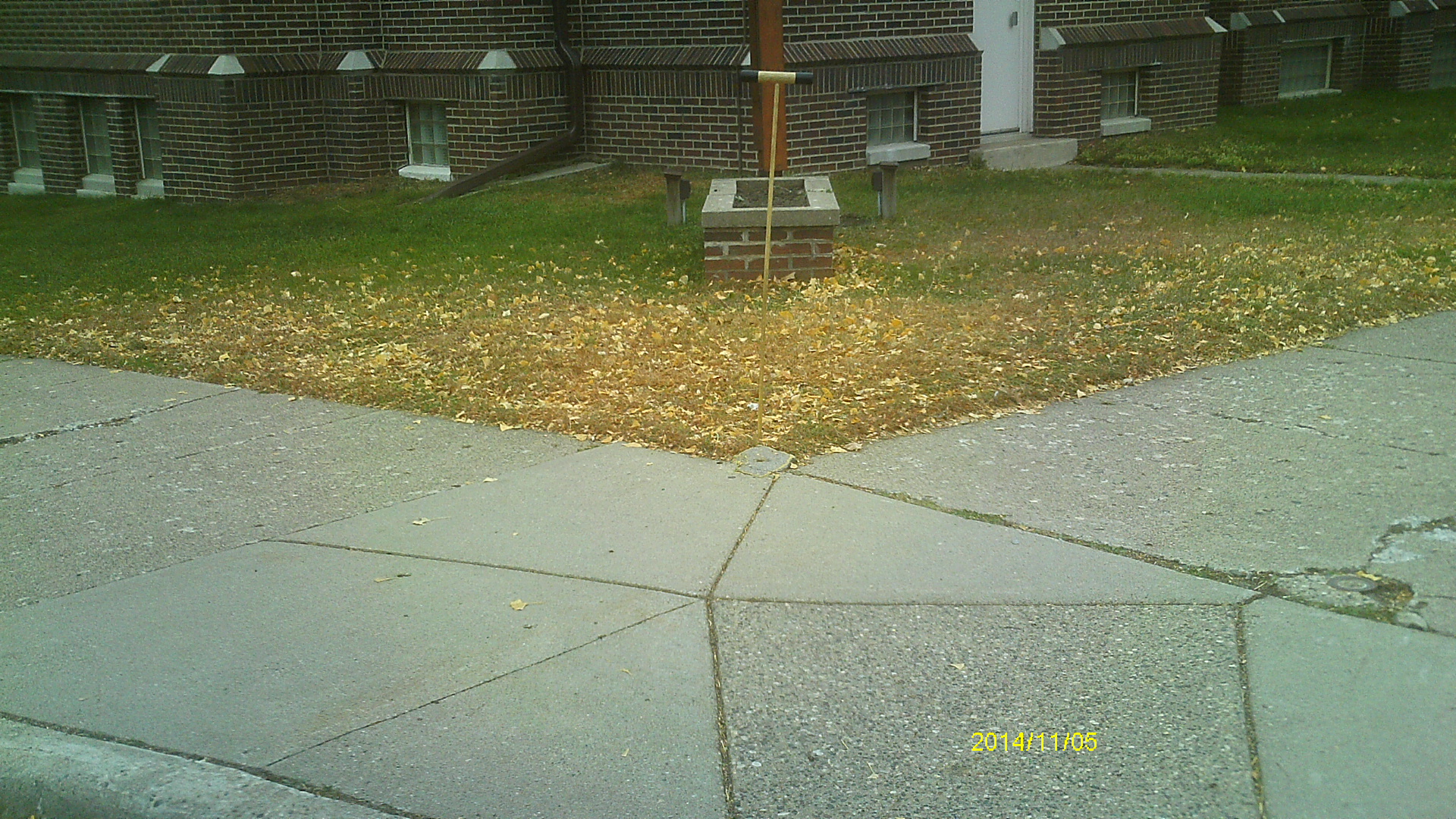
| 6700-__pc-2.jpg | November 5, 2014 | Close up of monument location. |
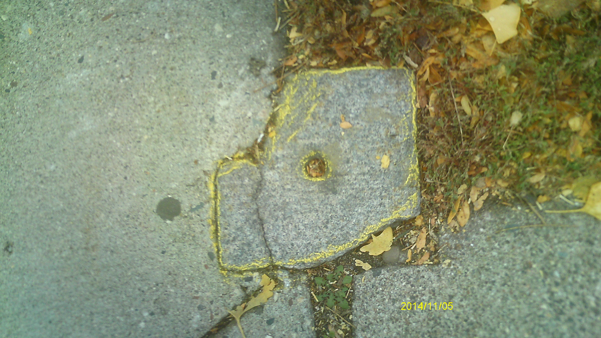
| 6700-__pc-1.jpg | November 5, 2014 | Close up of monument. |