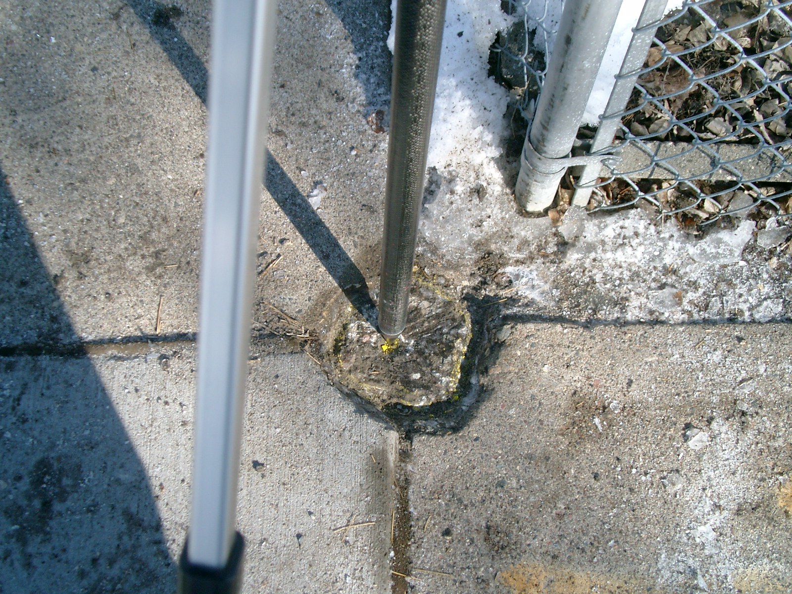
| 2/26/2010 | Found a chipped Conrete monument with a PK in the hole 0.1 ft below sidewalk grade. Placed ties. See CofL 6720-__pw-A.pdf Photos taken. |
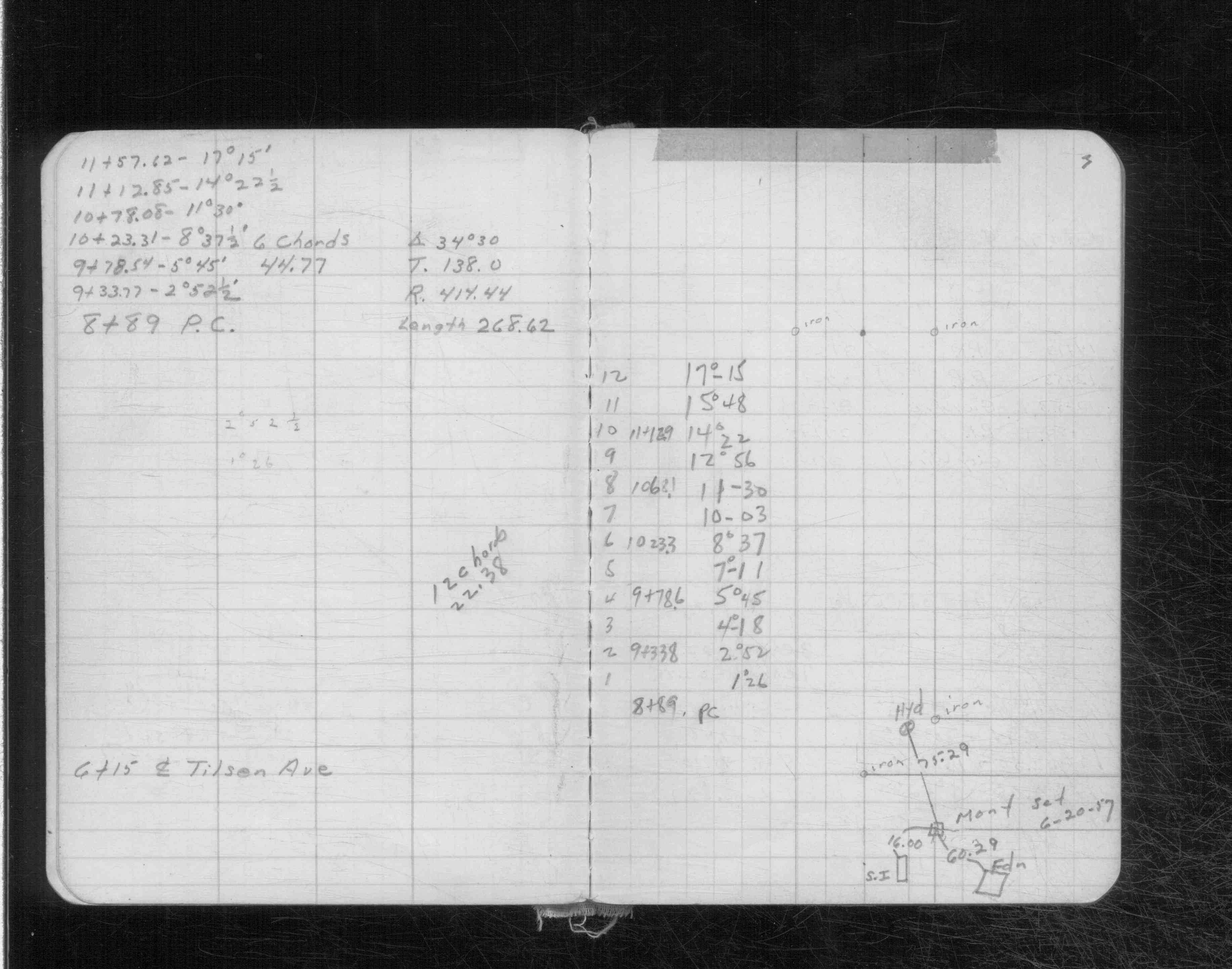
| 3/6/1956 | Placed ties on the monument. See CS 3144 p.3 |
Above is NOT an all inclusive history of this point. Please review all the links below.
| PLS NOTES | Field | Cross Section | Sewer | J.B. Irvine | Monument | River Survey |
|---|---|---|---|---|---|---|
| CS 3144p.03 |
| FILE | SURVEYOR | LIC. NO. | DATE SIGNED | DATE TIED |
|---|---|---|---|---|
| 6720-__pw-A.pdf | Samuel D. Gibson | 44880 | March 16, 2010 | February 26, 2010 |
| FILE | PHOTO DATE | COMMENTS |
|---|---|---|
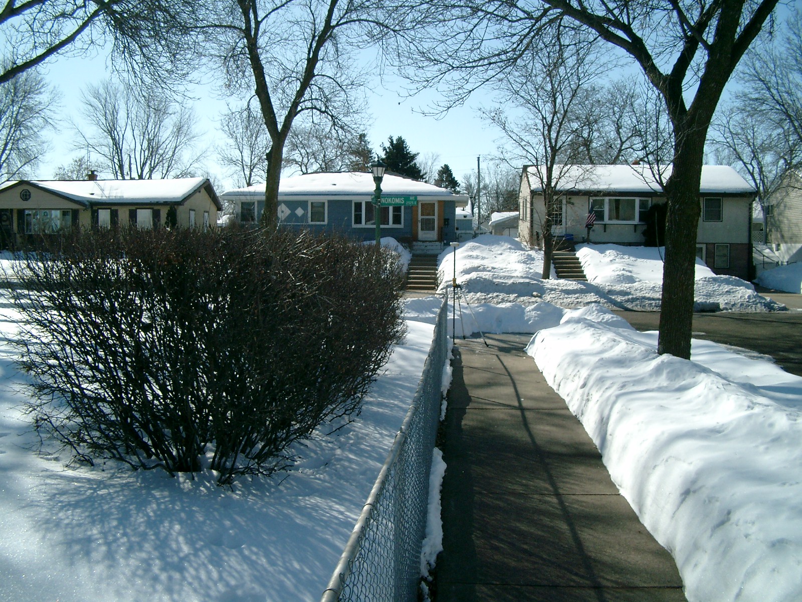
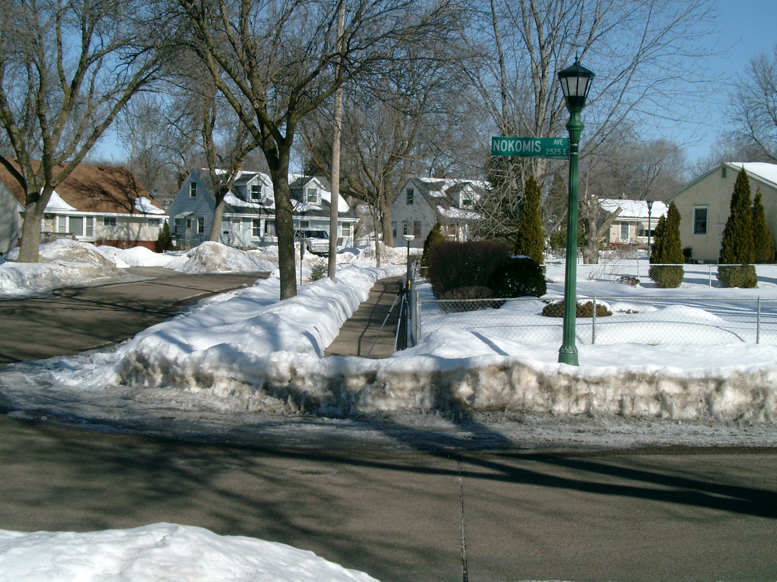
| 6720-__pw-5.jpg | February 26, 2010 | Looking West along the North side of Nokomis Ave. |
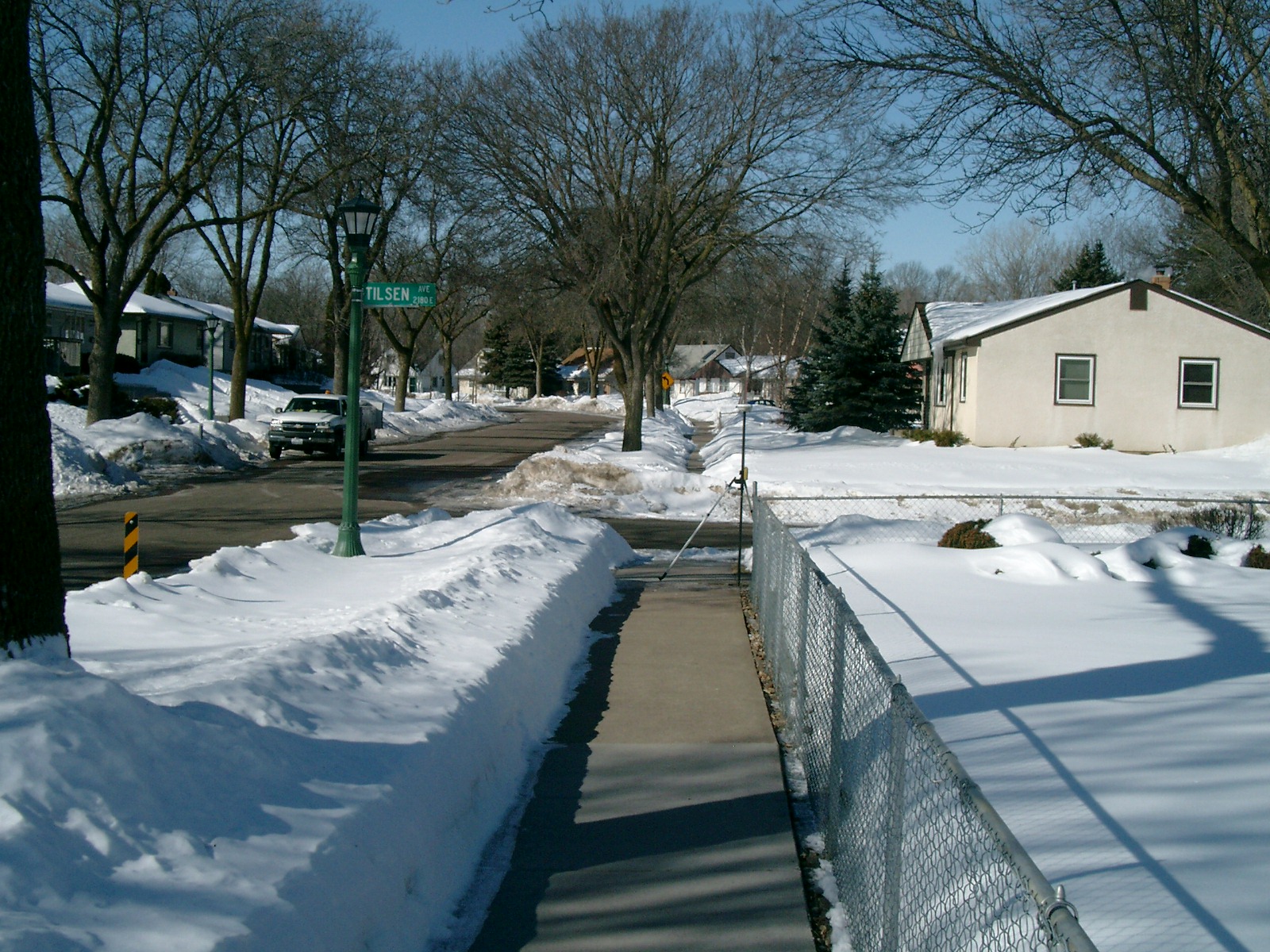
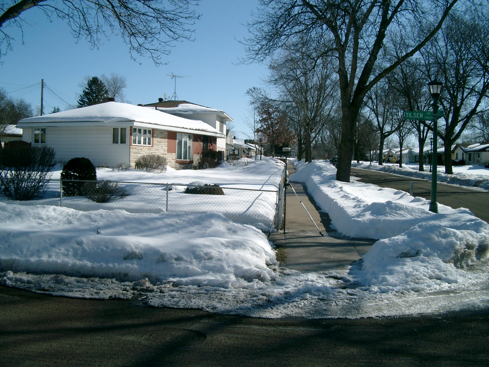
| 6720-__pw-4.jpg | February 26, 2010 | Looking South along the East side of Tilsen Ave. |
| 6720-__pw-3.jpg | February 26, 2010 | Looking East along the North side of Nokomis Ave. |
| 6720-__pw-2.jpg | February 26, 2010 | Looking North along the East side of Tilsen Ave. |
| 6720-__pw-1.jpg | February 26, 2010 | Close-up of the Concrete monument. |