| NAD83 COORDINATES (1986 adj.): |
|---|
| X= 575925.541 Y= 160057.797 Z= 771.038 5/16/2012 RTK-VRS |
| NAD83 COORDINATES (1996 adj.): |
|---|
| X= 575925.151 Y= 160058.425 Z= 771.3 12/5/2011 MnDot |
| X= 575925.168 Y= 160058.369 Z= 770.778 12/5/2011 MnDot |
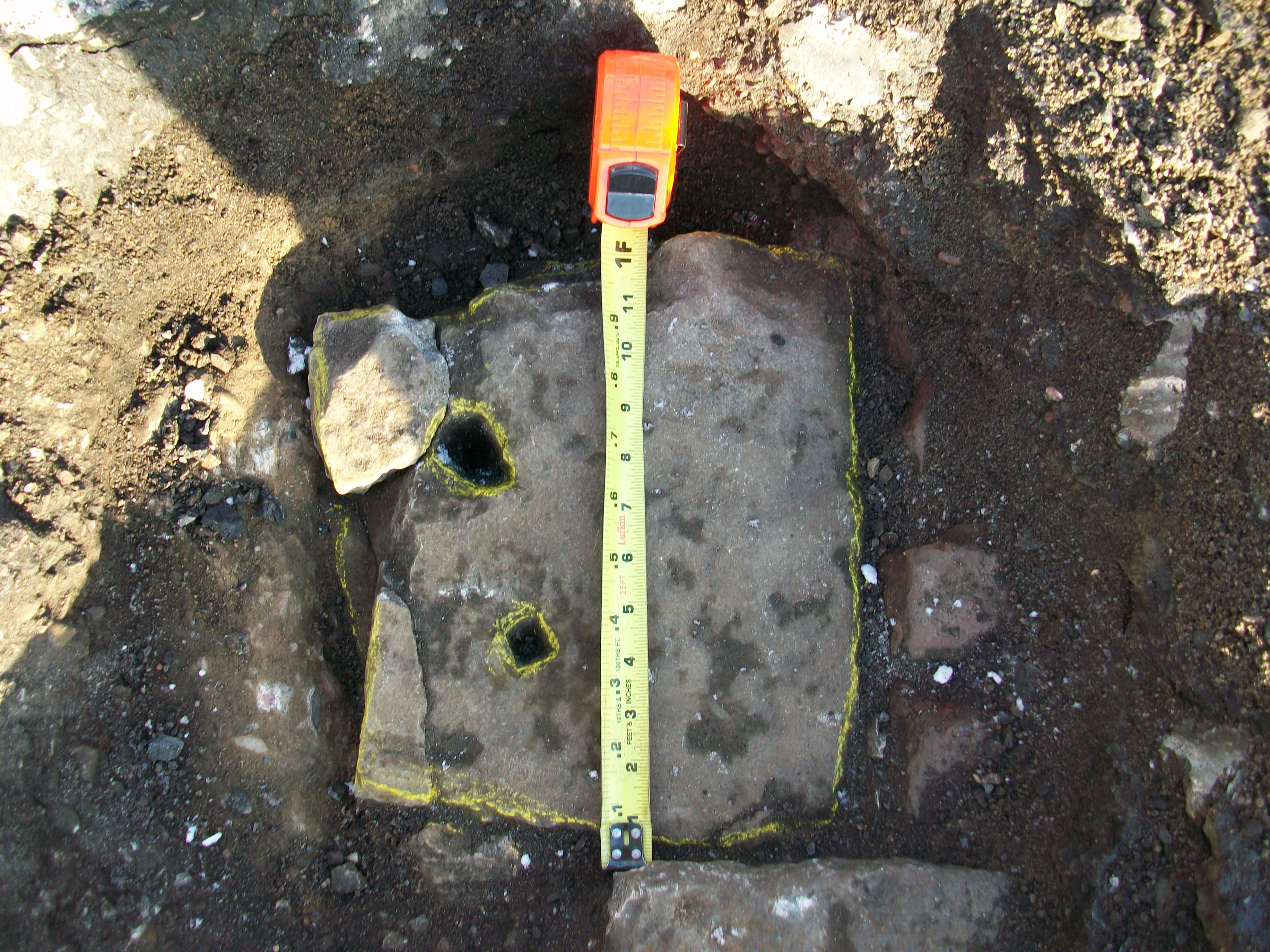
| 5/16/2012 | Position on Stone Monument established using RTK-VRS GPS. Elev. 76.94 ft. EDM ties placed using Trimble S6. |
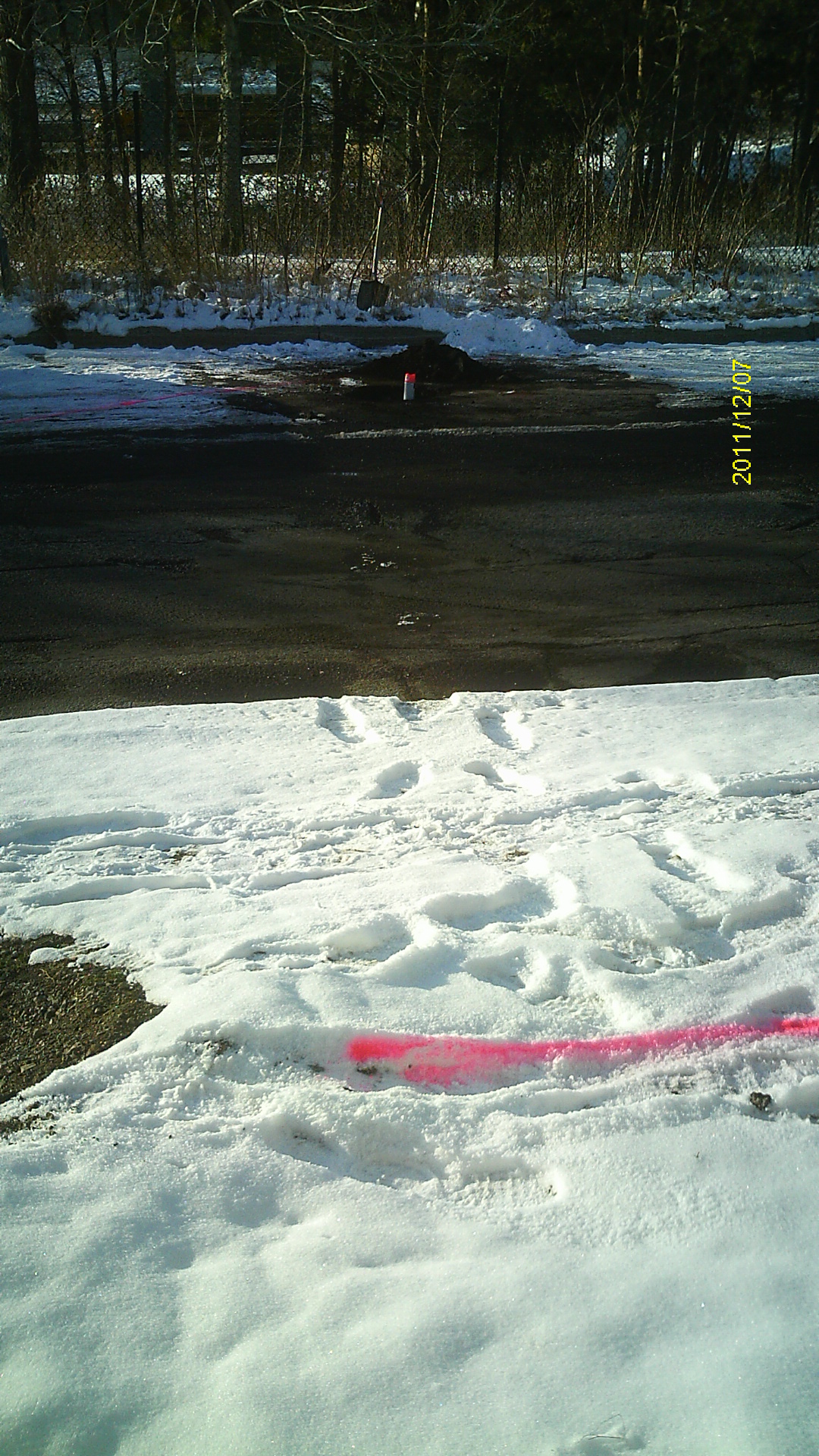
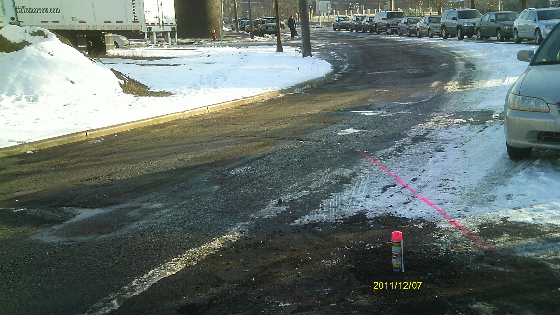
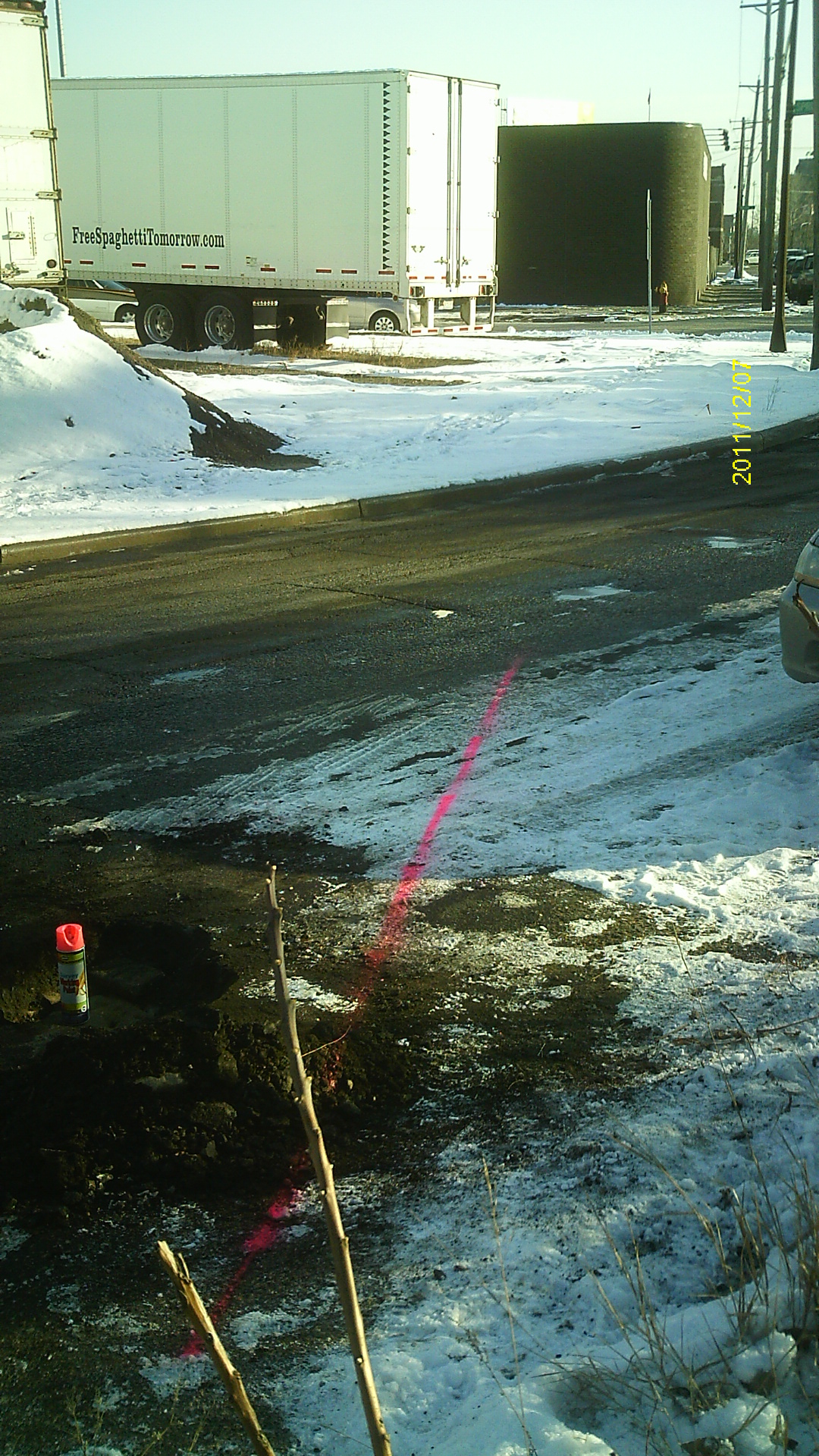
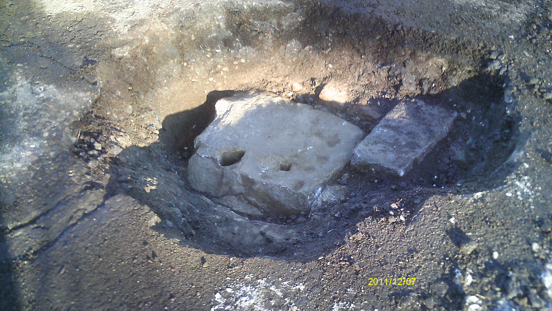
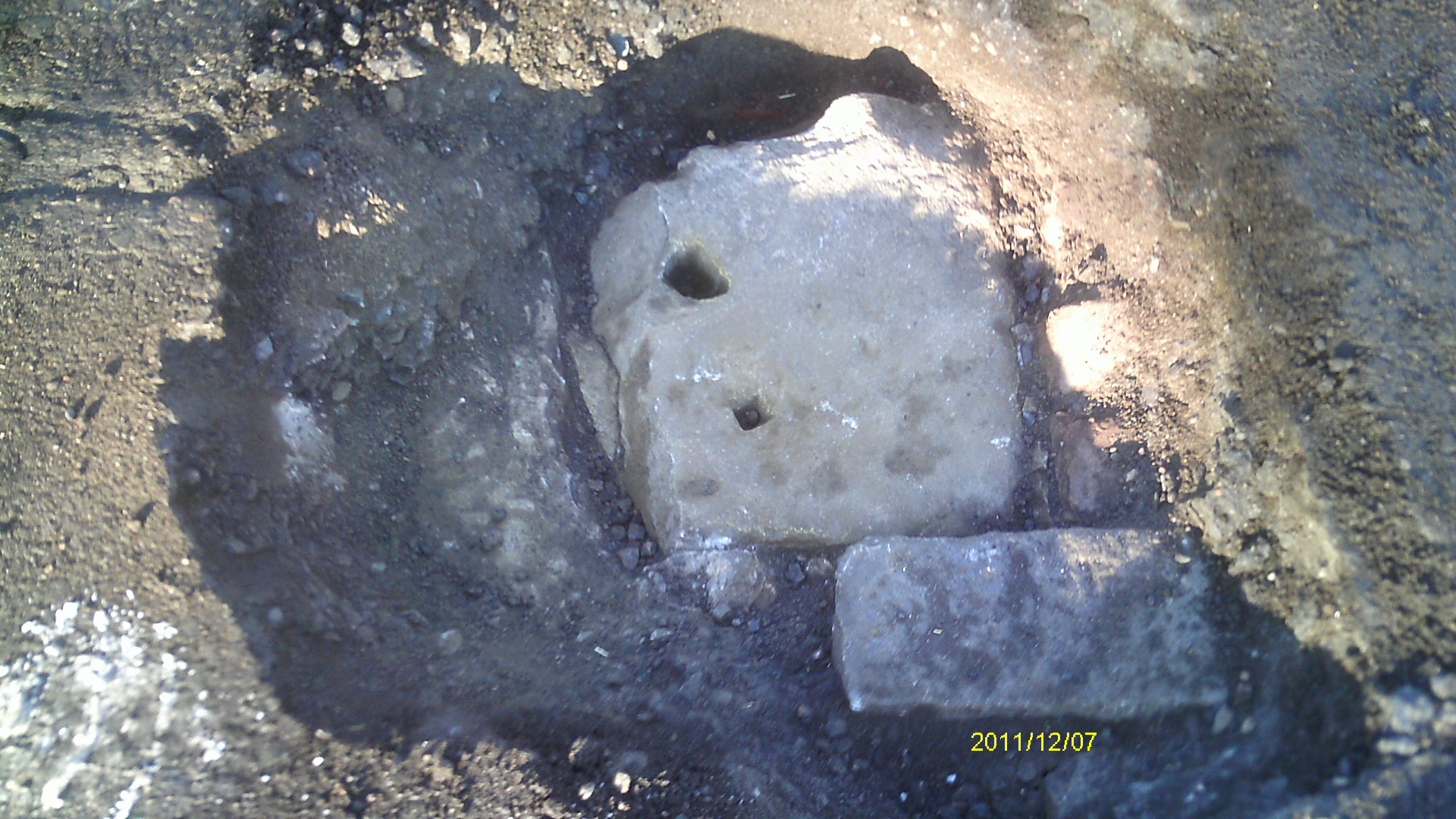
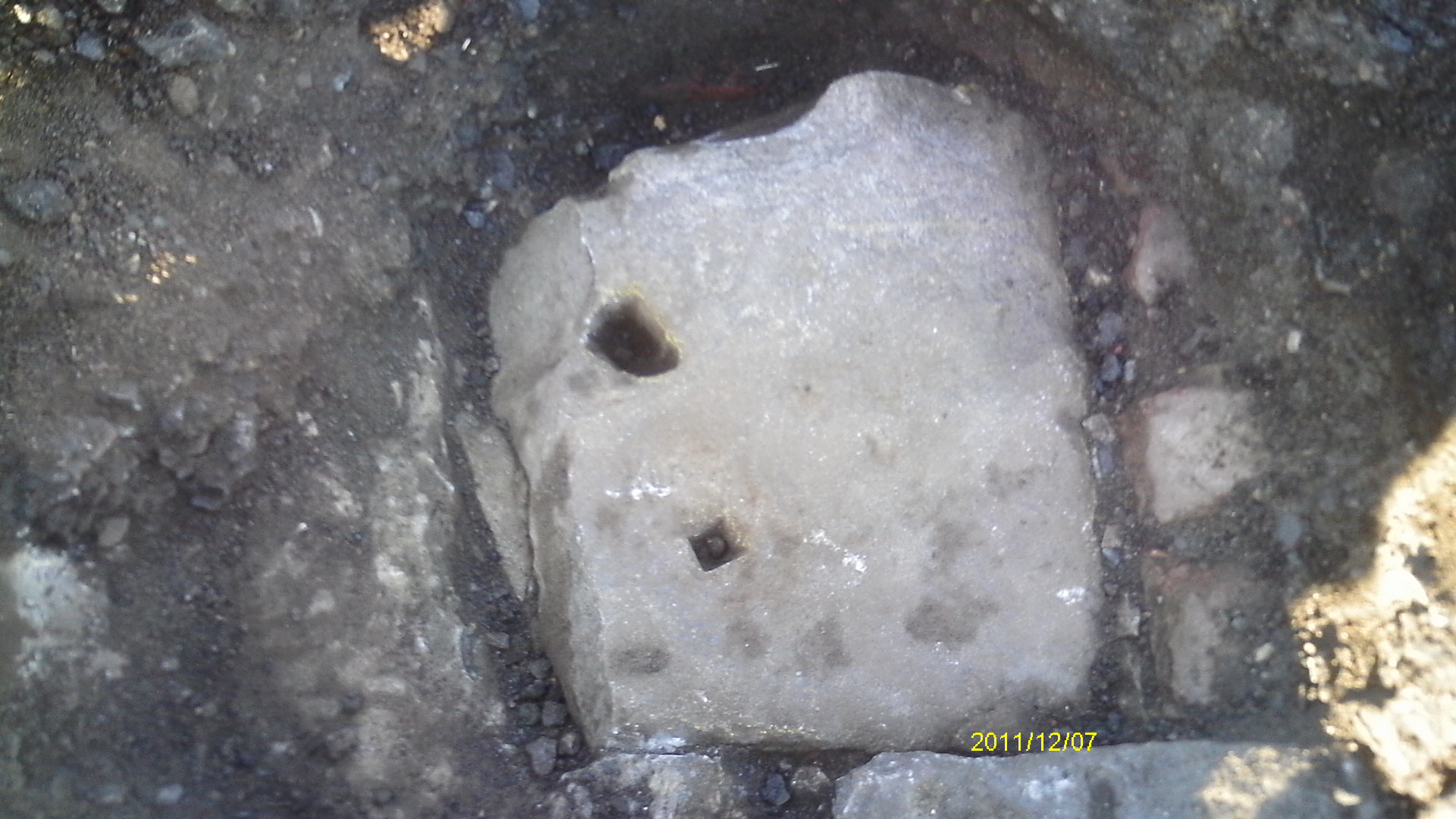
| 12/7/2011 | Found stone monument 0.6' below asphalt at location indicated on plat for Auditor's Subdivision No.23. Photos taken. |
| 12/5/2011 | Stone Monument found by MnDOT during survey for Cayuga Bridge project. Position established using both static and RTK-VRS GPS (1996 adj). City Elev = 77.04 ft. Photos taken. |
Above is NOT an all inclusive history of this point. Please review all the links below.
| PLS NOTES | Field | Cross Section | Sewer | J.B. Irvine | Monument | River Survey |
|---|---|---|---|---|---|---|
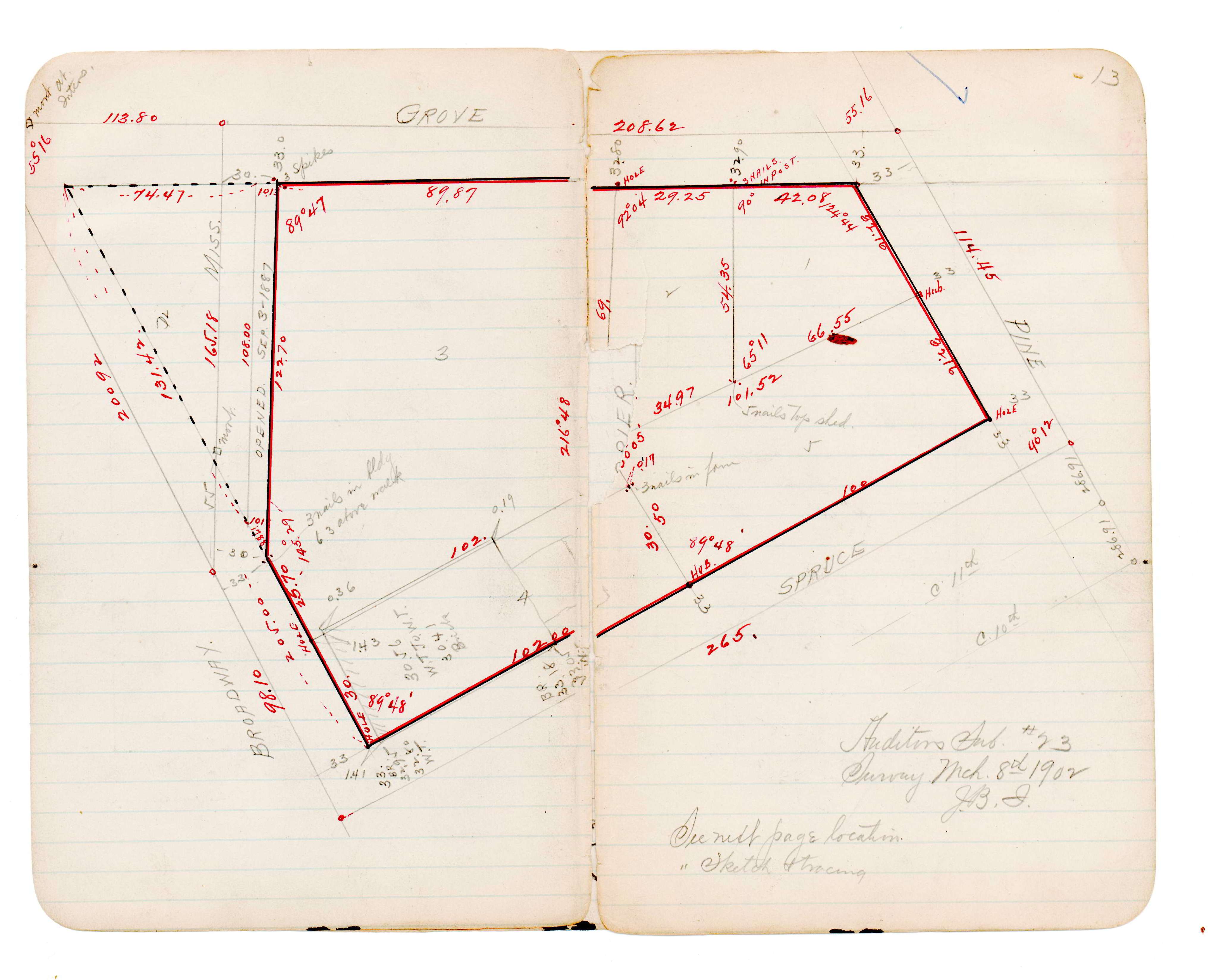
| JBI 46 p.13 |
| FILE | SURVEYOR | LIC. NO. | DATE SIGNED | DATE TIED |
|---|---|---|---|---|
| 6781-__sg-A.pdf | Samuel D. Gibson | 44880 | August 31, 2012 | May 16, 2012 |
| FILE | PHOTO DATE | COMMENTS |
|---|---|---|
| 6781-__sg-6.jpg | December 7, 2011 | Looking west across Mississippi St toward monument. |
| 6781-__sg-5.jpg | December 7, 2011 | Looking south along Broadway St. |
| 6781-__sg-4.jpg | December 7, 2011 | Looking southeast along Broadway St. |
| 6781-__sg-3.jpg | December 7, 2011 | Close up of monument location facing northeast. |
| 6781-__sg-2.jpg | December 7, 2011 | Close up of monument location facing north. |
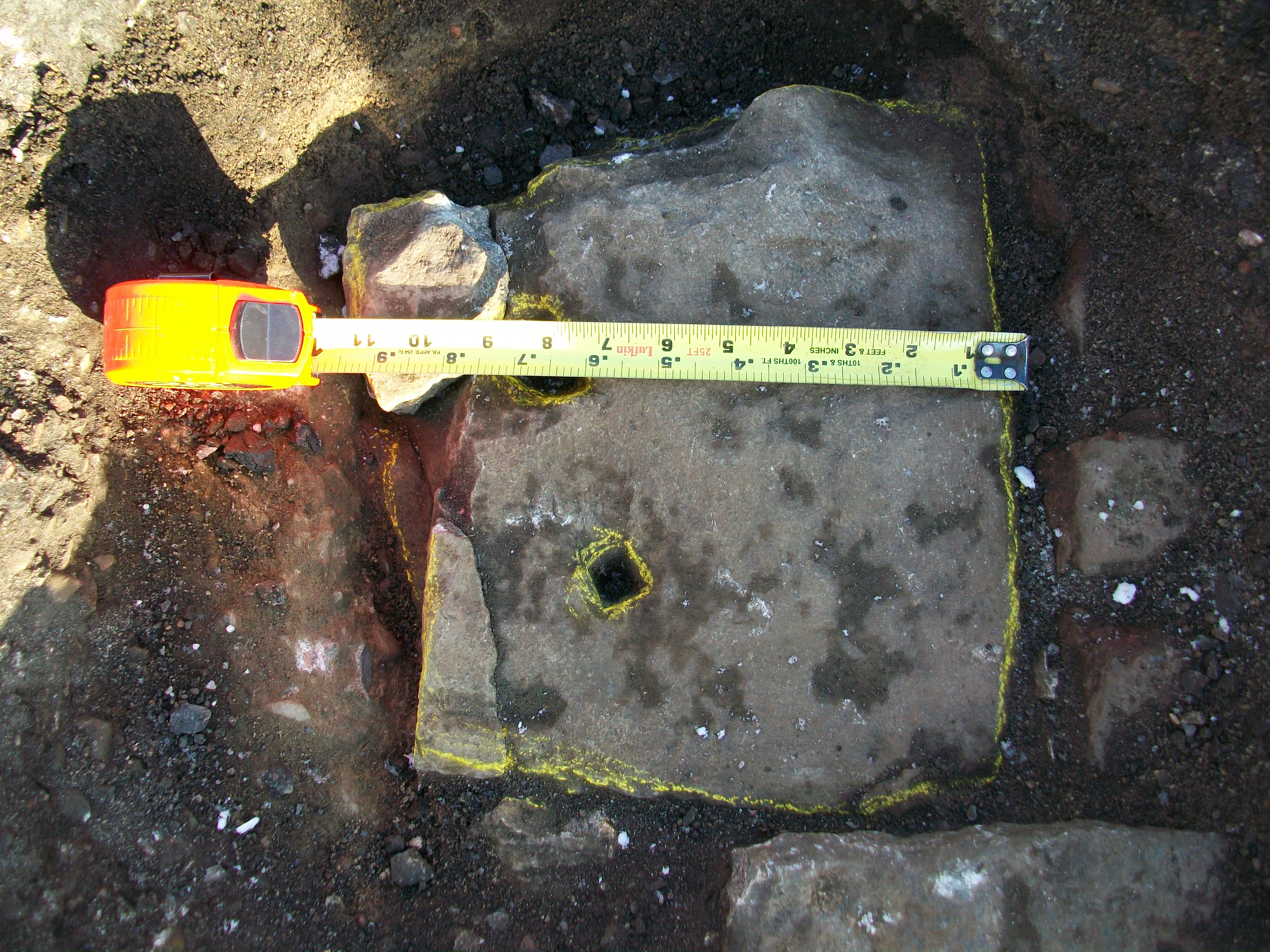
| 6781-__sg-1.jpg | December 7, 2011 | Close up of monument. |
| 6781-__sg-8.jpg | December 5, 2011 | Close up of monument. |
| 6781-__sg-7.jpg | December 5, 2011 | Close up of monument. |