| 11/1/2013 | Location currently falls in left northbound lane of Dale St. Unable to probe. |
Above is NOT an all inclusive history of this point. Please review all the links below.
| PLS NOTES | Field | Cross Section | Sewer | J.B. Irvine | Monument | River Survey |
|---|---|---|---|---|---|---|
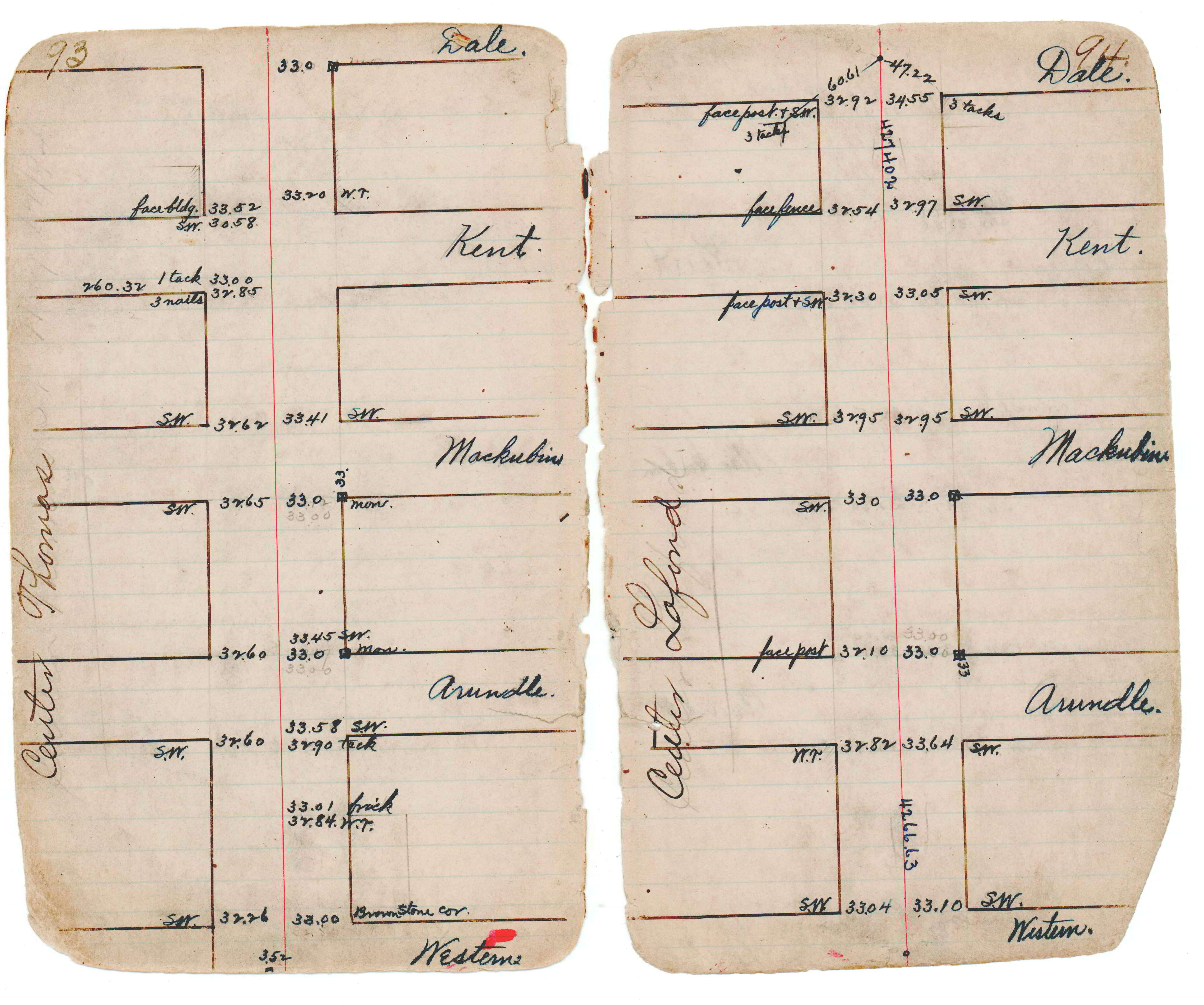
| JBI 10 p.93-94 | ||||||
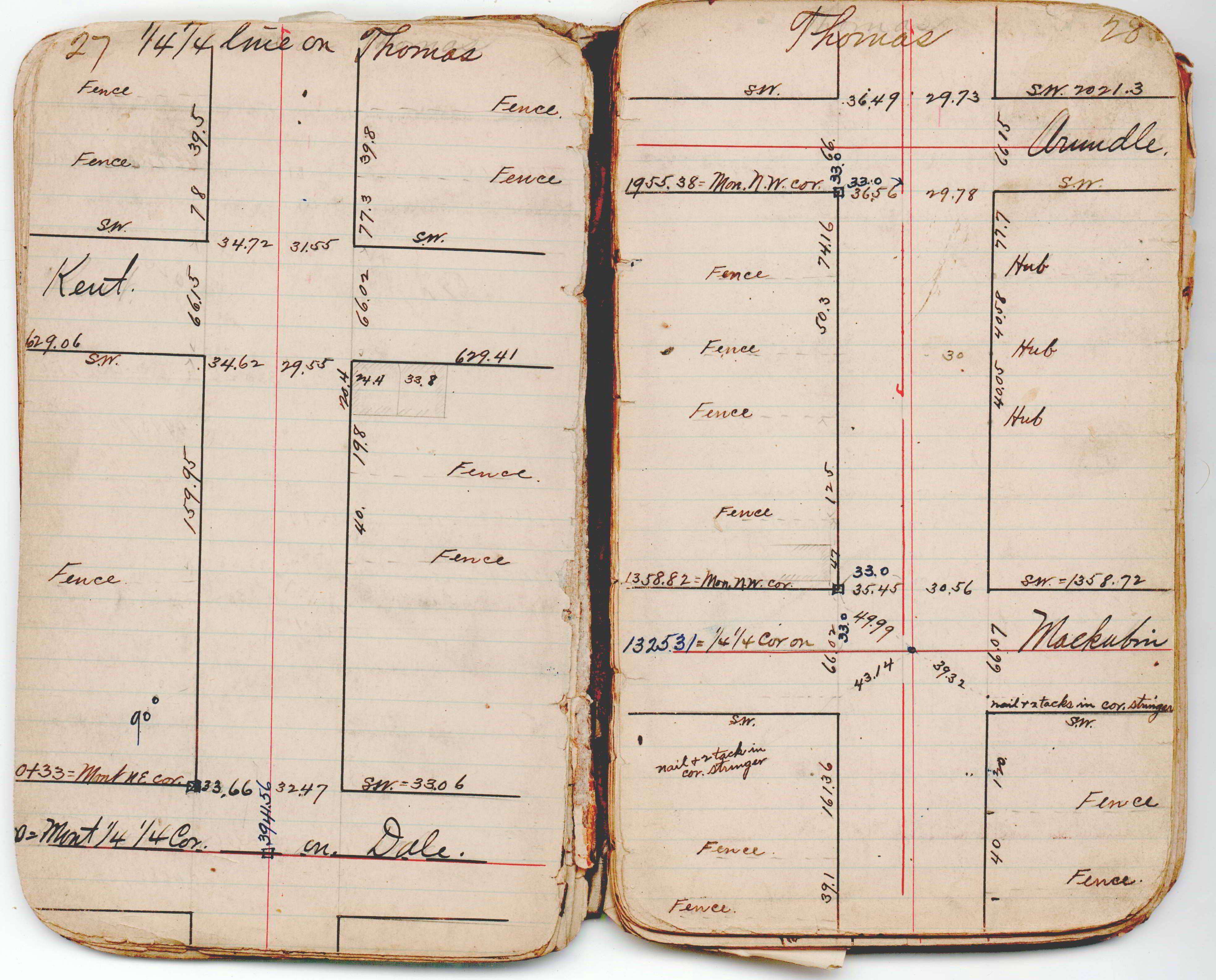
| JBI 10 p.27-28 |