Page(s) 1
Seventh (7th) & Montreal Ave
| Bldg Location | 1967-03-15
1
Page(s) 2
Fillmore St (Ave)
FROM
Starkey St
TO
120 ft East
| Locations | 1968-03-26 Page(s) 3
Winona St
FROM
Manomin Ave
TO
Ohio St
| Locations | 1968-04-08 Page(s) 4
Slyvan Park Add Alley B16
FROM
Randolph Ave
| Locations | 1968-05-14 Page(s) 5
Ramsey County Property
FROM
Near Hill St (Vac) & Kellogg Blvd
| Locations & Distances | 1968-10-03 Page(s) 6
Pedersen St & Wilson Ave
| Library Site Locs | 1968-12-04 Page(s) 7-11
White Bear & Burns Aves
FROM
Fire Station
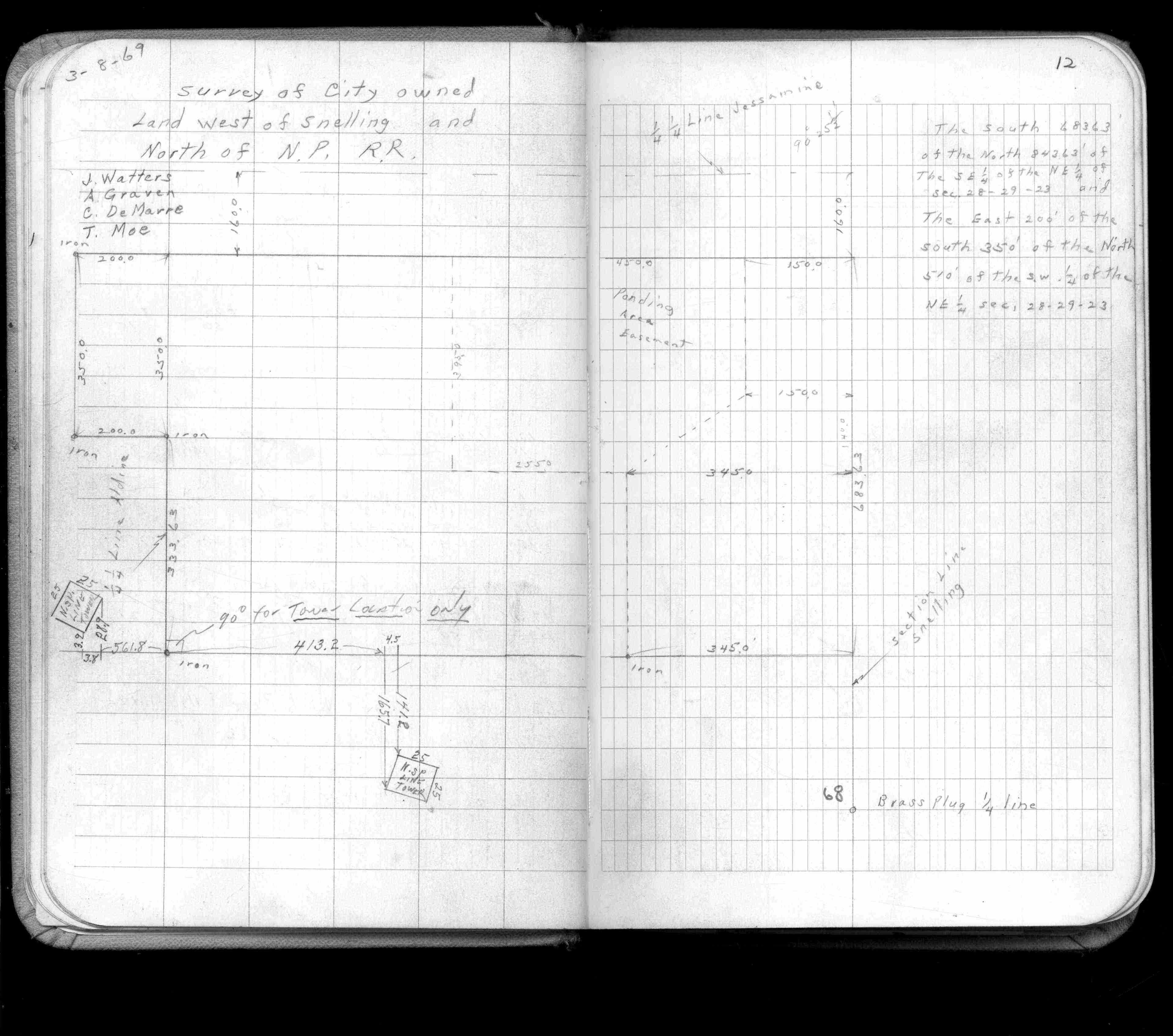
| Locations & X-Secs | 1969-03-19 Page(s) 12
City Land W of Snelling & N of NPRR
| Loc & Description | 1969-03-08 Page(s) 13
Hammer & Case Aves
FROM
Hammers RE
| Gravel Pit Location | 1969-09-16 Page(s) 14
Butterfields Syndicate Add 2 B12
FROM
Dale St
TO
Great Northern RR
| Loc & Description | 0000-00-00 Page(s) 15
Blank Page
FROM
Blank
TO
Blank
| Blank | 0000-00-00 Page(s) 16-17
Easement Portland Terrace
FROM
Kent St
TO
Brick Wall of 38.7
| Locations | 0000-00-00 Page(s) 18
Acker Playground
FROM
Granite St
TO
Cayuga St
| Locations | 1970-08-21 Page(s) 19
College Park bounded by Carter & Raymond & Doswell Aves & Chelmsford St Ext
| Locations | 1970-09-04 Page(s) 20
Gravel Pit Boundary Survey bounded by Case & Sims Ave & Hammer & Kennard Sts
| Boundary Survey | 1970-07-01 Page(s) 21
Magnolia Ave
FROM
Rice St
TO
Sylvan St
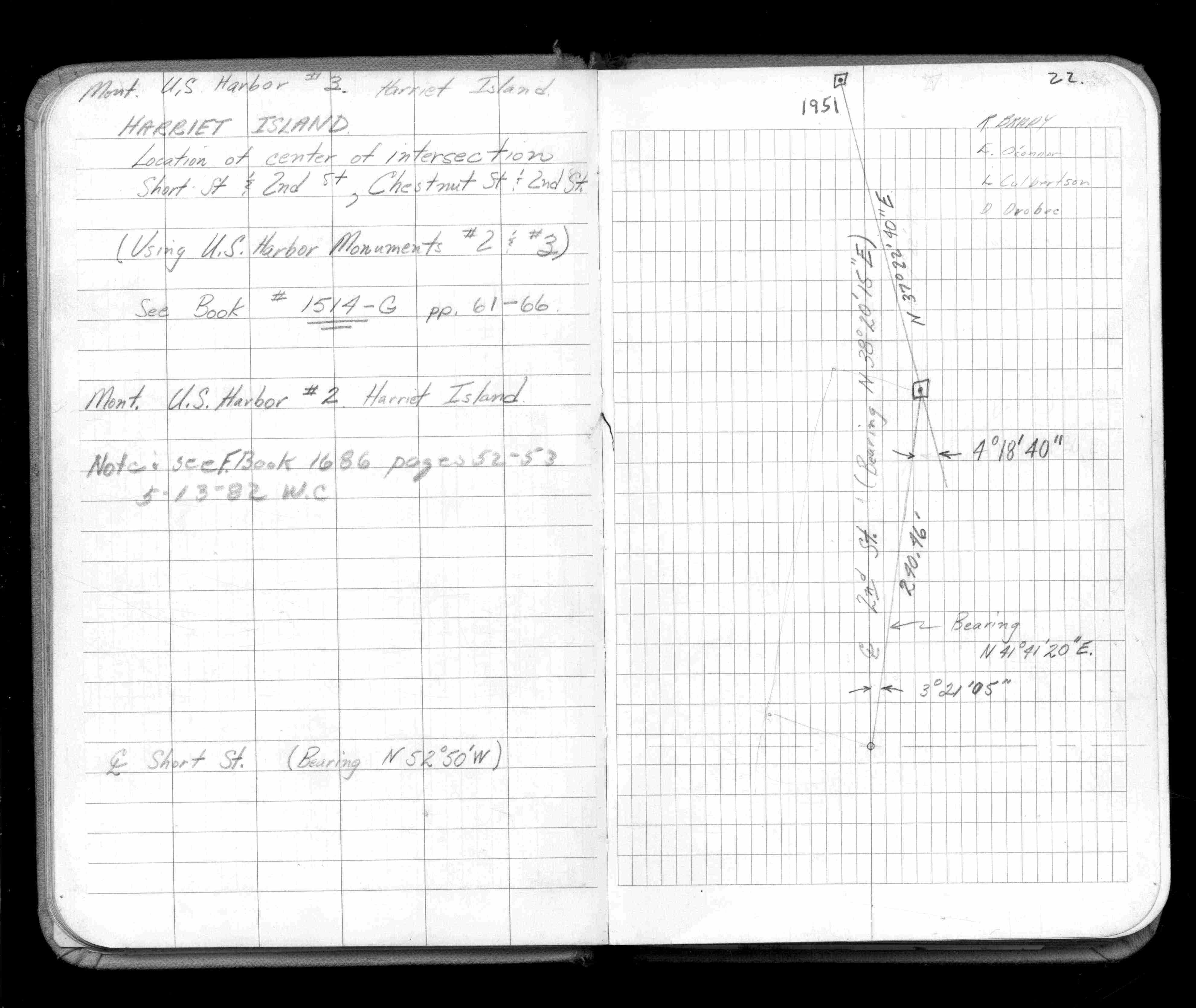
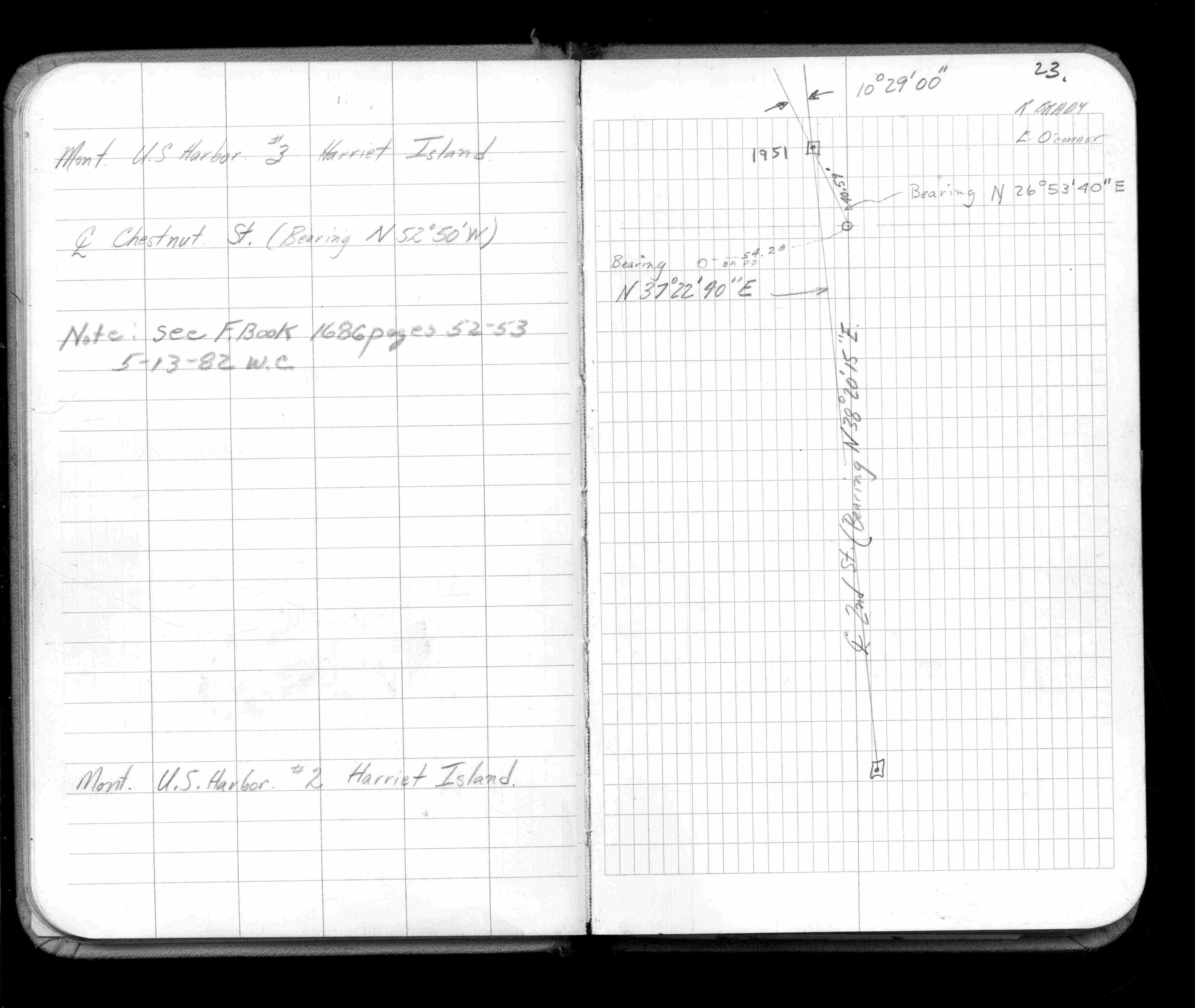
| Locations | 0000-00-00 Page(s) 22-23
Harriet Island
FROM
Second (2nd) & Chestnut Sts
| Locations | 0000-00-00 Page(s) 24-26
N Boundary Pigs Eye Dump
FROM
E Side RR Bridge Over Battle Creek
TO
1800 ft South
| Grading | 1971-04-30 Page(s) 27
Davern St & Shepard Rd
FROM
Holiday Harbor
| Locations | 1971-05-00 Page(s) 28-44
Burlington Heights Div 2 B15
FROM
Near Howard St & Park Ridge Ct
TO
(School Property)
| Locs & Stadia Topog | 1971-05-14 Page(s) 45
School Siren Pole
FROM
Burlington Heights Div 2 Blk 15
TO
(School Property)
| Pole Location | 0000-00-00 Page(s) 46-47
Blank Page
FROM
Blank
TO
Blank
| Blank | 0000-00-00 Page(s) 48
Davern St & Shepard Rd
FROM
Holiday Harbor
| Stake Survey | 1971-09-27 Page(s) 49
S P L Stanford Ave (Edgcumbe Pgd)
FROM
Griggs St
TO
Evergreen Pl (Vacated)
| Locations | 1971-09-27 Page(s) 50-54
Lafayette Rd & Univ Ave (PW Yard)
| Align & Locs & X-Secs | 1971-10-07 Page(s) 55-64
Davern St & Shepard Rd
FROM
Holiday Harbor Marina
| Topo & Align Survey | 1972-01-05 Page(s) 65
Loeb Lake Park boundary bounded by Jessamine Ave & Dale St & Mackubin St & Maryland Ave
| Boundary Survey | 1972-05-15 Page(s) 66
S Side Whitall St
FROM
Arkwright St
TO
Clark St
| Fence Location | 1972-06-15 Page(s) 67
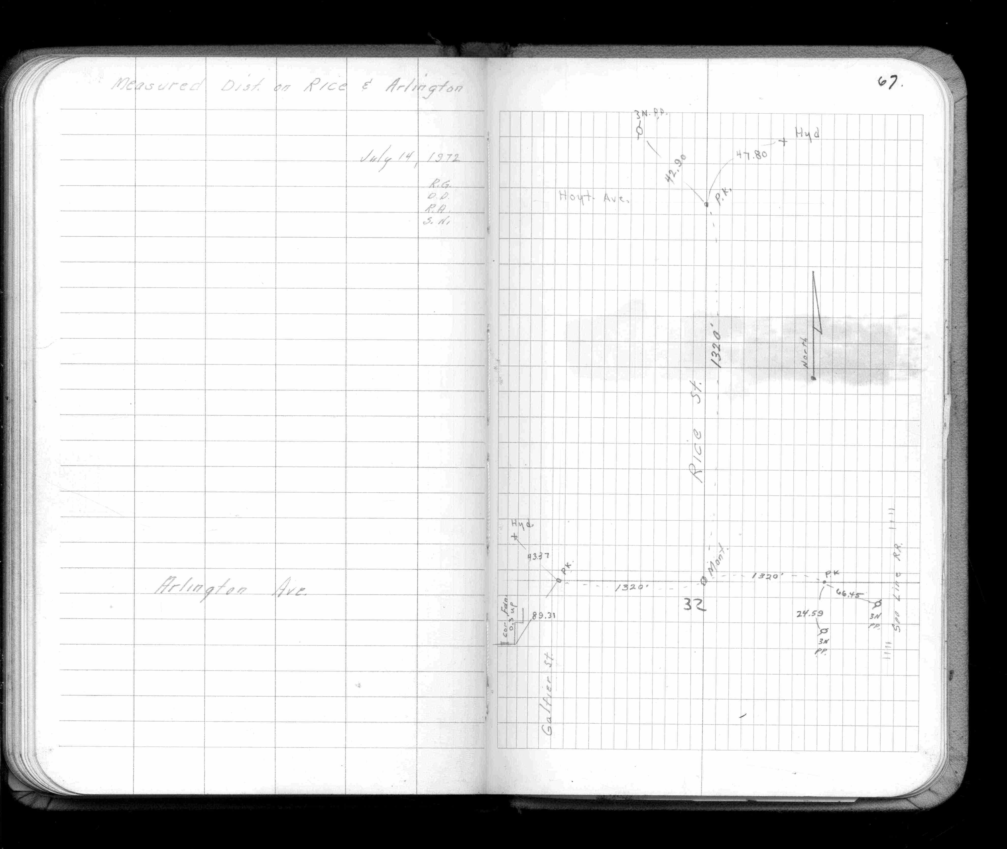
Rice St & Arlington Ave
| Mt Locs & Distances | 1972-07-14 Page(s) 68
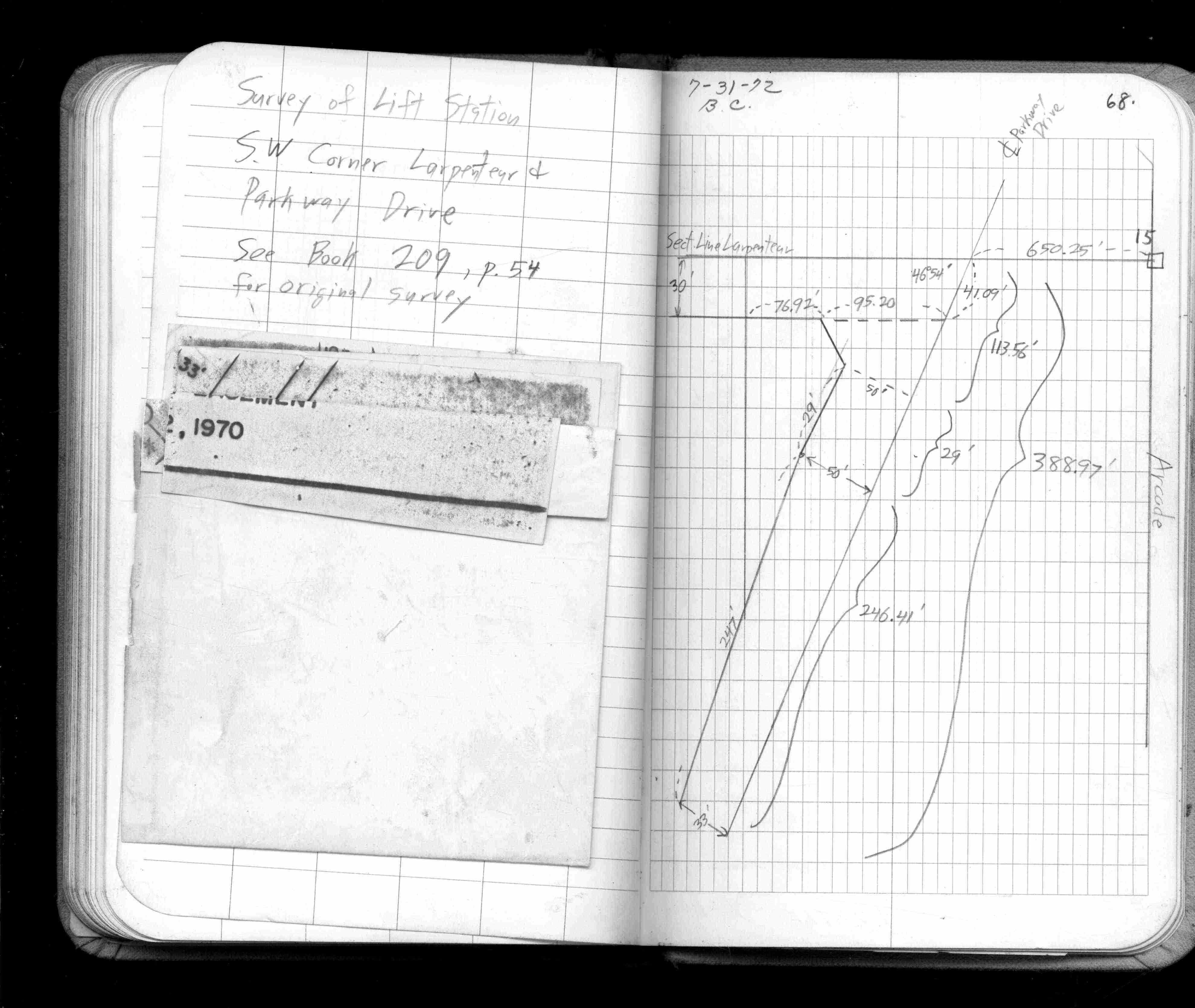
SW Cor Larpenteur Ave & Parkway Drive
| Lift Station Survey | 1972-07-31 Page(s) 69-70
Turtle Lake Rd & N Co Line J
FROM
S W Cor Sec 06-30nr22w @ lake
| Locs & Stadia | 1972-11-20 Page(s) 71
Seventh (7th) St & Western Ave
| Pub Safety Bldg Loc | 1972-12-15 Page(s) 72-74
Civic Center Hockey Rink
FROM
Station 0+00
TO
Station 2+03
| Elevations | 1973-02-08 Page(s) 75
Arlington-Arkwright Park
FROM
Arilington Ave & Arkwrigt St
| Locations | 0000-00-00 Page(s) 76
Irvines 2nd Add L5 B8
FROM
15 ft S of S Line Lot 5 Blk 8
TO
W line of Bates (Produced)
| Locations | 1973-08-13 Page(s) 77
Dunlap St Near Cen Medical Bldg
| Encroachmt Location | 1973-12-05 Page(s) 78
English St & 1/4 1/4 Sec Line Ext W
| Muellers Morturay Loc | 1975-04-21 Page(s) 79
Blank Page
FROM
Blank
TO
Blank
| Blank | 0000-00-00
2
3
4
5
6
7
8
9
10
11
12
13
14
16
17
18
19
20
21
22
23
24
25
26
27
28
29
30
31
32
33
34
35
36
37
38
39
40
41
42
43
44
45
48
49
50
51
52
53
54
55
56
57
58
59
60
61
62
63
64
65
66
67
68
69
70
71
72
73
74
75
76
77
78