Page(s) 1-8
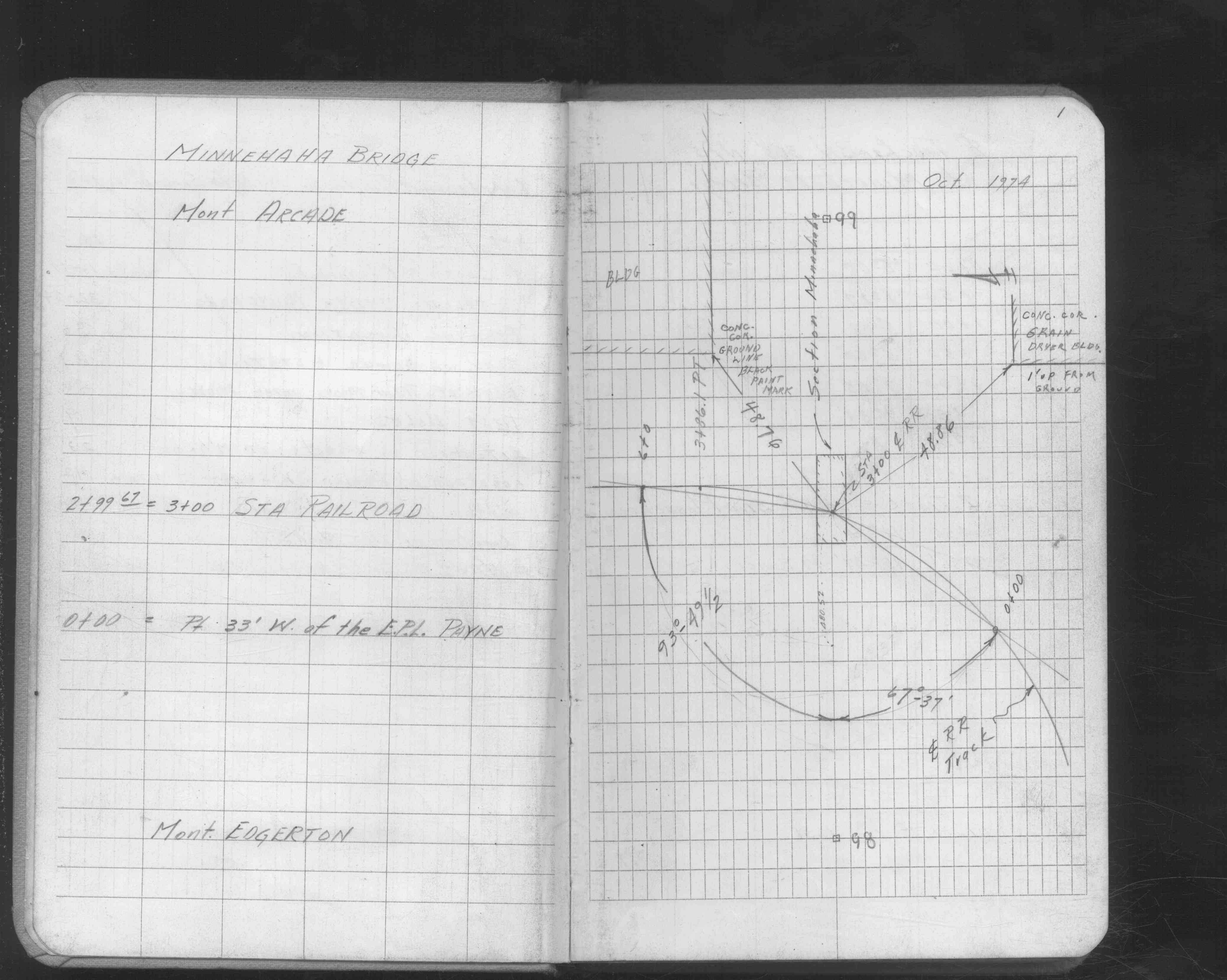
Minnehaha Ave
FROM
Payne Ave
TO
Greenbrier St
| Locations | 1974-10-00 Page(s) 9
Minnehaha Bridge
FROM
Test Hole # 3
TO
Test Hole # 9
| Test Holes | 1975-05-04 Page(s) 10-14
Blank Page
FROM
Blank
TO
Blank
| Blank | 0000-00-00 Page(s) 15
Minnehaha Ave
FROM
Payne Ave
TO
Bush Ave
| Bench Marks | 1974-10-21 Page(s) 16-19
Minnehaha Ave
FROM
Payne Ave
TO
East 651 ft
| Cross Sections | 0000-00-00 Page(s) 20-22
RR Under Br Near Minnehaha&Greenbrier
| Locs & Stationing | 1975-02-26 Page(s) 23
Minnehaha Ave
FROM
Station 1+50
TO
Station 2+50
| Cross Sections | 1975-08-20 Page(s) 24-28
Blank Page
FROM
Blank
TO
Blank
| Blank | 0000-00-00 Page(s) 29
Minnehaha Bridge E of Payne Ave
FROM
Near Payne Ave
TO
Greenbrier St (Proposed)
| Swr&Station Elev | 1975-01-24 Page(s) 30-31
Minnehaha Bridge E of Payne Ave
| Bearing Locations | 1975-01-24 Page(s) 32-33
RR Under Minnehaha Ave
FROM
Spike in RR Tie
TO
Station 4+77.5 Pole
| Track Location | 1975-01-02 Page(s) 34
RR & Reaney Ave & RR
| X-Sec BN Rail | 0000-00-00 Page(s) 35-37
Area Under Minnehah Br E of Payne Ave
FROM
Station 2+69.1
TO
Station 3+47.8
| Cross Sections | 1975-01-08 Page(s) 38
Blank Page
FROM
Blank
TO
Blank
| Blank | 0000-00-00 Page(s) 39-41
BN RR Tracks N&S of Minnehaha Bridge
FROM
Station 0+00
TO
Station 6+00
| Cross Sections | 0000-00-00 Page(s) 42
Phalen Creek Sewer @ Minnehaha Ave
FROM
Sec Line Minnehaha Ave
TO
MH on Reaney Ave
| Sewer Location | 1976-01-09 Page(s) 43
Grain Drying Bldg @ Payne & Minnehaha
| MH Location | 1976-01-11 Page(s) 44-45
Hamms Brewery @ Payne & Minnehaha Ave
FROM
Station 3+77.2
TO
Station 3+81.5
| Depths of MHs | 1976-04-15 Page(s) 46
Voltage Box Under Minnehaha Bridge
| Elevations | 0000-00-00 Page(s) 47
Conduit Power Ho Under Minnehaha Br
| Locs Looking North | 0000-00-00 Page(s) 48-49
Minnehaha Br By Minnehaha & Payne Aves
FROM
Pier # 2
TO
Pier #1
| Locations | 0000-00-00 Page(s) 50
West Abutment Minnehaha Br by Payne Av
| Station & Bearing | 0000-00-00 Page(s) 51
East Abutment Minnehaha Br by Payne Av
| Station & Bearing | 0000-00-00 Page(s) 52
Payne Ave
FROM
Minnehaha Ave
TO
Bush Ave
| Bench Marks | 1978-03-02 Page(s) 53
Albemarle & Wayzata Sts
| Loc CL Alignment | 1978-09-00 Page(s) 54-57
Albemarle St
FROM
Milford St
TO
600 ft North
| Locations | 1978-09-00 Page(s) 58-60
Wayzata St
FROM
Albermarle St
TO
Rice St
| Locations | 0000-00-00 Page(s) 61-62
Alley Near Wayzata & Milford Sts
FROM
Station 0+09.5
TO
Station 1+40.8
| Locations | 0000-00-00 Page(s) 63
At & Near Wayzata & Albemarle Sts
| Bench Marks | 0000-00-00 Page(s) 64-66
Albemarle St
FROM
Milford St
TO
200 ft N of Wayzata St
| Cross Sections | 0000-00-00 Page(s) 67-68
Survey Line
FROM
Wayzata St Station 8+50
TO
Rice St
| Cross Sections | 0000-00-00 Page(s) 69
Alley Near Wayzata St
FROM
Wayzata St
TO
200 ft North
| Cross Sections | 0000-00-00 Page(s) 70
Wayzata & Albemarle Sts
FROM
CL Alley
TO
West 133.8 ft
| CL Profile | 0000-00-00 Page(s) 71-78
Wayzata St
FROM
Albemarle St
TO
Marion St
| Locations & X-Secs | 1979-09-00 Page(s) 79
Lot 20 Line @ Albermarle & Wayzata Sts
FROM
CL Alley
TO
West 130 ft
| Cross Sections | 1979-10-25 Page(s) 80
Blank Page
FROM
Blank
TO
Blank
| Blank | 0000-00-00
1
2
3
4
5
6
7
8
9
15
16
17
18
19
20
21
22
23
29
30
31
32
33
34
35
36
37
39
40
41
42
43
44
45
46
47
48
49
50
51
52
53
54
55
56
57
58
59
60
61
62
63
64
65
66
67
68
69
70
71
72
73
74
75
76
77
78
79