What has changed recently in the St Paul Public Works - Survey Division web page?
________________________________________________________________________________
January 29, 2016
A link to our ArcGIS site has been established. ArcGIS Help file forthcoming.
________________________________________________________________________________
October 29, 2012
The links to the field book pages now include book 1 though book 1000. Over 38,000 field book pages are linked.
________________________________________________________________________________
June 22, 2010
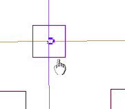
All monuments now have a City Index number, which allows us to list all of the known monuments in one location. We have replaced the "Old Monument Listing" with "Monument Location Listing". There is no longer a separation between the old numbering system and the new, they are now a combined system.
The monument pages have a new look with sections of information grouped by color. The Station (City Index Number) includes the map, old index and coordinate information. An asterisk (*) indicates which coordinate is the PLS coordinate and a slider bar is provided for multiple coordinates. The next section with a medium blue color is the monument history showing the most recent date at the top with a slider bar provided as needed. The light blue section are the books which are grouped by type, listing the links of the pages related to the monument. The links to the monument ties are in the purple section, with the most recent on top. Finally, the yellow section lists the photos starting with the most recent date.
________________________________________________________________________________
August 10, 2009
A new interface is now available for looking up survey data. The application is called GISmo.
GISmo Home Page
Use the GISmo3 Public to search for St. Paul information graphically. The Survey data is under the folder "Geodetic & Control Points". Benchmarks, Monuments and Survey Books have their own folders. The Benchmarks and Monuments are catagorized by year.
Benchmarks
The benchmark elevations are shown directly on the map and more information can be found including the described location by clicking on the benchmark symbol, assuming the map is zoomed in enough and the catagory is current. (see GISmo Quick Reference below)
Monuments
The monument photos and ties are linked directly from the map, and can also still be found through the individual monument history page. The monument history page is accessed by clicking on the monument symbol, assuming the map is zoomed in enough and the catagory is current. (see GISmo Quick Reference below)
Books
We have many pages of Survey books linked within the city, and are continually adding more pages to the site as they are linked. Most of the pages in the J.B. Irvine books are linked. Currently their are more than 7,600 Field Book page links (Books 1-374) and over 32,000 Cross Section page links (Books 1-2800). Zoom into an area where you are working, and you will be able to see many book pages that pertain to that area. The pages come up by picking the book symbol, assuming the map is zoomed in enough and the catagory is current. (see GISmo Quick Reference below)
Note:
Not all pages are on the map, and some may not be added since we are unable to interpret the location described on certain pages, but we will continue to add what we can to the map. Of course, pages of all of these books can still be found under BOOKS in the Survey Records section of our site.
This file will help you get started: GISmo Quick Reference
________________________________________________________________________________
May 14, 2009
The data under Survey Records section has been modified to reflect updated bench marks and the monument listing has been separated from the traverse points.
________________________________________________________________________________
May 16, 2005
PDF format has been added to compliment the DWF format for those who don't have a DWF viewer.
The DWF files are generally 1 tenth the size of the PDF format, so the download time will be longer. PDFs also may
require going back several times to get to a previous web page.
Either format can be selected directly from the
Break-Down page or the
Benchmark page or the
Monument page.
The PDF files also include links to images and files like the DWF format.
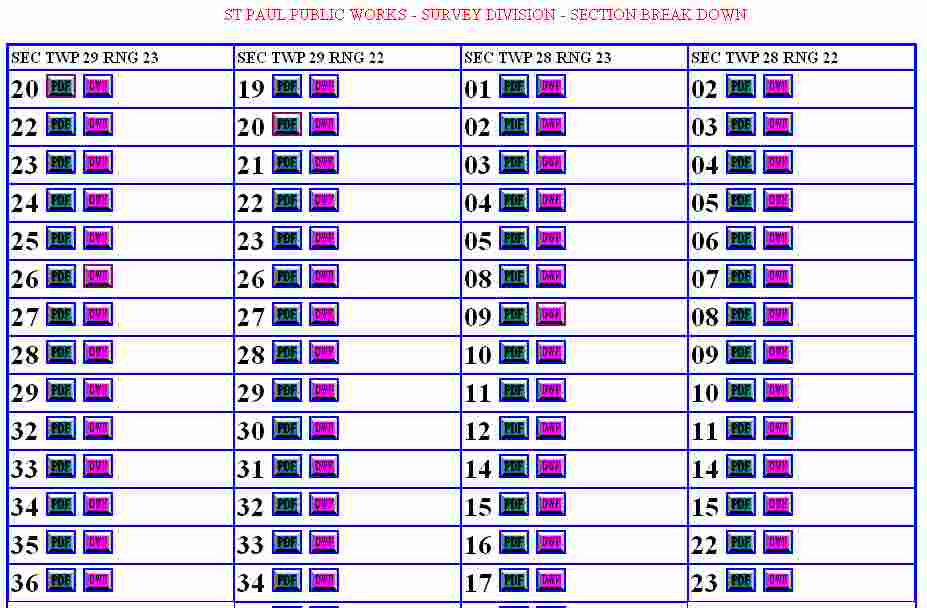
Section Break Down Map
Traverse City Map
________________________________________________________________________________
________________________________________________________________________________
July 14, 2004
The BOOKS page has been incorporated into the SURVEY RECORDS page. This
eliminates a step for getting to the book records.
The
Monuments
have been extracted from the Traverse map and are now in a separate map:
A DWF viewer is required to view these maps.
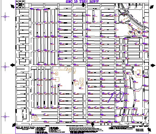
The
Monument map
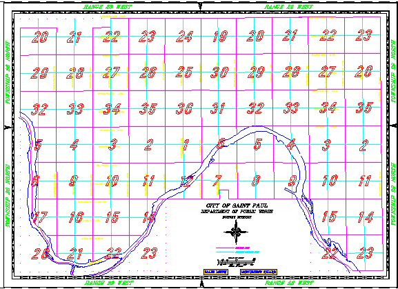
graphically shows the monuments that have been set since the city was
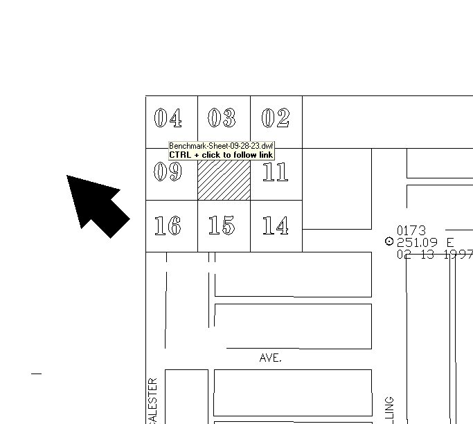
originally monumented. Pick on the section number in the map to go to the
individual sheet.
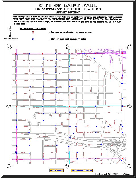
In the DWF format, right click in the map and select Named Views... to bring up a
listing of intersections within the sheet.
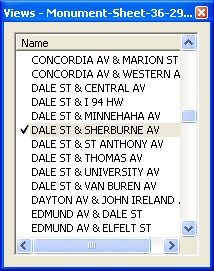
The intersection is brought to the center when the names are picked in the
list box. Adjacent maps can be brought up by picking an arrow with the CONTROL
KEY.
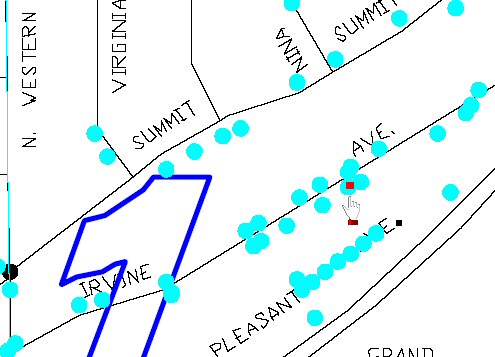
Many monuments are still in place while others may have been removed. There are
two symbols in the map to differentiate between those monuments that have a
position established and the monuments that may or may not be still in place.
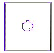 Symbolizes monuments that were found and coordinates established.
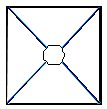 Symbolizes monuments that may or may not physically exist and don't have
coordinates.
Symbolizes monuments that may or may not physically exist and don't have
coordinates.
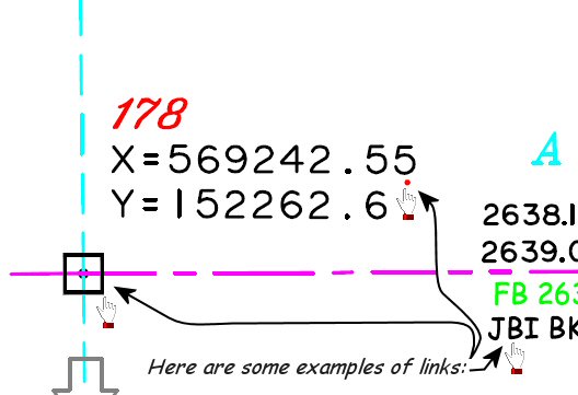
Click on these symbols to bring up the information page about the monument.
________________________________________________________________________________
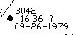
The
Benchmark
elevation coding has changed:
NA = No Elevation
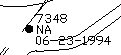
? = Questionable elevation
The
Benchmark map
graphically shows the benches within the city. A DWF viewer is required to
view these maps.
Pick on the section number in the map to go to the individual sheet.
In the DWF fromat, right click in the map and select Named Views... to bring up a listing of intersections
within the sheet.
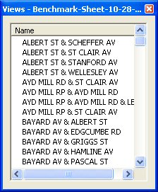
The intersection is brought to the center when the names are picked in the
list box. Adjacent maps can be brought up by picking an arrow with the CONTROL
KEY held or by picking (with the CONTROL KEY) the section number in the upper
left part of the map.