| NAD83 COORDINATES (1986 adj.): |
|---|
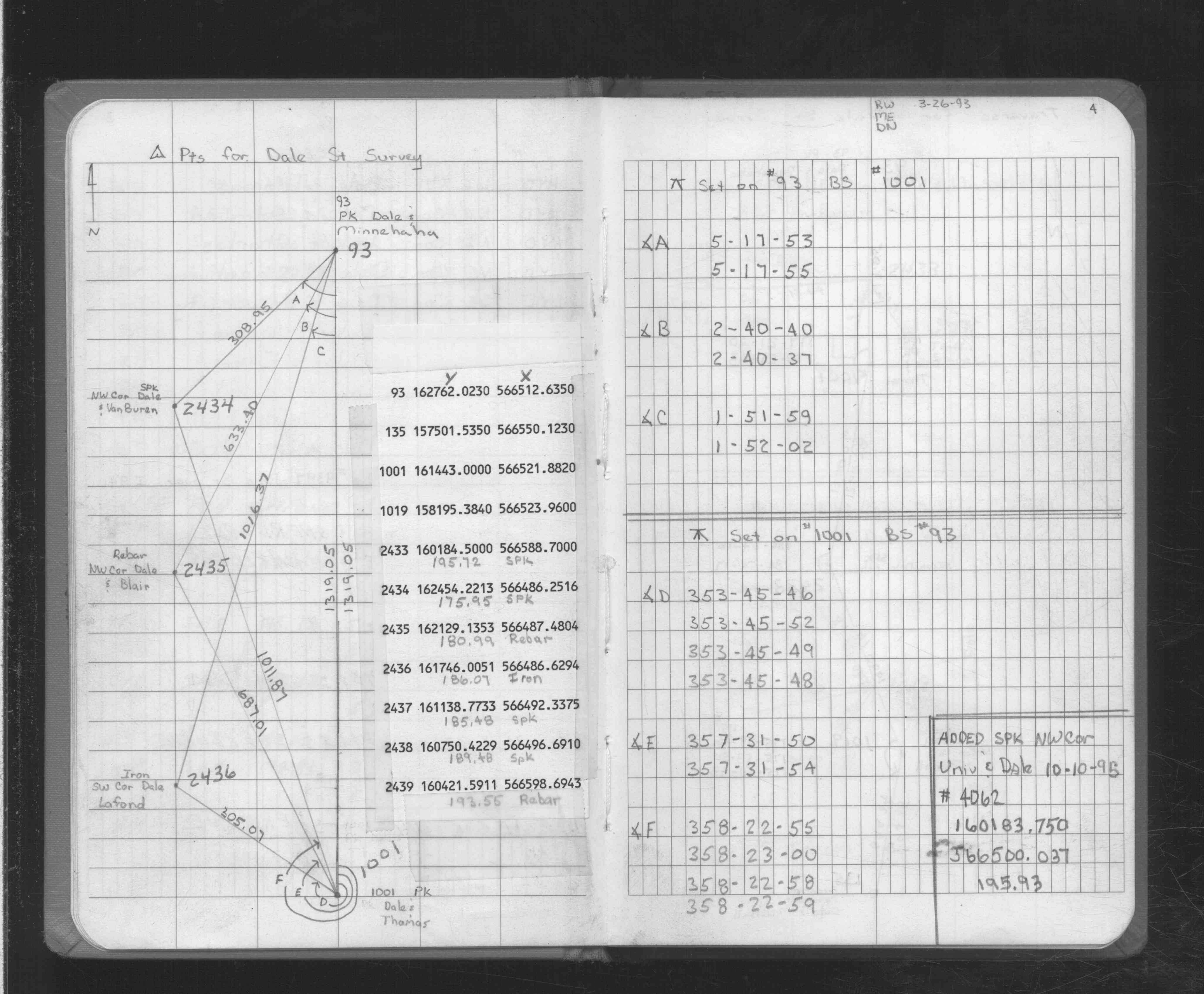
| * X= 566512.64 Y= 162762.02 Z= 0 LSQ 12/6/1991 S FLT |
| X= 566512.6 Y= 162762.06 Z= 869.5 3/10/2006 RTK-VRS |
| 10/1/2012 | DO NOT HOLD MAGNAIL AT LOCATION AS TRUE POSITION. Nail was put in position from ties; waiting to GPS in order to determine positional accuracy. |
| 6/7/2012 | Unable to find PK. |
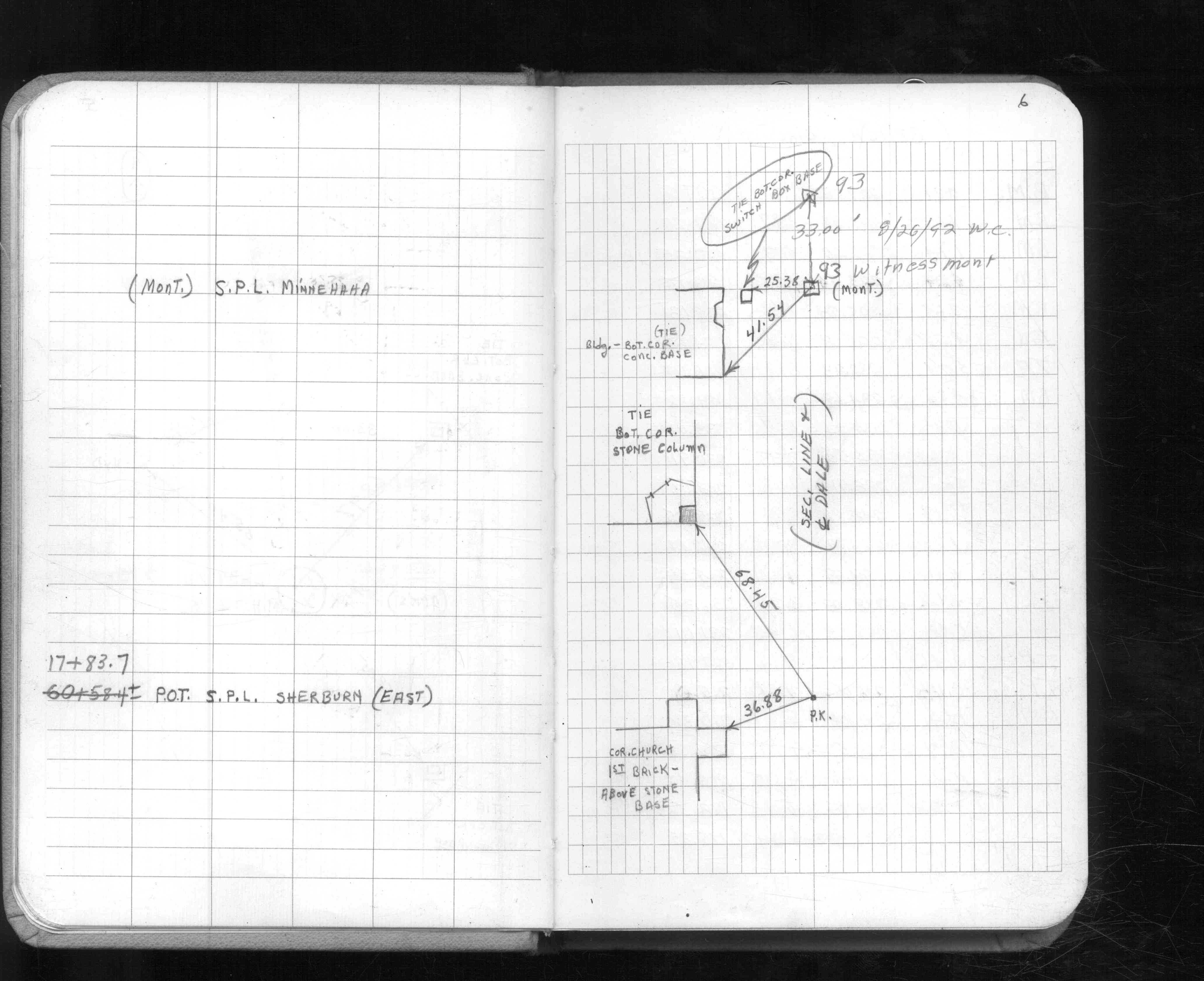
| 2/27/2008 | Fd PK at the edge of a MH. |
| 3/10/2006 | Position on PK established by RTK-VRS GPS. Elev. 869.5 Ft. |
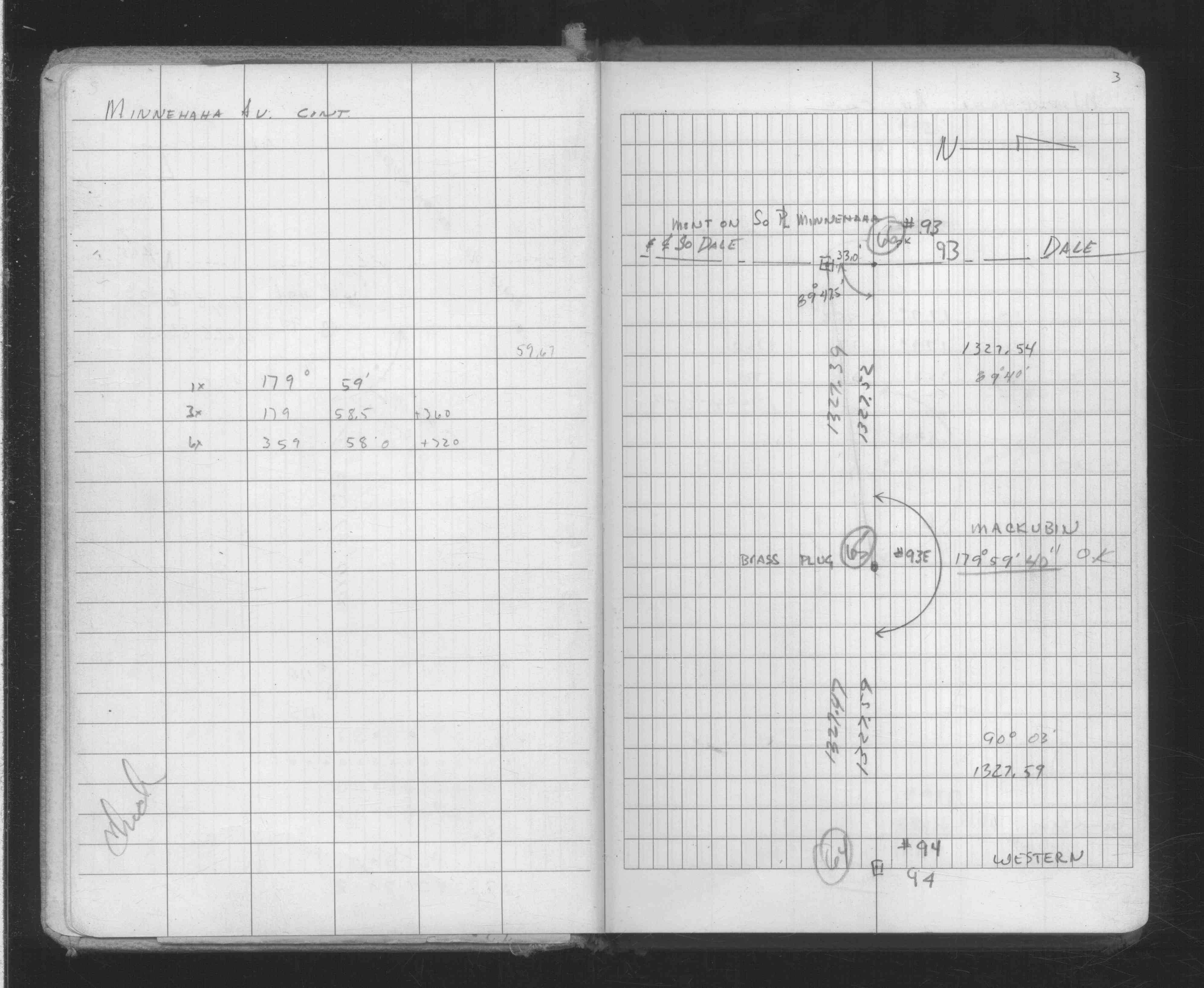
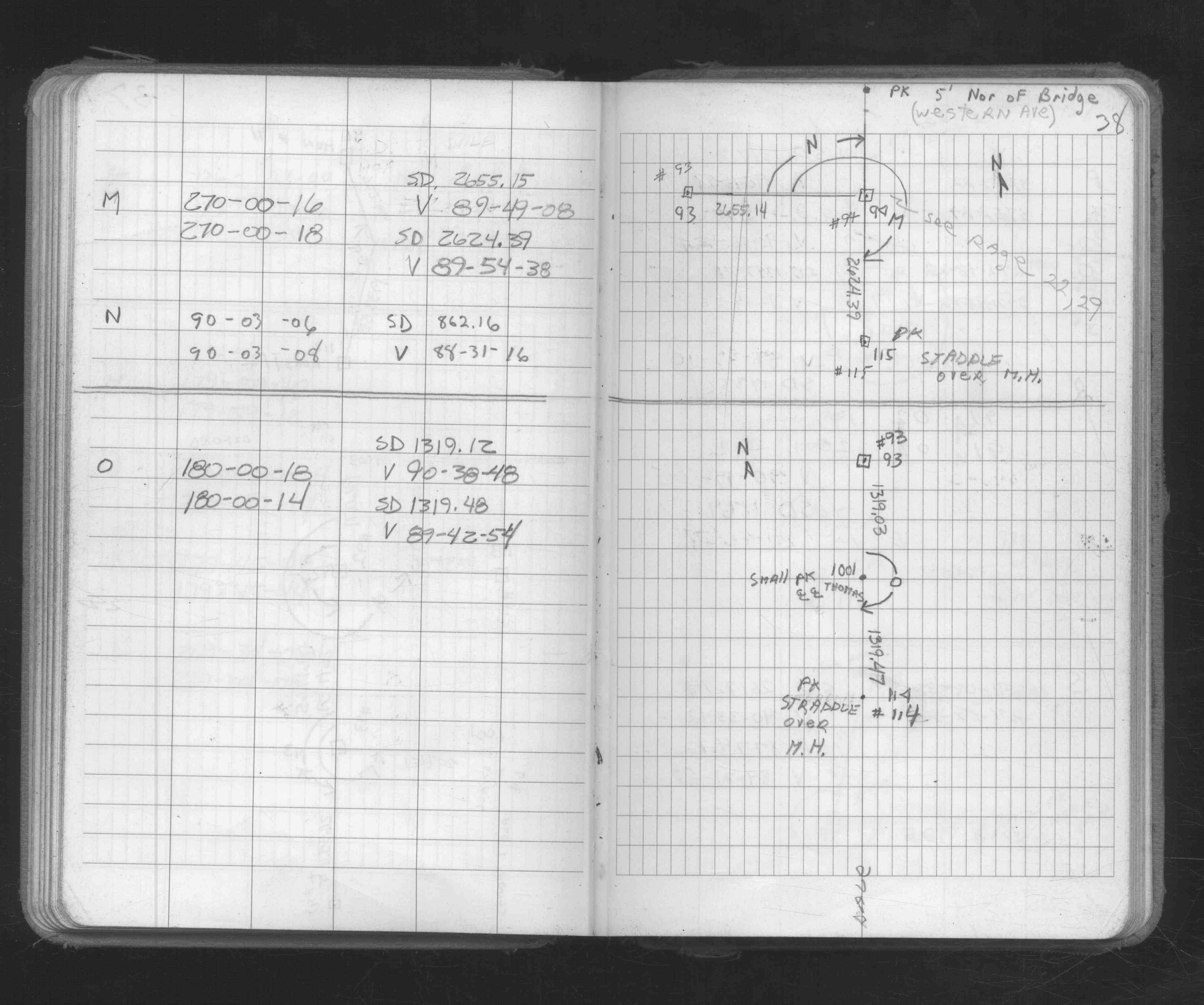
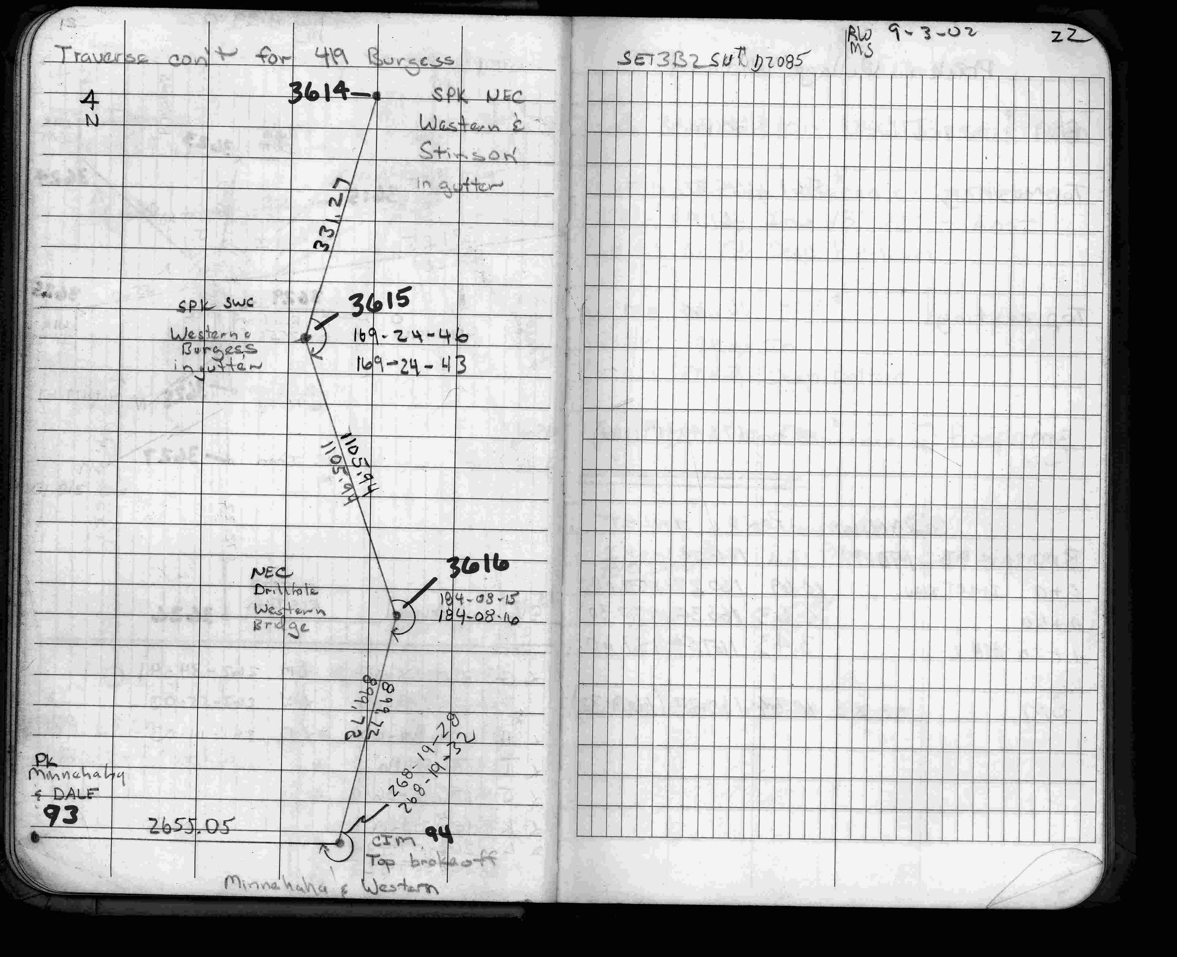
| 8/29/2002 | Used PK nail for traverse control. See FB 1735 p.22 |
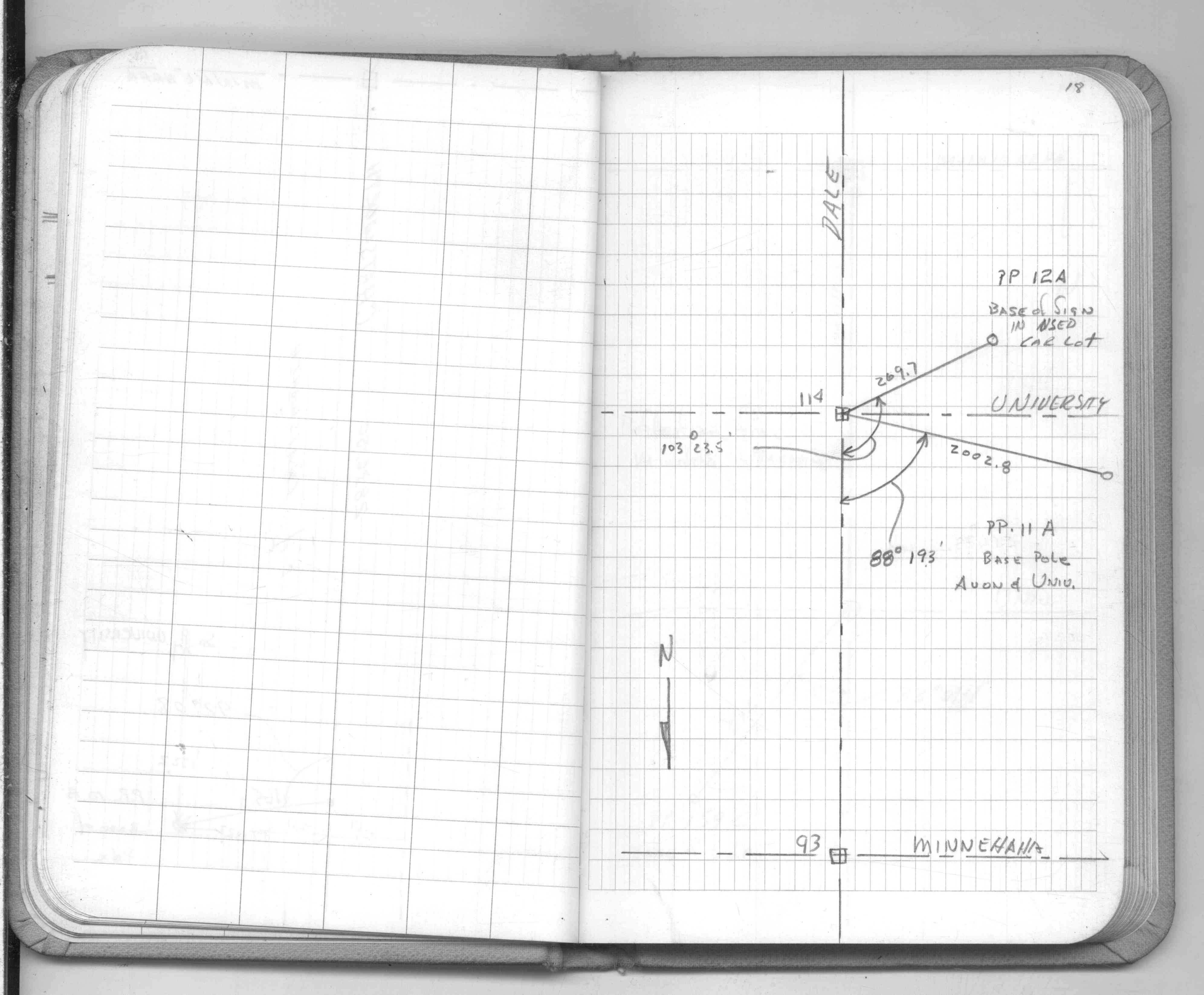
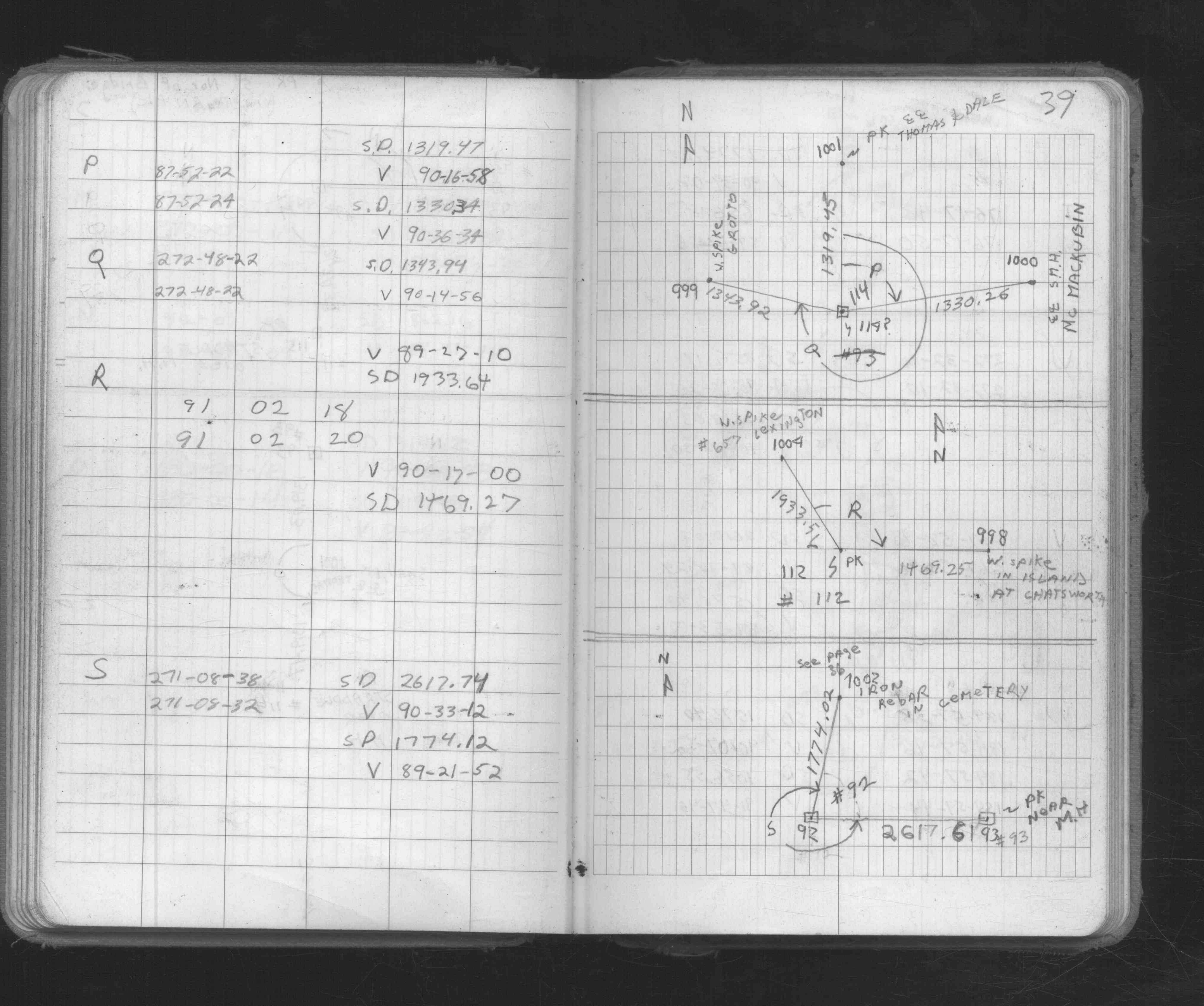
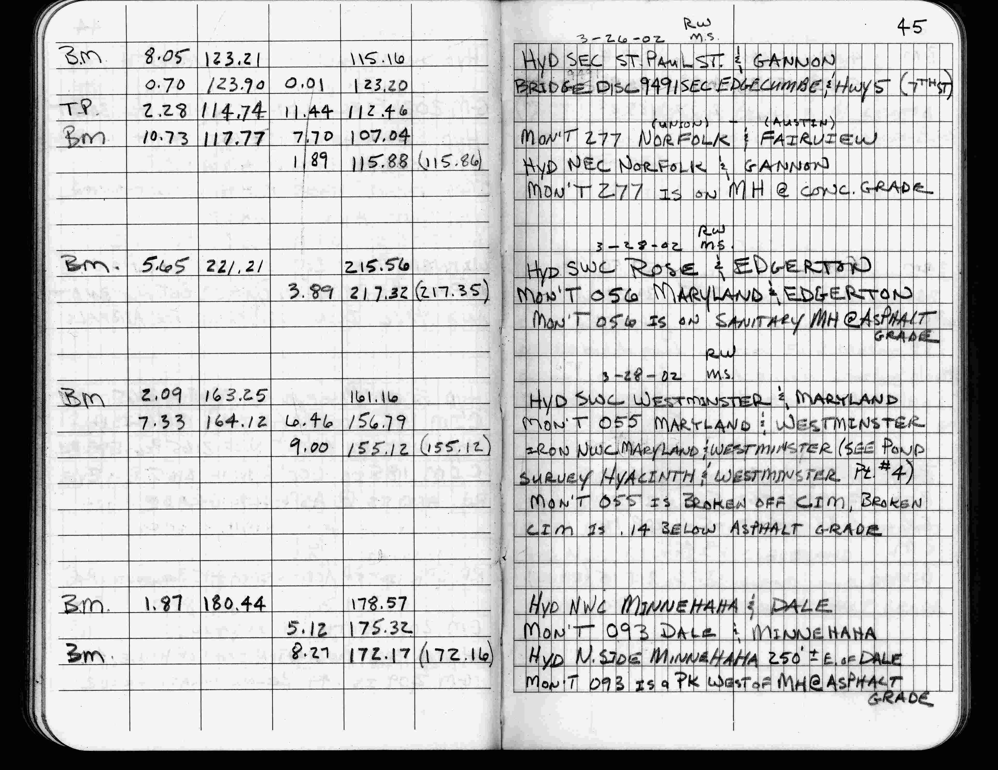
| 3/28/2002 | Elev 175.32 ft on PK nail west of MH at asphalt surface. See FB 1736 p.45 |
| 3/1/2000 | (Unknown date Mar __, 2000 ) Fd PK west of MH (marked for painting target for 2000 aerial) |
| 9/21/1995 | Fd headless PK nail west of sewer MH (marked for painting target for 1995 aerial) |
| 3/1/1988 | (Unknown date Mar __, 1988 ) PK in place of monument; MH casting too close for monument |
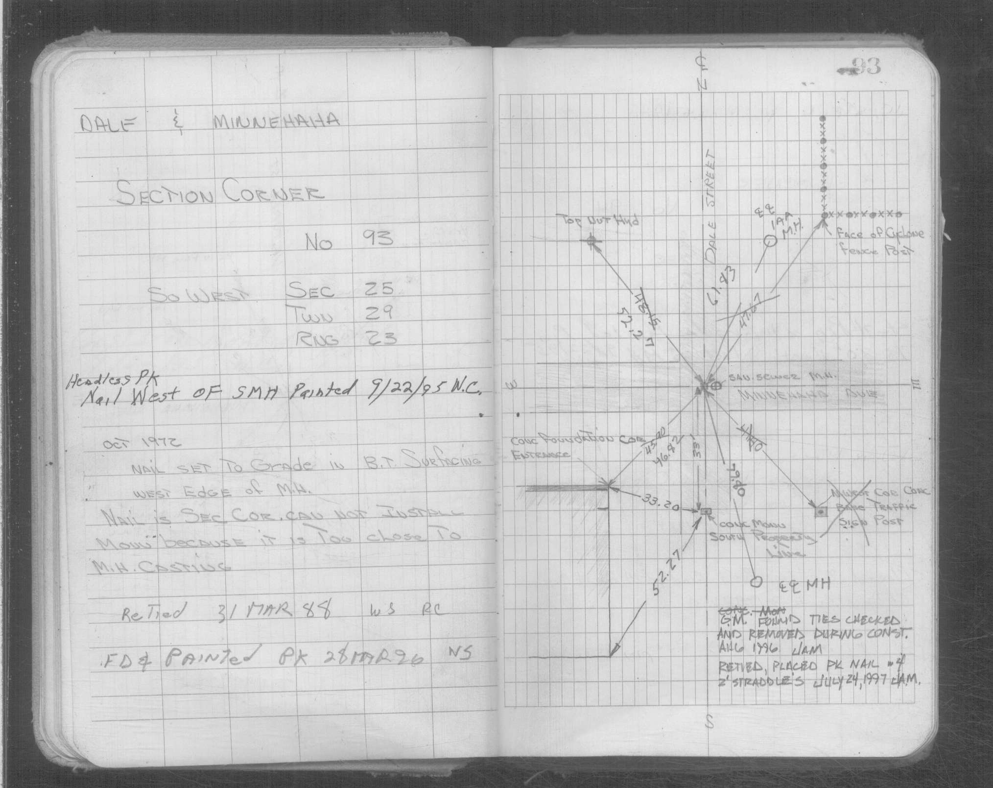
| 11/1/1847 | (Unknown date Nov __, 1847 ) Isaac N Higbee deputy surveyor set post. Tied to 1 BT. See IH p.068-069 2923 |
Above is NOT an all inclusive history of this point. Please review all the links below.
| PLS NOTES | Field | Cross Section | Sewer | J.B. Irvine | Monument | River Survey |
|---|---|---|---|---|---|---|
| IH p.068-069 | FB 0158p. 10 ,14 | |||||
| FB 0197p. 39 ,52 | ||||||
| FB 0276CPYp. 07 ,08 | ||||||
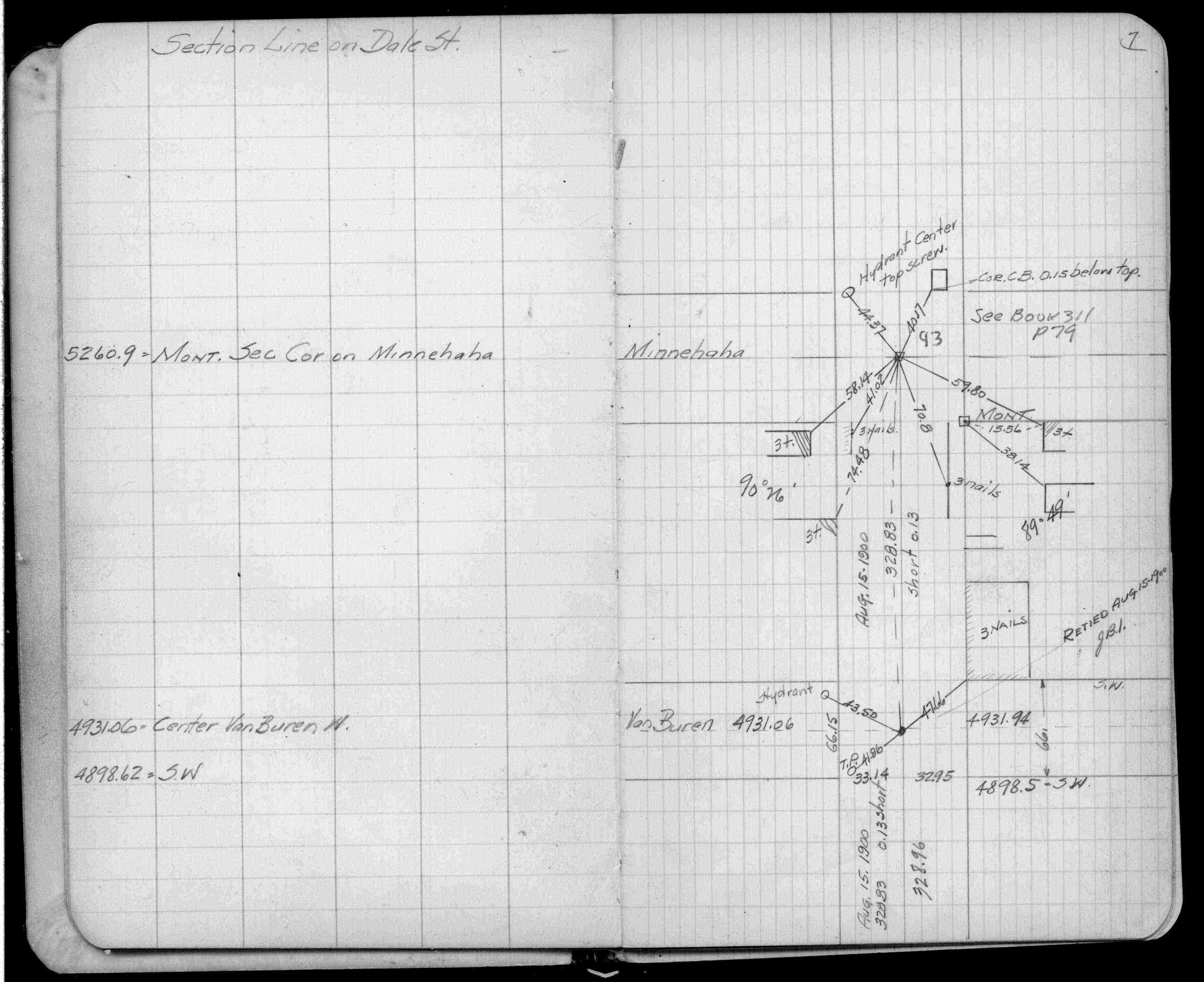
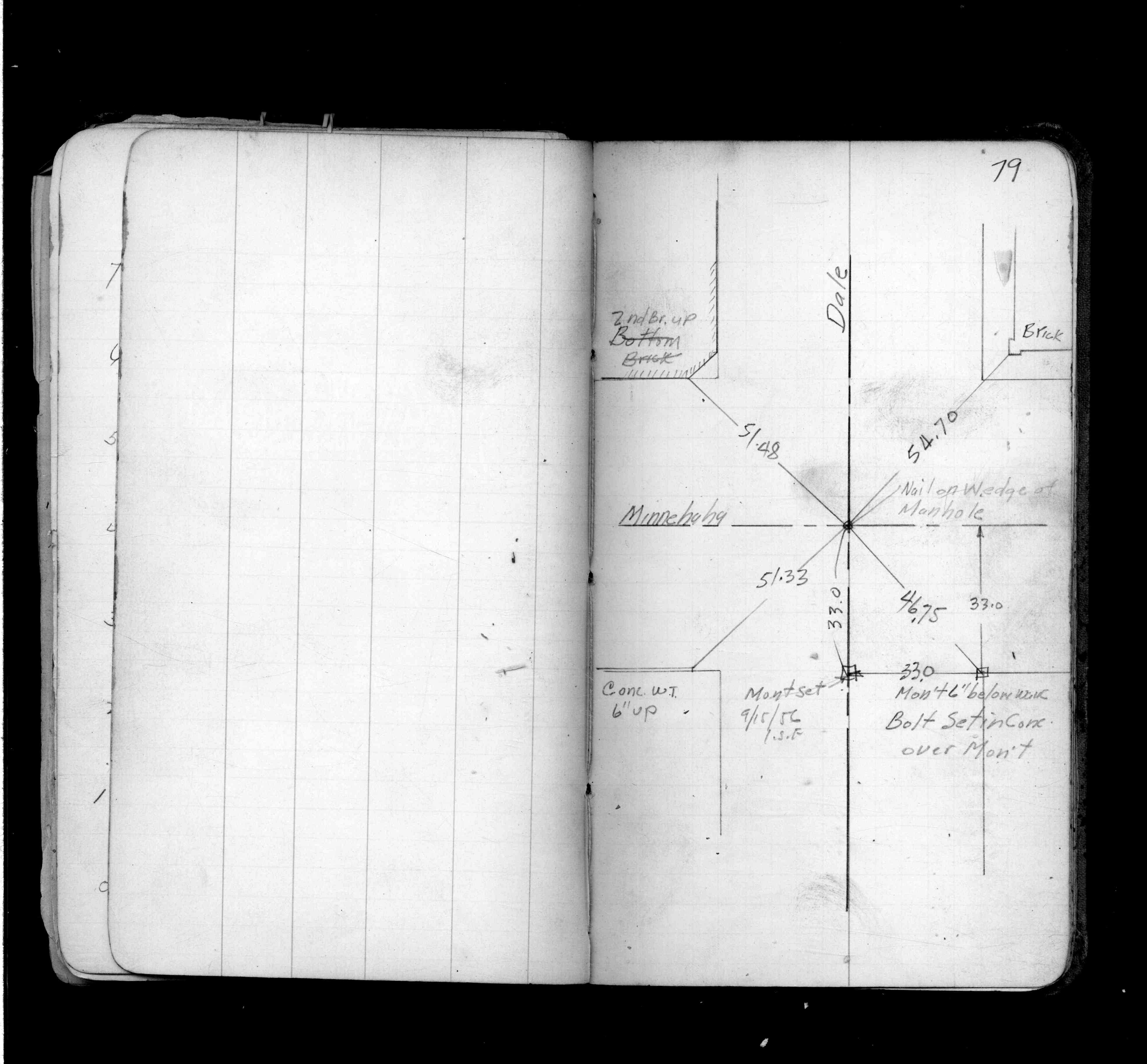
| FB 0311p.79 | ||||||
| FB 1523p.05 | ||||||
| FB 1546p.02 | ||||||
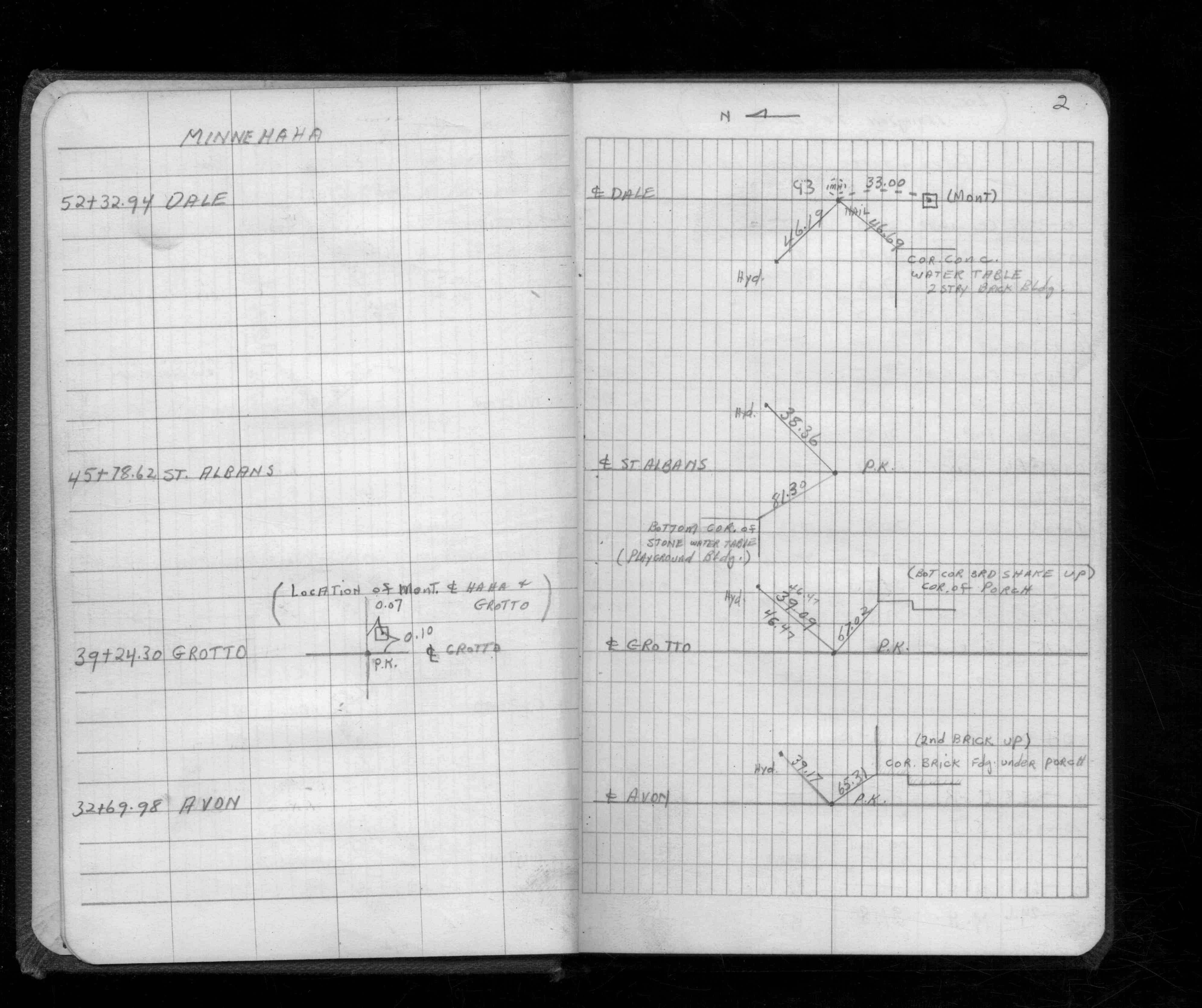
| FB 1549Fp. 07 ,08 ,10 ,18 | ||||||
| FB 1609p.06 | ||||||
| FB 1634Dp. 03 ,04 ,05 ,06 ,09 | ||||||
| FB 1673Ap. 37 ,38 ,39 ,40 | ||||||
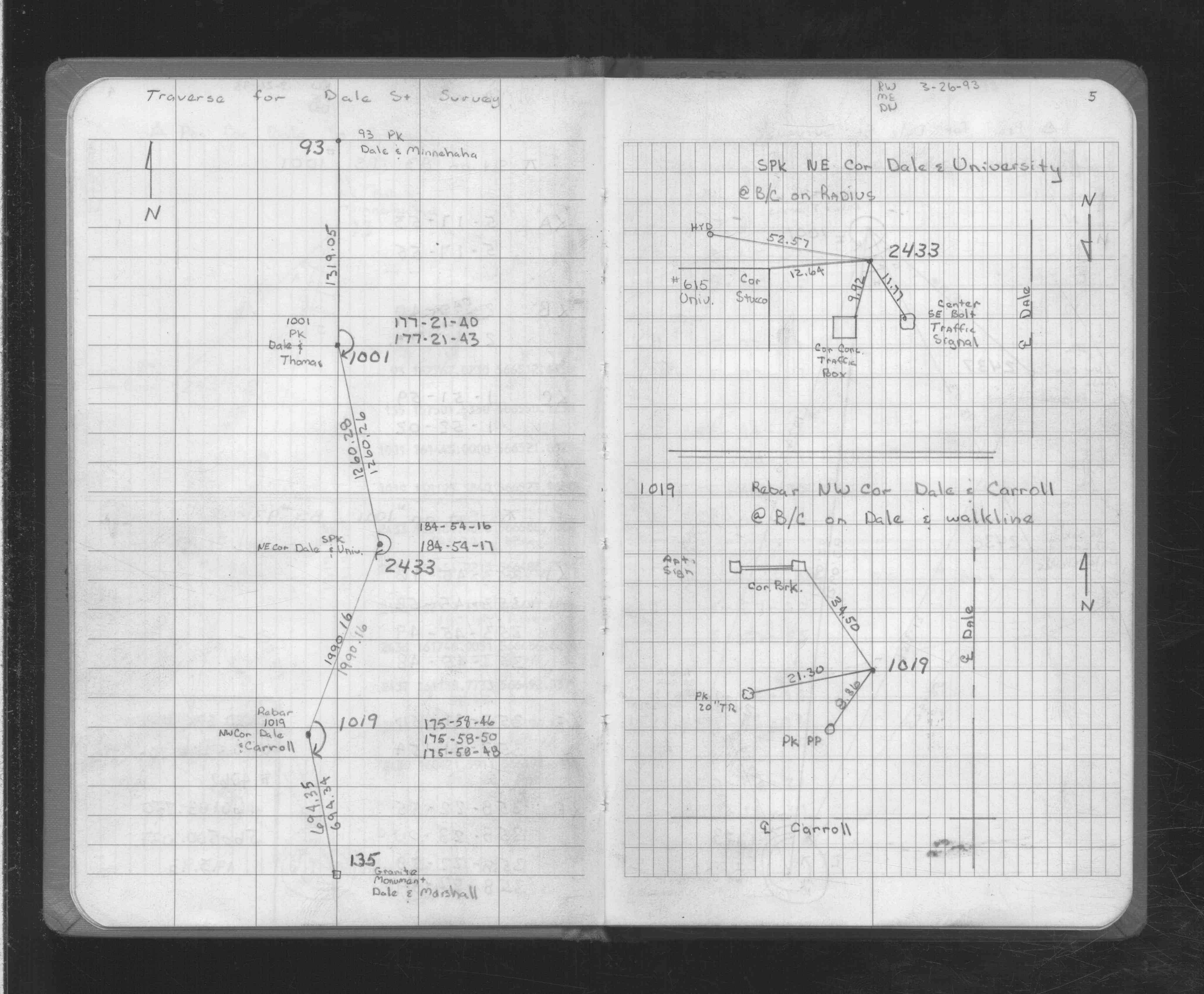
| FB 1725p. 04 ,05 | ||||||
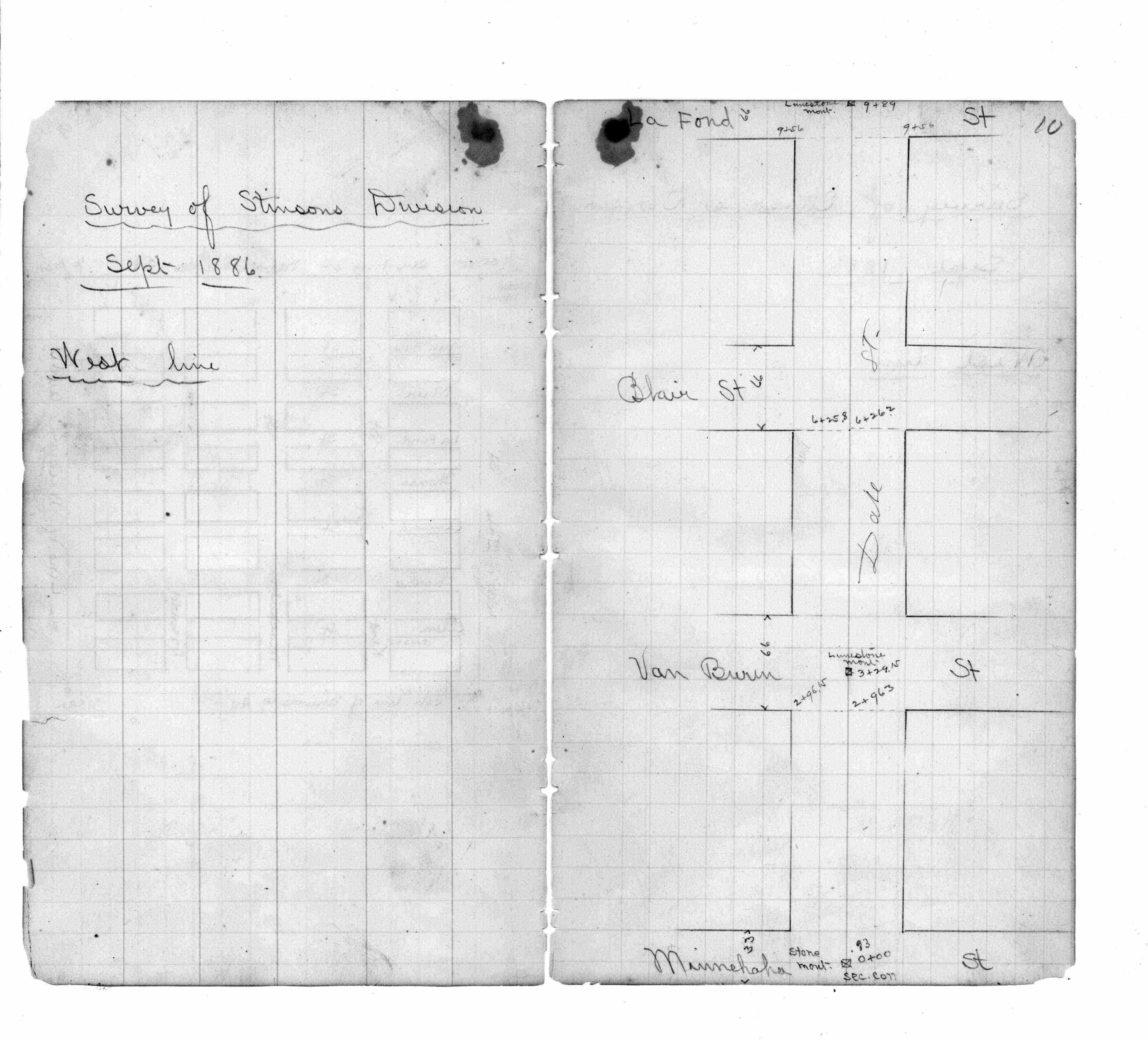
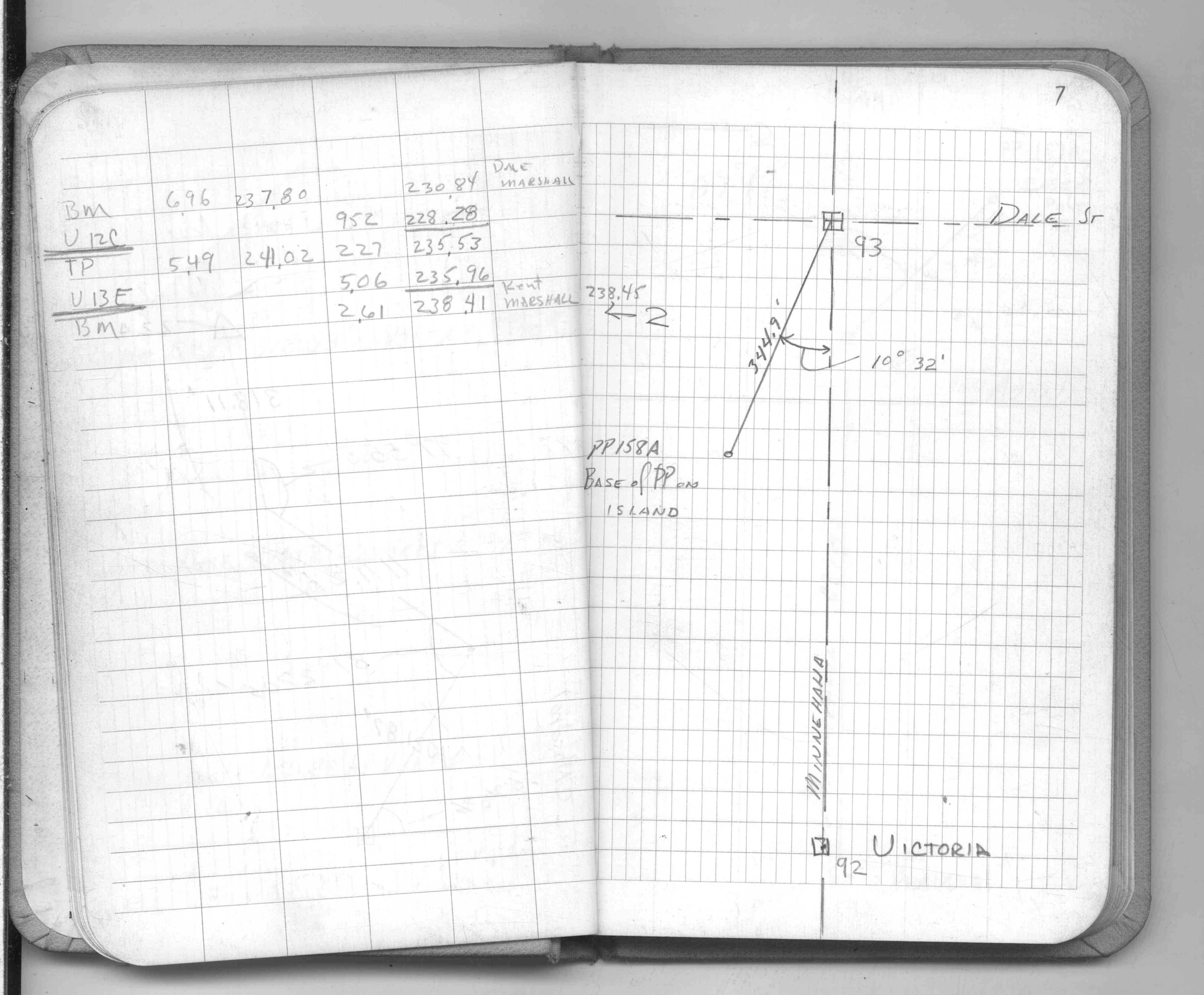
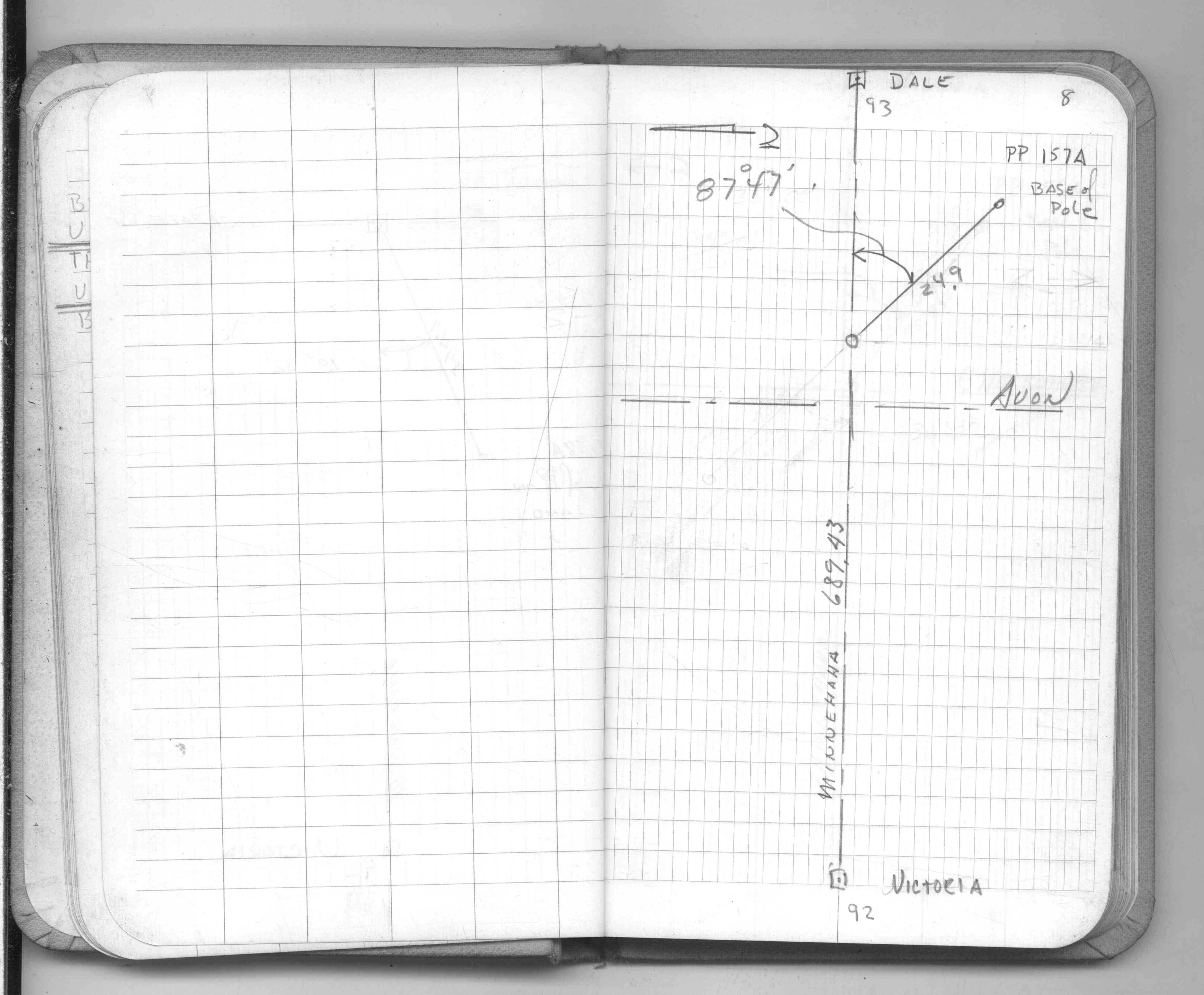
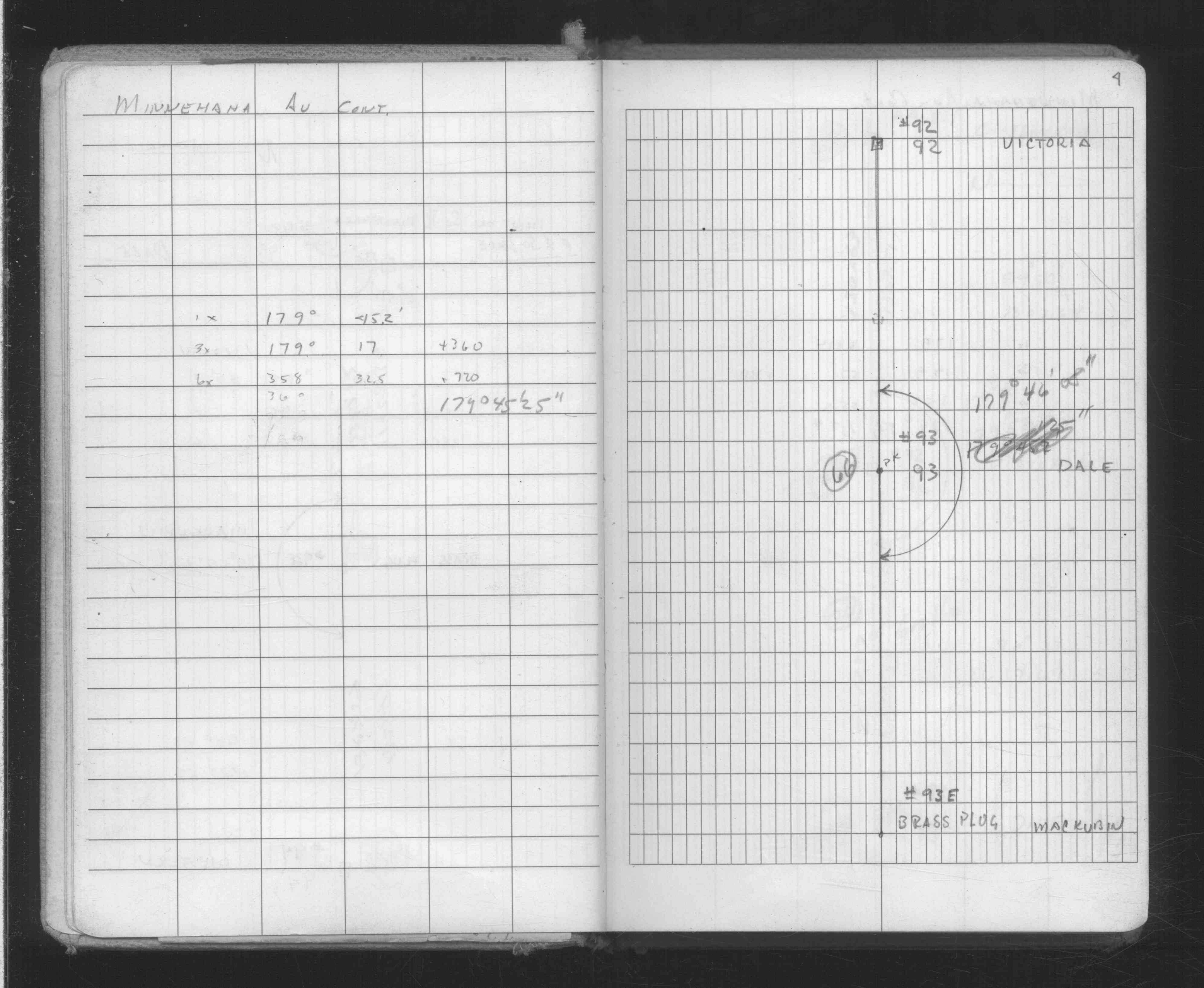
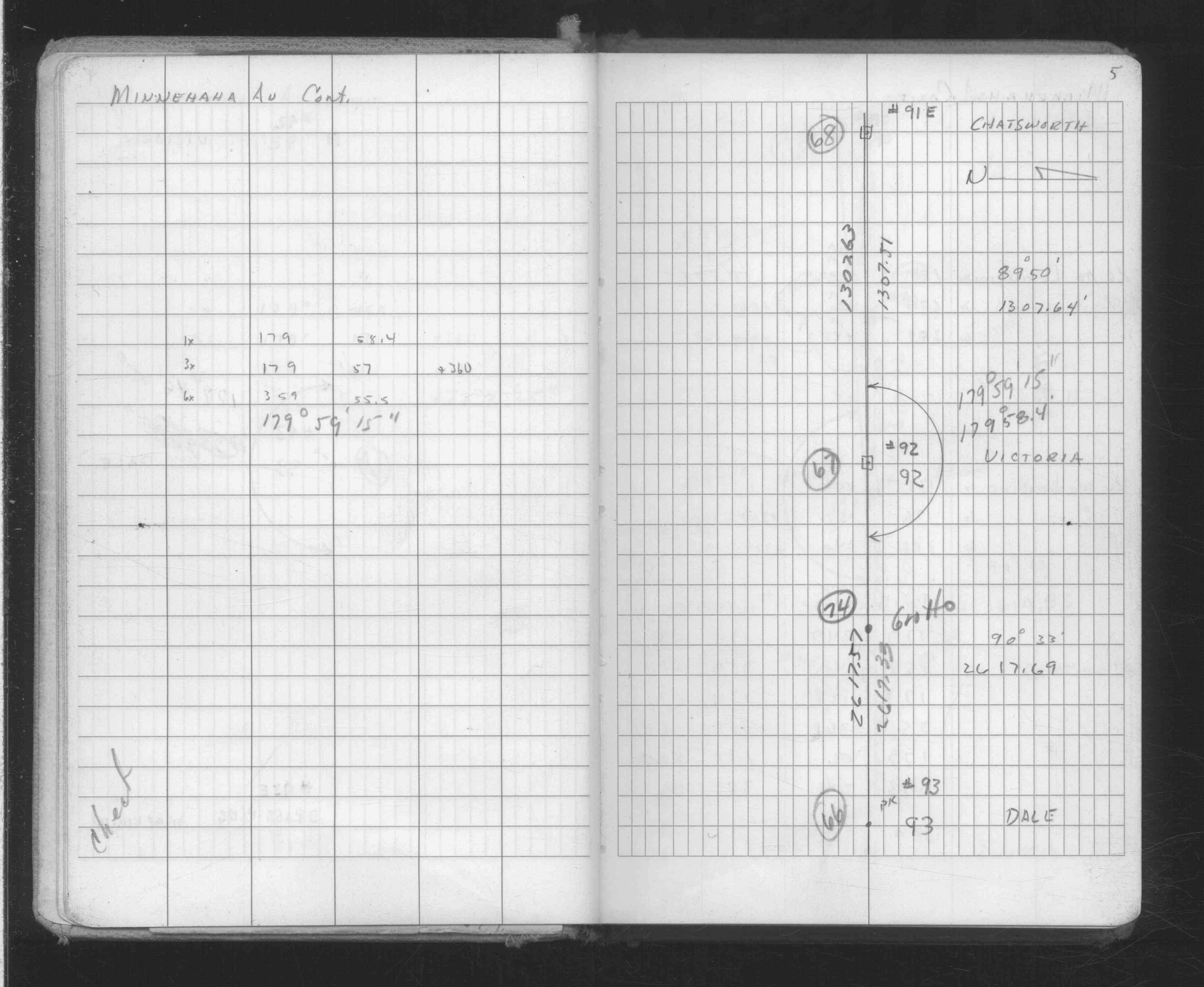
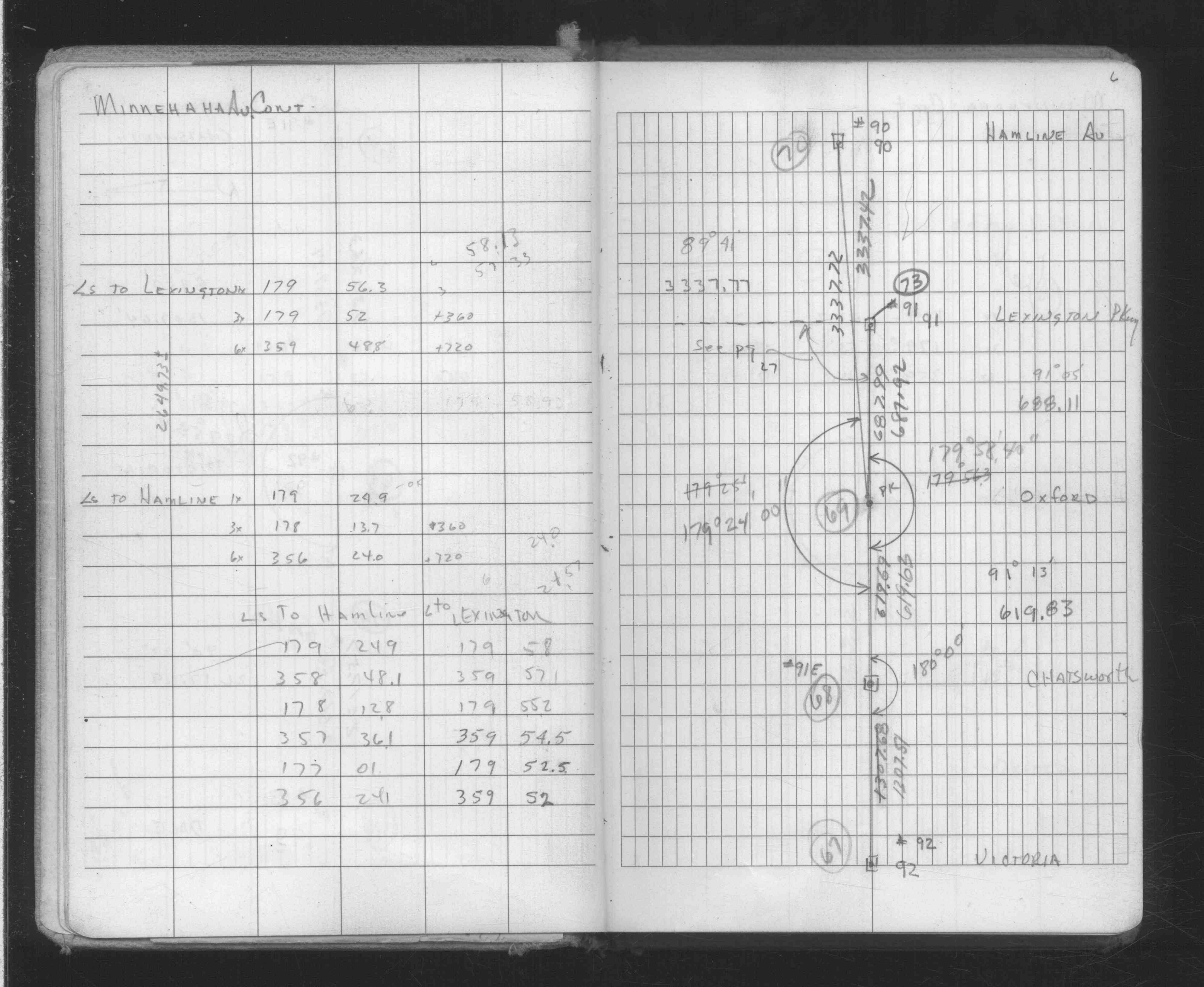
| FB 1735p.22 | ||||||
| FB 1735p.22 | ||||||
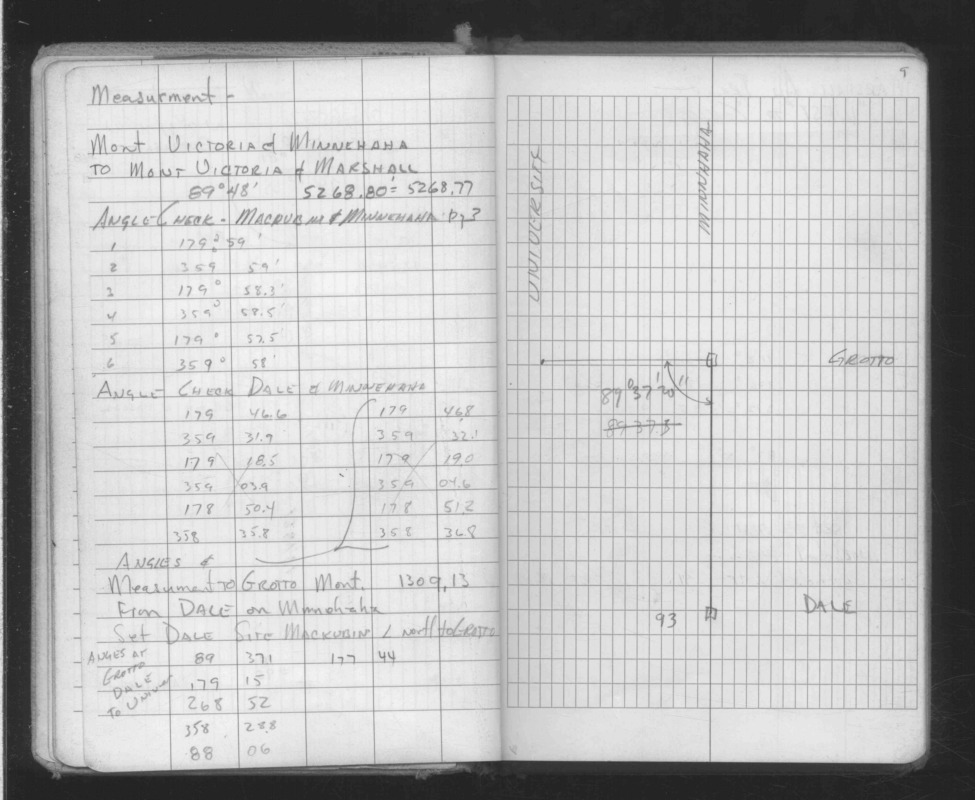
| FB 1736p.45 |
| FILE | SURVEYOR | LIC. NO. | DATE SIGNED | DATE TIED |
|---|---|---|---|---|
| ST_079-156p093.jpg | none | none | none | none |
| 0093-0057-A.dwf | none | none | none | none |