| NAD83 COORDINATES (1986 adj.): |
|---|
| * X= 571881.534 Y= 152272.879 Z= 000.00 LSQ 12/06/1991 S FIX |
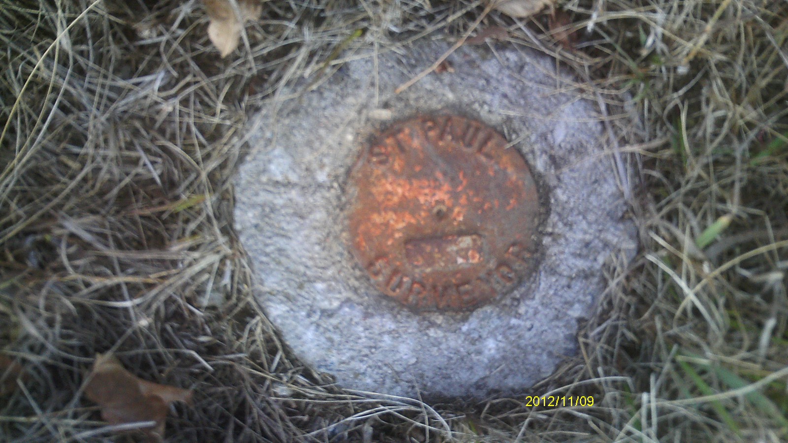
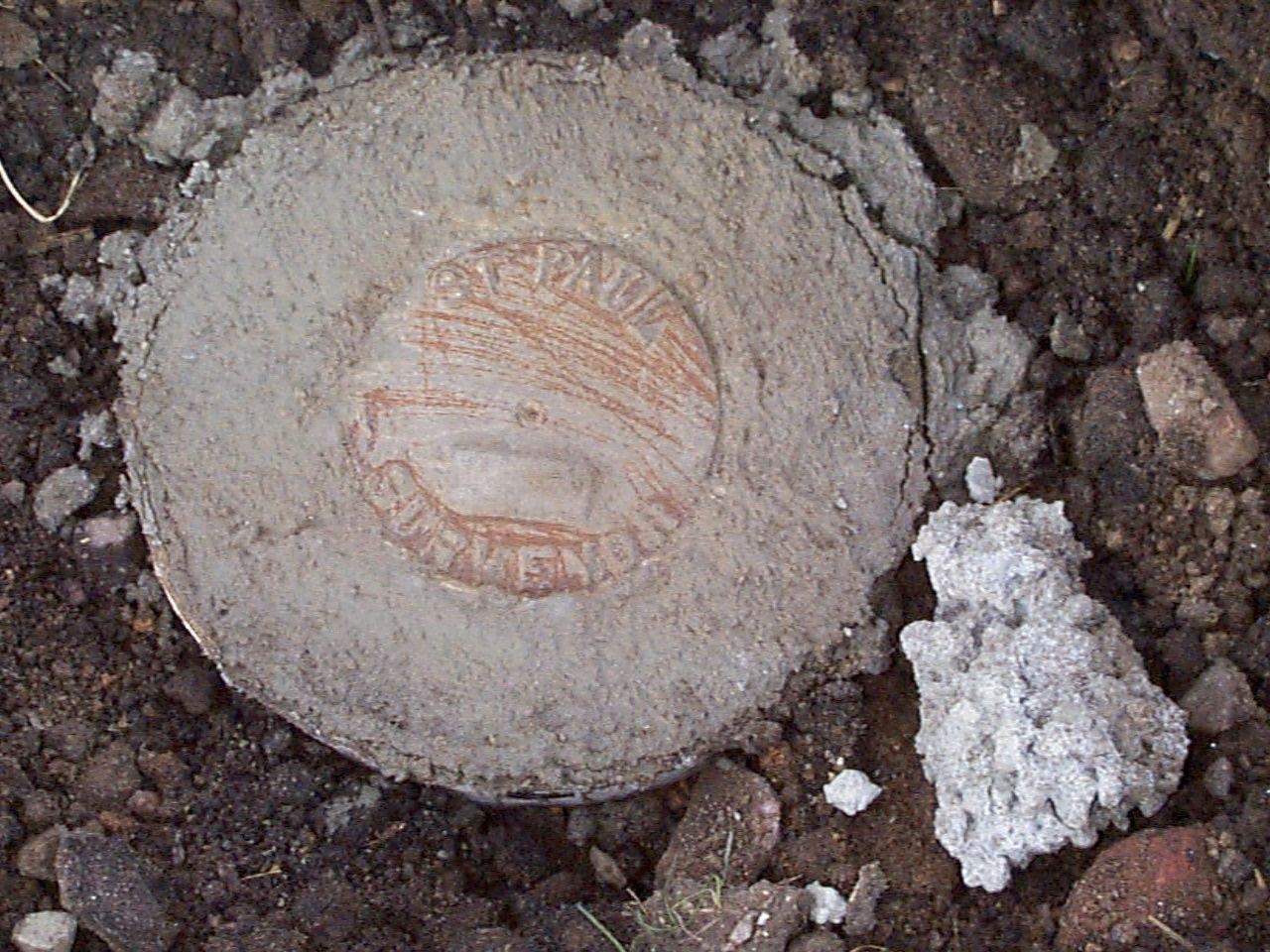
| 11/9/2012 | Found CIM at surface grade. Photos taken. |
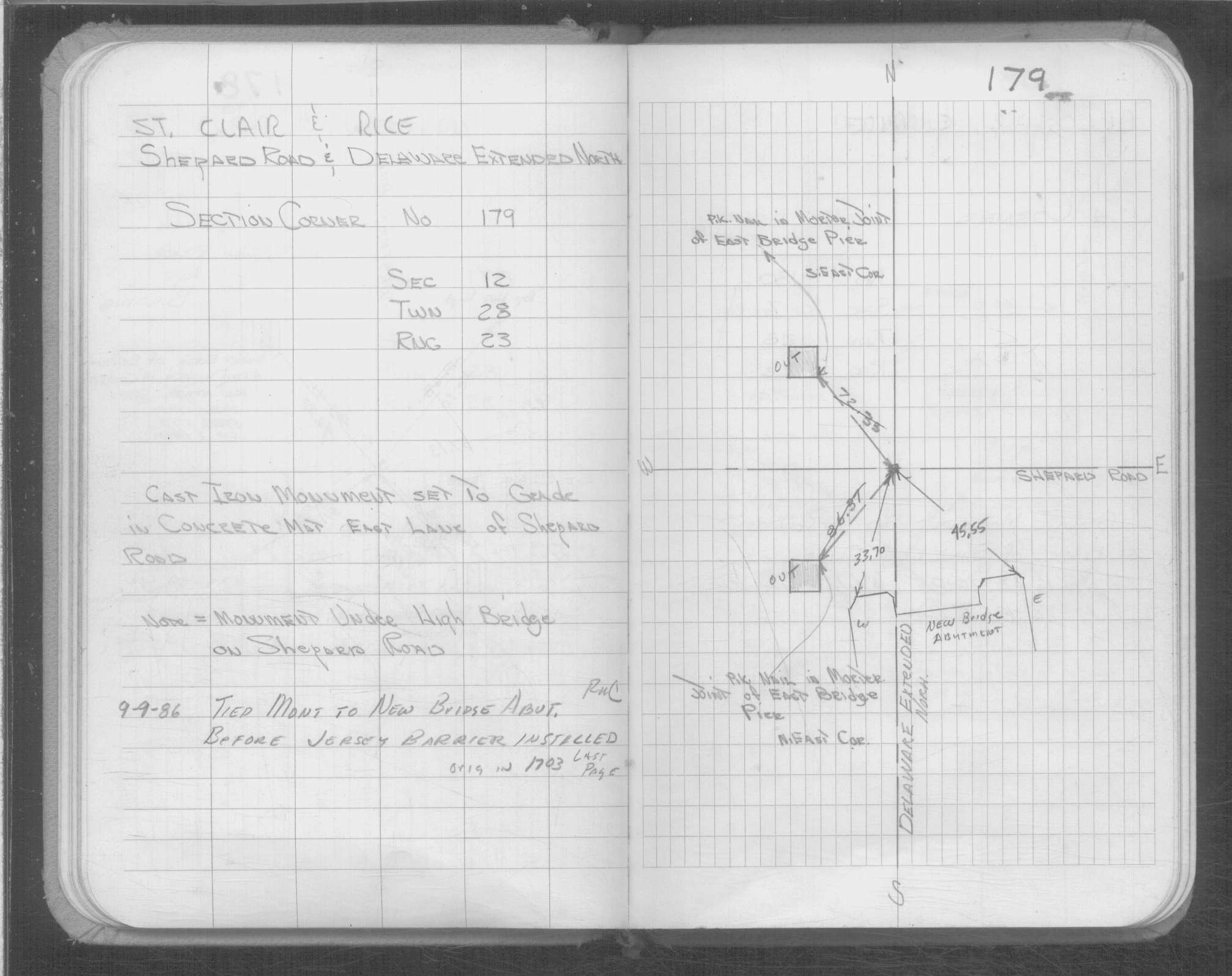
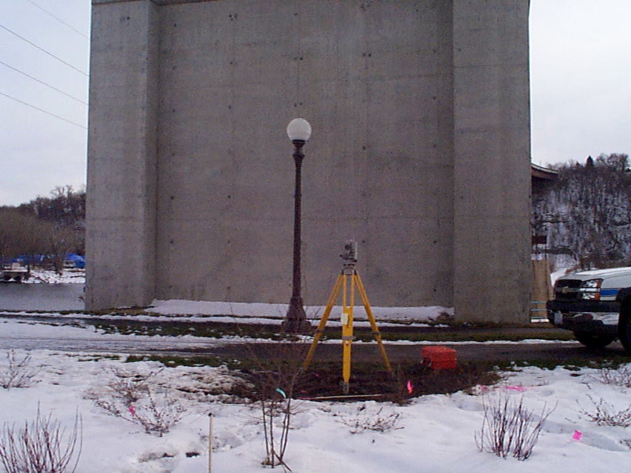
| 12/19/2003 | Placed CIM labeled "ST PAUL SURVEYOR" in concrete over bent rebar. See CofL 0179-0139-B |
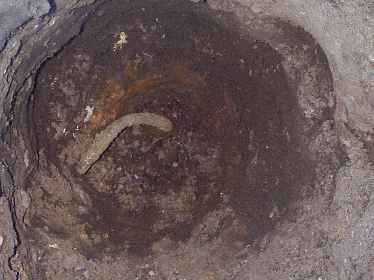
| 12/18/2003 | Fd bent rebar 2.0 ft below landscaping grade. |
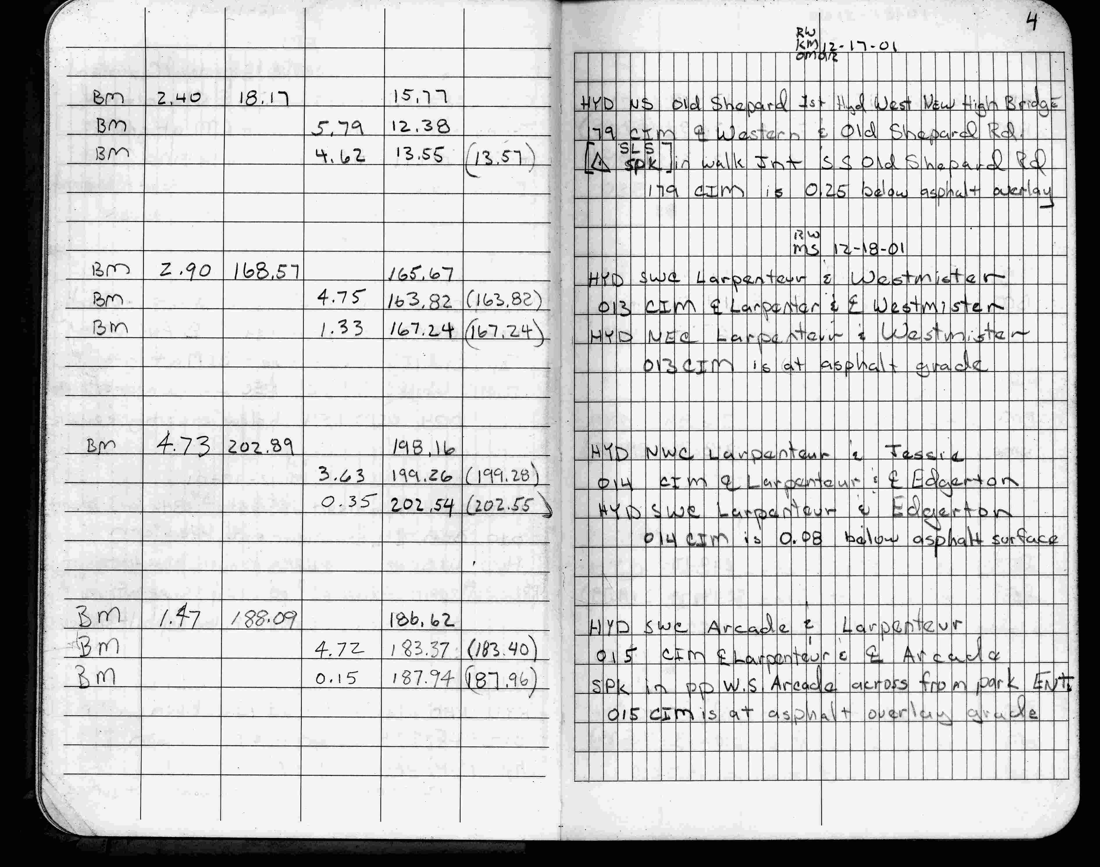
| 12/17/2001 | Fd CIM 0.25 ft below grade, placed ties, left CIM as found. See CofL 0179-0139-A |
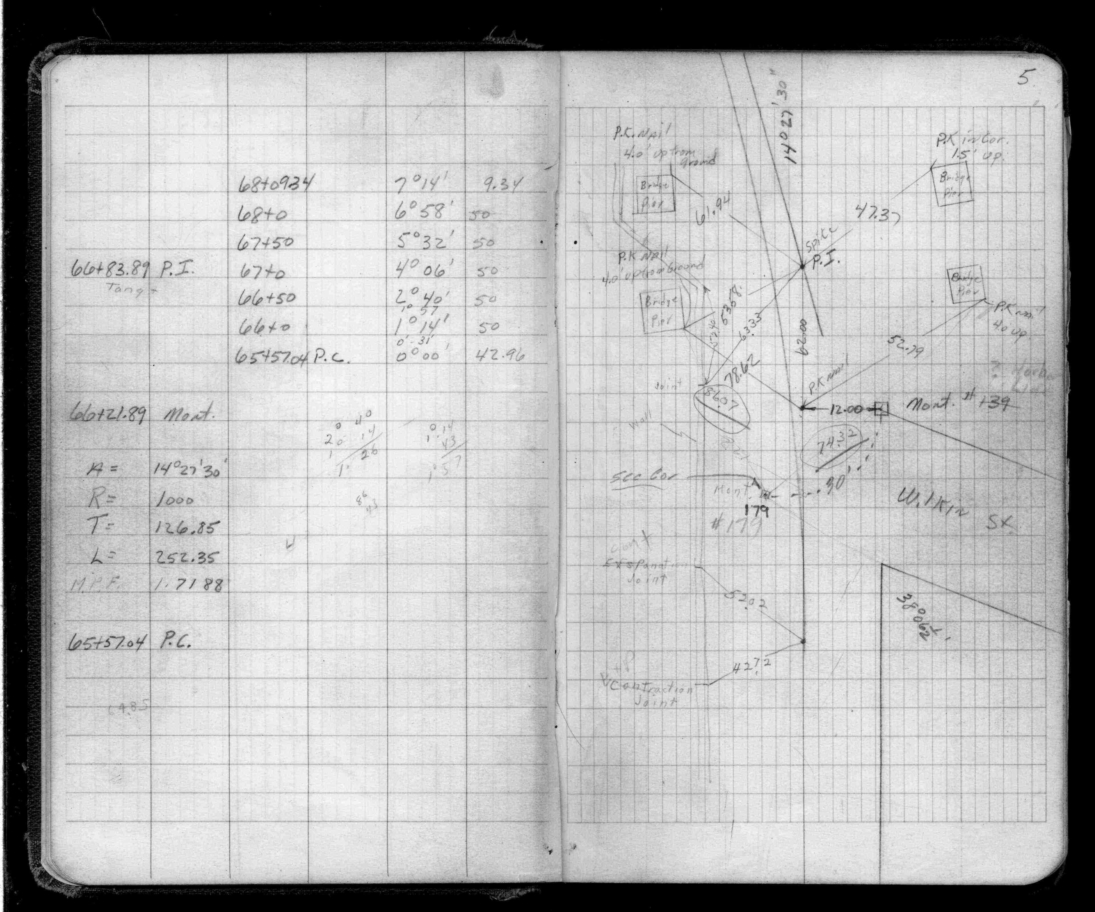
| 12/17/2001 | Elev 12.38 ft on CIM, 0.25 ft below asphalt surface. See FB 1736 p.4 |
| 9/1/1986 | (Unknown date Sep __, 1986 ) Placed ties. See FB 1703 last page |
| 9/1/1986 | (Unknown date Sep __, 1986 ) CIM set to grade in concrete mat E. lane of Shepard Rd. |
| 1/1/1985 | (Unknown date ___ __,1985 ) Historic, one time only GPS survey = S151 |
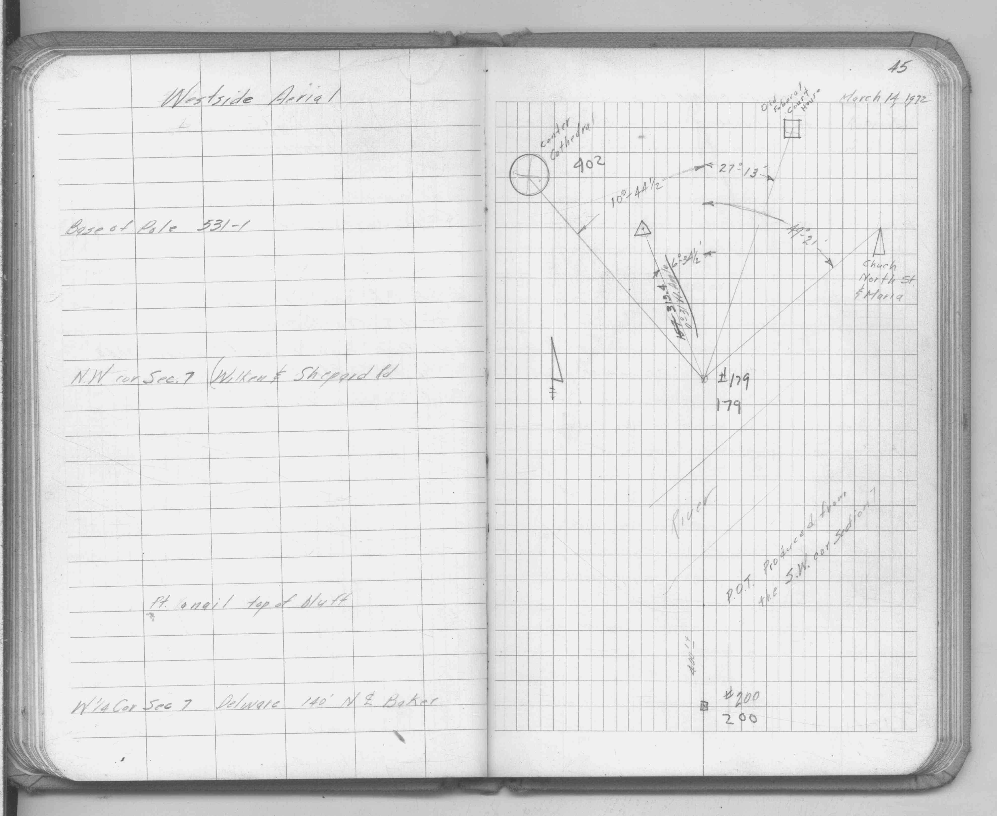
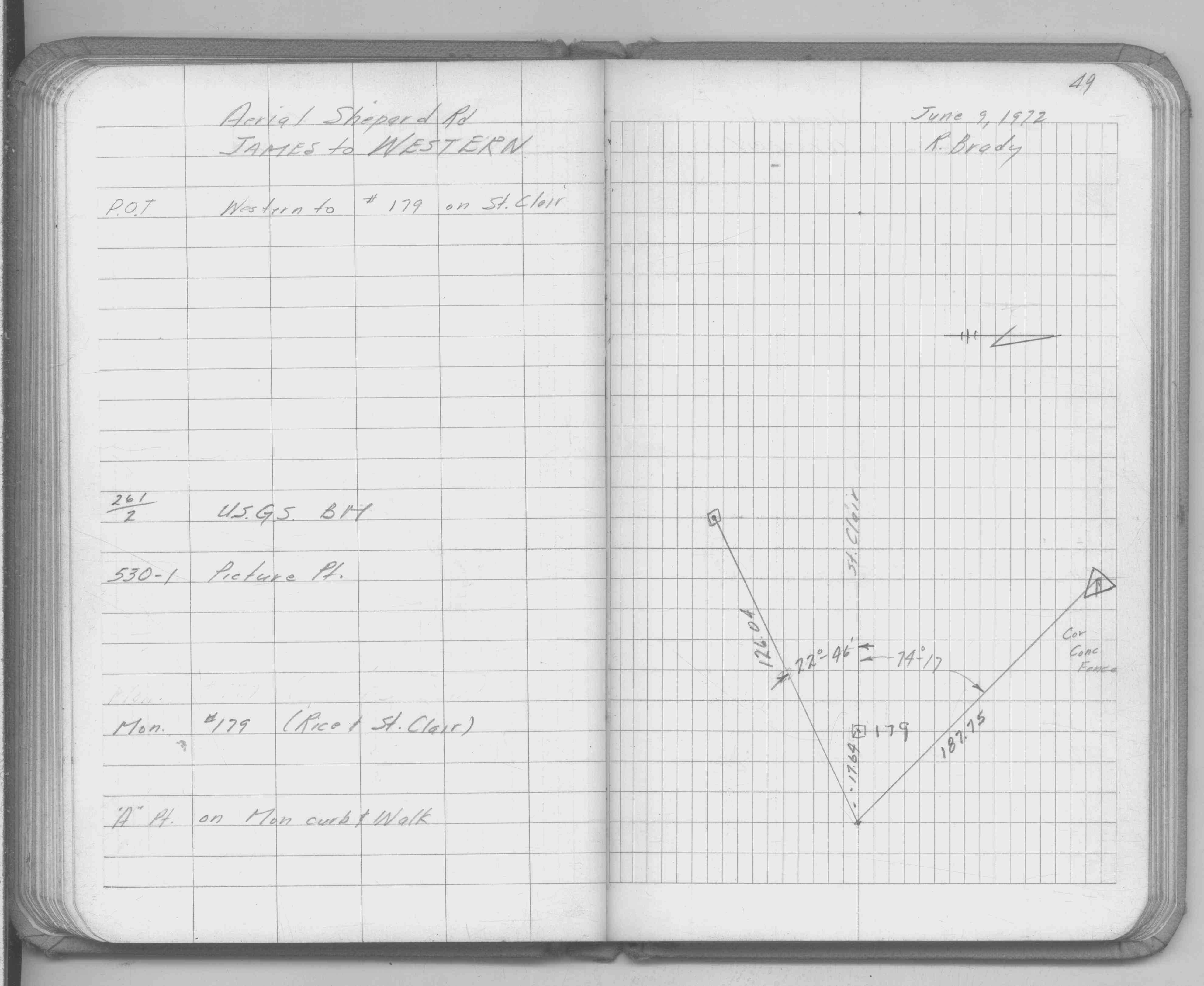
| 2/16/1972 | Fd CIM at grade. See FB 1689A p.7 |
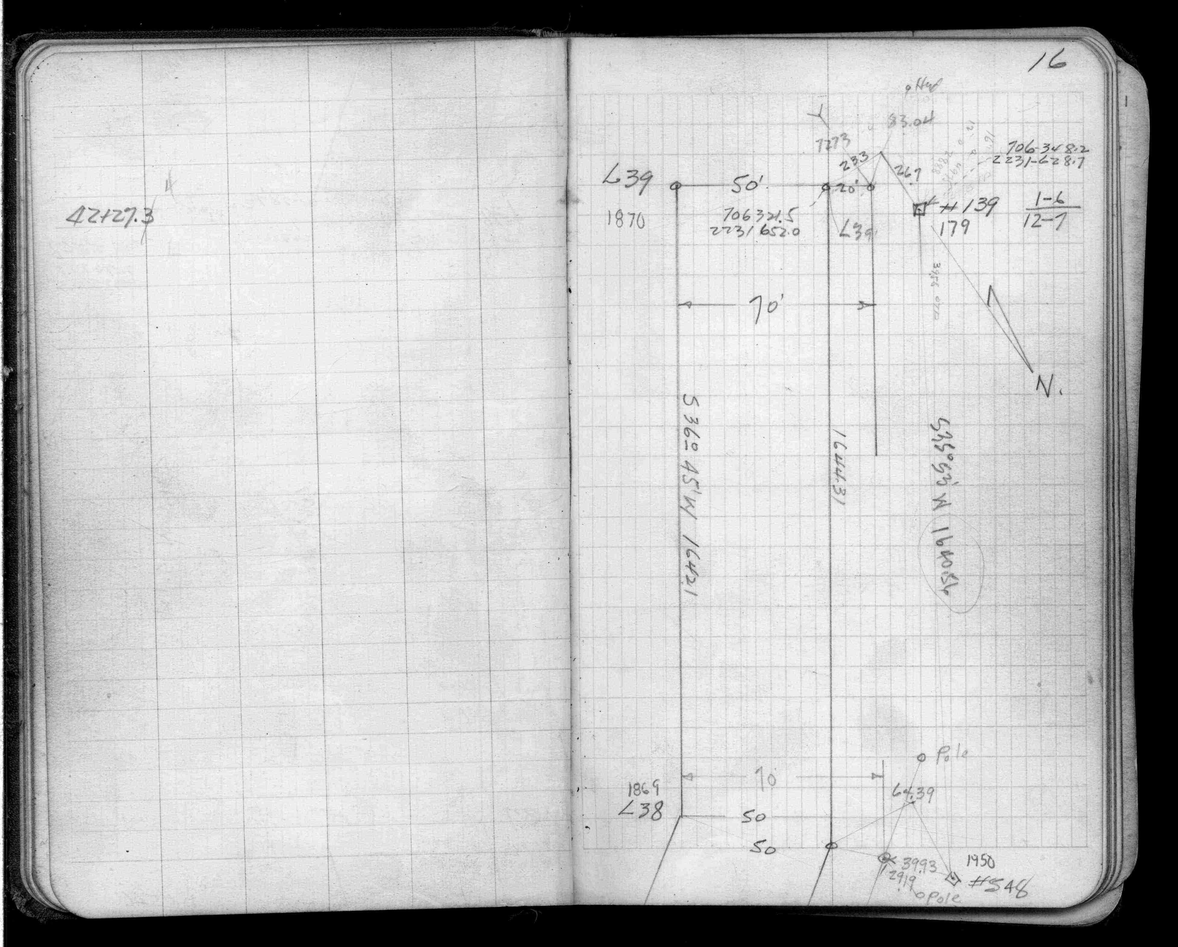
| 1/1/1940 | (Unknown date ___ __, 1940 ) Placed ties. See FB 956 p.56 |
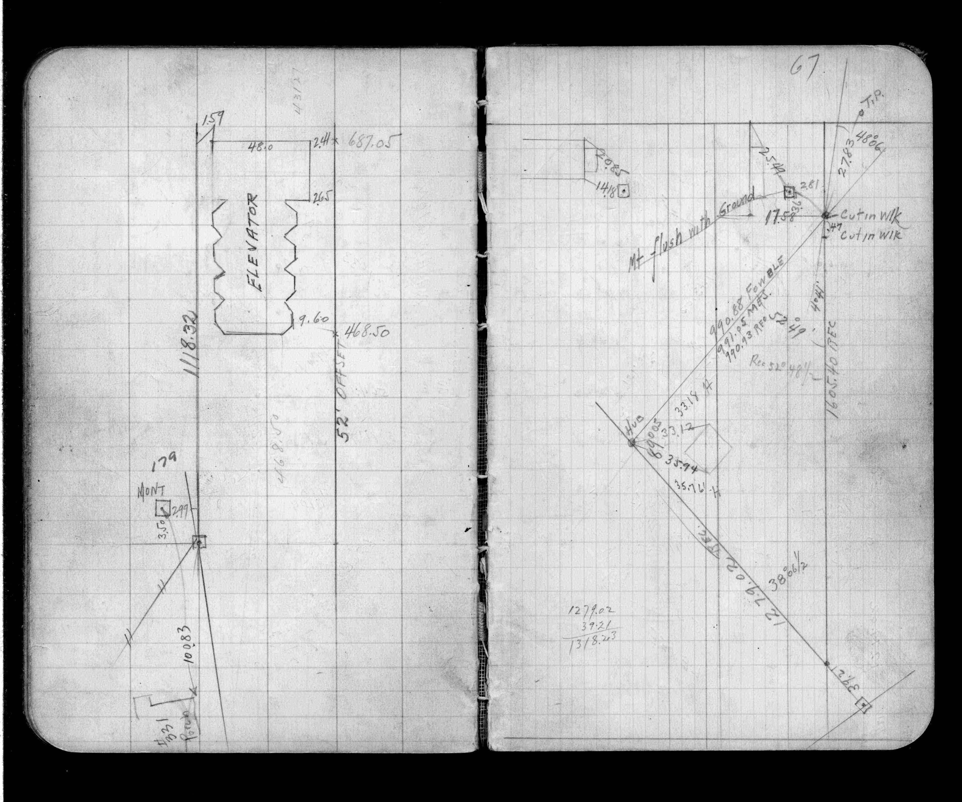
| 3/1/1929 | (Unknown date Mar __, 1929 ) Placed ties. See FB 1170 p.67 |
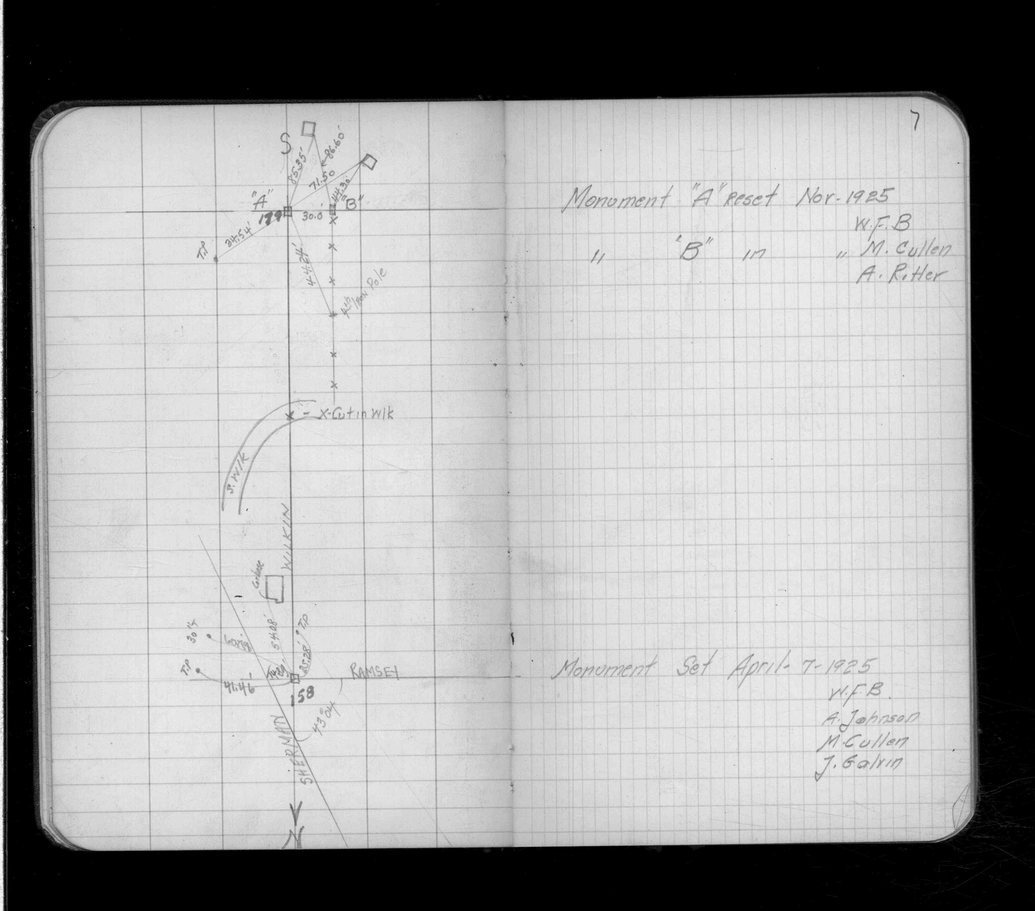
| 11/1/1925 | (Unknown date Nov __, 1925 ) Placed ties. See FB 1132 p.7 |
| 12/1/1901 | (Unknown date Dec __, 1901 ) Monument reset by J H Armstrong |
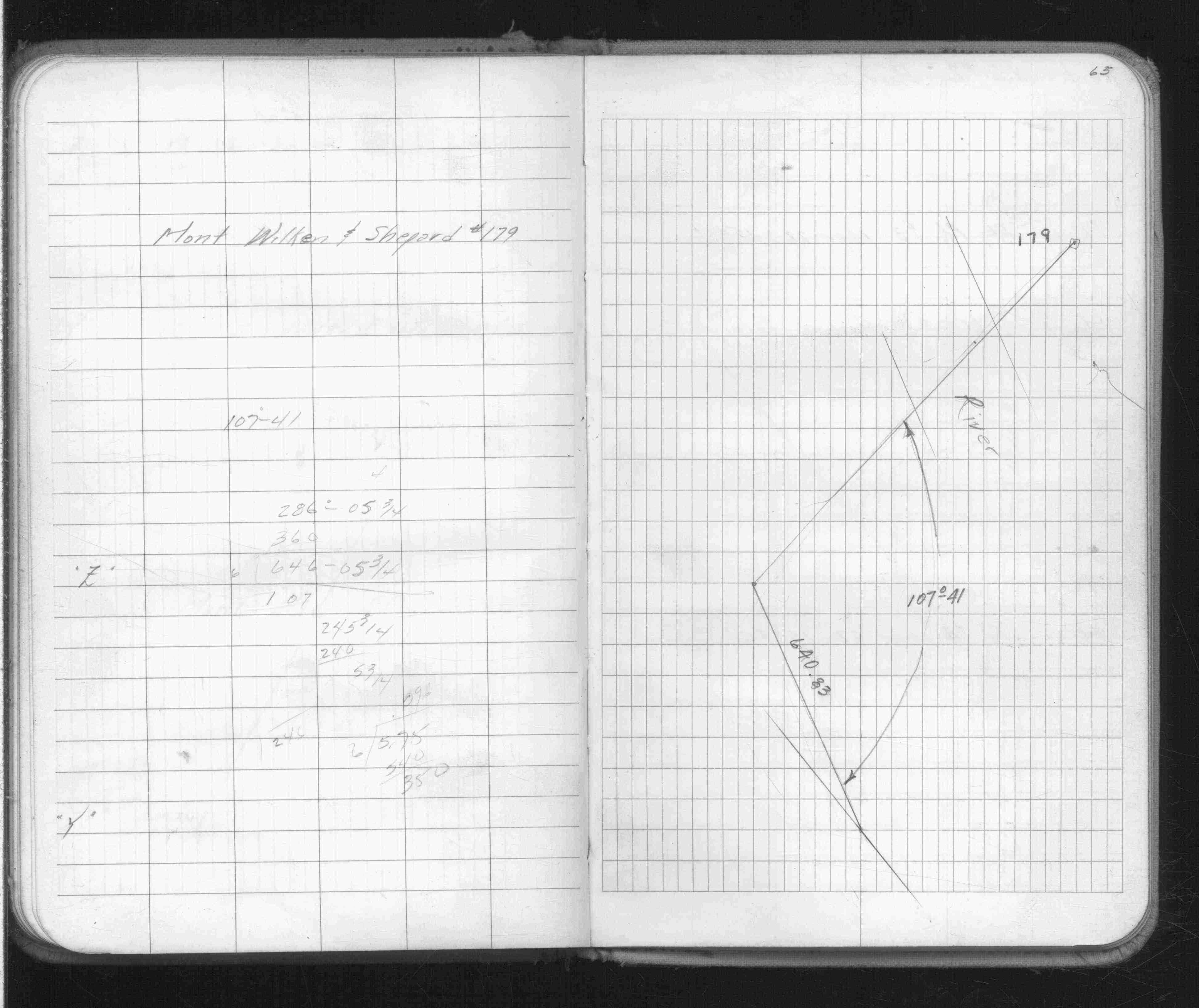
| 1/1/1885 | (Unknown date ___ __, 1885 ) Armstrongs 1885 River survey. See RS 1885 p.012-013 |
| 10/7/1847 | James M Marsh deputy surveyor set post. Tied to 4 BTs. See JM p.073-074 border |
Above is NOT an all inclusive history of this point. Please review all the links below.
| PLS NOTES | Field | Cross Section | Sewer | J.B. Irvine | Monument | River Survey |
|---|---|---|---|---|---|---|
| JM p.073-074 | FB 0263CPYp.07 | 1885 p.012-013 | ||||
| FB 0277p.64 | ||||||
| FB 0350p. 41 ,42 | ||||||
| FB 0358p.132 | ||||||
| FB 0956p.56 | ||||||
| FB 1132p.07 | ||||||
| FB 1170p.67 | ||||||
| FB 1401p.16 | ||||||
| FB 1401Cp.05 | ||||||
| FB 1514Gp. 63 ,65 | ||||||
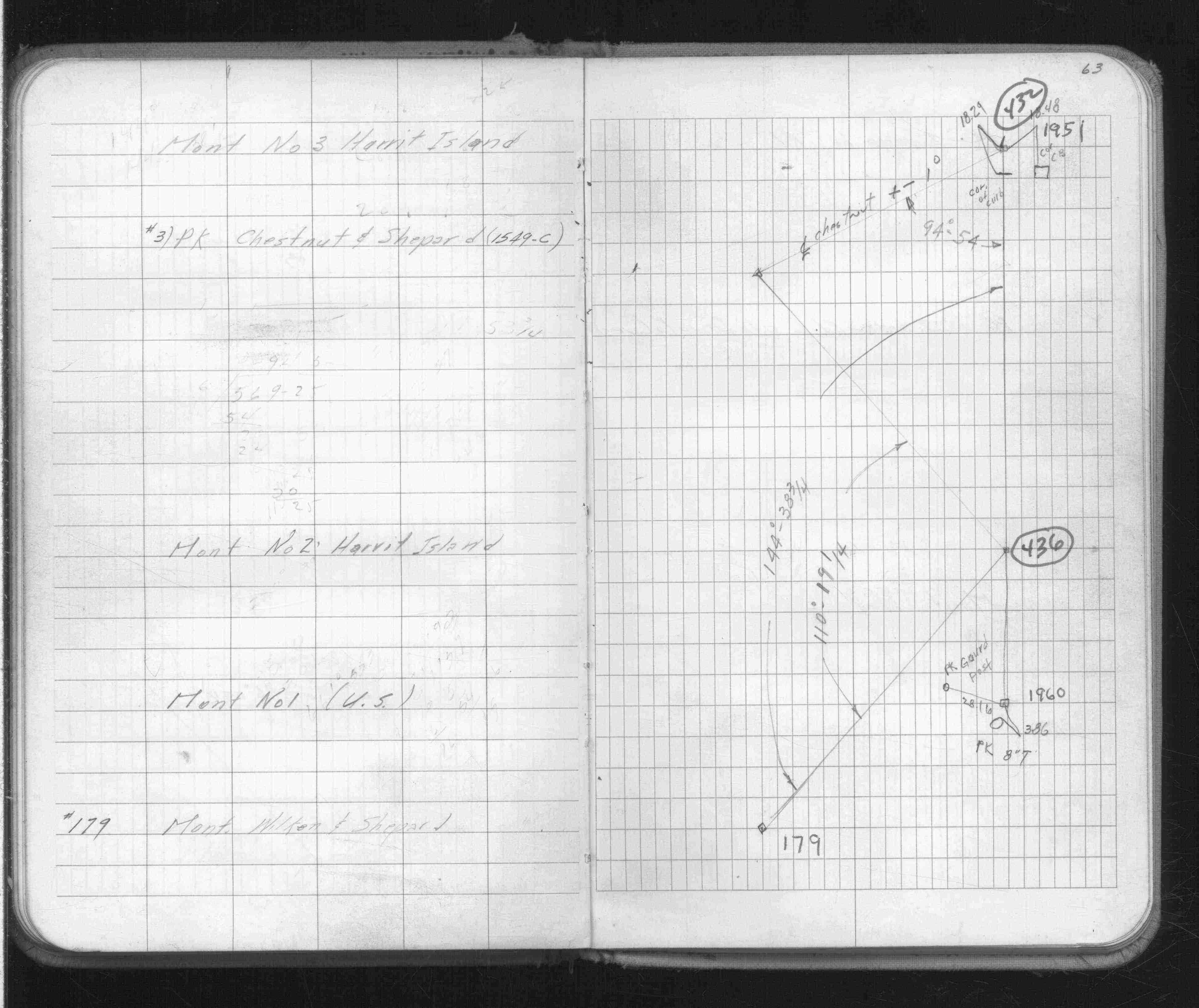
| FB 1549Cp.20 | ||||||
| FB 1549Ep. 45 ,49 | ||||||
| FB 1676Dp.41 | ||||||
| FB 1686p.41 | ||||||
| FB 1689Ap.07 | ||||||
| FB 1736p.04 |
| FILE | SURVEYOR | LIC. NO. | DATE SIGNED | DATE TIED |
|---|---|---|---|---|
| 0179-0139-B.tif | Michael P. Murphy | 41001 | December 22, 2003 | December 19, 2003 |
| 0179-0139-A.tif | Jeffery L. Grosso | 13144 | December 28, 2001 | December 17, 2001 |
| ST_157-234p179.jpg | none | none | none | none |
| 0179-0139-A.dwf | none | none | none | none |
| FILE | PHOTO DATE | COMMENTS |
|---|---|---|
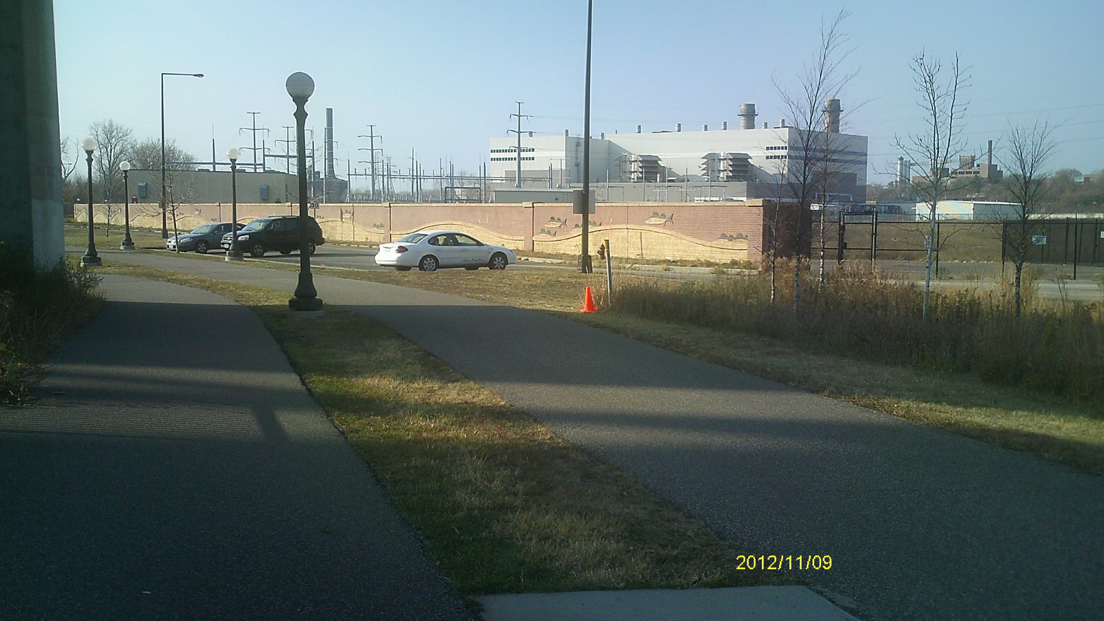
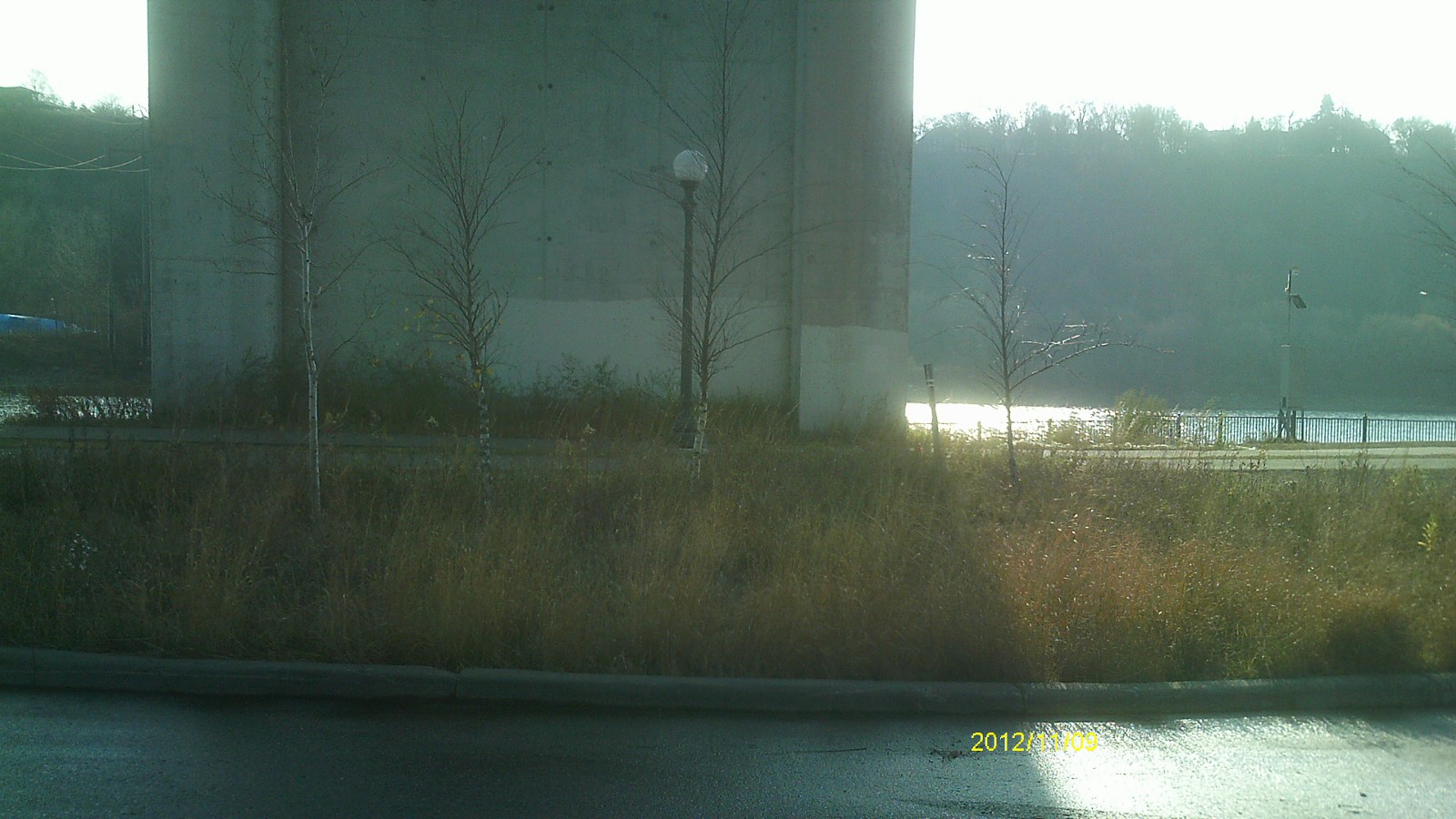
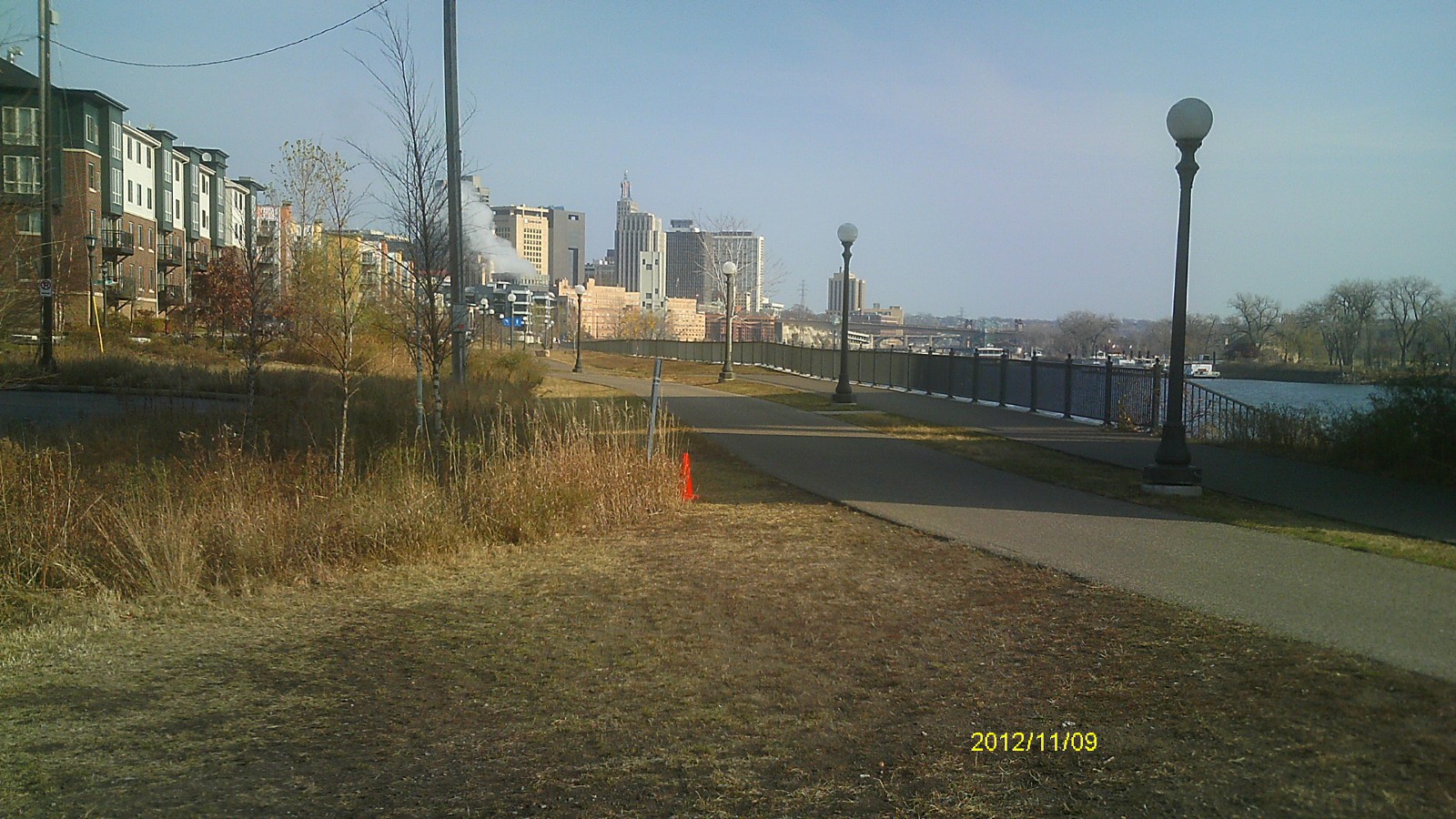
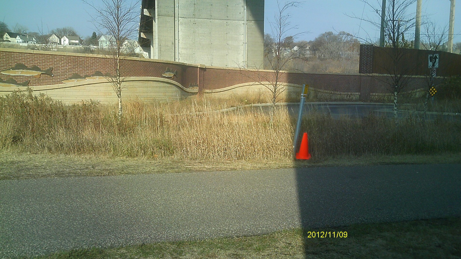
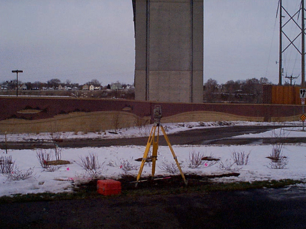
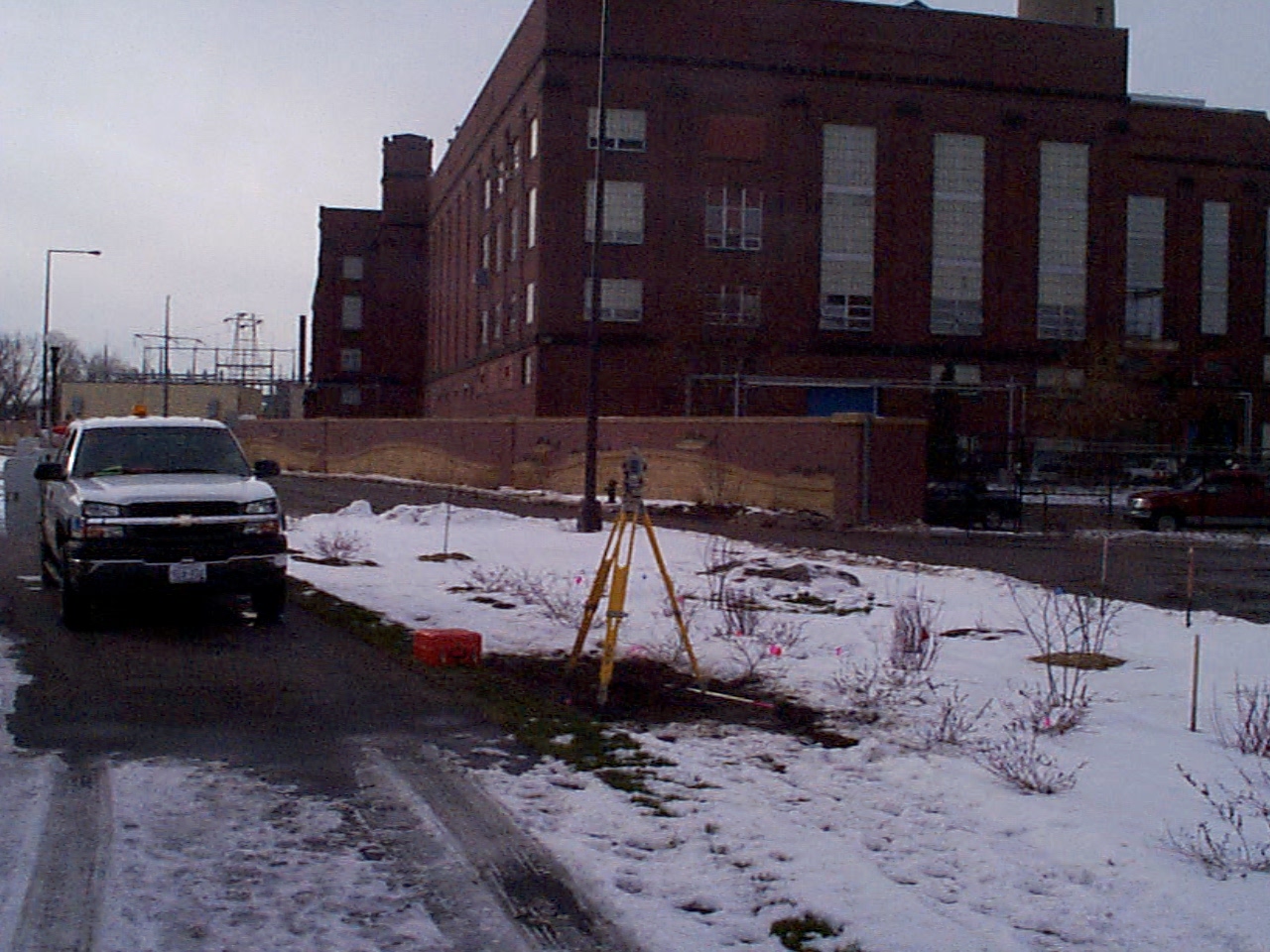
| 0179-0139-14.jpg | November 9, 2012 | Looking west. |
| 0179-0139-13.jpg | November 9, 2012 | Looking south. |
| 0179-0139-12.jpg | November 9, 2012 | Looking east. |
| 0179-0139-11.jpg | November 9, 2012 | Looking north. |
| 0179-0139-10.jpg | November 9, 2012 | Close up of monument. |
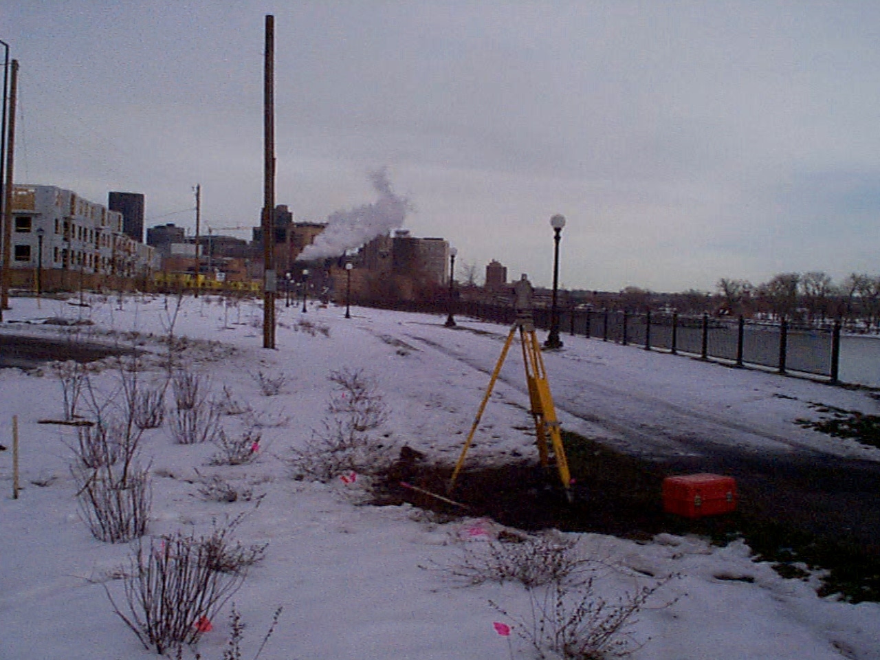
| 0179-0139-6.jpg | December 19, 2003 | Looking Southerly from under the high bridge. |
| 0179-0139-5.jpg | December 19, 2003 | Looking Easterly from under the high bridge. |
| 0179-0139-4.jpg | December 19, 2003 | Looking Northerly from under the high bridge. |
| 0179-0139-3.jpg | December 19, 2003 | Close up of the CIM placed in concrete. |
| 0179-0139-1.jpg | December 18, 2003 | Close up of bent rebar down 2.0 feet below grade. |
| 0179-0139-8.jpg | October 29, 2002 | Looking Westerly from under the high bridge. |