| NAD83 COORDINATES (1986 adj.): |
|---|
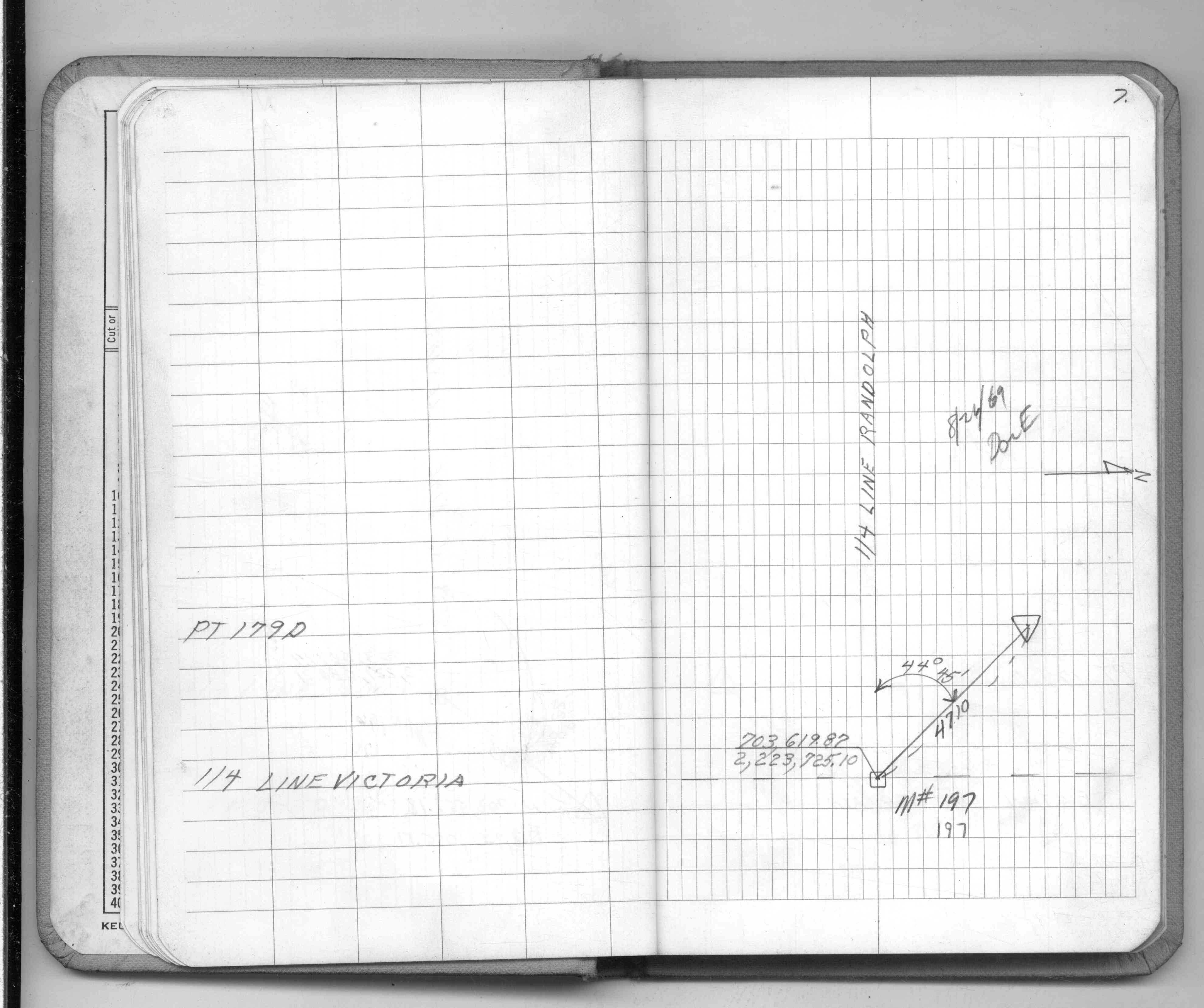
| * X= 563958.036 Y= 149604.349 Z= 000.00 LSQ 12/06/1991 S FLT |
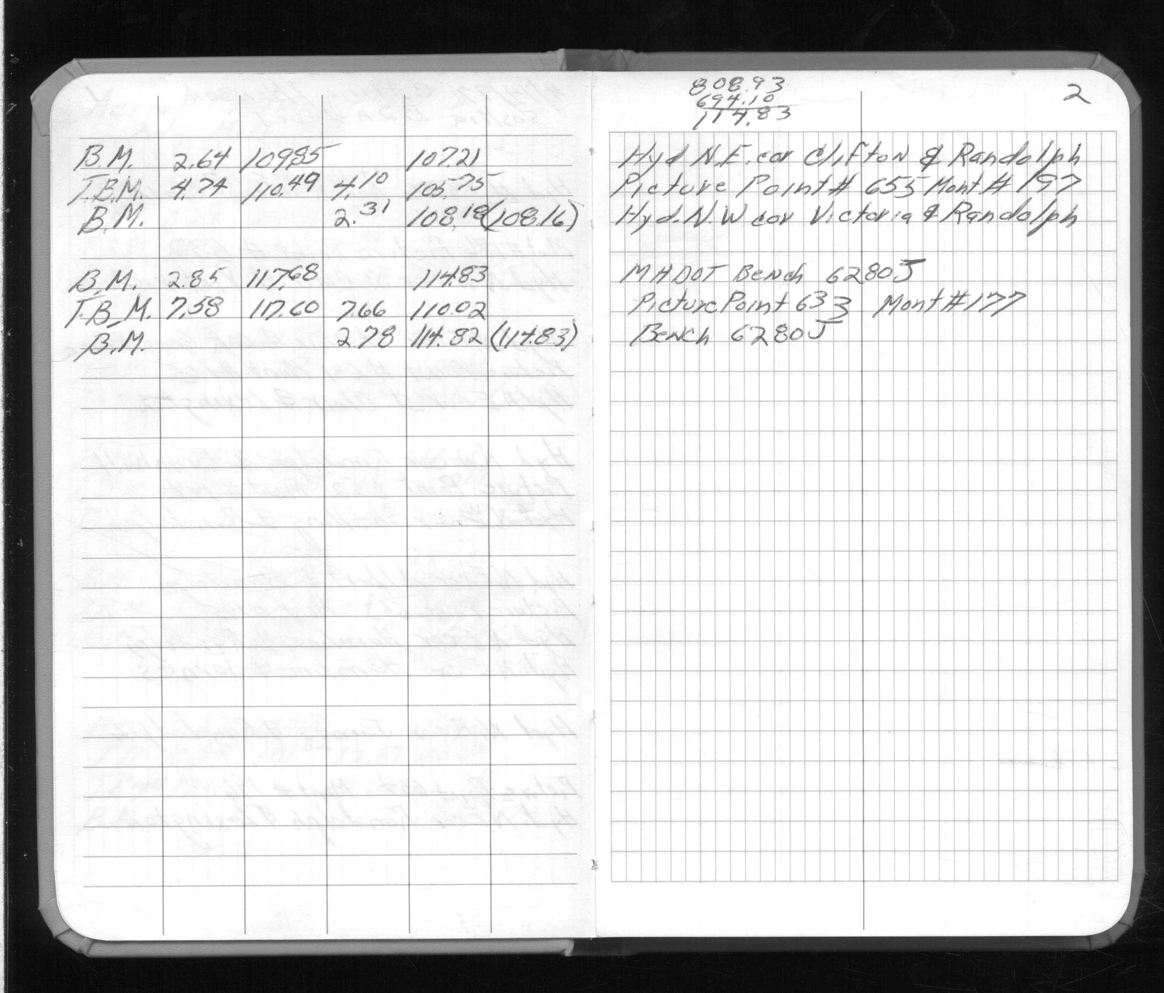
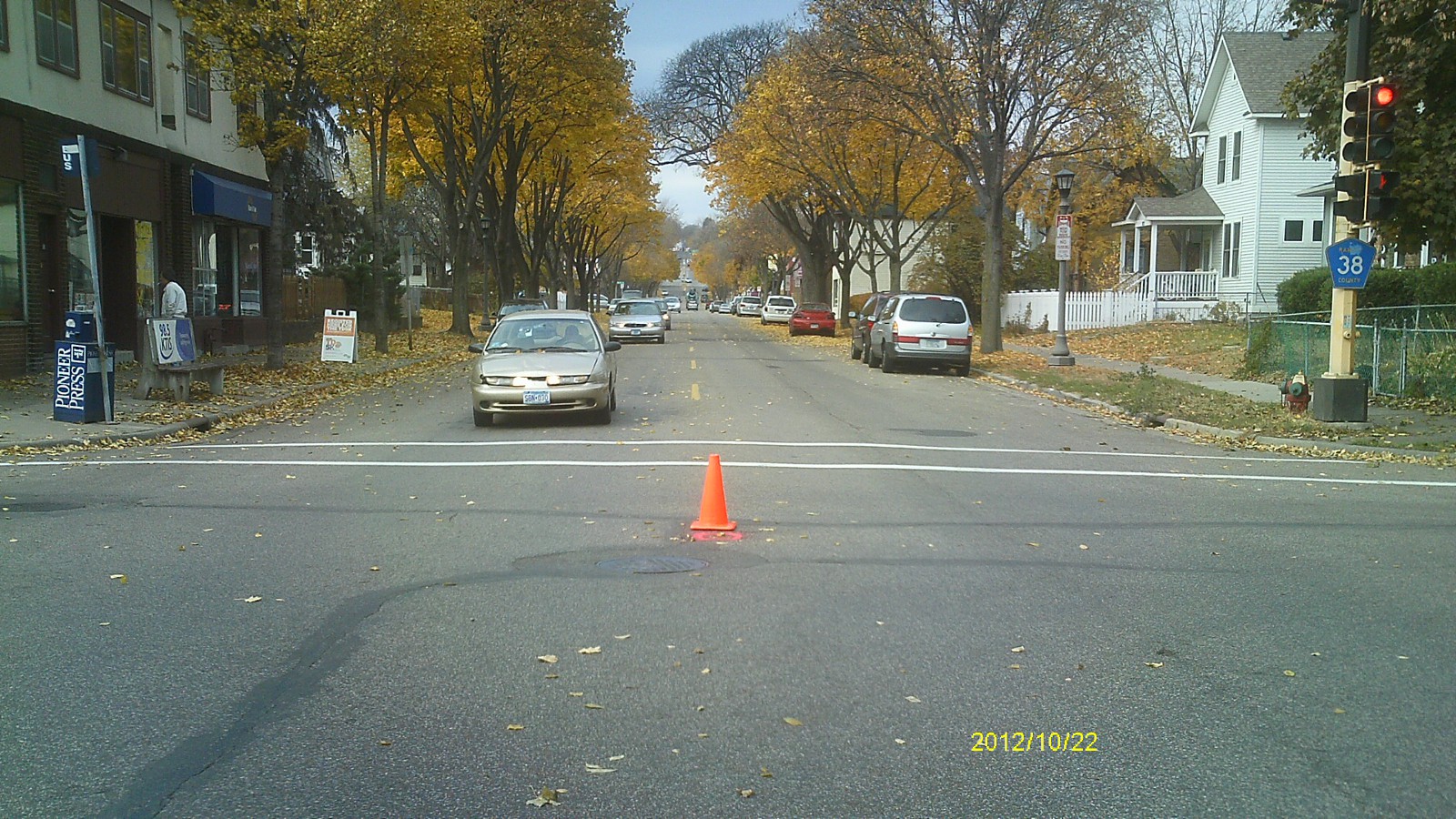
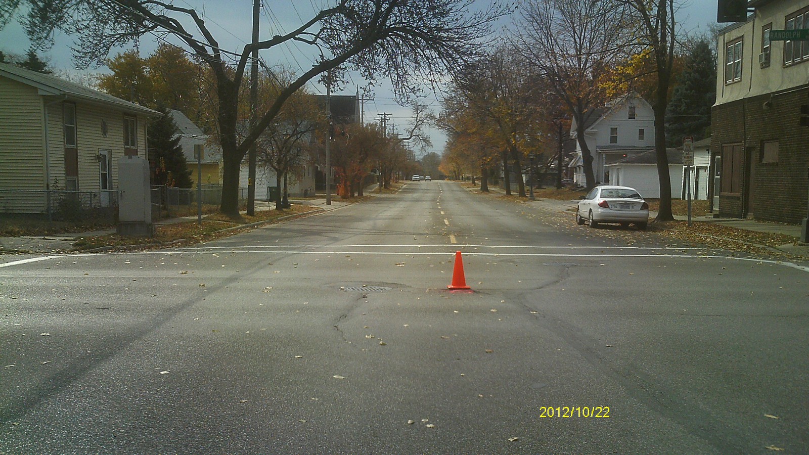
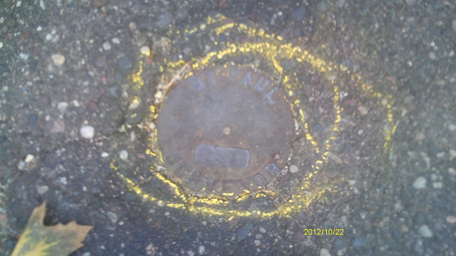
| 10/22/2012 | Found CIM at street grade. Photos taken. |
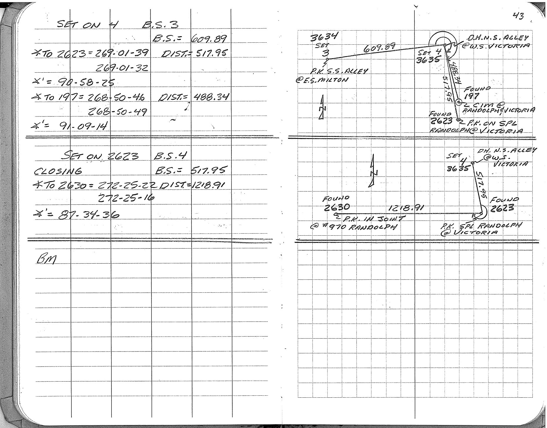
| 11/7/2002 | Side shot inplace CIM. See FB 1737 p.43 |
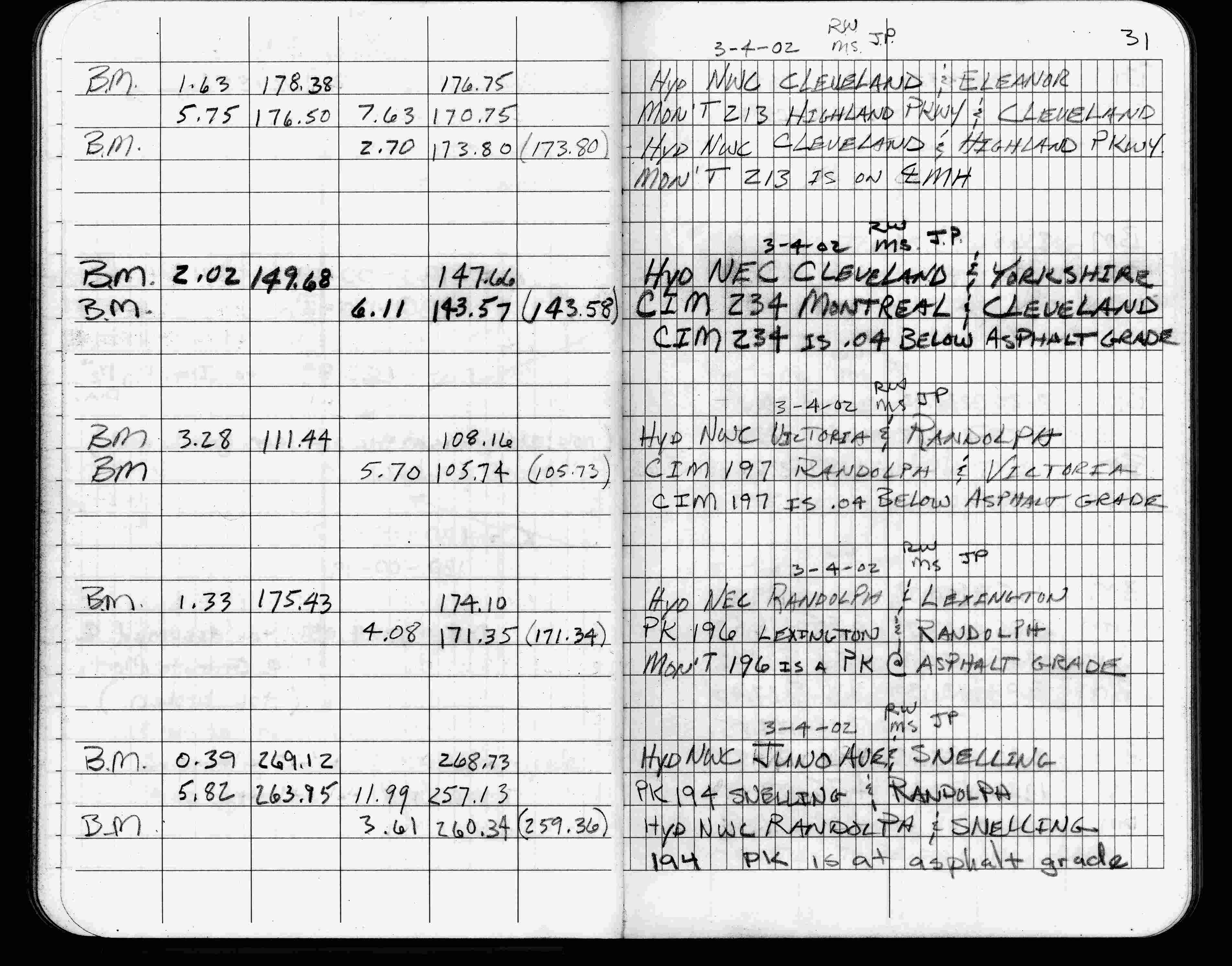
| 3/4/2002 | Elev 105.74 ft on CIM 0.04 ft below asphalt surface. See FB 1736 p.31 |
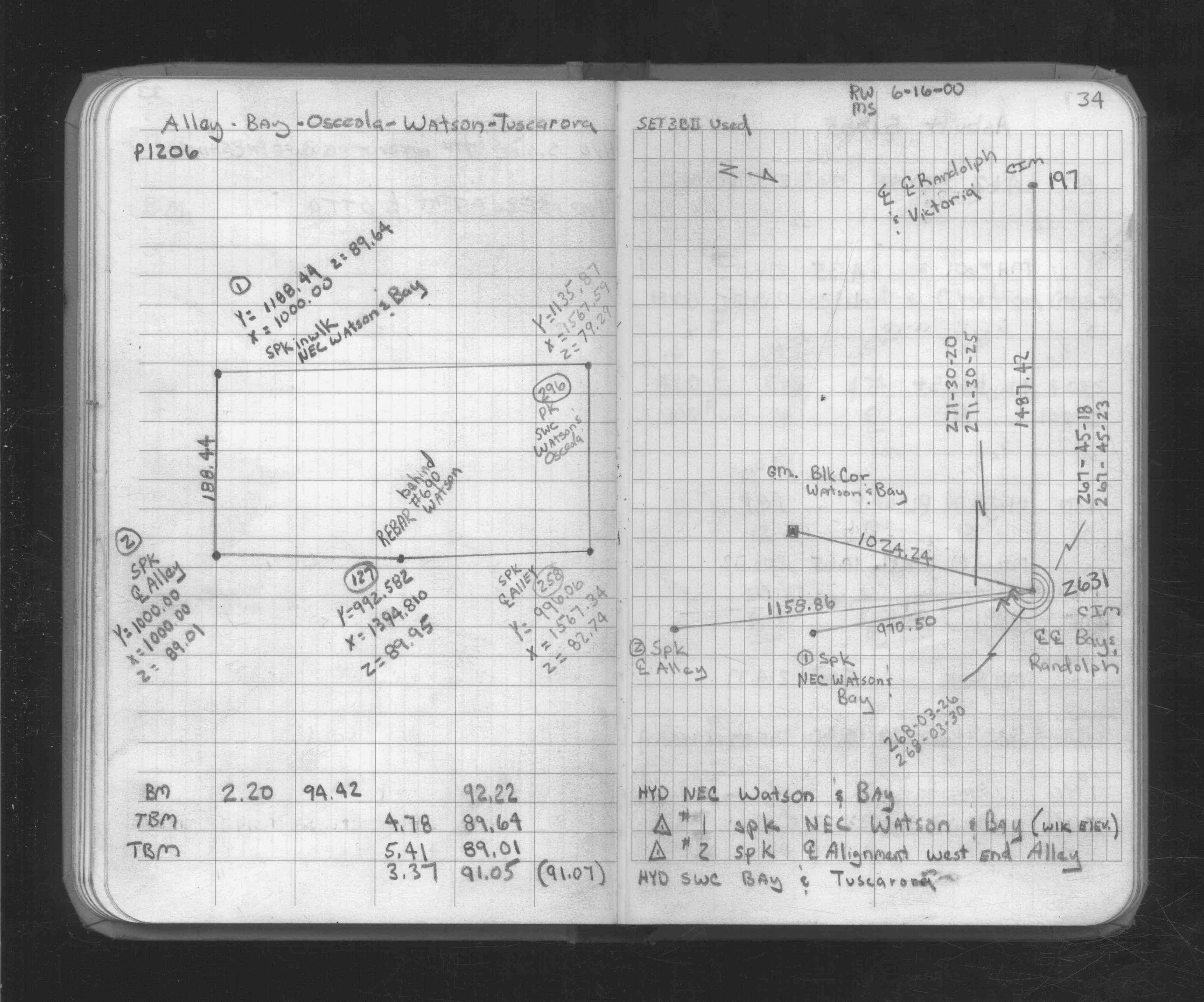
| 6/16/2000 | Fd CIM. See FB 1734A p.34 |
| 3/1/2000 | (Unknown date Mar __, 2000 ) Fd CIM at grade (marked for painting target for 2000 aerial) |
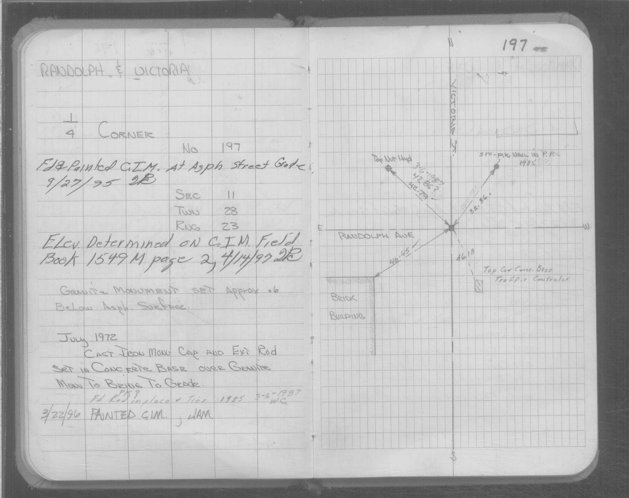
| 4/14/1997 | Elev 105.75 ft on CIM. See FB 1549M p.2 |
| 9/27/1995 | Fd CIM at grade. See Yellow Tie Book. |
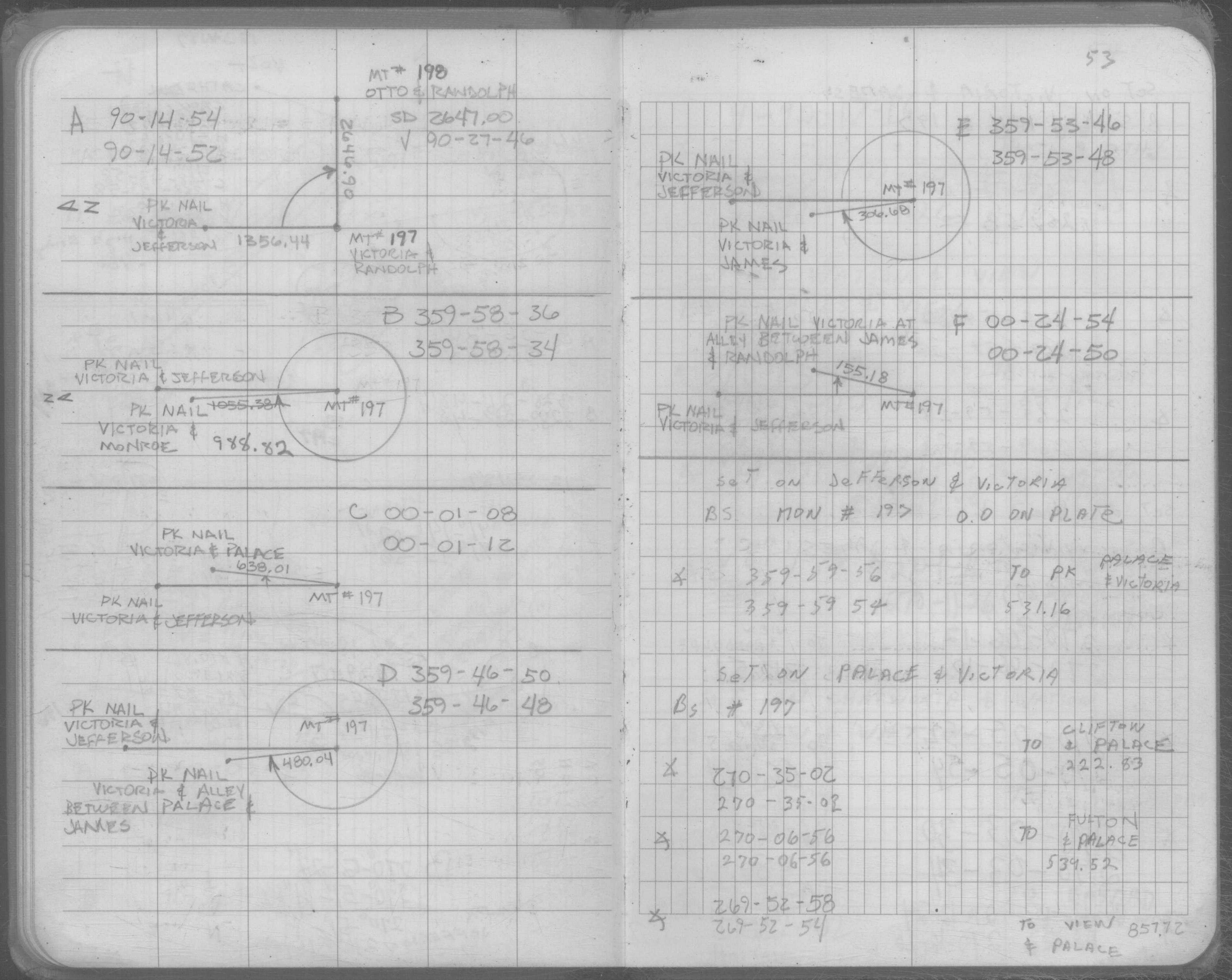
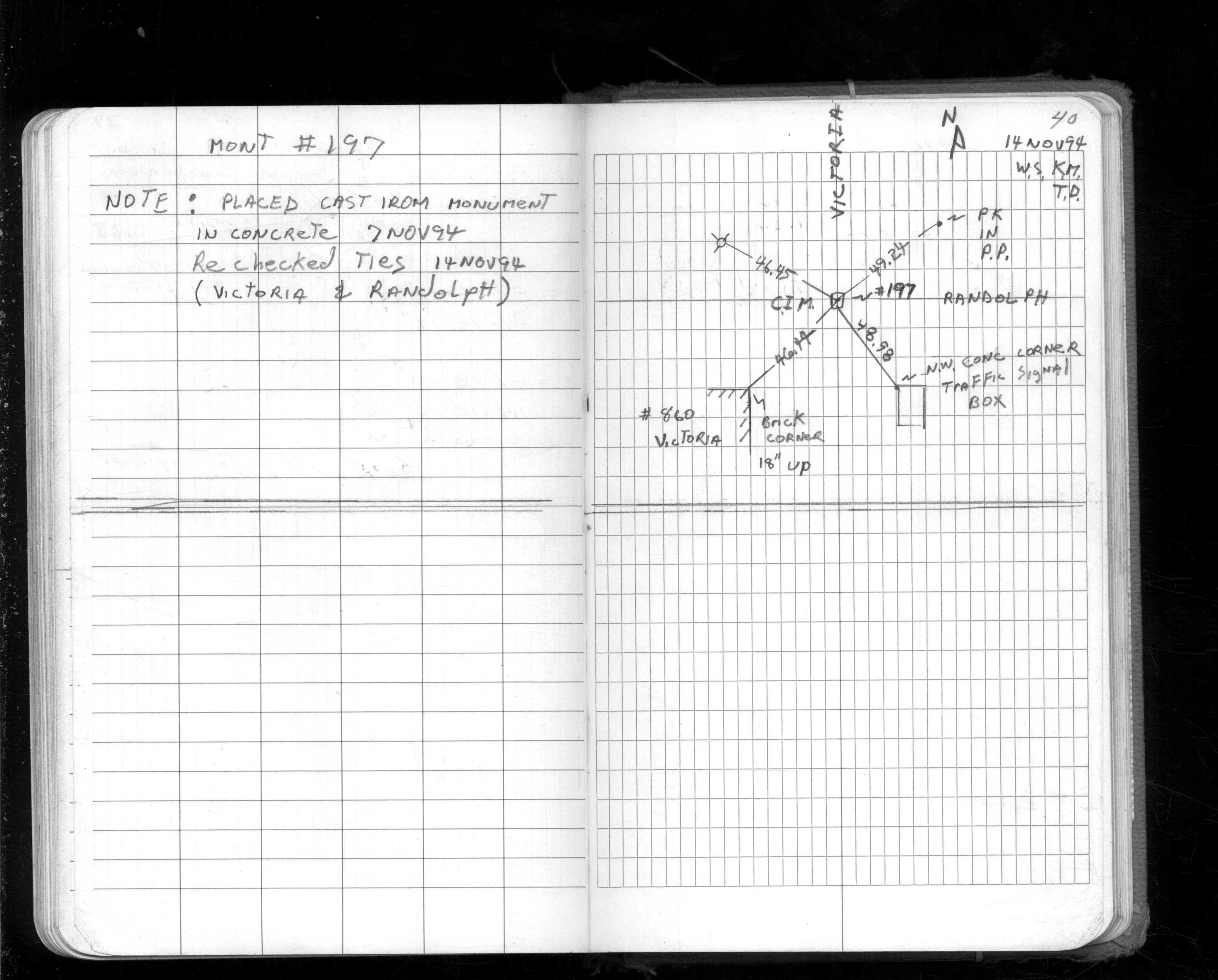
| 11/7/1994 | Set CIM in concrete, placed ties. See CofL 0197-0153-B |
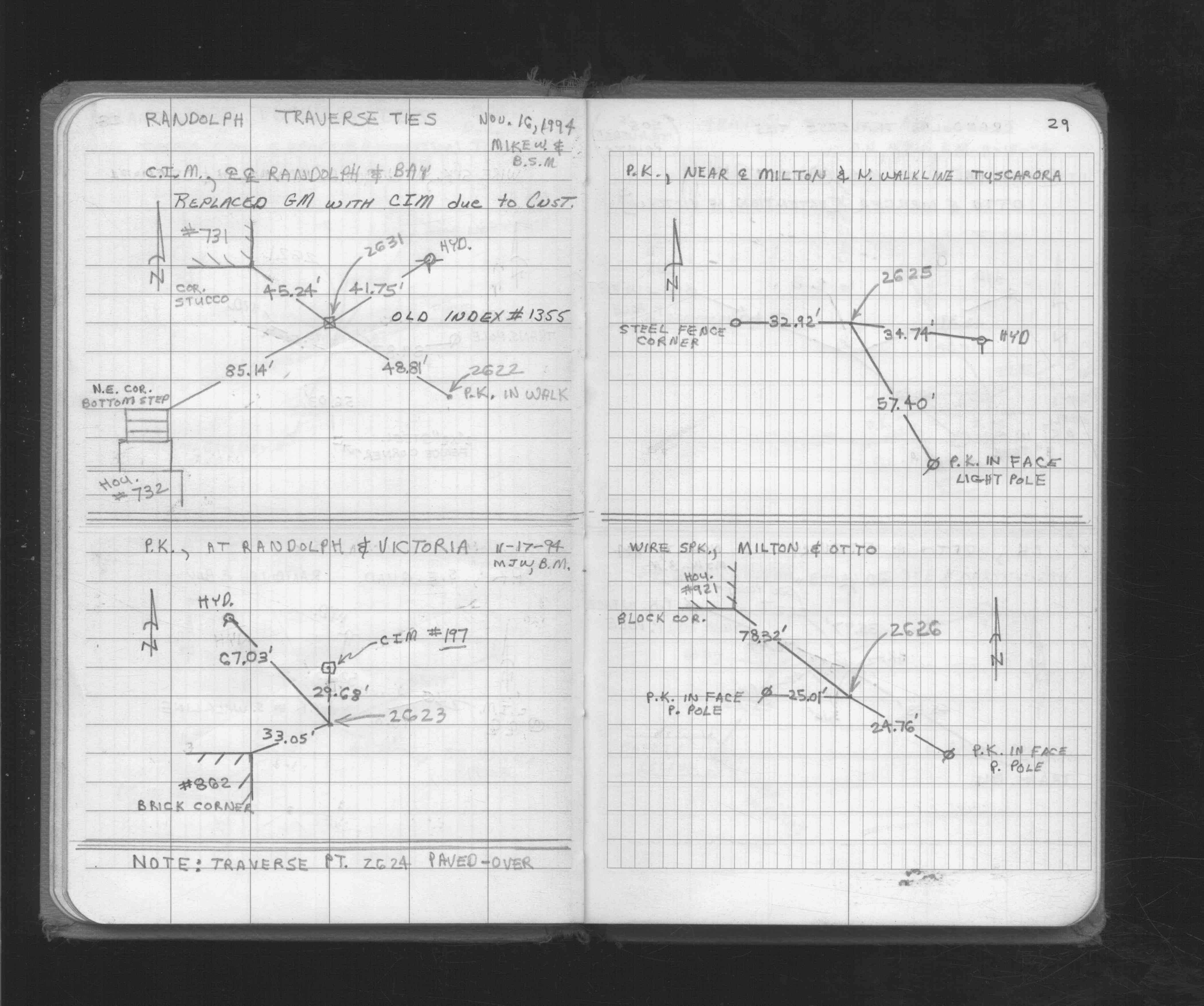
| 11/1/1994 | (Unknown date Nov __, 1994 ) Fd CIM, placed ties. See FB 1565B p.40 |
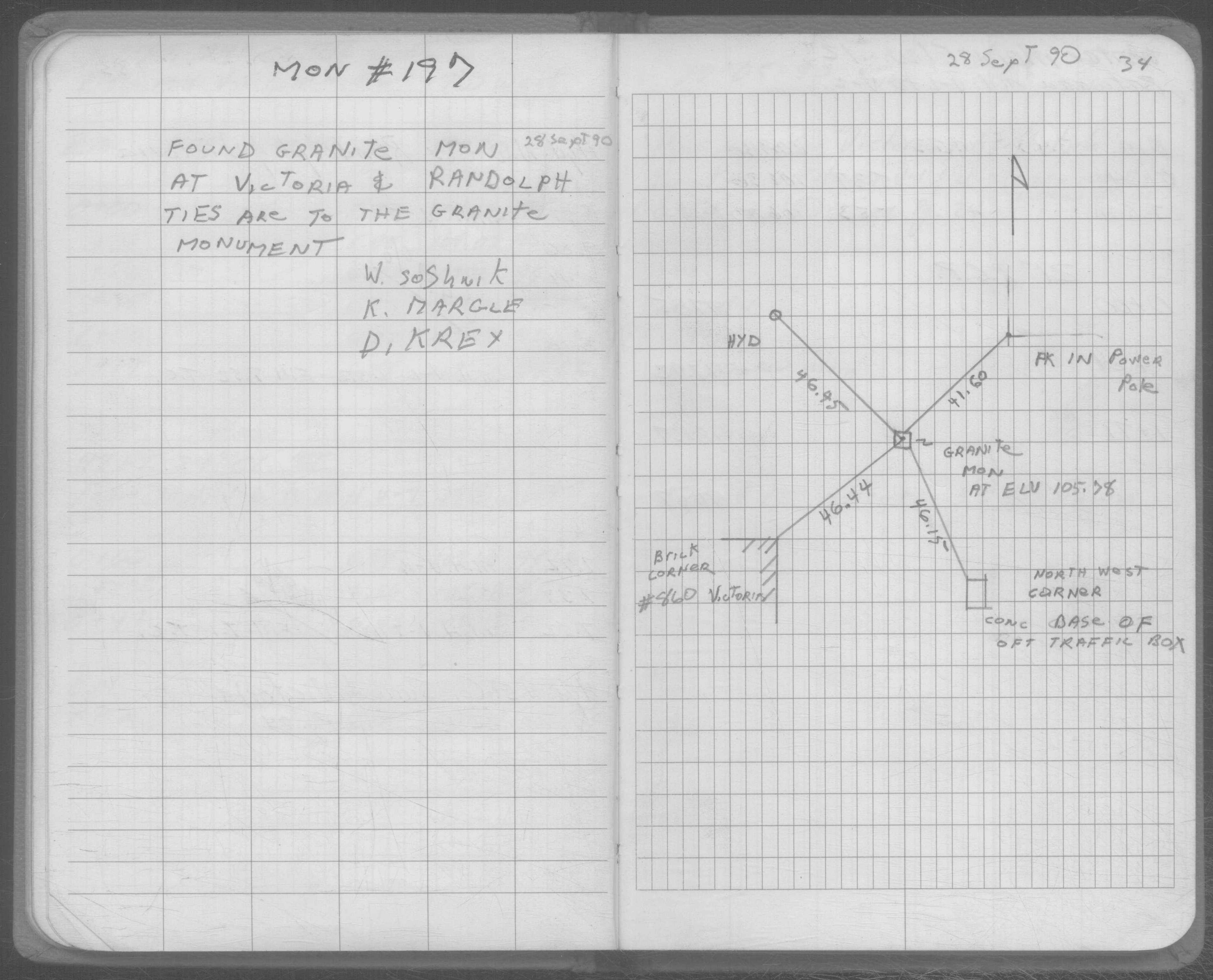
| 9/28/1990 | Fd GM, placed ties. See SB 0658 p.34 |
| 9/28/1990 | Fd GM at Elev 105.78 ft, left GM as found, placed ties. See CofL 0197-0153-A & SB 658 p.34 |
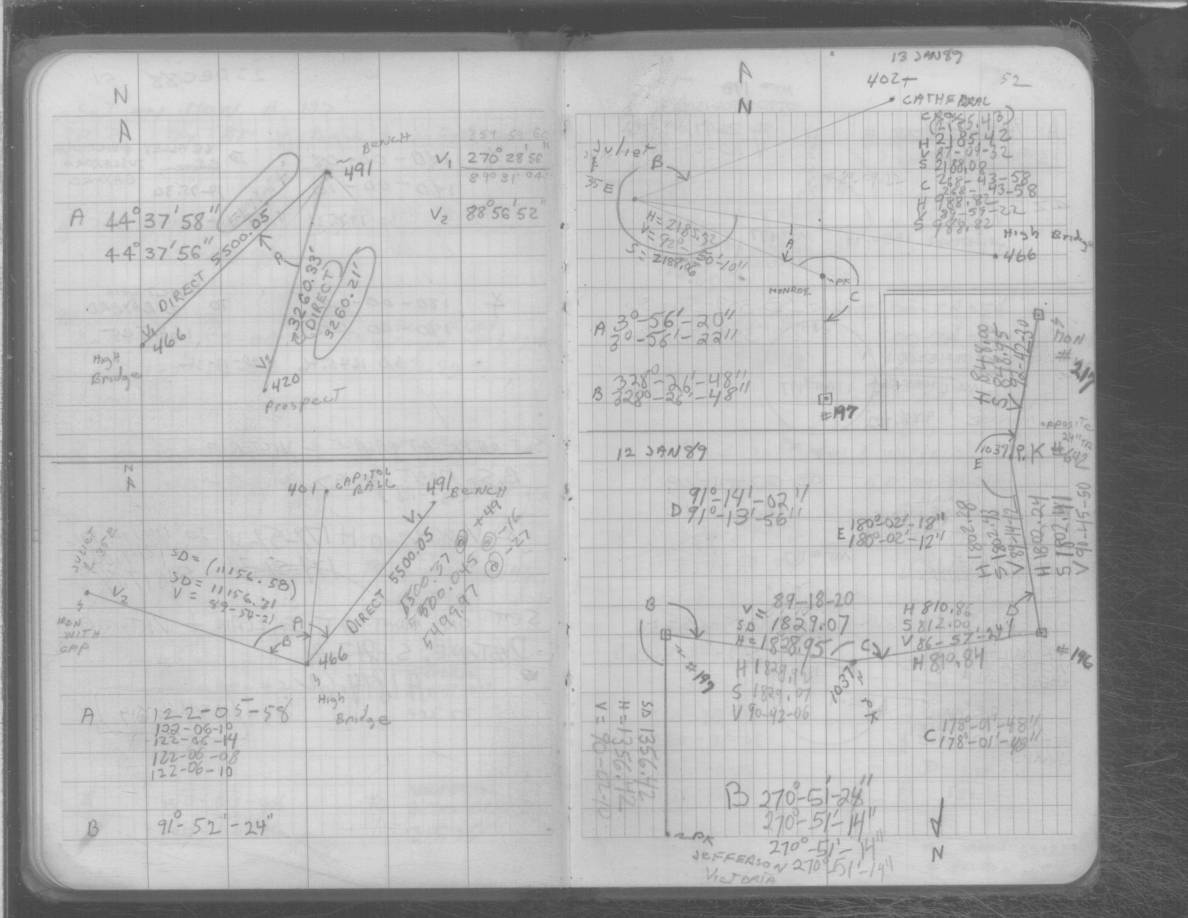
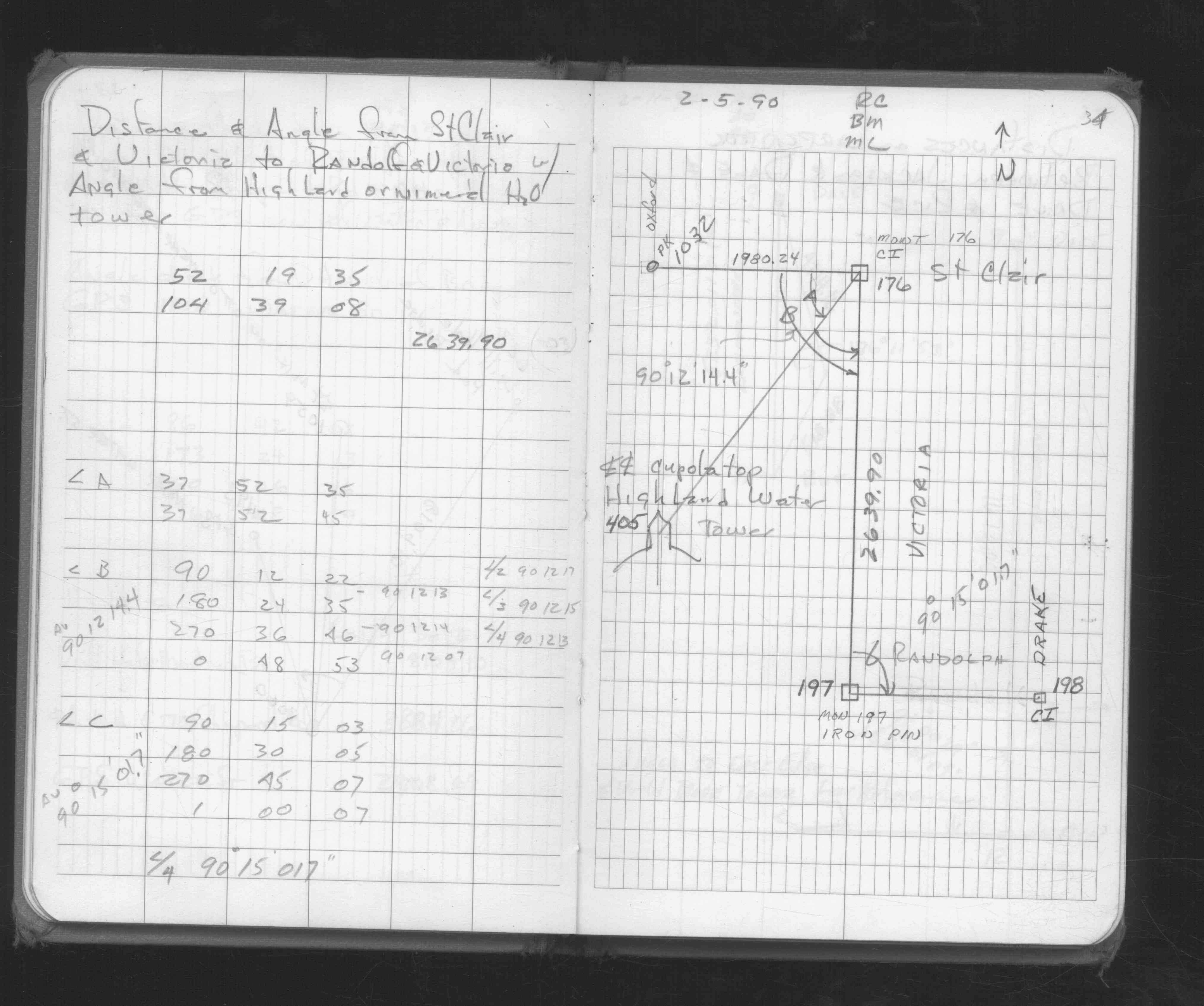
| 2/5/1990 | Found iron pin, measured to Monument 176. See FB 1676D p.34 |
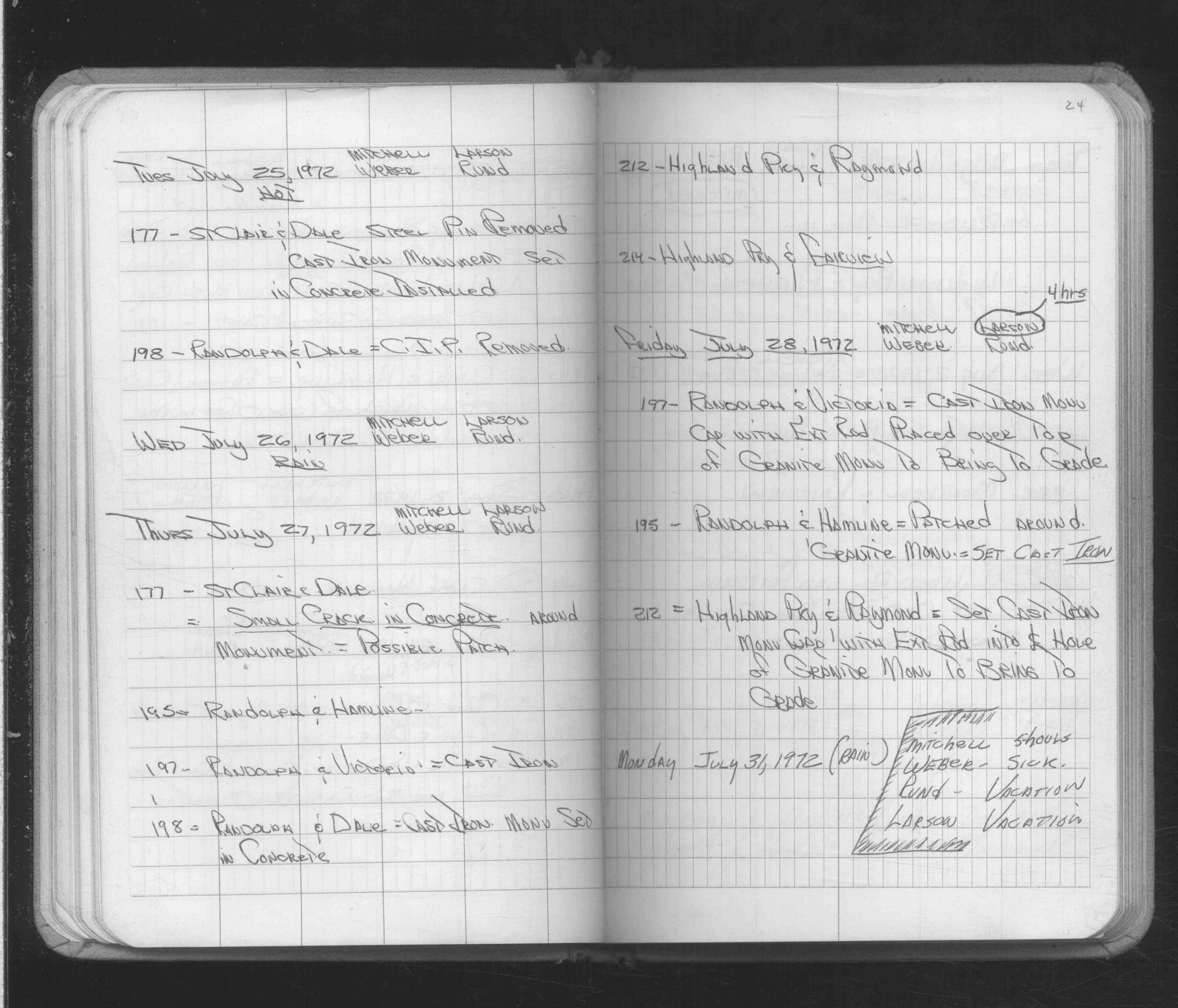
| 7/28/1972 | Set CIM cap with extension rod over GM, GM 0.6 ft below grade. See Yellow Tie Book & See FB 1689A p.24 |
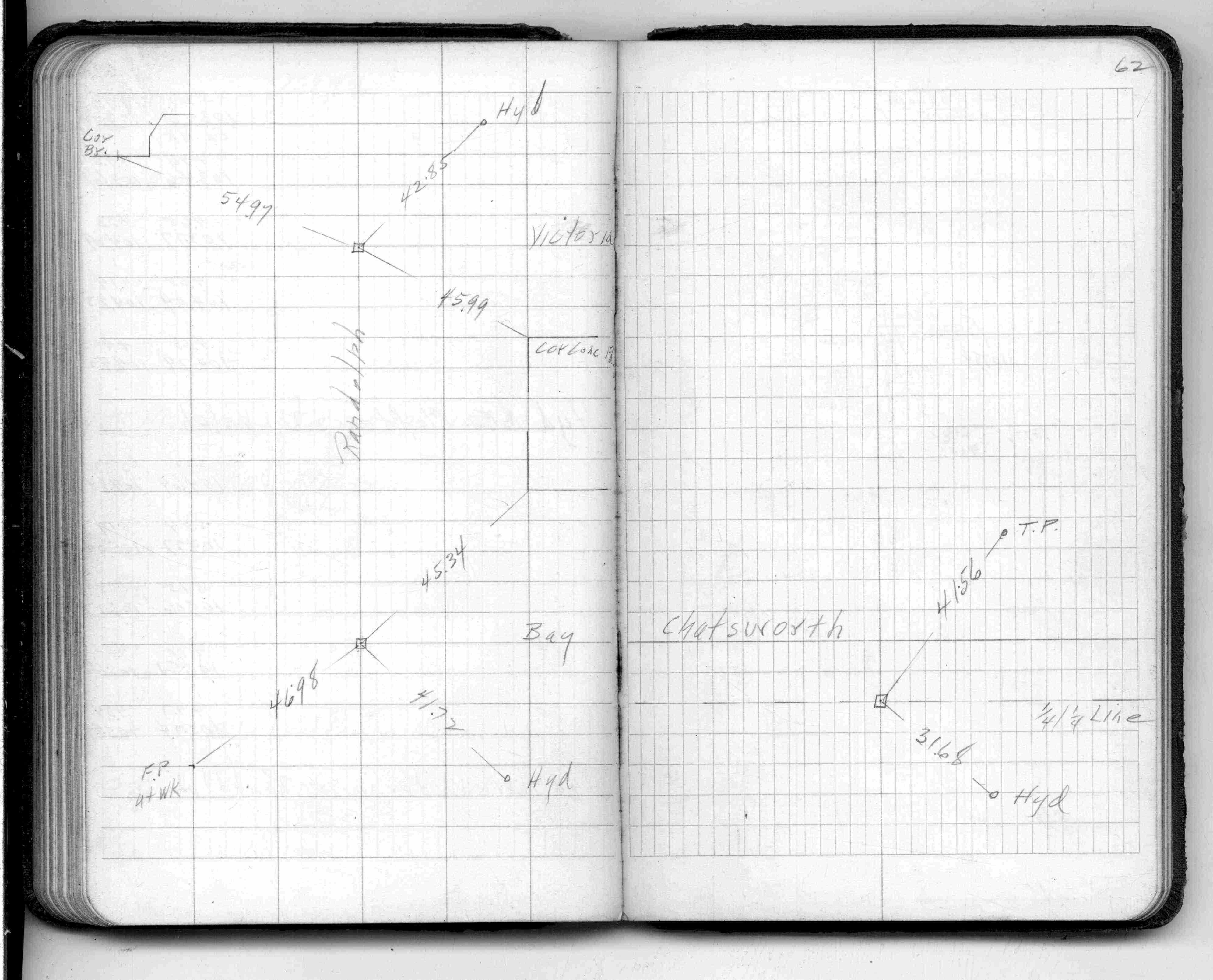
| 5/1/1961 | (Unknown date May __, 1961 ) Placed ties. See FB 1384 p.62 |
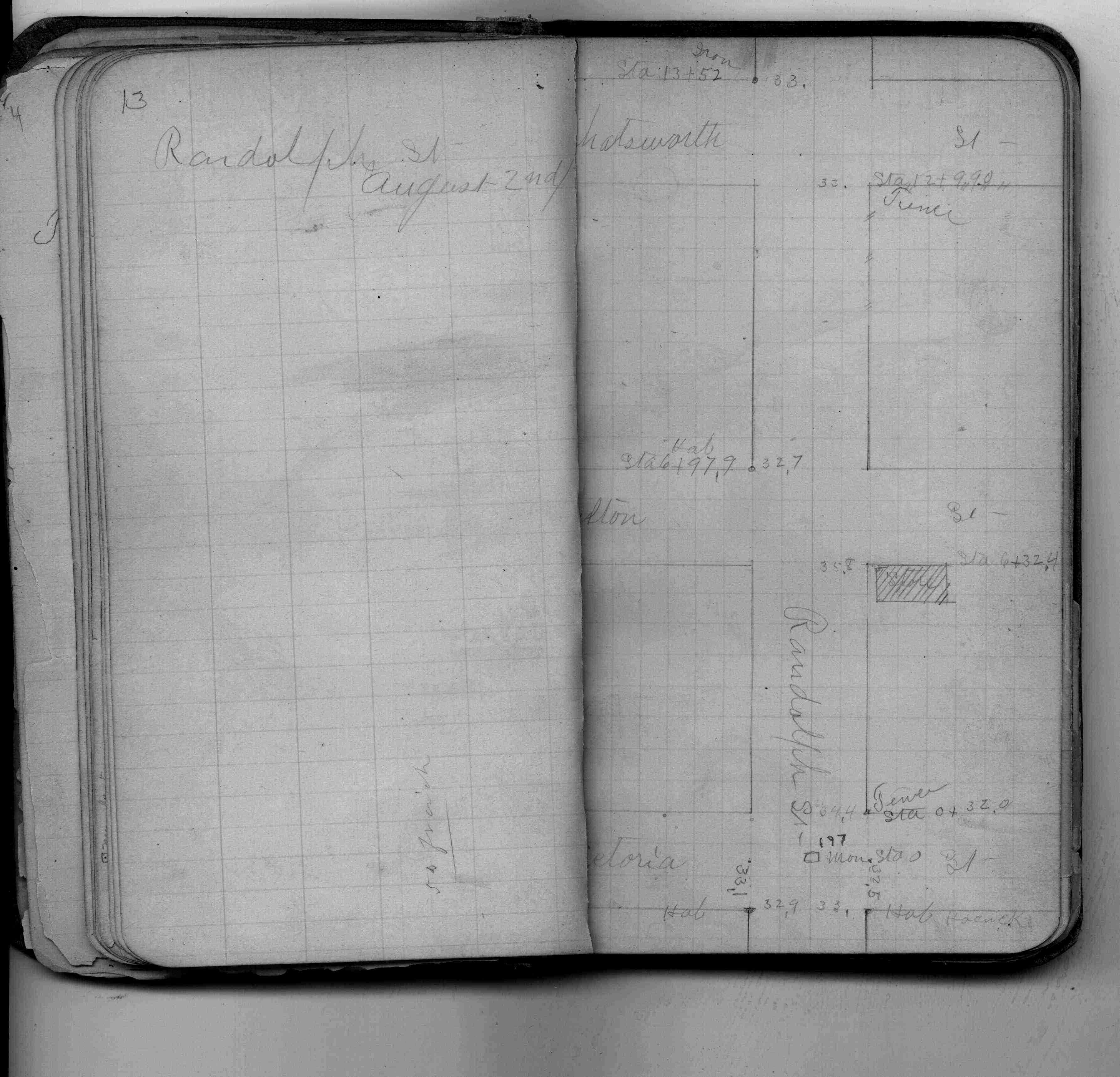
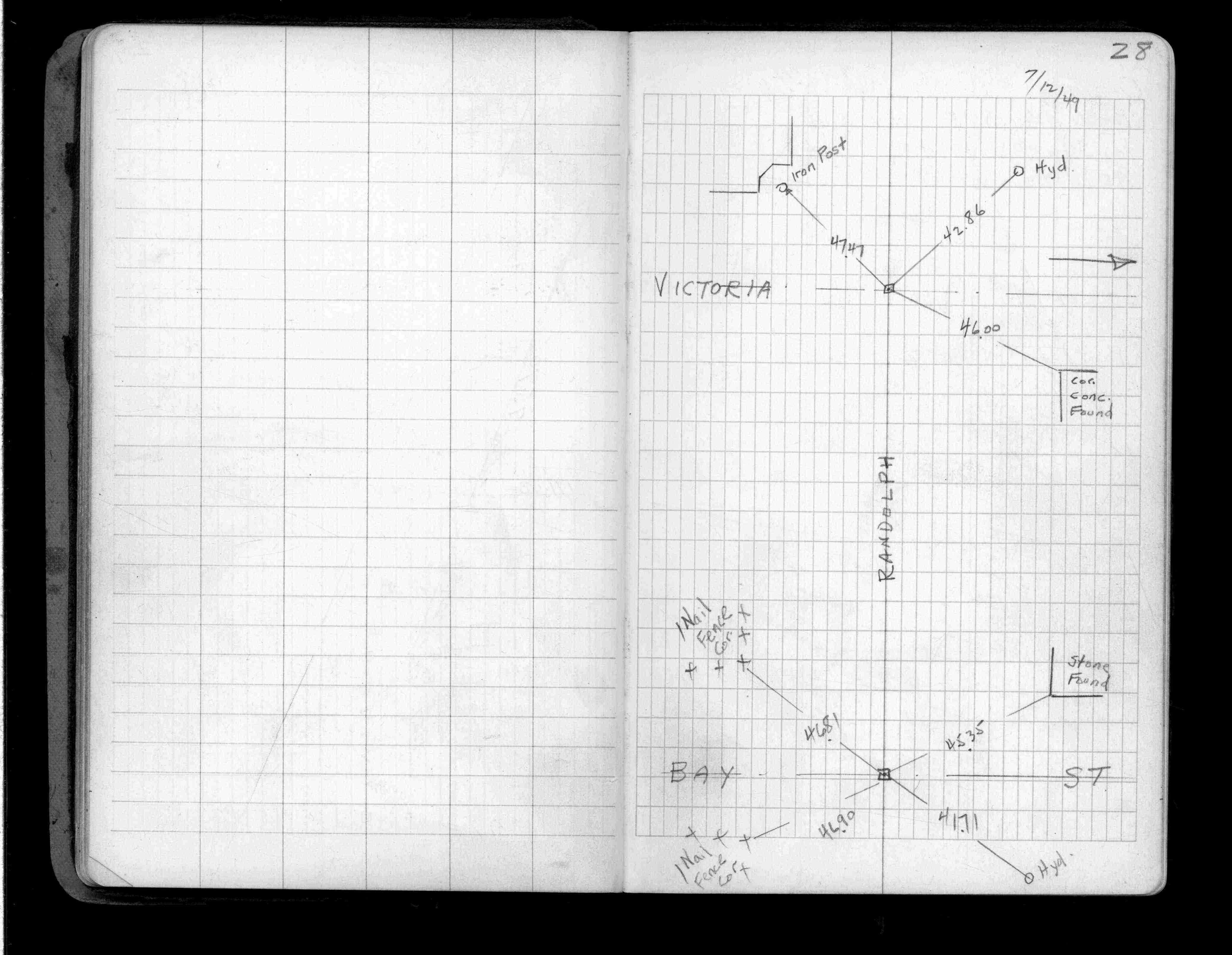
| 7/1/1949 | (Unknown date Jul __, 1949 ) Placed ties. See FB 1357 p.28 |
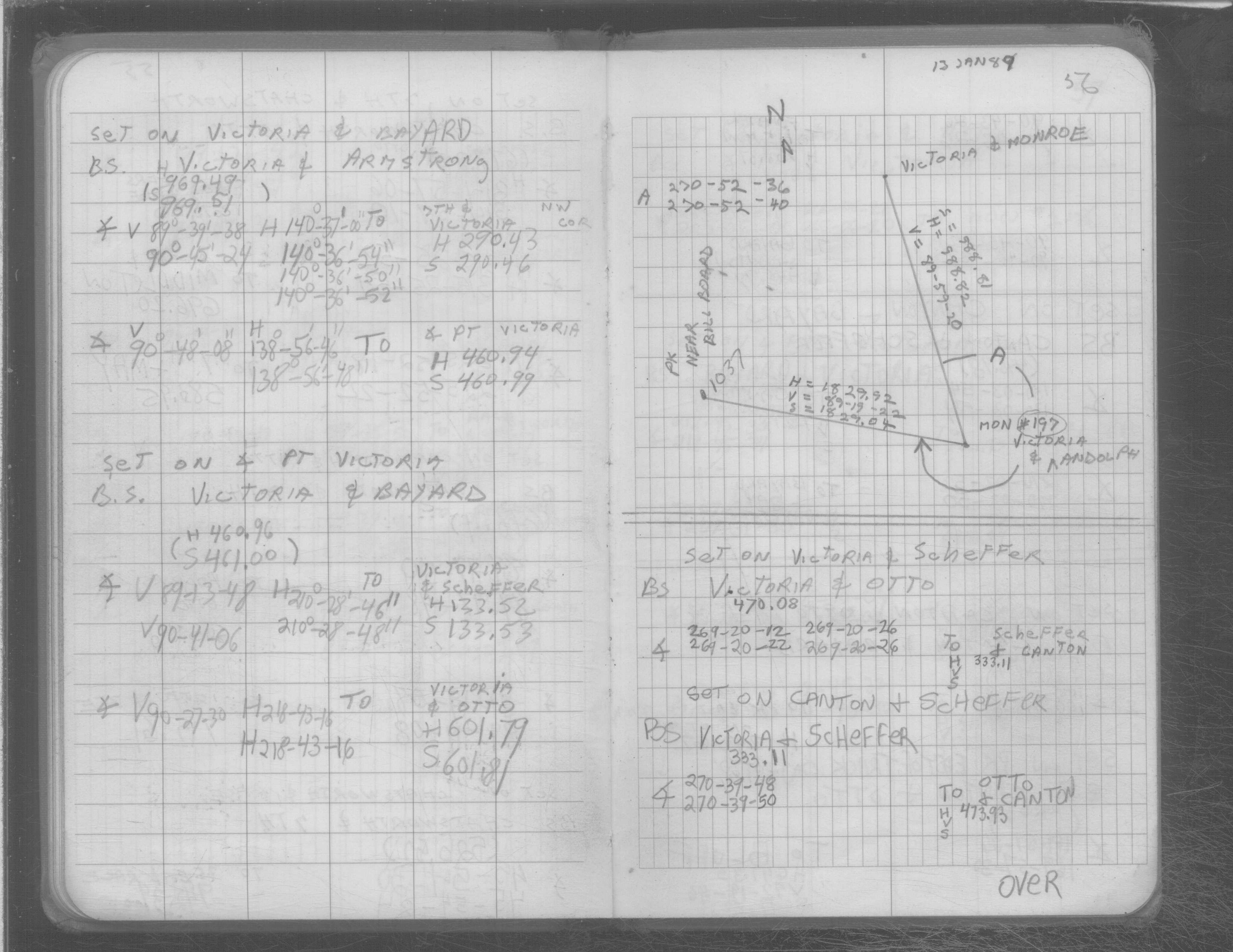
| 7/17/1888 | Monument dug out by Water Dept put in by J H Armstrong. See FB 258 p.9 |
| 1/1/1800 | (Unknown date ___ __, ____ ) GM taken out. |
Above is NOT an all inclusive history of this point. Please review all the links below. Yellow Tie Books are 'ST' in the Monument category.
| PLS NOTES | Field | Cross Section | Sewer | J.B. Irvine | Monument | River Survey |
|---|---|---|---|---|---|---|
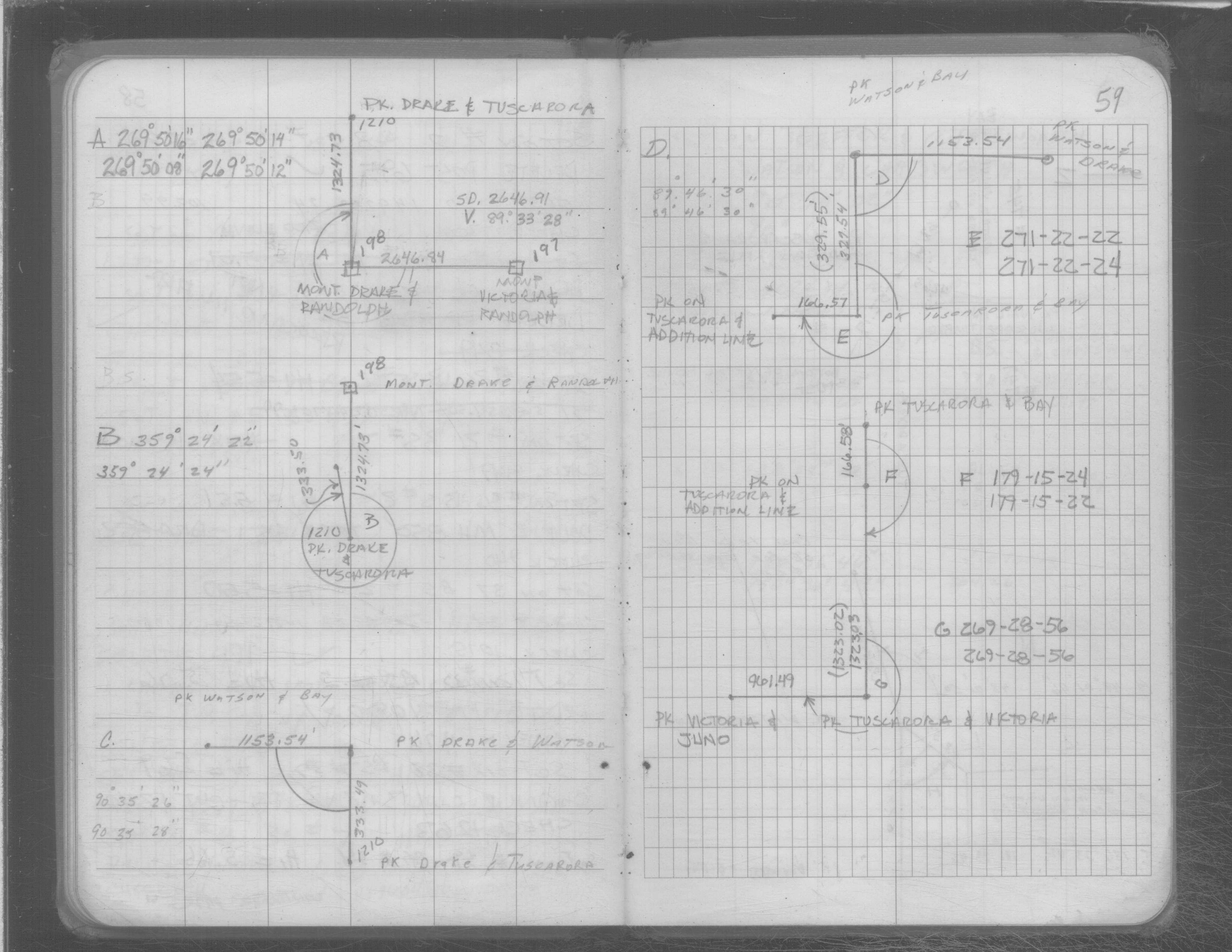
| FB 0201p.13 | SB 0641p. 52 ,53 ,56 ,59 | ST 157-234 p.197 | ||||
| FB 0258p. 08 ,14 | SB 0658p.34 | |||||
| FB 0258p.09 | ||||||
| FB 0438p.74 | ||||||
| FB 1210p. 15 ,16 | ||||||
| FB 1357p.28 | ||||||
| FB 1384p.62 | ||||||
| FB 1549Cp.07 | ||||||
| FB 1549Mp.02 | ||||||
| FB 1565Bp.40 | ||||||
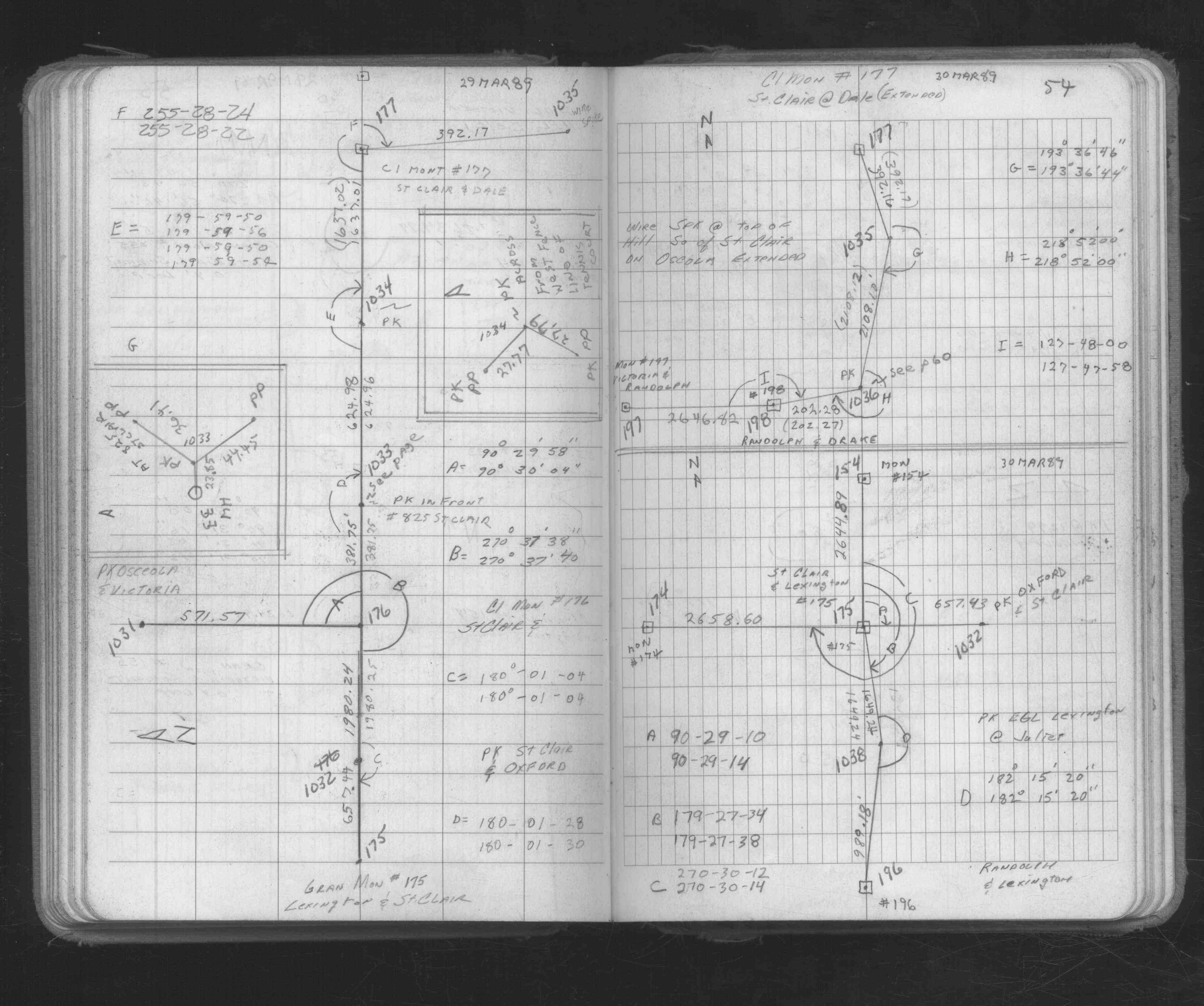
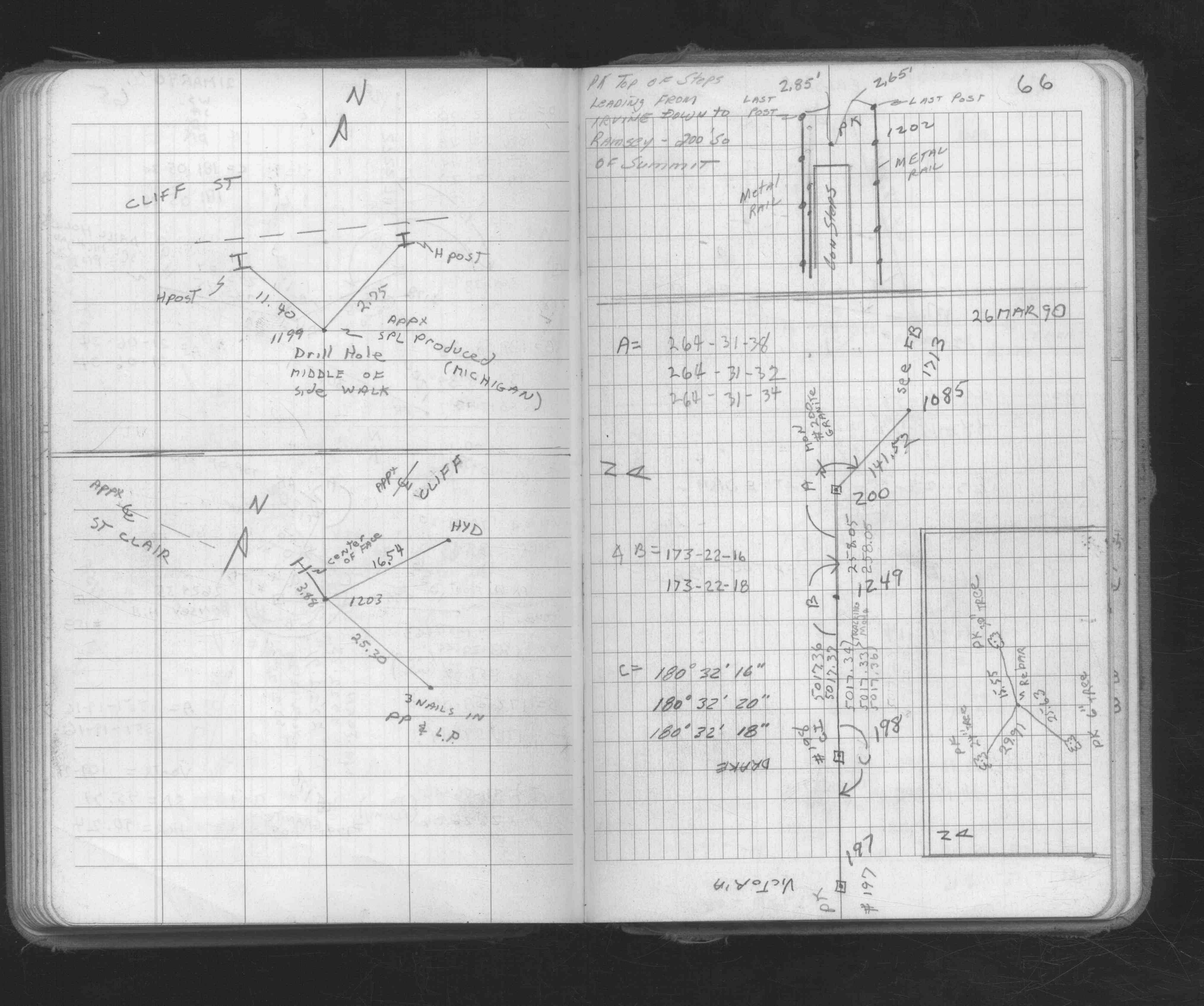
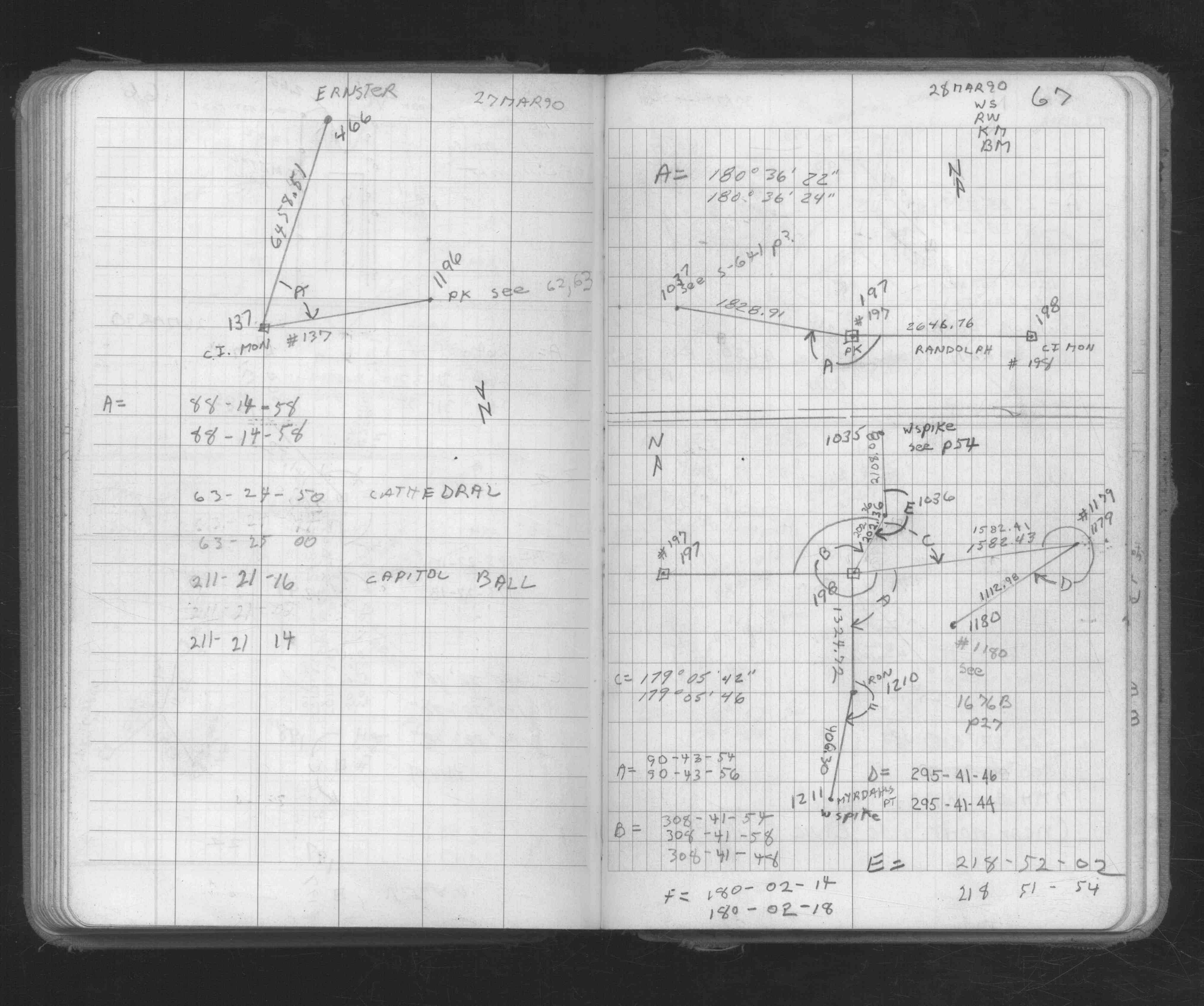
| FB 1673Ap. 54 ,66 ,67 ,70 | ||||||
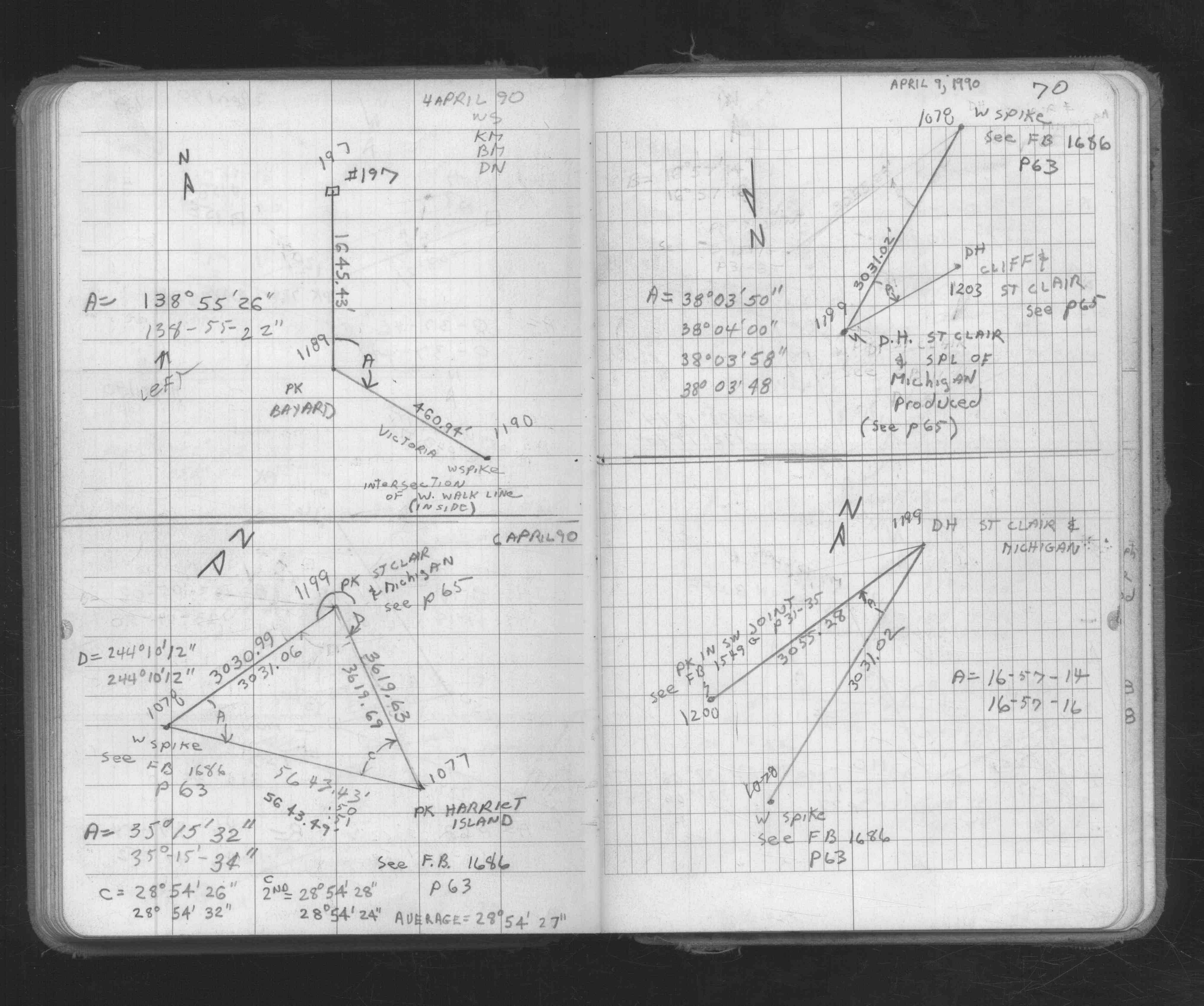
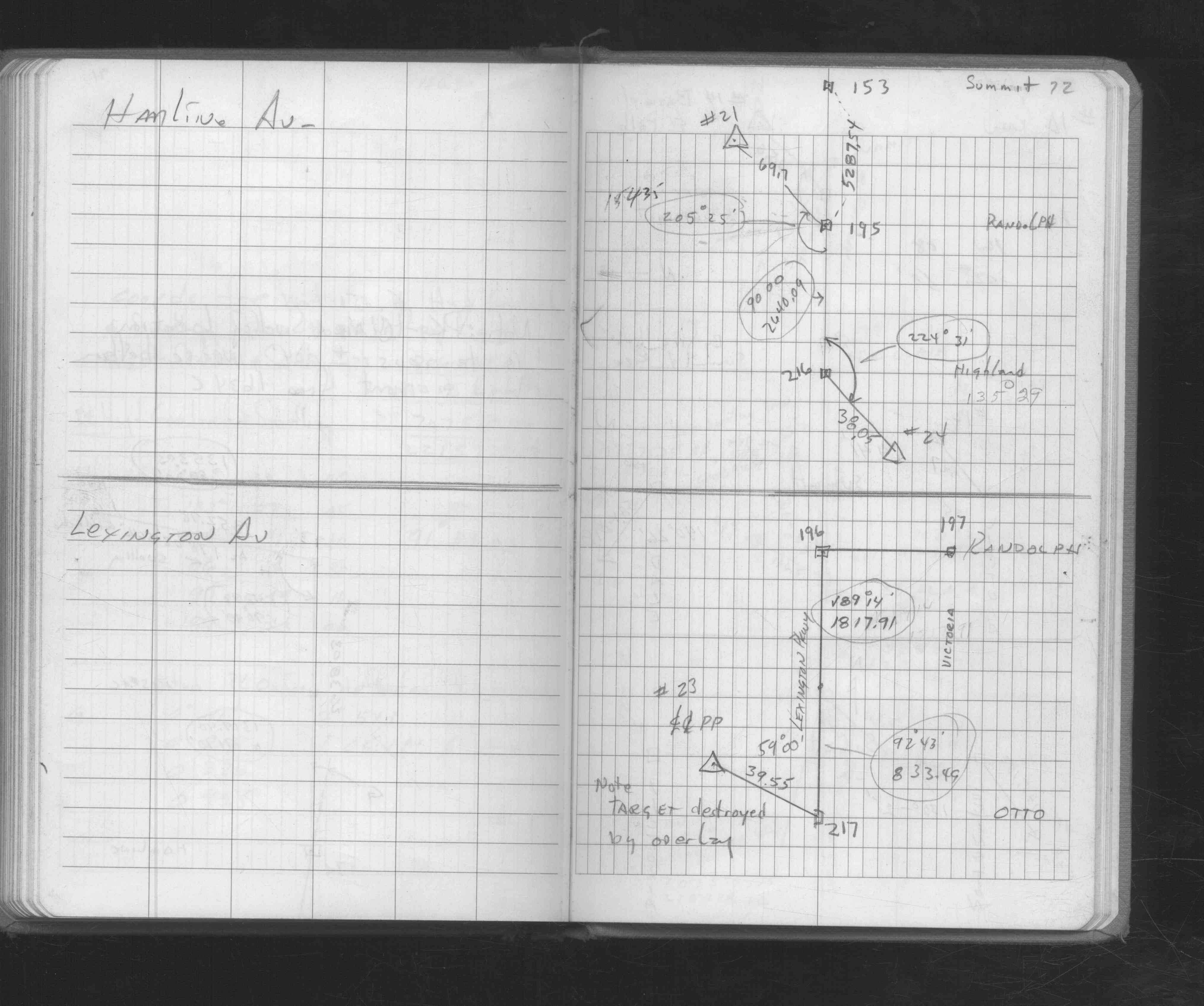
| FB 1676Ap.72 | ||||||
| FB 1676Dp.34 | ||||||
| FB 1689Ap.24 | ||||||
| FB 1704p.78 | ||||||
| FB 1716p.29 | ||||||
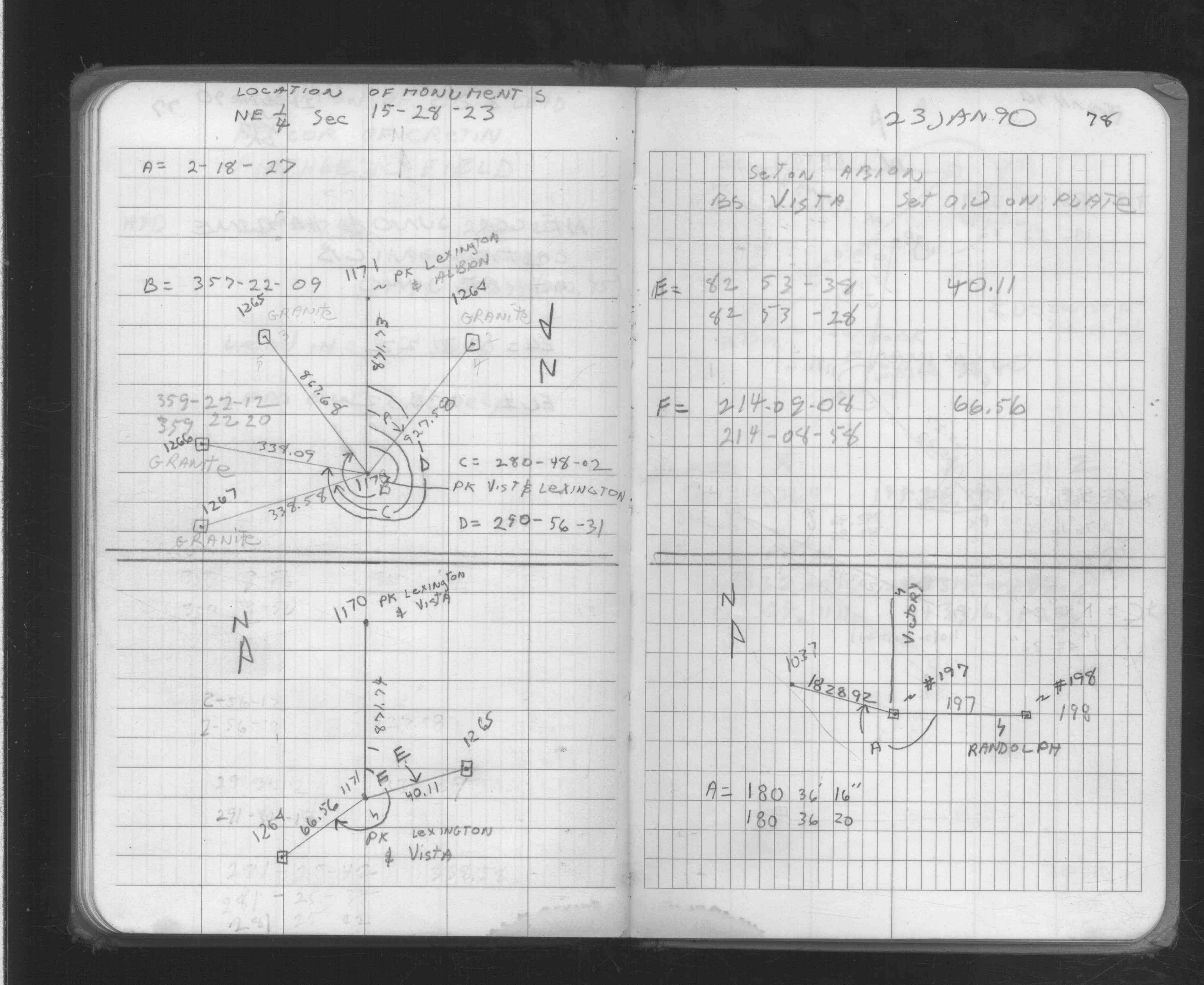
| FB 1734Ap.34 | ||||||
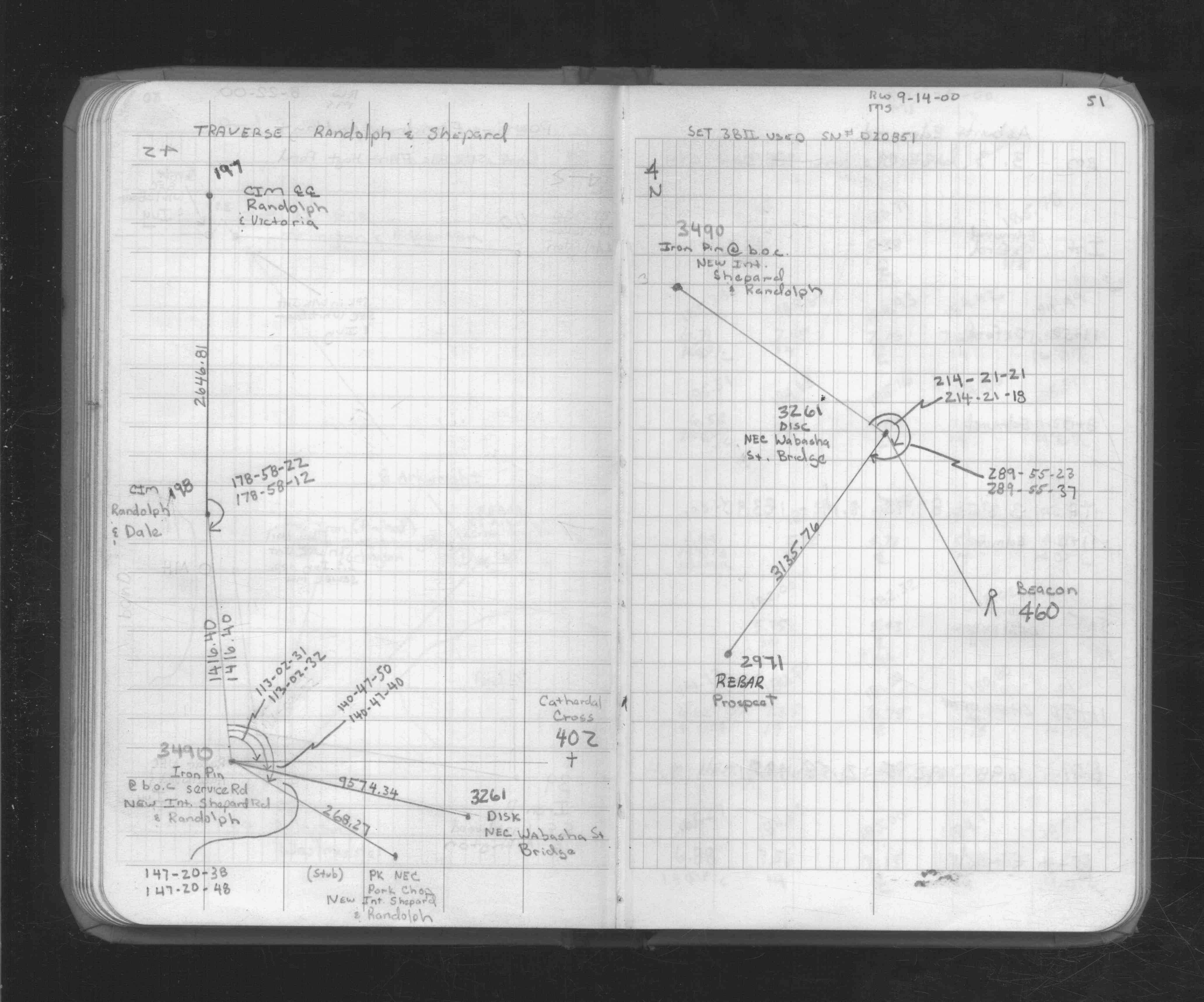
| FB 1734Ap.51 | ||||||
| FB 1736p.31 | ||||||
| FB 1737p.43 | ||||||
| FB 1737p.43 |
| FILE | SURVEYOR | LIC. NO. | DATE SIGNED | DATE TIED |
|---|---|---|---|---|
| 0197-0153-B.tif | William J. Cutting | 20576 | November 21, 1994 | November 7, 1994 |
| 0197-0153-A.tif | William J. Cutting | 20576 | January 14, 1993 | September 28, 1990 |
| ST_157-234p197.jpg | none | none | none | none |
| 0197-0153-A.dwf | none | none | none | none |
| FILE | PHOTO DATE | COMMENTS |
|---|---|---|
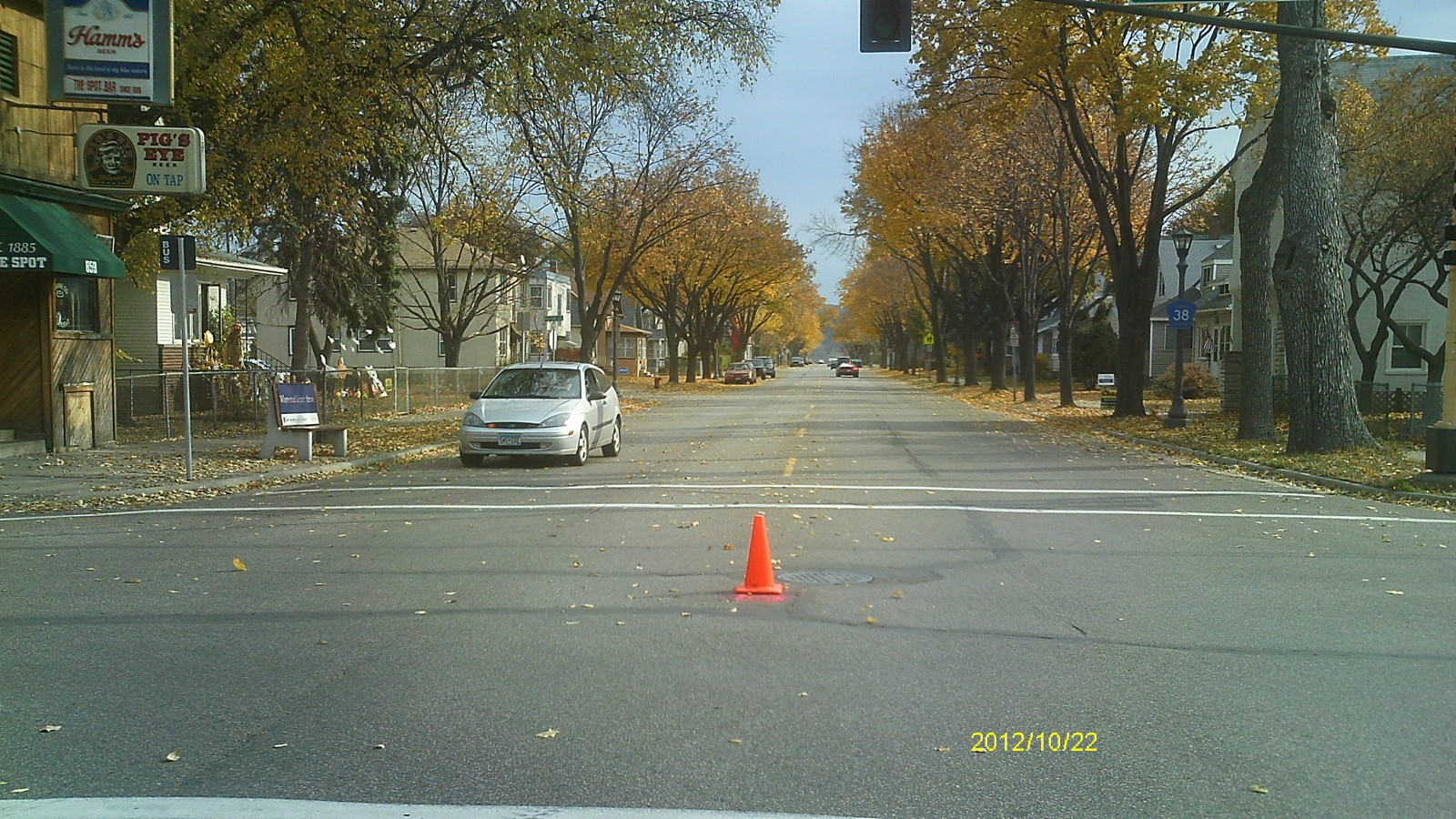
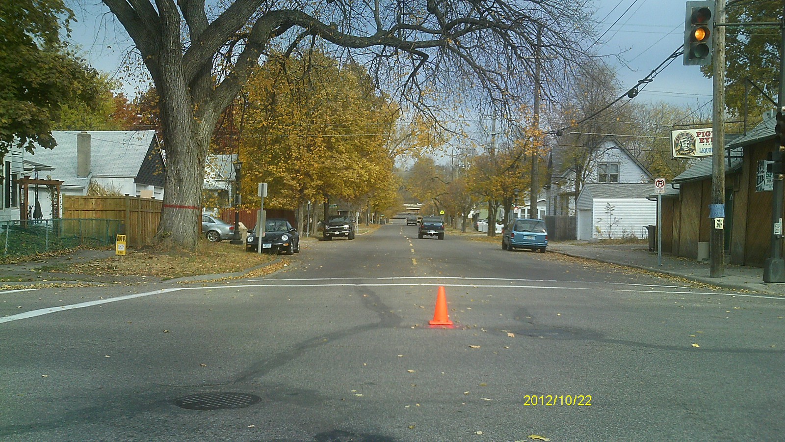
| 0197-0153A-5.jpg | October 22, 2012 | Looking west along Randolph Ave. |
| 0197-0153A-4.jpg | October 22, 2012 | Looking south along Victoria St. |
| 0197-0153A-3.jpg | October 22, 2012 | Looking east along Randolph Ave. |
| 0197-0153A-2.jpg | October 22, 2012 | Looking north along Victoria St. |
| 0197-0153A-1.jpg | October 22, 2012 | Close up of monument. |