| NAD83 COORDINATES (1986 adj.): |
|---|
| X= 591415.487 Y= 157661.121 Z= 000.00 LSQ 12/06/1991 S FLT |
| NAD83 COORDINATES (1996 adj.): |
|---|
| X= 591415.158 Y= 157661.860 Z= 916.9 7/29/2010 MnDot |
| 7/29/2010 | MnDOT found 8 in sq GM appx 1.4 ft below grade. Coordinate established using total station w/ static GPS control (1996 adj). City Elev = 222.64 ft |
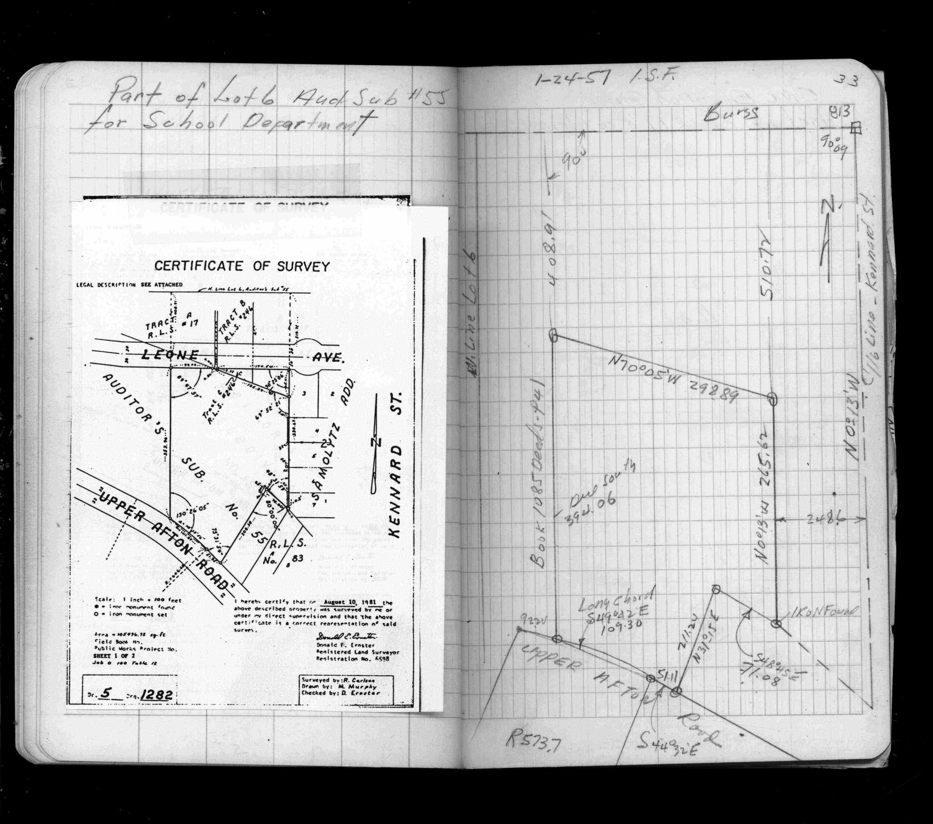
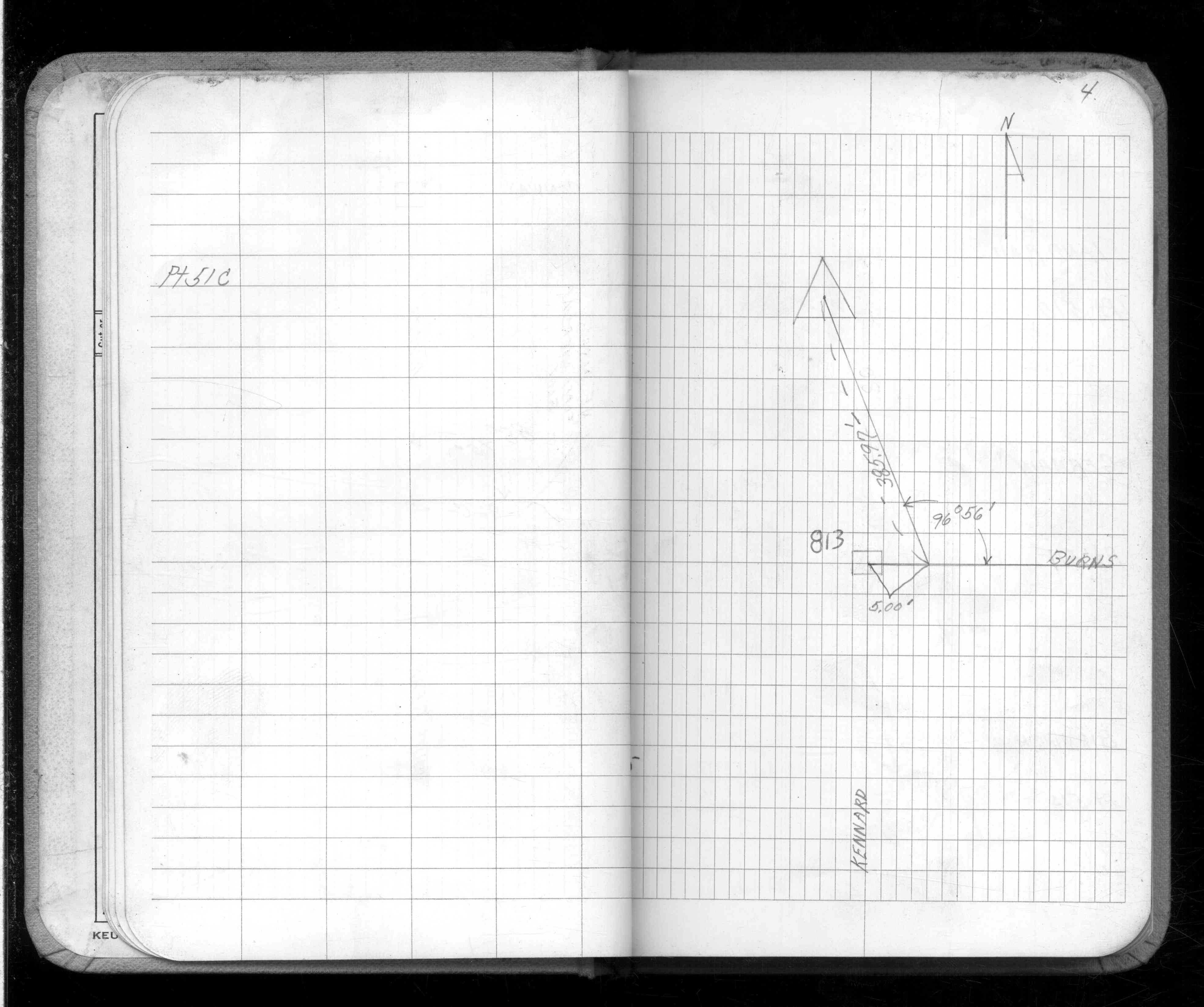
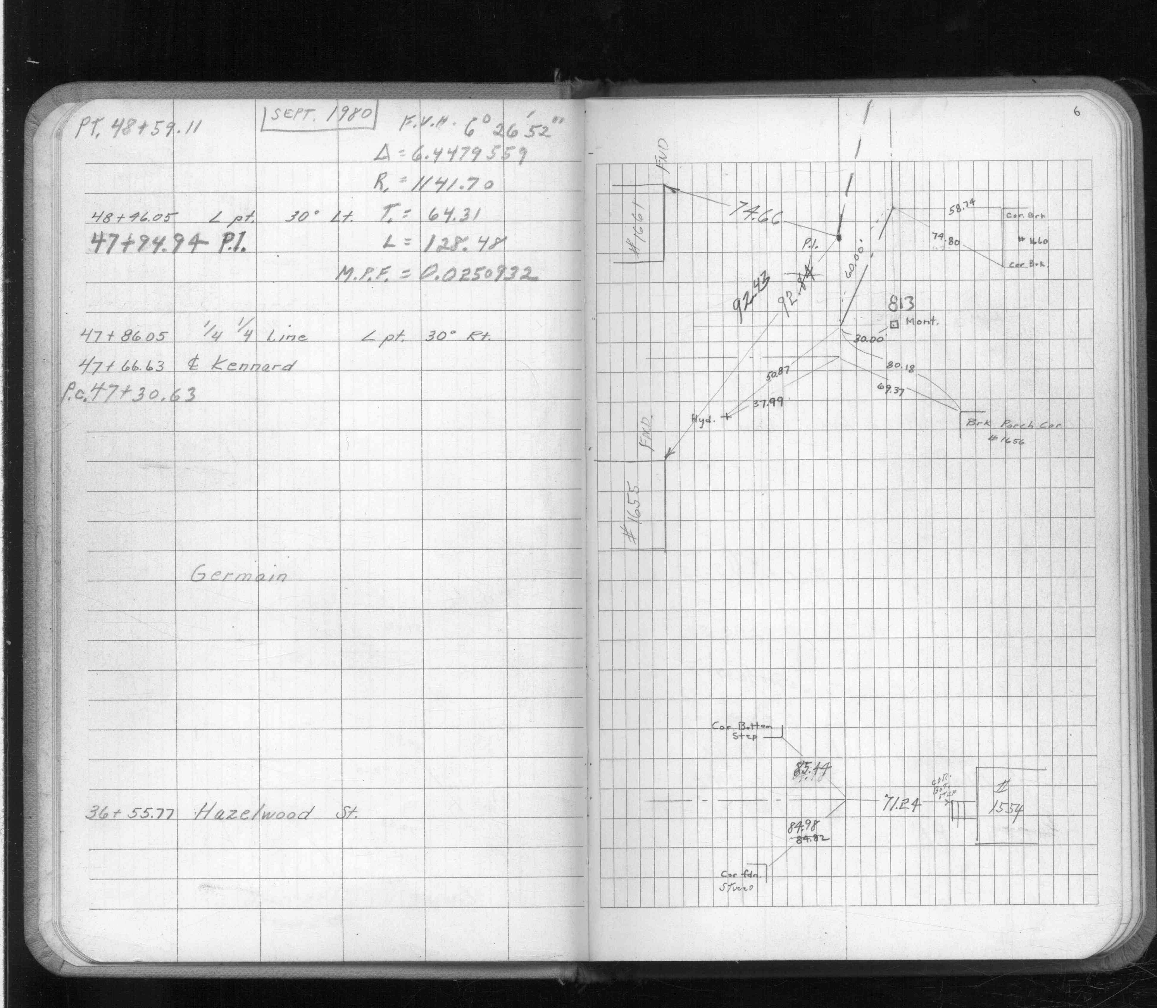
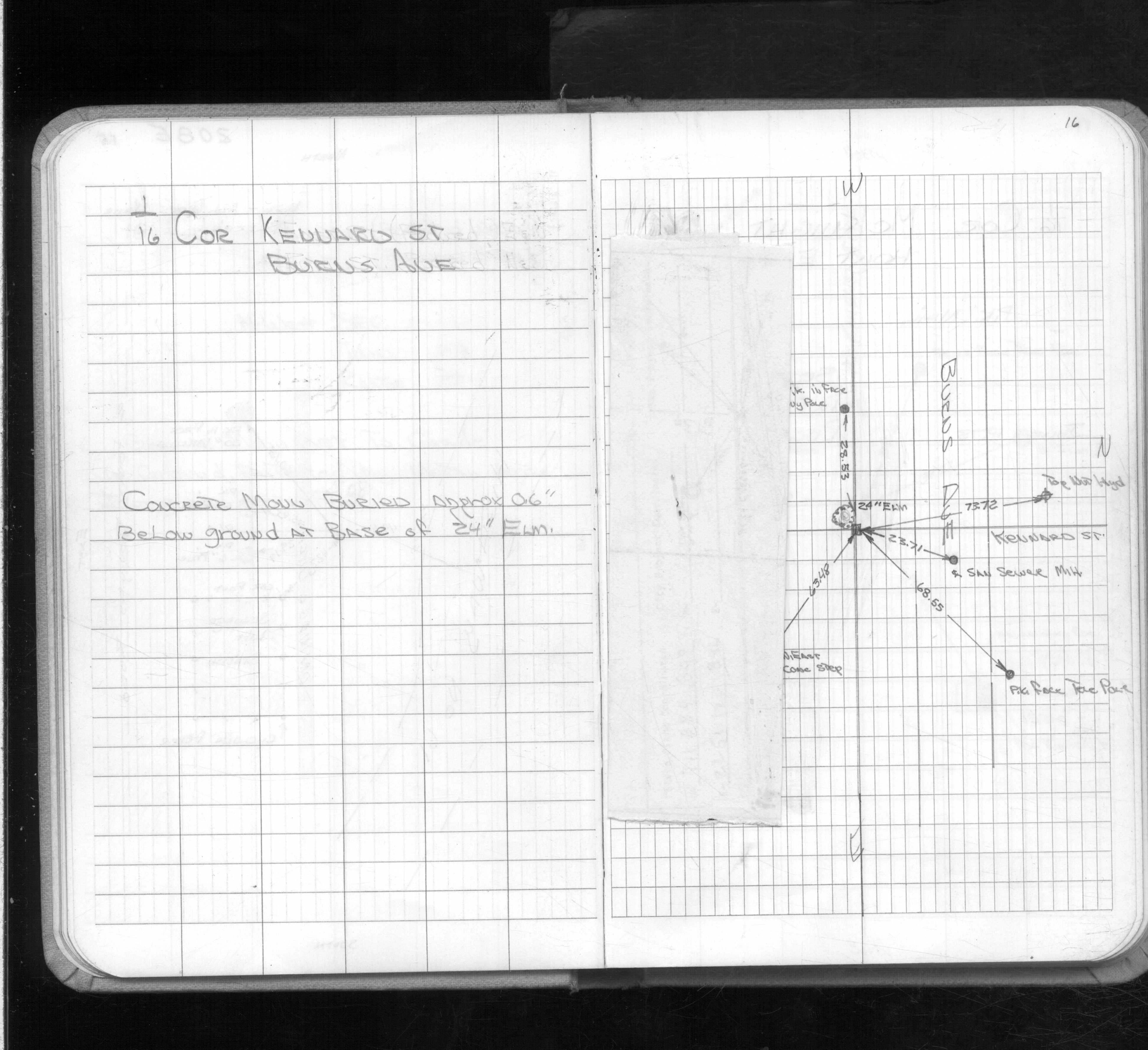
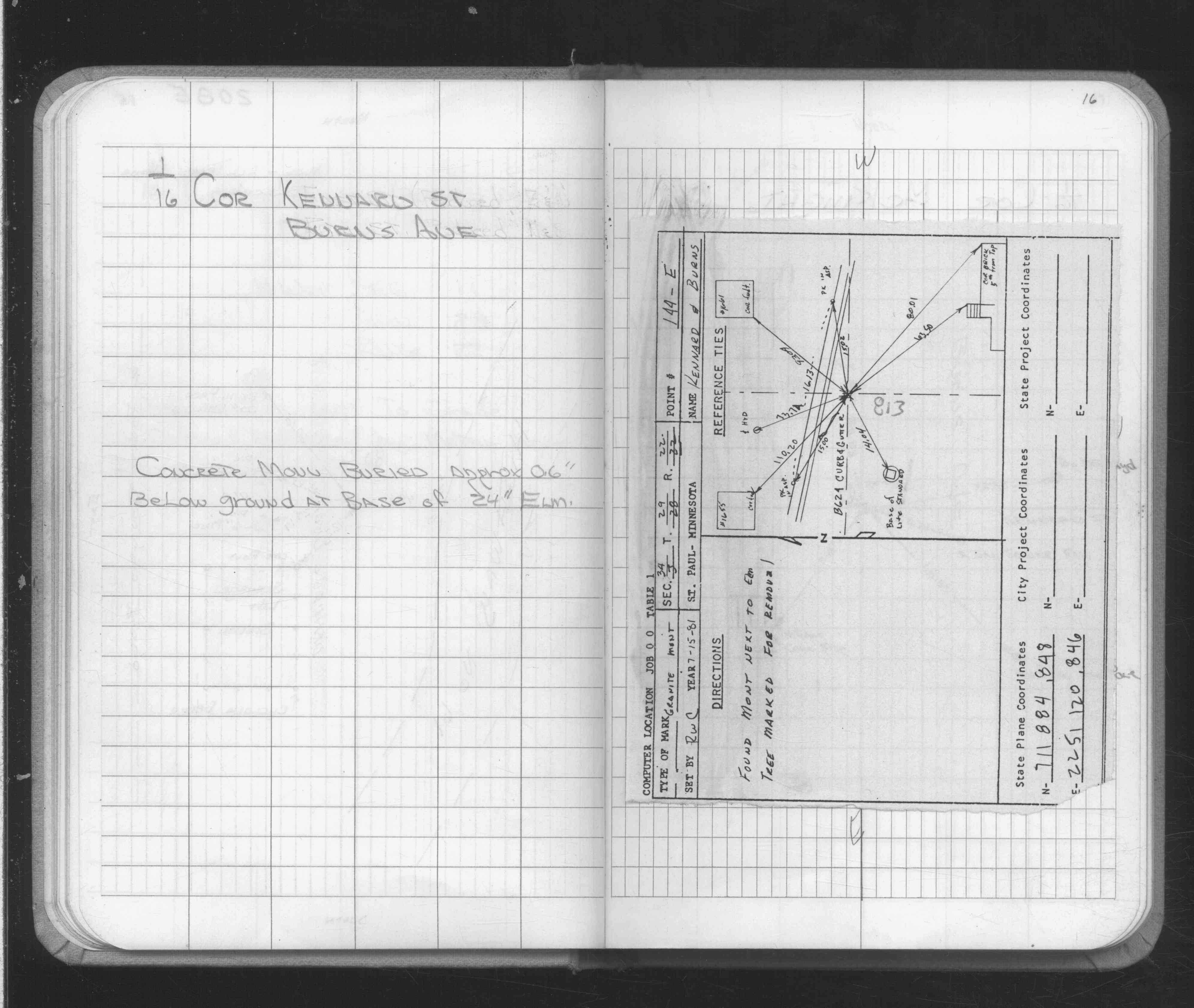
| 7/15/1981 | See CofL 0813-2233-A, copied from FB 1689 p.16 |
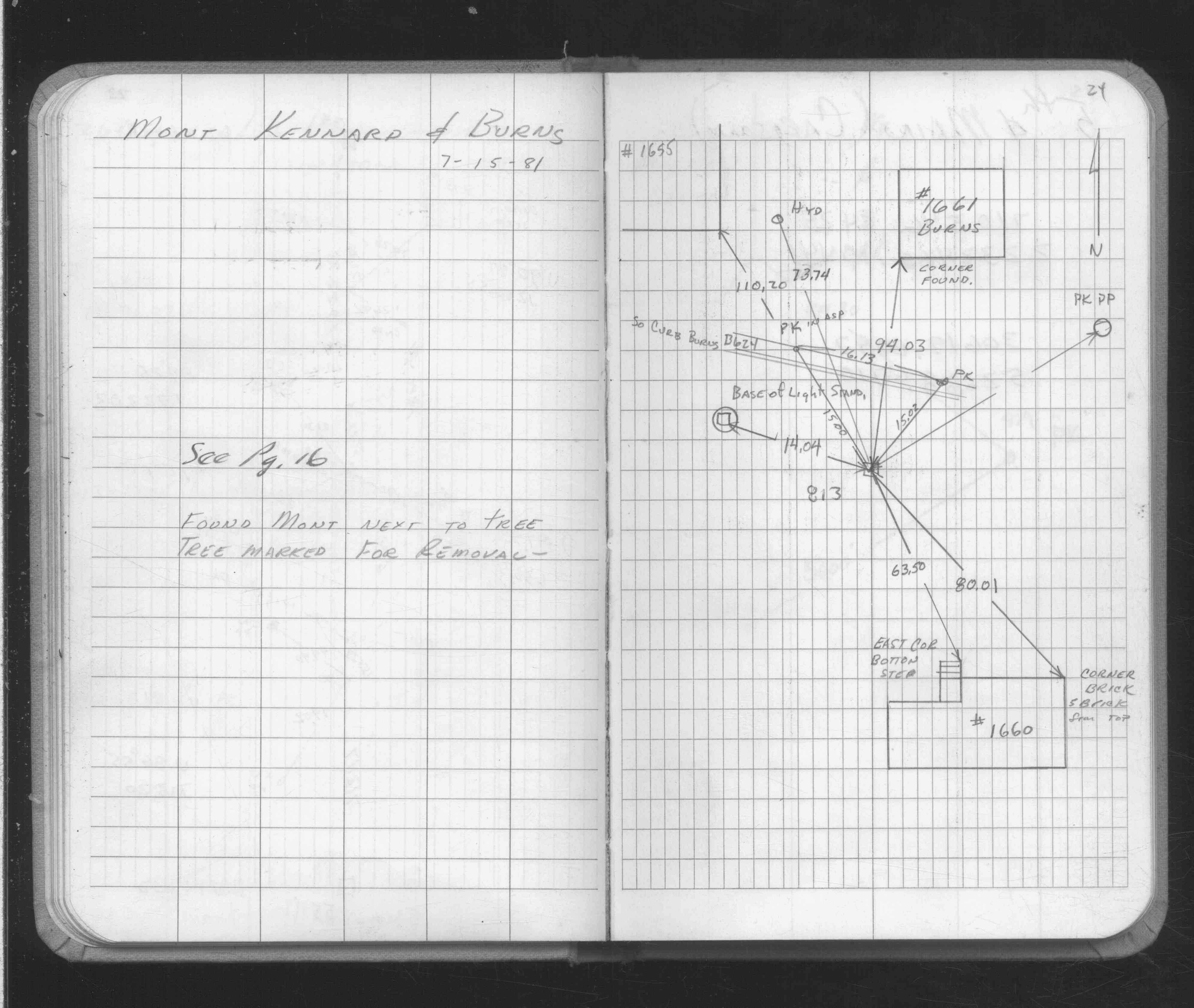
| 7/15/1981 | Placed ties on GM next to tree marked for removal. See FB 1689 p.16,24 |
| 1/20/1891 | Monument set by J H Armstrong |
| 1/1/1800 | (Unknown date ___ __, ____ ) Fd concrete monument 0.6 ft below grade. See FB 1689 p.16 |
Above is NOT an all inclusive history of this point. Please review all the links below.
| PLS NOTES | Field | Cross Section | Sewer | J.B. Irvine | Monument | River Survey |
|---|---|---|---|---|---|---|
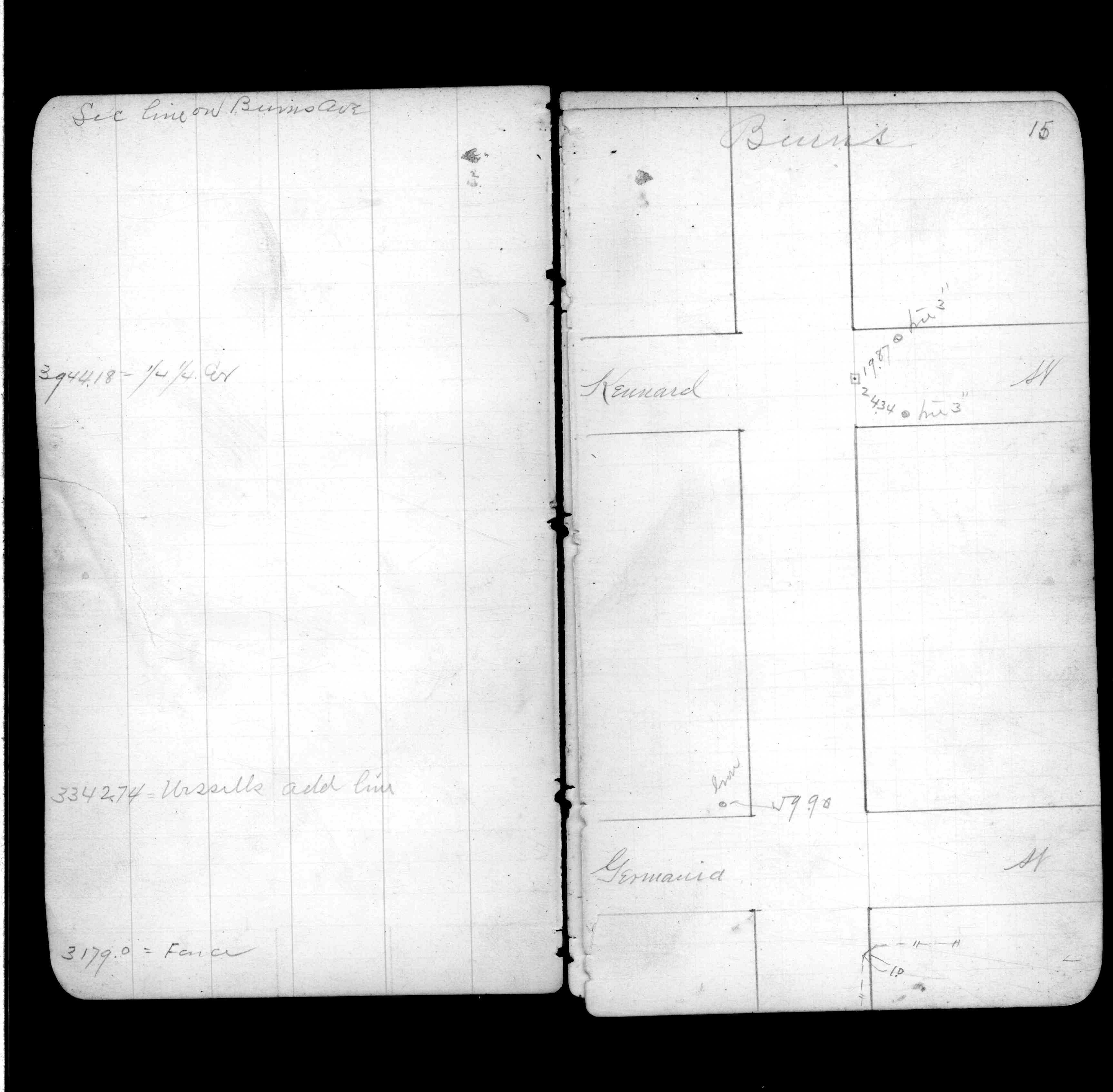
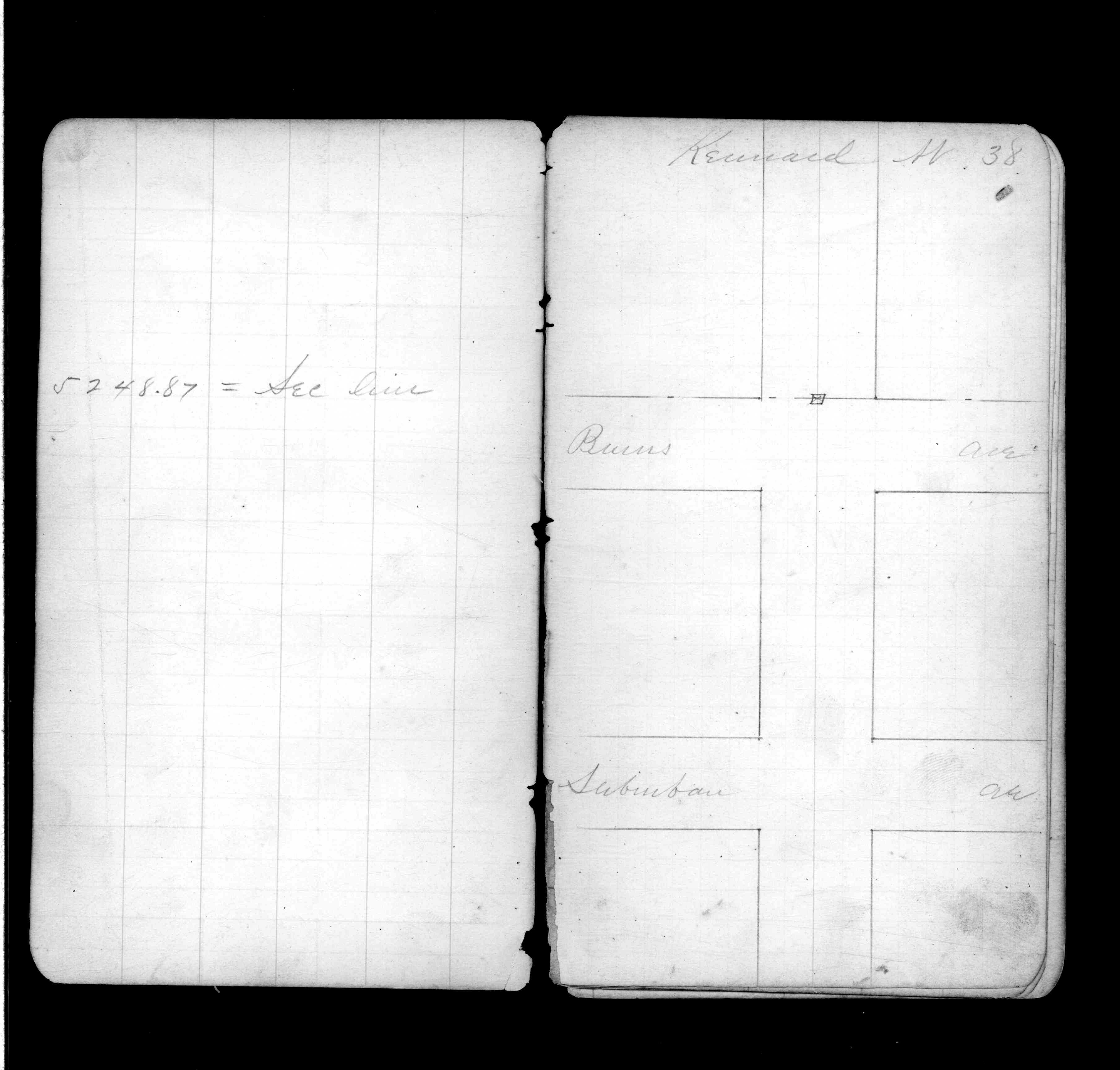
| FB 0339p. 15 ,38 | ||||||
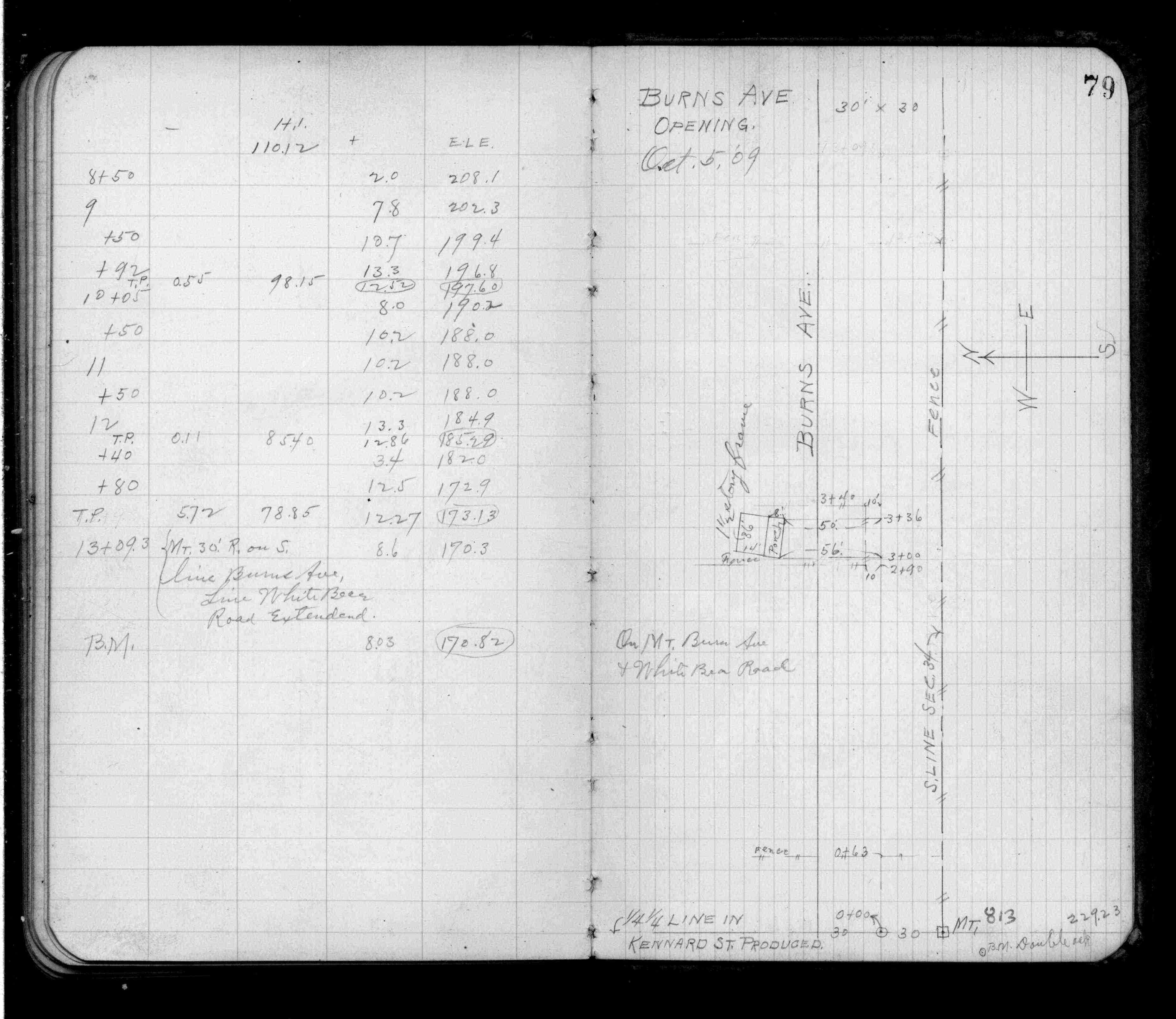
| FB 0619p.79 | ||||||
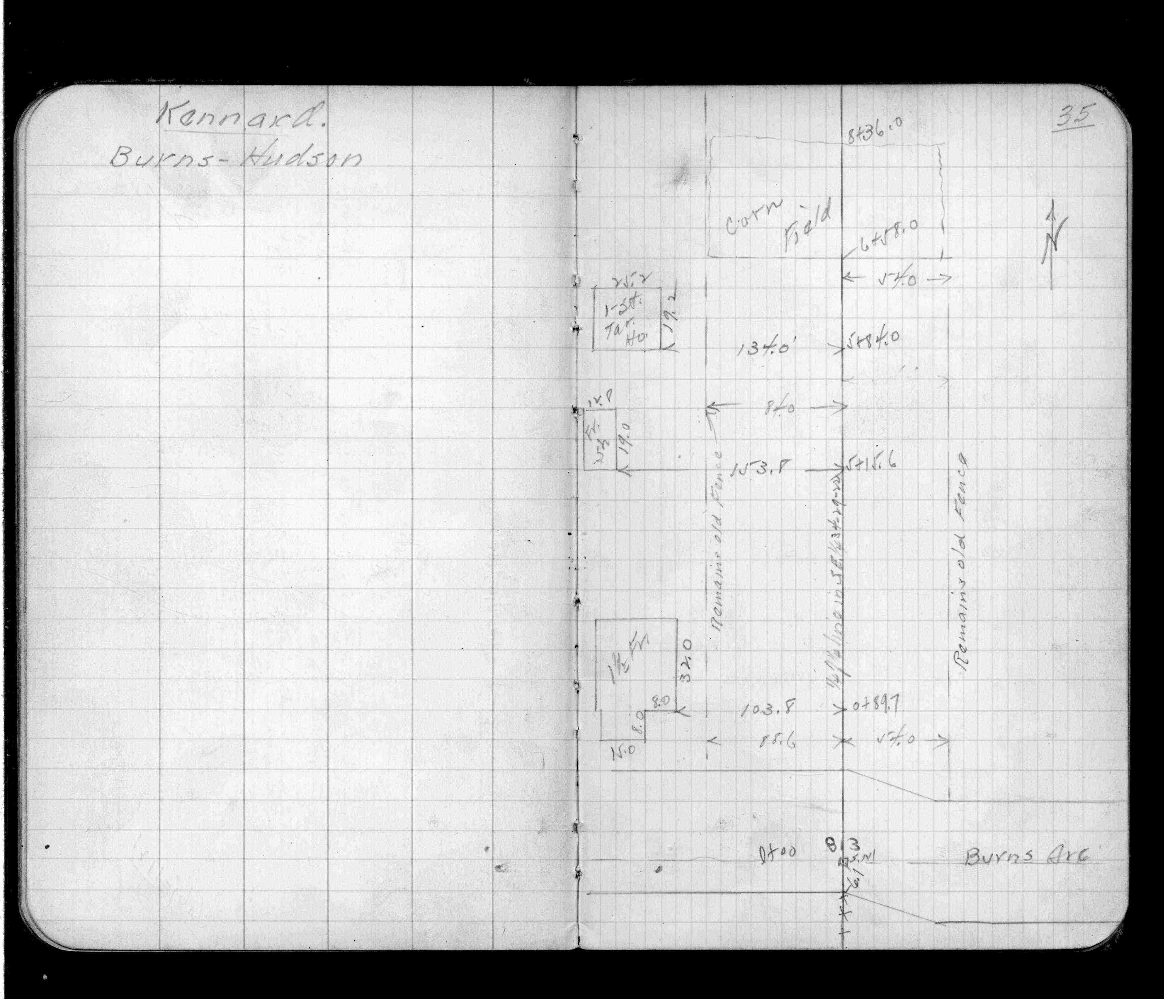
| FB 1137p.35 | ||||||
| FB 1422p.33 | ||||||
| FB 1549D2p.04 | ||||||
| FB 1549Fp. 29 ,30 | ||||||
| FB 1588p. 06 ,23 | ||||||
| FB 1634p. 06 ,07 | ||||||
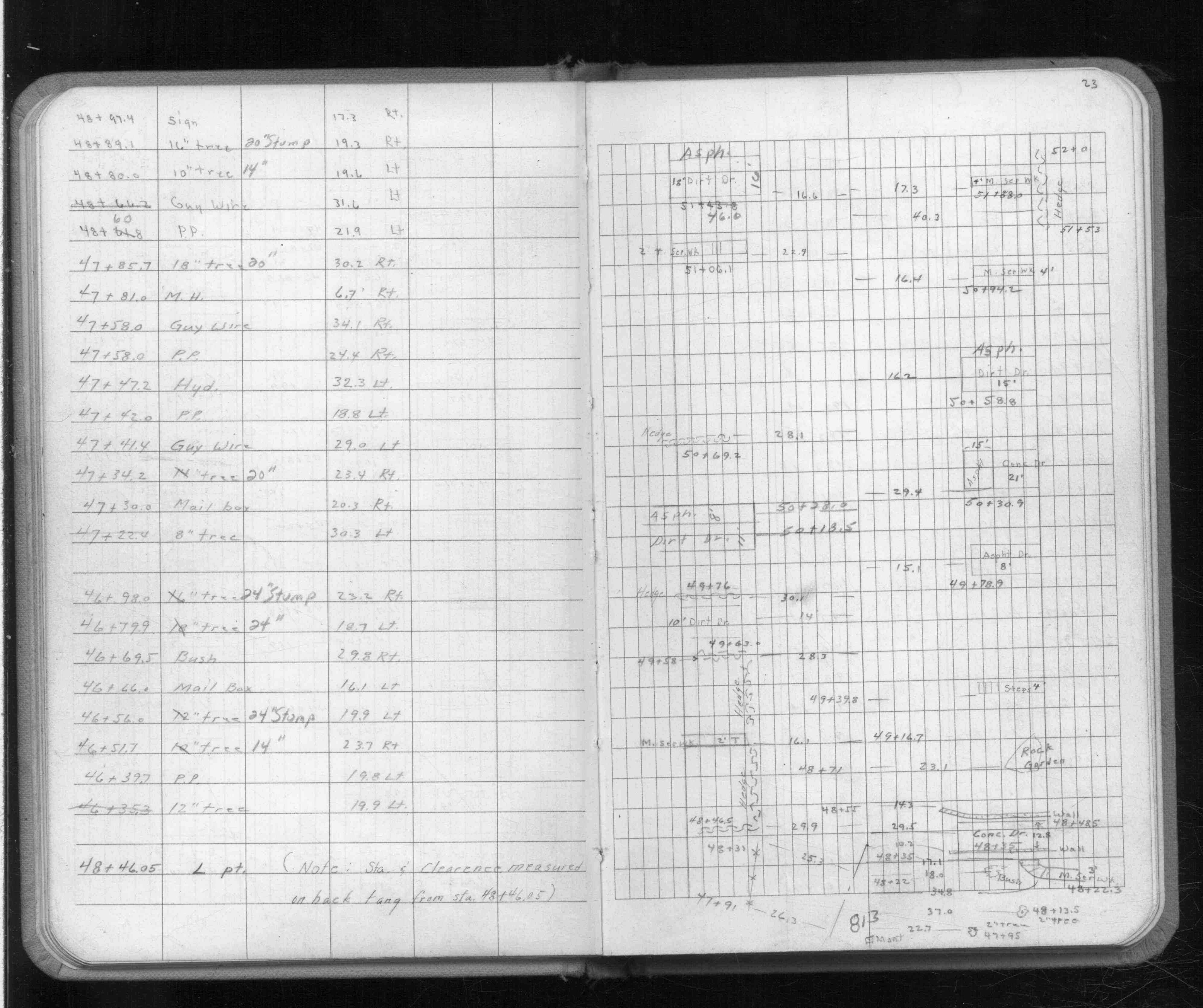
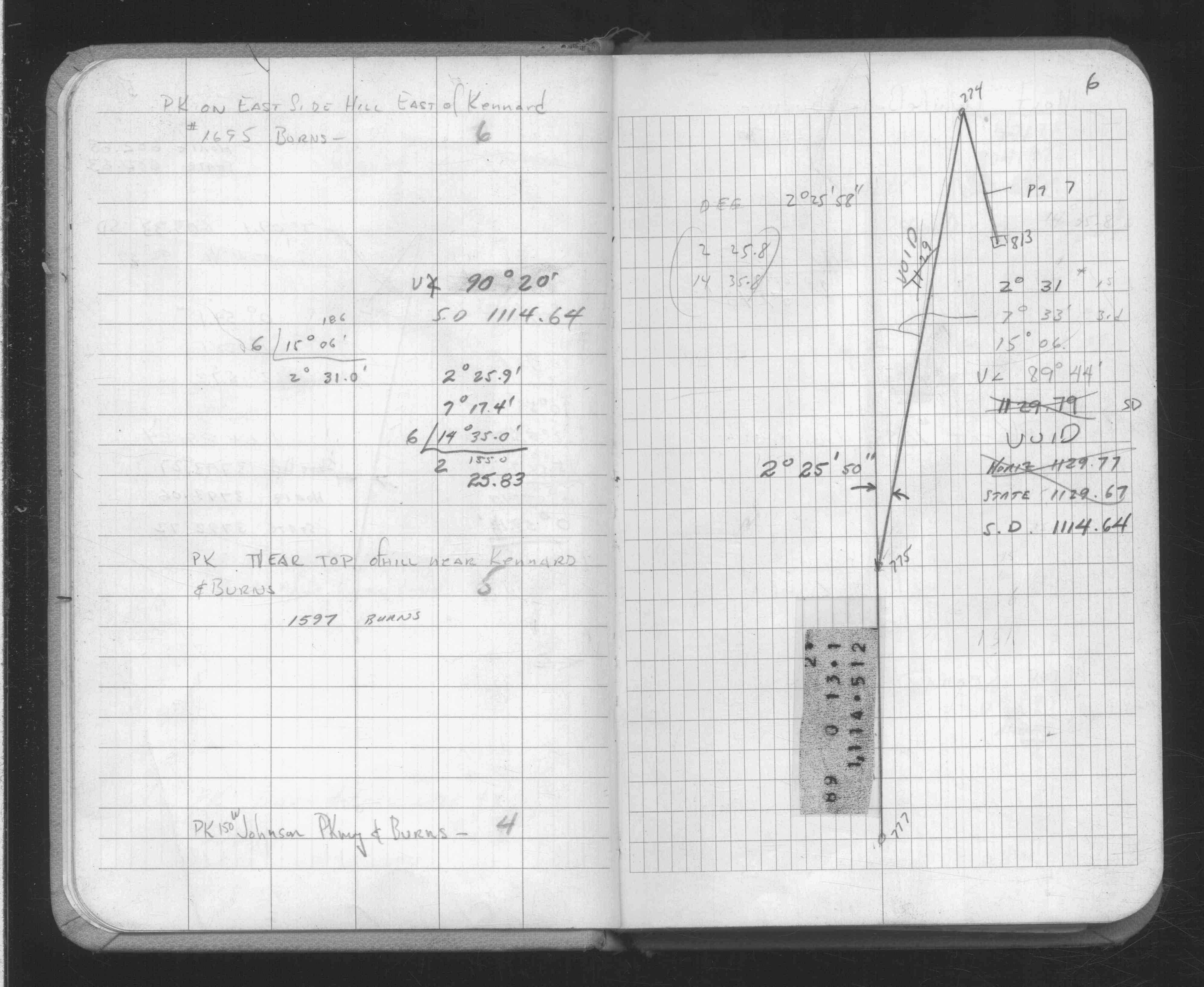
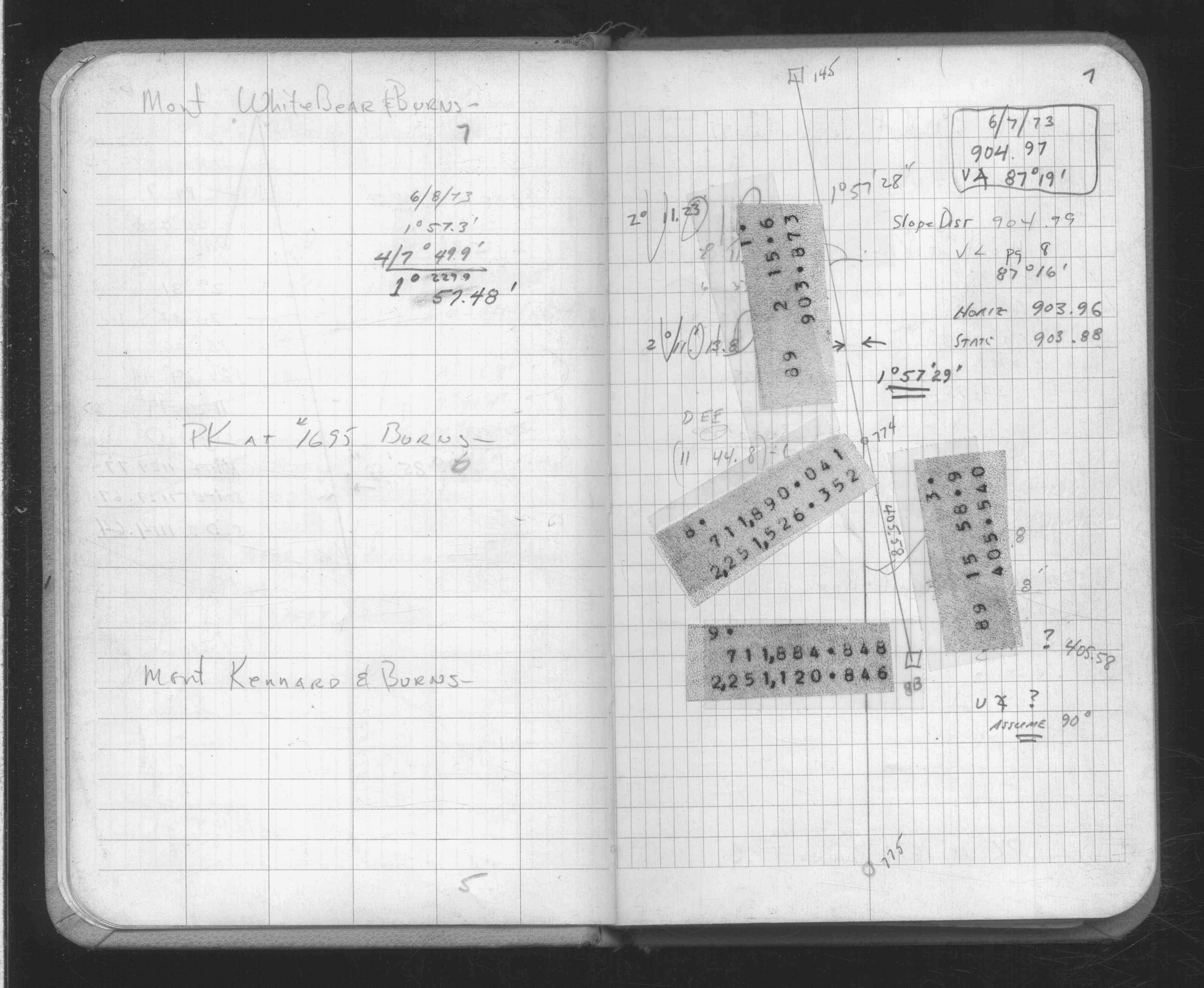
| FB 1689p. 16 ,16a ,24 | ||||||
| FB 1708Ap.17 |
| FILE | SURVEYOR | LIC. NO. | DATE SIGNED | DATE TIED |
|---|---|---|---|---|
| 0813-2233-A.tif | none | none | none | July 15, 1981 |