| NAD83 COORDINATES (1986 adj.): |
|---|
| X= 573157.803 Y= 151246.999 Z= 000.00 CPS 01/06/1994 |
| X= 570103.95 Y= 152505.14 Z= 783.2 02/02/2007 RTK-VRS |
| X= 570103.840 Y= 152504.889 Z= 000.00 LSQ 02/02/1994 FLT |
| 2/2/2007 | Position on GM established by RTK-VRS GPS Elev 783.2 ft. |
| 1/30/2007 | Photos taken. |
| 1/29/2007 | Fd GM 0.30 ft above sidewalk grade. Set ties. See CofL 2538-0950-A |
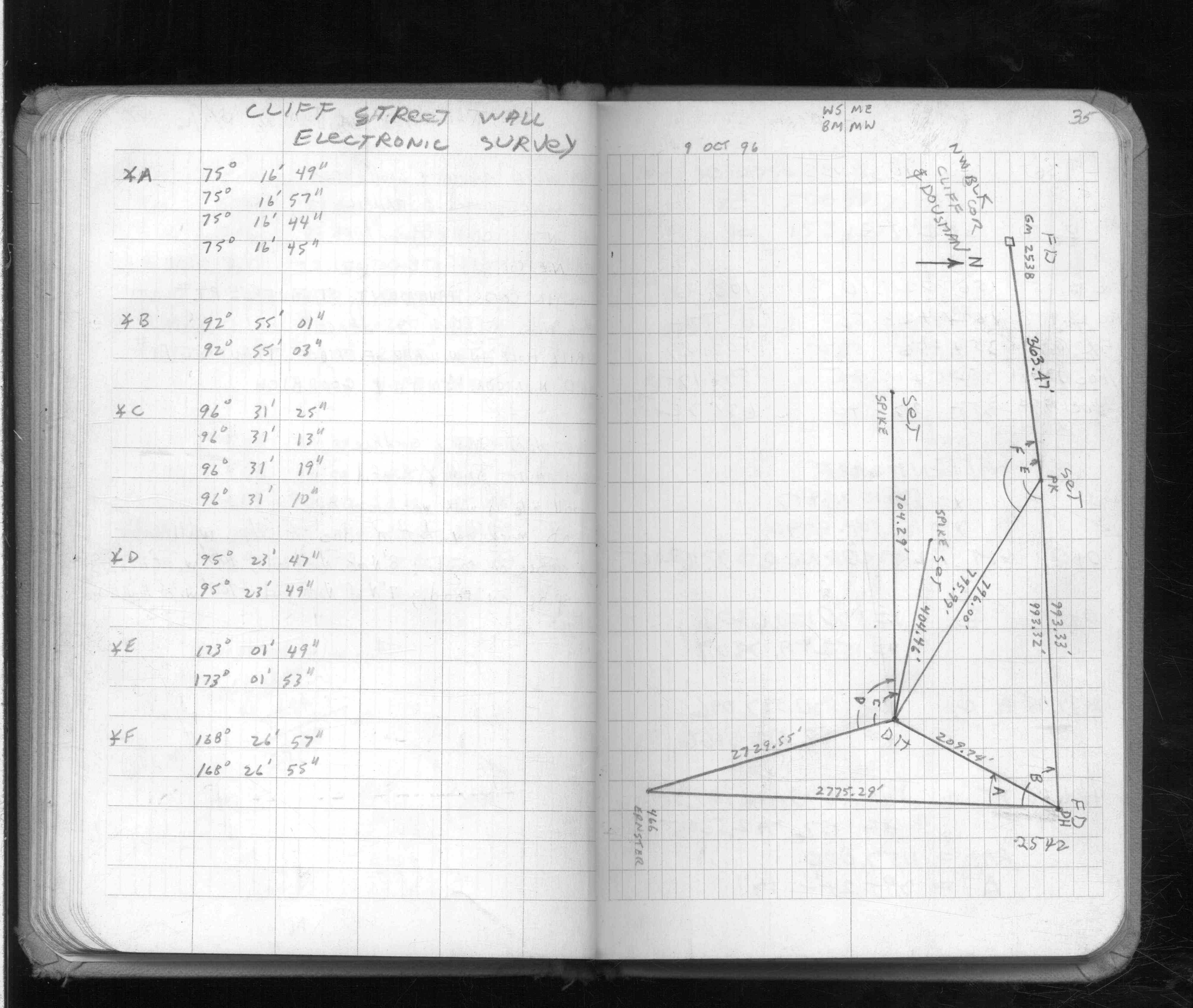
| 10/9/1996 | Used drill hole for traverse control. See FB 1574 p.35 |
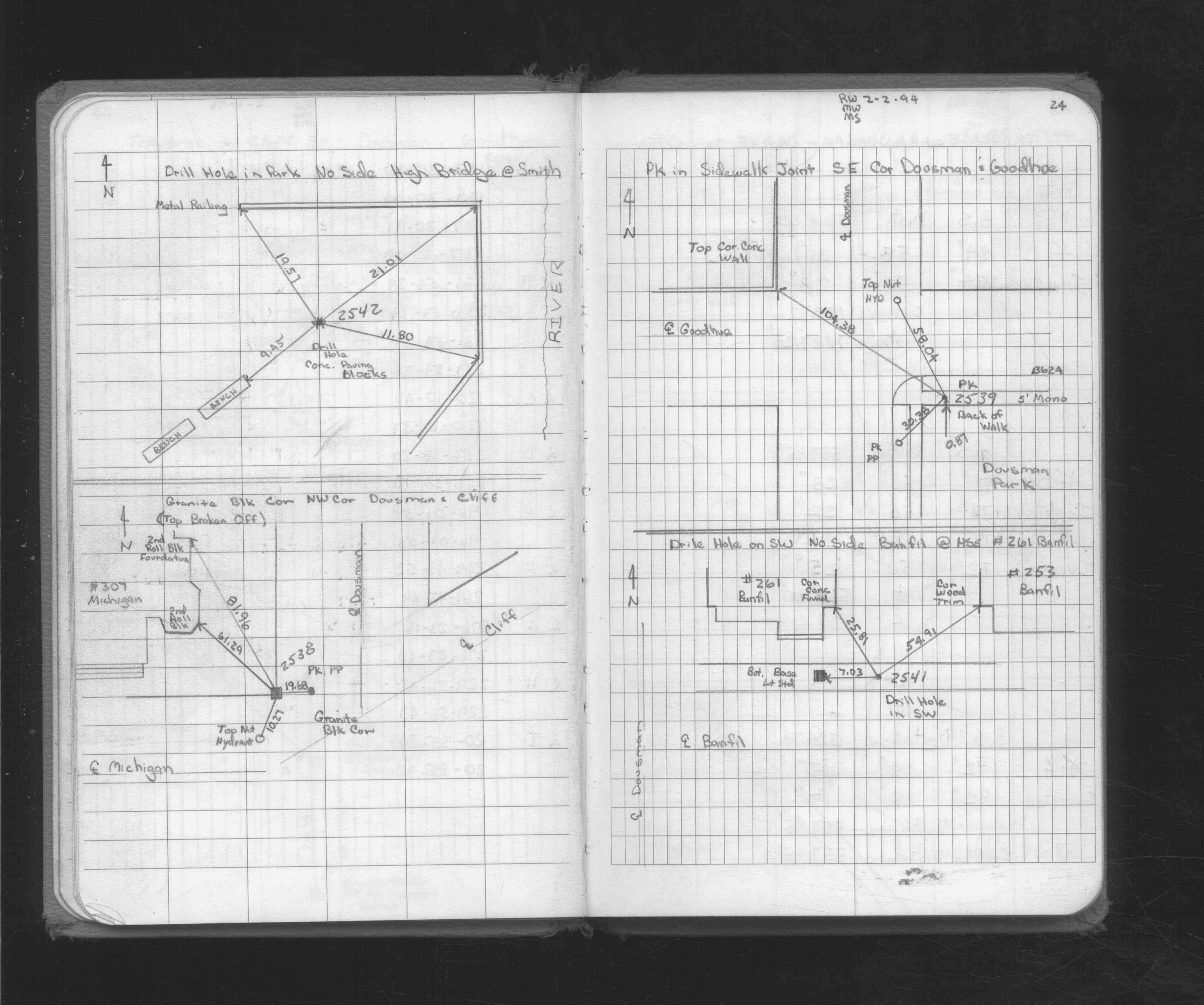
| 2/2/1994 | Placed ties on GM. See FB 1716 p.24 |
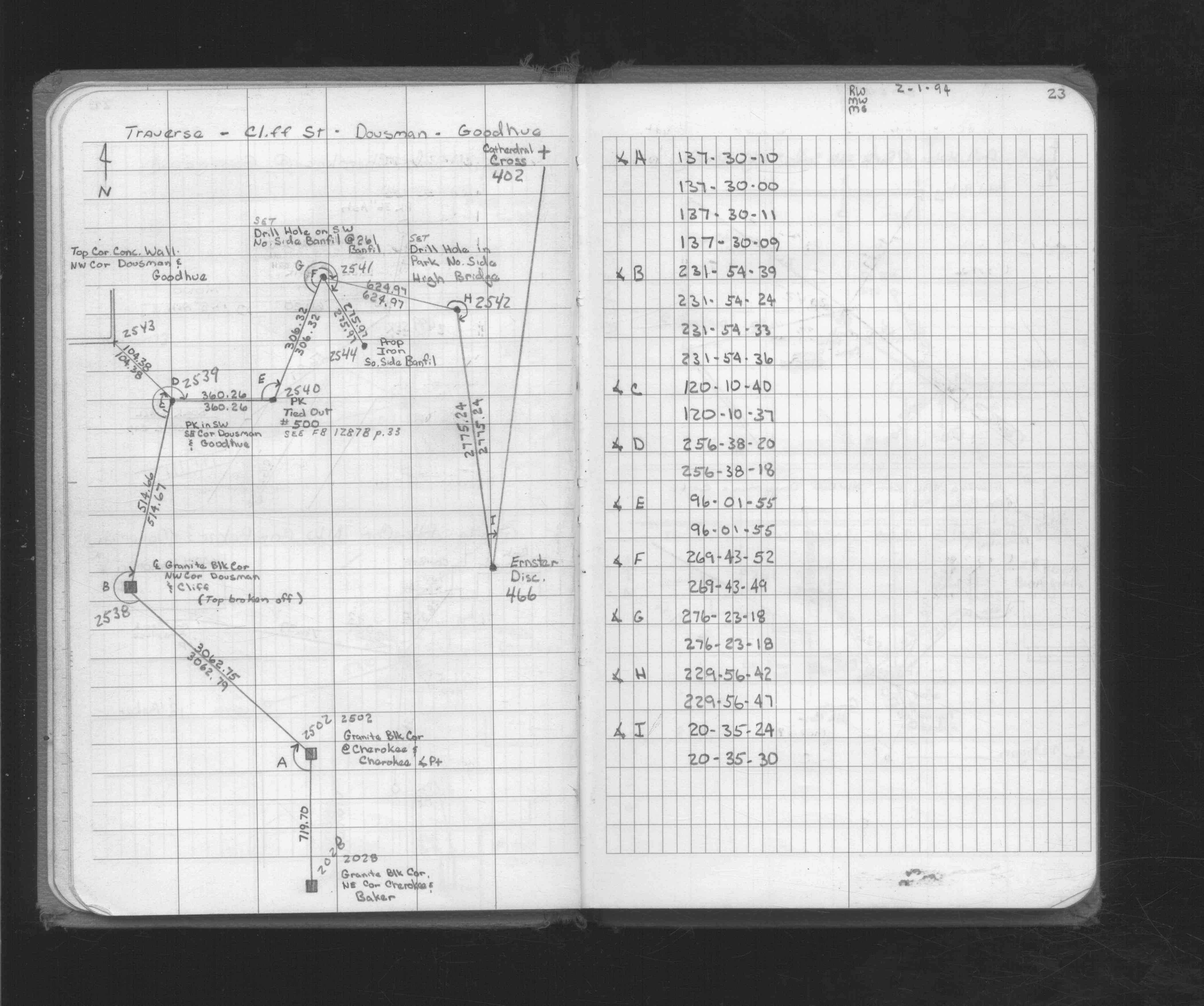
| 2/1/1994 | Located GM (top broken off) by traverse. See FB 1716 p.23 |
| 3/1/1887 | (Unknown date Mar __, 1887 ) Monument set by Chas Hunt from survey March 1887 |
Above is NOT an all inclusive history of this point. Please review all the links below.
| PLS NOTES | Field | Cross Section | Sewer | J.B. Irvine | Monument | River Survey |
|---|---|---|---|---|---|---|
| FB 1574p.35 | ||||||
| FB 1574p.35 | ||||||
| FB 1716p.23 | ||||||
| FB 1716p.23 | ||||||
| FB 1716p.24 |
| FILE | SURVEYOR | LIC. NO. | DATE SIGNED | DATE TIED |
|---|---|---|---|---|
| 2538-0950-A.tif | none | none | none | January 29, 2007 |
| FILE | PHOTO DATE | COMMENTS |
|---|---|---|
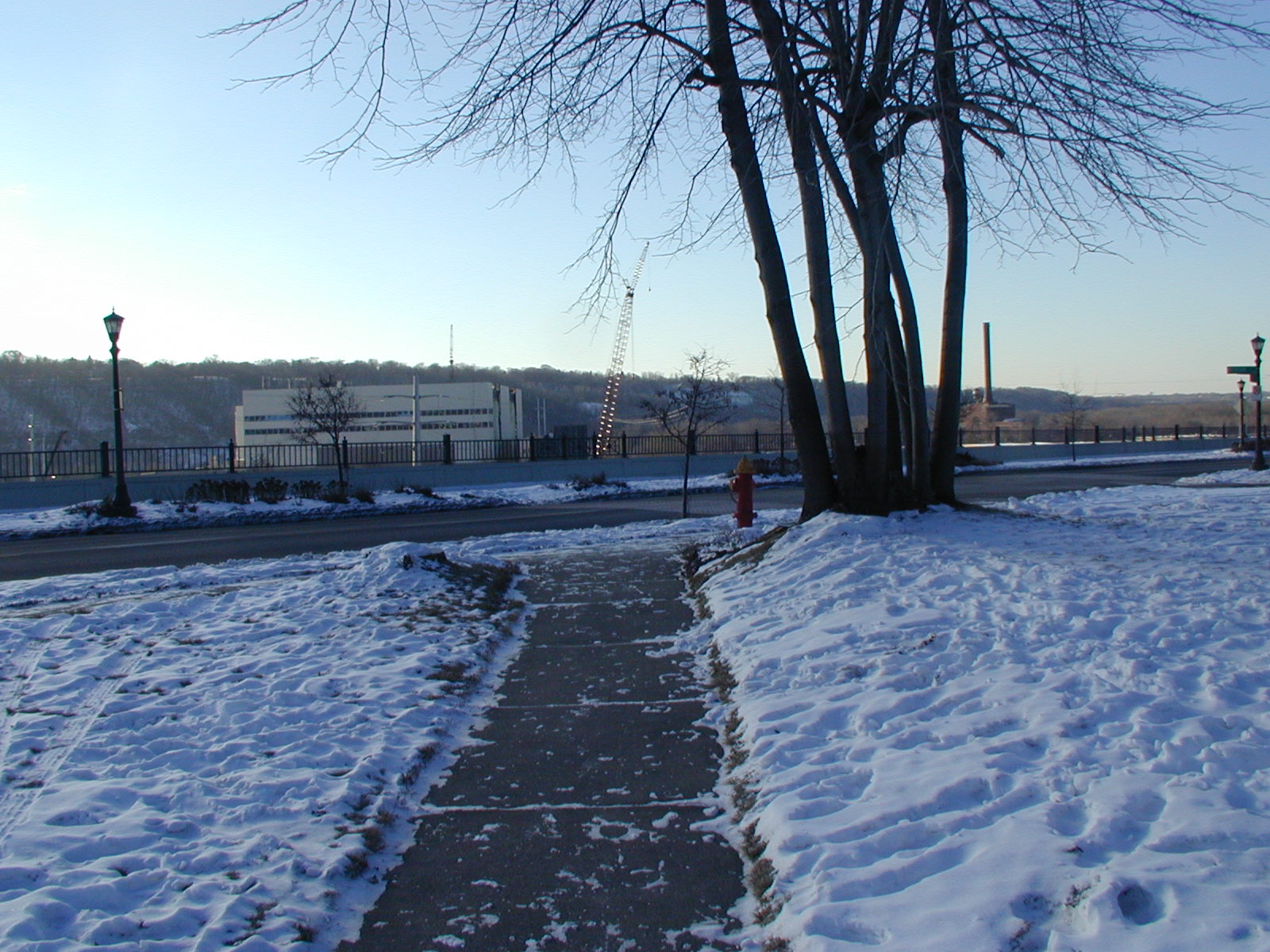
| 2538-0950-5.jpg | January 30, 2007 | Looking West along the North side of Michigan. |
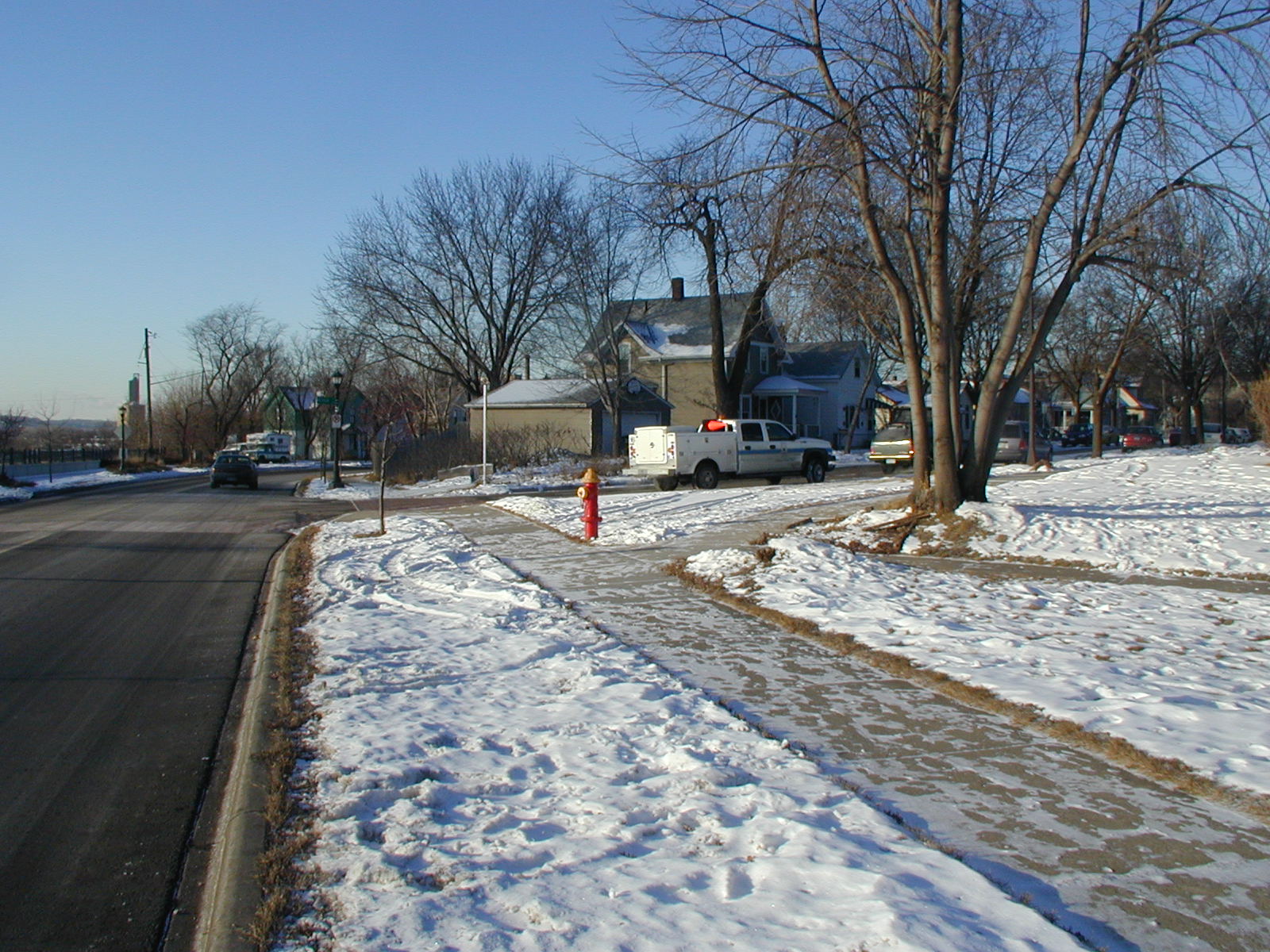
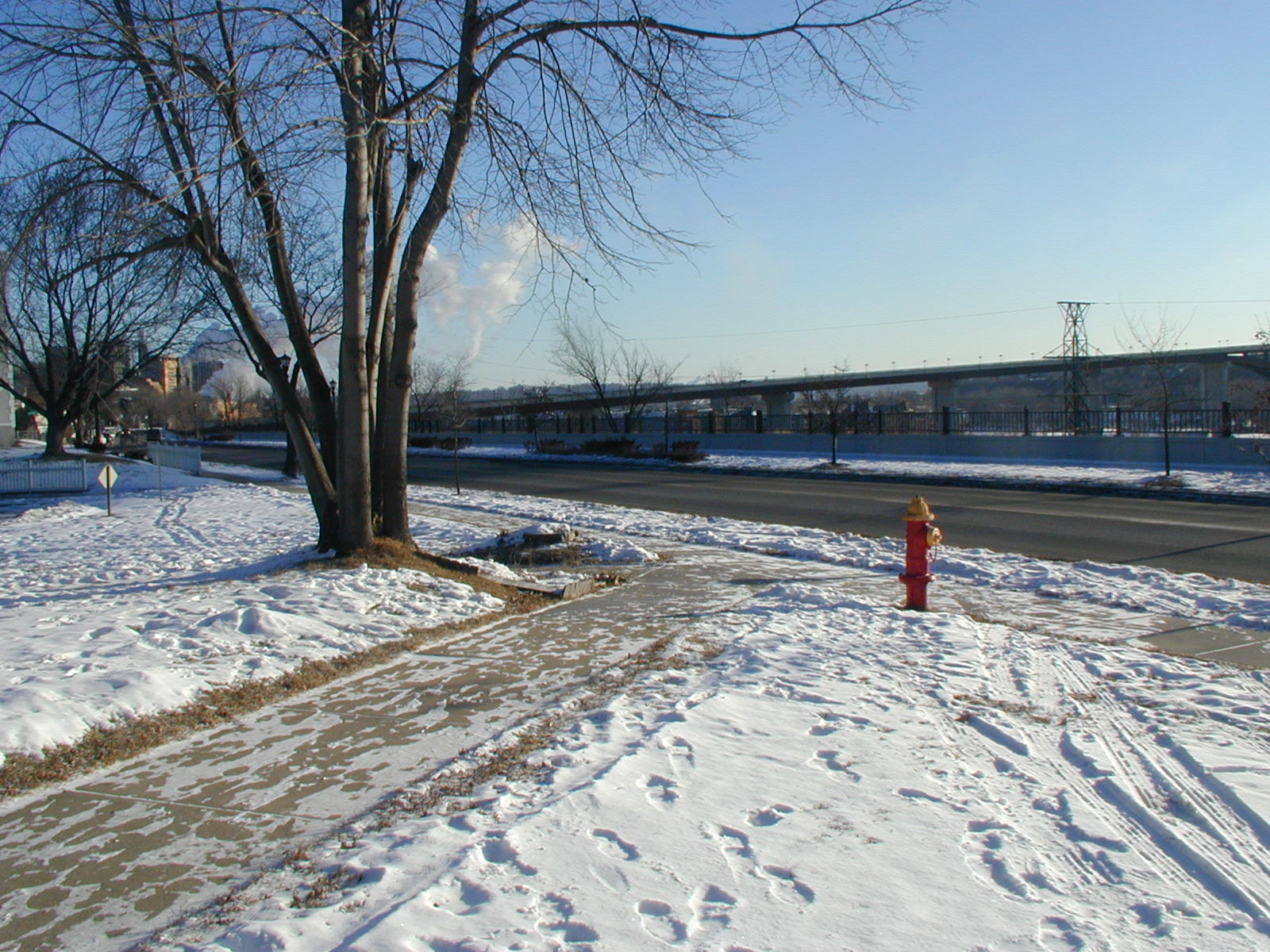
| 2538-0950-4.jpg | January 30, 2007 | Looking South along the West side of Dousman. |
| 2538-0950-3.jpg | January 30, 2007 | Looking Northeasterly. |
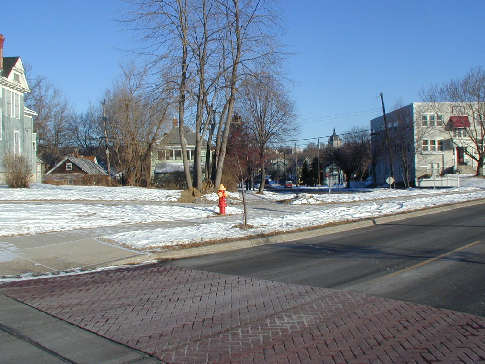
| 2538-0950-2.jpg | January 30, 2007 | Looking North along the West side of Dousman. |
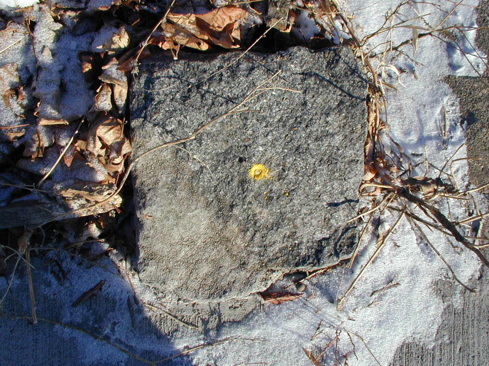
| 2538-0950-1.jpg | January 30, 2007 | Close-up of GM. |