| NAD83 COORDINATES (1986 adj.): |
|---|
| X= 553385.862 Y= 163092.107 Z= 227.31 TOT 11/28/1998 UAJ |
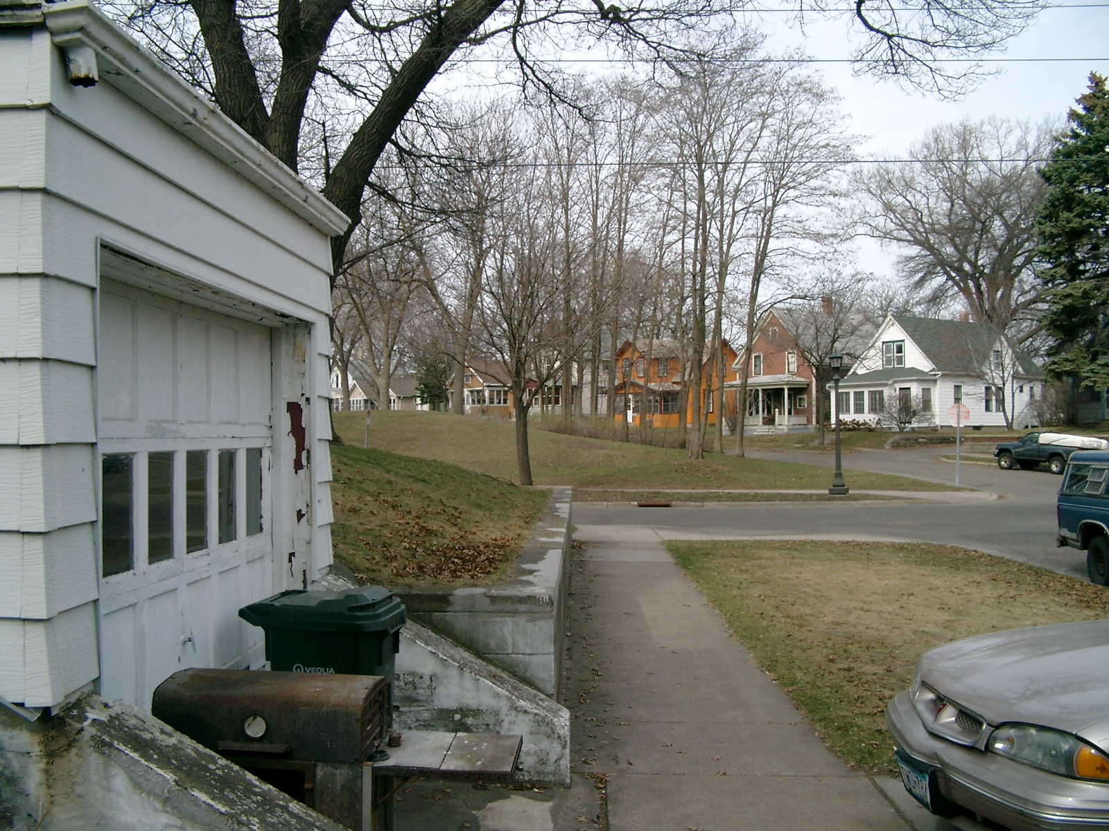
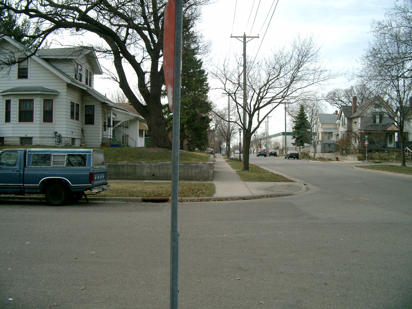
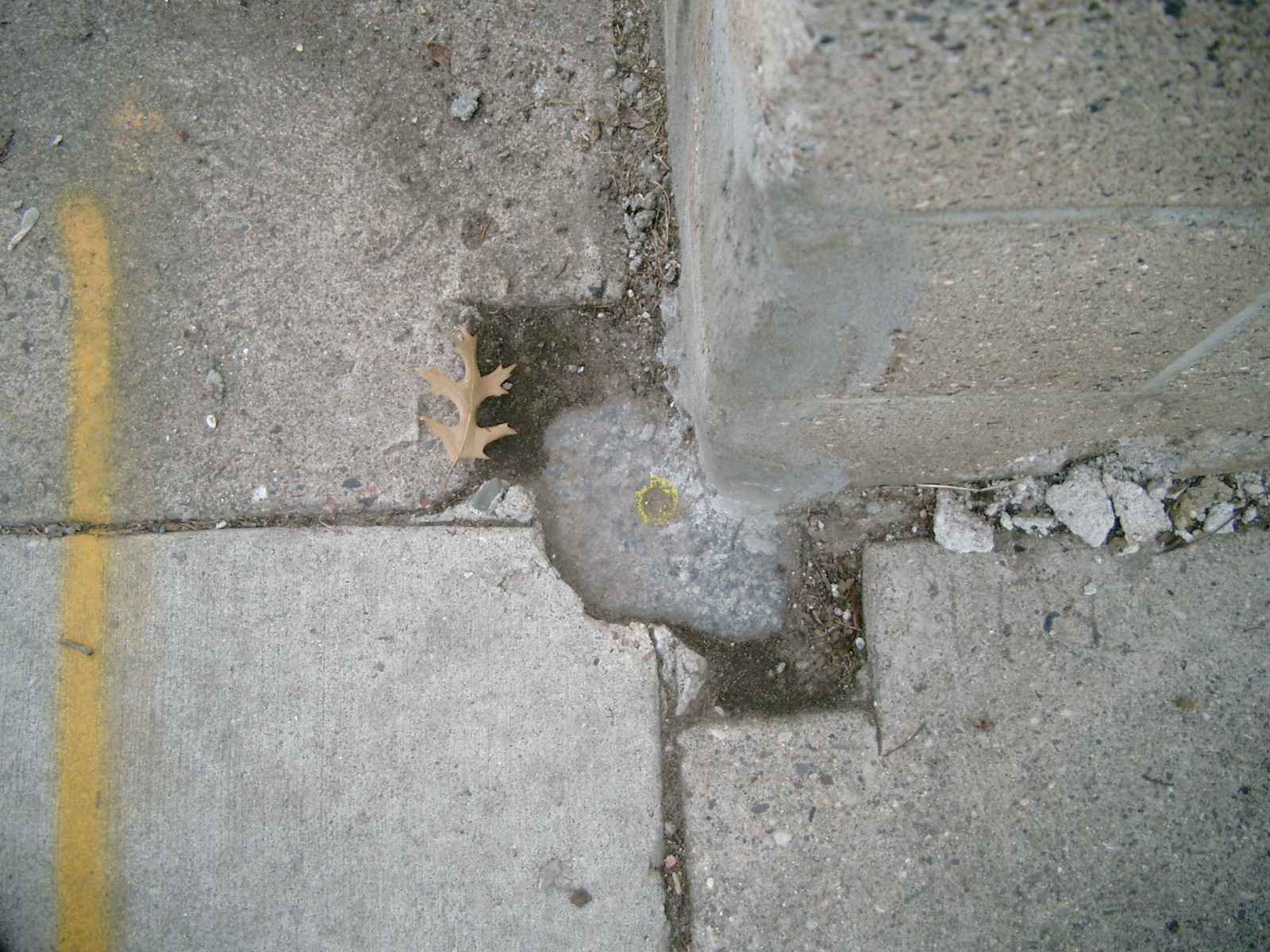
| 3/31/2010 | Found a GM below the sidewalk, under a retaining wall. Photos taken. |
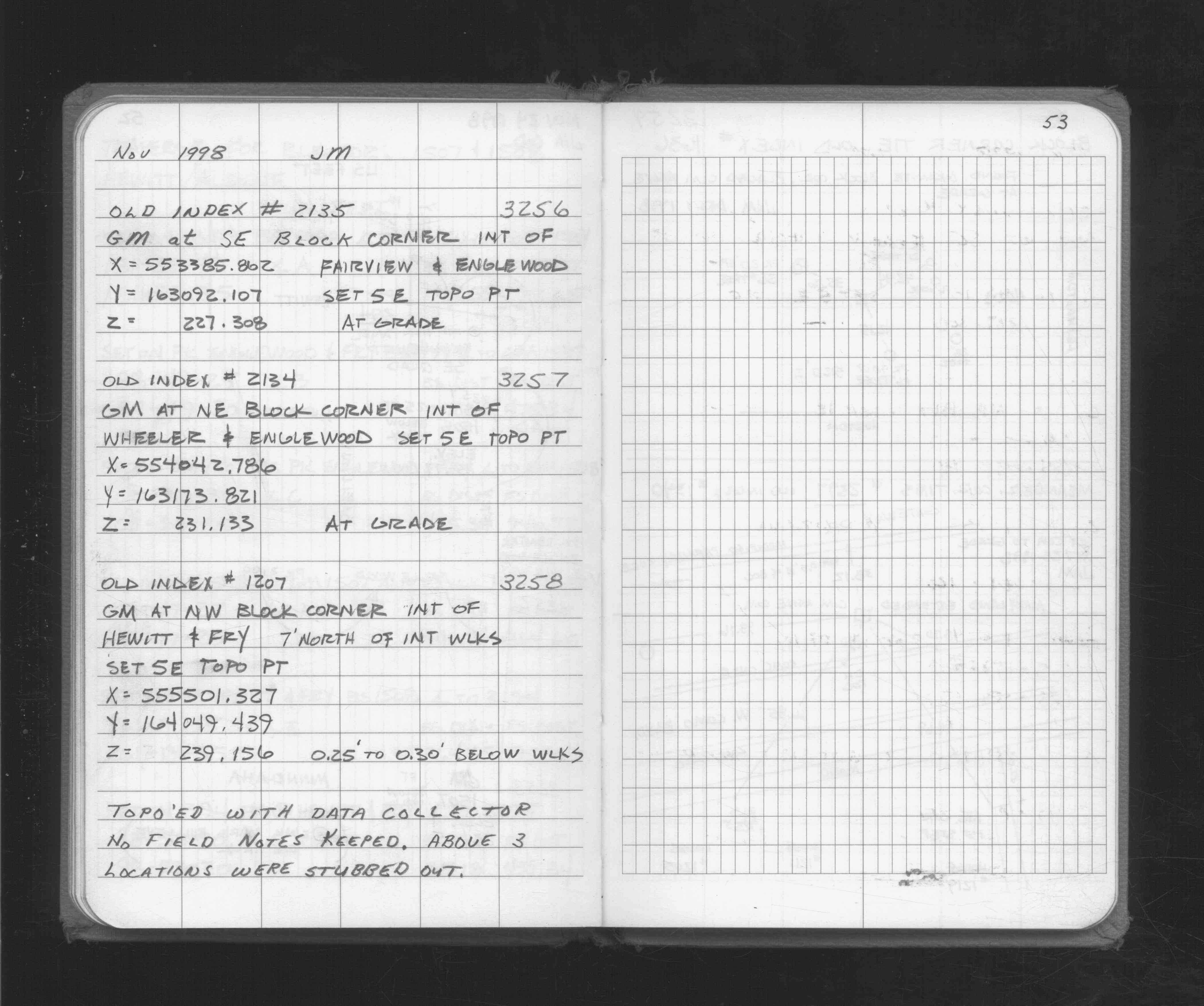
| 11/24/1998 | Located GM by topo. See FB 1716 p.53 |
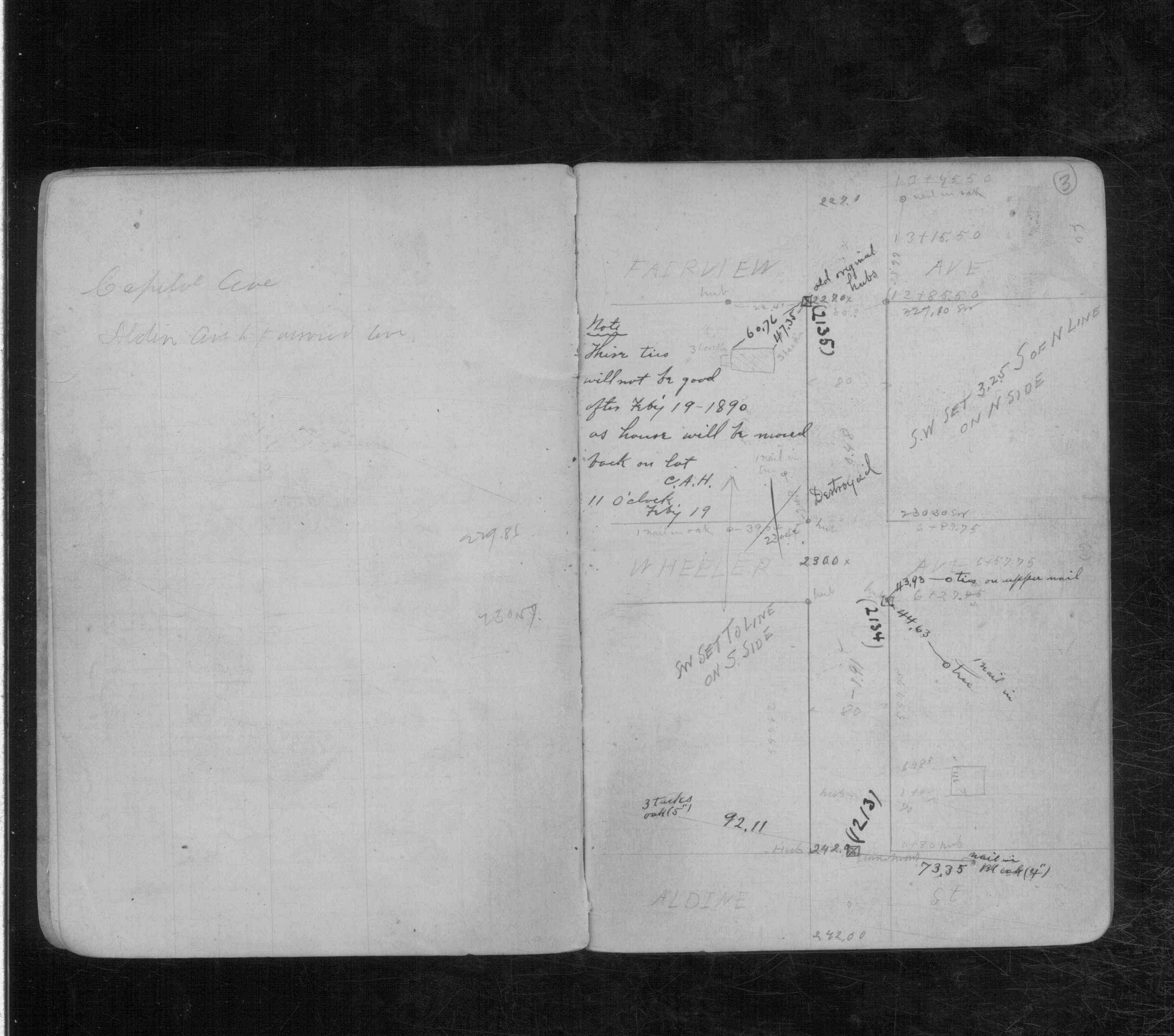
| 2/1/1890 | (Unknown date Feb __, 1890 ) Monument set by Chas A Hunt after grading. See CS 845 p.3 |
| 1/1/1800 | (Unknown date ___ __, 18?? ) Elev 277.770 ft on GM. See Old Benches Book, Entry 1734 |
Above is NOT an all inclusive history of this point. Please review all the links below.
| PLS NOTES | Field | Cross Section | Sewer | J.B. Irvine | Monument | River Survey |
|---|---|---|---|---|---|---|
| FB 1716p.53 | CS 0845p.03 |
| FILE | PHOTO DATE | COMMENTS |
|---|---|---|
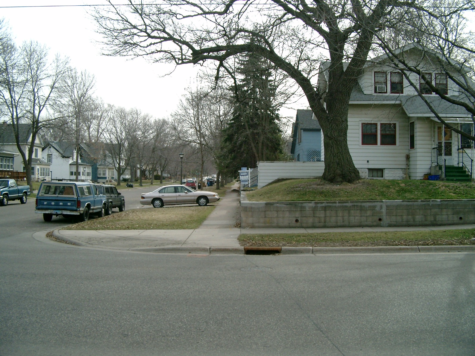
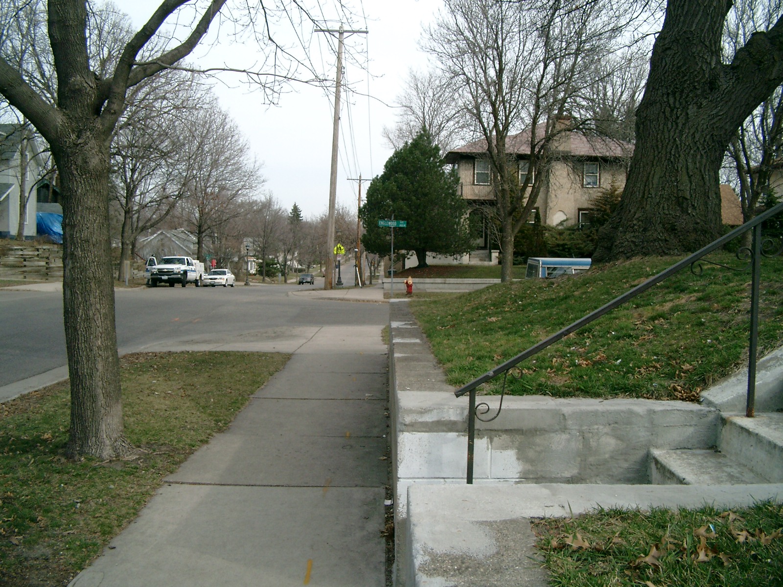
| 3256-2135-5.jpg | March 31, 2010 | Looking West along the North side of Englewood Ave. |
| 3256-2135-4.jpg | March 31, 2010 | Looking South along the East side of Fairview Ave. |
| 3256-2135-3.jpg | March 31, 2010 | Looking East along the North side of Englewood Ave. |
| 3256-2135-2.jpg | March 31, 2010 | Looking North along the East side of Fairview Ave. |
| 3256-2135-1.jpg | March 31, 2010 | Close-up of the GM below the sidewalk under the retaining wall. |