| NAD83 COORDINATES (1986 adj.): |
|---|
| X= 572566.732 Y= 147024.188 Z= 000.00 LSQ 11/18/2002 FLT |
| X= 572566.745 Y= 147024.214 Z= 000.00 PRO 10/31/2002 CMP |
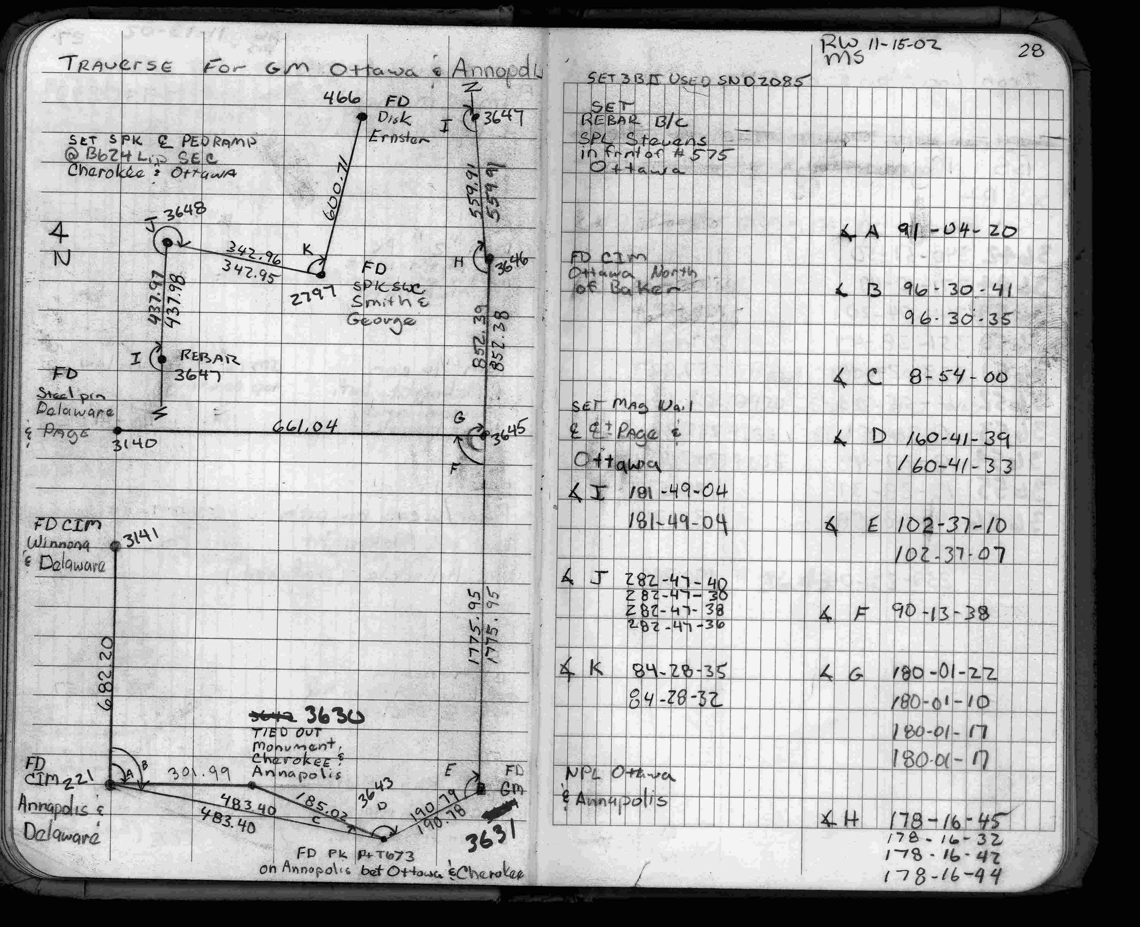
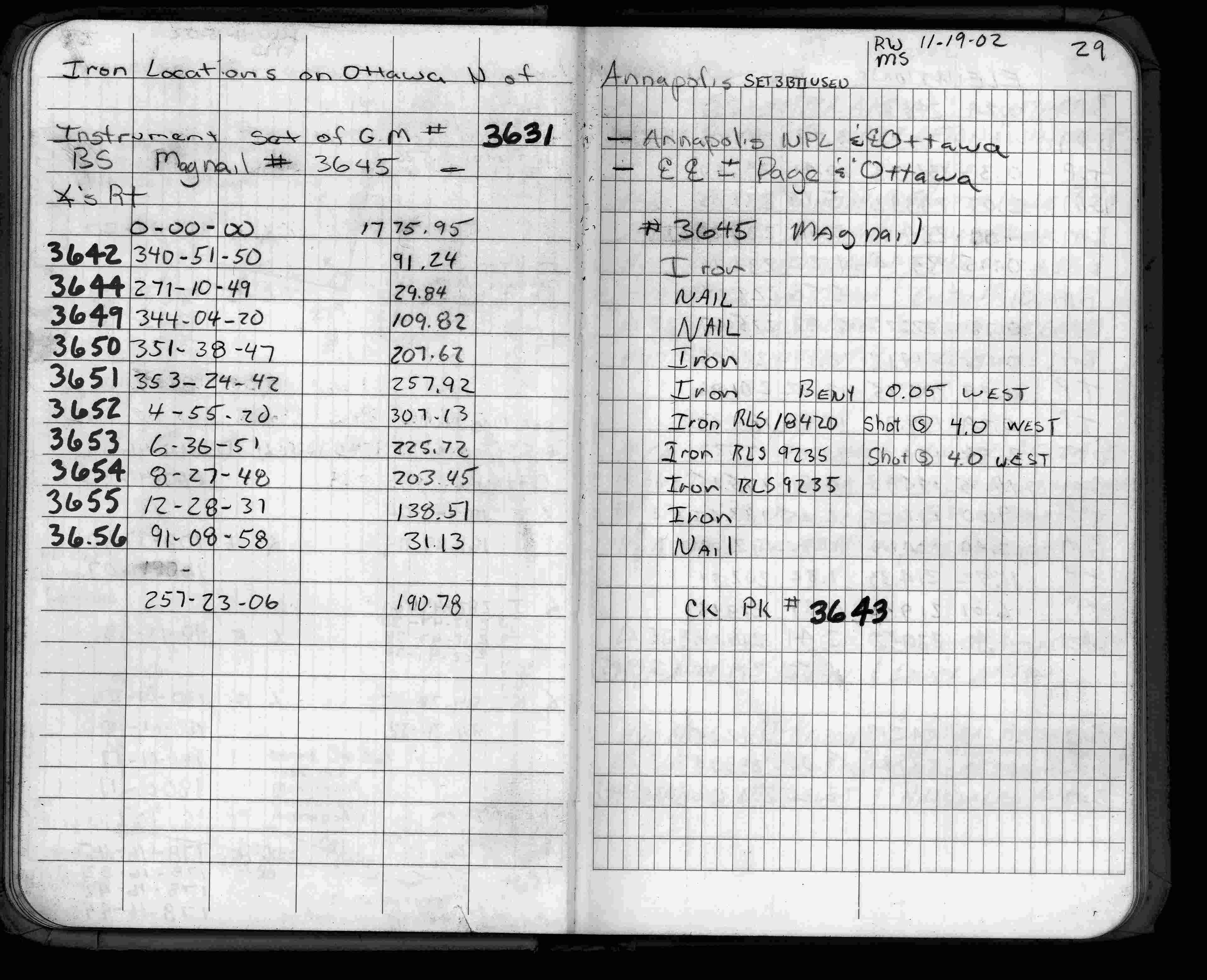
| 10/30/2002 | Placed ties on GM. See CofL 3631-1971-A |
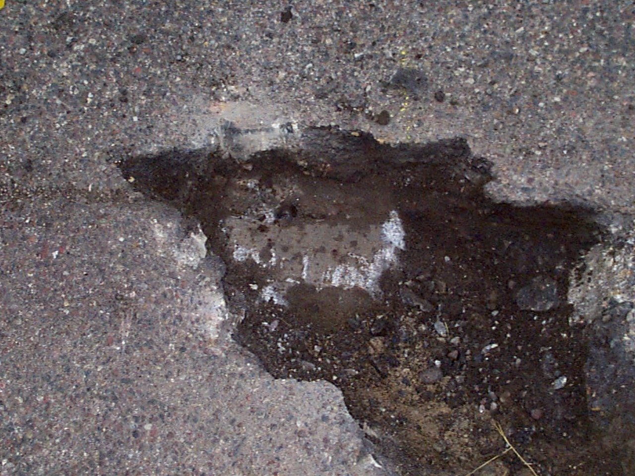
| 10/30/2002 | Fd GM 0.2 ft below street surface. Placed magnet in GM. Left GM as found. Photos taken. |
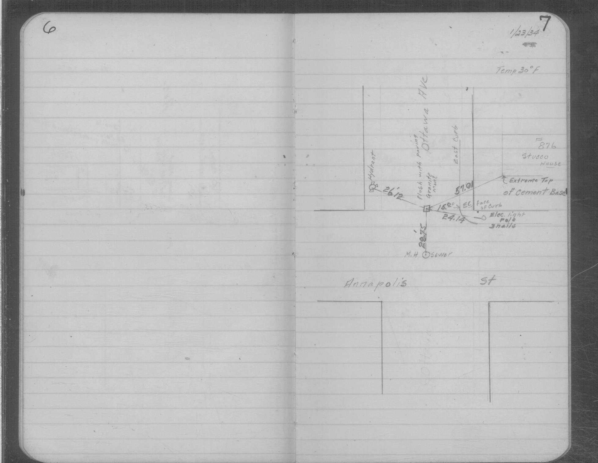
| 1/23/1934 | Placed ties on GM flush with pavement. See MSX 1 p.6-7 |
| 10/28/1890 | Monument set by J H Armstrong |
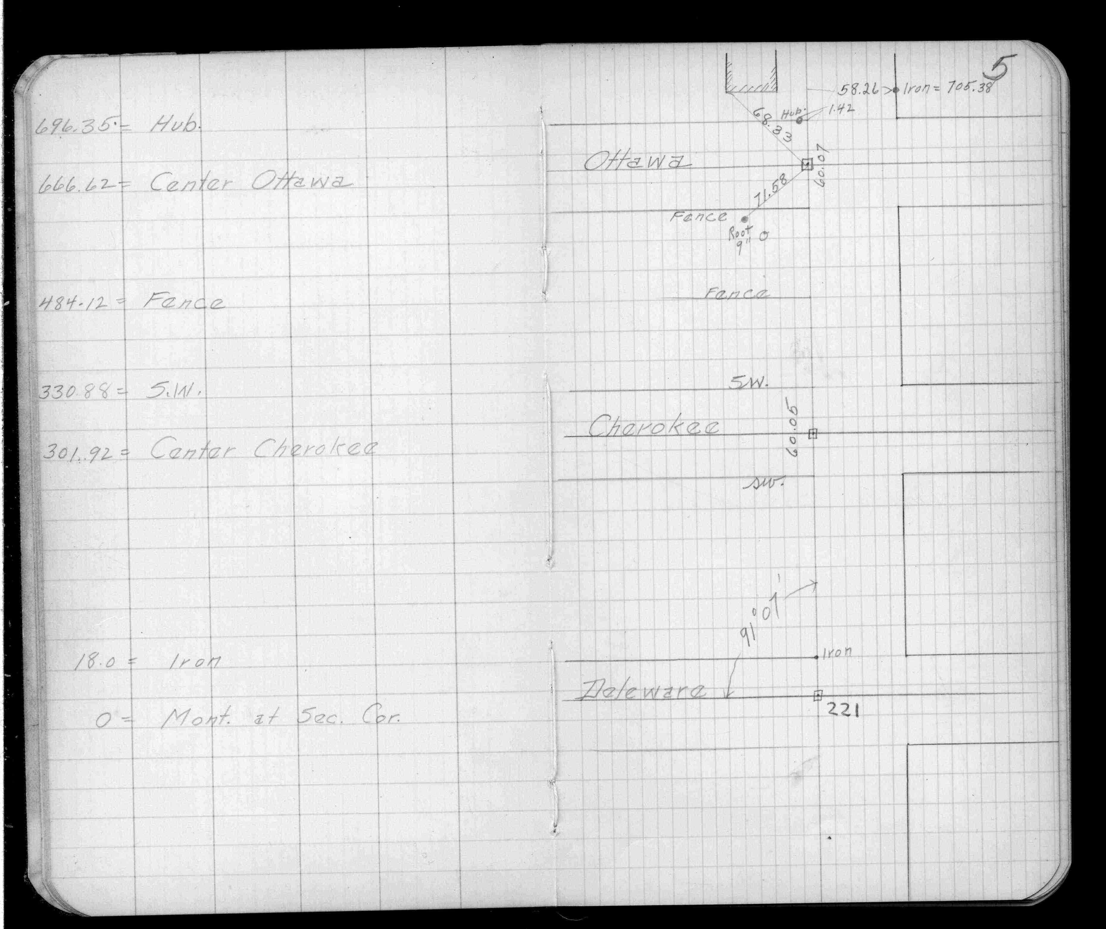
| 5/1/1890 | (Unknown date May __, 1890 ) Placed ties. See FB 320 p.5 |
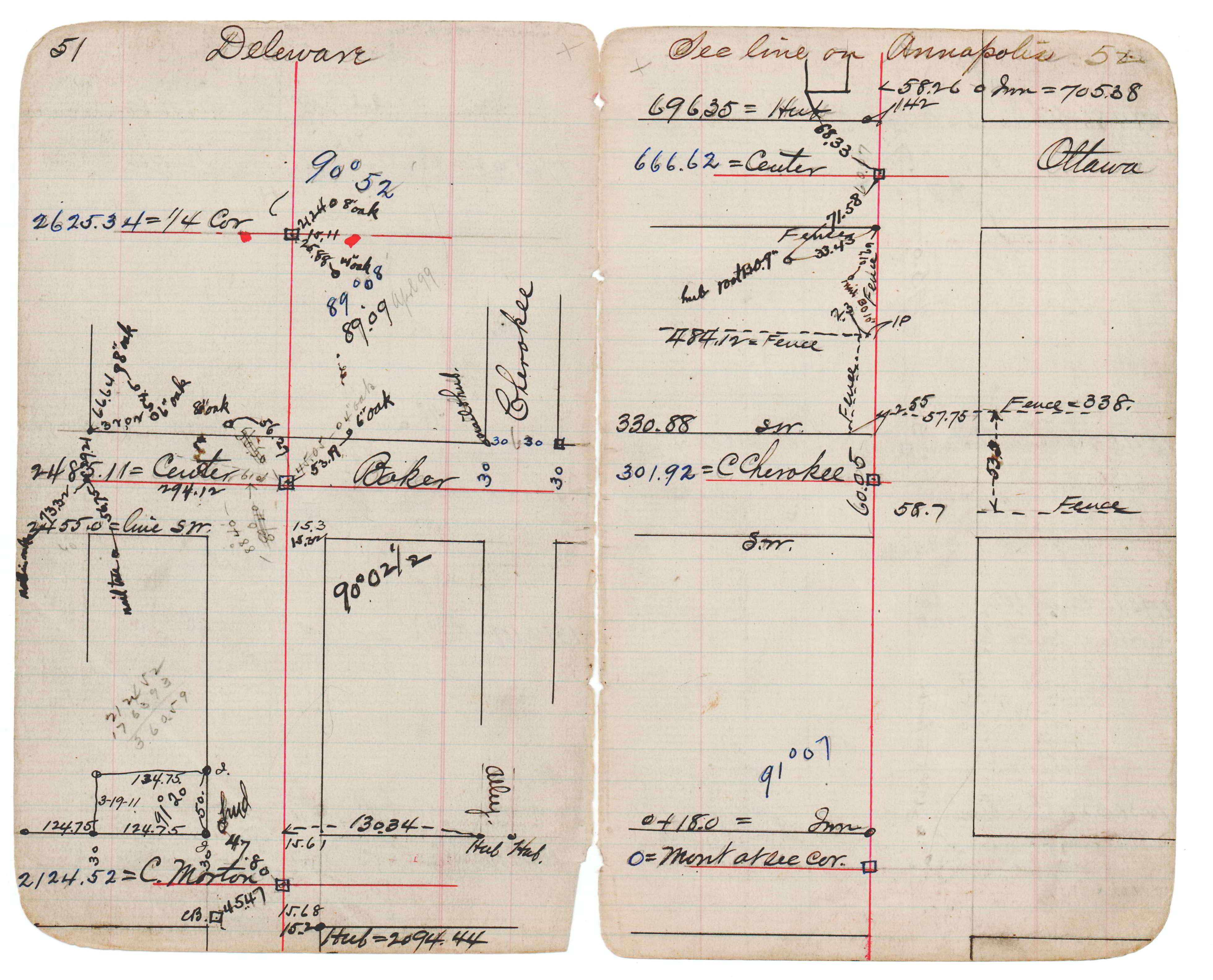
| 1/1/1890 | (Unknown date abt __, 189? ) Monument at Sta 6+66.62 on Annapolis at Ottawa. See JBI 17 p.51-52 |
Above is NOT an all inclusive history of this point. Please review all the links below.
| PLS NOTES | Field | Cross Section | Sewer | J.B. Irvine | Monument | River Survey |
|---|---|---|---|---|---|---|
| FB 0320p.05 | JBI 17 p.51-52 | MSX 0001 p.006-007 | ||||
| FB 1735p. 28 ,29 |
| FILE | SURVEYOR | LIC. NO. | DATE SIGNED | DATE TIED |
|---|---|---|---|---|
| 3631-1971-A.tif | Jeffery L. Grosso | 13144 | October 31, 2002 | October 30, 2002 |
| FILE | PHOTO DATE | COMMENTS |
|---|---|---|
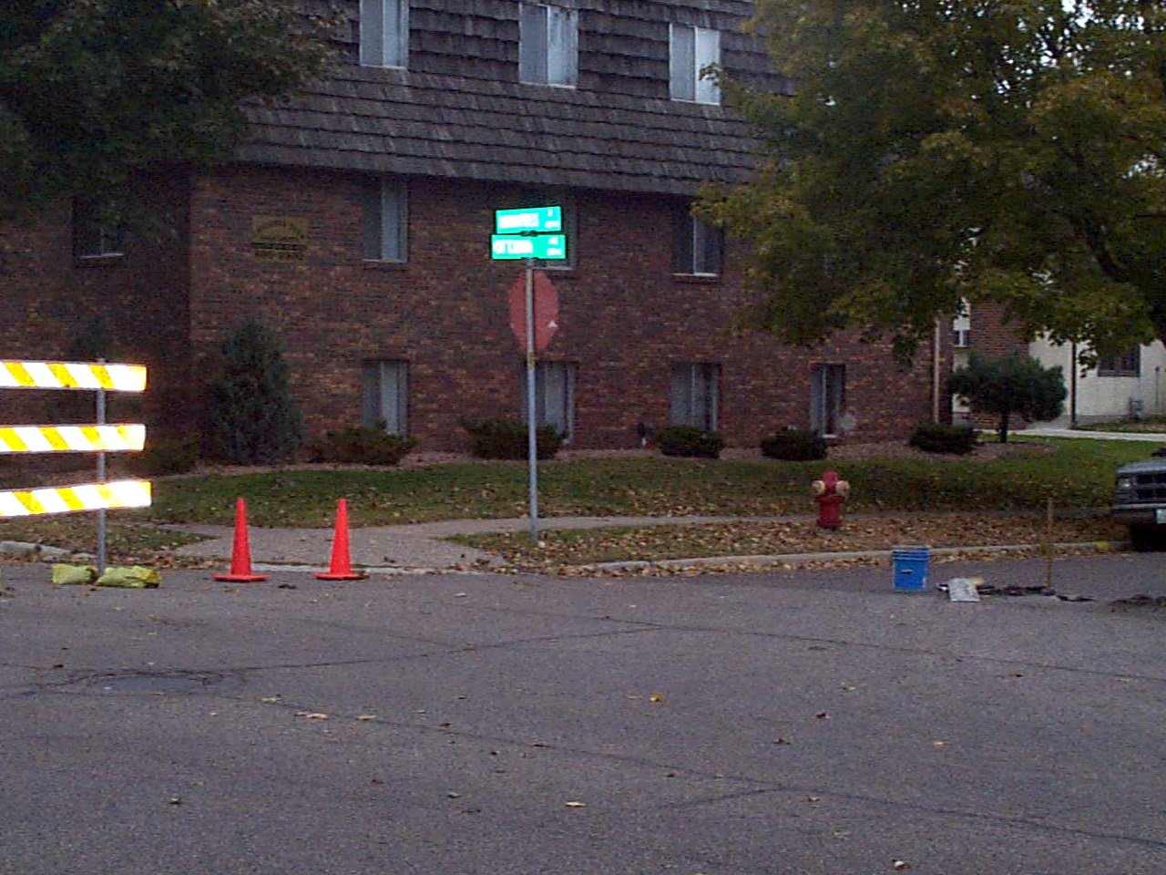
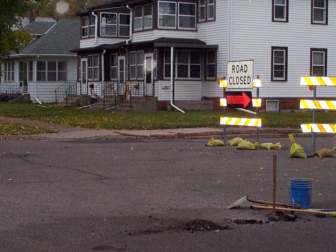
| 3631-1971-3.jpg | October 30, 2002 | Looking NW towards tie point. See Certificate of Location 3631-1971-A |
| 3631-1971-3.jpg | October 30, 2002 | Close up of GM with inverted spike over hole. Keel at previous excavation. |
| 3631-1971-2.jpg | October 30, 2002 | Looking SW towards tie point. See Certificate of Location 3631-1971-A |
| 3631-1971-1.jpg | October 30, 2002 | Close up of GM 0.2 ft below street surface. |