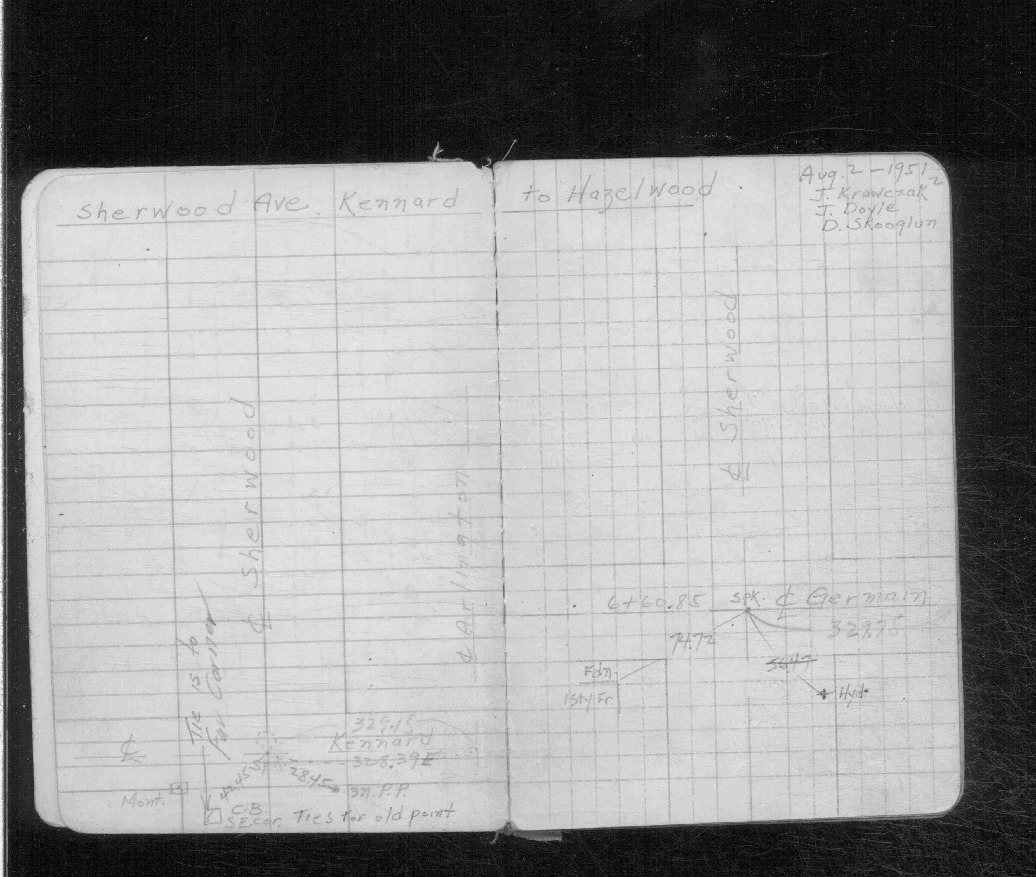
| NAD83 COORDINATES (1986 adj.): |
|---|
| X= 591371.20 Y= 170439.22 Z= 922.9 04/07/2008 RTK-VRS |
| 4/7/2008 | Position on Concrete monument set by RTK-VRS GPS Elev 228.8 ft. See CofL 3852-__kp-A |
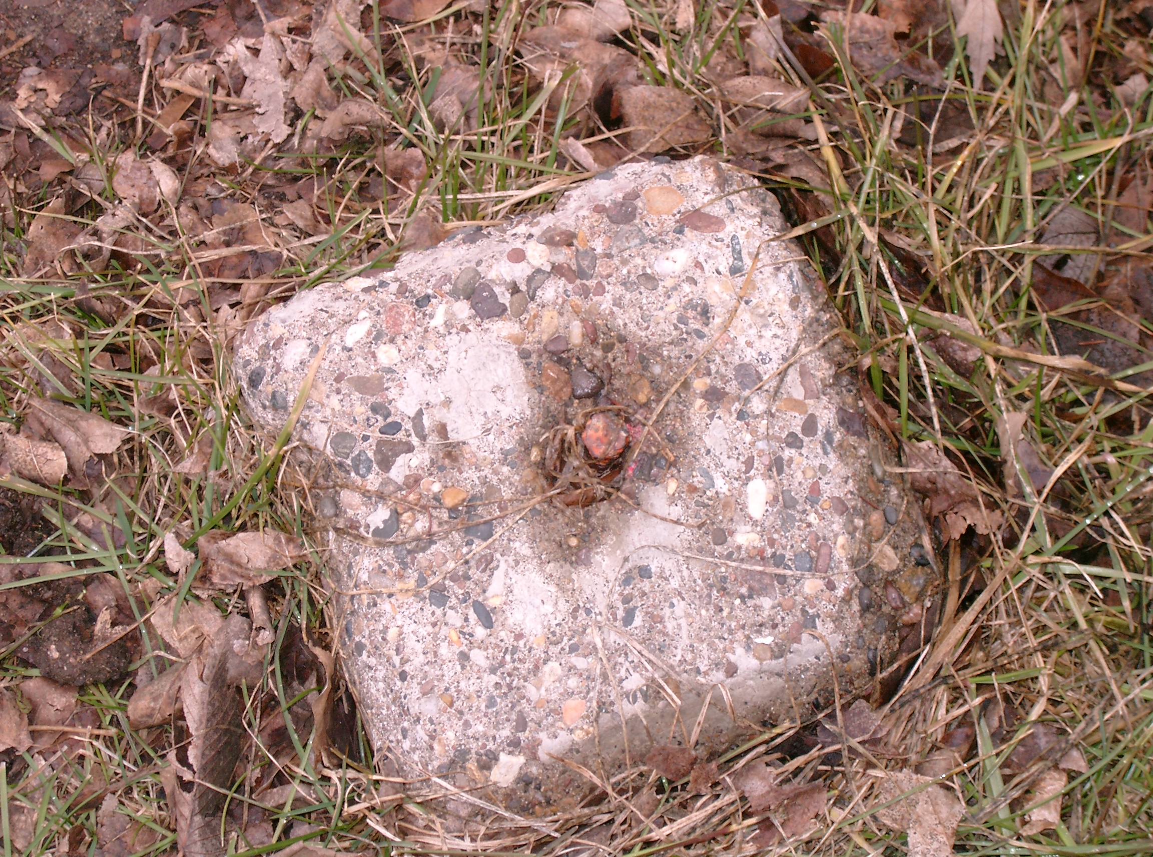
| 4/7/2008 | Found concrete monument 0.45 ft above grade. EDM ties placed using Sokkia Set 5. Photos taken. |
Above is NOT an all inclusive history of this point. Please review all the links below.
| PLS NOTES | Field | Cross Section | Sewer | J.B. Irvine | Monument | River Survey |
|---|---|---|---|---|---|---|
| CS 2913p.02 |
| FILE | SURVEYOR | LIC. NO. | DATE SIGNED | DATE TIED |
|---|---|---|---|---|
| 3852-__kp-A.pdf | Samuel D. Gibson | 44880 | December 24, 2012 | April 7, 2008 |
| FILE | PHOTO DATE | COMMENTS |
|---|---|---|
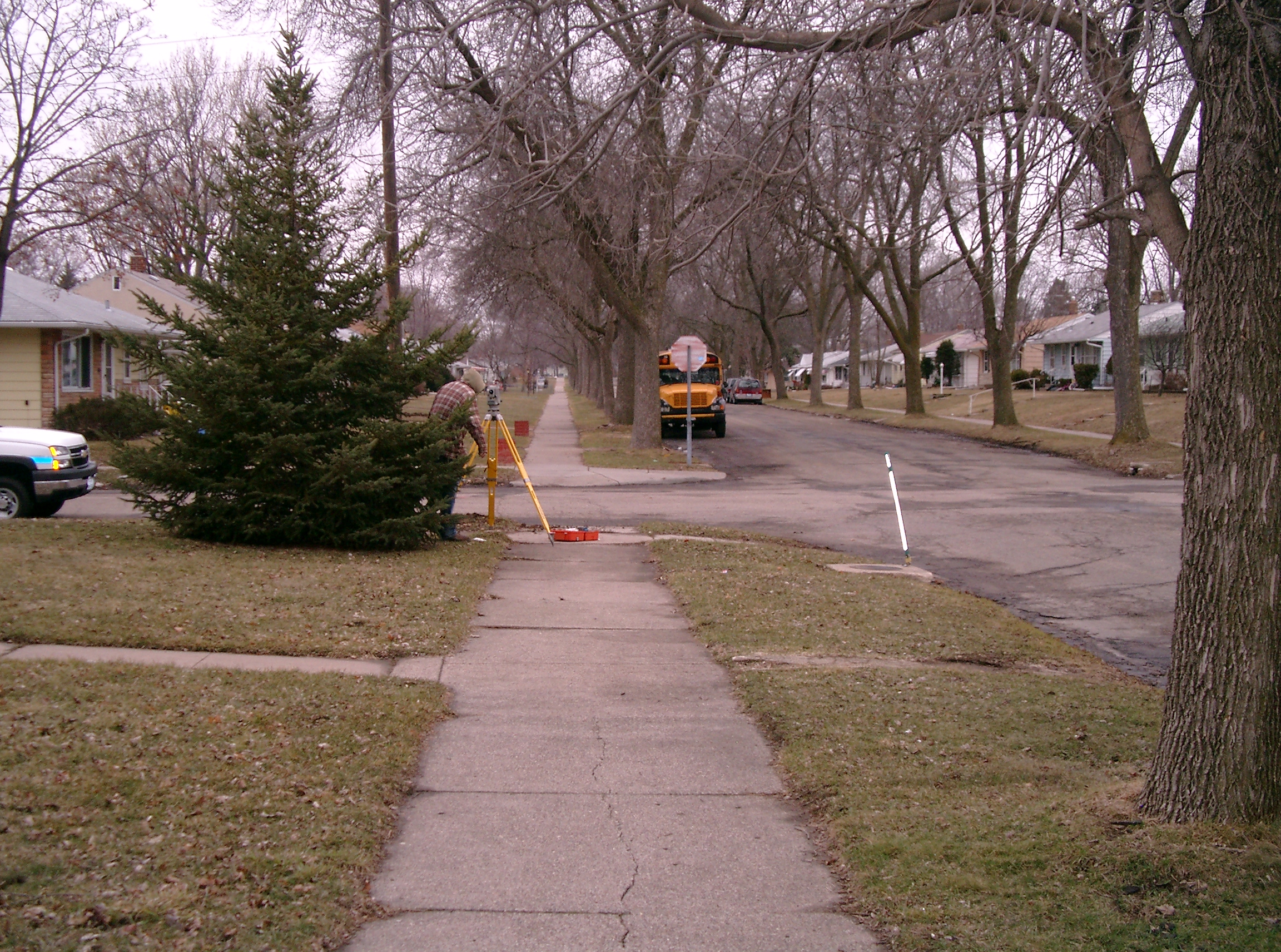
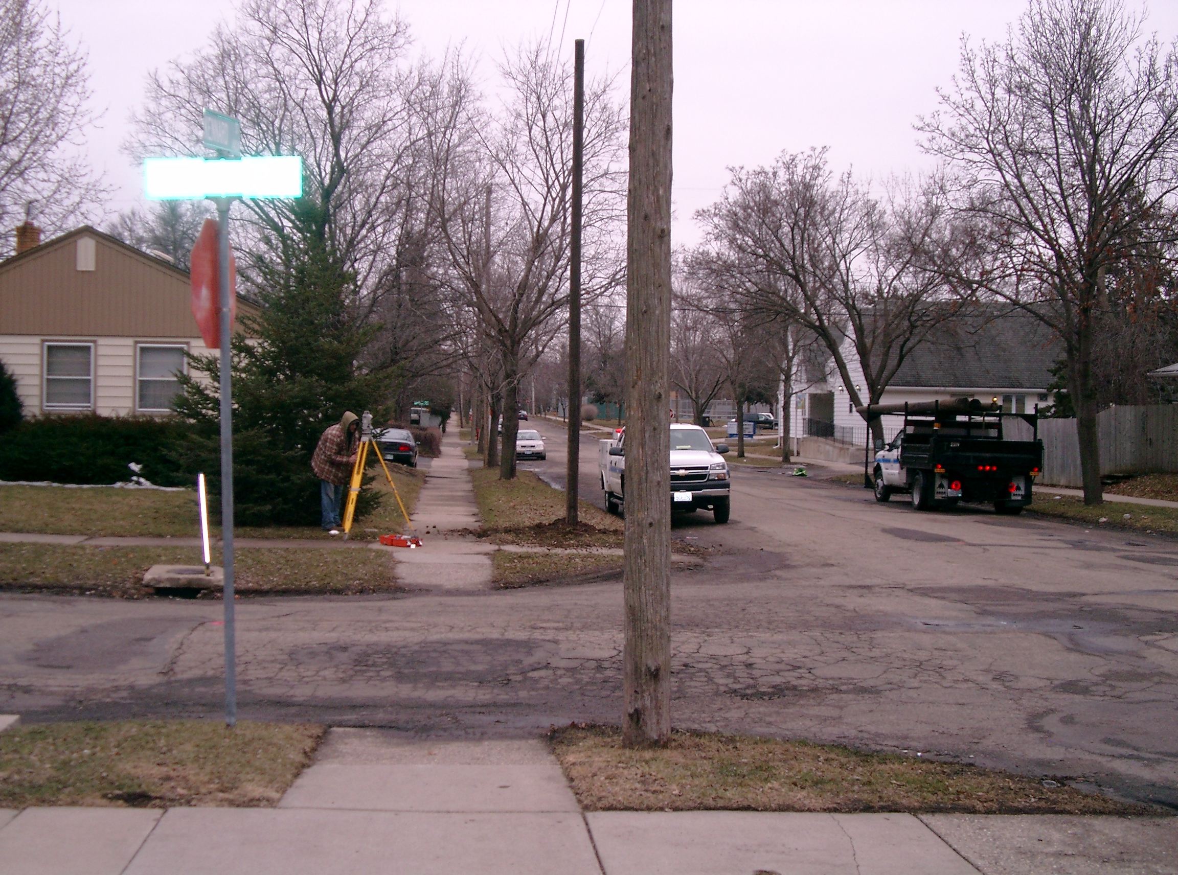
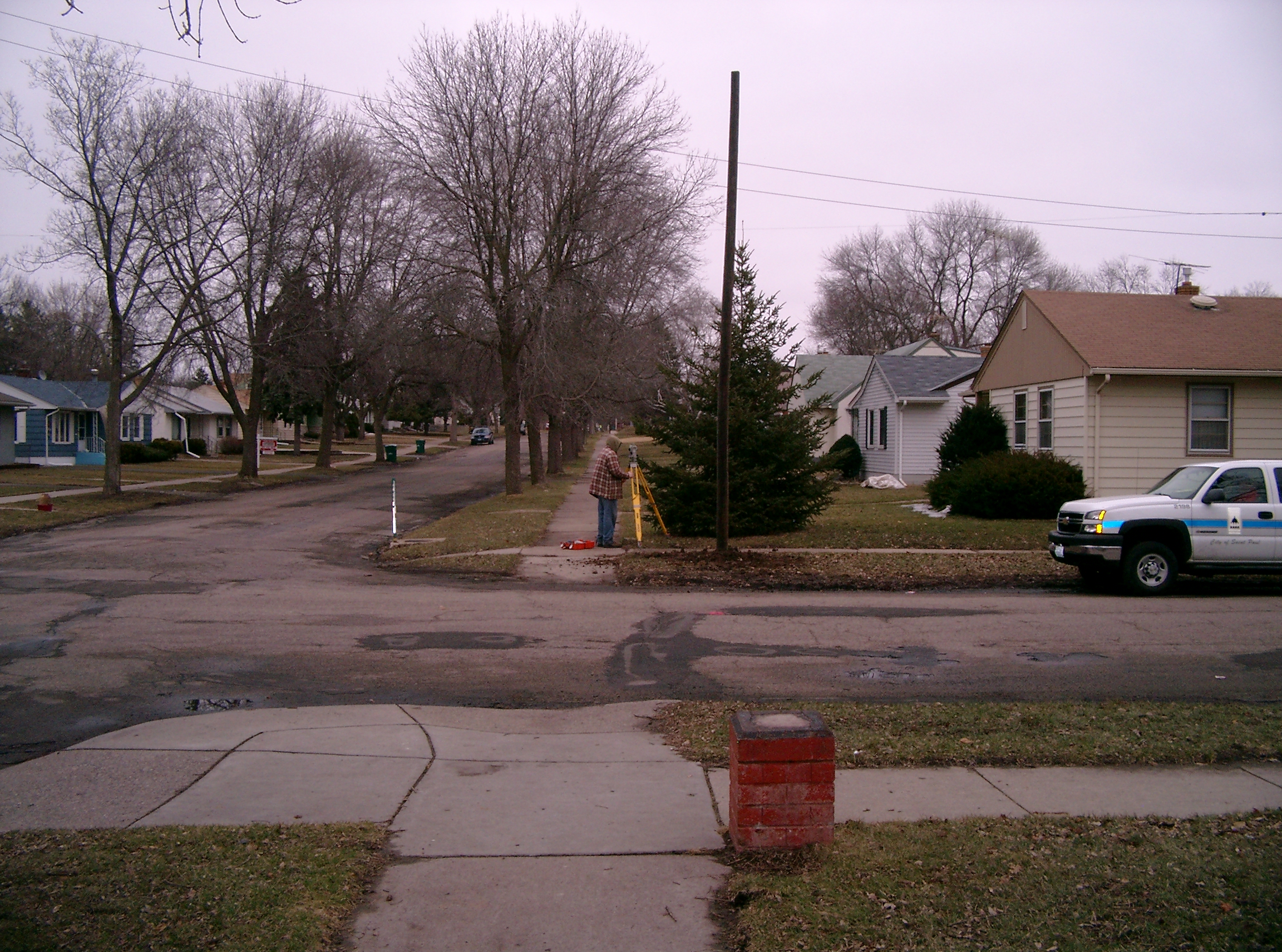
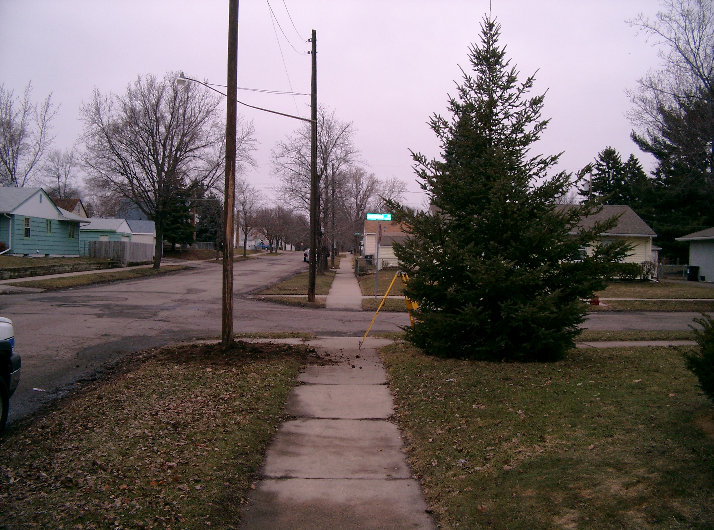
| 3852-__kp-5.jpg | April 7, 2008 | Looking West along the South side of Sherwood Ave. |
| 3852-__kp-4.jpg | April 7, 2008 | Looking South along the East side of Kennard St. |
| 3852-__kp-3.jpg | April 7, 2008 | Looking East along the South side of Sherwood Ave. |
| 3852-__kp-2.jpg | April 7, 2008 | Looking North along the East side of Kennard St. |
| 3852-__kp-1.jpg | April 7, 2008 | Close-up of the Concrete monument. |