| NAD83 COORDINATES (1996 adj.): |
|---|
| X= 557108.3544 Y= 141701.7567 Z= 12/1/2014 MnDot |
| 12/1/2014 | (Unknown date Dec __, 2014) GM found by MnDOT. Coordinate established with total station using static GPS derived control (1996 adj.). |
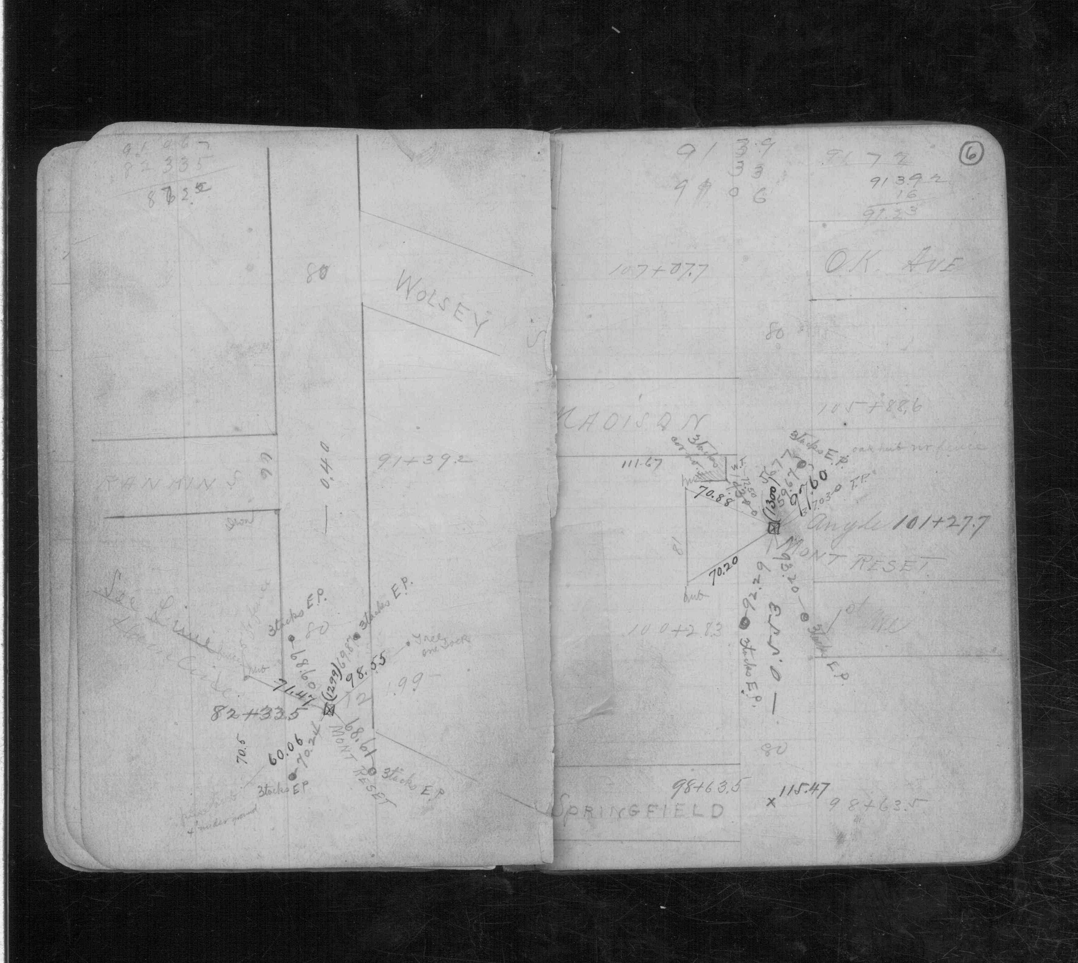
| 3/1/1892 | (Unknown date Mar __, 1892 ) Monument reset by J B Irvine. See CS 971 p.6 |
| 6/1/1886 | (Unknown date Jun __, 1886 ) Monument set by J H Armstrong. see FB 253 |
| 1/1/1800 | (Unknown date ___ __, 18?? ) Elev 115.431 ft on GM. See Old Benches Book, Entry 1322 |
Above is NOT an all inclusive history of this point. Please review all the links below.
| PLS NOTES | Field | Cross Section | Sewer | J.B. Irvine | Monument | River Survey |
|---|---|---|---|---|---|---|
| CS 0971p.06 |