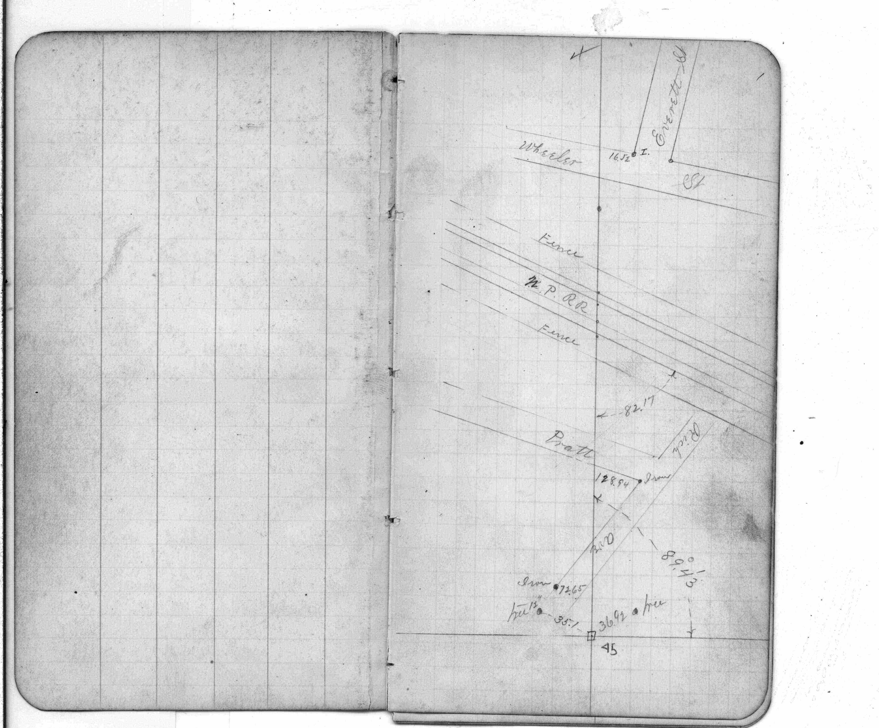
STATION: 5485 PC on CL Como Ave (66' ROW) east of Raymond Ave
OLD INDEX NUMBER(s): 1776
MAP: B02 SE 1/4 Sec 20 T29N R23W
GPS STATION:
DATE COMMENTS:
9/6/1889
Monument set by G Saulez after grading
Above is NOT an all inclusive history of this point. Please review all the links below.
BOOKS
PLS NOTES
Field
Cross Section
Sewer
J.B. Irvine
Monument
River Survey
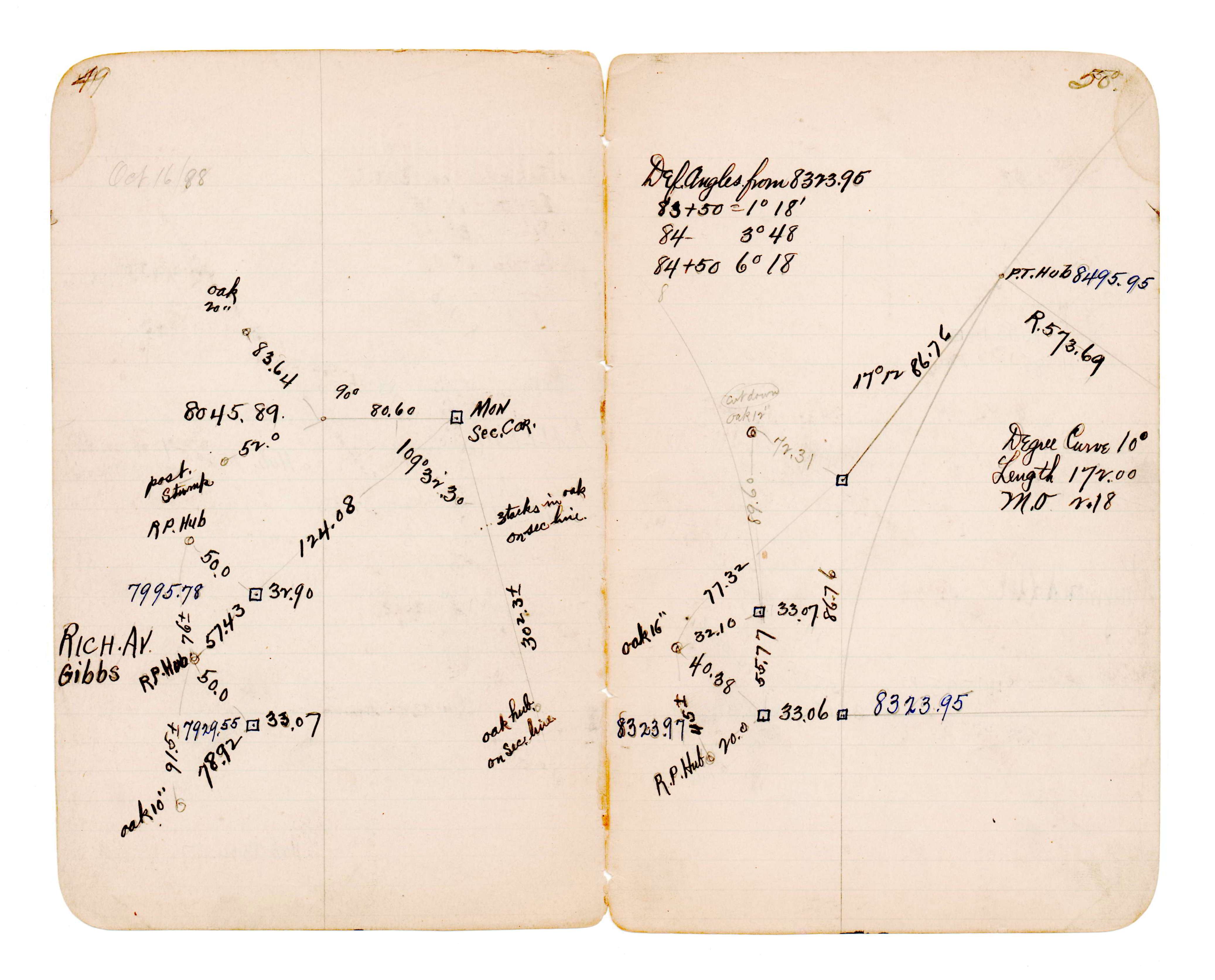
FB 0216CPYp.01
JBI 42 p.49-50
Revised: September 06, 1889 Updated HTML File: March 02, 2015