| 11/8/2012 | Excavated 2 ft x 2 ft x 2 ft hole and probed an additional 1.0 ft, no monument found. Location in boulevard area. |
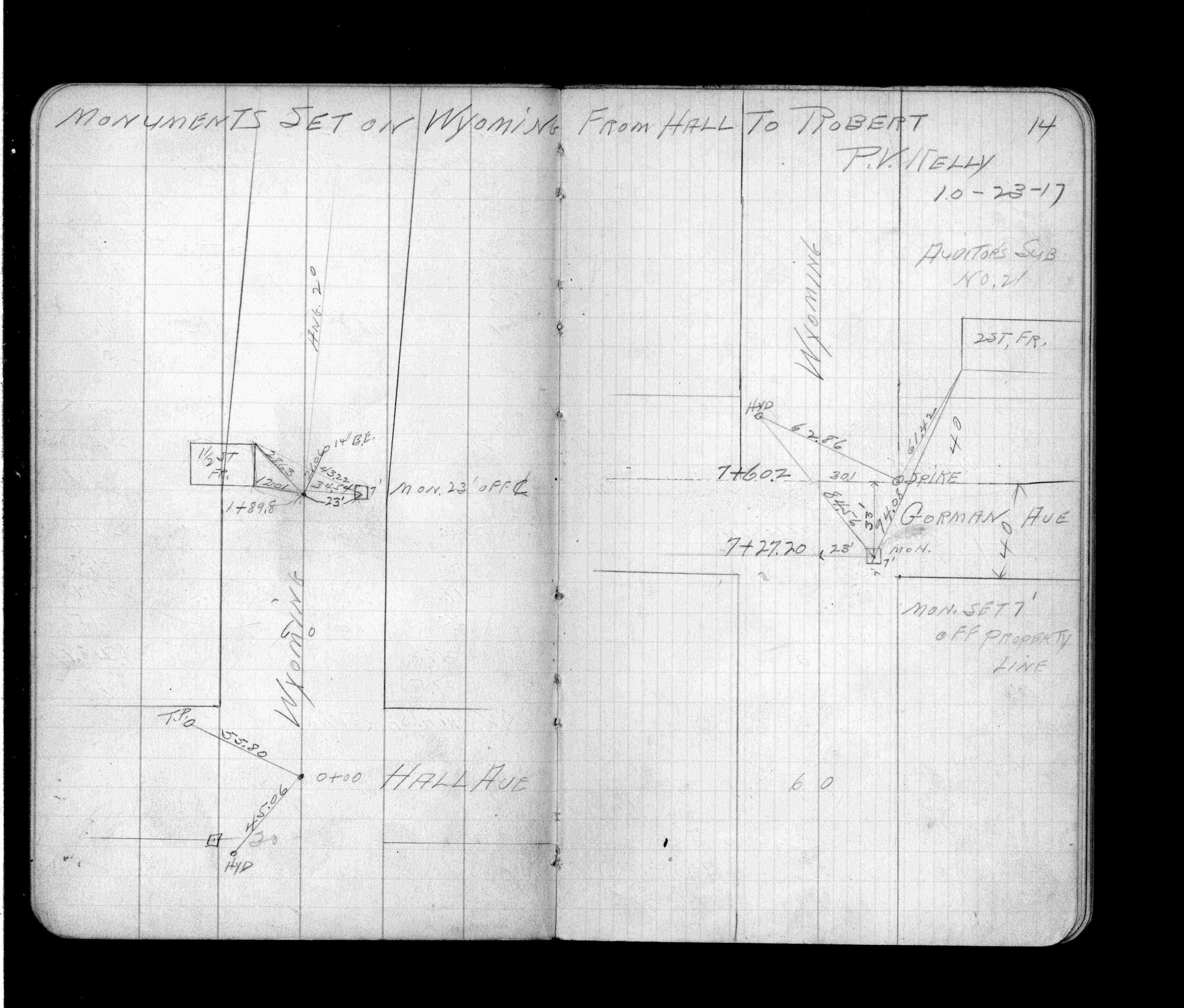
| 10/1/1917 | (Unknown date Oct __, 1917 ) Monument ties. See FB 918 p.14 |
Above is NOT an all inclusive history of this point. Please review all the links below.
| PLS NOTES | Field | Cross Section | Sewer | J.B. Irvine | Monument | River Survey |
|---|---|---|---|---|---|---|
| FB 0918p.14 |