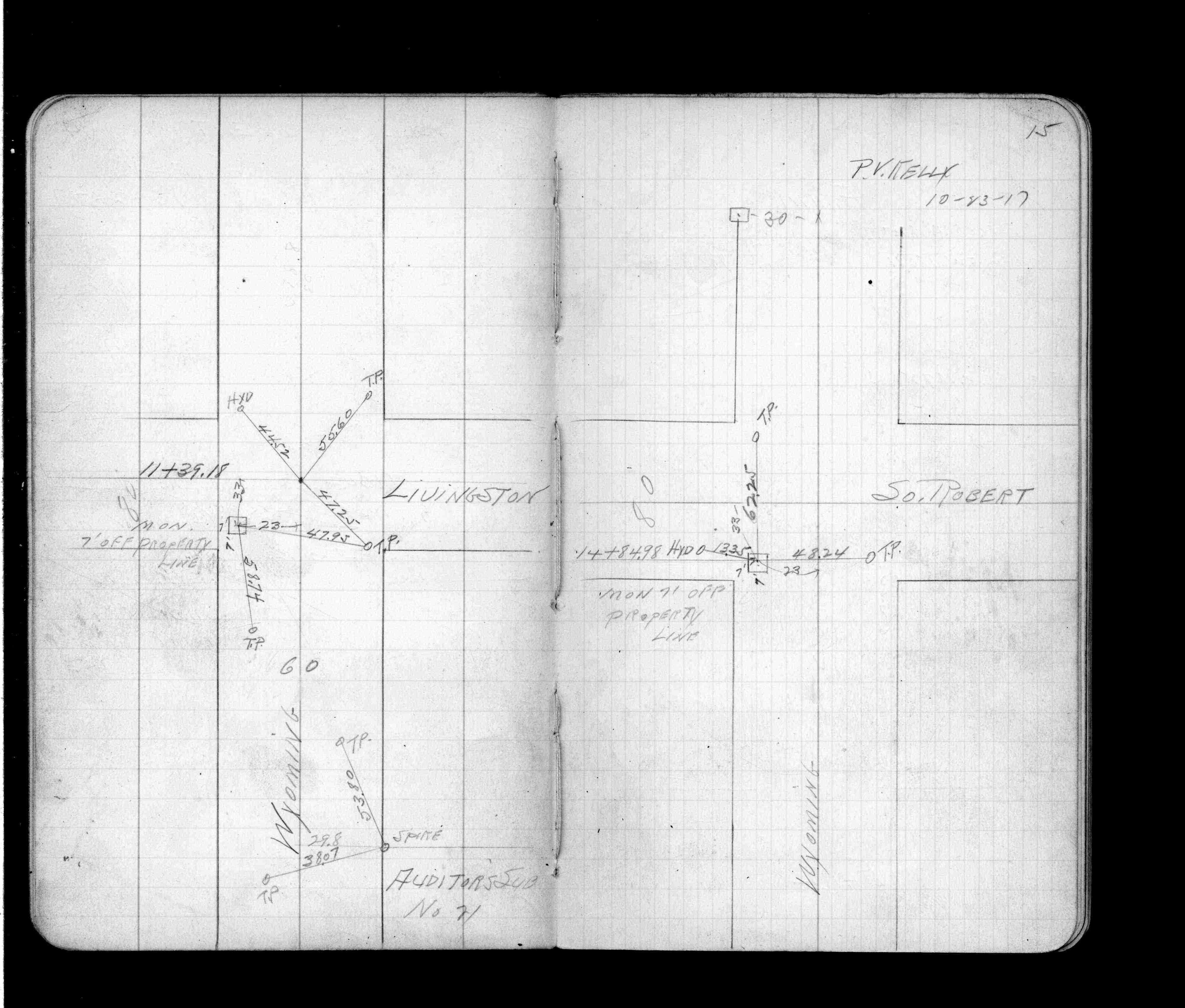
STATION: 6516 Offset Blk Cor 7 ft south and 7 ft east of NW Livingston Ave & Wyoming St
OLD INDEX NUMBER(s): __ao
MAP: N10 SW 1/4 Sec 08 T28N R22W
GPS STATION:
DATE COMMENTS:
10/1/1917
(Unknown date Oct __, 1917 ) Monument ties. See FB 918 p.15
Above is NOT an all inclusive history of this point. Please review all the links below.
BOOKS
PLS NOTES
Field
Cross Section
Sewer
J.B. Irvine
Monument
River Survey
FB 0918p.15
Revised: October 01, 1917 Updated HTML File: March 11, 2015