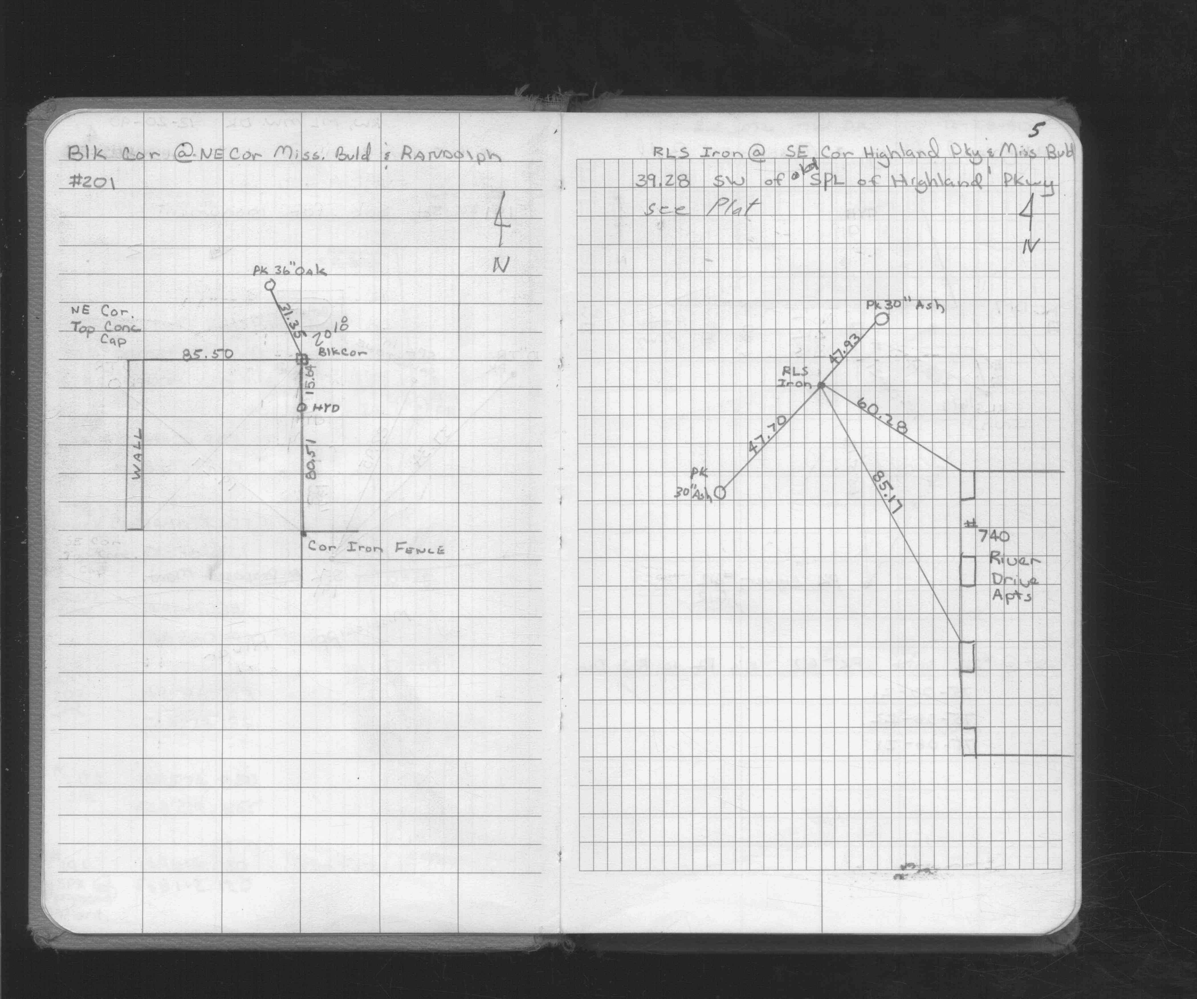
STATION: 6538 Blk Cor SE Mississippi River Blvd & Highland Pkwy
OLD INDEX NUMBER(s): __ch
MAP: A11 NW 1/4 Sec 17 T28N R23W
GPS STATION:
DATE COMMENTS:
12/1/1990
(Unknown date Dec __, 1990 ) RLS IRON. See FB 1716 p.5
Above is NOT an all inclusive history of this point. Please review all the links below.
BOOKS
PLS NOTES
Field
Cross Section
Sewer
J.B. Irvine
Monument
River Survey
FB 1716p.05
Revised: December 01, 1990 Updated HTML File: March 02, 2015