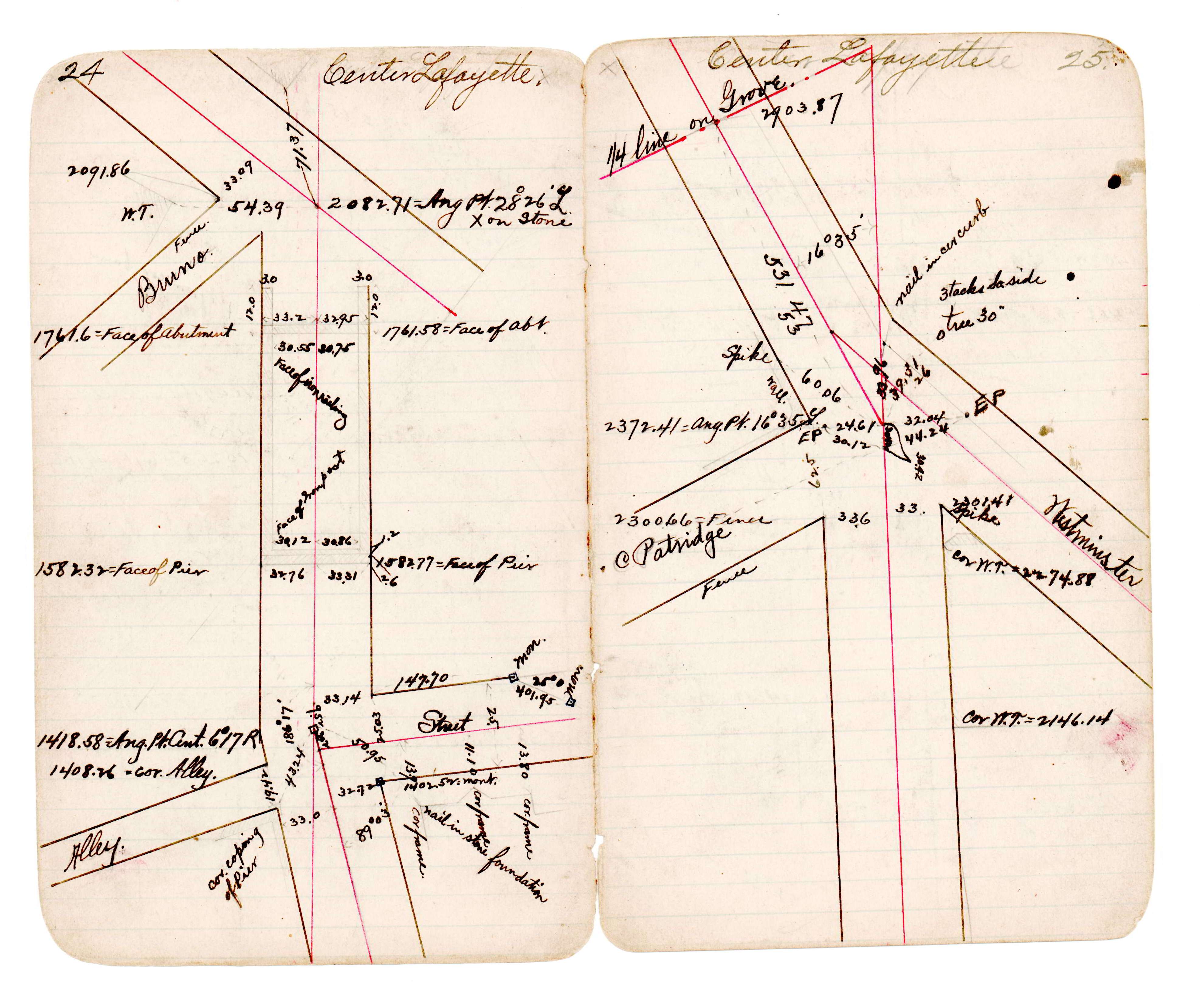
STATION: 6557 AP on CL Lafayette Rd (previous alignment) west of Otsego St
OLD INDEX NUMBER(s): __dq
MAP: N05 NW 1/4 Sec 32 T29N R22W
GPS STATION:
DATE COMMENTS:
1/1/1800
(Unknown date ___ __, ____ ) See JBI 22 p.24-25
Above is NOT an all inclusive history of this point. Please review all the links below.
BOOKS
PLS NOTES
Field
Cross Section
Sewer
J.B. Irvine
Monument
River Survey
JBI 22 p.24-25
Revised: January 01, 1800 Updated HTML File: March 02, 2015