Page(s) index
Book Index
| Book Index | 0000-00-00
index
Page(s) 1
L1 - L6 & L26 - L28 B2 bounded by Mackubin - Burgess - Topping & Arundel Sts
| Lot Survey | 0000-06-00
1
Page(s) 2
Blank page
| Blank | 0000-00-00
Page(s) 3
Como Ave & Mackubin St Area
| Bench Marks | 0000-00-00
3
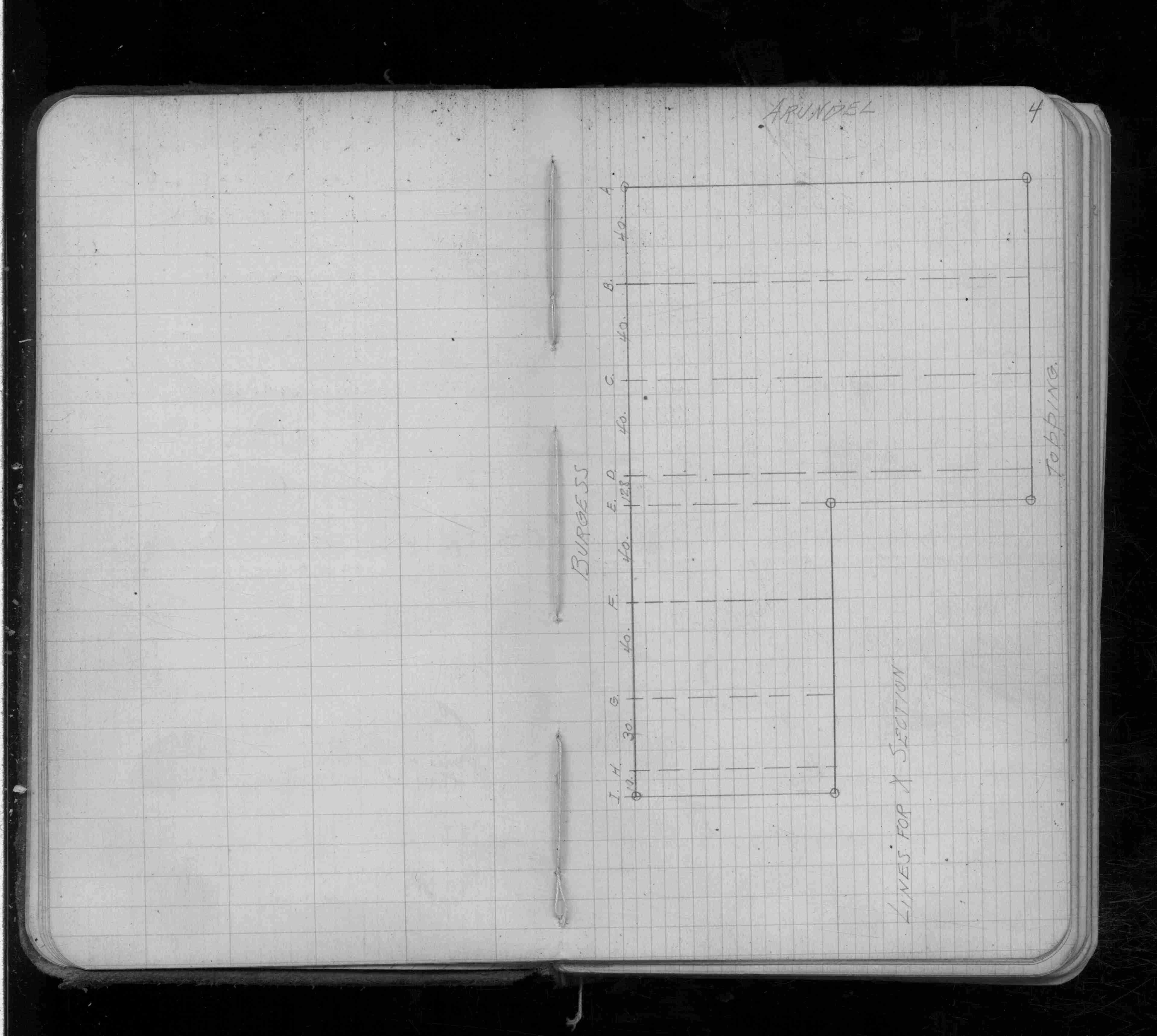
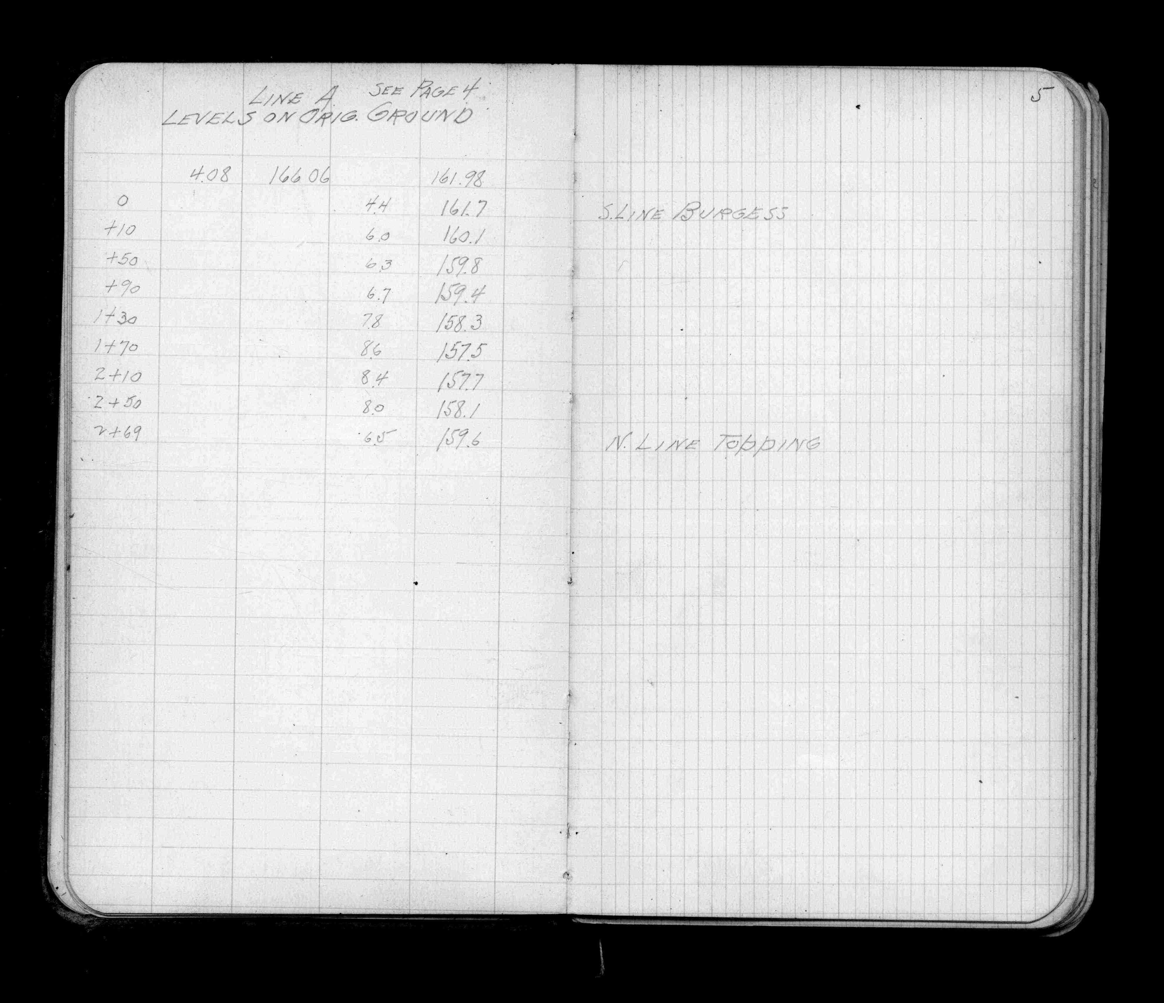
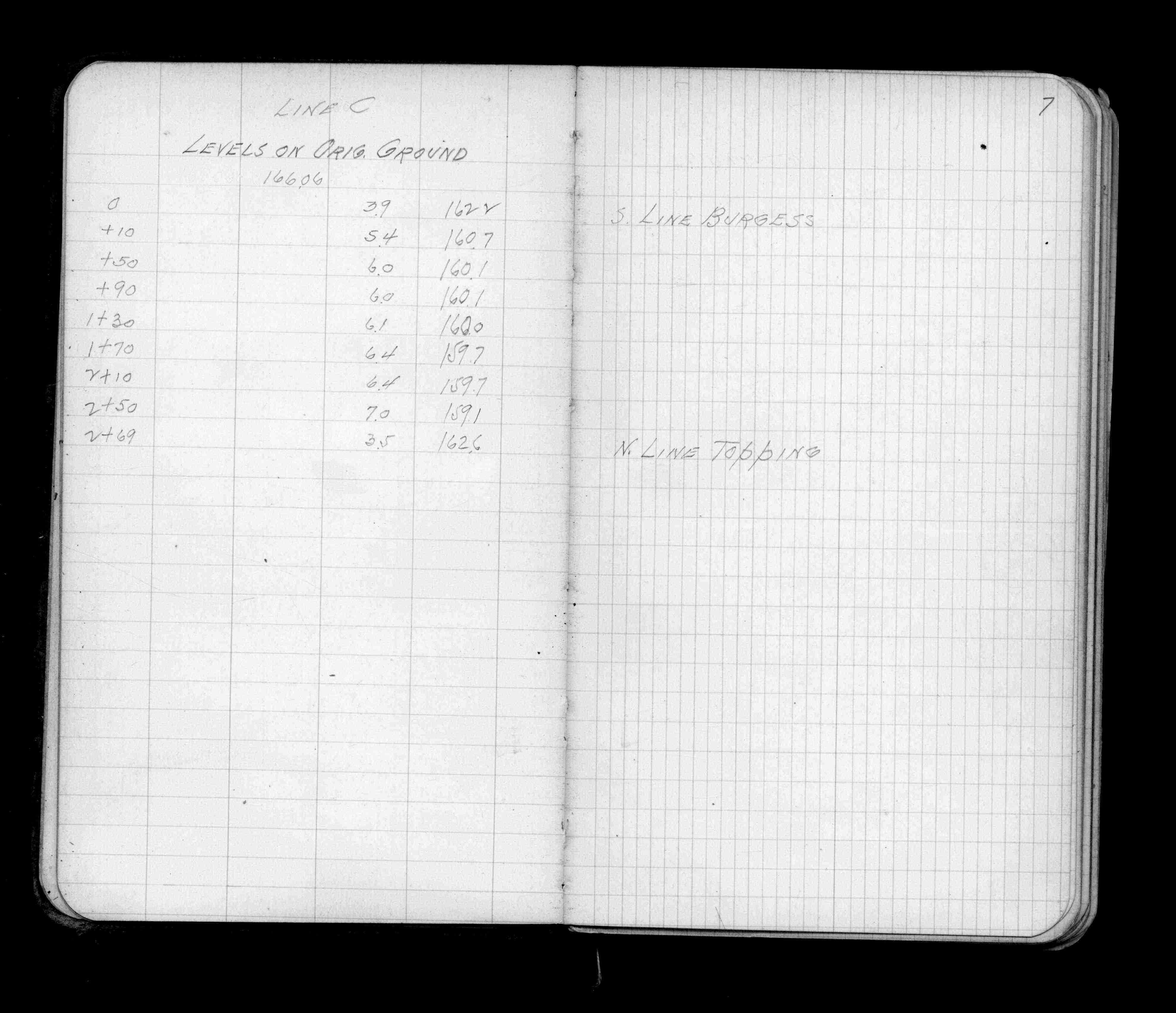
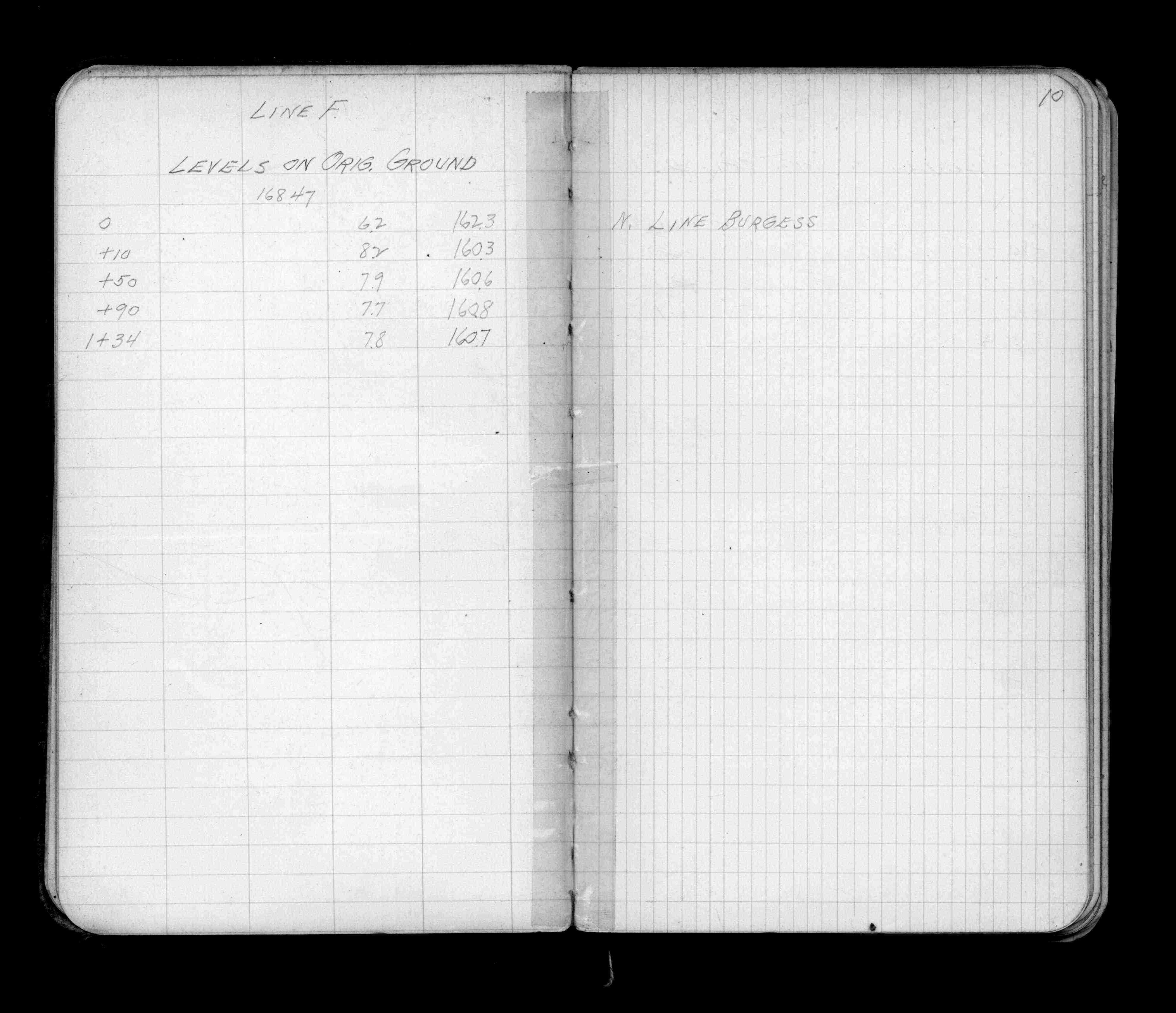
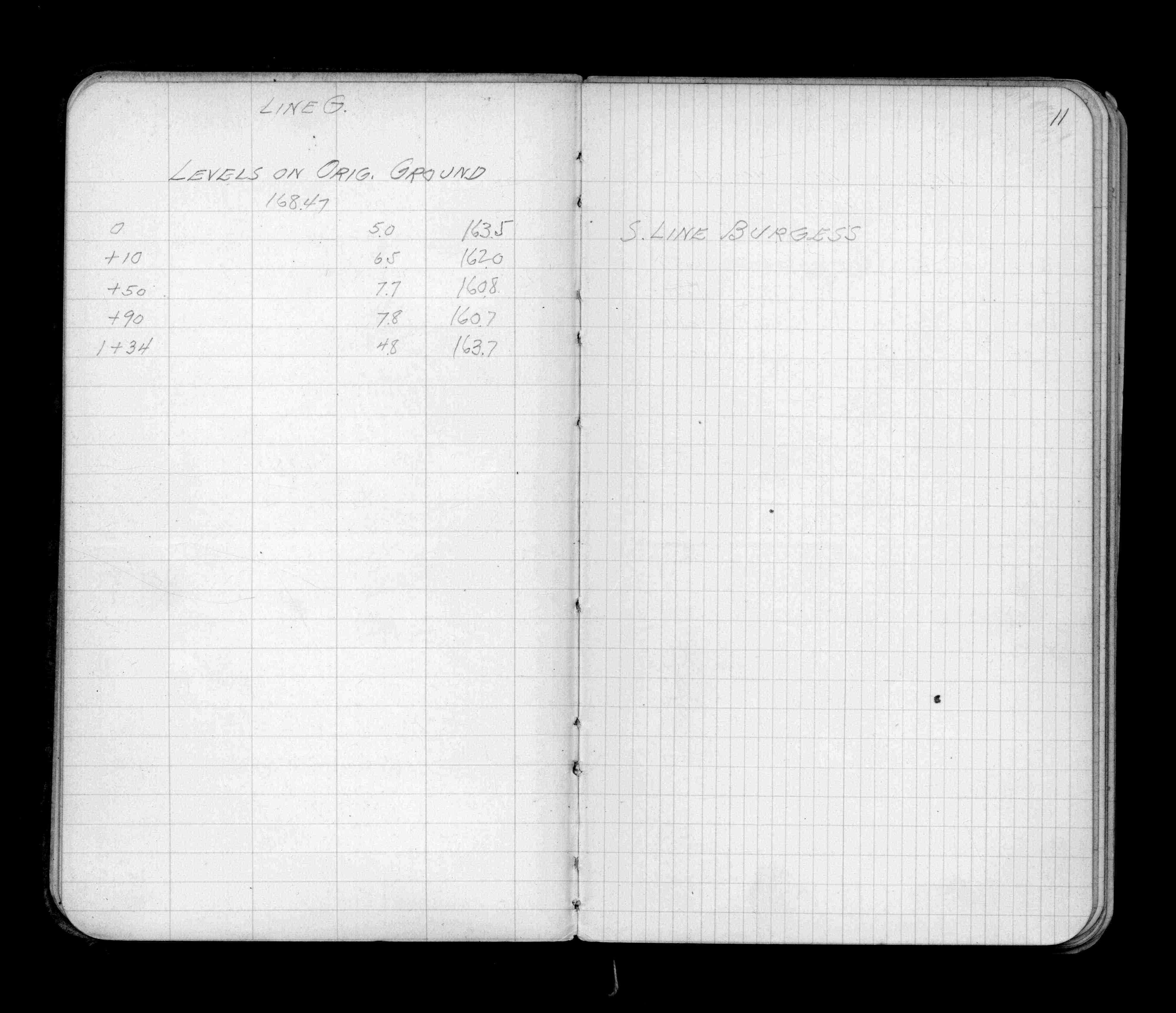
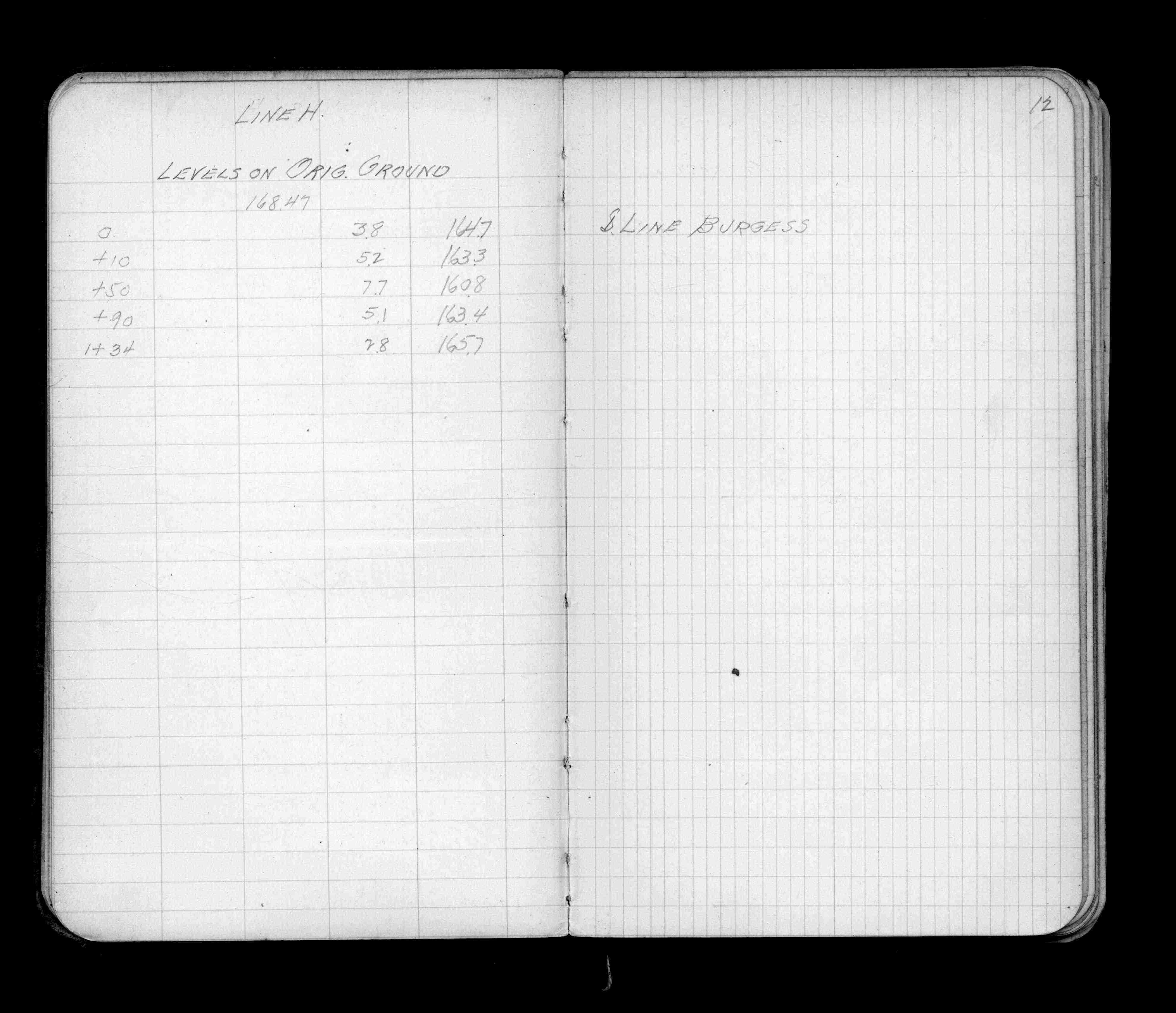
Page(s) 4-13
Area bounded by Arundel - Burgess & Topping Sts Lines A-I
| Location & Levels | 0000-00-00
4
5
6
7
8
9
10
11
12
13
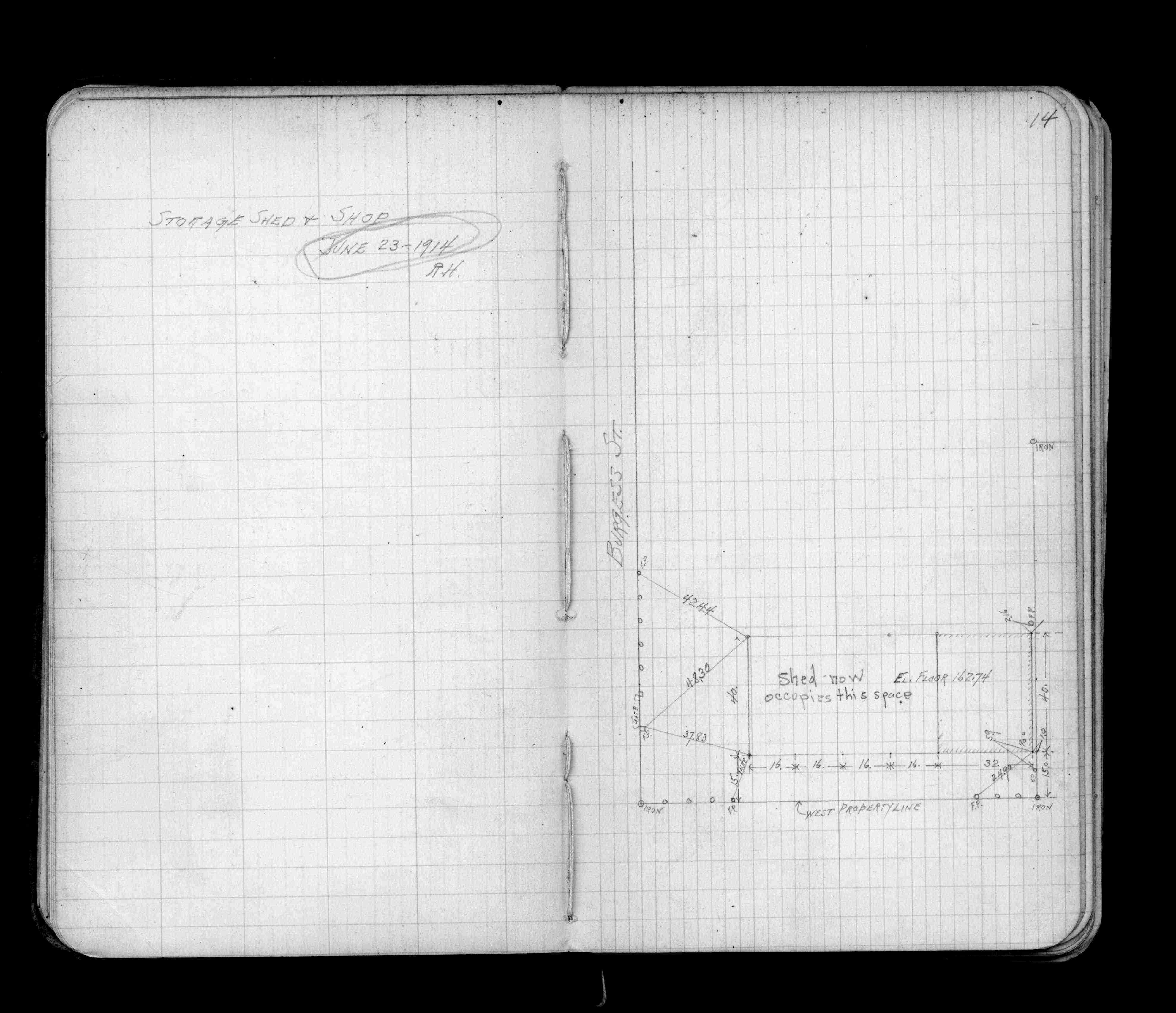
Page(s) 14
Asphalt Storage Shed & Shop
FROM
Burgess St
| Locations | 1914-06-23
14
Page(s) 15
Cen Ln Prop Track Area bounded by Arundel St & Burgess St & Proposed Track
| Spike Locs | 0000-00-00
15
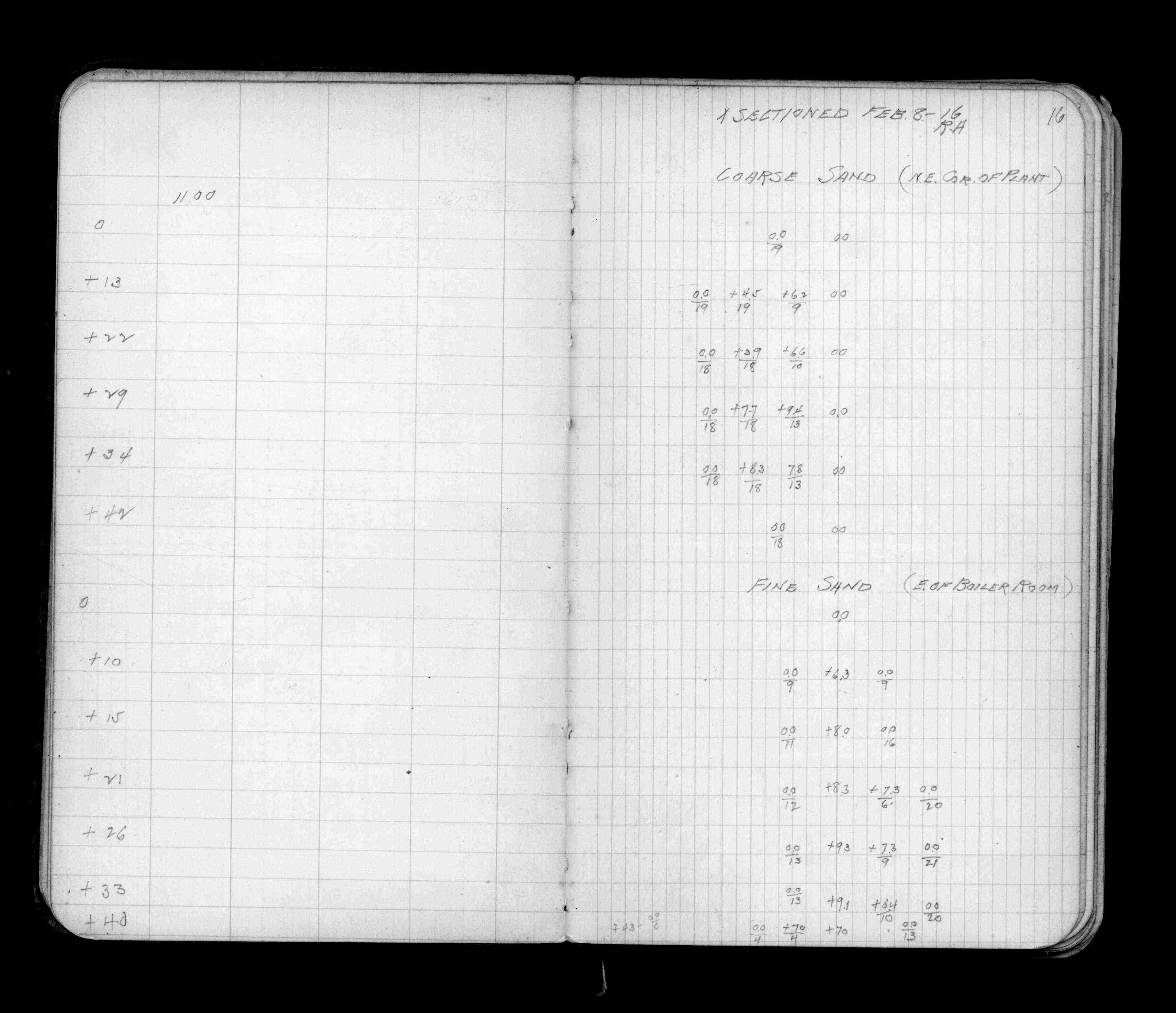
Page(s) 16
Asphalt Plant on Topping St
FROM
Coarse Sand (NE Cor of Plant)
| X-Sections | 1916-02-08
16
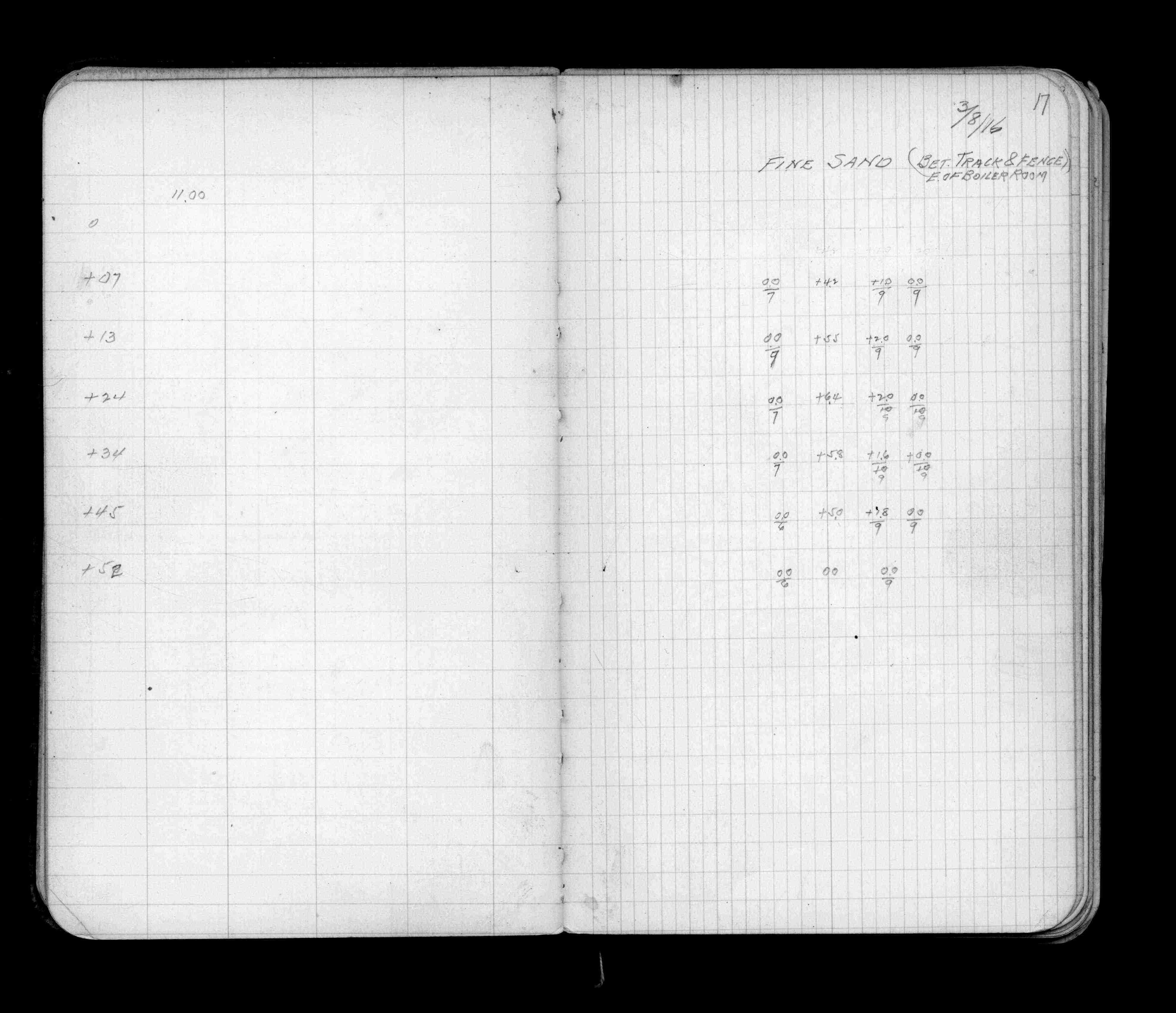
Page(s) 16-17
Asphalt Plant on Topping St
FROM
Fine Sand (E of Boiler Room) from track to fence
| X-Sections | 1916-02-08
16
17
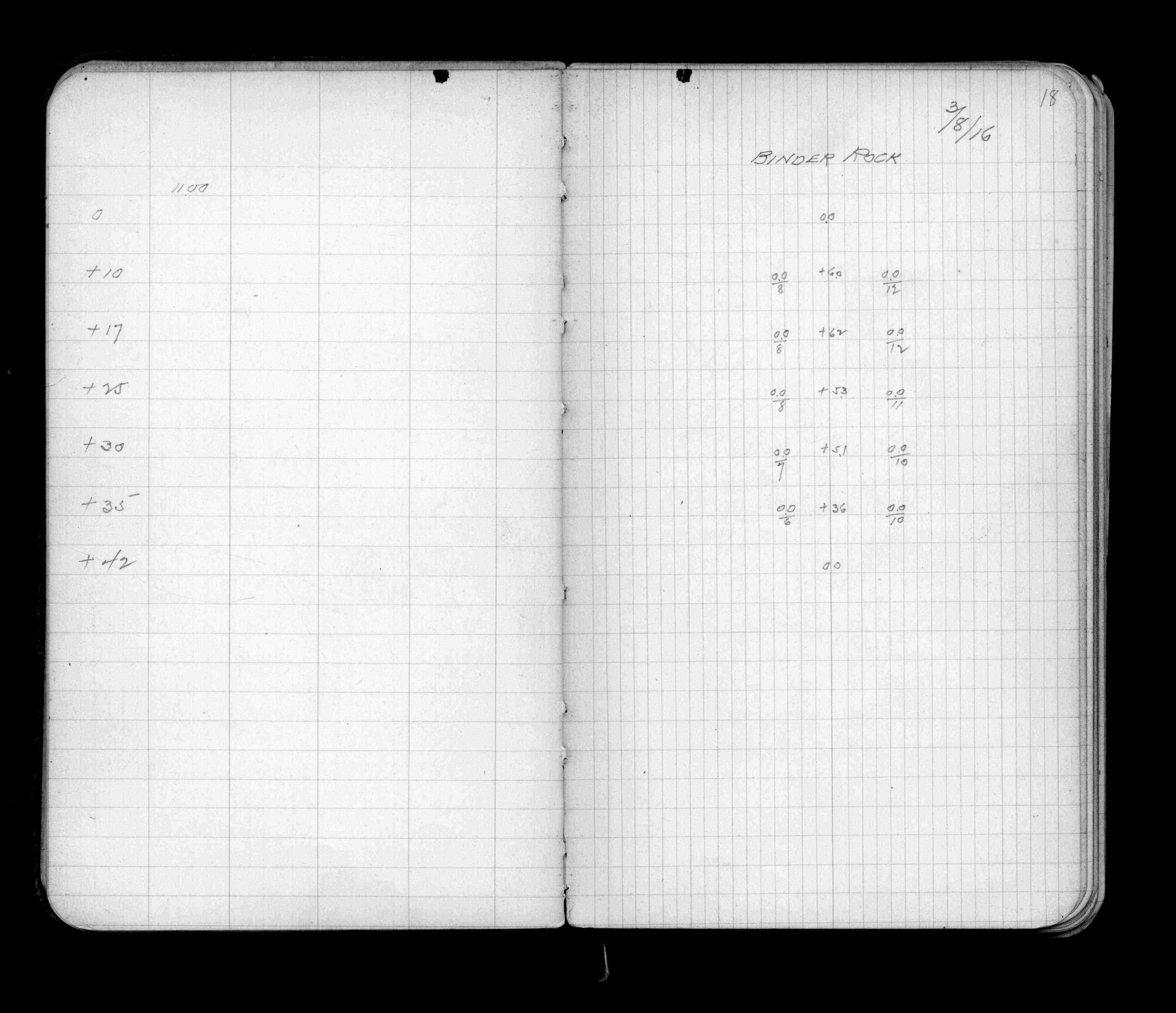
Page(s) 18
Binder Rock
| X-Sections | 1916-03-08
18
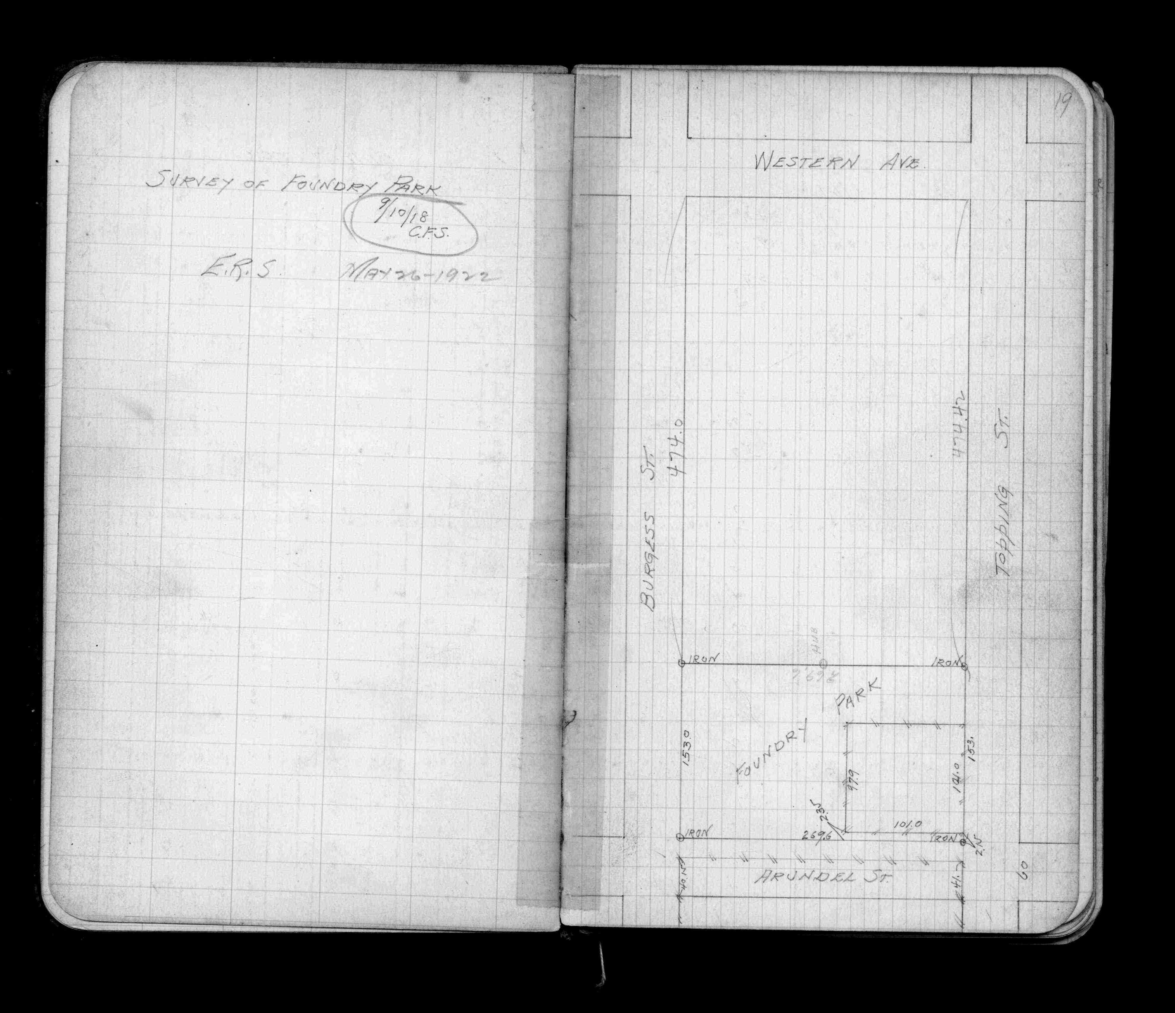
Page(s) 19
Foundry Park bounded by Arundel - Topping - Burgess St & Western Ave
| Survey & Locations | 1918-09-10
19
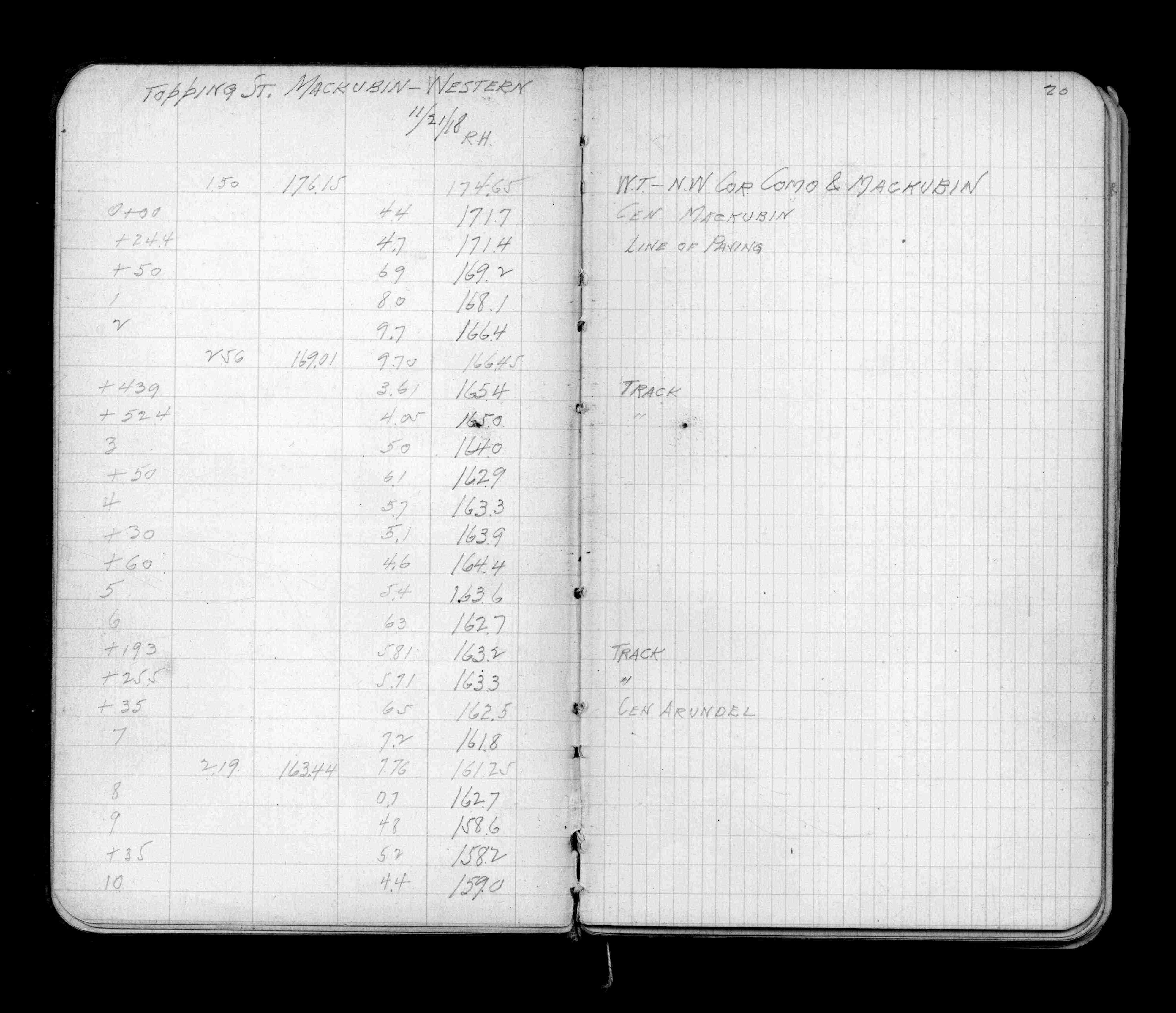
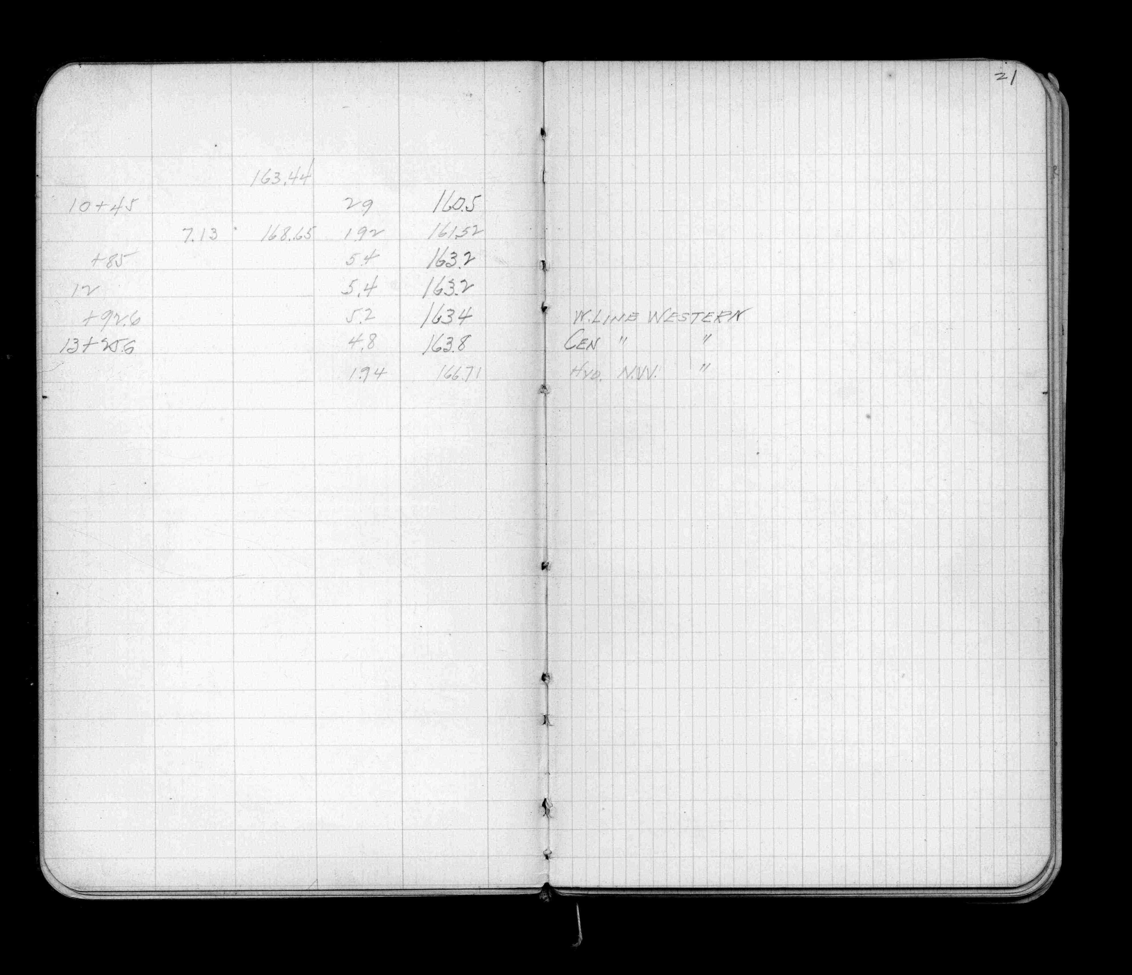
Page(s) 20-21
Topping St
FROM
Mackubin St
TO
Western Ave
| Levels | 1918-11-21
20
21
Page(s) 22
Burgess St
FROM
Mackubin St
TO
Western Ave
| Levels | 1918-11-18
22
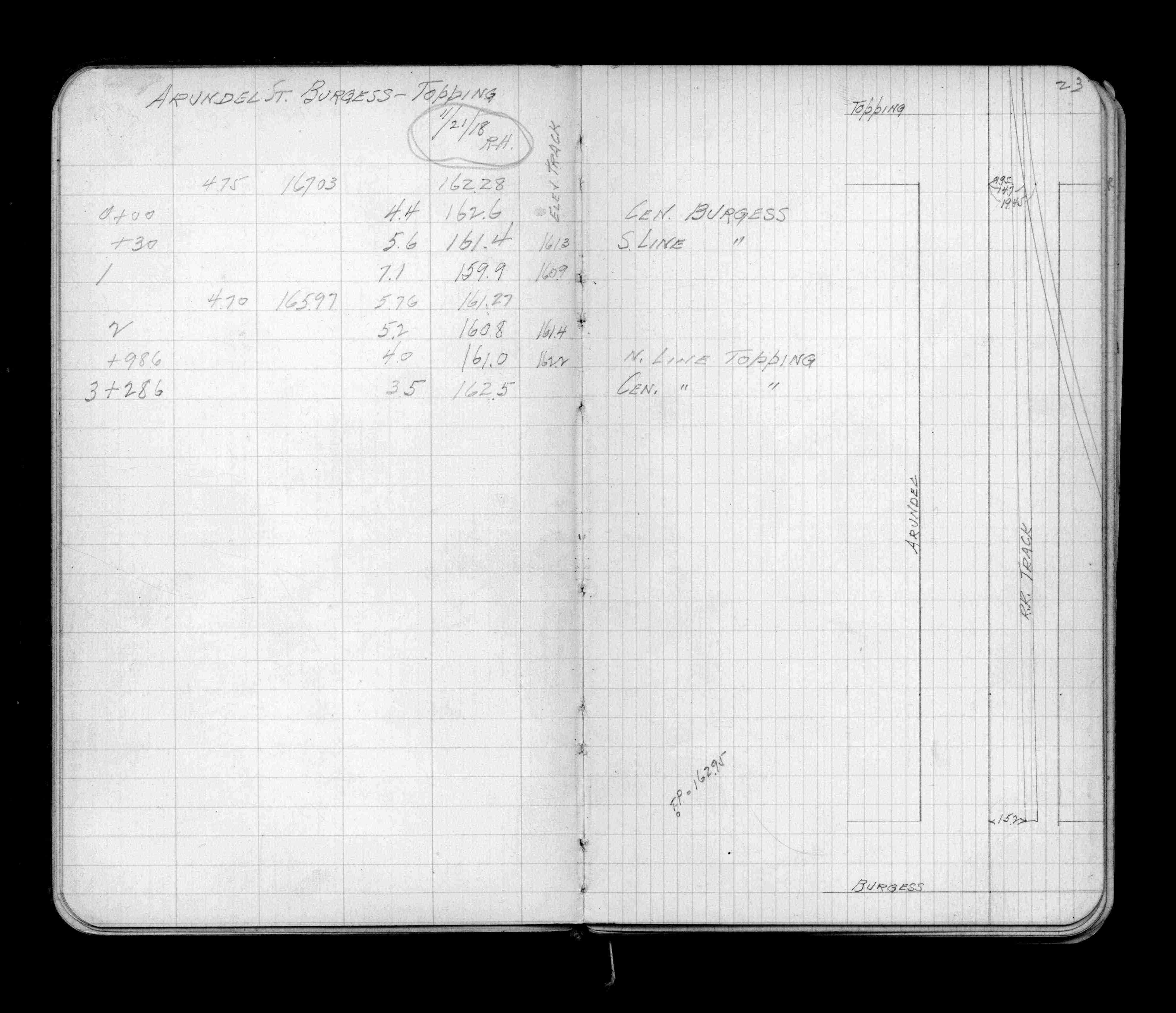
Page(s) 23
Arundel St
FROM
Burgess St
TO
Topping St
| Levels & Locations | 1918-11-21
23
Page(s) 24
Blank page
| Blank | 0000-00-00
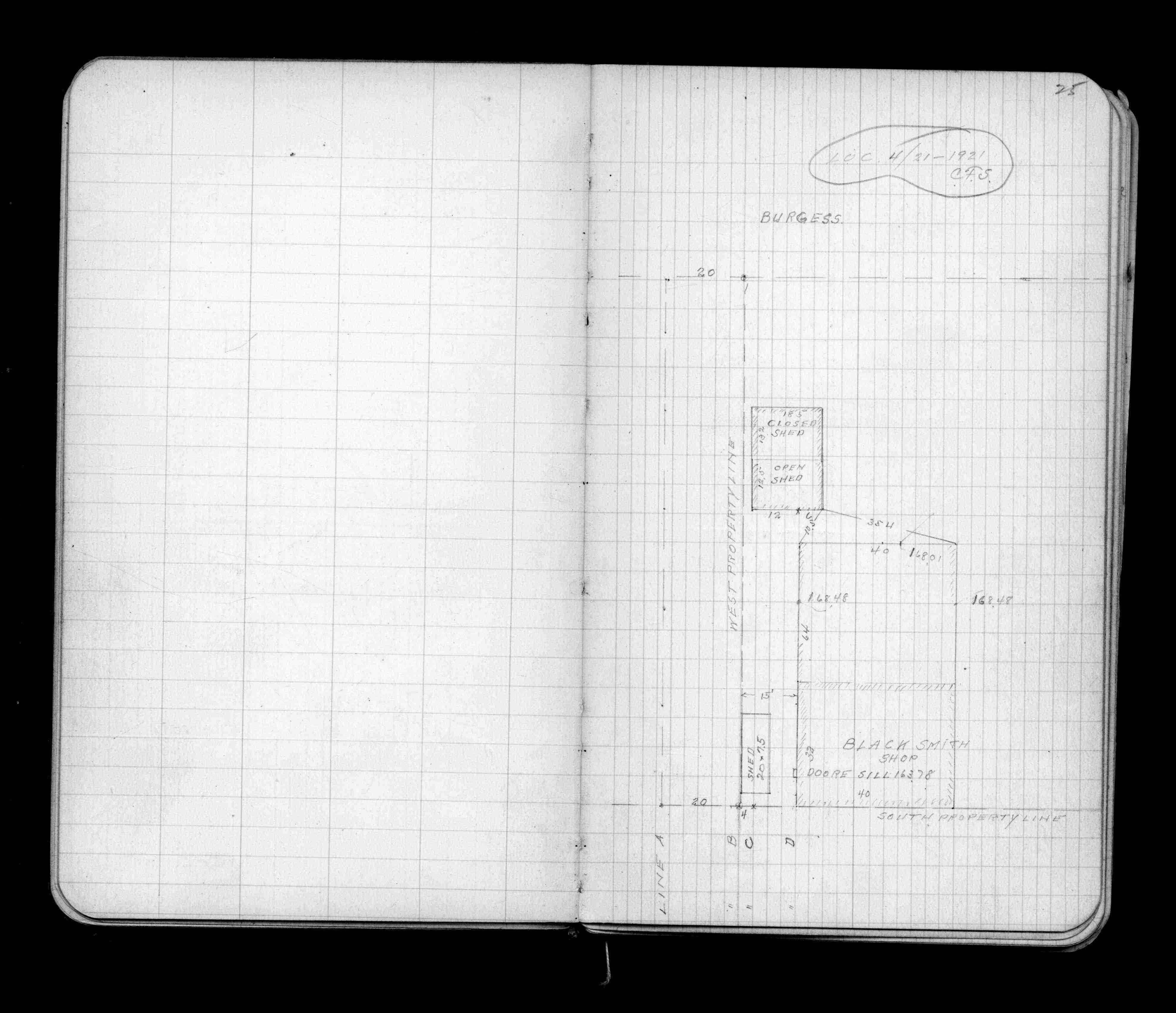
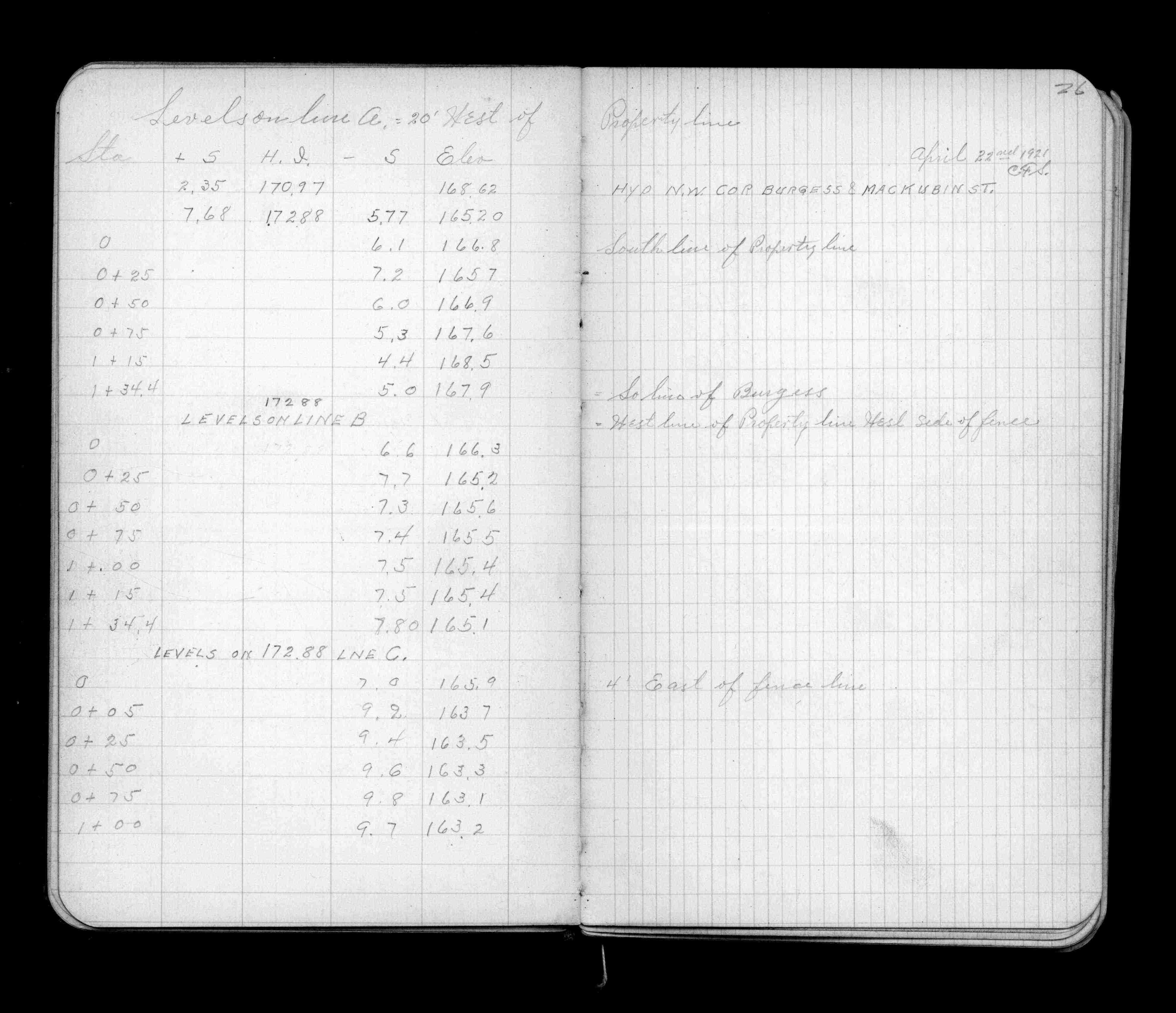
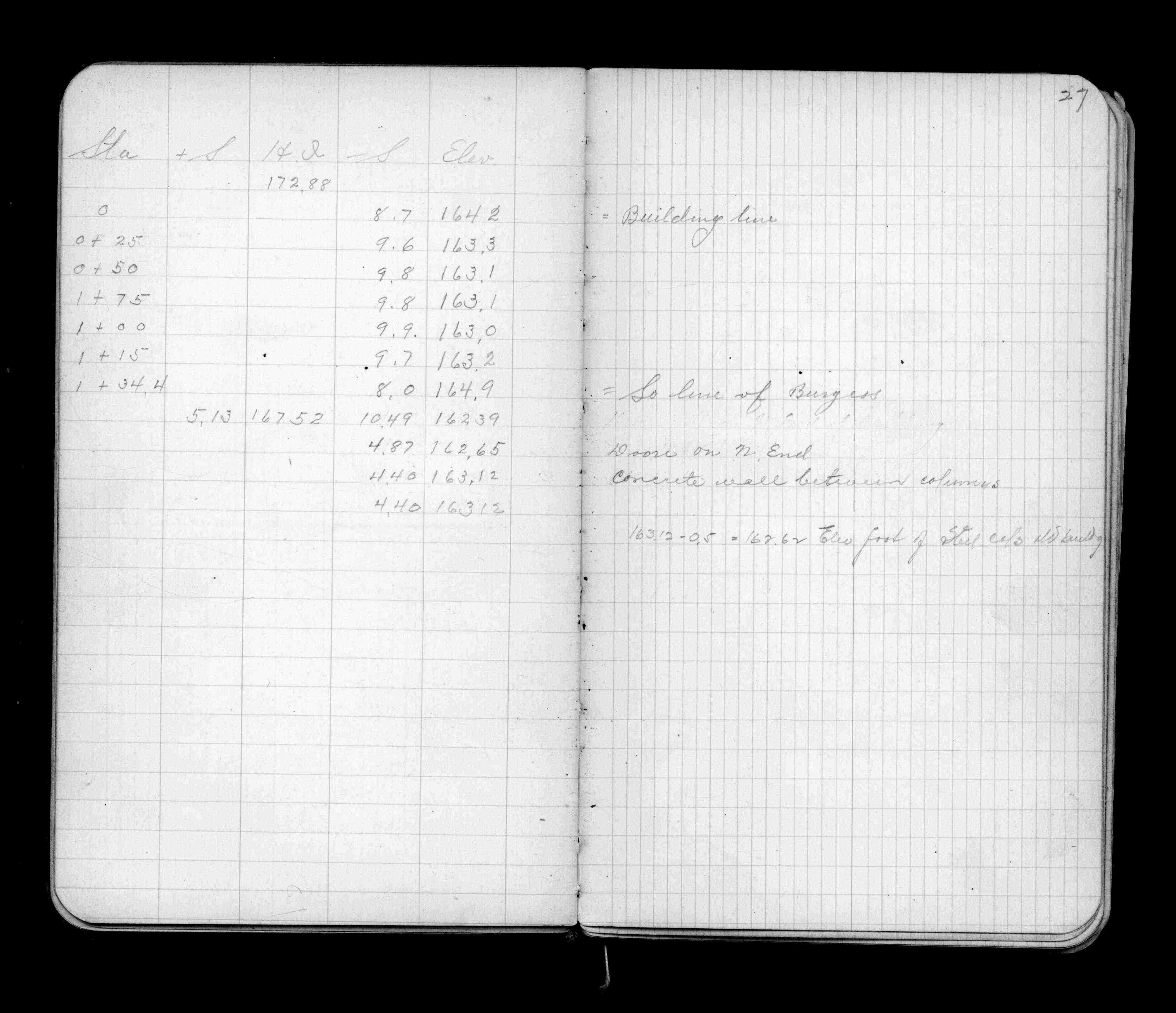
Page(s) 25-27
Asphalt Plant bounded by W Prop Line & Burgess St
| Loc & Levels 20 ft W | 1921-04-22
25
26
27
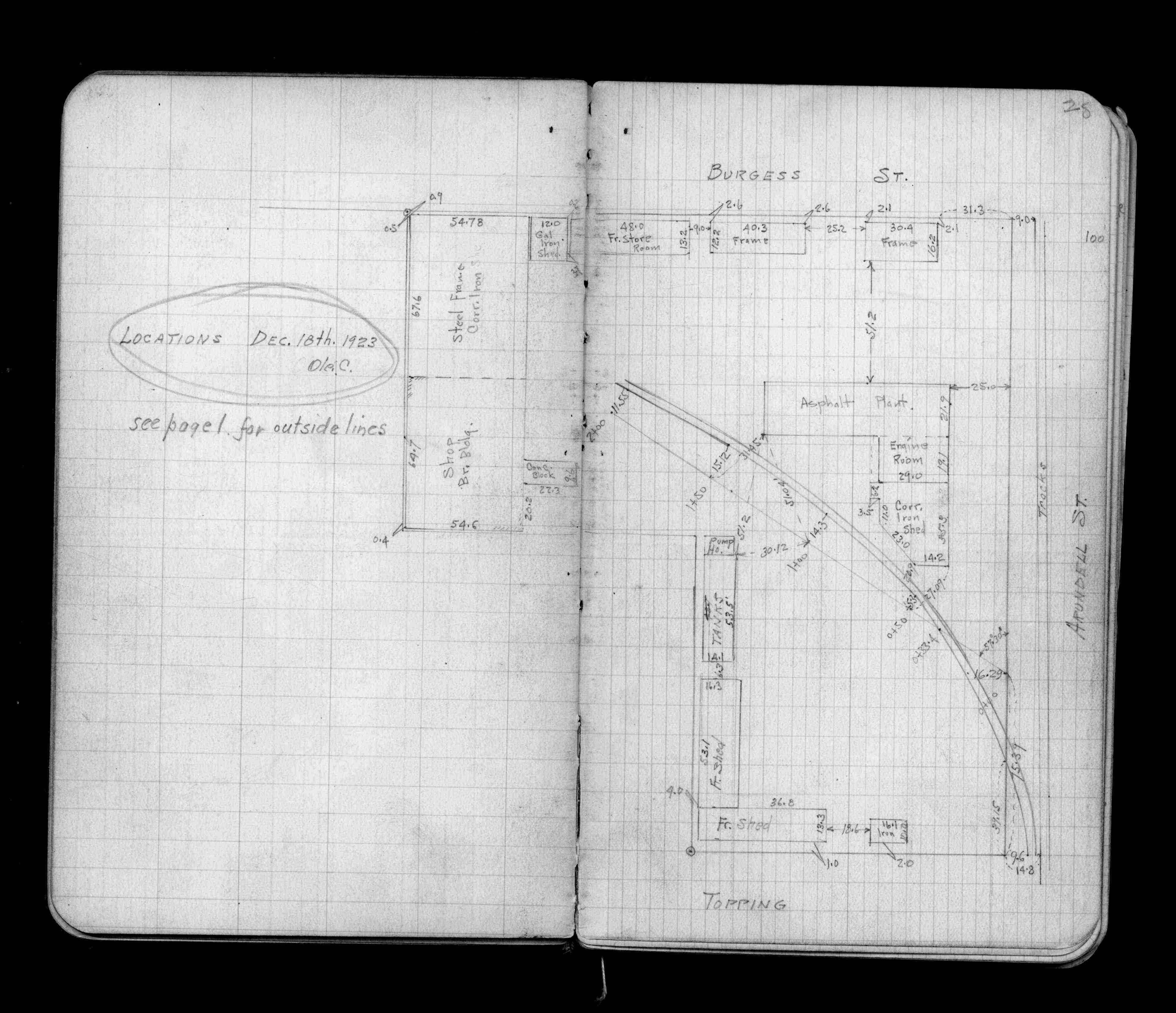
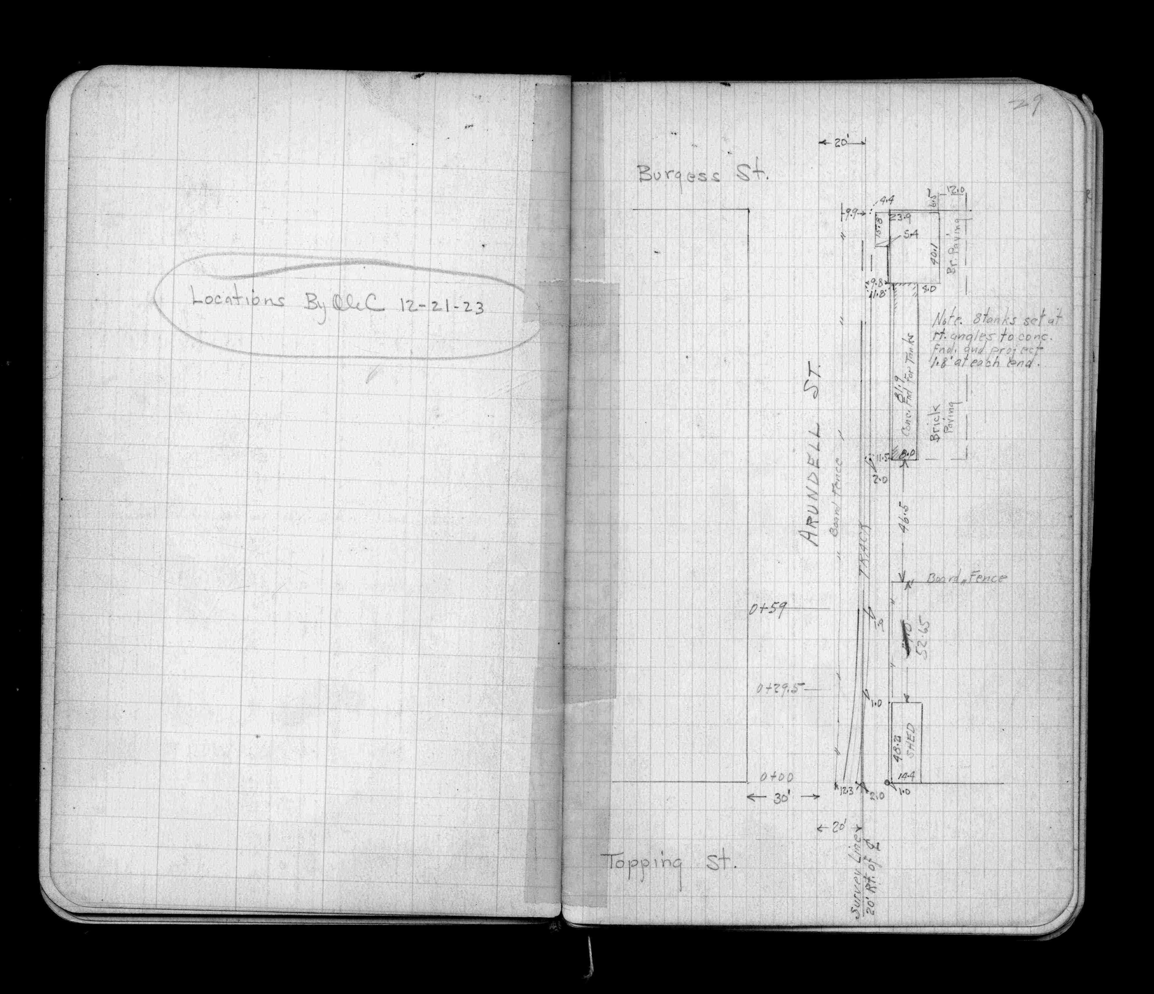
Page(s) 28-29
Asphalt Plant bounded by Topping - Arundel & Burgess Sts
| Locations | 1923-12-18
28
29
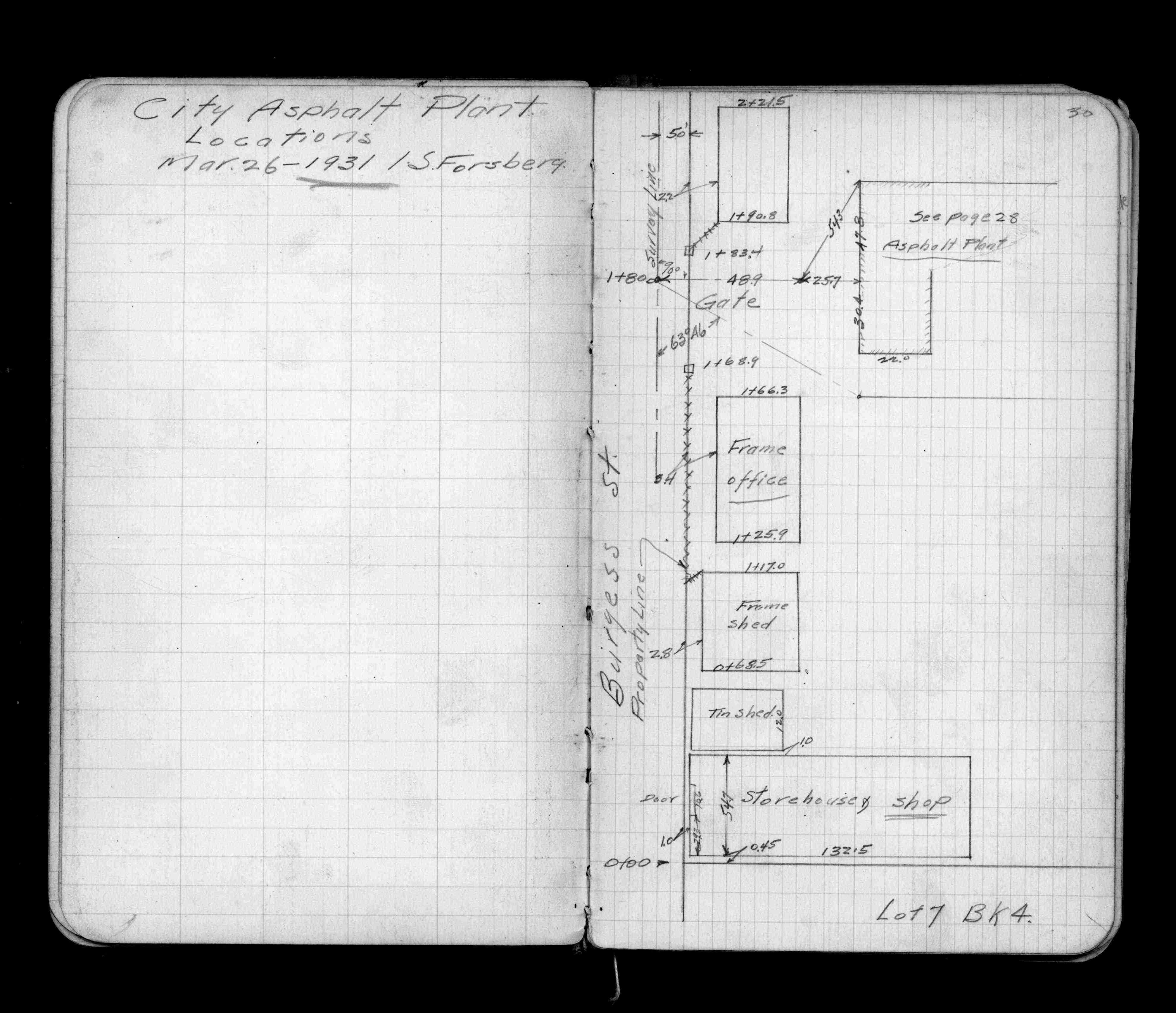
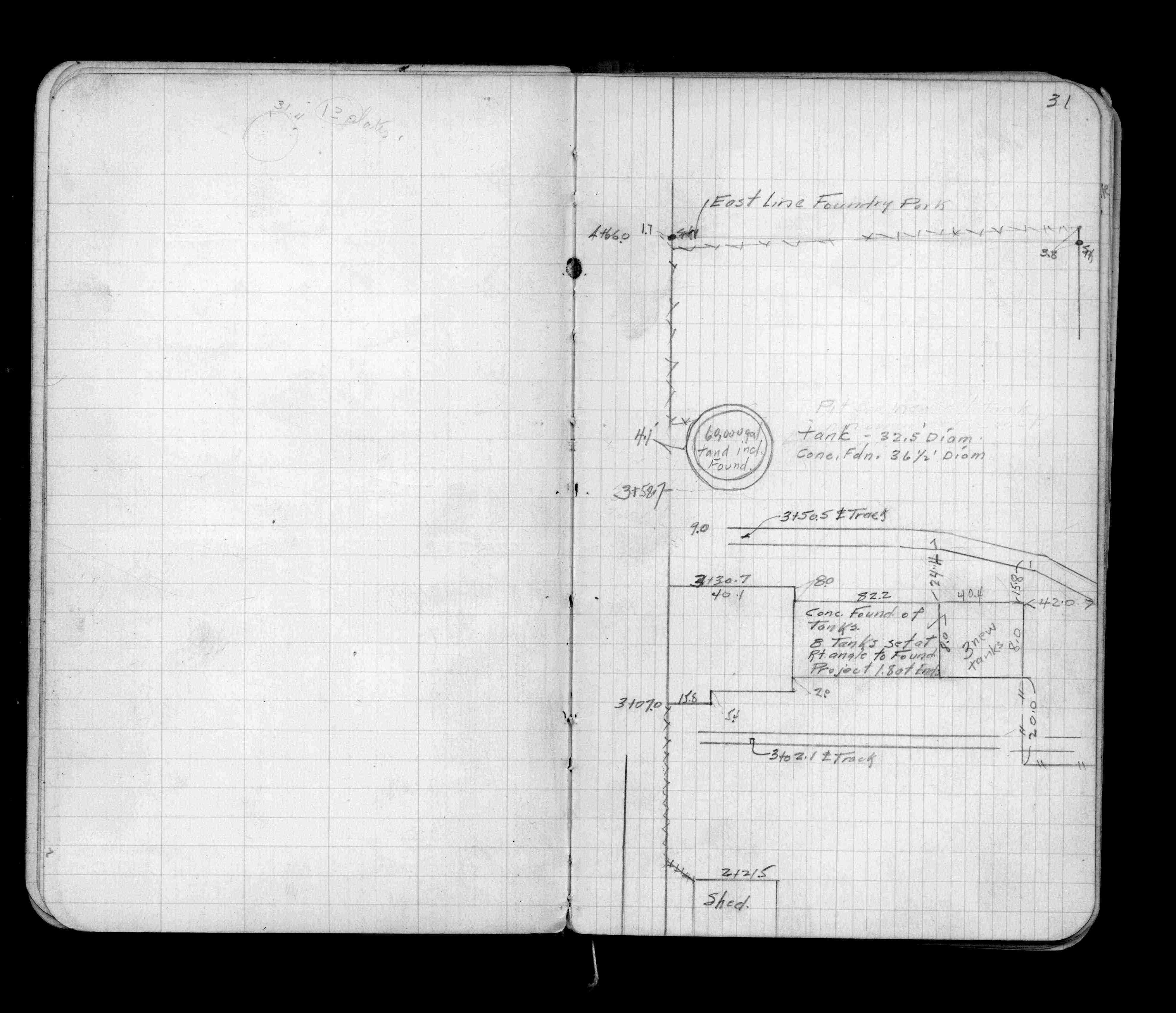
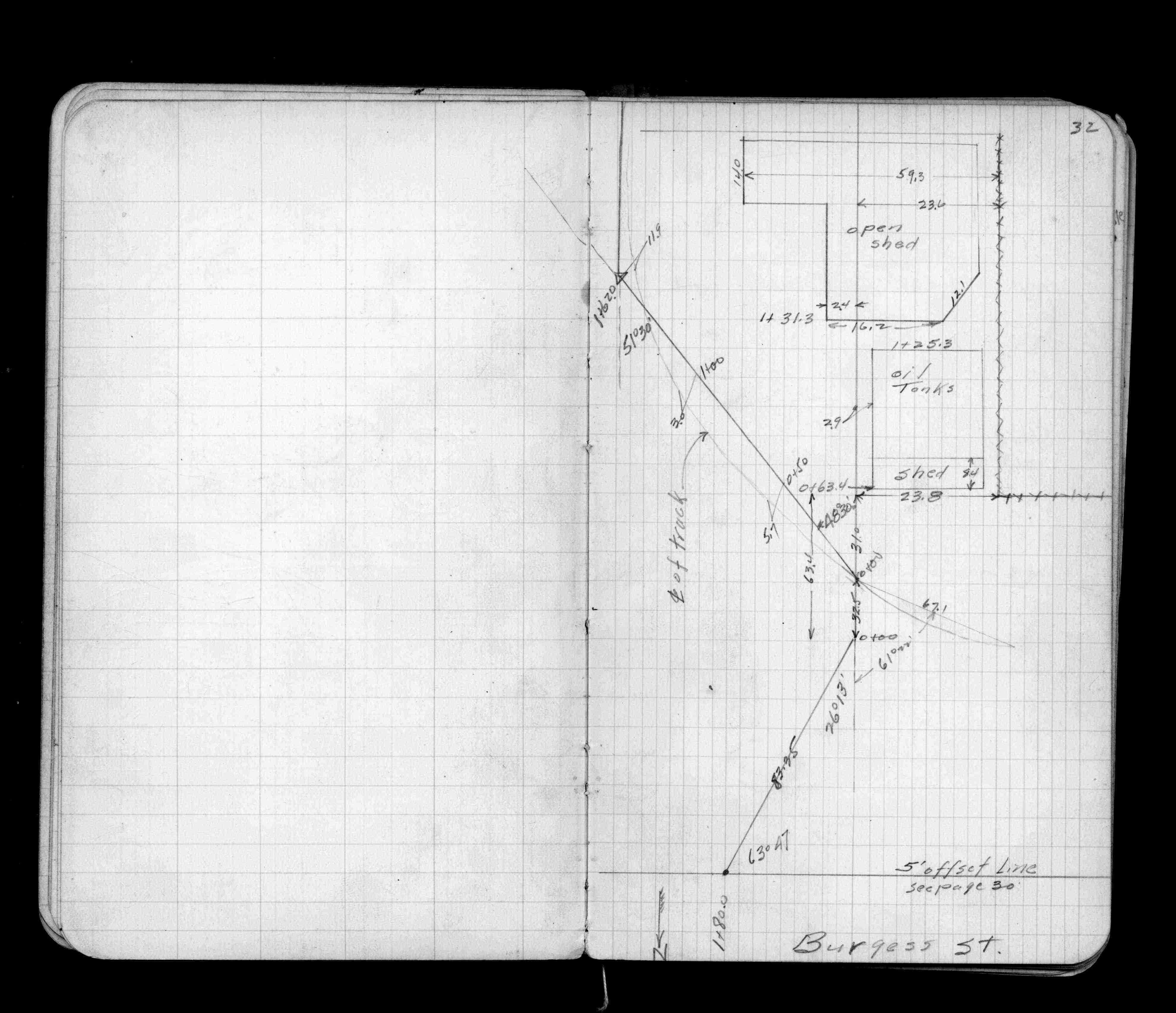
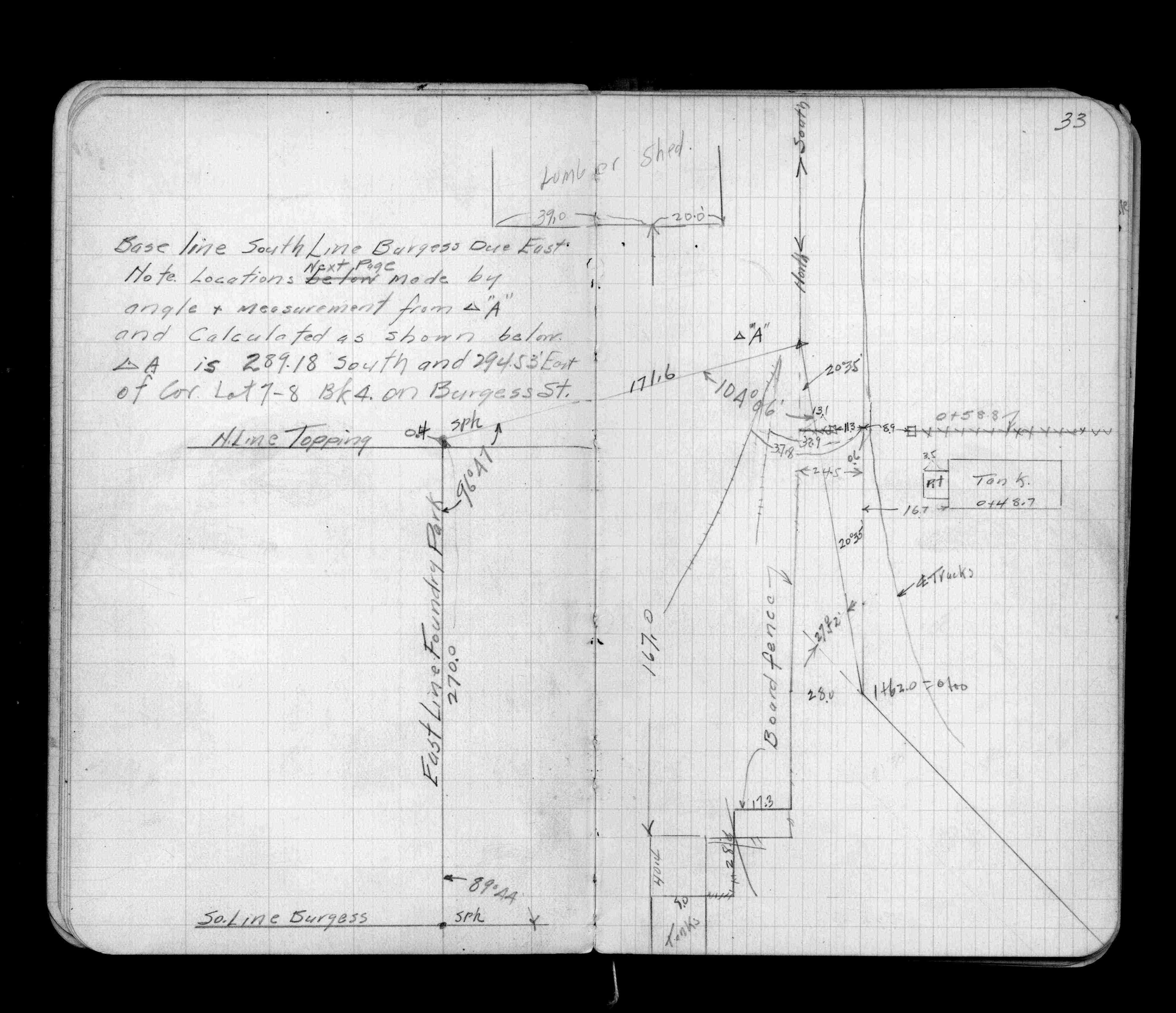
Page(s) 30-34
Asphalt Plant bounded by L7 B4 & Burgess St
| Locations | 1931-03-26
30
31
32
33
34
Page(s) 35
Foundry Add L24 - L28 B2 bounded by Stinson - Burgess - Arundel & Mackubin Sts
| Lot Survey | 1932-09-26
35
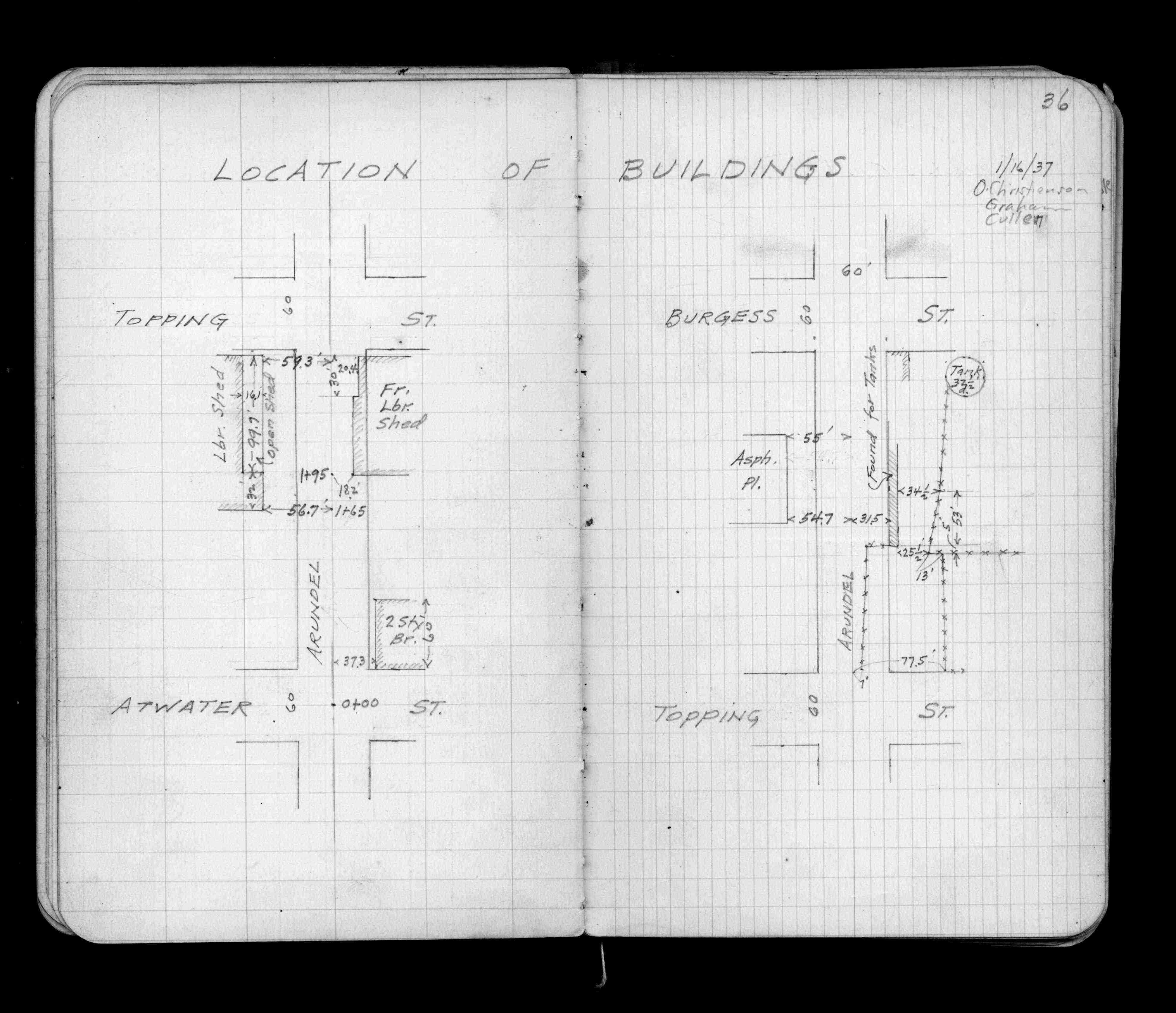
Page(s) 36
Arundel St
FROM
Atwater St
TO
Burgess St
| Bldg Locations | 1937-01-16
36
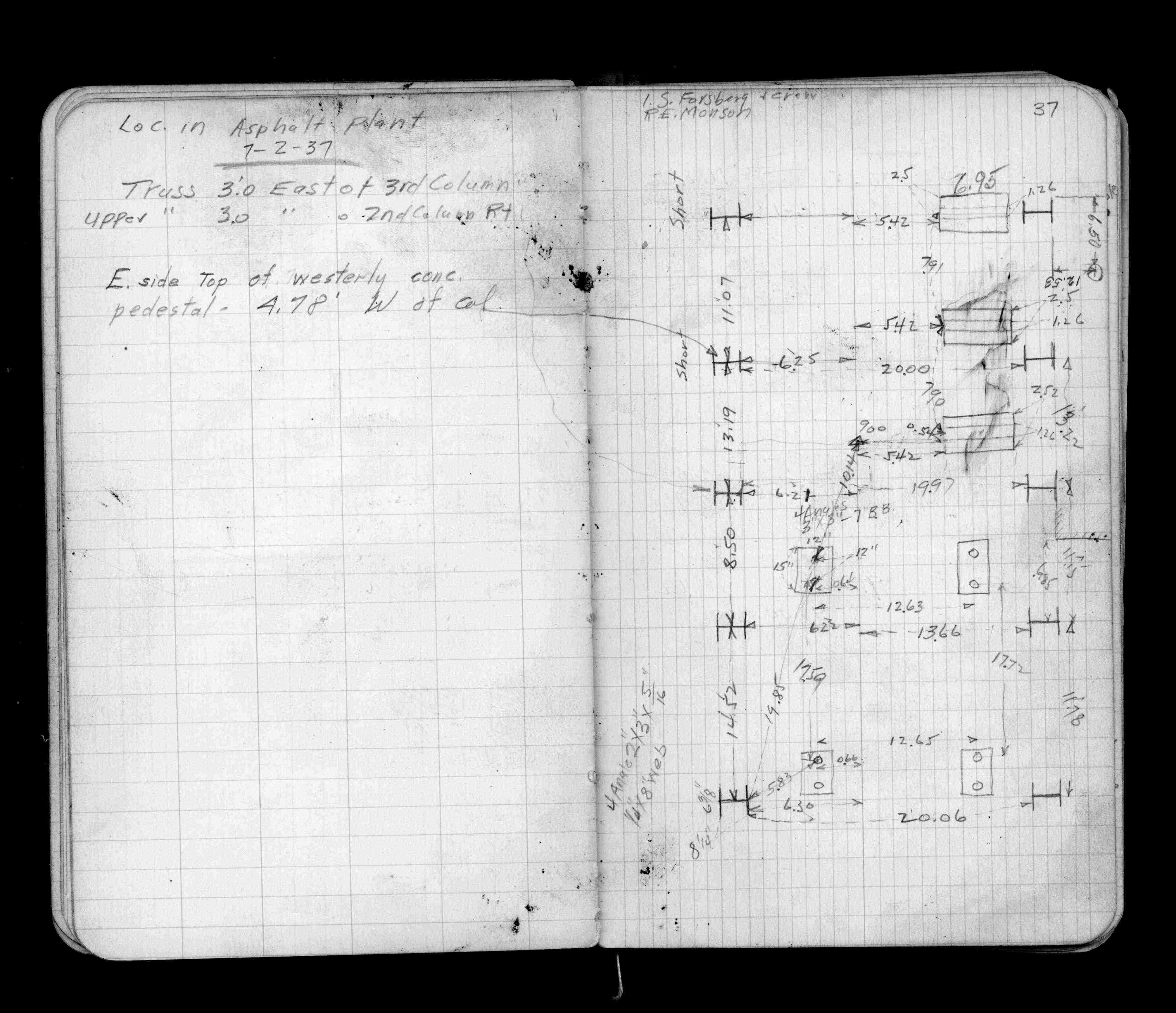
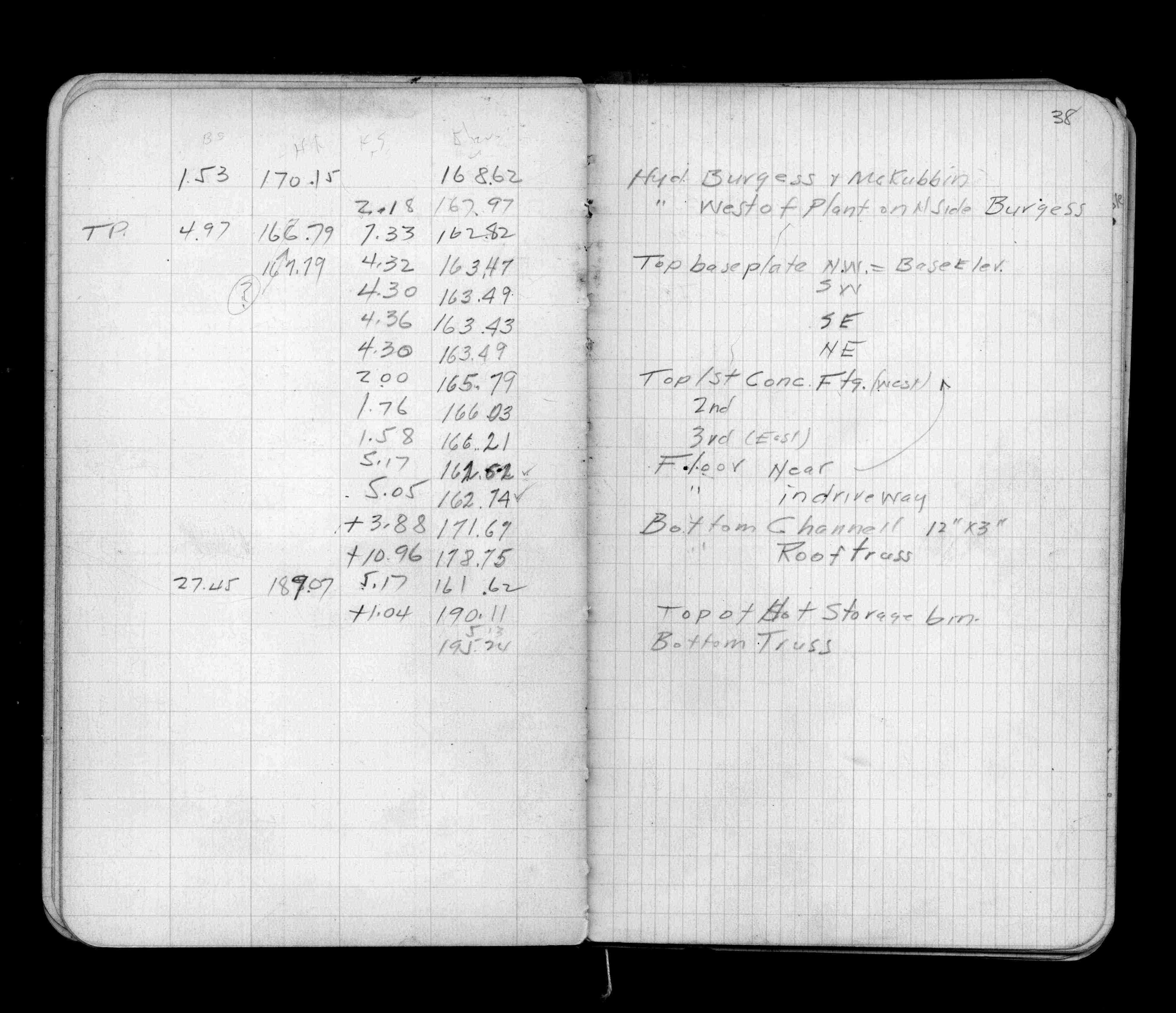
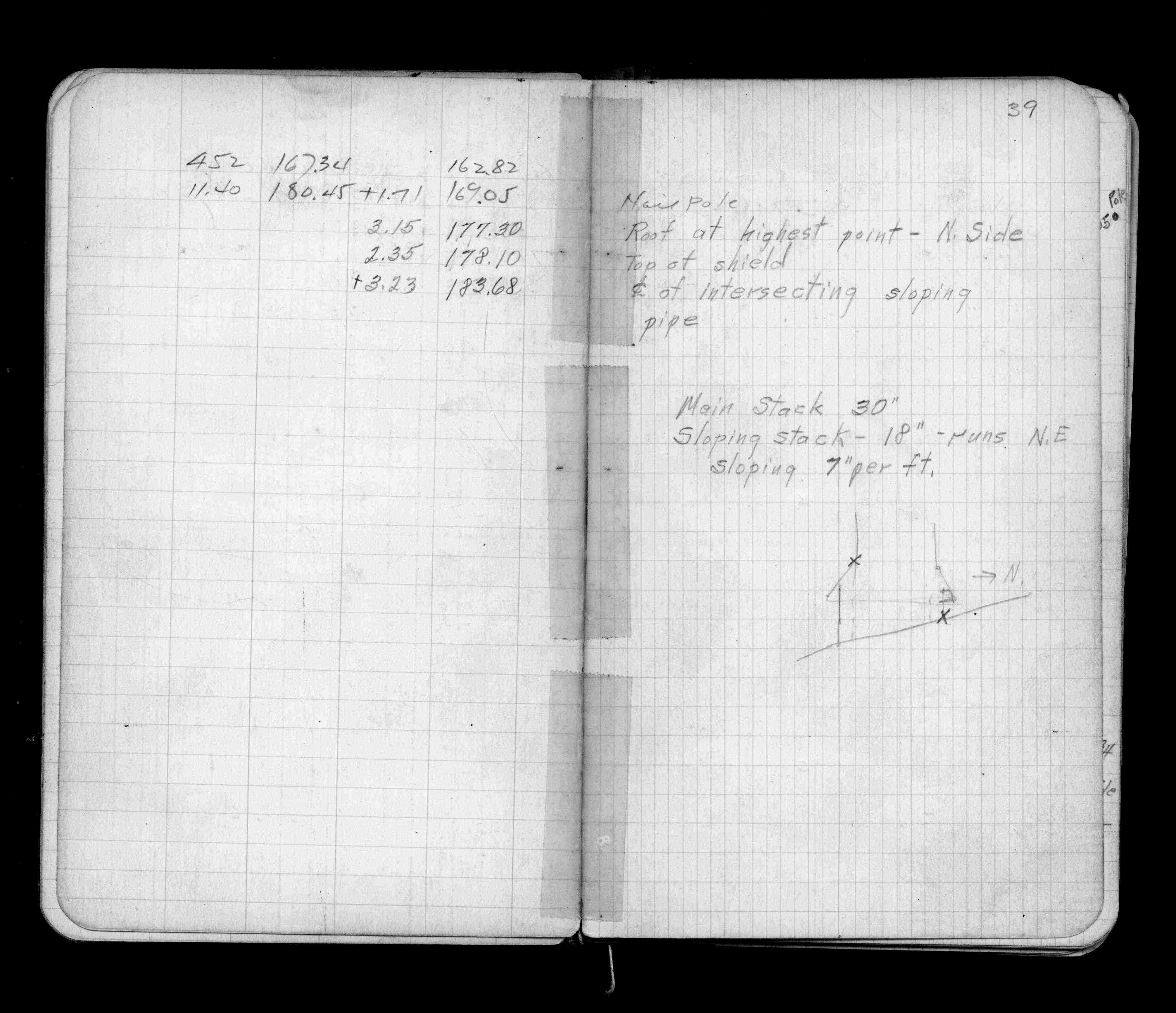
Page(s) 37-39
Asphalt Plant
| Locs-Levels & BM | 1937-07-02
37
38
39
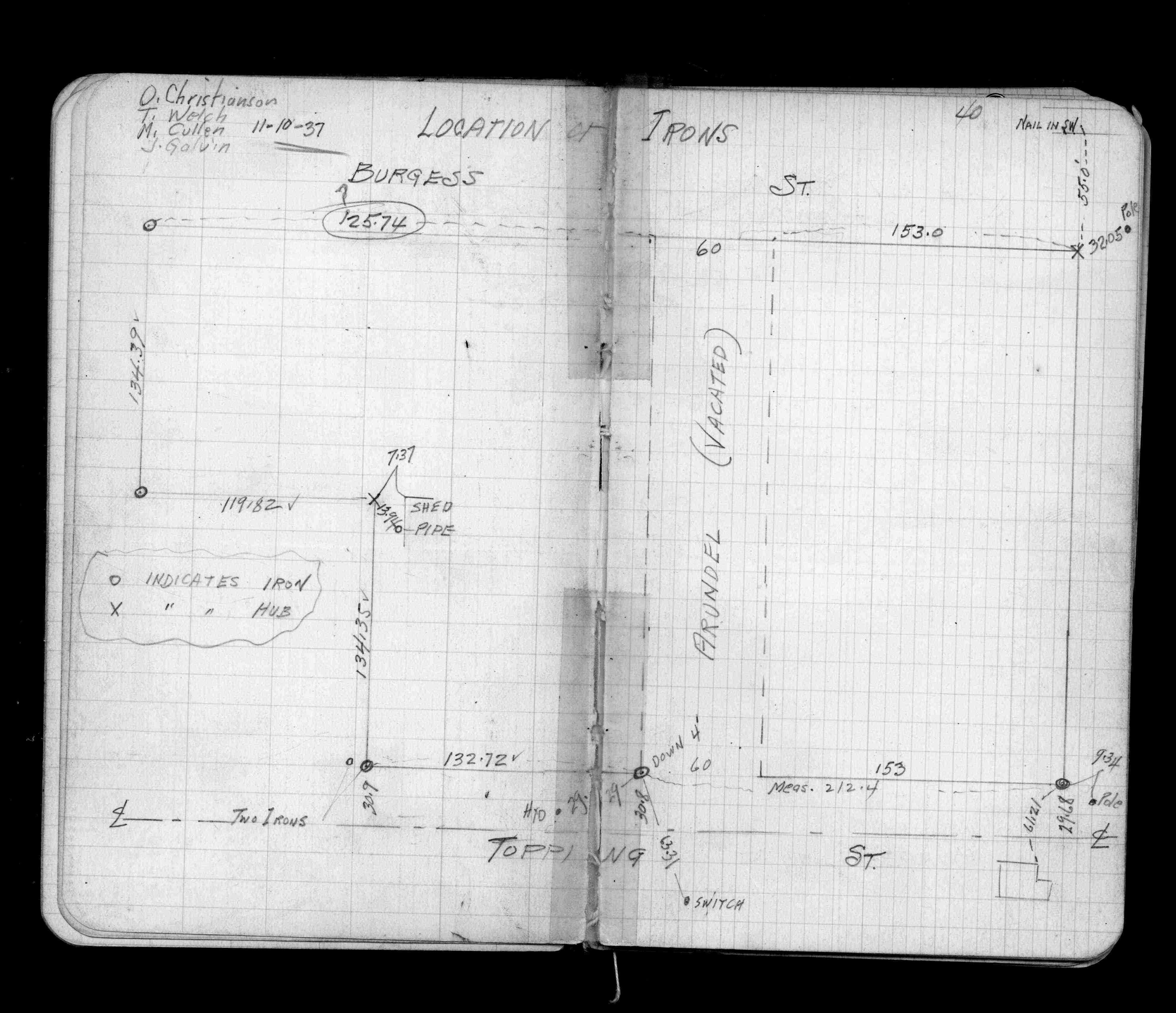
Page(s) 40-41
Arundel St (vacated)
FROM
Topping St
TO
Stinson St
| Location of Irons | 1937-11-10
40
41
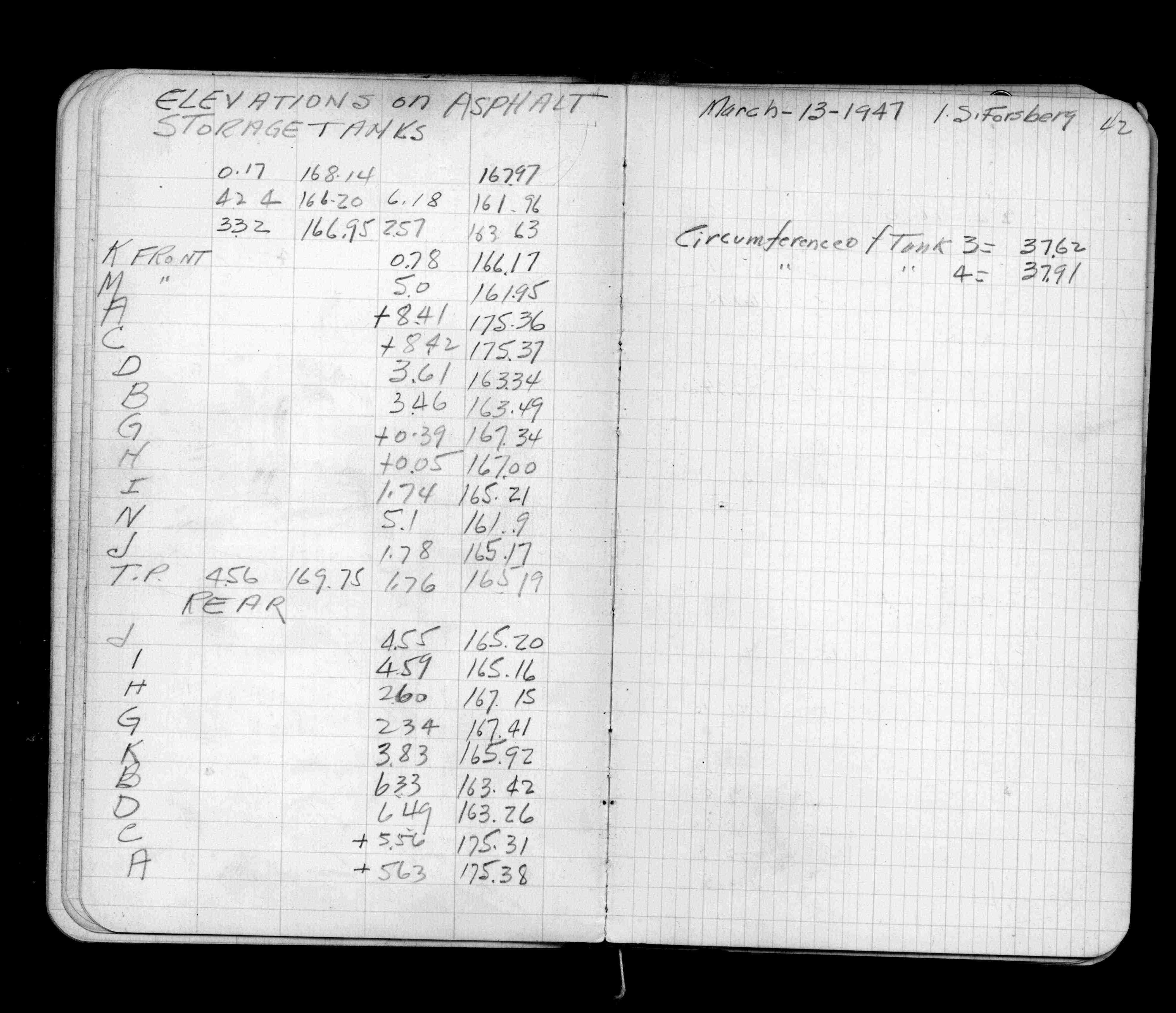
Page(s) 42
Asphalt Plant Storage Tanks
FROM
Tank "A"
TO
Tank "M"
| Elevations | 1947-03-13
42
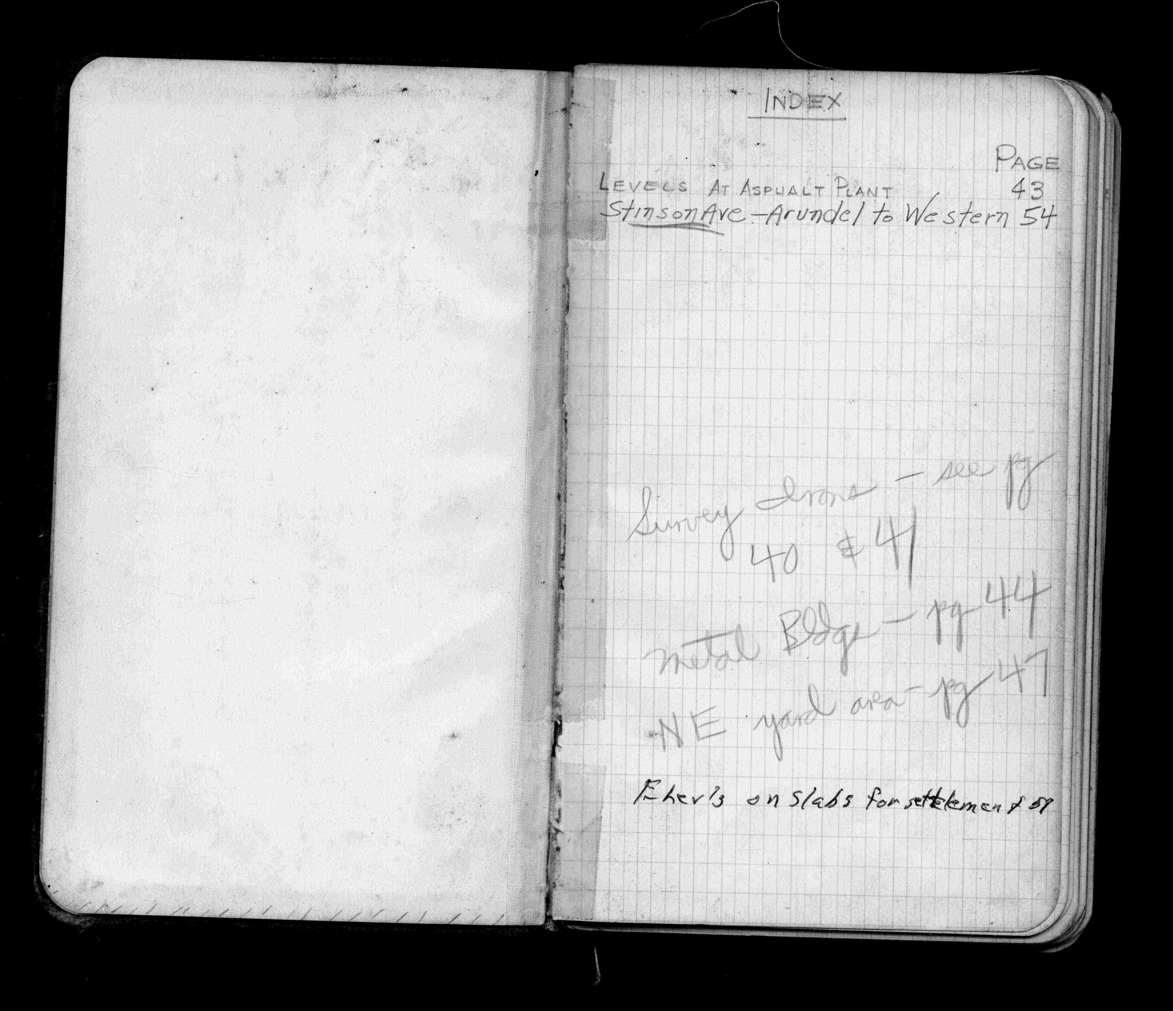
Page(s) 43
Asphalt Plant
| Levels | 1955-09-23
43
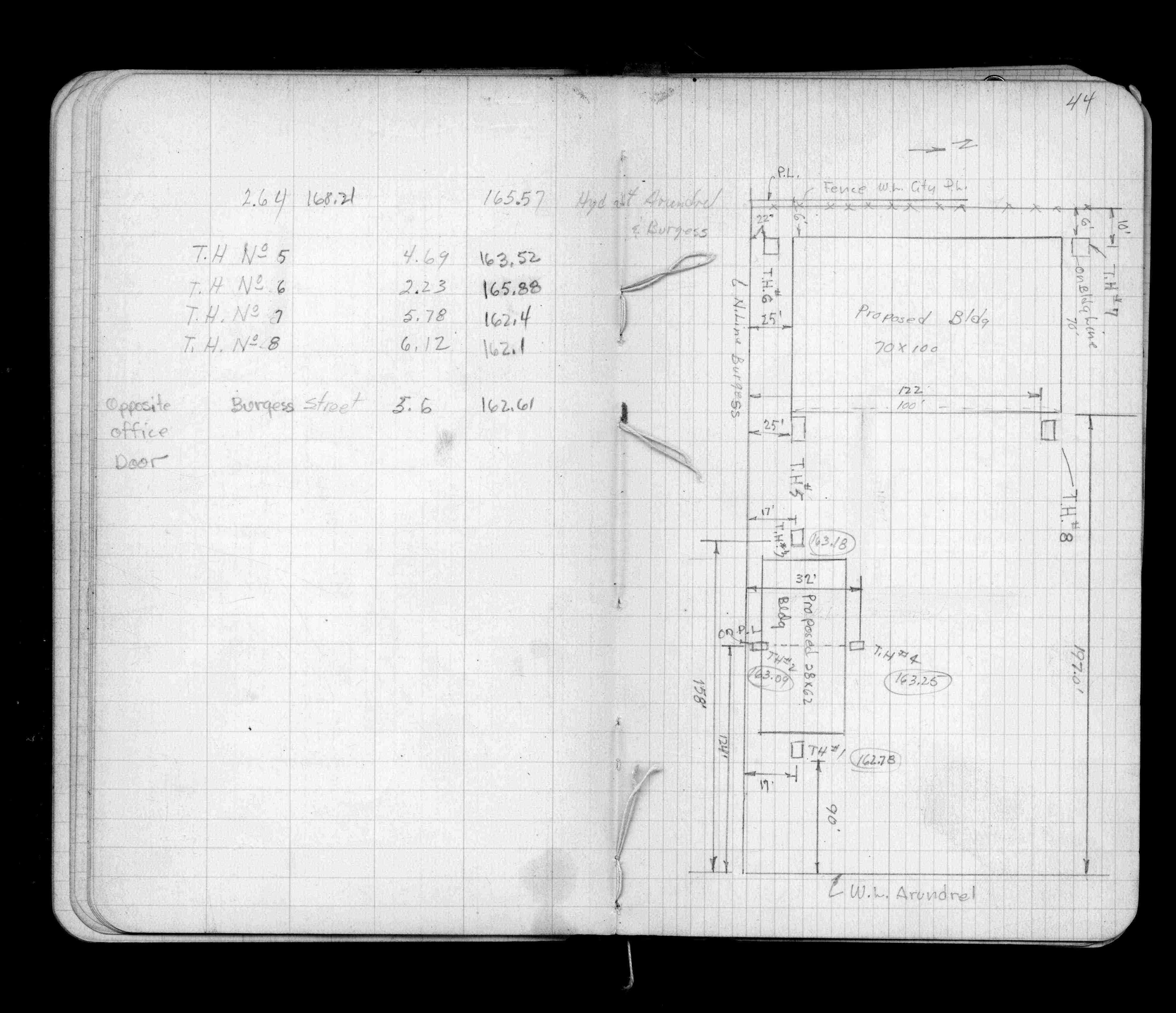
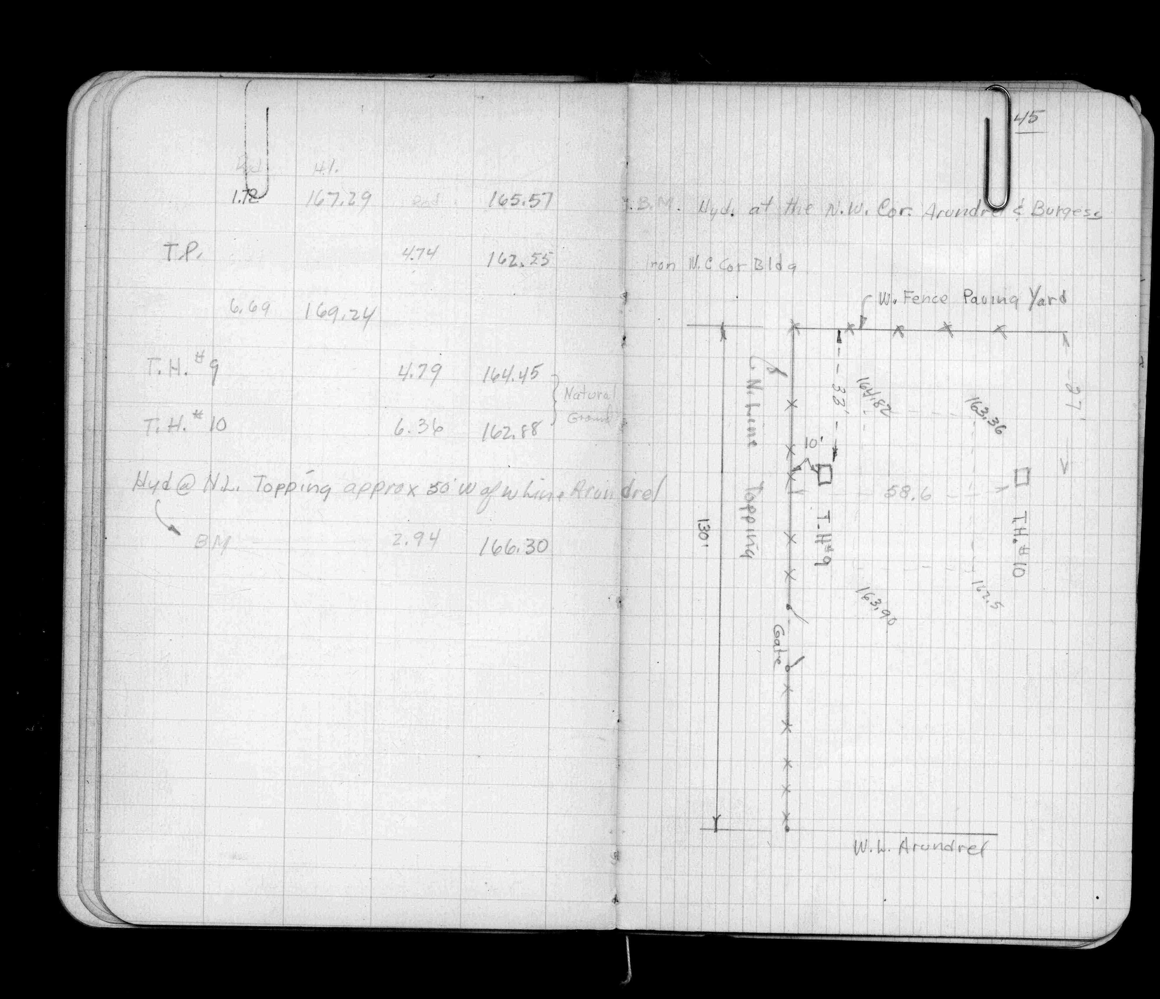
Page(s) 44-46
Asphalt Plant Metal Bldg bounded by Arundel & Topping Sts & W Fence
| Proposed Locations | 0000-00-00
44
45
Page(s) 47-49
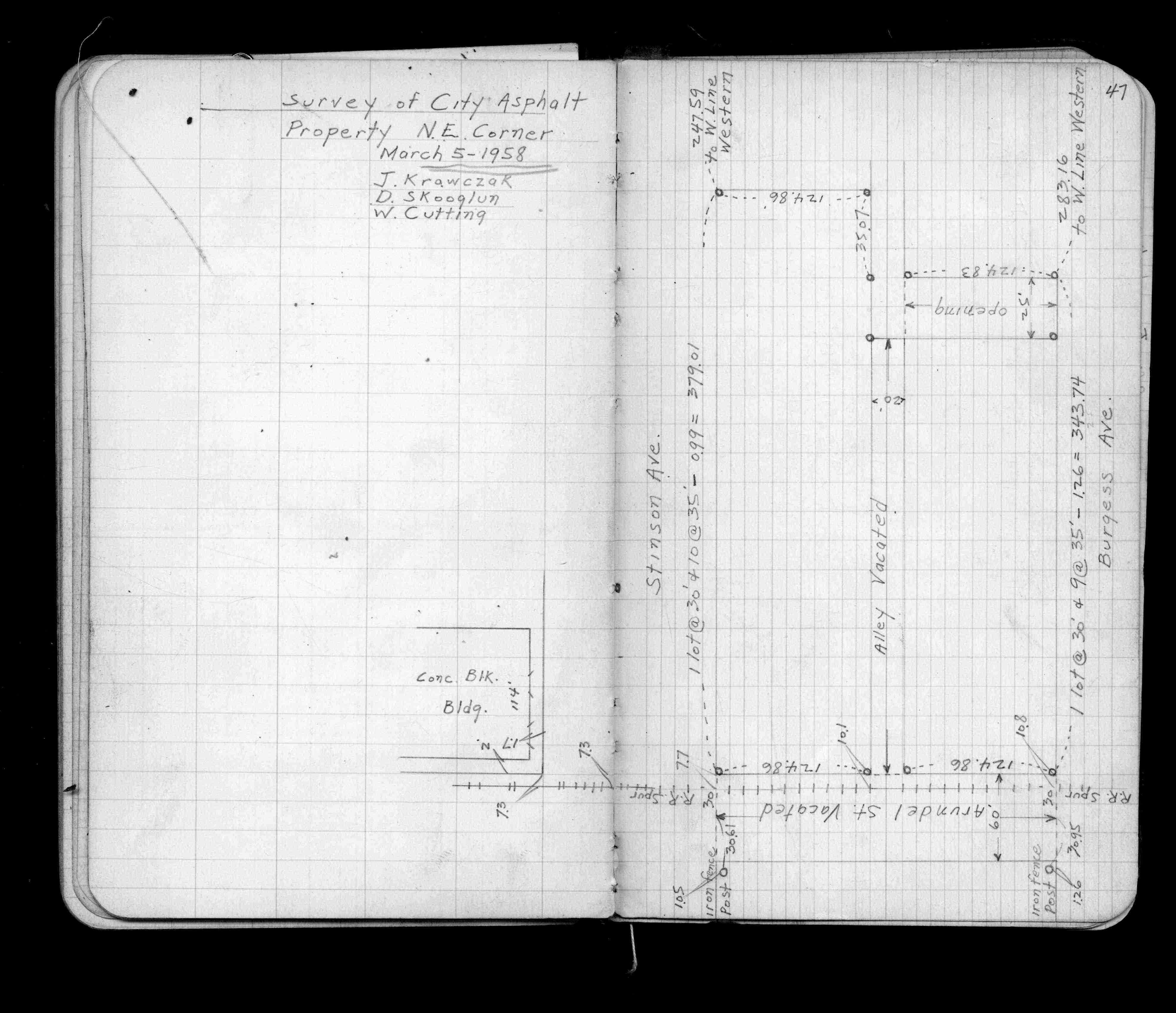
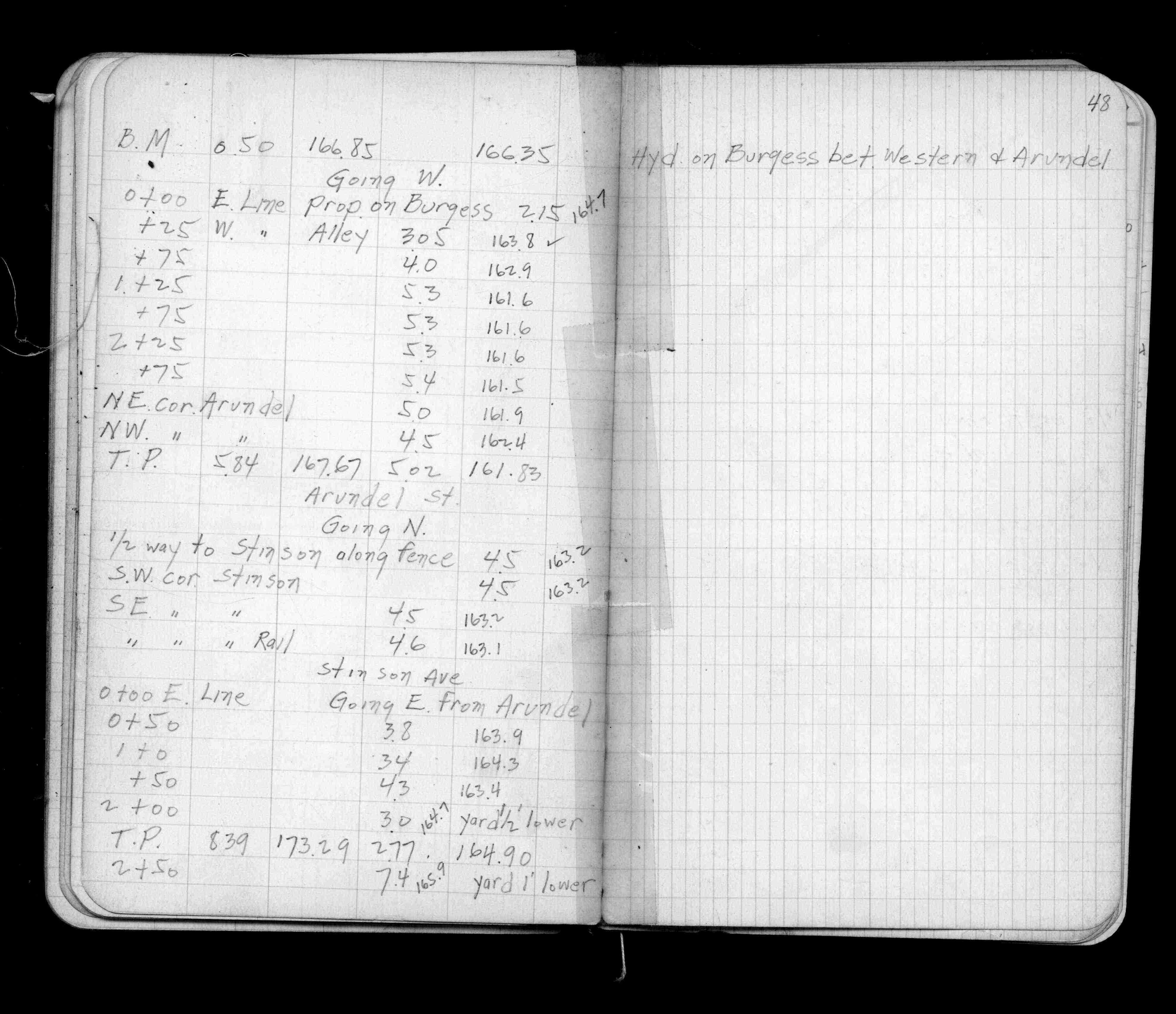
NE Cor City Asphalt Property bounded by Arundel St (vacated) - Stinson Ave (St)-Burgess St
| Locations & Levels | 1958-03-05
47
48
49
Page(s) 50-51
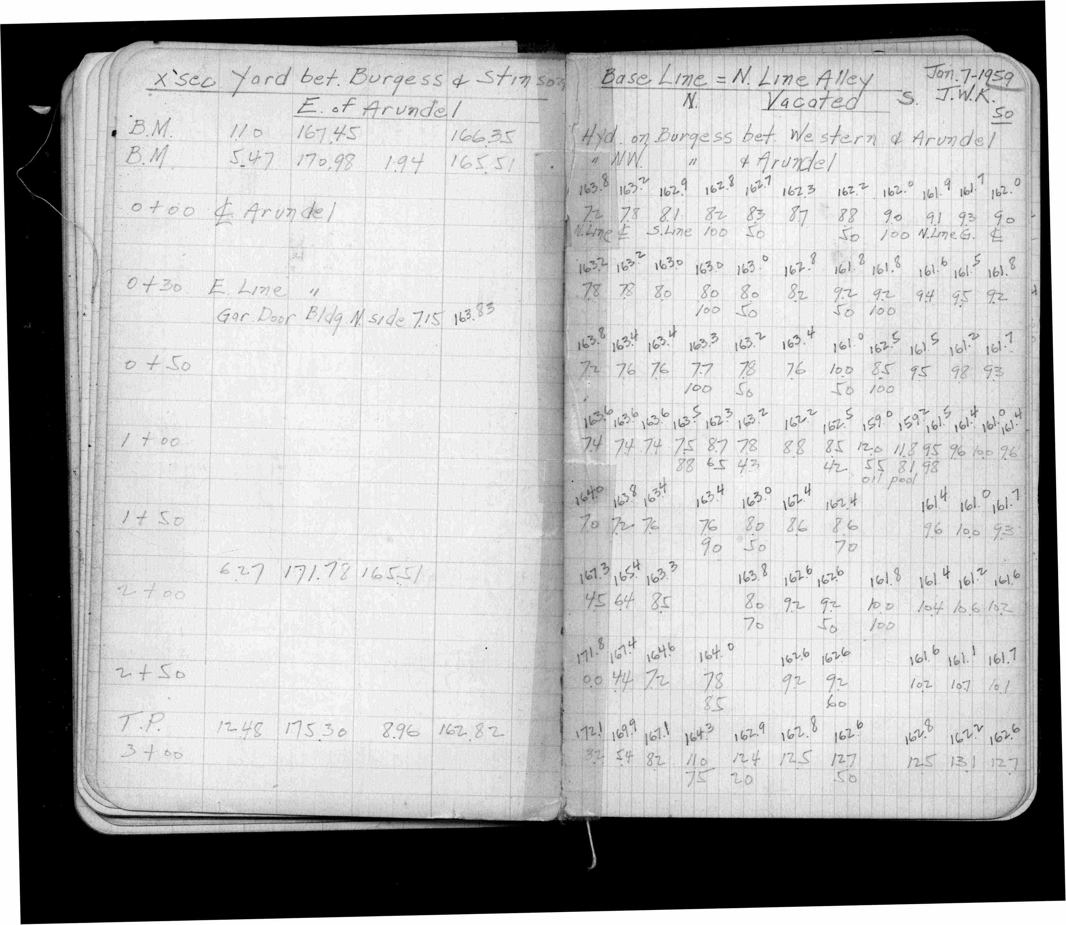
Asphalt Plant Yard E of Arundel
FROM
Burgess St
TO
Stinson Ave (St)
| Cross Sections | 1959-01-07
50
51
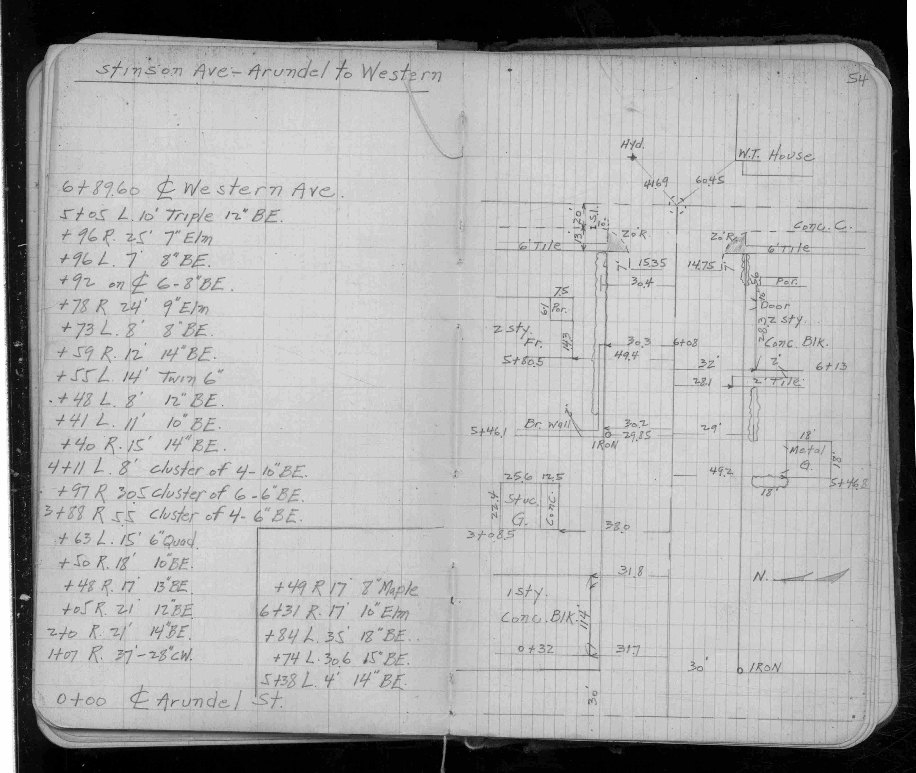
Page(s) 51-54
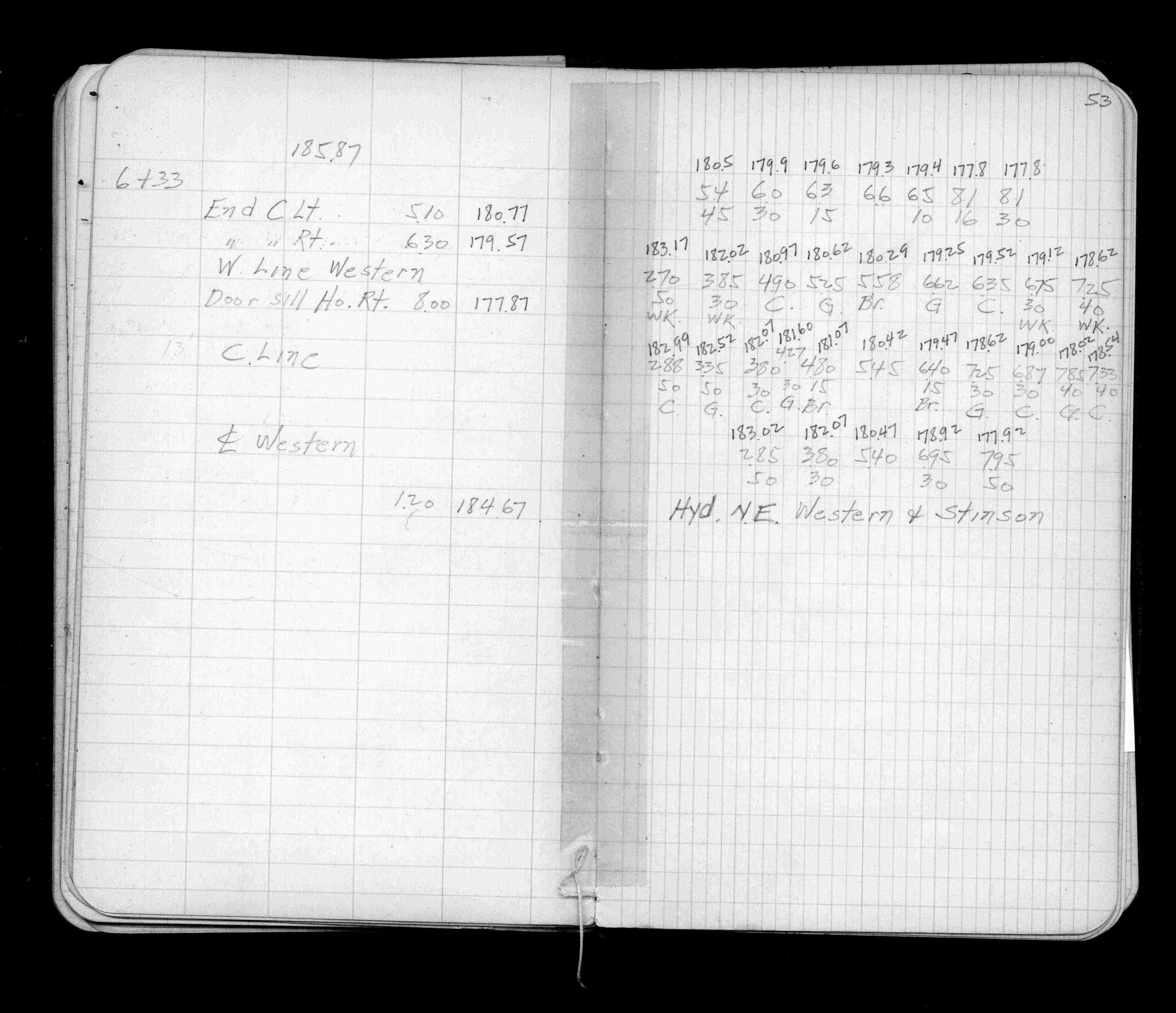
Stinson Ave (St)
FROM
Arundel St
TO
Western Ave
| X-Secs & Locations | 0000-00-00
51
52
53
54
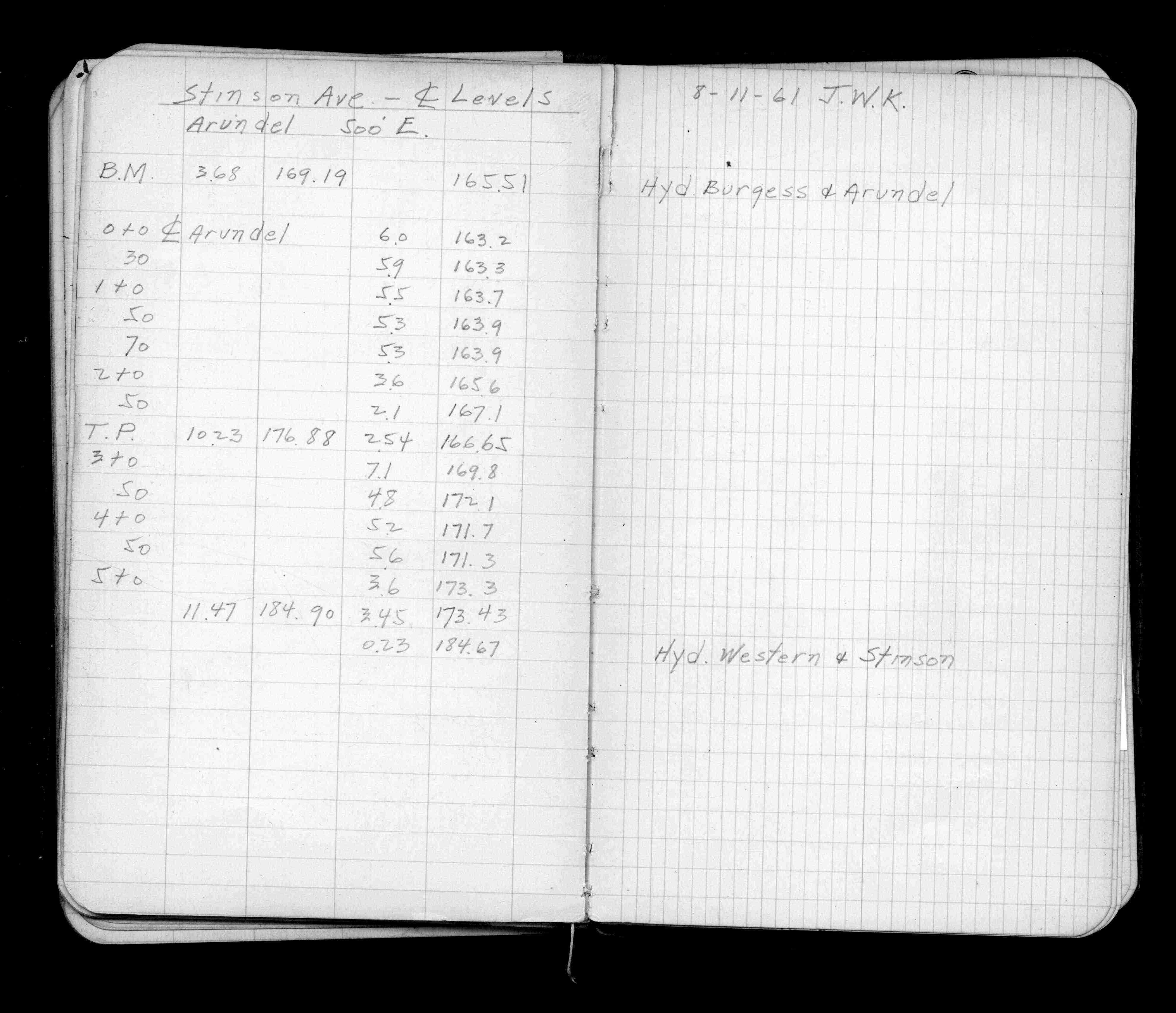
Page(s) 55
Stinson Ave (St)
FROM
Arundel St
TO
500 ft east
| Center Line Levels | 1961-08-11
55
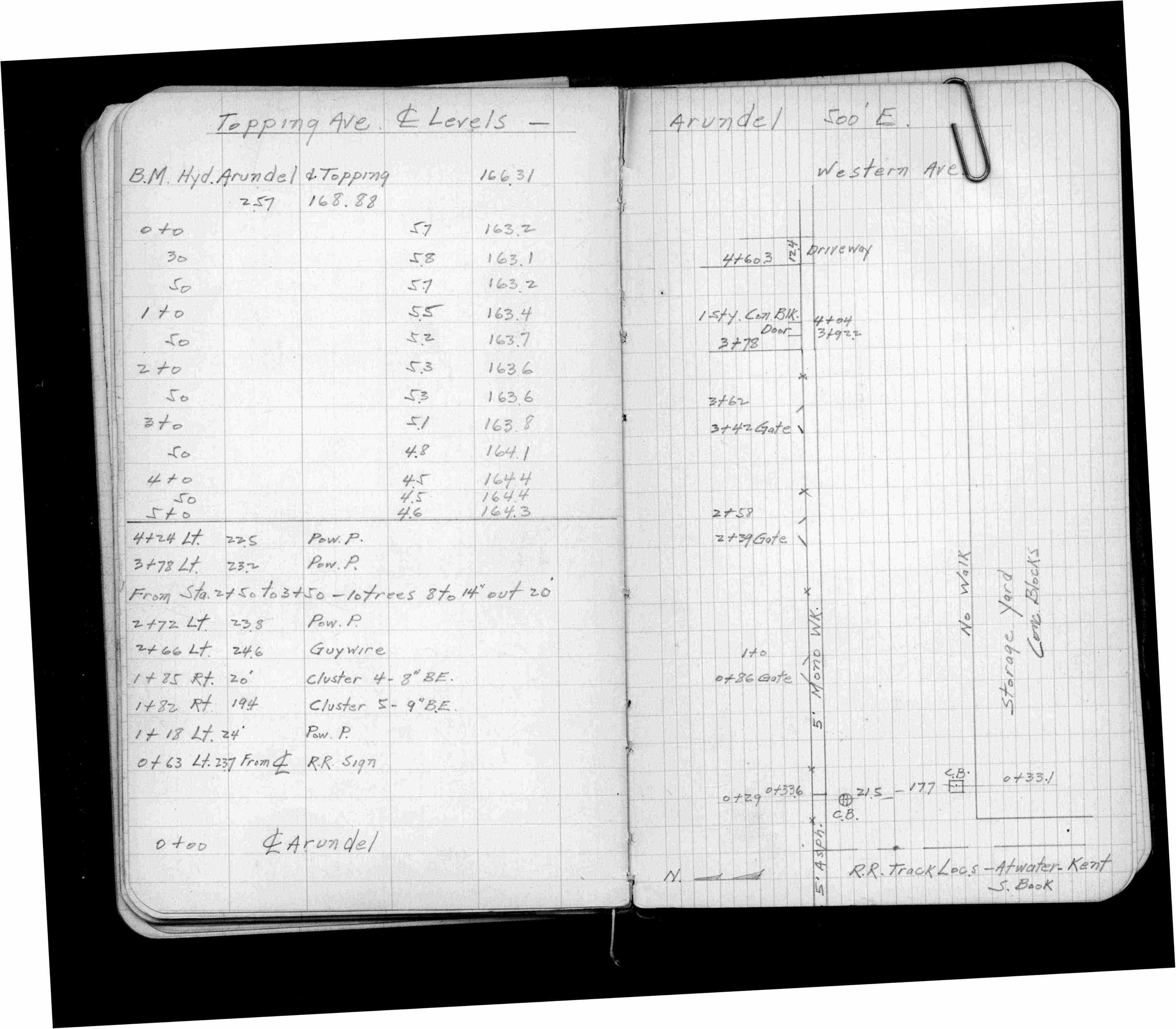
Page(s) 56
Topping Ave
FROM
Arundel St
TO
500 ft east
| Center Line Levels | 0000-00-00
56
Page(s) 57
Blank page
| Blank | 0000-00-00
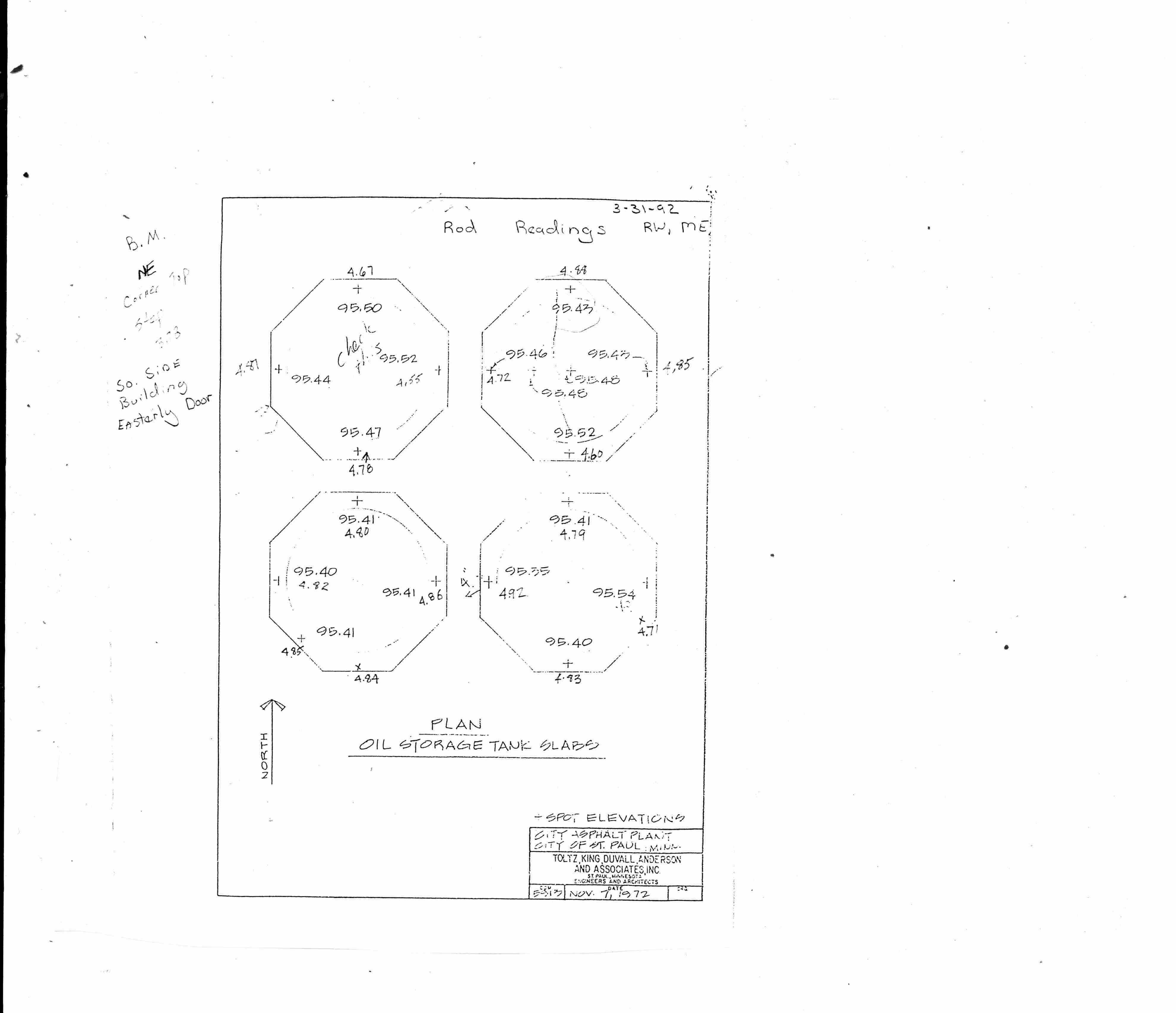
Page(s) 58
City Asphalt Plant
FROM
Oil Storage Tank Slabs
| | 1972-11-07
58
Page(s) 59-END
Blank pages
| Blank | 0000-00-00