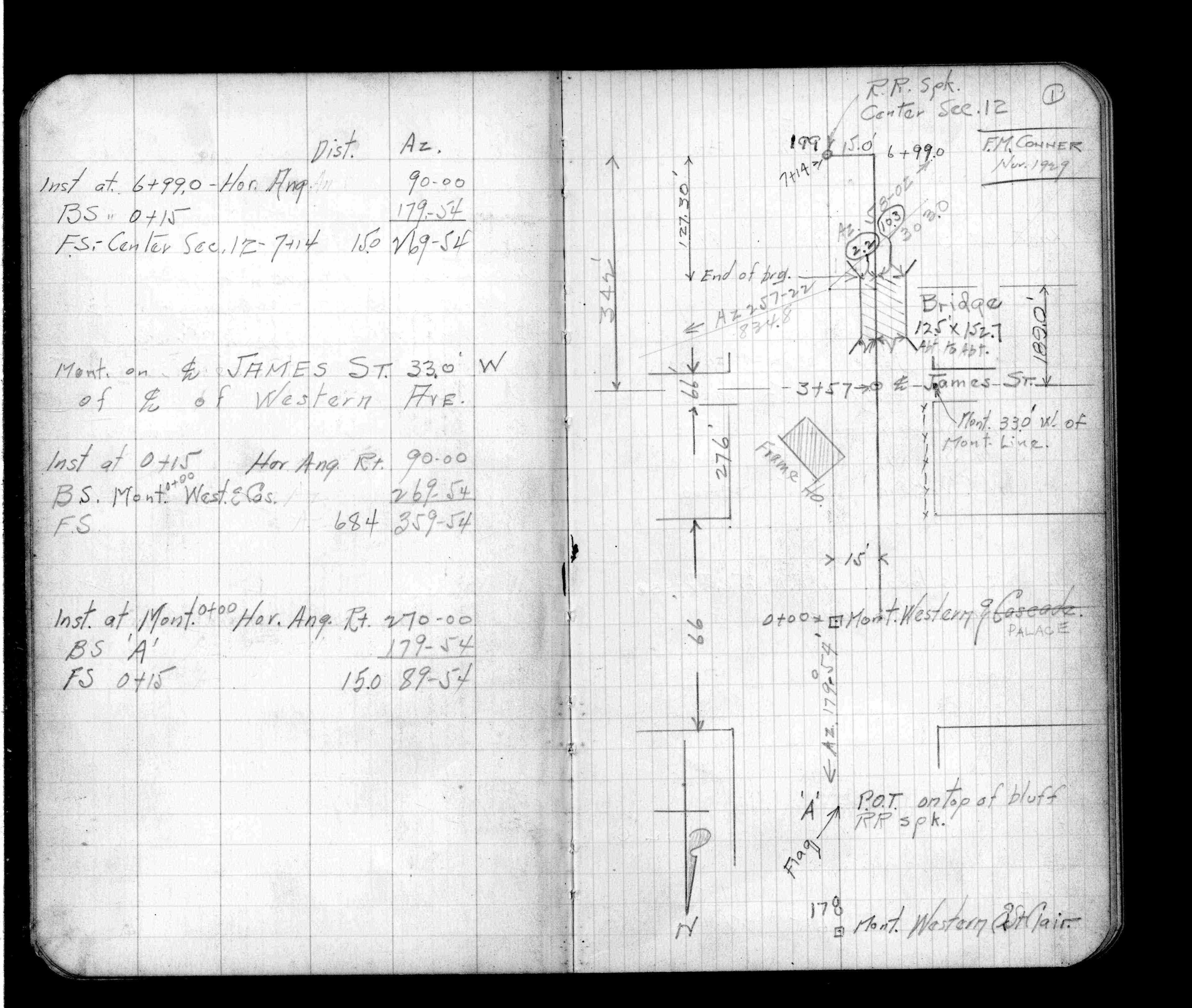
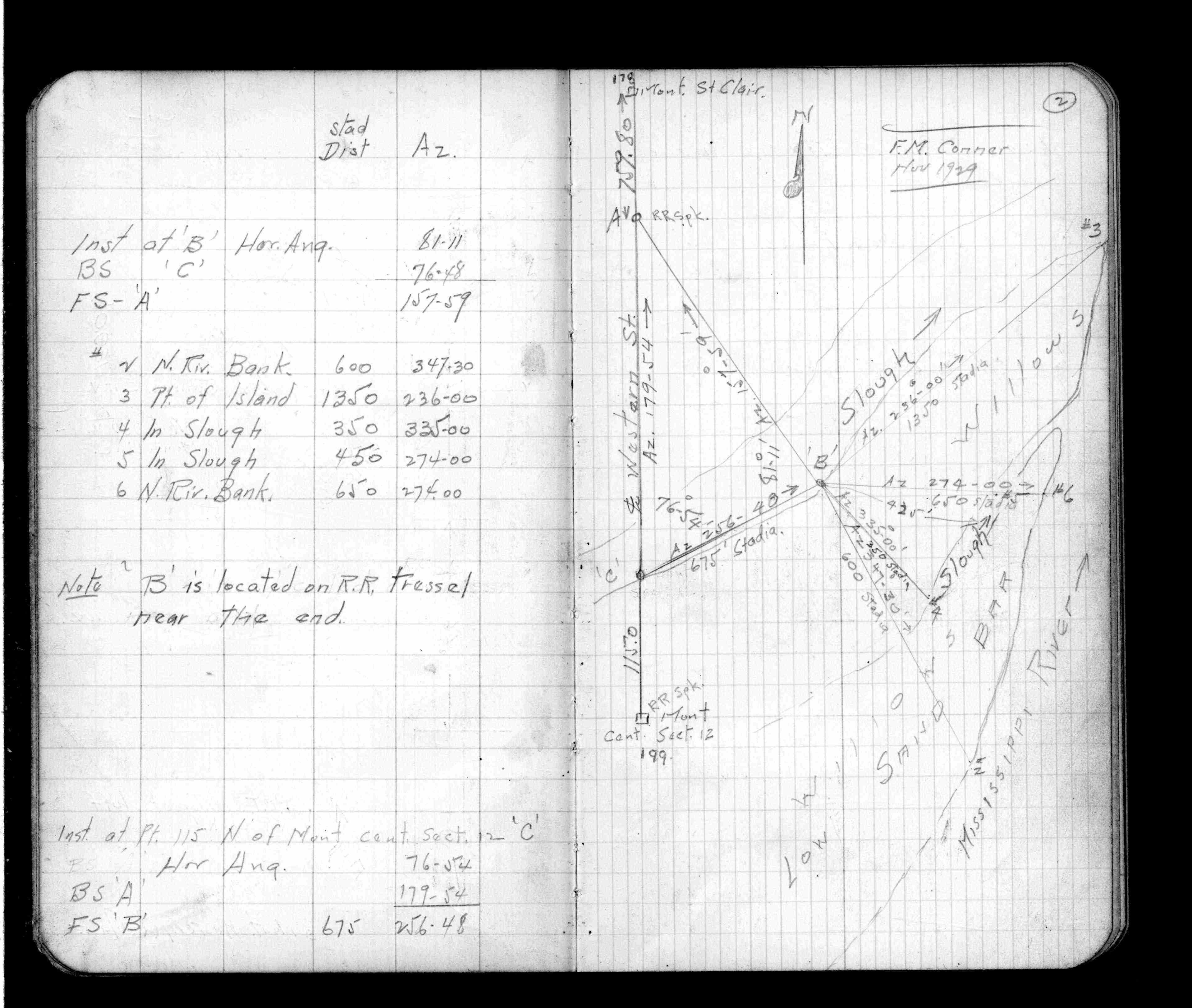
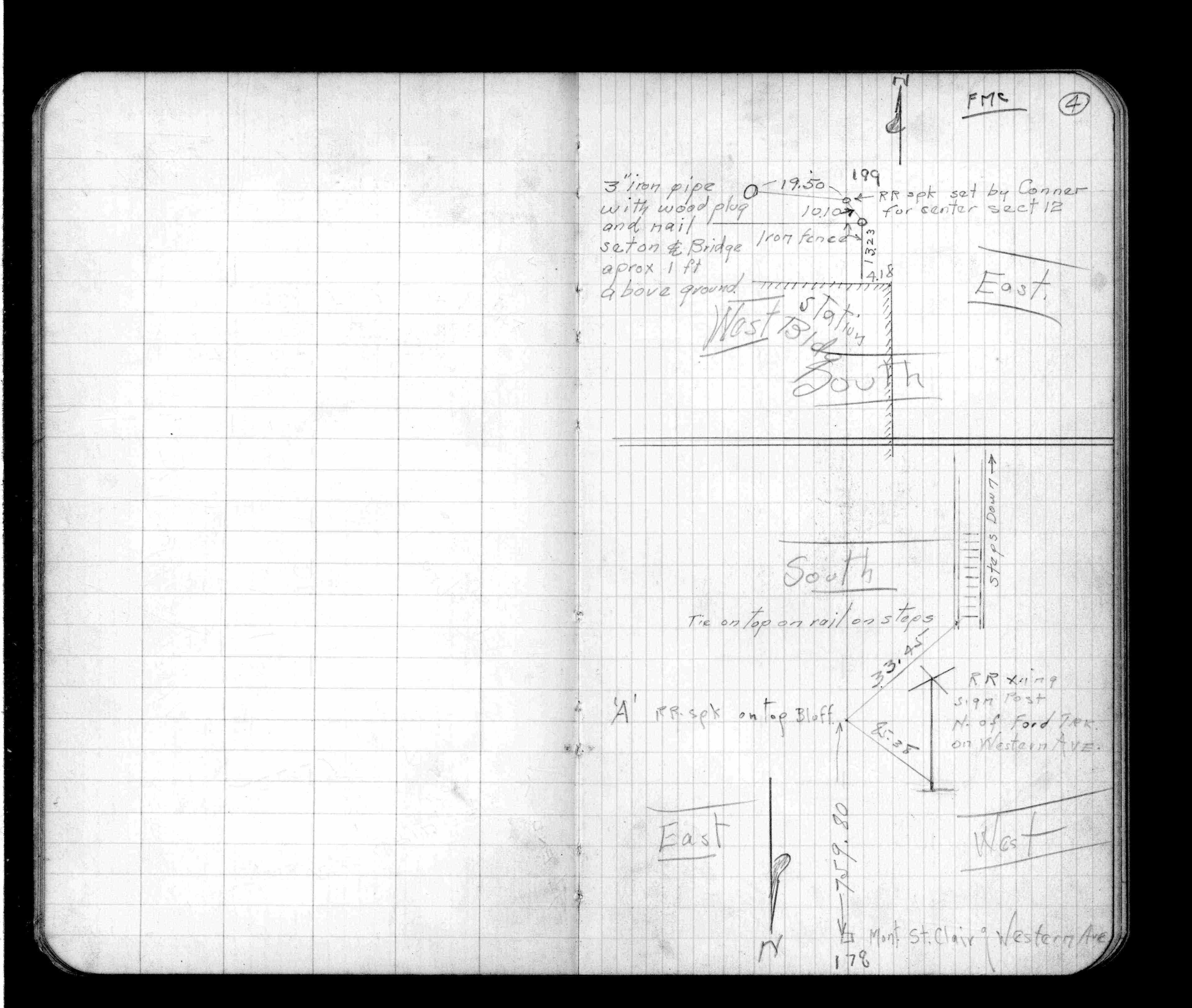
Page(s) 1-4
Western Ave Cen Line & NSP Land Near Center Section 12
| Locations | 1929-11-00
1
2
3
4
Page(s) 5
Como Pk & Maryland Ave
| Blank | 1929-12-00
5
Page(s) 6
Anoka Cut-Off
FROM
Como Ave
TO
Larpententeur Ave
| Como Park School Loc | 0000-00-00
6
Page(s) 7
Area bounded by Hoyt & Nebraska Aves & Adams (Milton) St & Quincy (Victoria) St
| Bldg Locations | 0000-00-00
7
Page(s) 8-15
Como Area
FROM
Como Ave & Front St (Ave)
TO
Lexington Pkwy &Larpenteur Ave
| Monument Locations | 0000-00-00
8
9
10
11
12
13
14
15
Page(s) 16
Blank Page
FROM
Blank
TO
Blank
| Blank | 0000-00-00
Page(s) 17
Como Ave
FROM
Maryland Ave
TO
Grotto St
| TPs & BMs | 0000-00-00
17
Page(s) 18-25
Western Ave
FROM
Como Ave
TO
Maryland Ave
| Cross Sections | 0000-00-00
18
19
20
21
22
23
24
25
Page(s) 26-29
Western Ave (Produced)
FROM
Maryland Ave
TO
Carbon St (Orange Ave)
| Cross Sections | 0000-00-00
26
27
28
29
Page(s) 30-31
Western Ave
FROM
Como Ave
TO
Maryland Ave
| Bldg Locations | 0000-00-00
30
31
Page(s) 32
Blank Page
FROM
Blank
TO
Blank
| Blank | 0000-00-00
Page(s) 33-34
VanSlyke Ave
FROM
Chatsworth St
TO
Argyle St
| Bldg Locs & X-Secs | 1929-12-00
33
34
Page(s) 35-37
Juno St
FROM
View St
TO
W Seventh (7th) St
| Locs & Elevations | 1929-12-00
35
36
37
Page(s) 38
Bay & W Seventh (7th) St
| Ties to Iron Pipe | 1929-12-00
38
Page(s) 39
Pascal St & Midway Pkwy
FROM
Lyngblomsten Home for the Aged
| Location & Elevs | 1929-12-00
39
Page(s) 40
Area bounded by Fry St & Shields & Universtiy Aves & 20 ft Alley (Homer H Hoyts Cos Add
| Bldg Locations | 1929-12-00
40
Page(s) 41
Clarks Sub EW Alley B32
FROM
Arlington Hills Add
TO
York St (Ave)
| Bldg Locations | 1929-12-00
41
Page(s) 42
Decatur St (Payne Ave)
FROM
Irvines 2nd Add L6 B6
| Bldg Locations | 1929-12-00
42
Page(s) 43-44
Beaumont St
FROM
Irvines 2nd Add B7
| Bldg Locations | 1929-12-00
43
44
Page(s) 45
Preble St
FROM
Beaumont
TO
Irvines 2nd Add B7
| Bldg Locations | 1929-12-00
45
Page(s) 46-54
Anoka Cut-Off
FROM
Grotto St & South St (Ivy Ave)
TO
Lexington Pkwy & Larpenter Ave
| Cross Sections | 1930-03-12
46
47
48
49
50
51
52
53
54
Page(s) 55
Blank Page
FROM
Blank
TO
Blank
| Blank | 0000-00-00
Page(s) 56
Anoka Cutoff
FROM
South St (Ivy Ave)
TO
Larpenteur Ave
| Locations | 0000-00-00
56
Page(s) 57
Arlington Ave & Osage St
| Locations | 0000-00-00
57
Page(s) 58-62
Anoka Cut-Off
FROM
Lk Como/Phalen (Arlington) Ave
| Locations | 1930-04-16
58
59
60
61
62
Page(s) 63
Blank Page
FROM
Blank
TO
Blank
| Blank | 0000-00-00
Page(s) 64-68
Harriet Island Approach
FROM
Wabasha St
| Locations | 0000-00-00
64
65
66
67
68
Page(s) 69
Moses St (Vacated)
FROM
So Channel of Mississippi River
| Sewer Elevations | 1930-01-05
69
Page(s) 70
200 ft east of Walter St
FROM
So Channel of Mississippi River
| Elev Over Fill | 1930-01-05
70
Page(s) 71
200 ft east of Wabasha St Bridge
FROM
Road Across So Channel Miss River
| Road Elevation | 1930-01-05
71
Page(s) 72-73
Ontario St (Produced)
FROM
South Bank Mississippi River
TO
N Bank Mississippi River
| River Channel | 1931-01-09
72
73
Page(s) 74-75
Ninth (9th) St
FROM
Wabasha St
TO
St Peter St
| Bldg Locations | 1932-01-28
74
75
Page(s) 76-77
Blank Pages
FROM
Blank
TO
Blank
| Blank | 0000-00-00
Page(s) 78
Grotto St & South St(IvyAve)
| BM & Monument Locs | 0000-00-00
78
Page(s) 79
Como Blvd
| Ties | 0000-00-00
Page(s) 80
Calculations
FROM
Calculations
TO
Calculations
| Calculations | 0000-00-00