Page(s) 1
Mississippi River Harbor Line
FROM
Wabasha St
TO
Robert St
| Locations | 1948-08-11
1
Page(s) 2-3
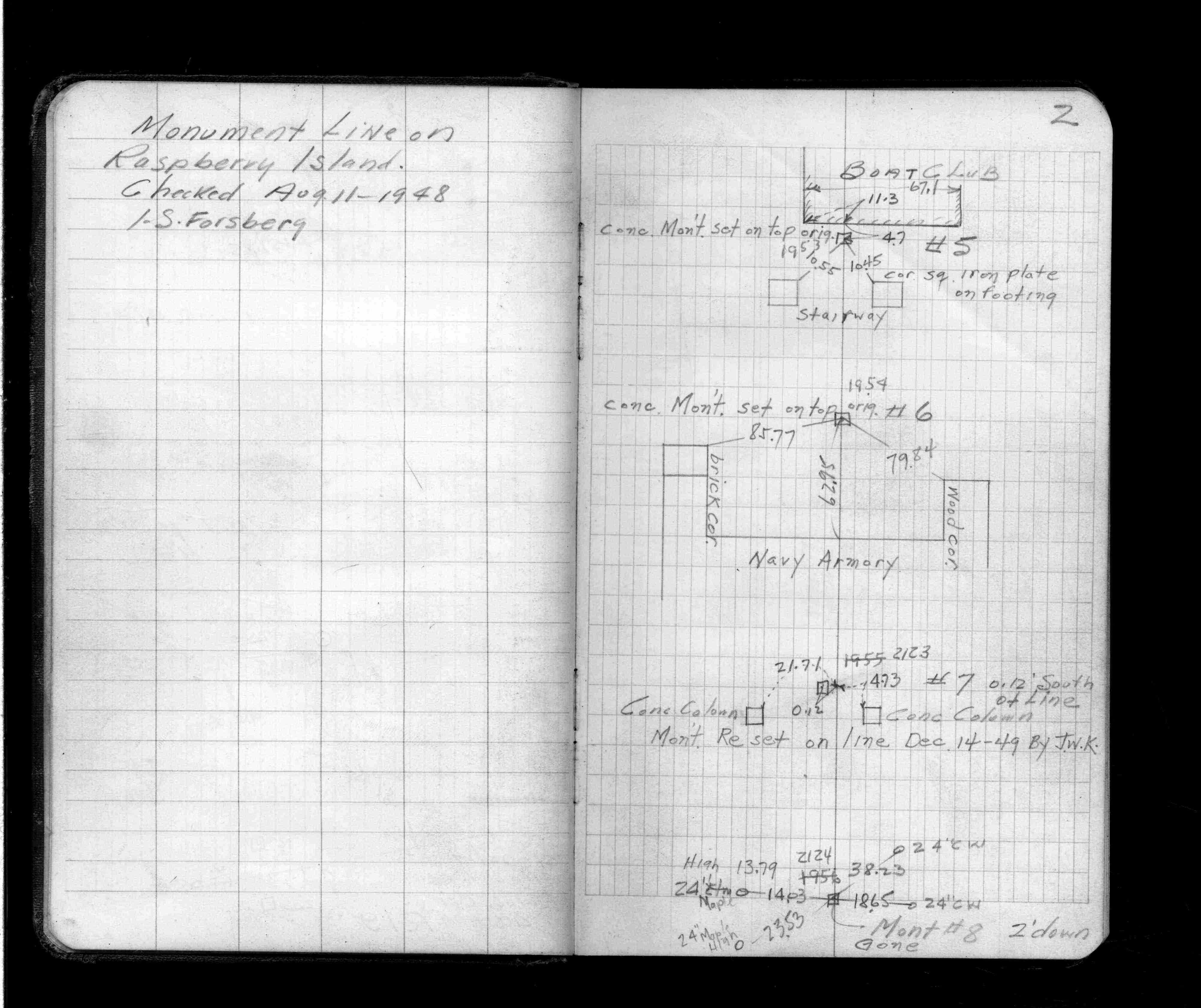
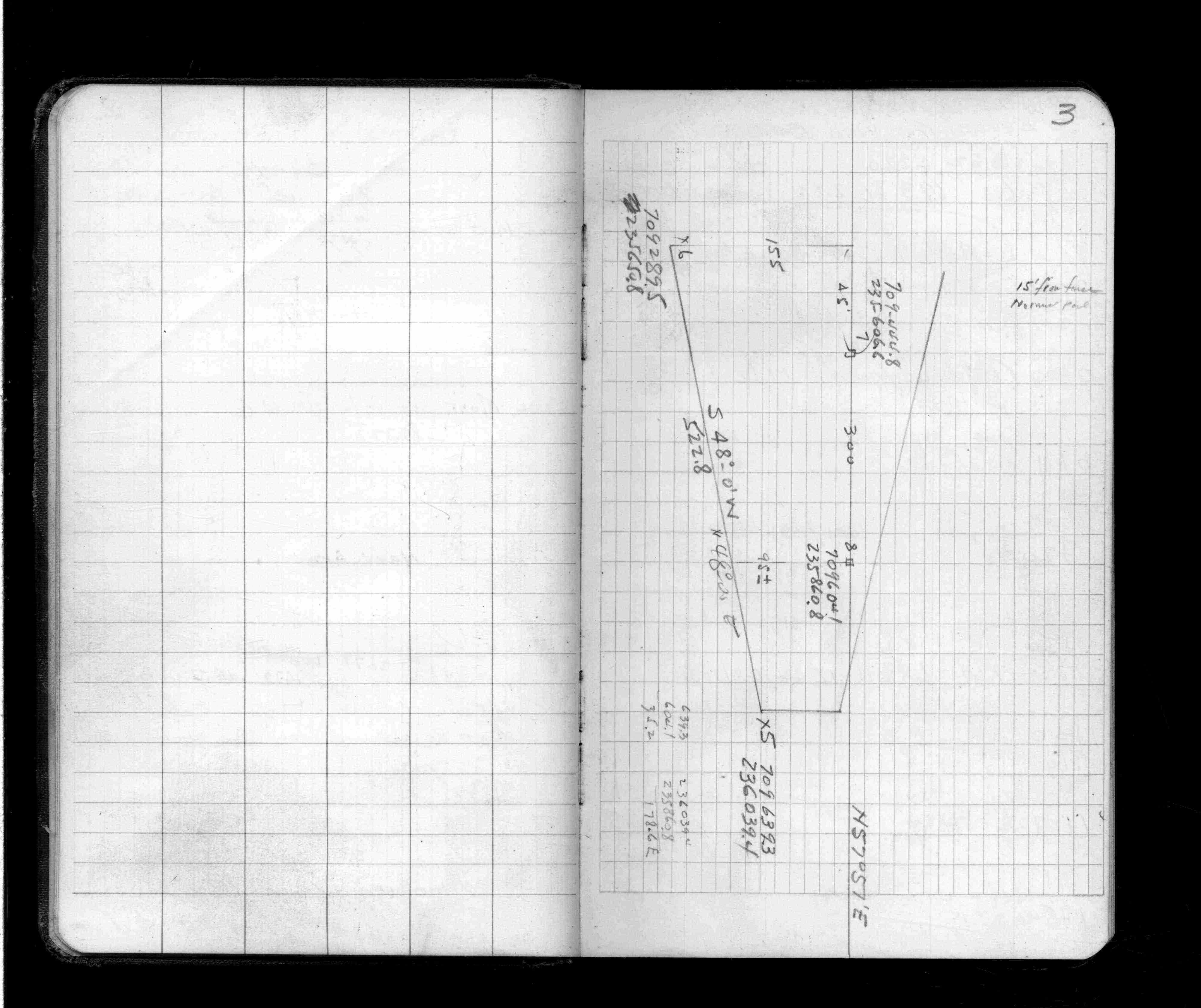
Monument Line on Raspberry Island
FROM
Monument 8
TO
Boat Club
| Locations | 1948-08-11
2
3
Page(s) 4-5
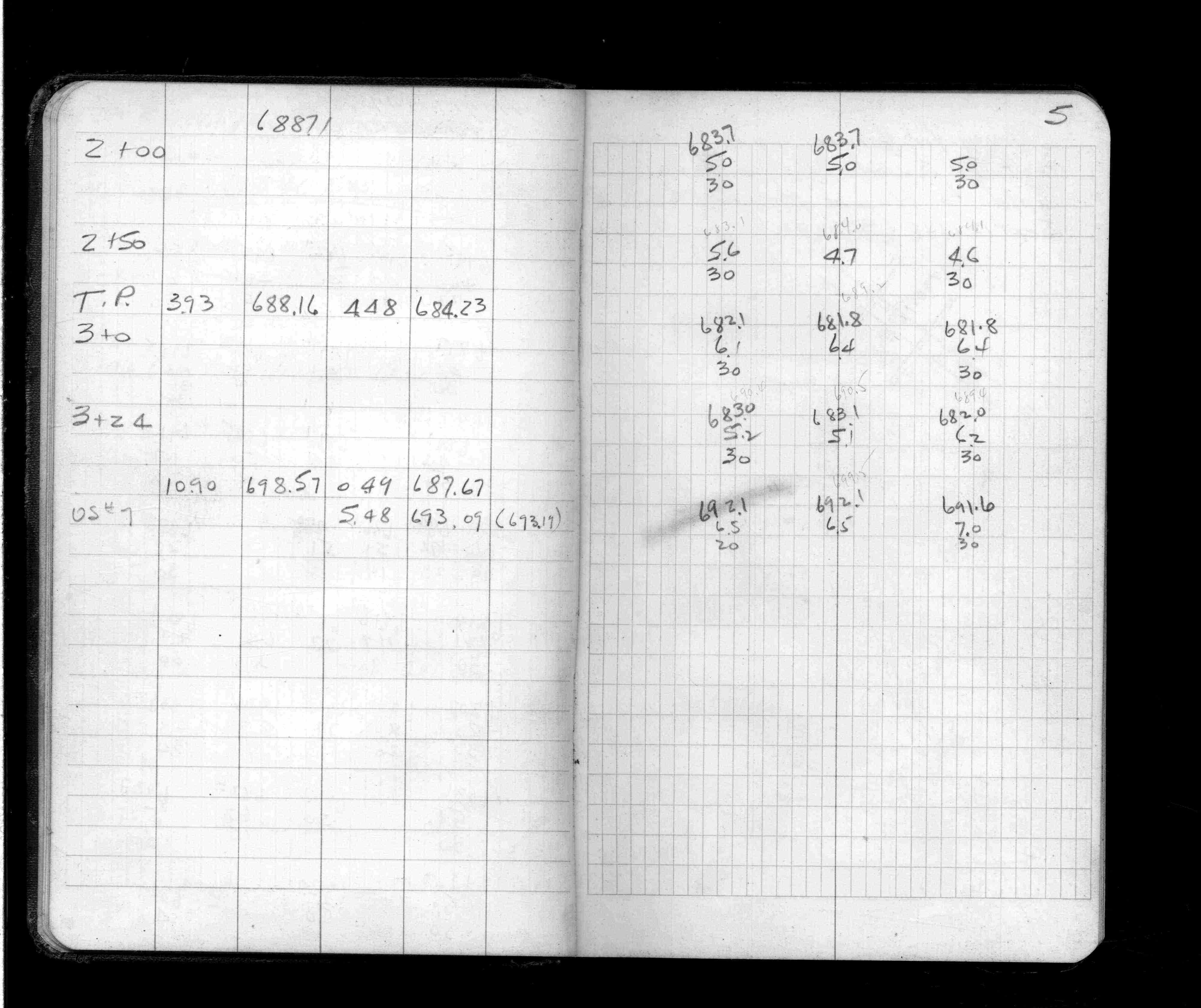
New Ln 50 Ft from Pres Wabasha Br
FROM
Station 0+00 (15 Ft back fr R19)
TO
Station 3+24
| Cross Sections | 1947-08-17
4
5
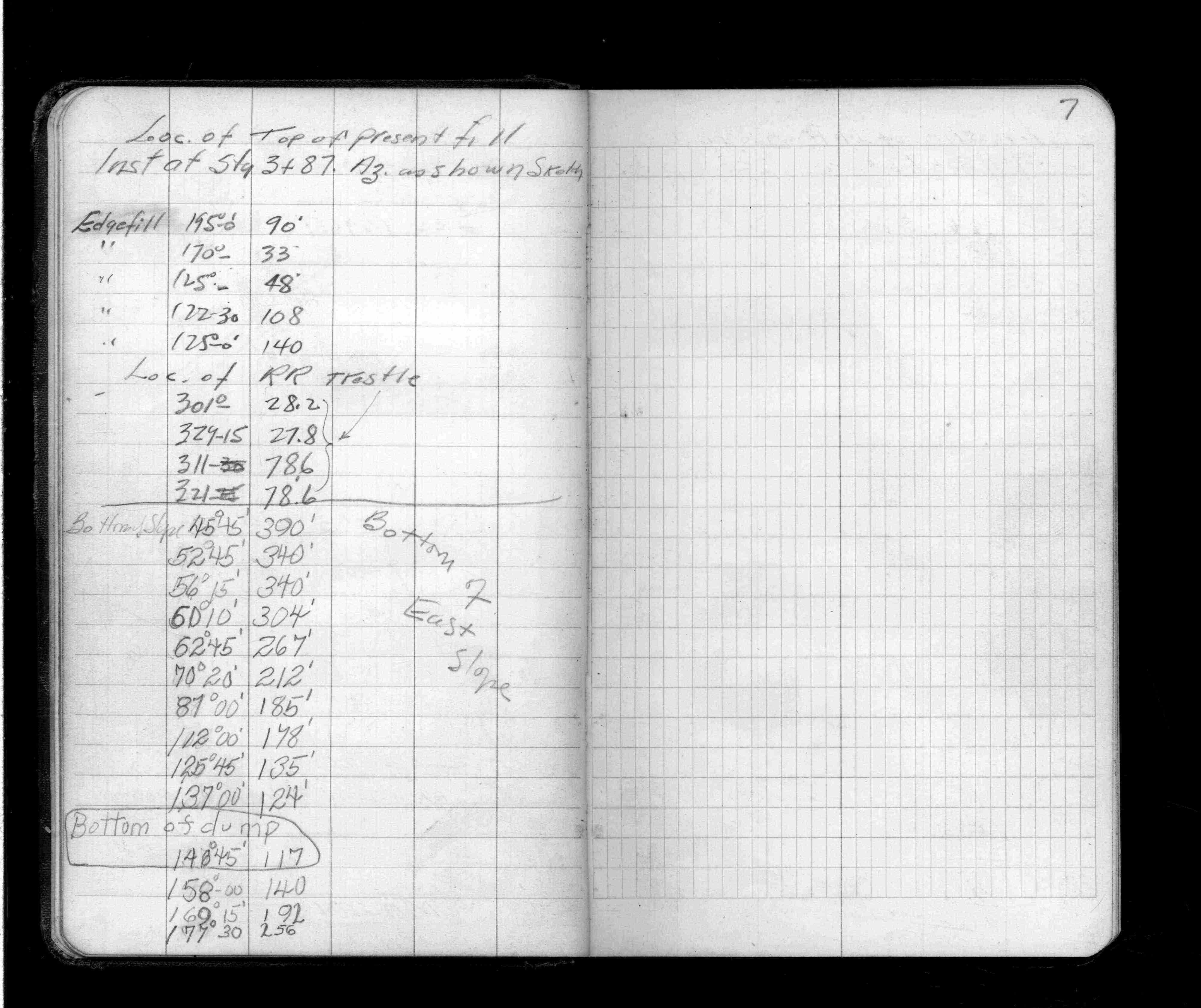
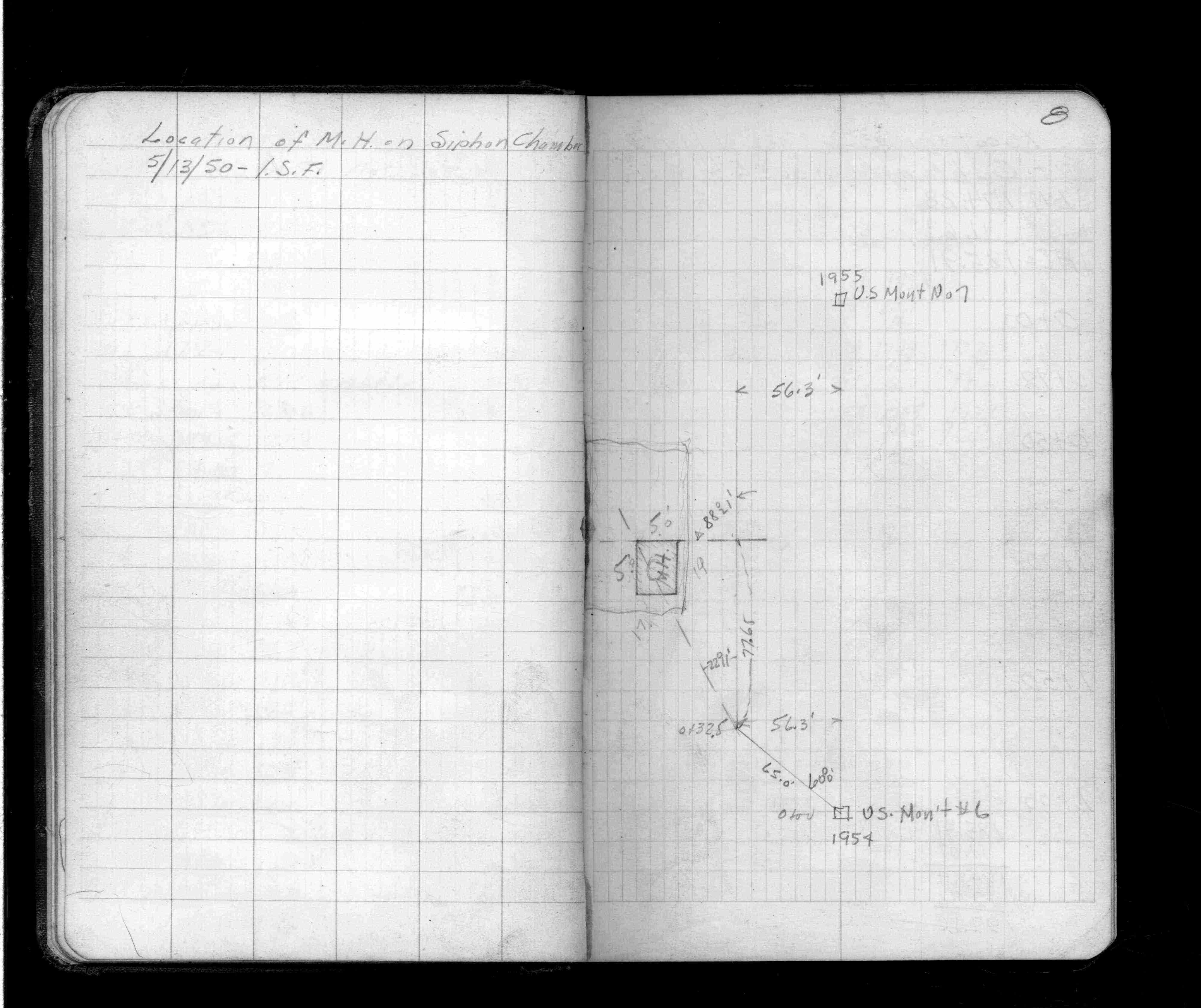
Page(s) 6-8
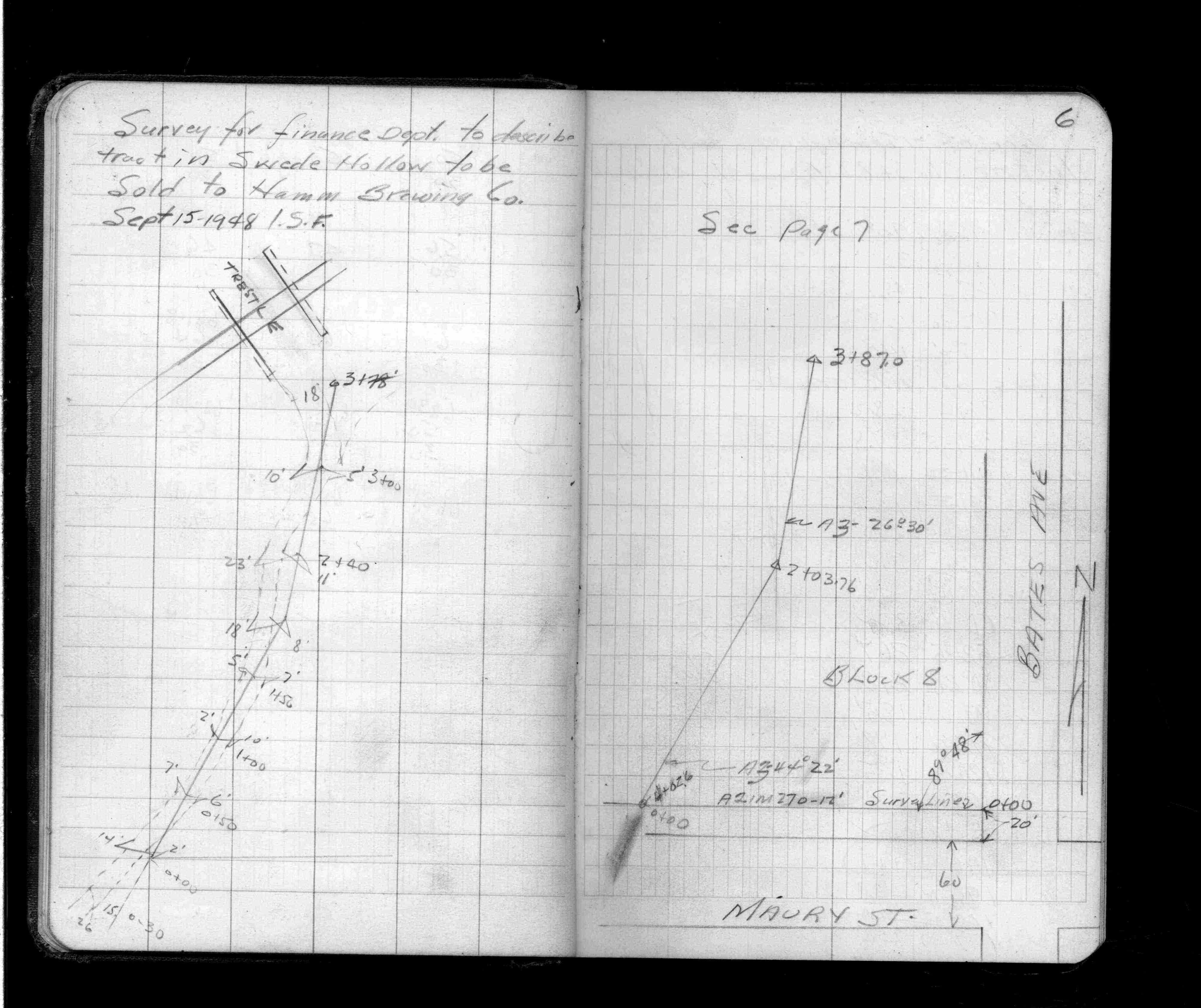
Swede Hollow Tract Sold to Hamms
FROM
Maury St & Bates Ave (Blk 8)
| Locations | 1948-09-15
6
7
8
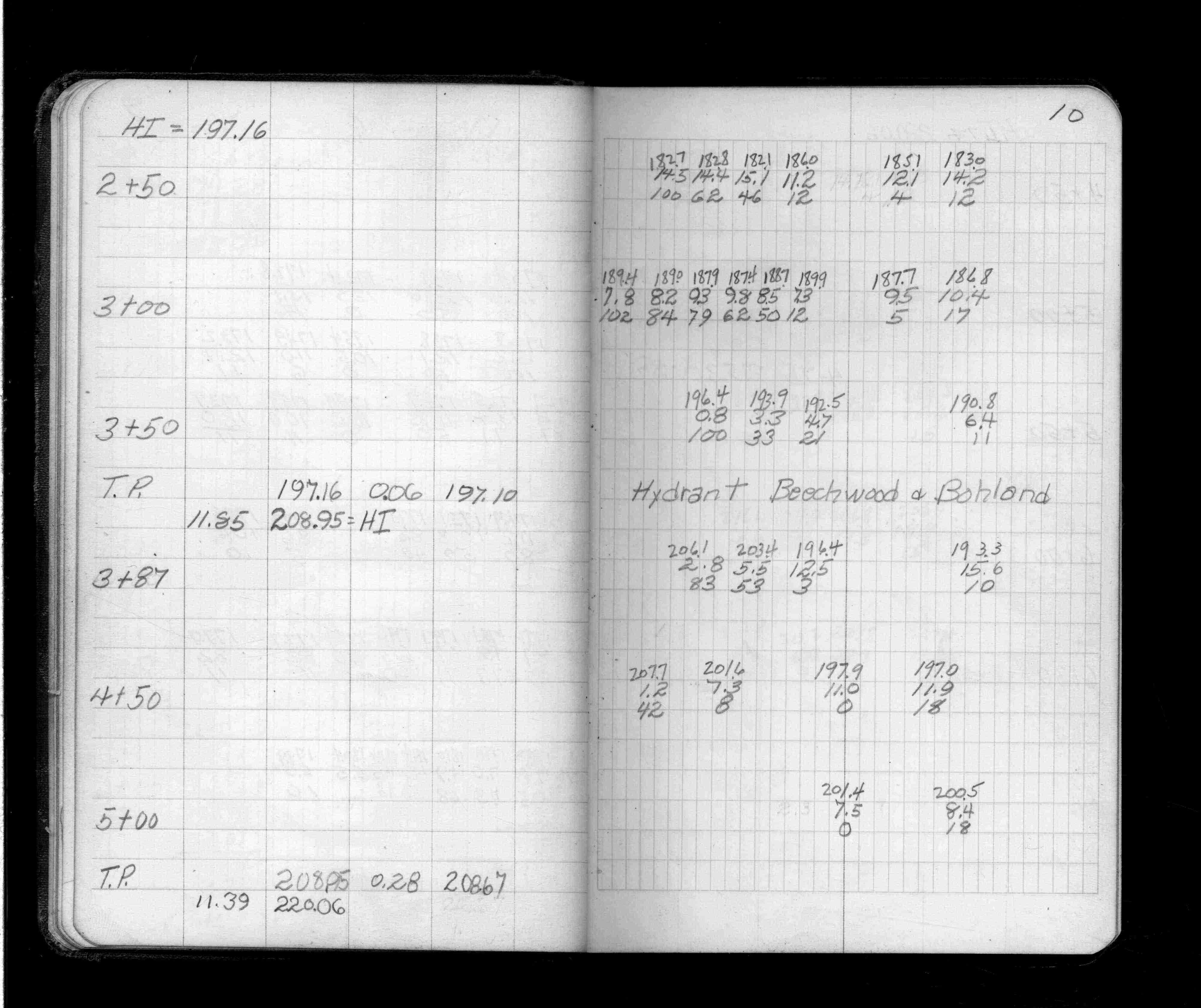
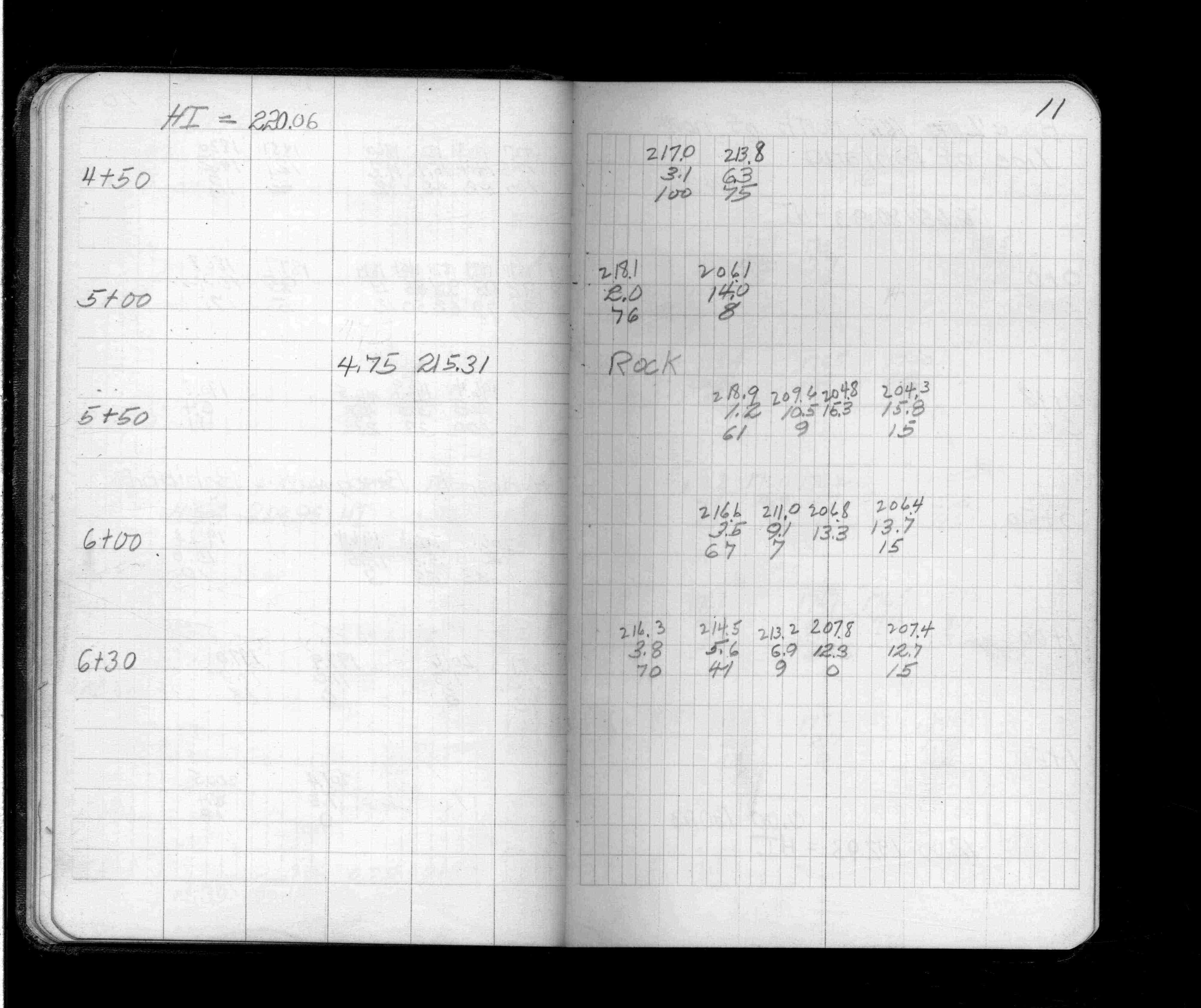
Page(s) 9-11
Line North of Bohland Ave
FROM
Kenneth St
| Cross Sections | 0000-00-00
9
10
11
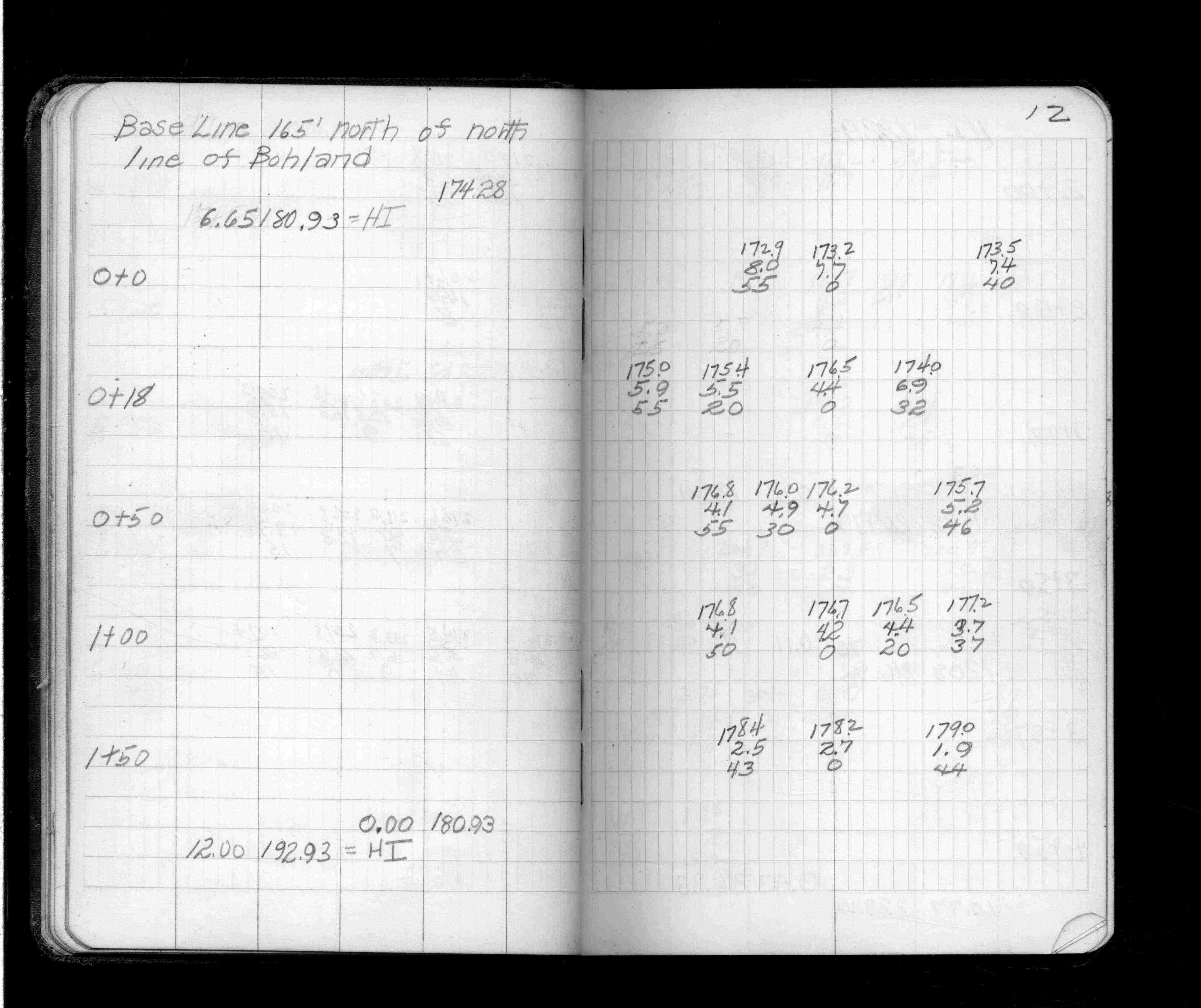
Page(s) 12-14
Line 165 Ft N of Bohland Ave
FROM
Kenneth St
TO
Station 6+30
| Cross Sections | 0000-00-00
12
13
14
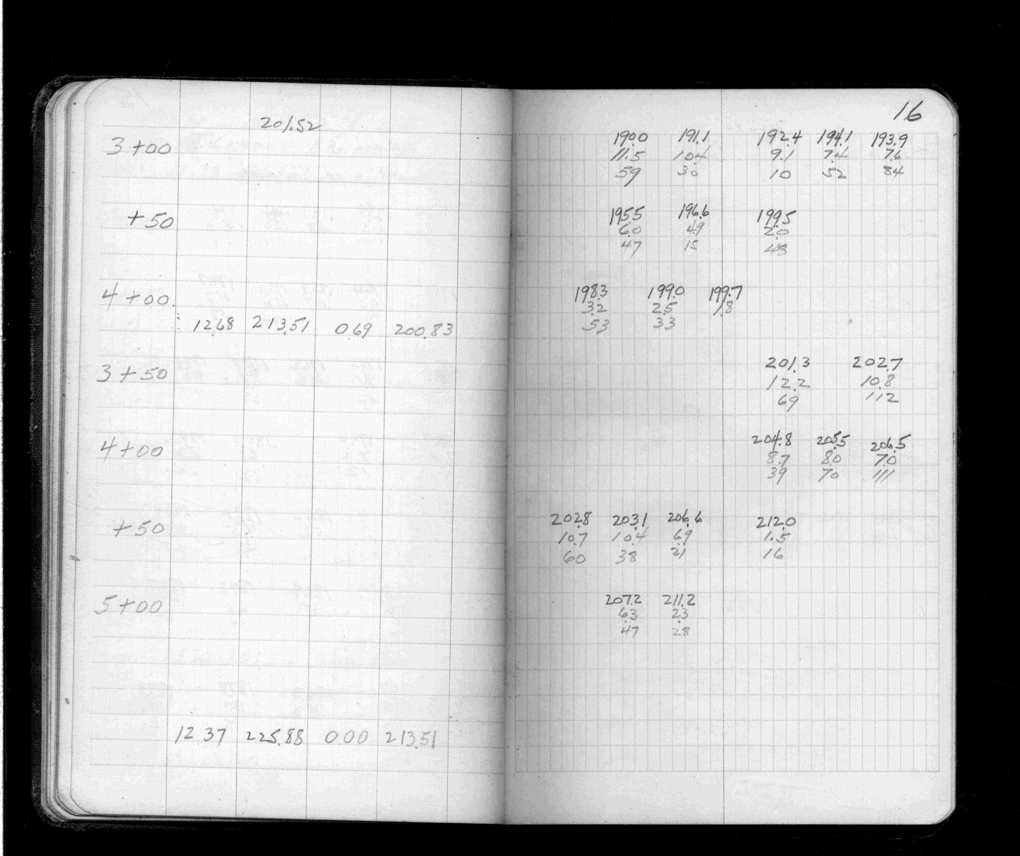
Page(s) 15-17
Line 150 Ft N of Hillcrest Ave
FROM
Kenneth St
| Cross Sections | 0000-00-00
15
16
17
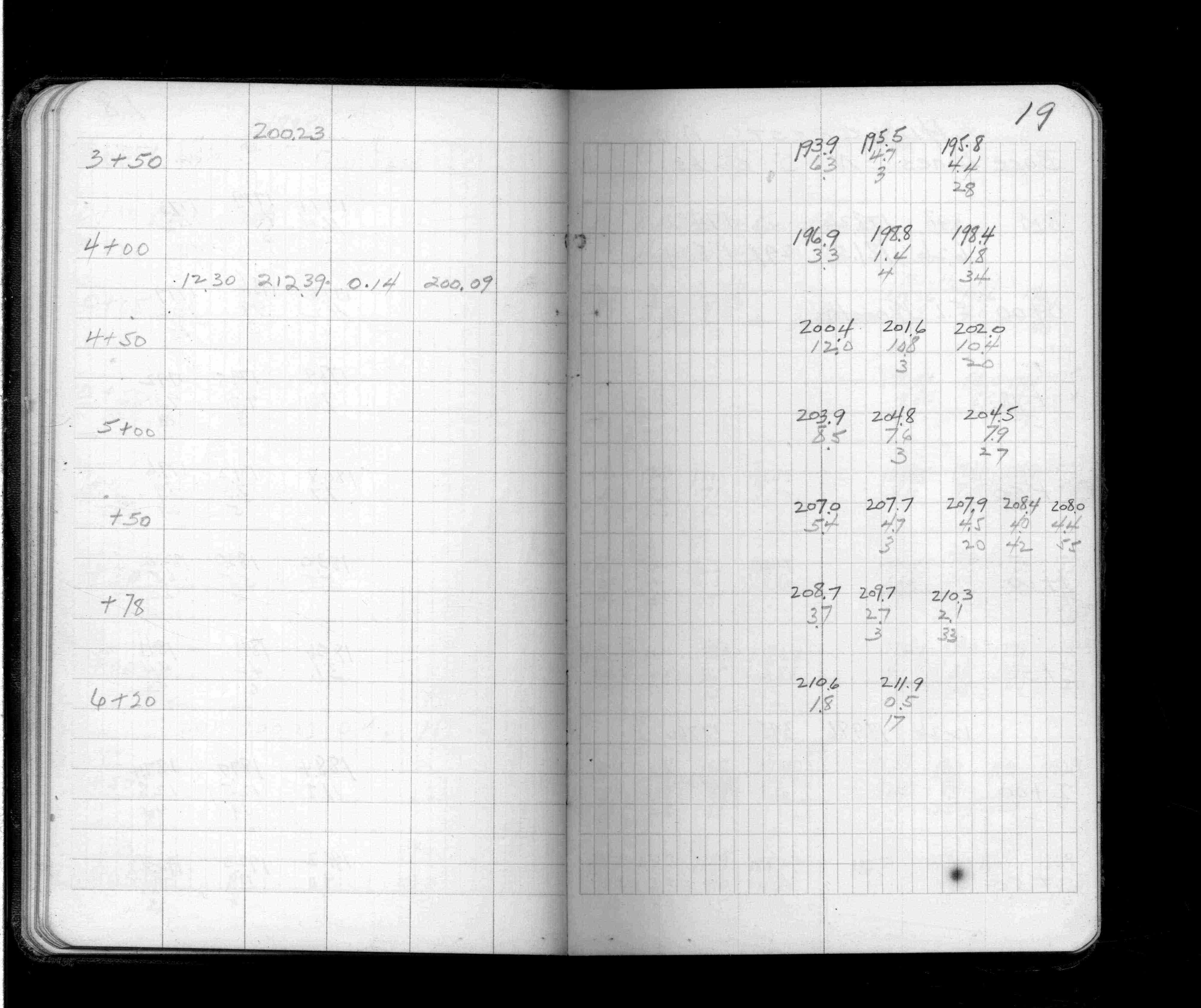
Page(s) 18-19
S Line Ford Road (Parkway)
FROM
Kenneth St
TO
Station 6+20
| Cross Sections | 0000-00-00
18
19
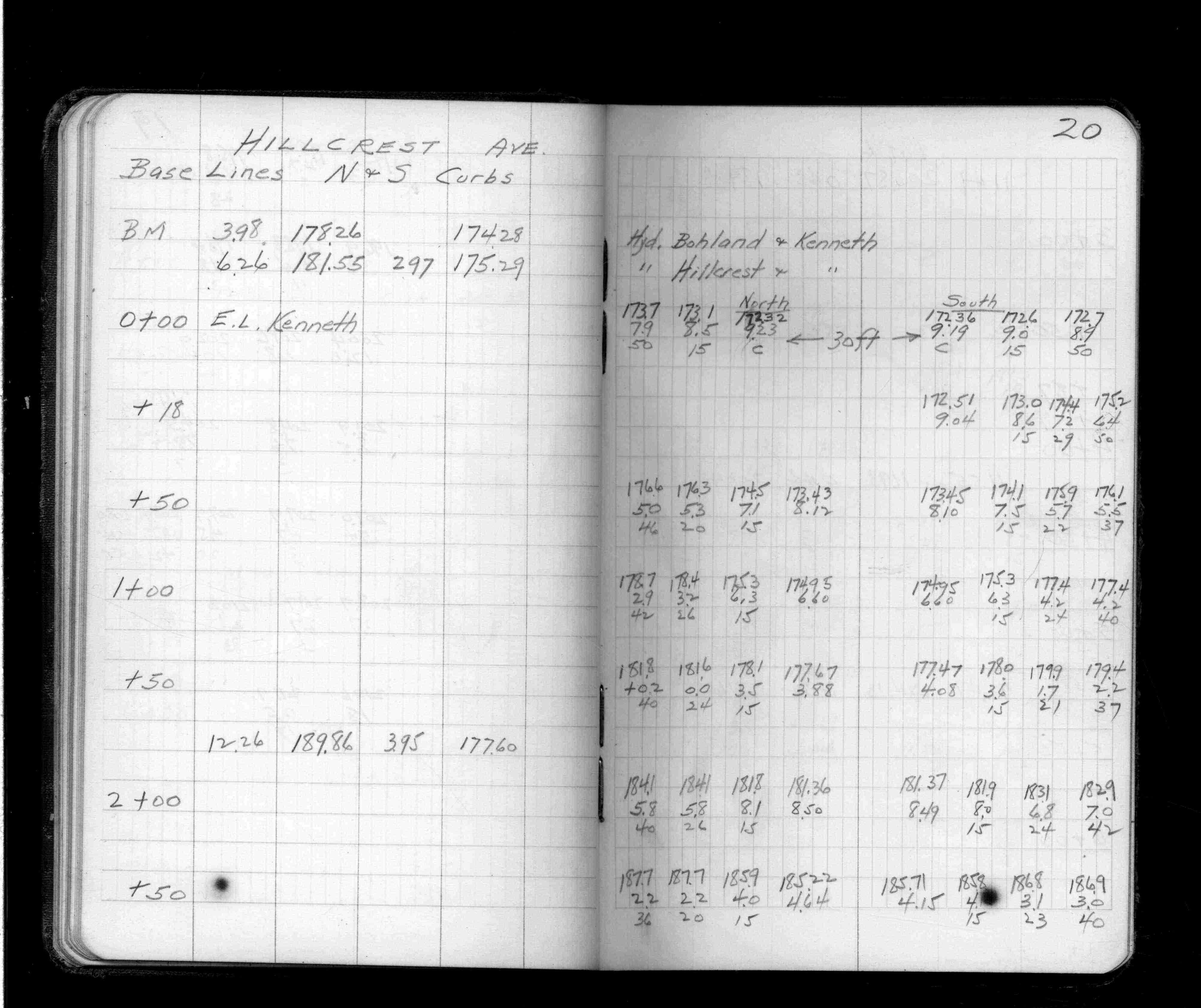
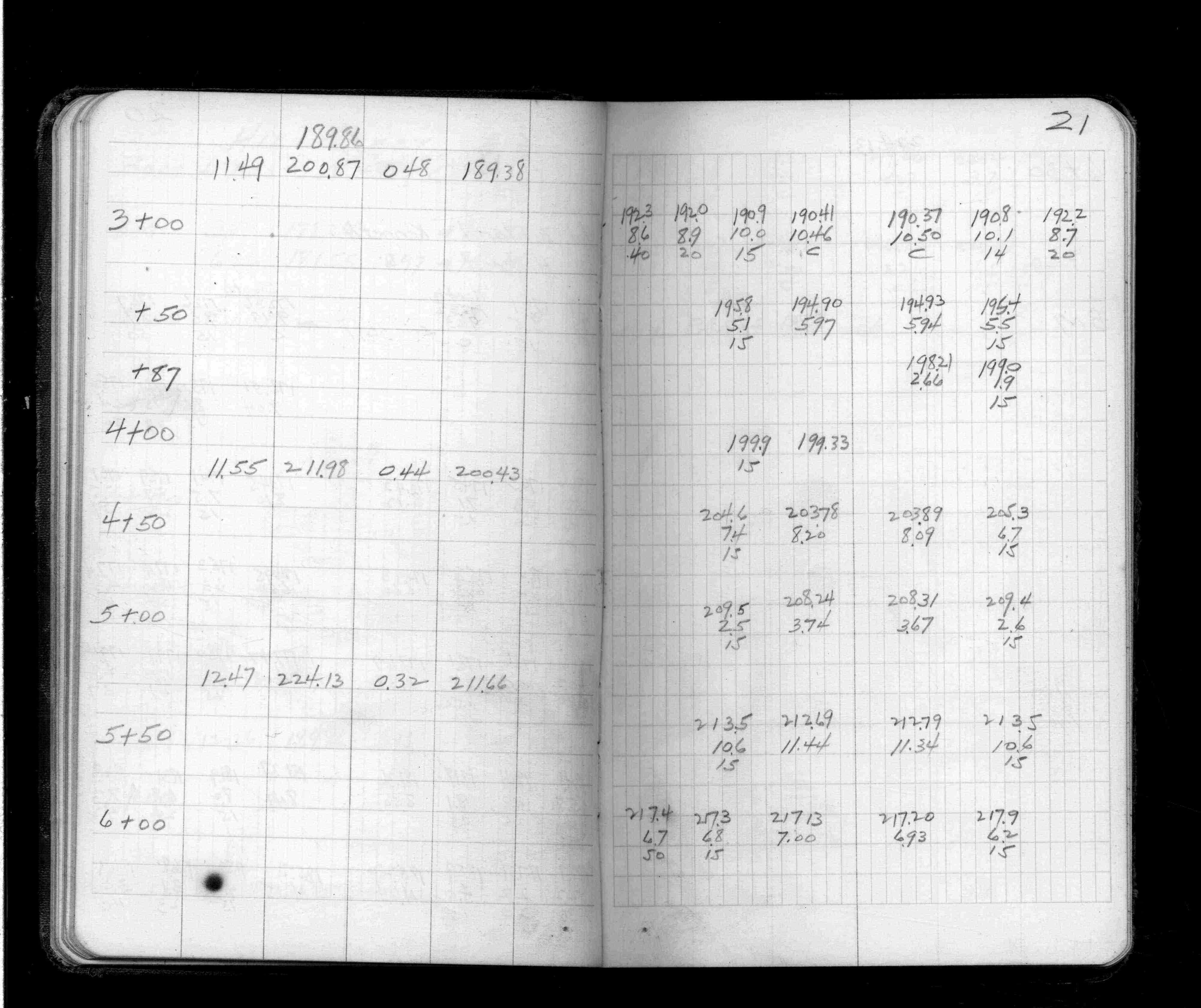
Page(s) 20-22
Hillcrest Ave
FROM
Kenneth St
TO
Prior Ave
| Cross Sections | 0000-00-00
20
21
22
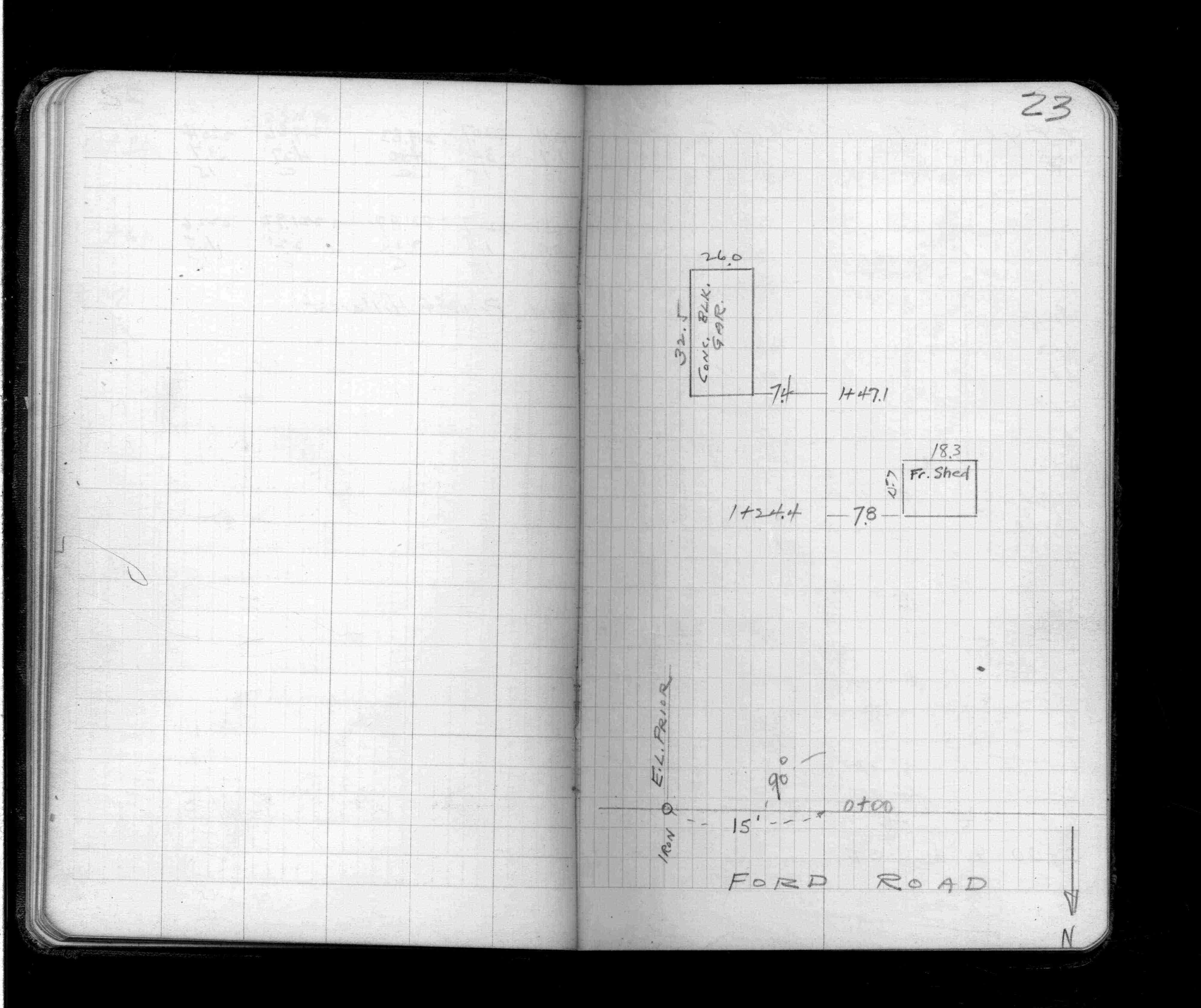
Page(s) 23
Ford Road (Pkwy) & Prior Ave
| Bldg Locations | 0000-00-00
23
Page(s) 24
Eagle St Parking Lot
FROM
Hill St
TO
Ryan Ave
| Locations & Levels | 1948-11-18
24
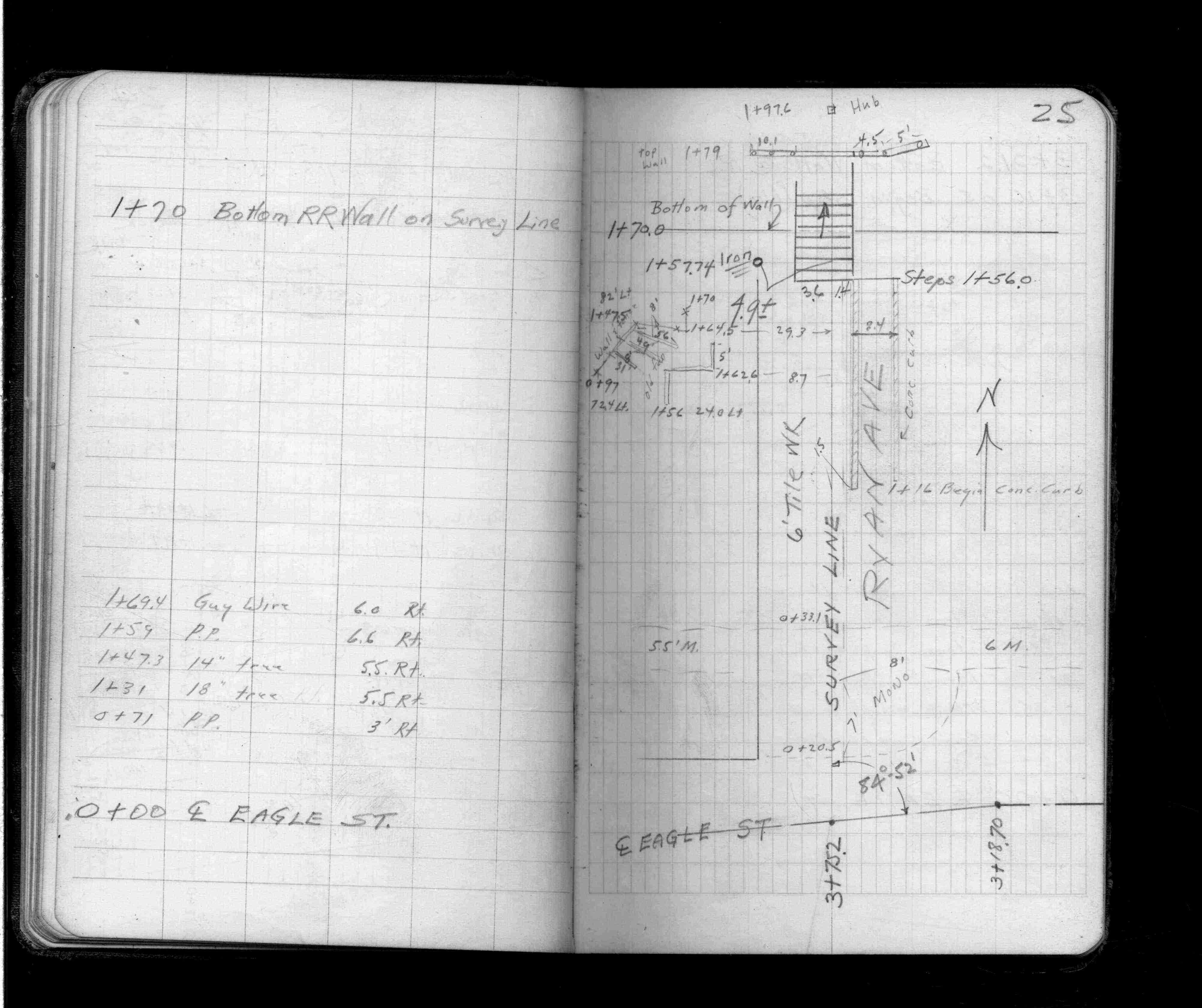
Page(s) 25
Ryan Ave
FROM
Eagle St
TO
Bottom Rip Rap Wall on Line
| Locations | 0000-00-00
25
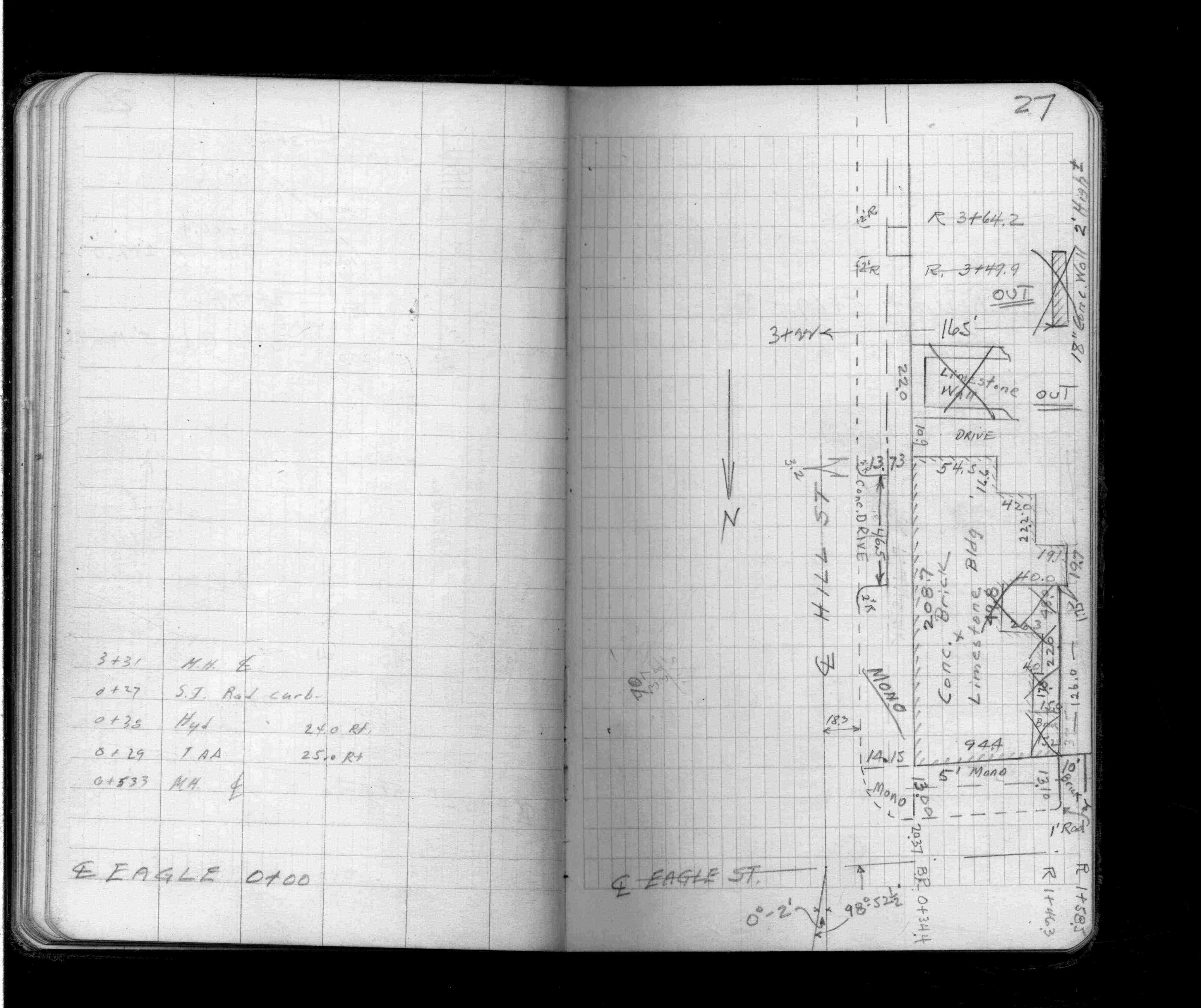
Page(s) 26-28
Hill St
FROM
Eagle St
TO
Chestnut St
| Locations | 0000-00-00
26
27
28
Page(s) 29
Chestnut St
FROM
Hill St
TO
Ryan Ave
| Locations | 0000-00-00
29
Page(s) 30
Ryan Ave
FROM
Chestnut St
TO
Eagle St
| Locations & Levels | 0000-00-00
30
Page(s) 31
Eagle St
FROM
Hill St
TO
318.5 Ft East
| Locations | 0000-00-00
31
Page(s) 32-33
Hill St
FROM
Eagle St
TO
North 346 Ft
| Cross Sections | 0000-00-00
32
33
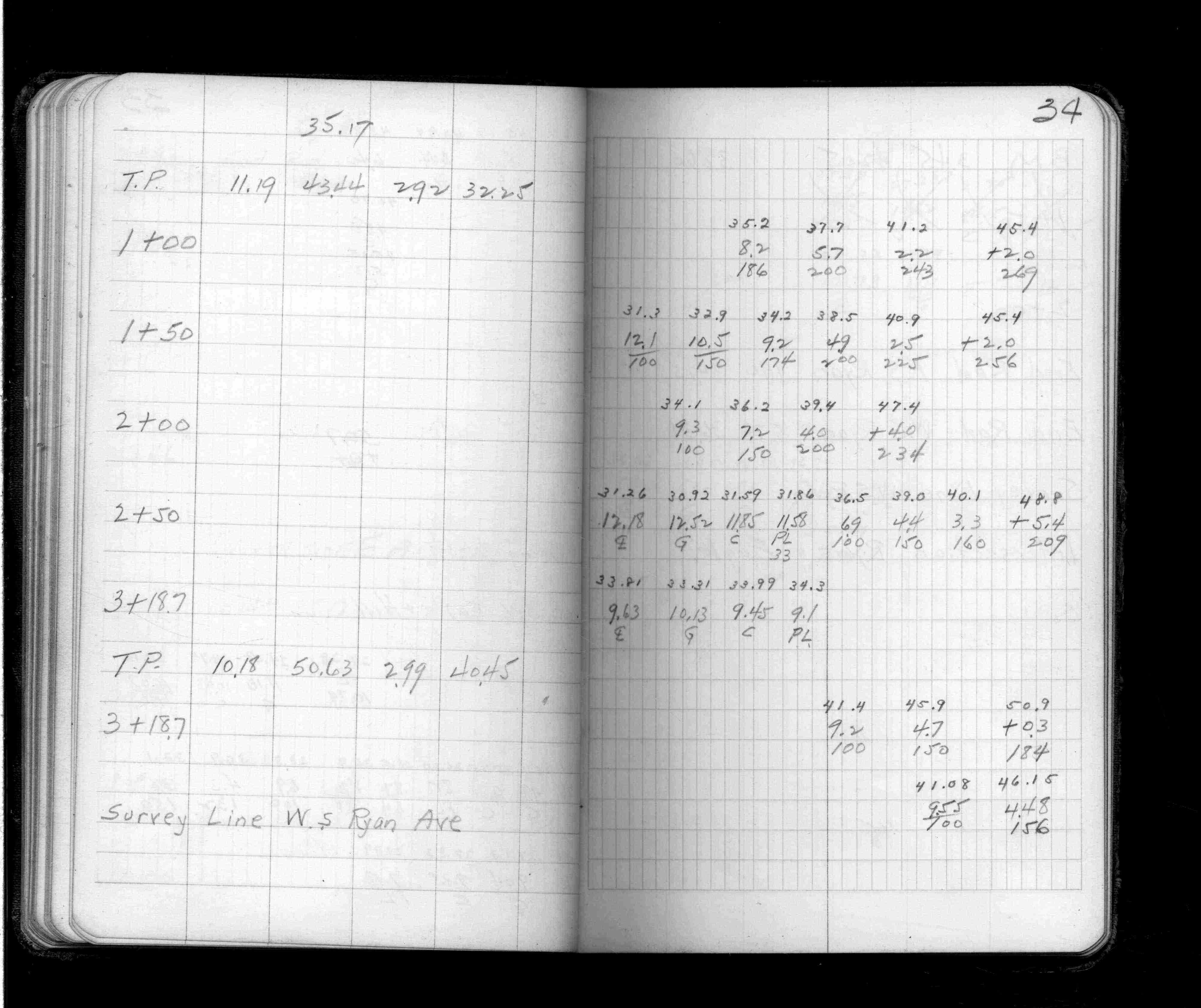
Page(s) 33-35
Eagle St
FROM
Hill St
TO
Ryan Ave
| Cross Sections | 0000-00-00
33
34
35
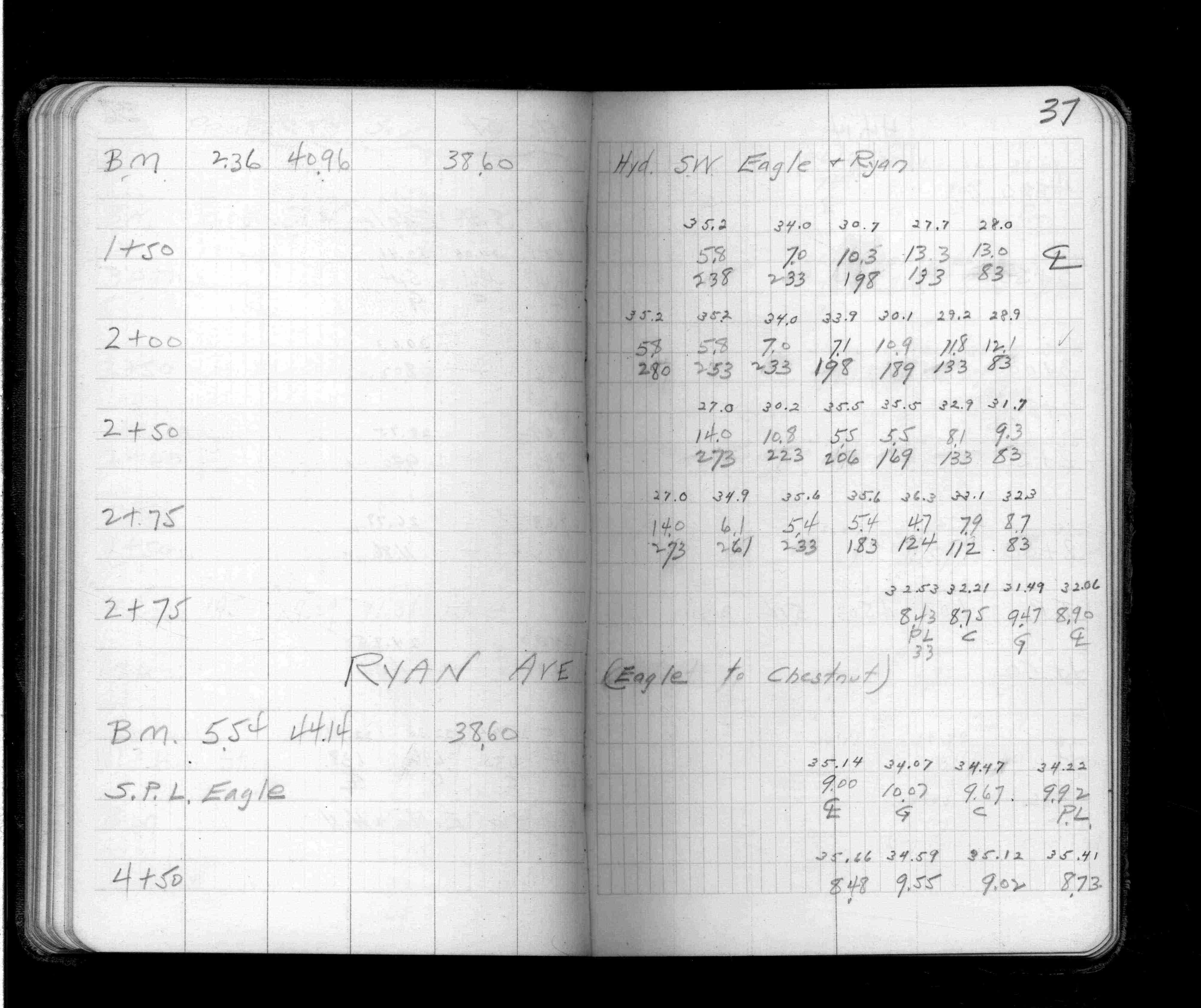
Page(s) 36-37
Eagle St
FROM
South 275 Ft
| Cross Sections | 0000-00-00
36
37
Page(s) 37-39
Ryan Ave
FROM
Eagle St
TO
Chestnut St
| Cross Sections | 0000-00-00
37
38
39
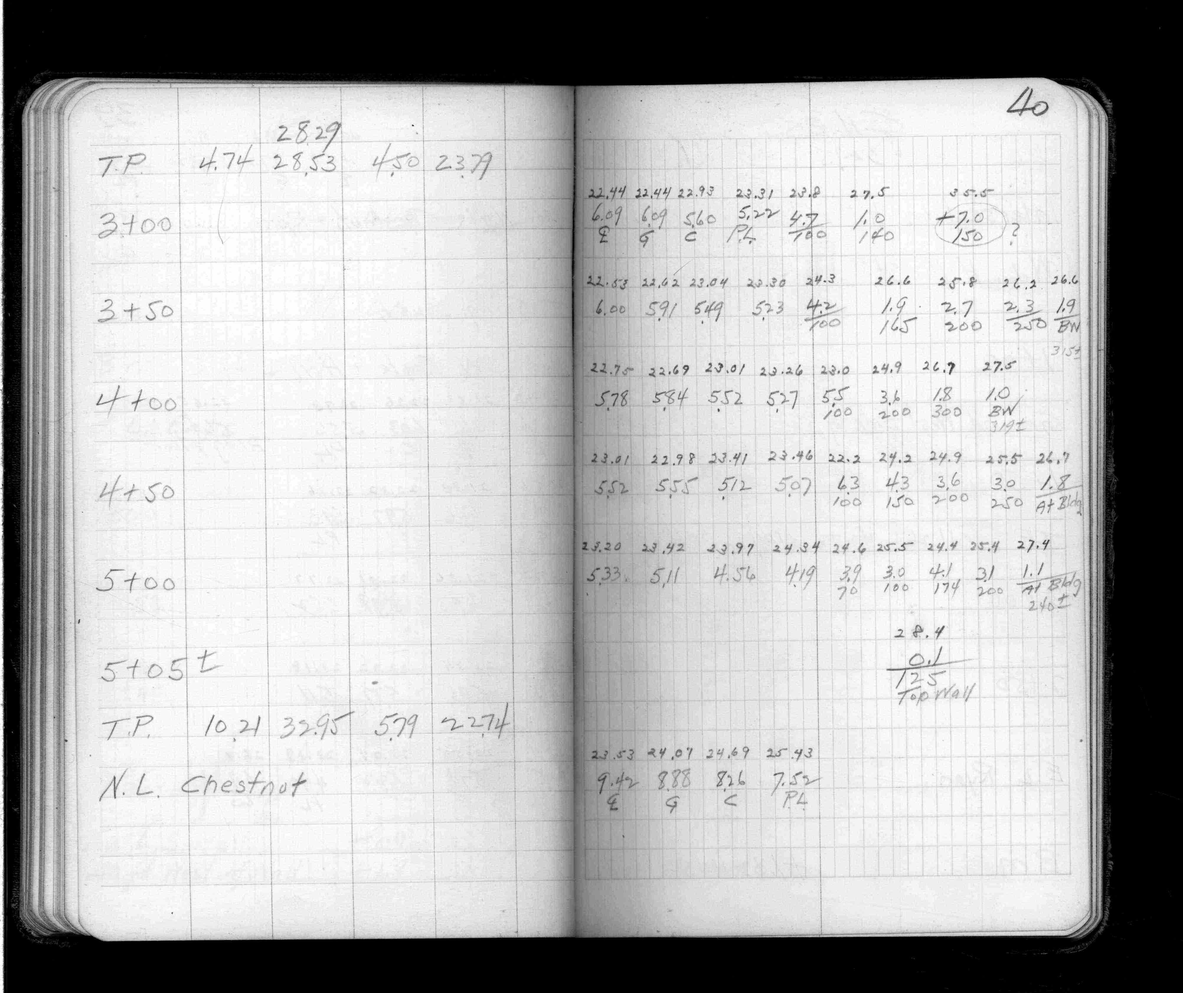
Page(s) 39-40
Hill St
FROM
Eagle St
TO
Chestnut St
| Cross Sections | 0000-00-00
39
40
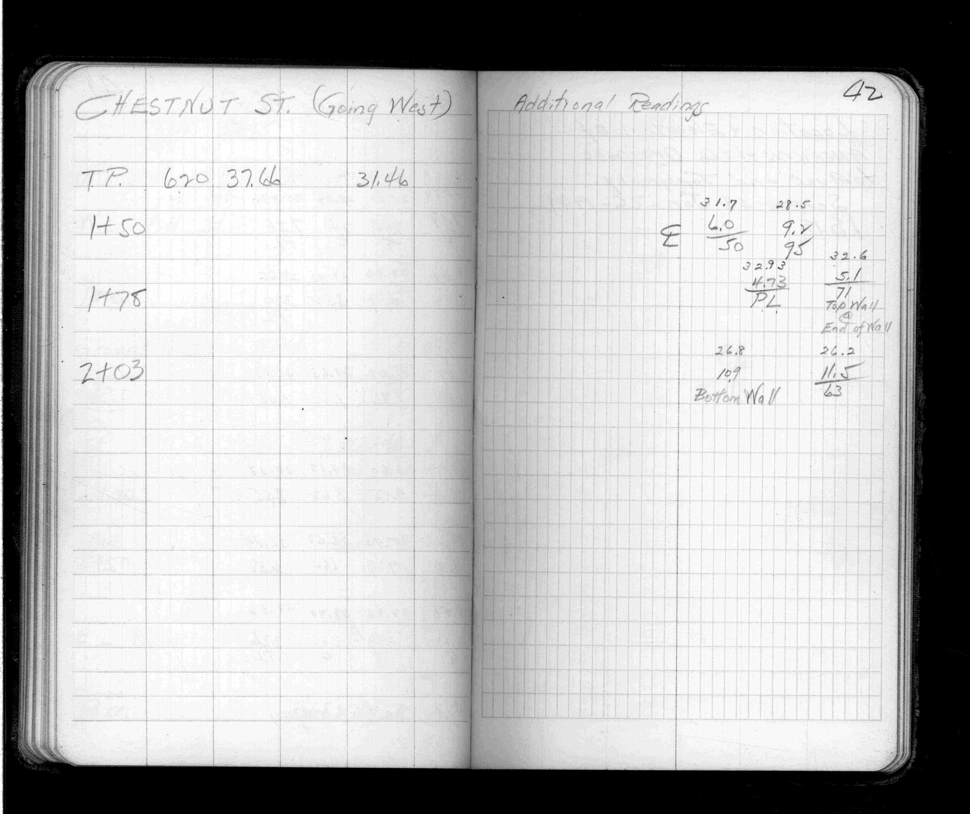
Page(s) 41-42
Chestnut St
FROM
Hill St
TO
Ryan St
| Cross Sections | 0000-00-00
41
42
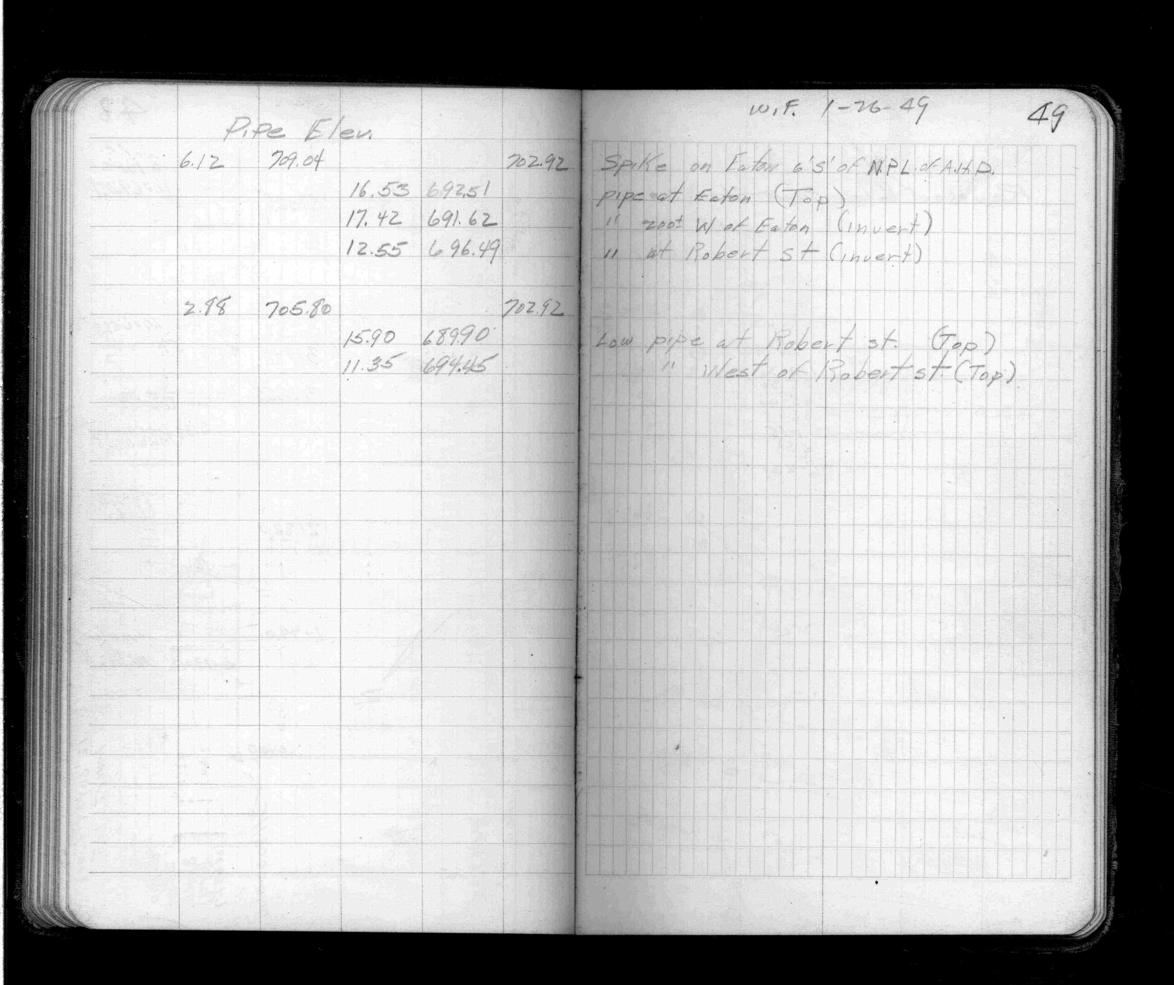
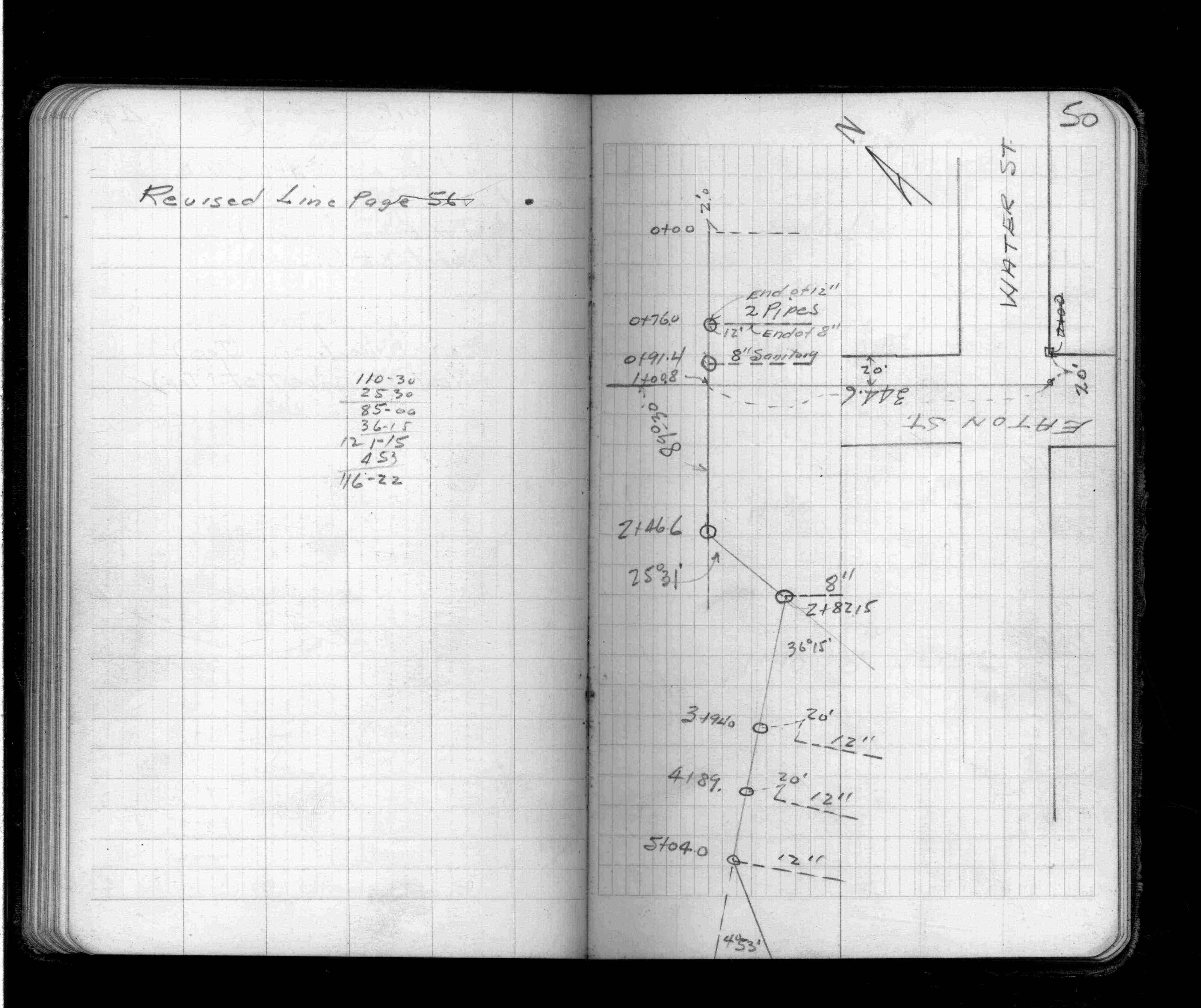
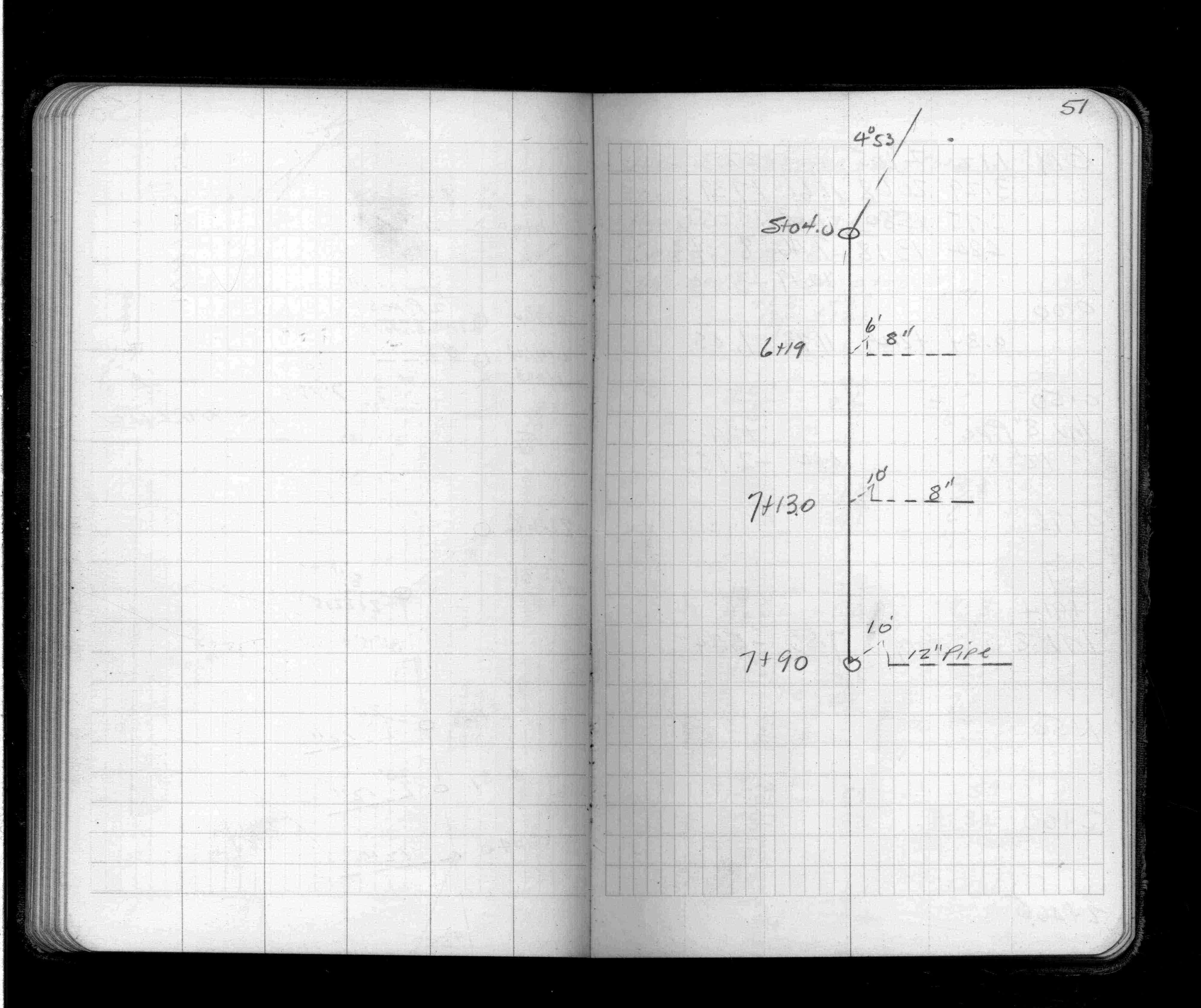
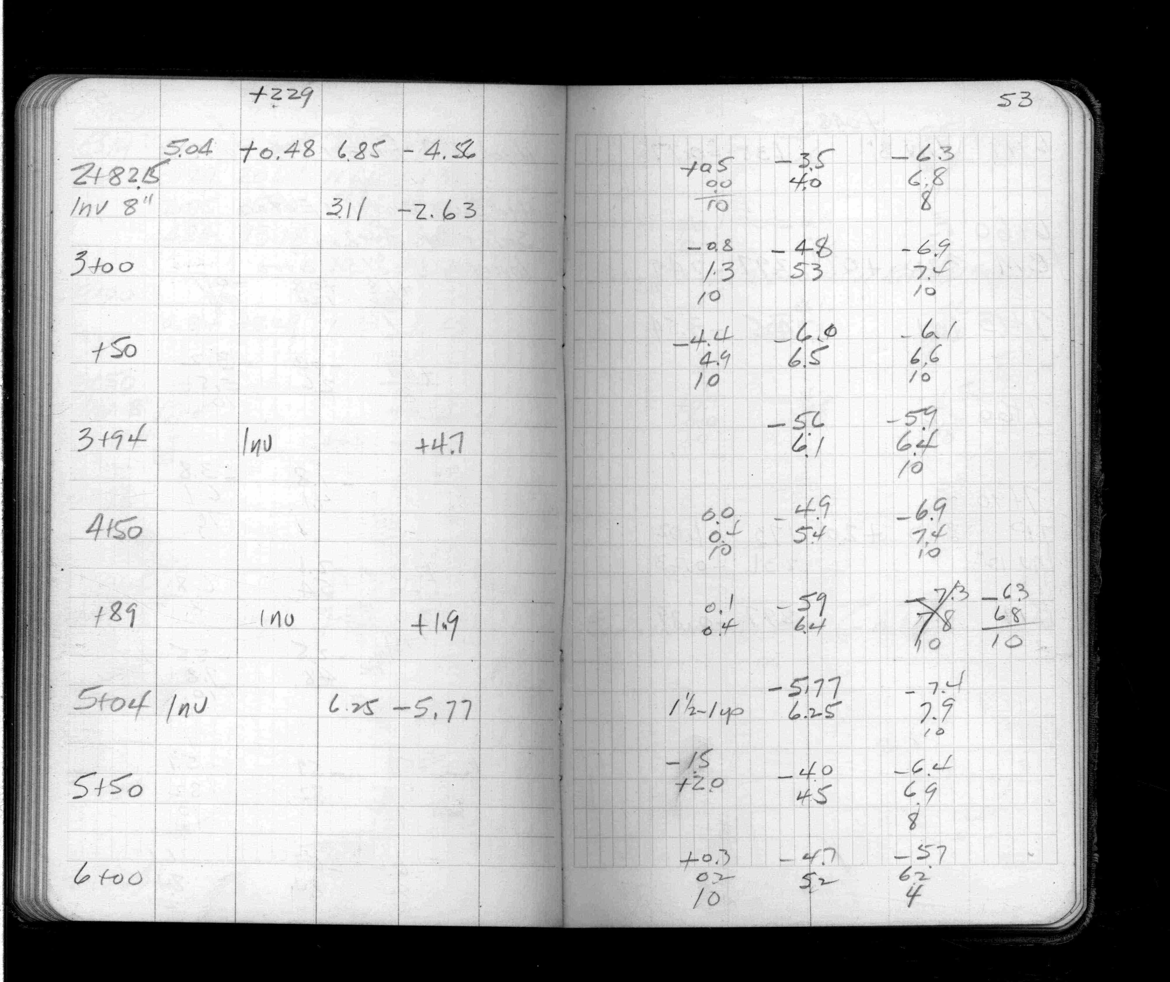
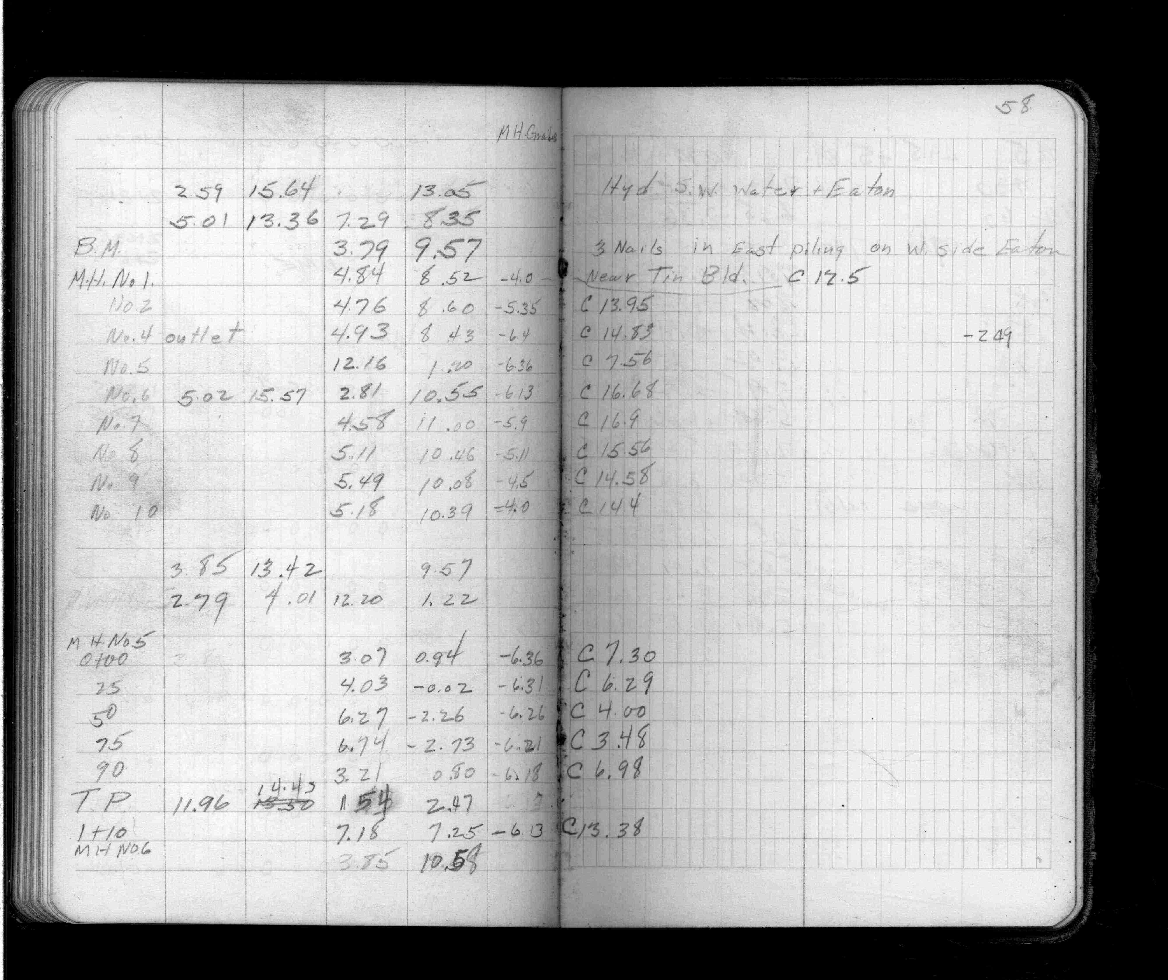
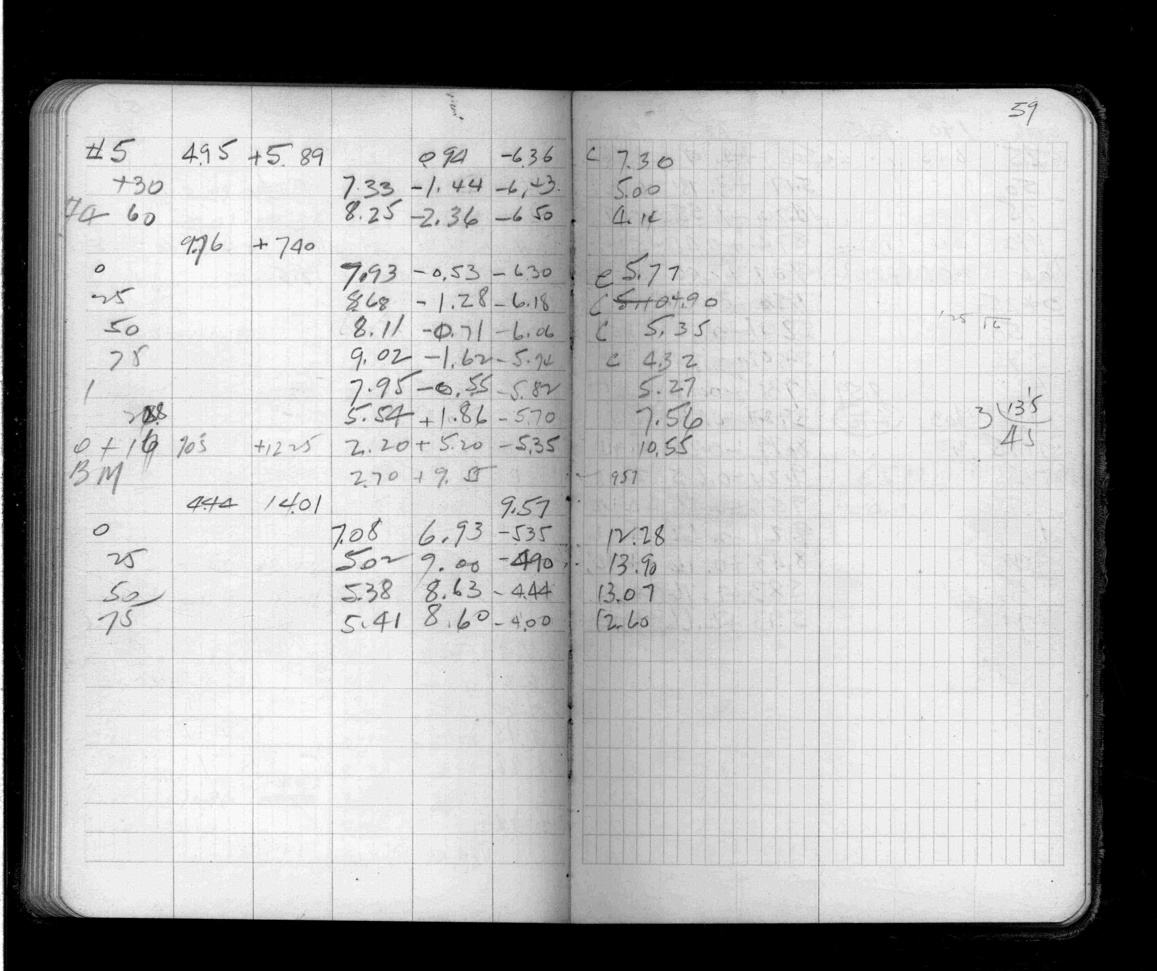
Page(s) 43-61
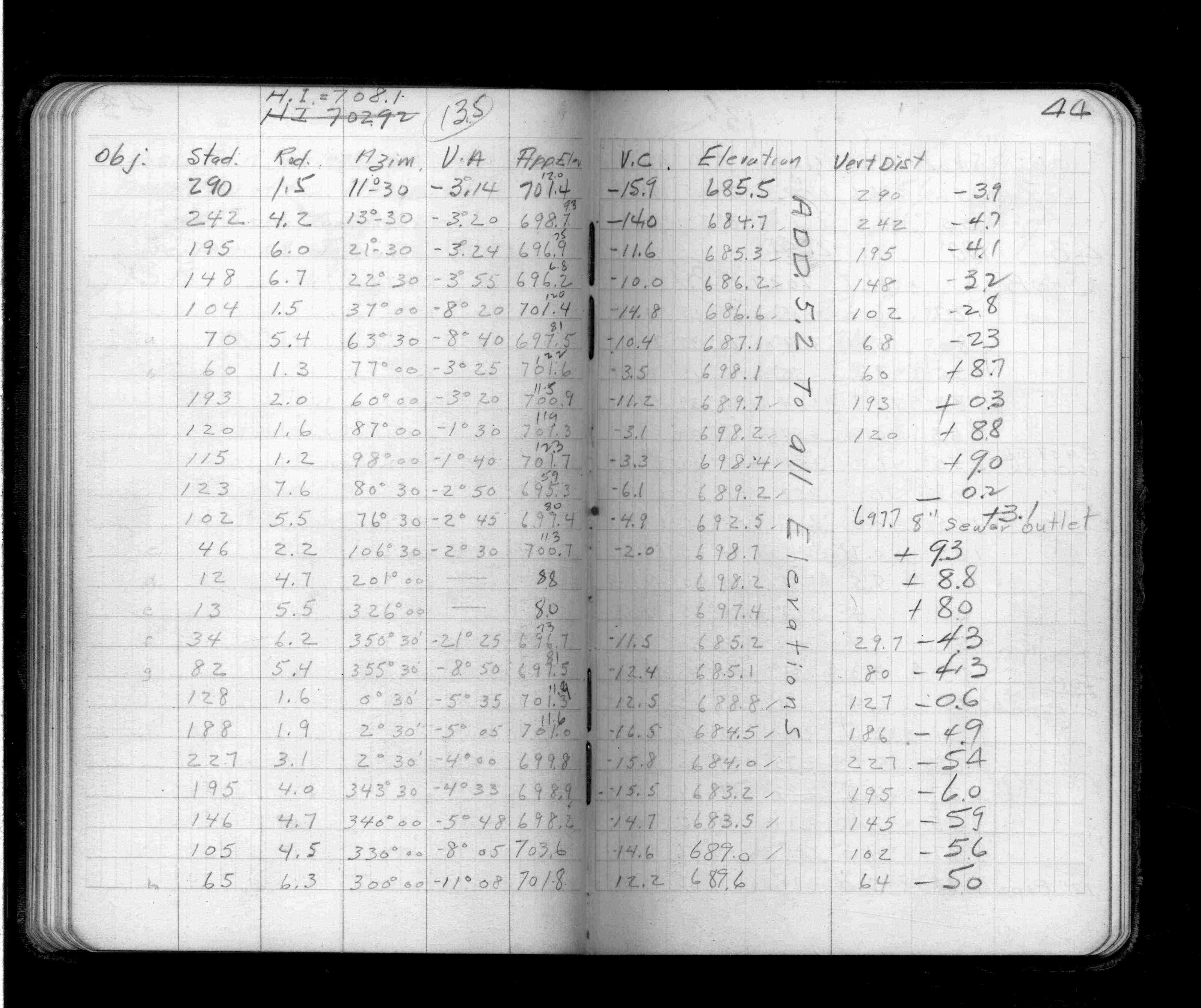
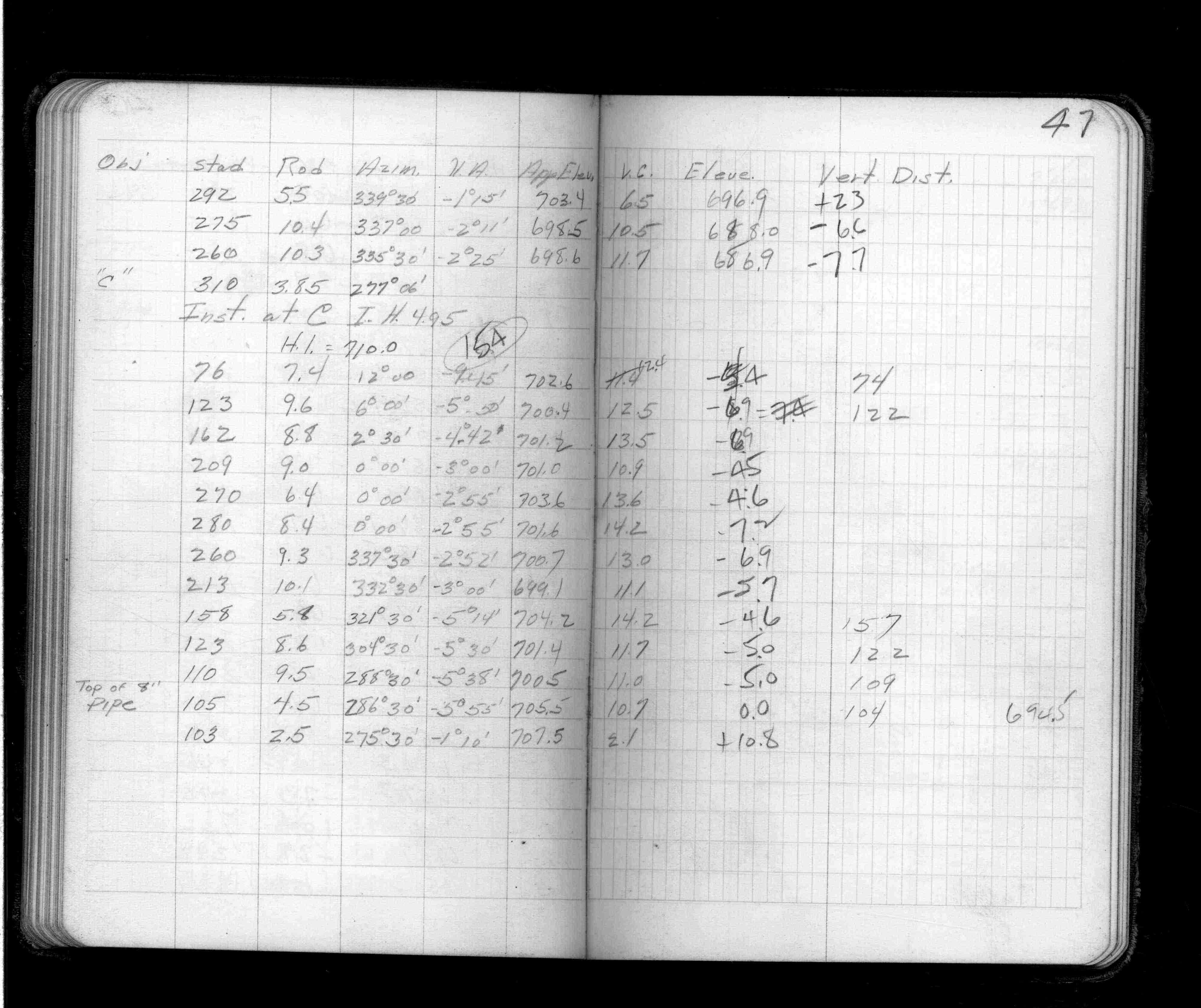
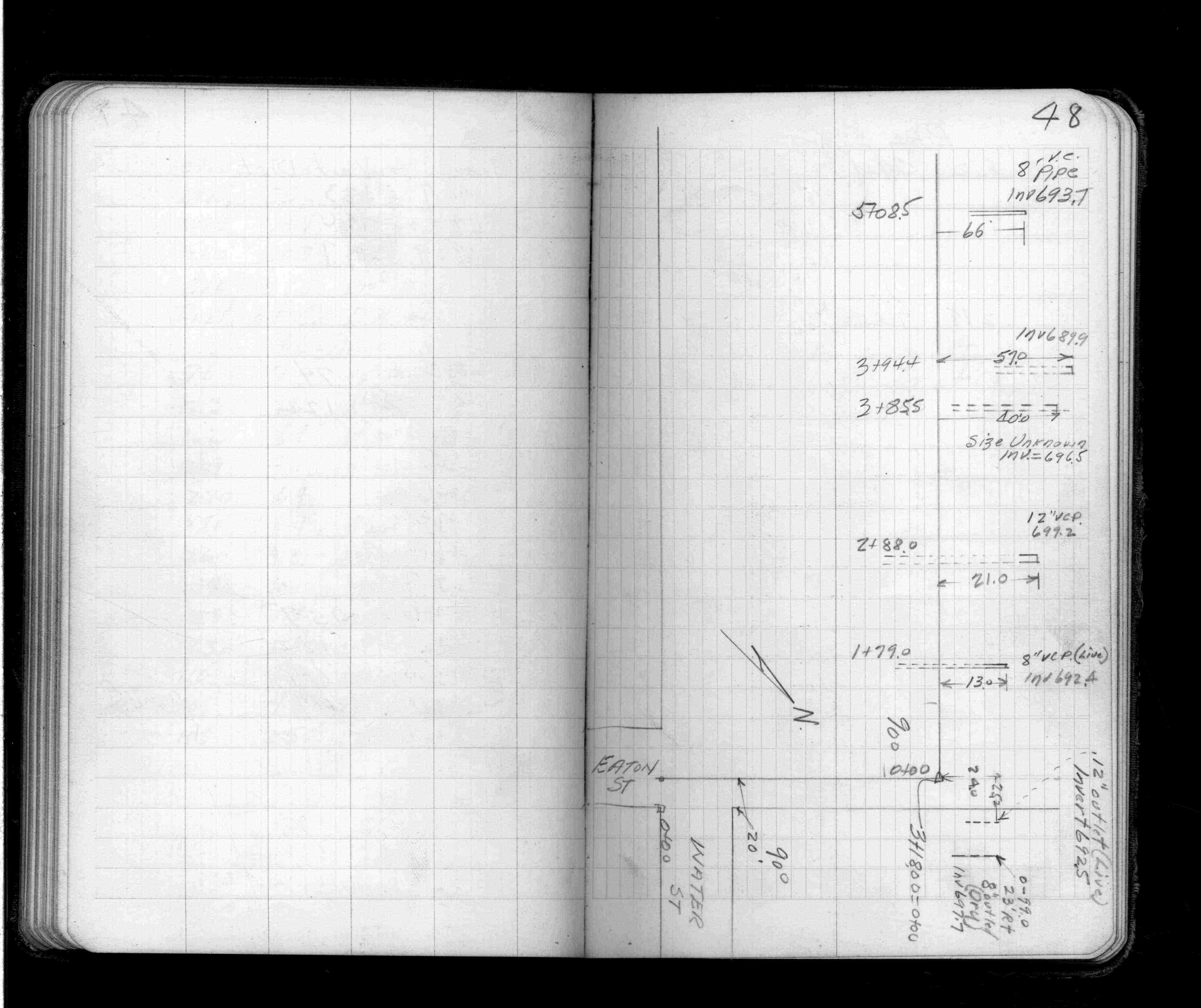
American Hoist & Derrick
FROM
Near Eaton (Eva)St & Fillmore Ave
| Locs&Elevs&Levels | 1949-01-26
43
44
45
46
47
48
49
50
51
52
53
54
55
56
57
58
59
60
61
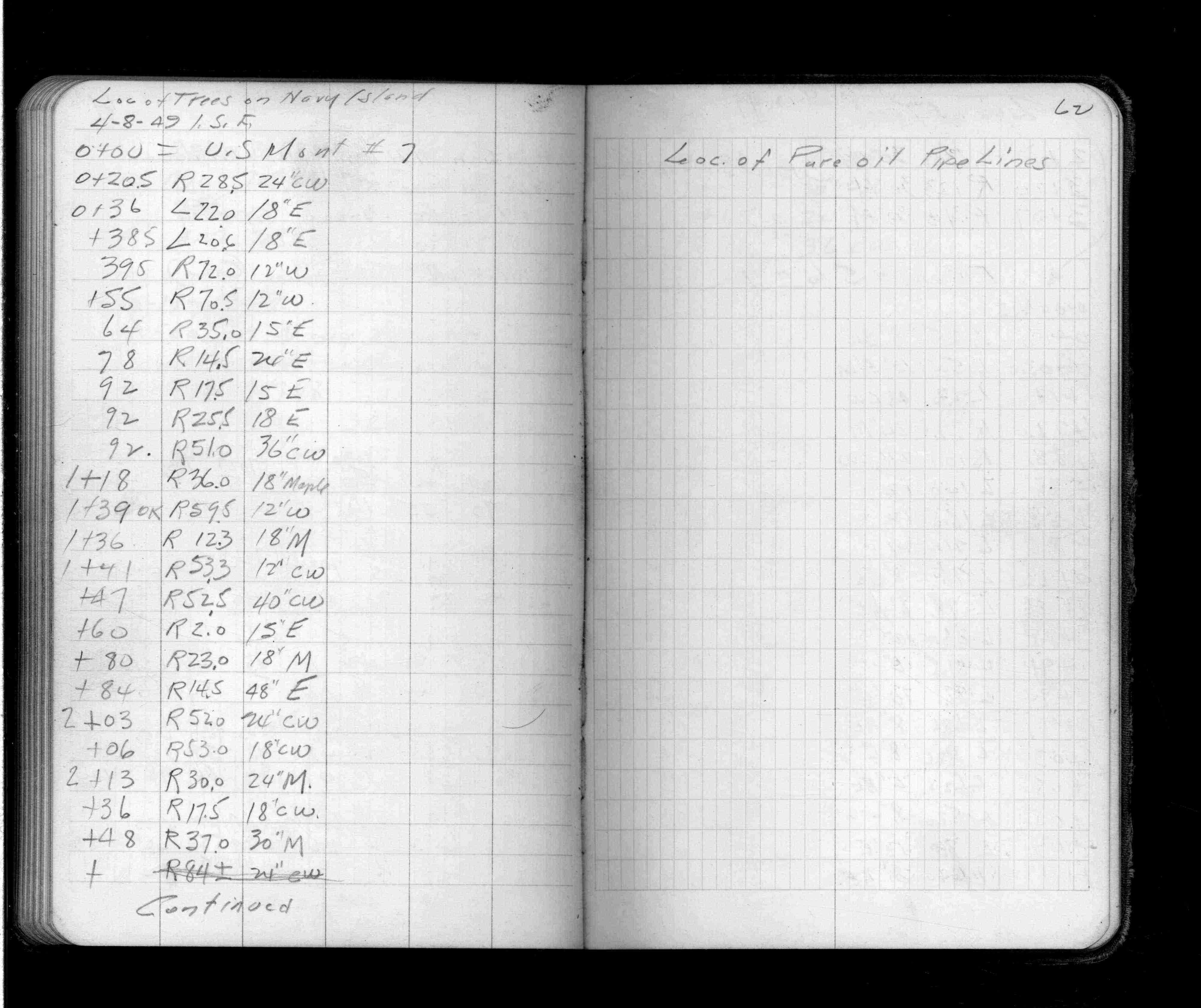
Page(s) 61-63
Navy Island
FROM
Navy Bldg
TO
Downstream
| Cross Sections | 1947-08-19
61
62
63
Page(s) 64-65
Water St
FROM
Wabasha St
TO
High Bridge
| Levels | 1949-04-26
64
65
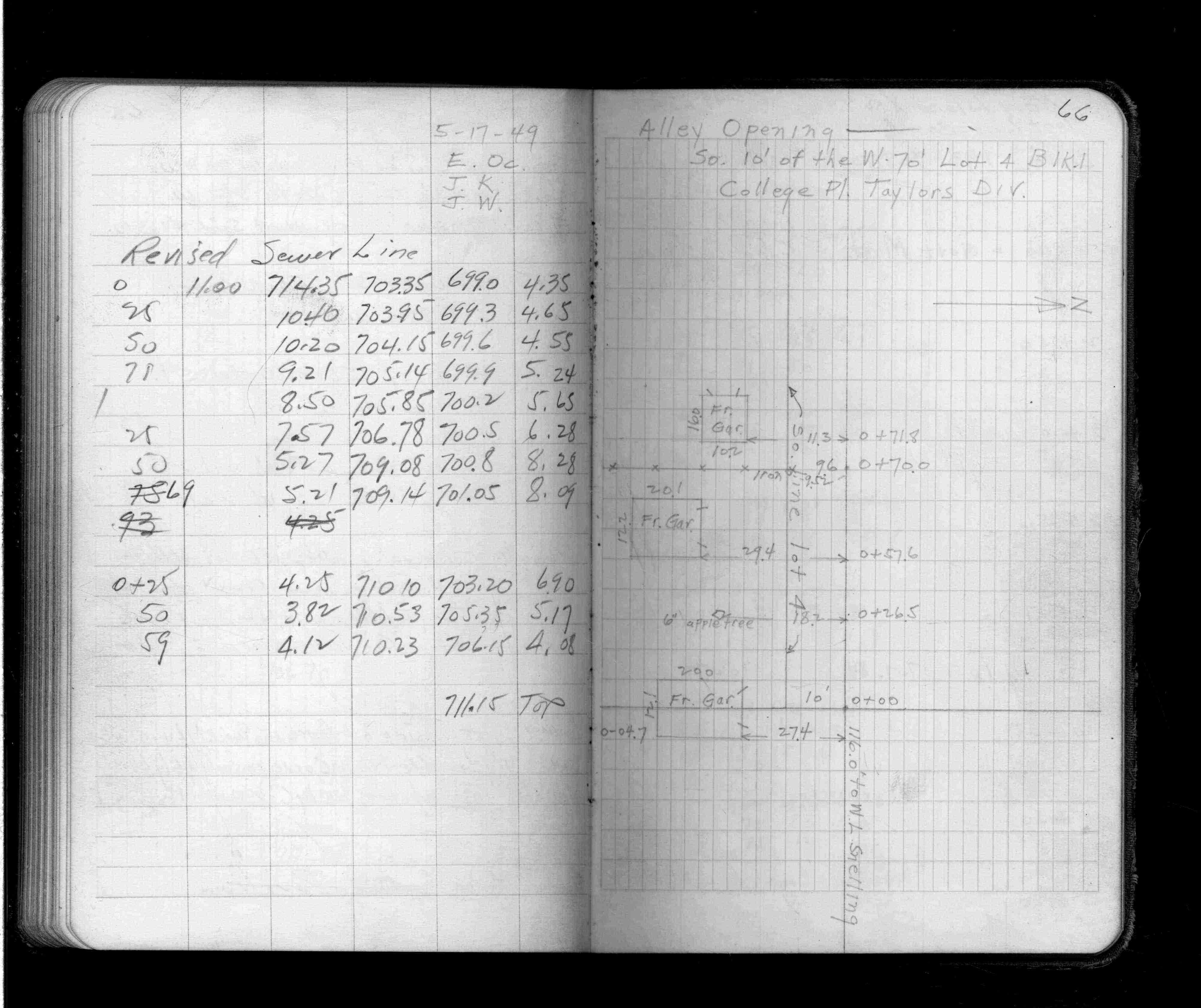
Page(s) 66
College Place Taylors Div
FROM
Station 0+00(116 Ft W of Snelling)
TO
Station 0+71.8 (West)
| Alley Opening | 1949-05-00
66
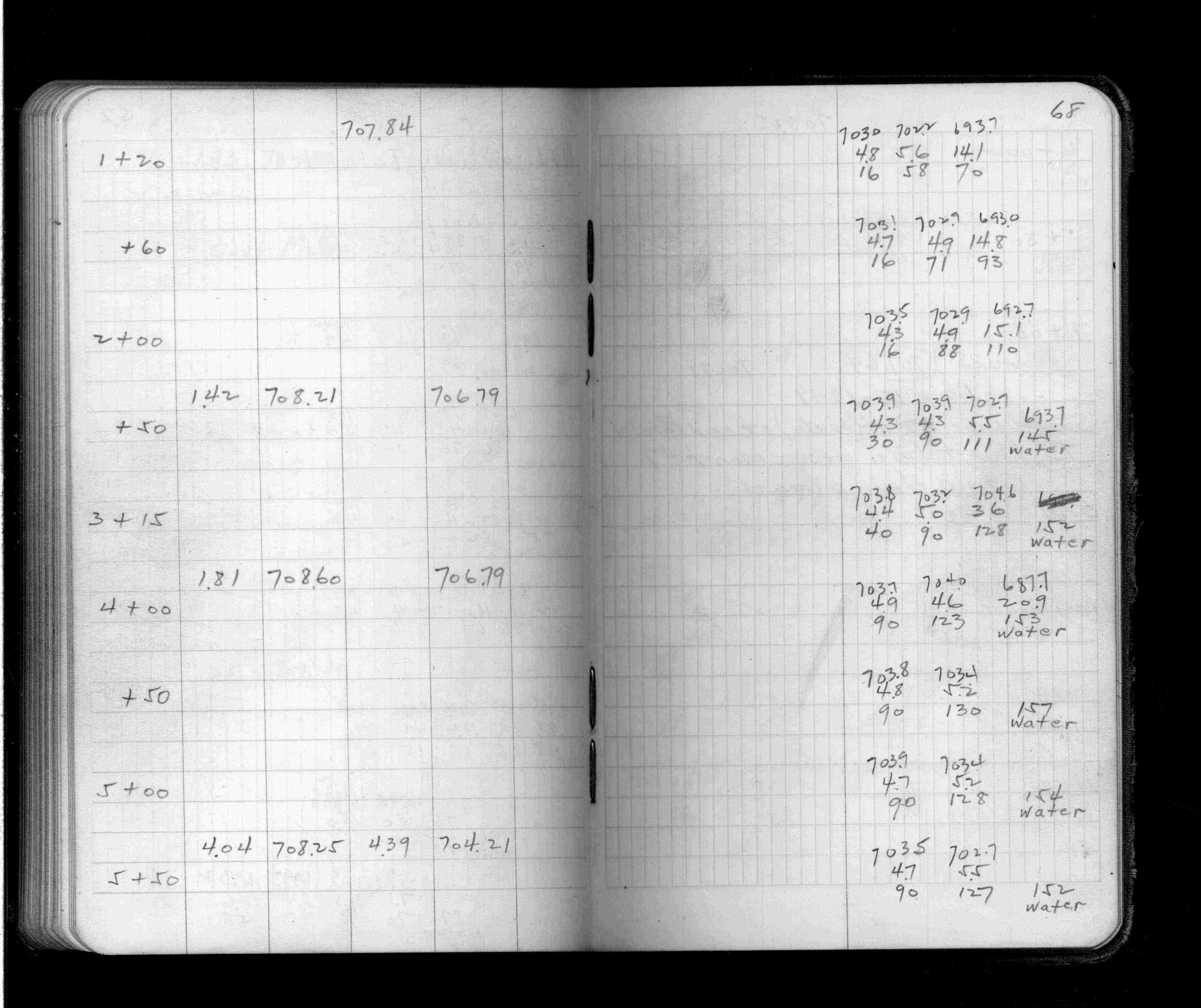
Page(s) 67-69
Navy Island
FROM
Govt Monument # 5
TO
Station 7+00
| Cross Sections | 1949-06-06
67
68
69
Page(s) 69-71
Ln 45 Ft S & Parallel to Monument Line
FROM
Mt7
TO
Station 3+80 (Downstream)
| Cross Sections | 1949-06-17
69
70
71
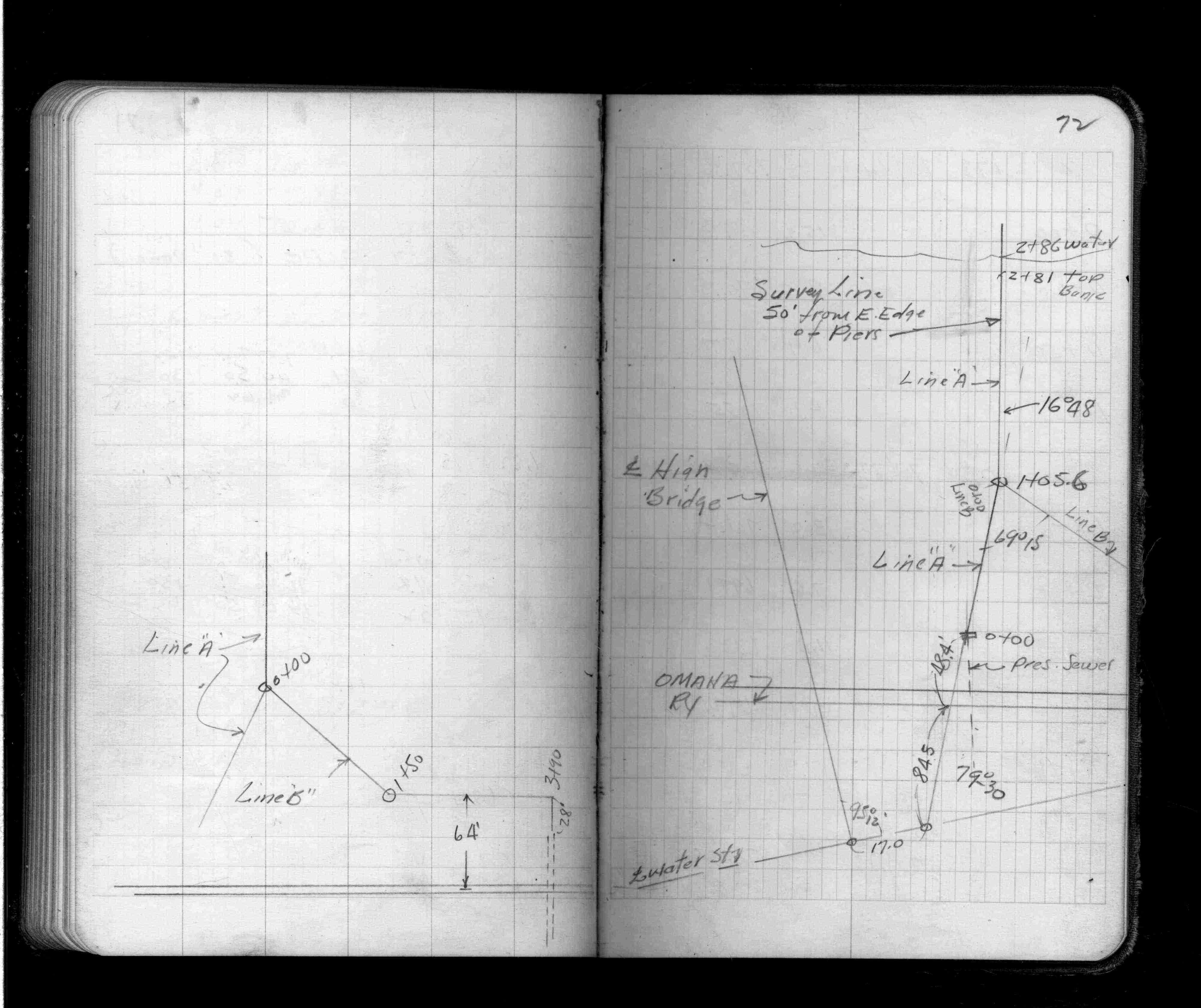
Page(s) 71-74
Navy Island
FROM
Station 2+50
TO
Station 3+90
| X-Secs & Locations | 0000-00-00
71
72
73
74
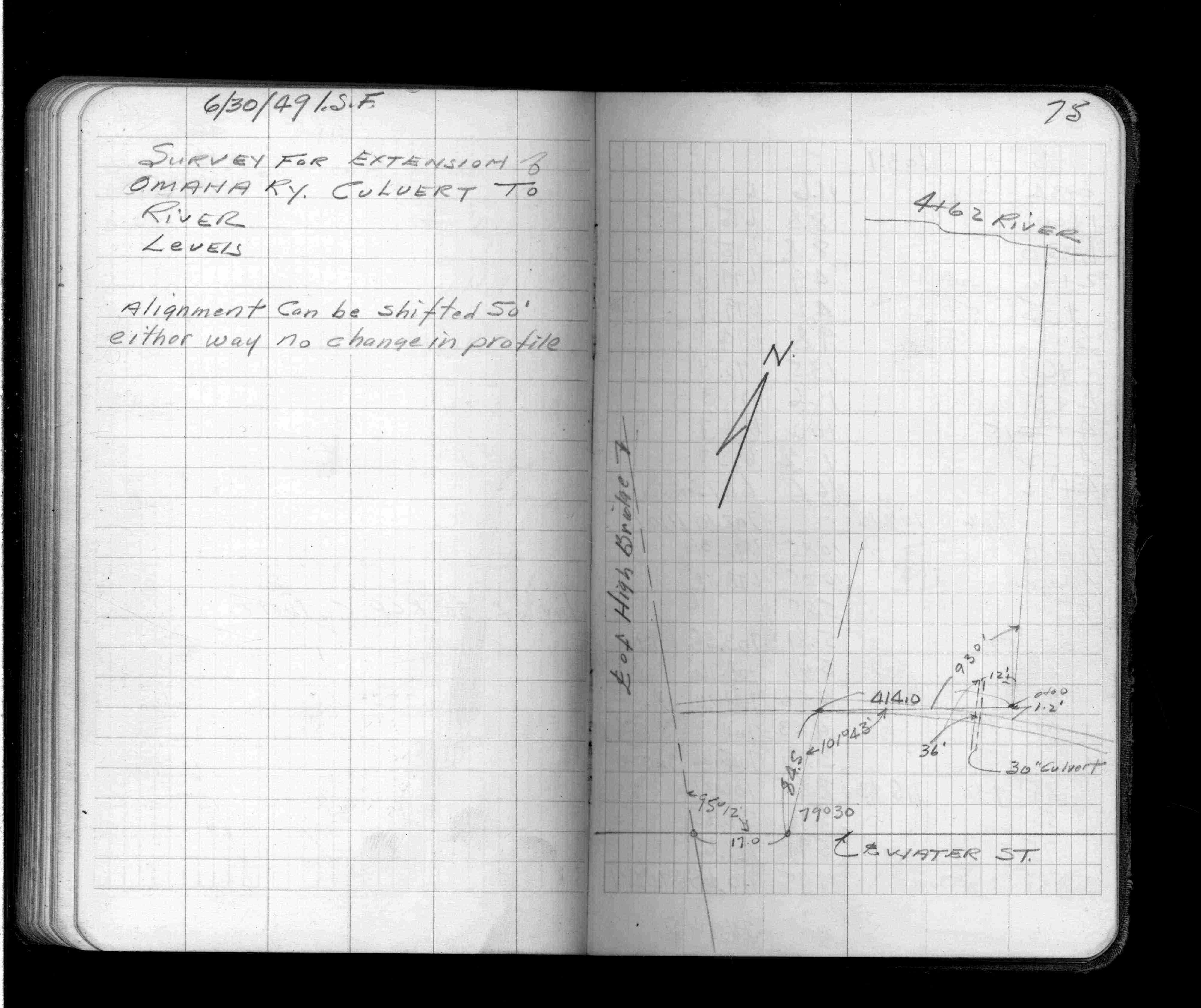
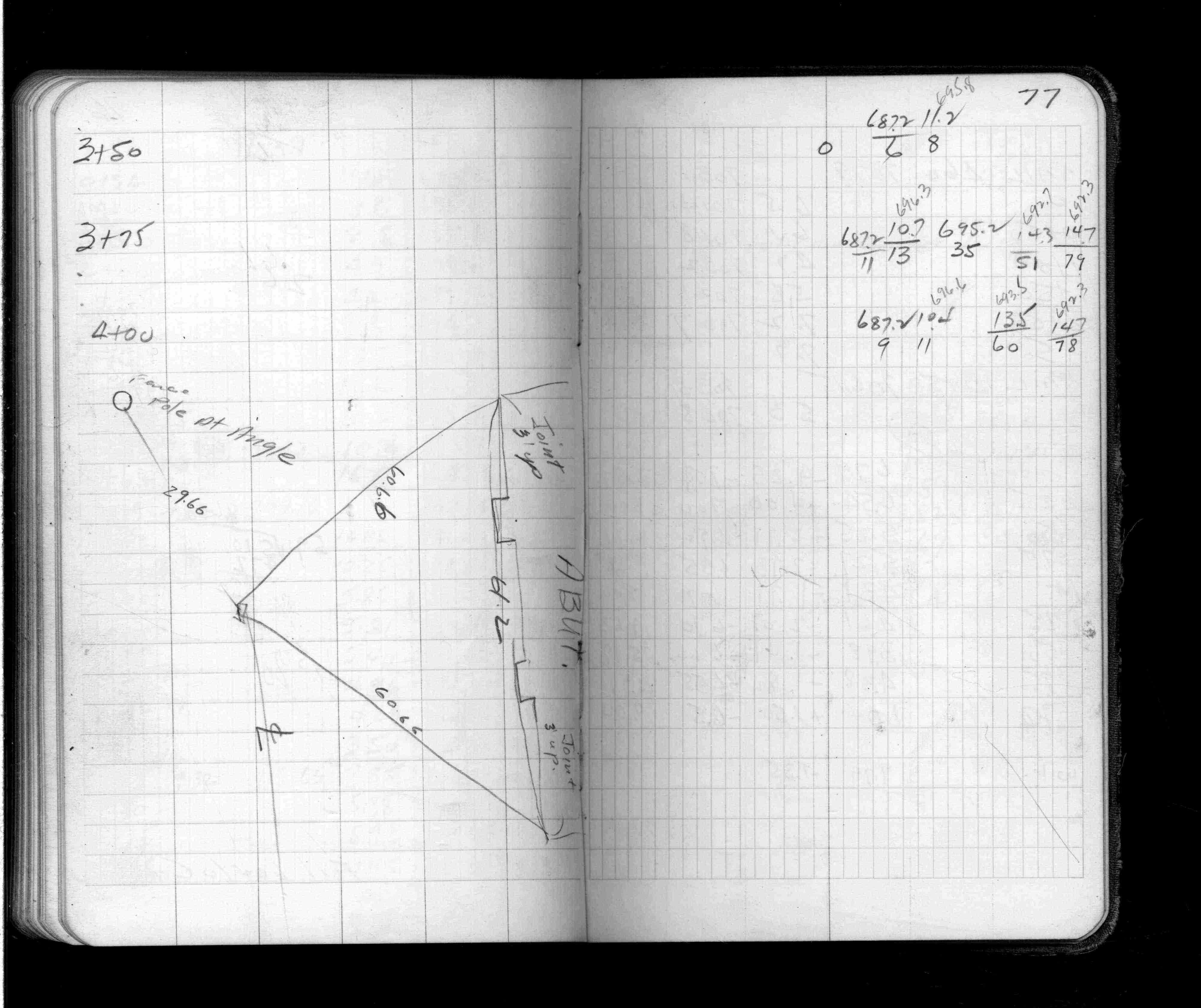
Page(s) 75-80
Ext Omaha RR Curlvert to River
FROM
High Bridge & Water St
TO
Station 4+62 River
| Locations & Levels | 1949-06-30
75
76
77
78
79
80
Page(s) 37-39
Oxford St @ Summit Ave
| Locations & X-Secs | 0000-00-00
37
38
39
Page(s) 65-67
Cook St (Ave)
FROM
Arcade St
TO
Mendota St
| Curbing Locs&X-Secs | 1950-08-08
65
66
67
Page(s) 72-73
Wheeler St
FROM
University Ave
TO
400 Ft North
| Locations & X-Secs | 1952-10-10
72
73