Page(s) 1-5
Kasota St
FROM
Raymond Ave
TO
State Trunk Hwy # 280
| Cross Sections | 1956-11-10
1
2
3
4
5
Page(s) 6
Blank
FROM
Blank
TO
Blank
| Blank | 0000-00-00
Page(s) 7
Marshall Ave
FROM
Finn St
TO
Montrose Pl
| Bench Marks | 1956-11-15
7
Page(s) 8
Marshall Ave
FROM
Exeter Pl
TO
Finn St
| Bench Marks & TPs | 1956-11-20
8
Page(s) 8
Dayton Ave
FROM
Finn St
TO
Exeter Pl
| Sewer Elevations | 0000-00-00
8
Page(s) 9
Universtiy Ave
FROM
Hamline Ave
TO
Fairview Ave
| Measurmnt of Roadway | 1957-03-20
9
Page(s) 10
Blank Page
FROM
Blank
TO
Blank
| Blank | 0000-00-00
Page(s) 11-12
Seventh (7th) St
FROM
Broadway
TO
Minnesota St
| Profiles | 1957-04-09
11
12
Page(s) 13
Dayton Ave
FROM
Exter Pl
TO
Cretin Ave
| Sewer Profile | 0000-00-00
13
Page(s) 14
Finn St
FROM
Dayton Ave
TO
Selby Ave
| Sewer Profile | 0000-00-00
14
Page(s) 15
Cretin Ave
FROM
Dayton Ave
TO
Selby Ave
| Sewer Profile | 0000-00-00
15
Page(s) 16-19
James Ave
FROM
Cleveland Ave
TO
Finn St
| Curb Locs & X-Secs | 1957-11-19
16
17
18
19
Page(s) 20-24
Maywood St
FROM
California Ave
TO
Iowa Ave
| Locs & X-Secs | 1957-11-20
20
21
22
23
24
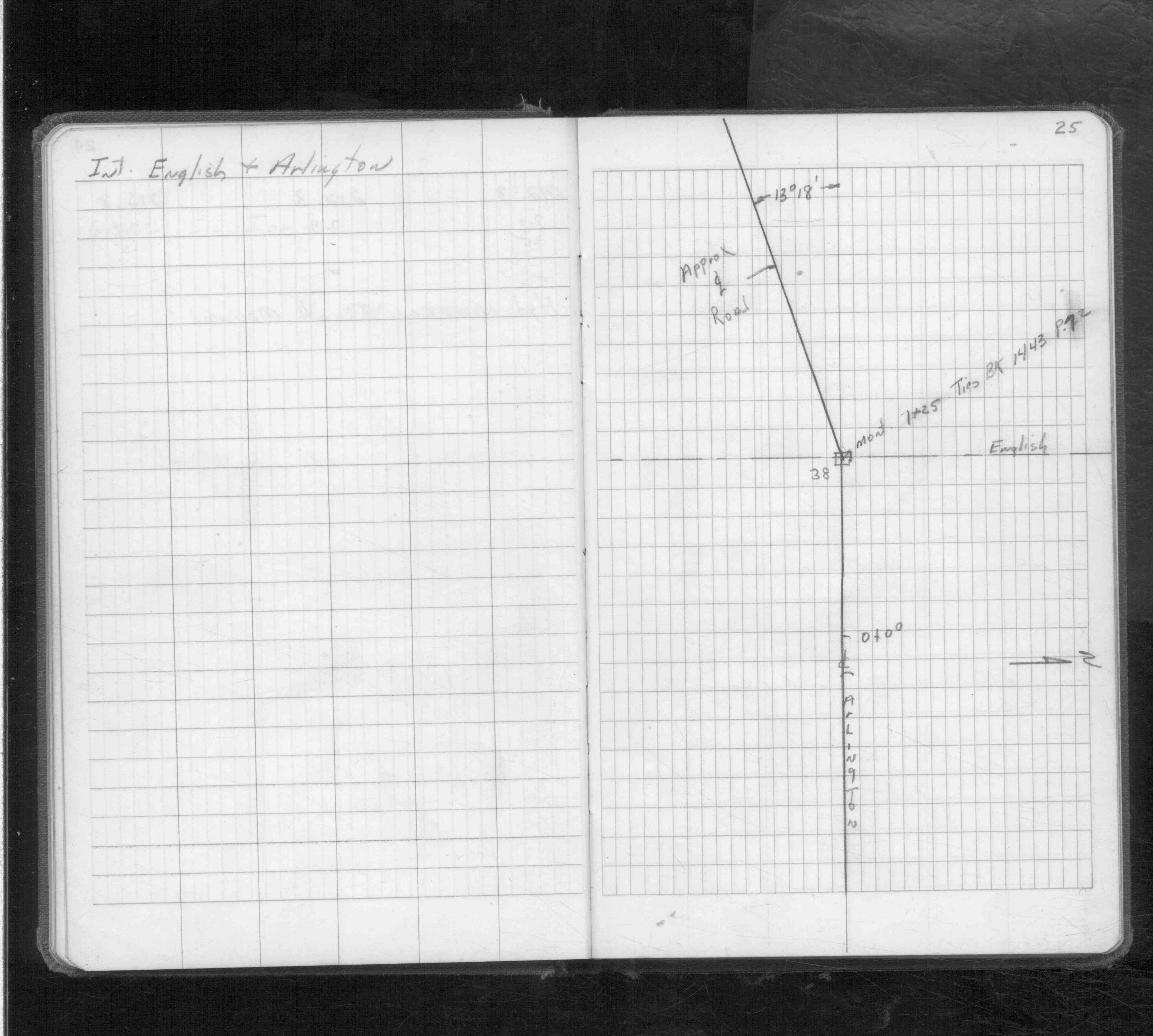
Page(s) 25
English St & Arlington Ave
| Monument Location | 0000-00-00
25
Page(s) 26
Blank Page
FROM
Blank
TO
Blank
| Blank | 0000-00-00
Page(s) 27-28
English St & Arlington Ave
| Cross Sections | 0000-00-00
27
28
Page(s) 29-30
Snelling Ave
FROM
Shields Ave
TO
150 ft South
| Locations & X-Secs | 1958-10-09
29
30
Page(s) 31
Kasota Ave @ Bayless Pl
| Fence Location | 0000-00-00
31
Page(s) 32
Kasota Ave @ Bayless Pl
| Cross Sections | 0000-00-00
32
Page(s) 33-34
Bridge Over Bayless Pl
FROM
Intercampus Transitway
TO
Blake Ave (& South of Langford)
| Cross Sections | 0000-00-00
33
34
Page(s) 35
Kasota Ave @ Bayless Pl
FROM
Line A From Page 31
| Cross Sections | 0000-00-00
35
Page(s) 36
Blank Page
FROM
Blank
TO
Blank
| Blank | 0000-00-00
Page(s) 37-45
Kasota Ave
FROM
Raymond Ave
TO
One Set of RR Tracks
| X-Secs & Locations | 0000-00-00
37
38
39
40
41
42
43
44
45
Page(s) 46
Kasota Ave
FROM
South From 7+0
TO
13+0
| Ties | 0000-00-00
46
Page(s) 47
Kasota & Raymond Aves
| Ties | 0000-00-00
47
Page(s) 48-50
E of RR Tracks @ 7+0 + or -
FROM
South of Temp Kasota Ave
| Cross Sections | 1959-05-14
48
49
50
Page(s) 51-54
Kasota Ave
FROM
Raymond Ave
TO
250 ft West
| X-Secs & Locs | 1959-07-28
51
52
53
54
Page(s) 55
Blank Page
FROM
Blank
TO
Blank
| Blank | 0000-00-00
Page(s) 56-58
Kasota Ave Borrow Area
FROM
Raymond Ave
TO
One Set of RR Tracks
| Re-Cross Sections | 0000-00-00
56
57
58
Page(s) 59-60
Kasota & Raymond Aves
| Re-Cross Sections | 1959-12-28
59
60
Page(s) 61-69
Flood Control (Line A Page 69)
FROM
Near Creek & River Trail
| Cross Sectons & Locs | 0000-00-00
61
62
63
64
65
66
67
68
69
Page(s) 70-75
Kasota Ave
FROM
Raymond Ave
TO
Trunk Hwy 280
| Locations | 1973-03-22
70
71
72
73
74
75
Page(s) 76
Blank Page
FROM
Blank
TO
Blank
| Blank | 0000-00-00
Page(s) 77
Unknown Location
FROM
Sta 0+0
TO
Sta 1+72
| Ditch Grades | 0000-00-00
77
Page(s) 78
Unknown Location
FROM
Sta 4+0
TO
Sta 4+46
| Grades | 0000-00-00
78
Page(s) 79
Calculations
FROM
Calculations
TO
Calculations
| Calculations | 0000-00-00
79