Page(s) 1
W Seventh (7th) St Blvd
FROM
West Bound Lane
TO
East Bound Lane
| Sod & Top Soil | 0000-00-00
1
Page(s) 2
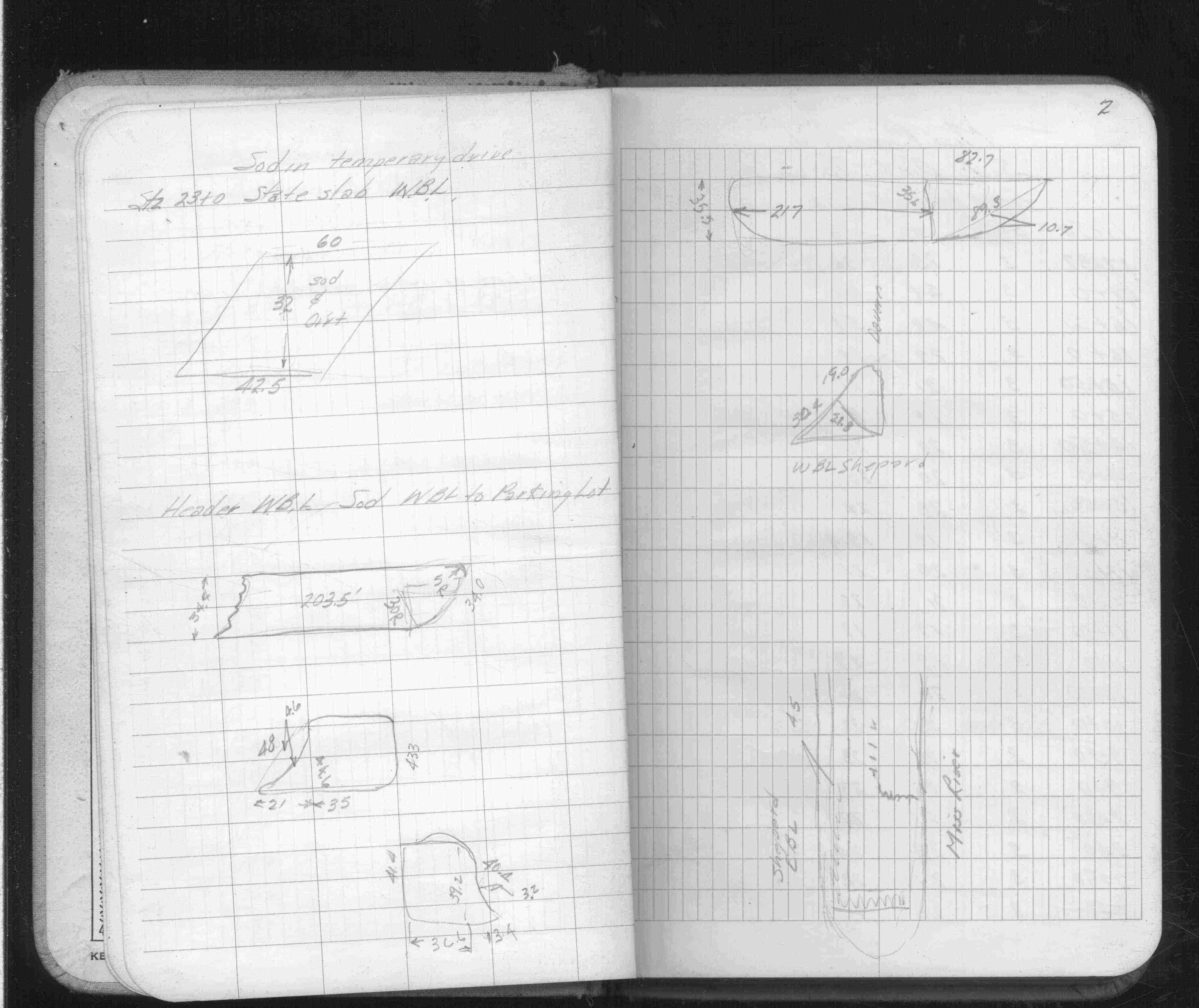
Sod & Top Soil
FROM
N Side Shepard Rd
TO
Davern St
| Sod in Temp Drive | 0000-00-00
2
Page(s) 3-4
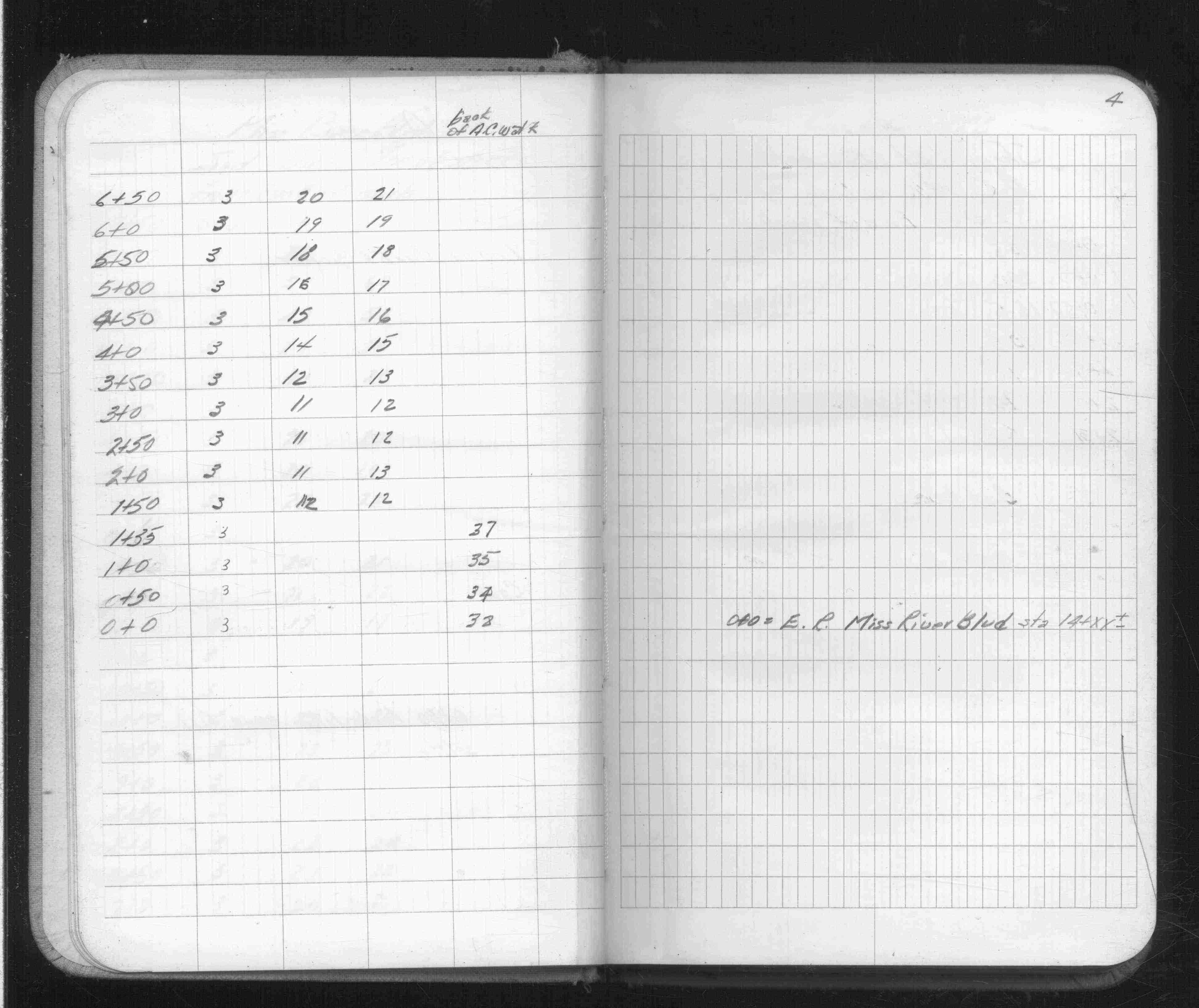
Miss River Blvd
FROM
End of Curb & Gutter (Sta 17+0)
TO
MRB Station 14
| Sod & Soil-Slope Toe | 0000-00-00
3
4
Page(s) 5
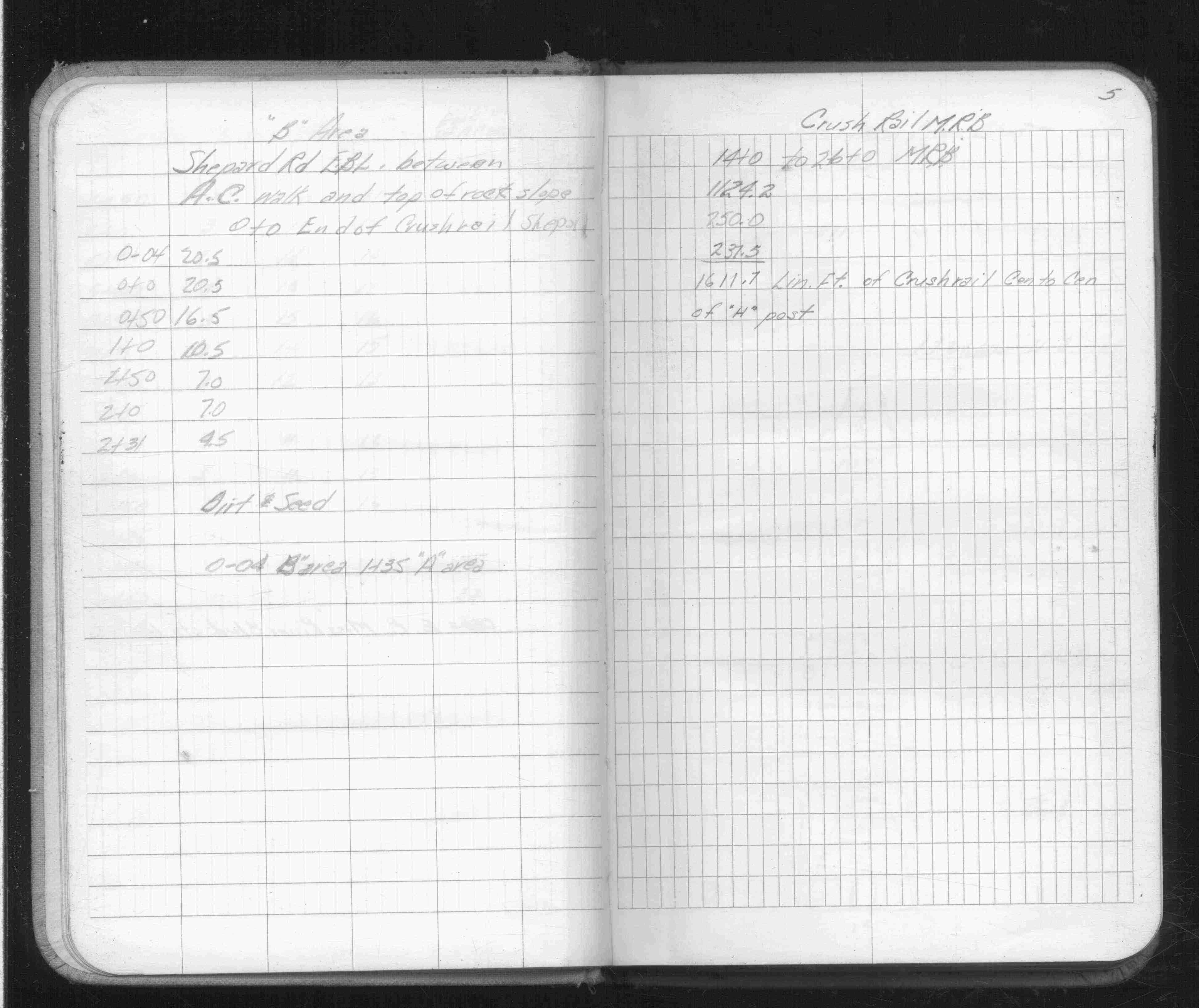
Shepard Road
FROM
AC Walk
TO
Top of Rock Slope
| Sod & Soil | 0000-00-00
5
Page(s) 6-7
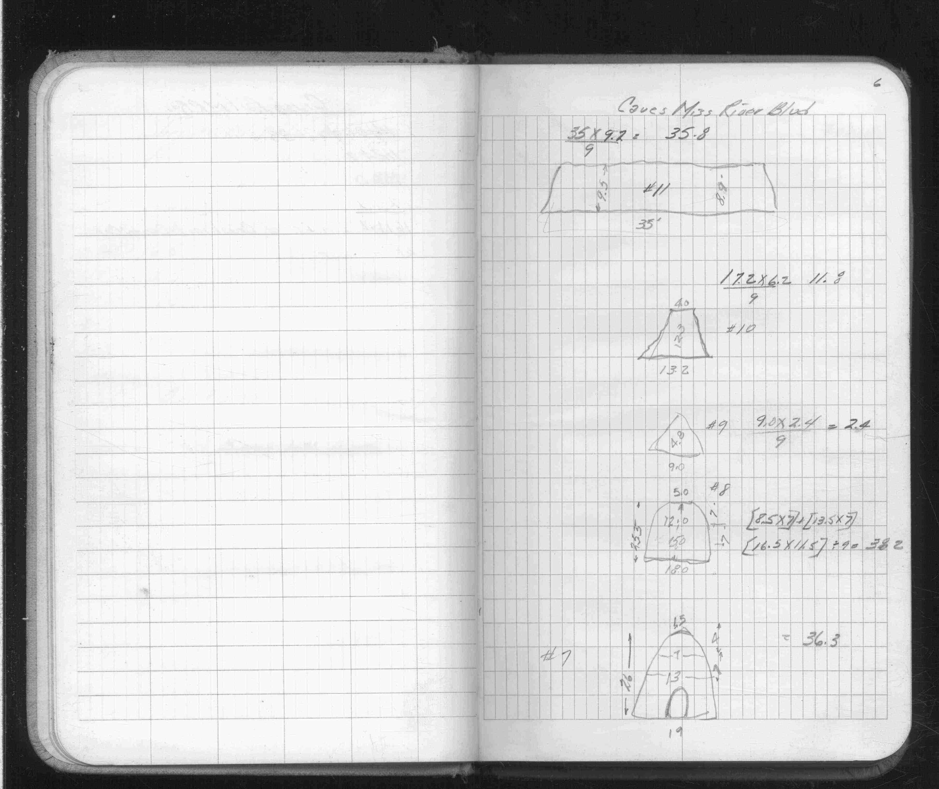
Miss River Blvd Caves
| Locations | 0000-00-00
6
7
Page(s) 8
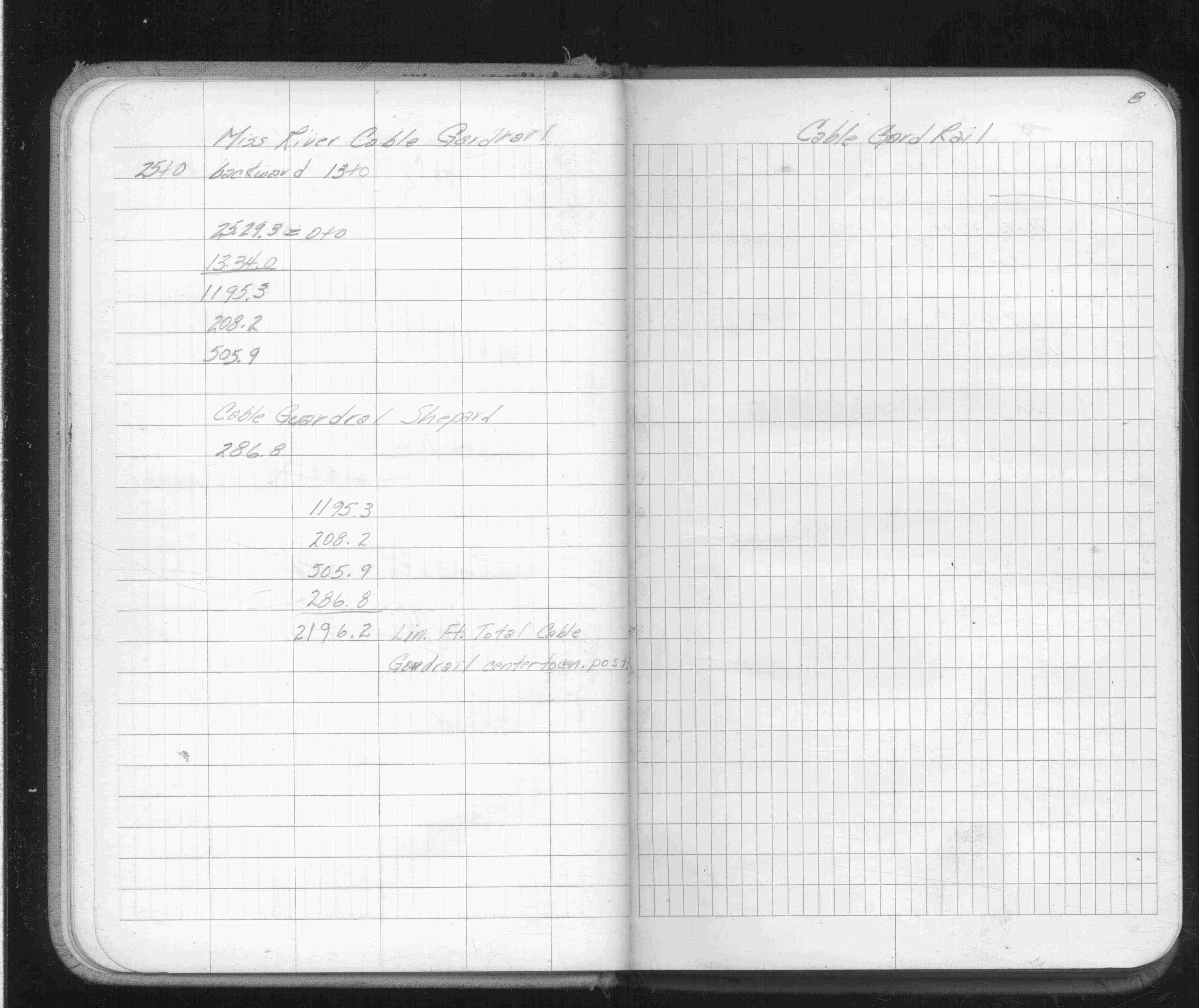
Miss River Cable Guard Rail
| Location | 0000-00-00
8
Page(s) 8
Shepard Road Guard Rail
| Location | 0000-00-00
8
Page(s) 9-11
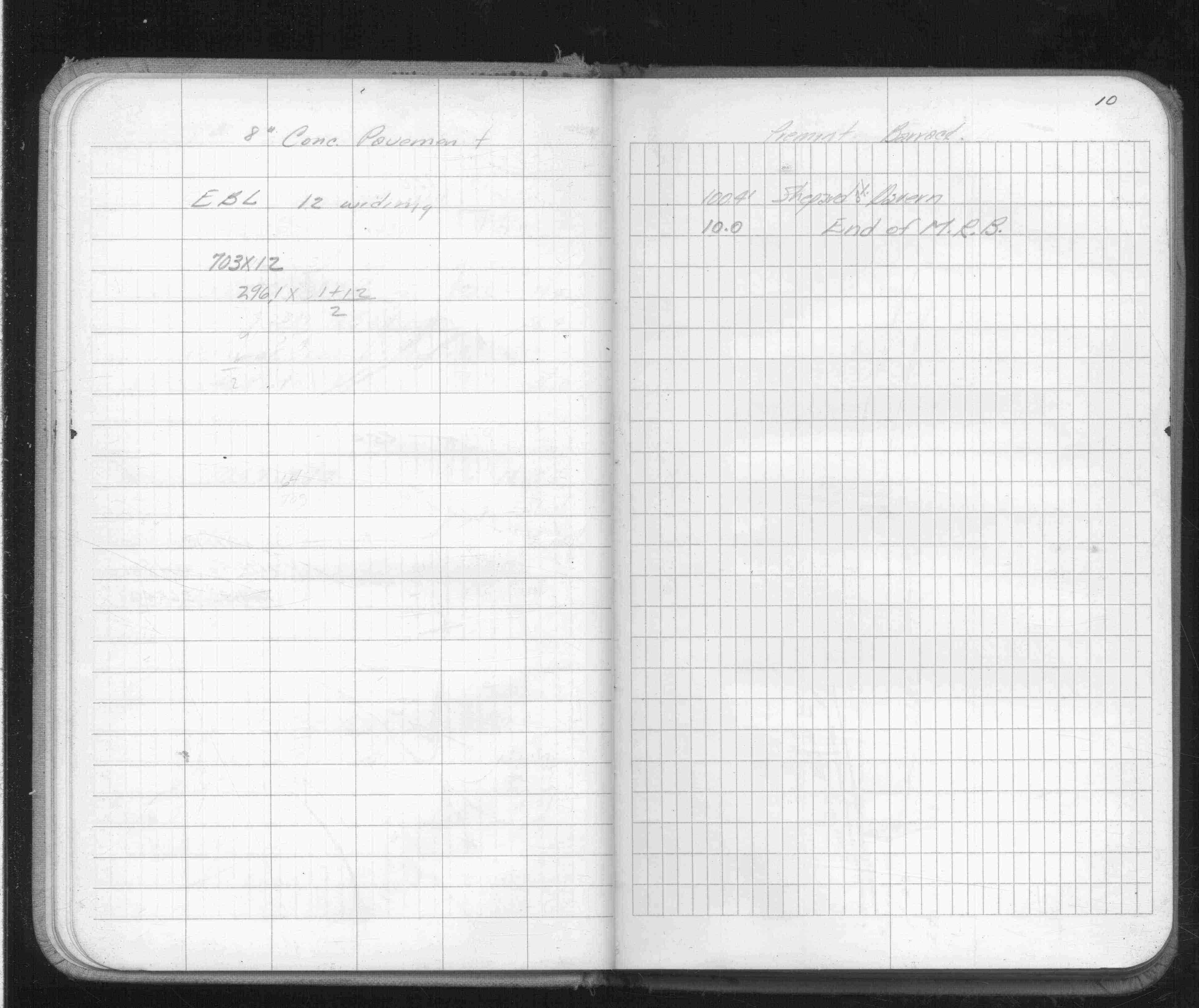
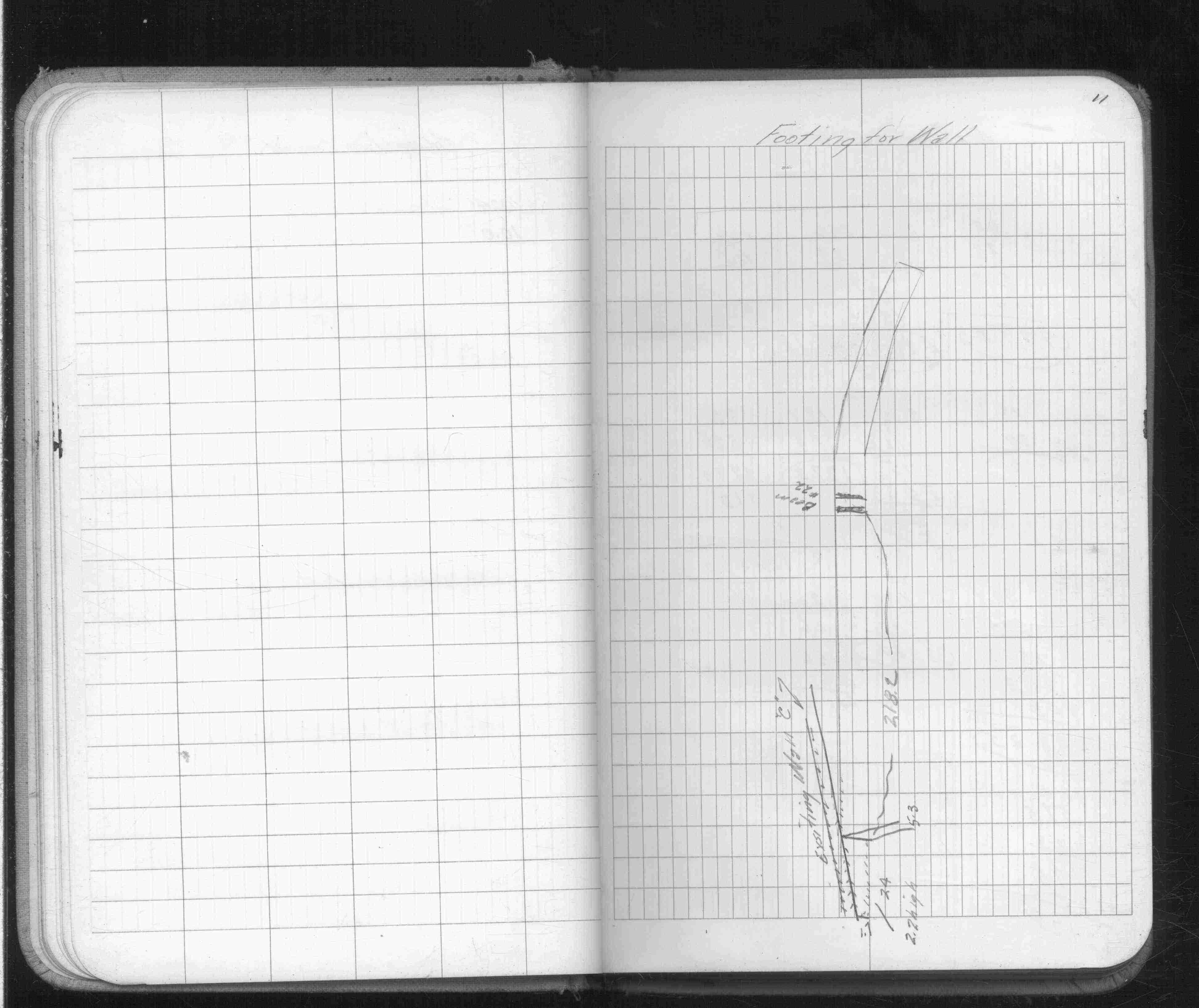
Shepard Road
| Locations | 0000-00-00
9
10
11
Page(s) 12-13
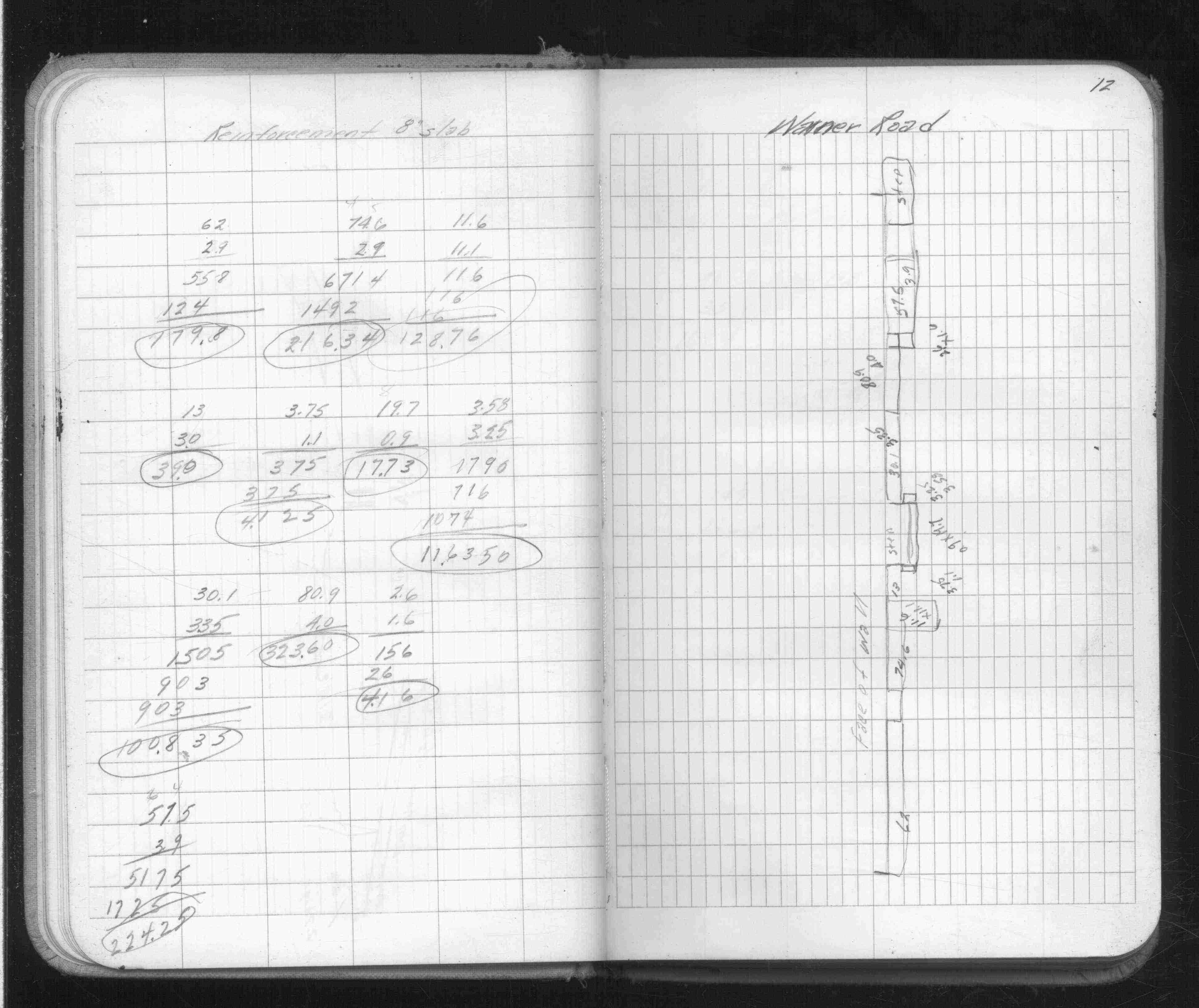
Warner Road
| Reinforcement Slab | 0000-00-00
12
13
Page(s) 14
Ohio St
FROM
Isabel Ave
TO
Fairfield Ave (Vac)
| Deflections | 0000-00-00
14
Page(s) 15-17
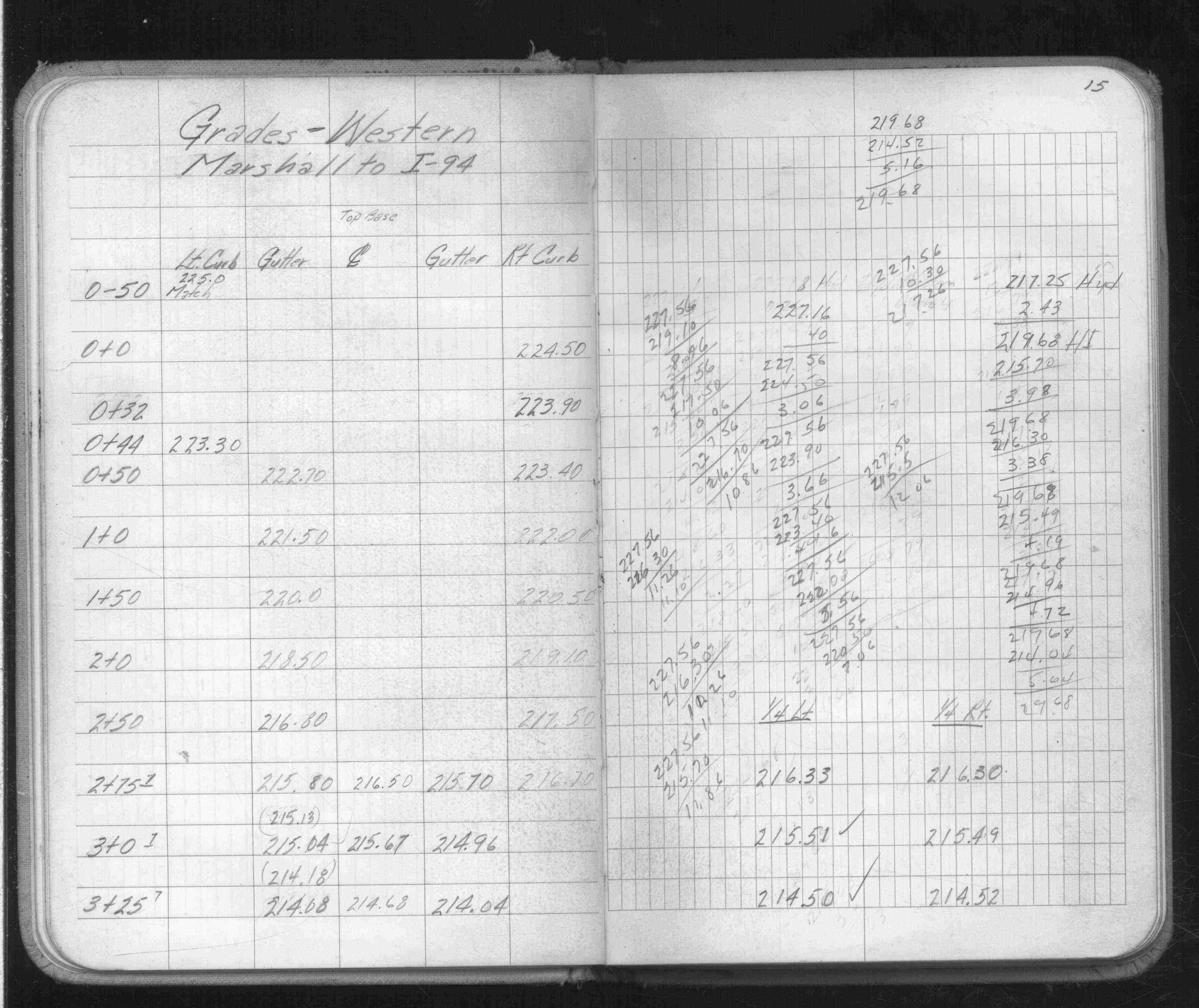
Western Ave
FROM
Marshall Ave
TO
I-94
| Grades | 0000-00-00
15
16
17
Page(s) 18
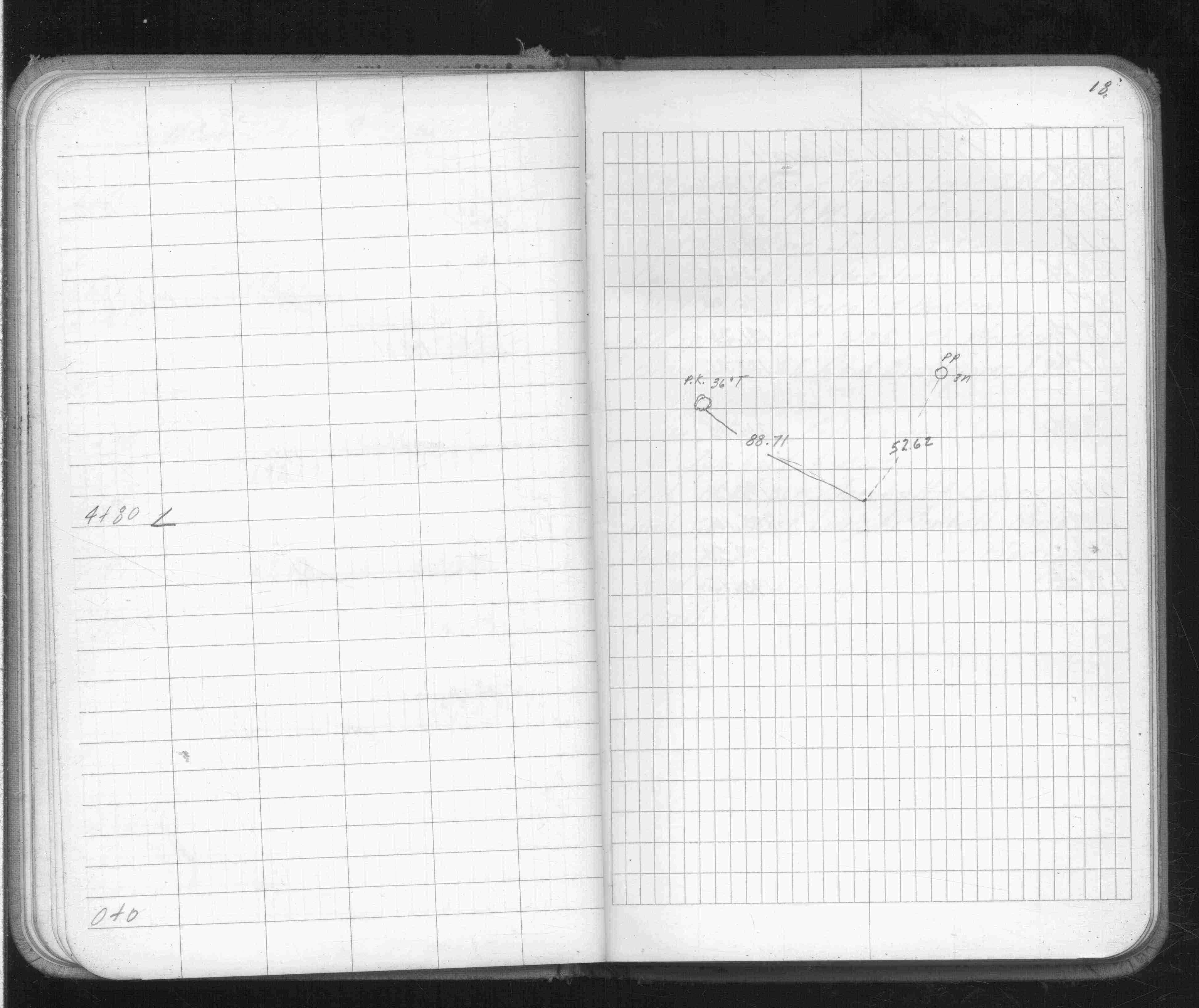
Western Ave
FROM
Angle Pt @ Station 4+80
| Ties | 0000-00-00
18
Page(s) 19
Western Ave
FROM
Marshall Ave
TO
Carroll Ave
| Bench Marks | 0000-00-00
19
Page(s) 20
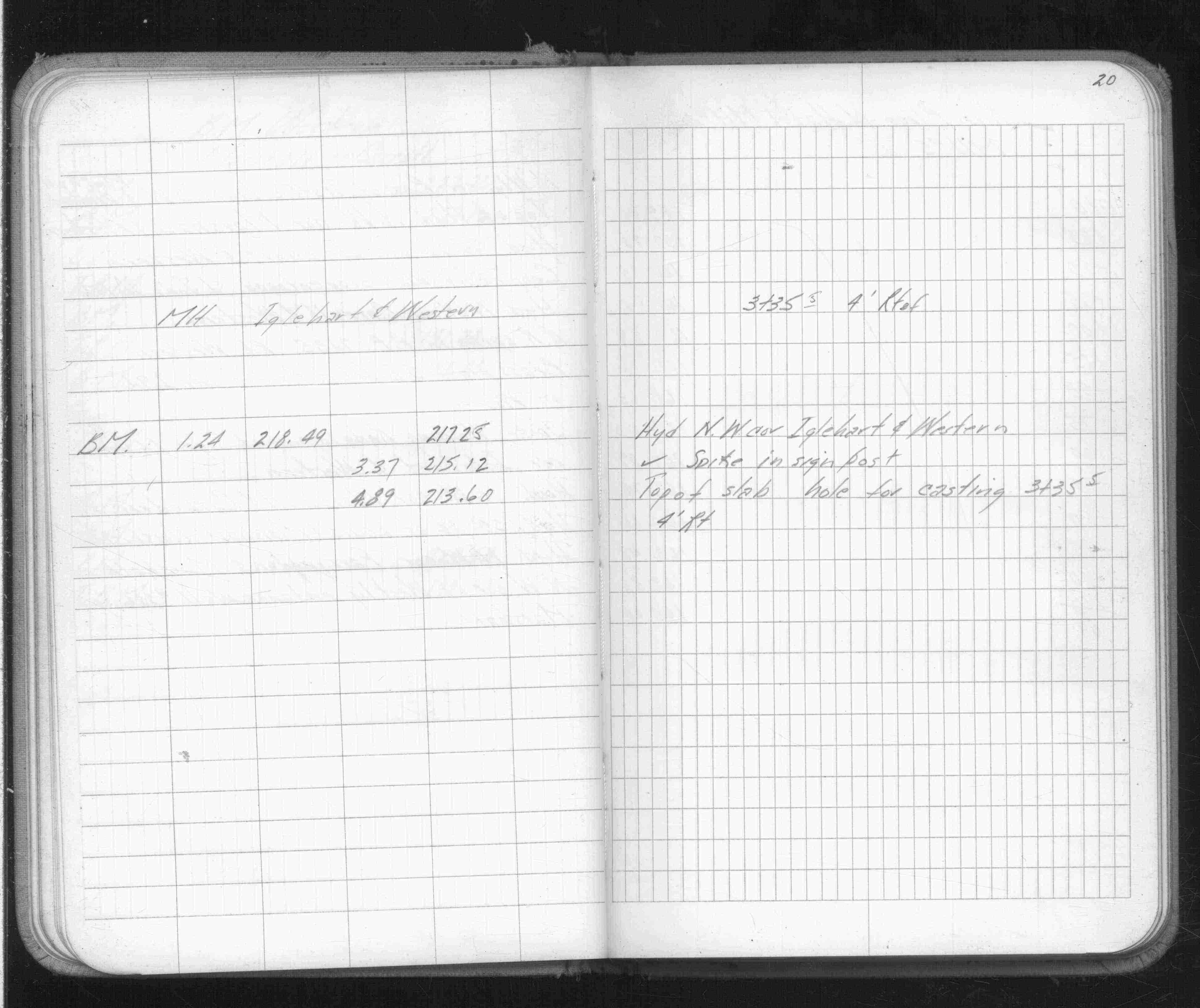
Iglehart & Western Aves
| Bench Mark | 0000-00-00
20
Page(s) 21-22
Kim Place
FROM
Void
TO
Void
| Void | 0000-00-00
21
22
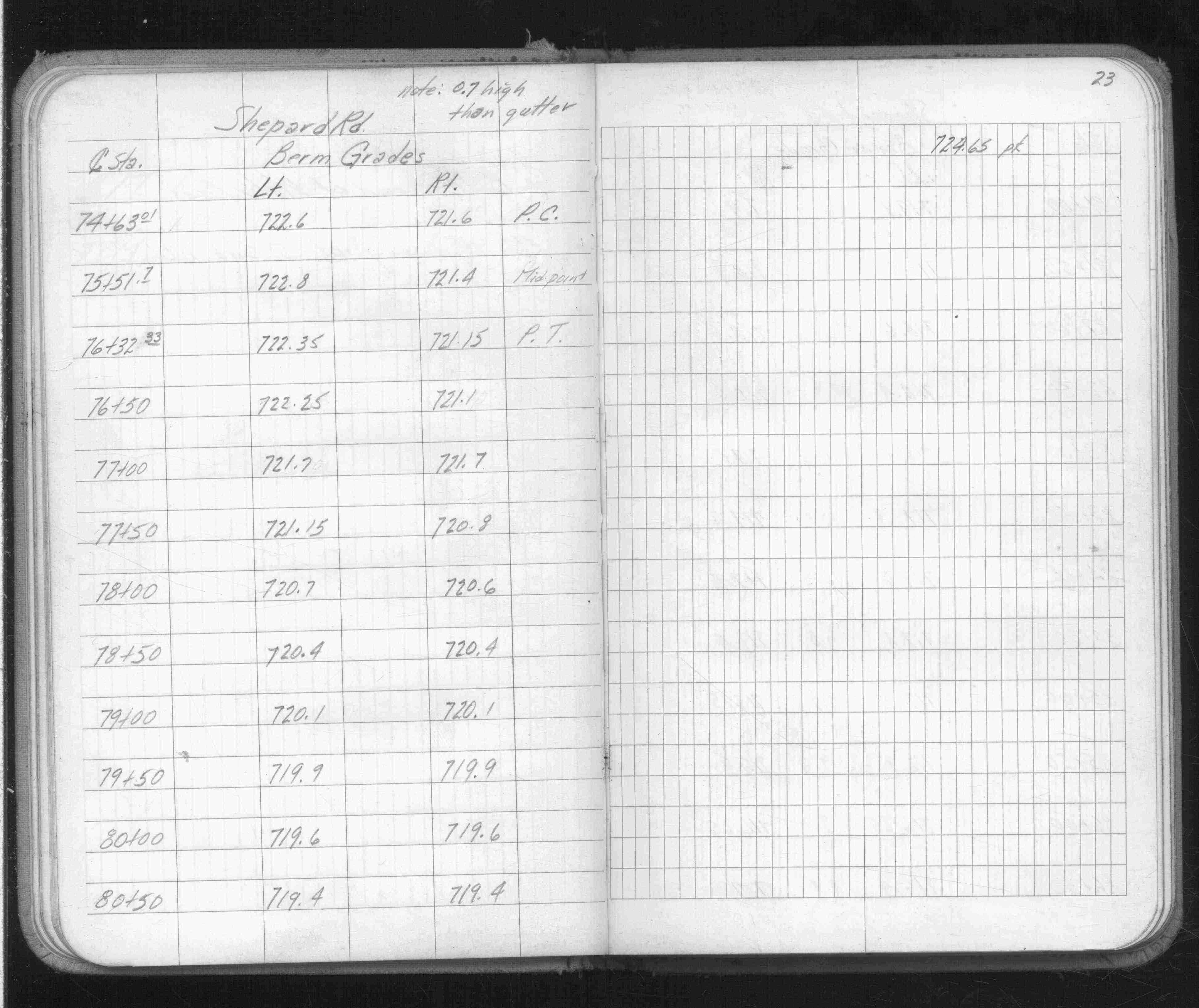
Page(s) 23-26
Shepard Rd
FROM
Station 74+63.01
TO
Station 91+54
| Berm Grades | 0000-00-00
23
24
25
26
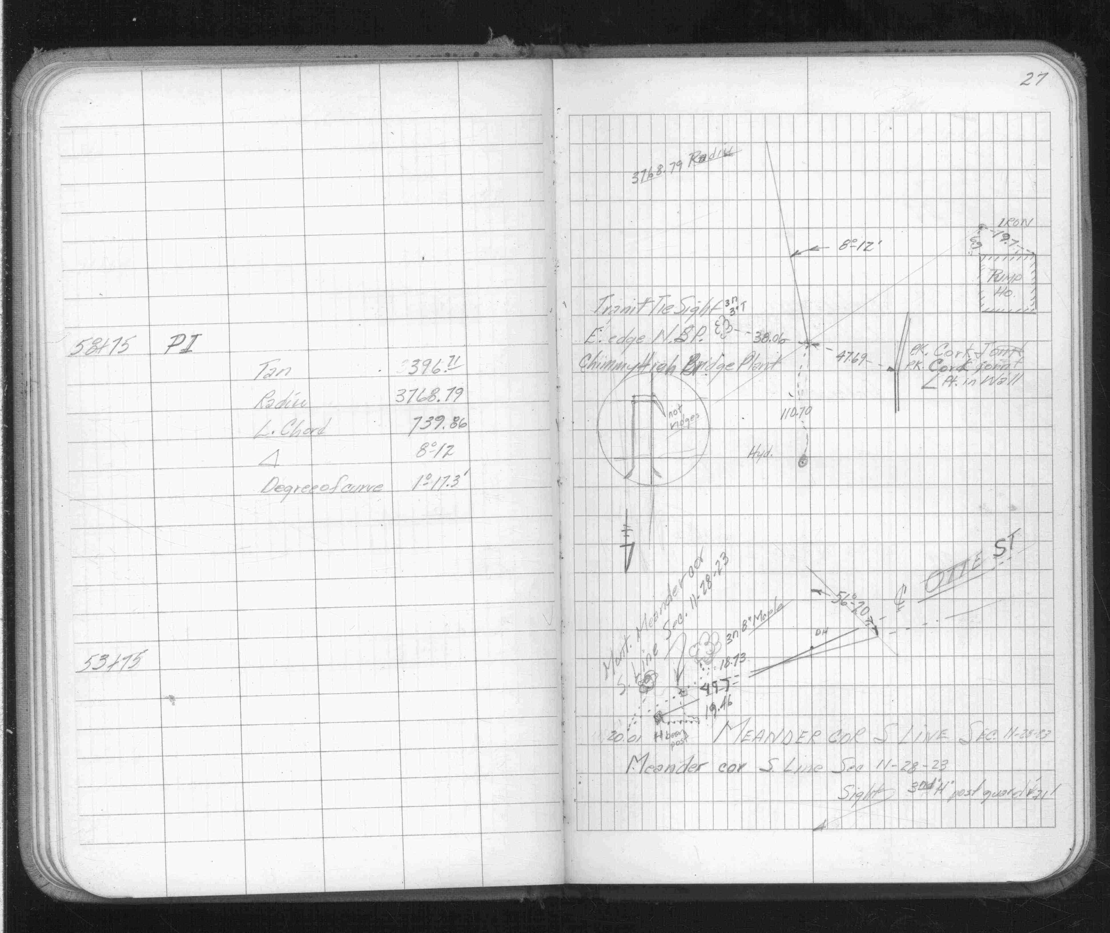
Page(s) 27-28
Shepard Rd @ Bridge
| Alignment | 1966-12-06
27
28
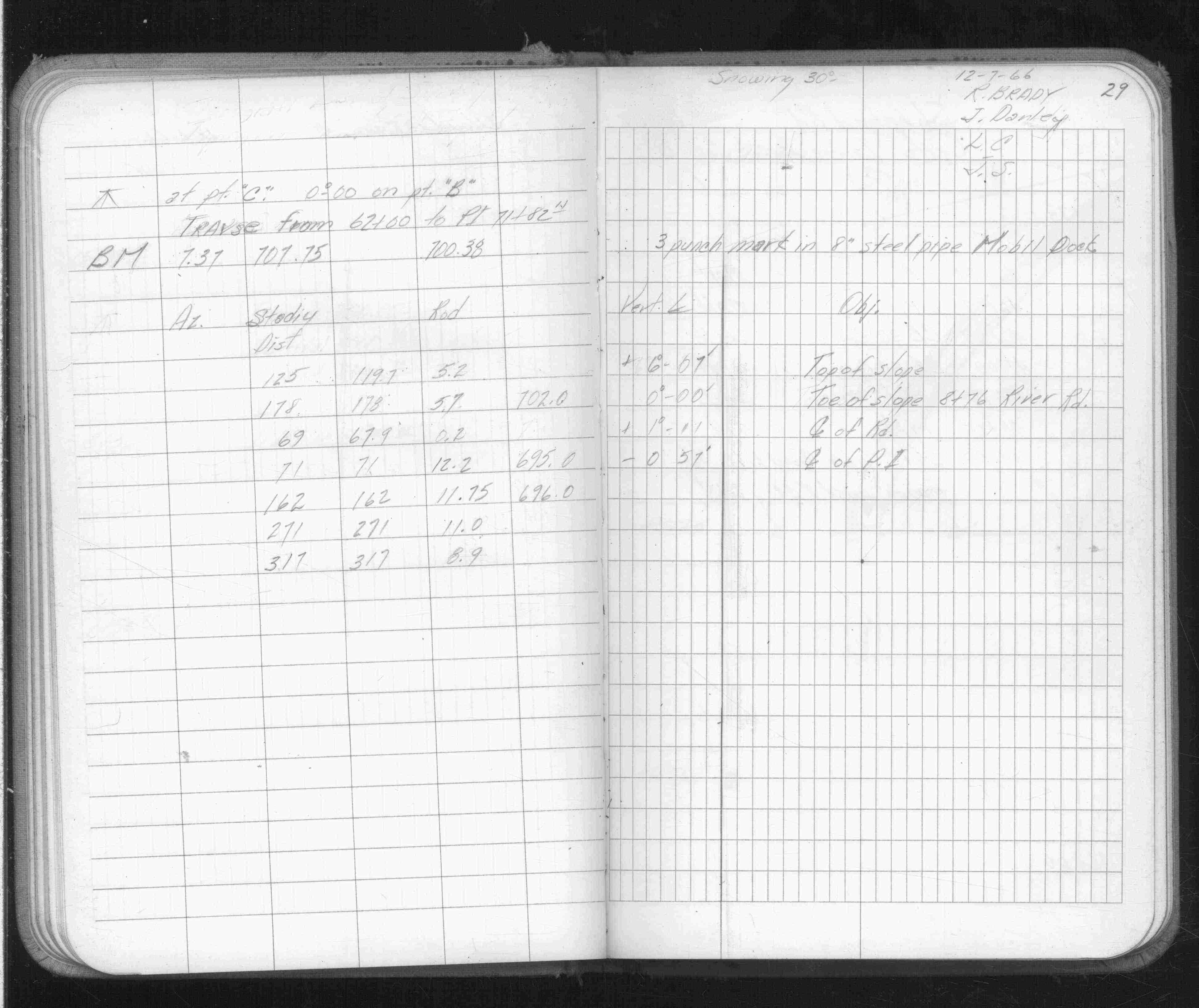
Page(s) 29
Shepard Rd @ Bridge
FROM
Station 62+00
TO
PI 71+82.11
| Traverse | 1966-12-07
29
Page(s) 30-31
Shepard Rd & Otto Ave
FROM
Station 46+00
TO
Station 48+50
| Locations & X-Secs | 0000-00-00
30
31
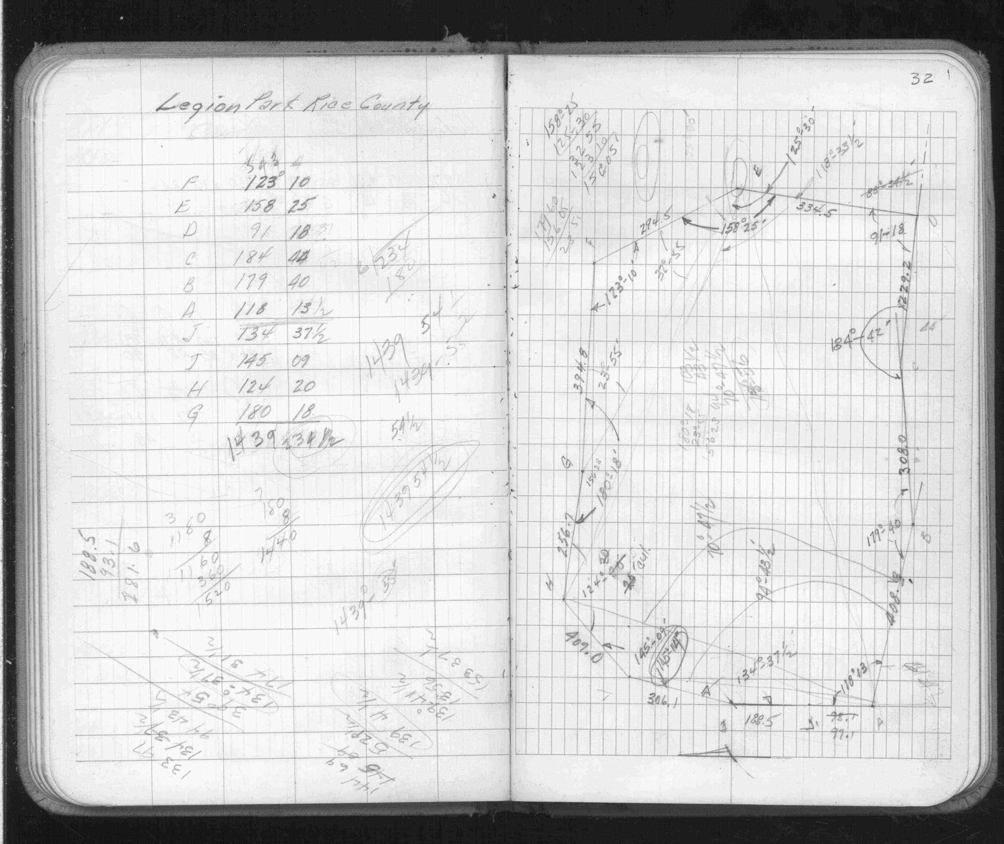
Page(s) 32
Legion Park Rice County
| Park Boundary | 0000-00-00
32
Page(s) 33
Area bounded by Herschel St & Shields& St Anthony Aves & Aldine St
| Alley Measurments | 0000-00-00
33
Page(s) 34
Alley
FROM
Herschel St
TO
NS Alley
| Locations | 0000-00-00
34
Page(s) 35
Darfield
FROM
MH # 1
TO
SE Corner
| Elevation | 0000-00-00
35
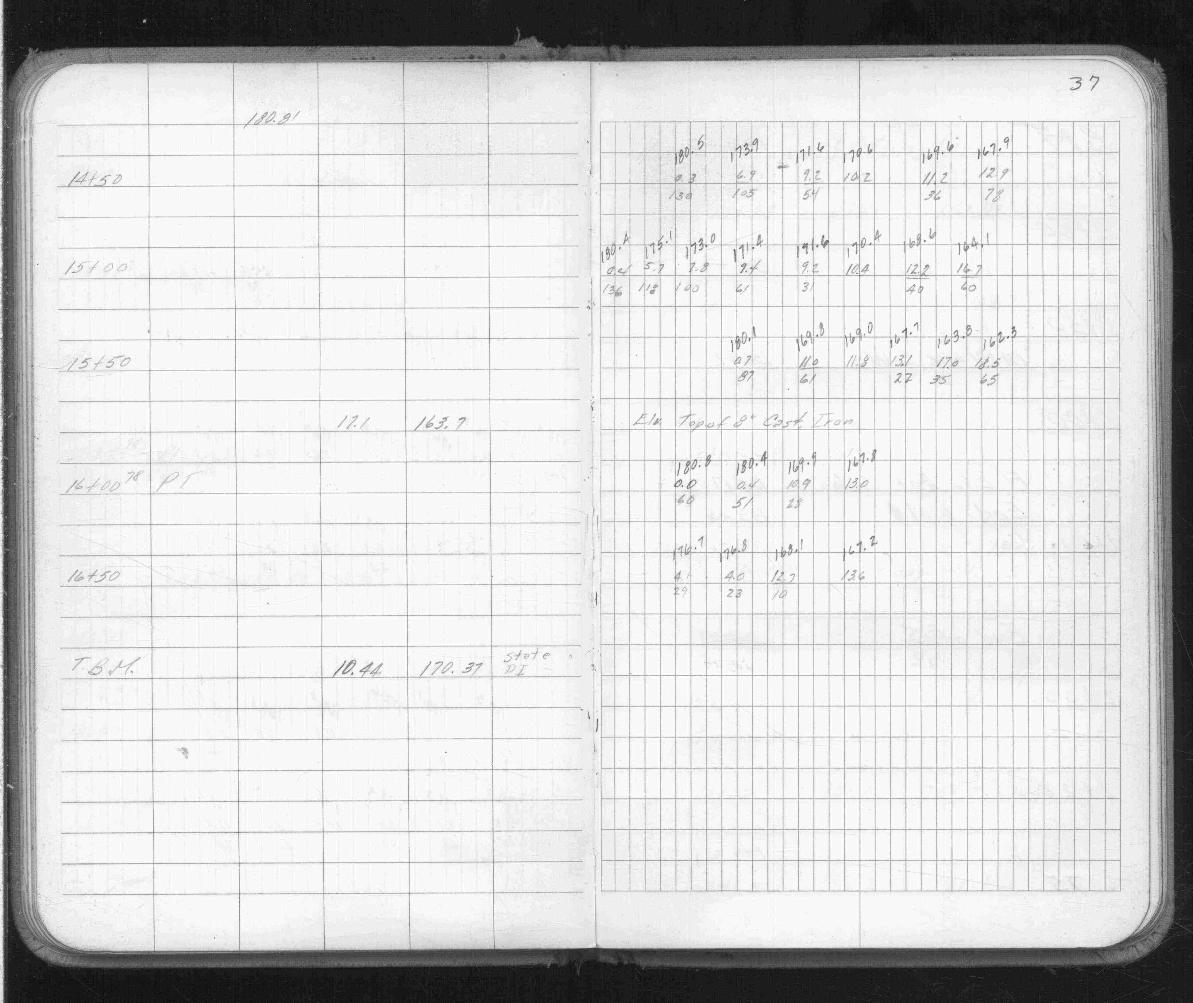
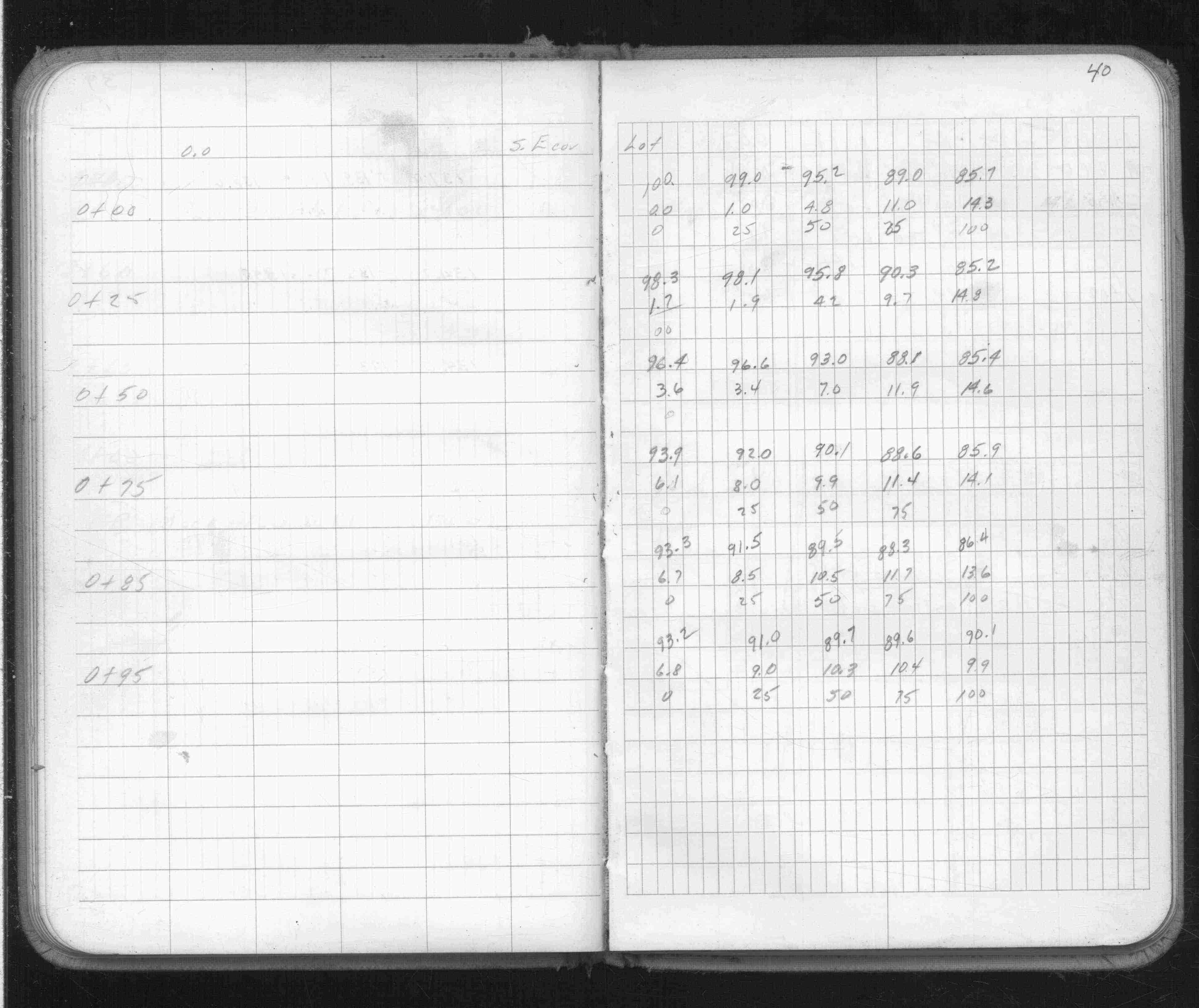
Page(s) 36-40
Ramp C Short Line
FROM
Station 11+77.57
TO
Station 16+50
| Cross Sections | 0000-00-00
36
37
38
39
40
Page(s) 41
Alley Going West from Aldine St
FROM
Aldine St
TO
End of Alley
| Locations | 0000-00-00
41
Page(s) 42-45
Civic Stadium
| BMs & X-Secs | 1970-01-13
42
43
44
45
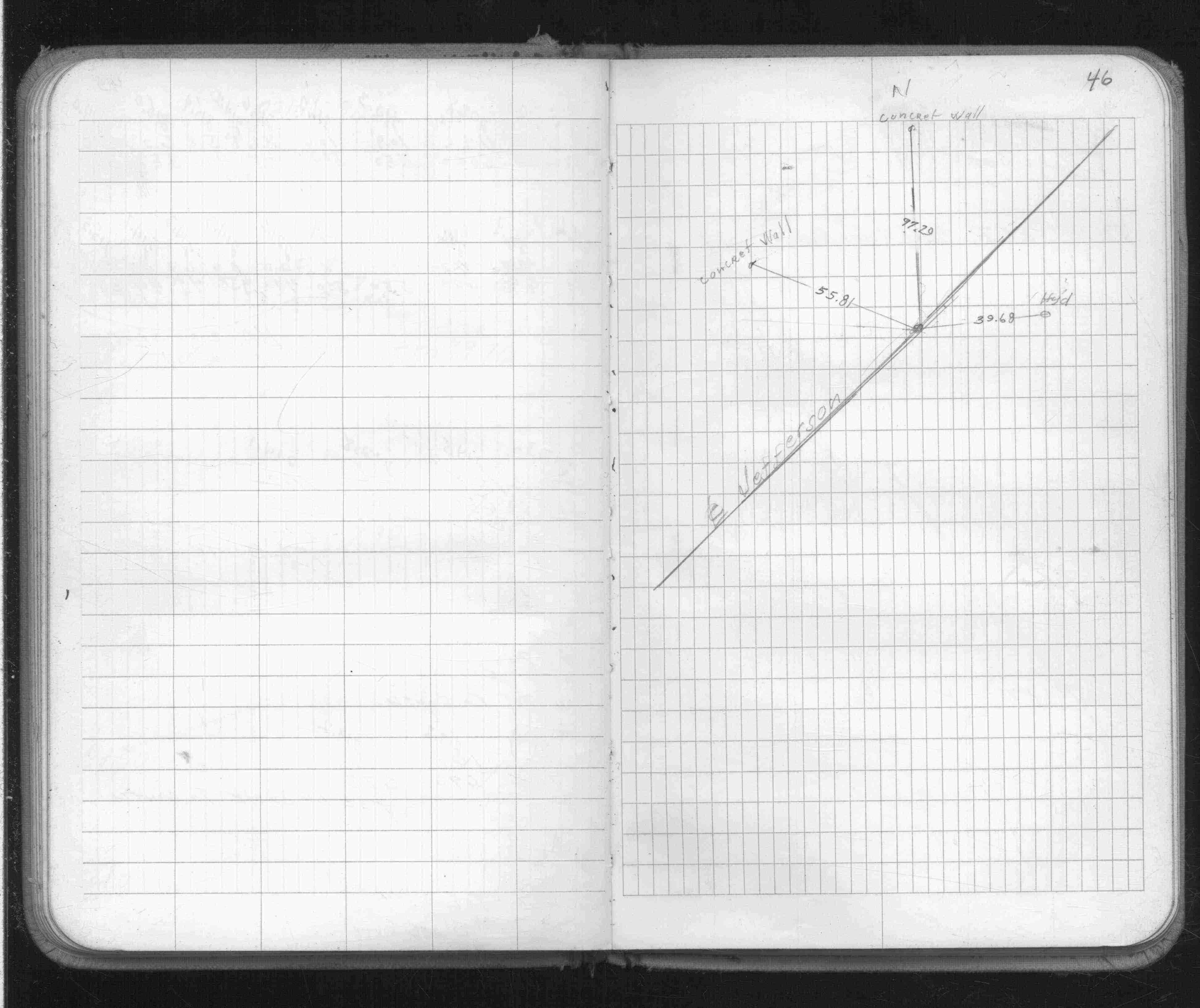
Page(s) 46
Center Line Jefferson Ave
| Ties | 0000-00-00
46
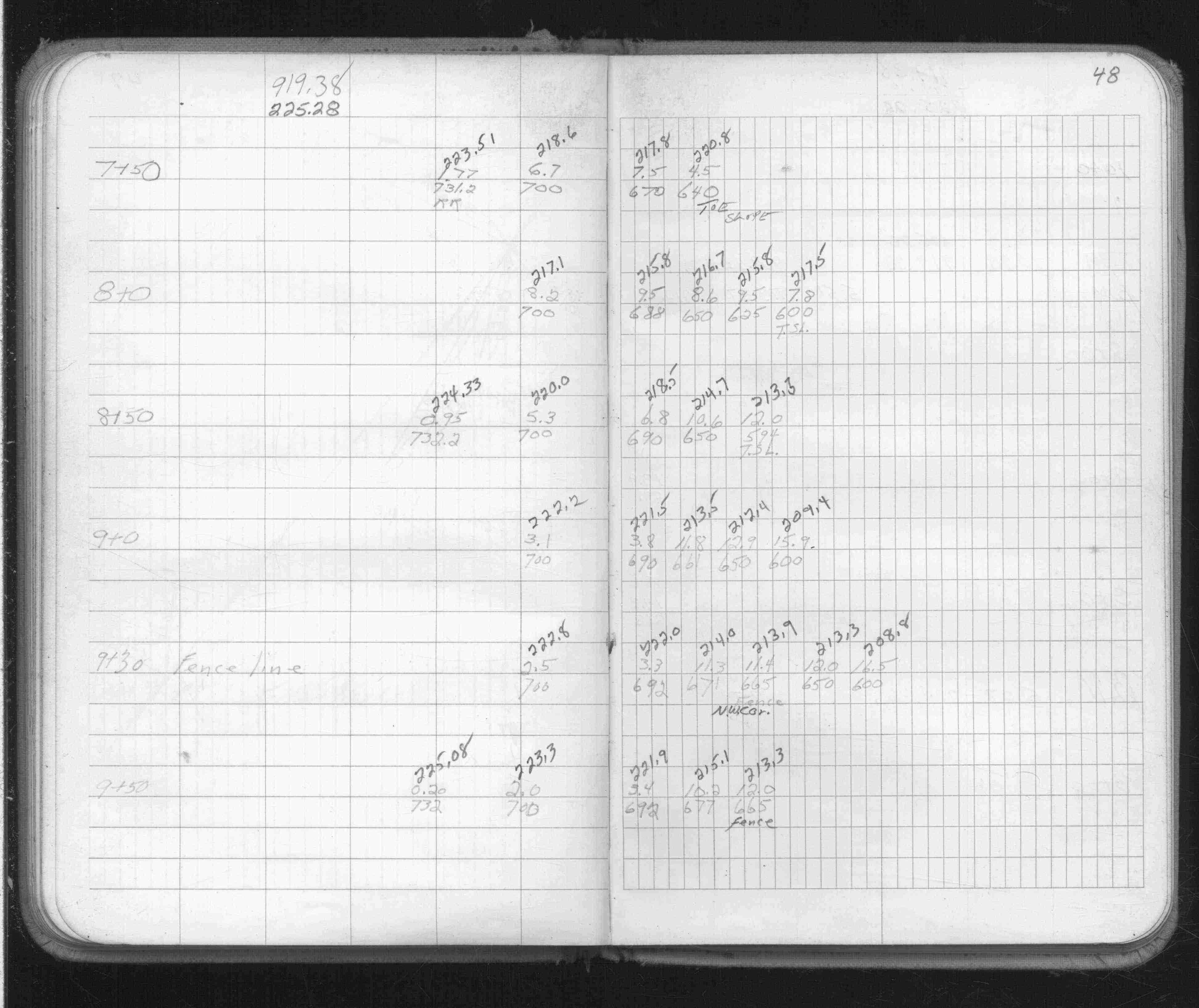
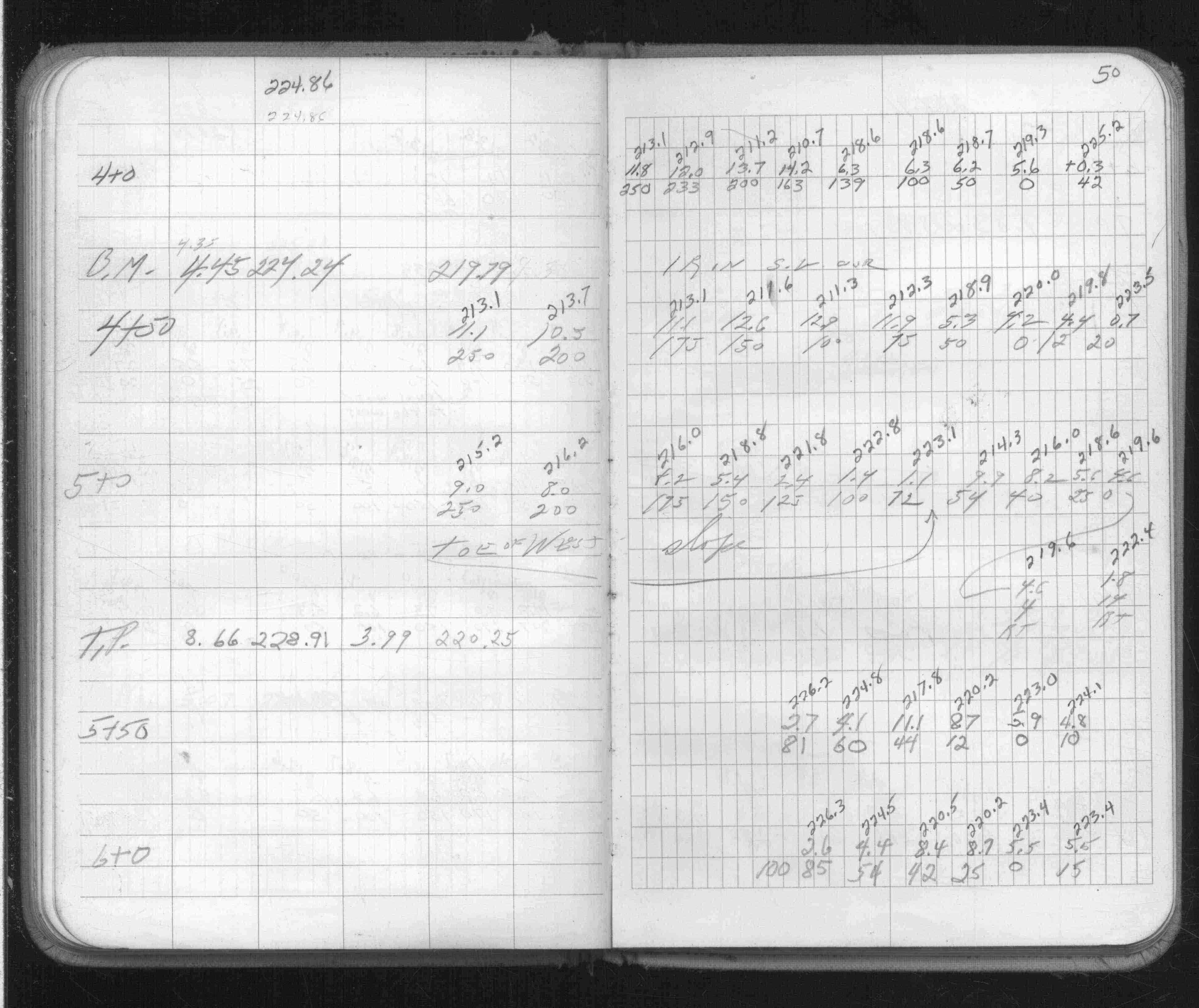
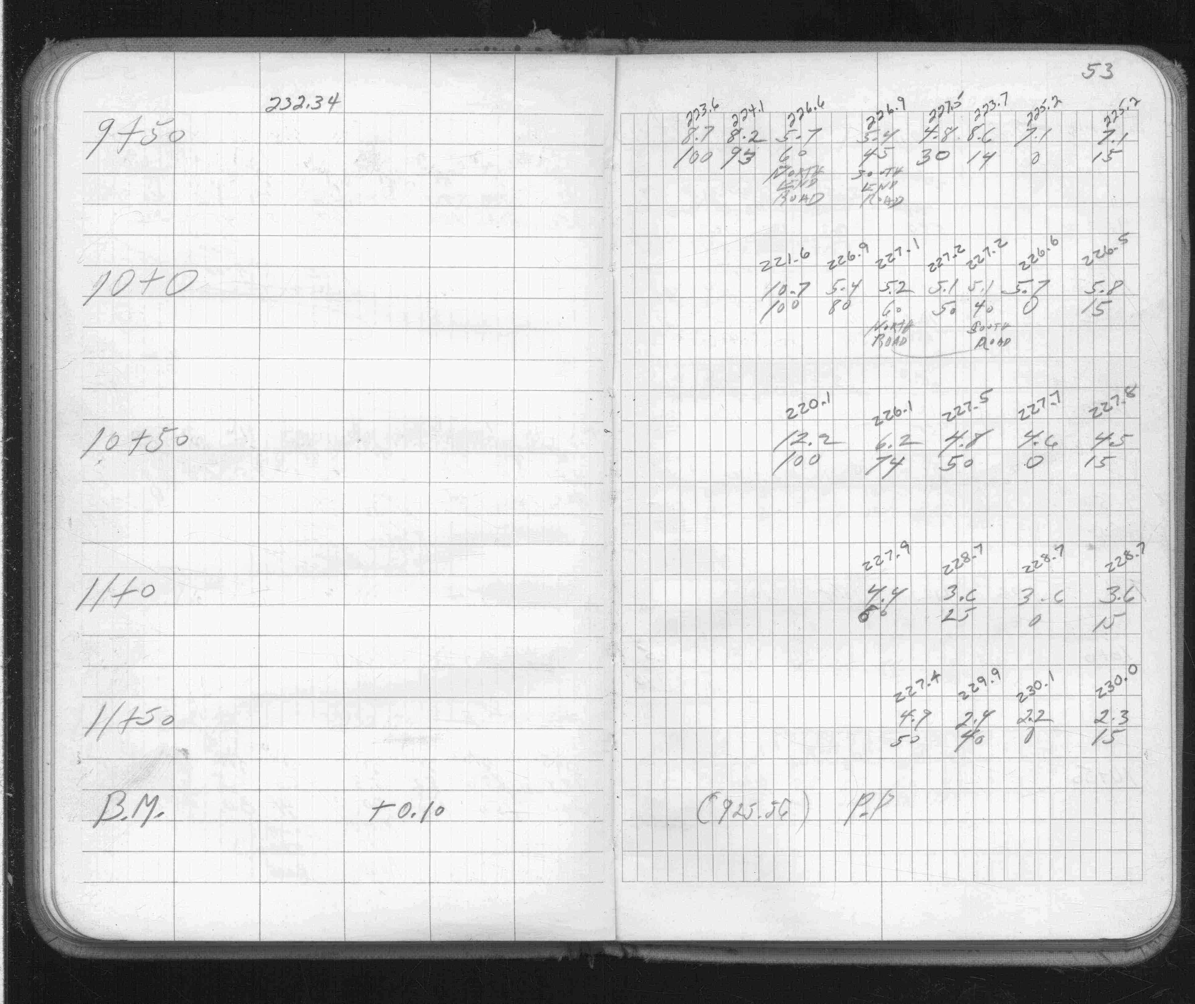
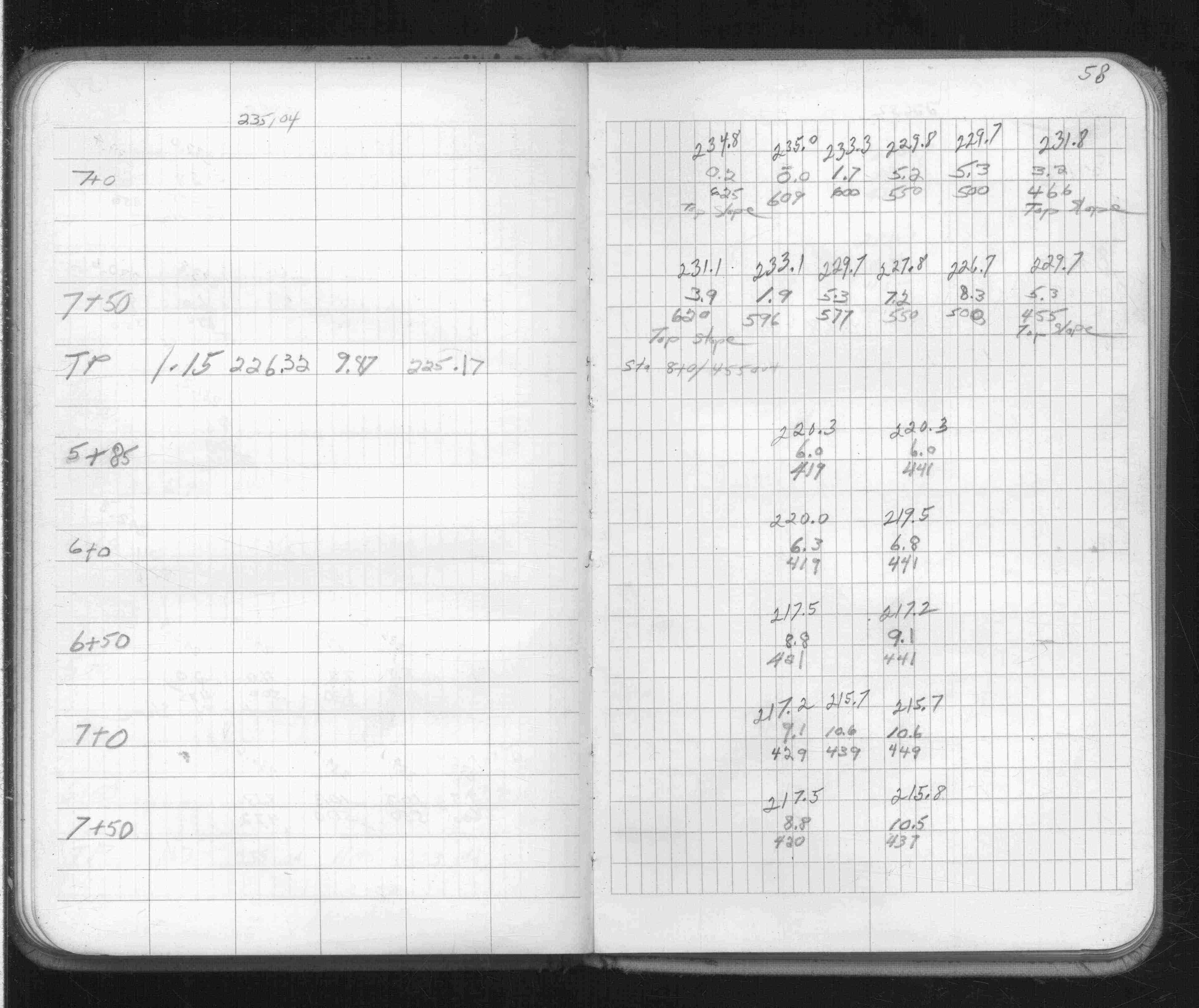
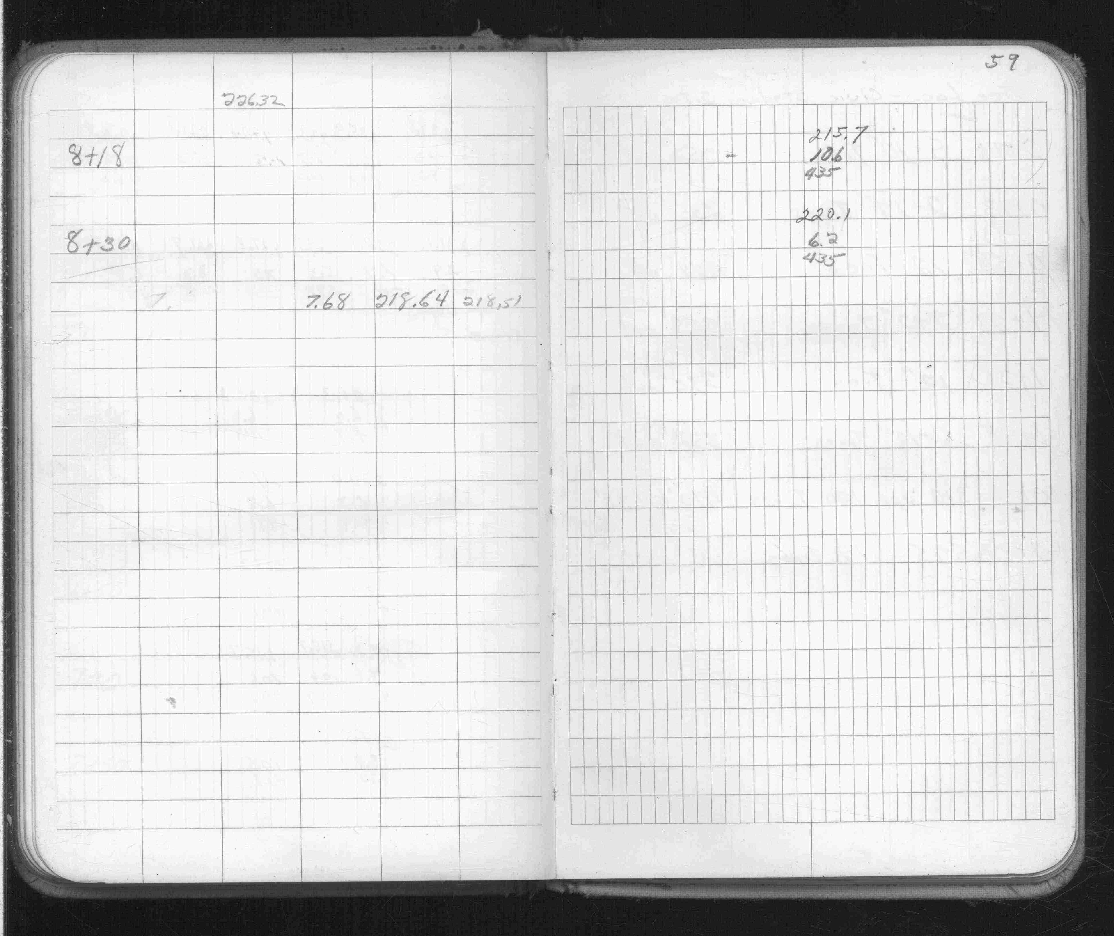
Page(s) 47-59
Civic Stadium
| Ties & X-Secs | 0000-00-00
47
48
49
50
51
52
53
54
55
56
57
58
59
Page(s) 60
Civic Stadium Site
FROM
Station 0+14
TO
Station 3+0
| Tree Locations | 0000-00-00
60
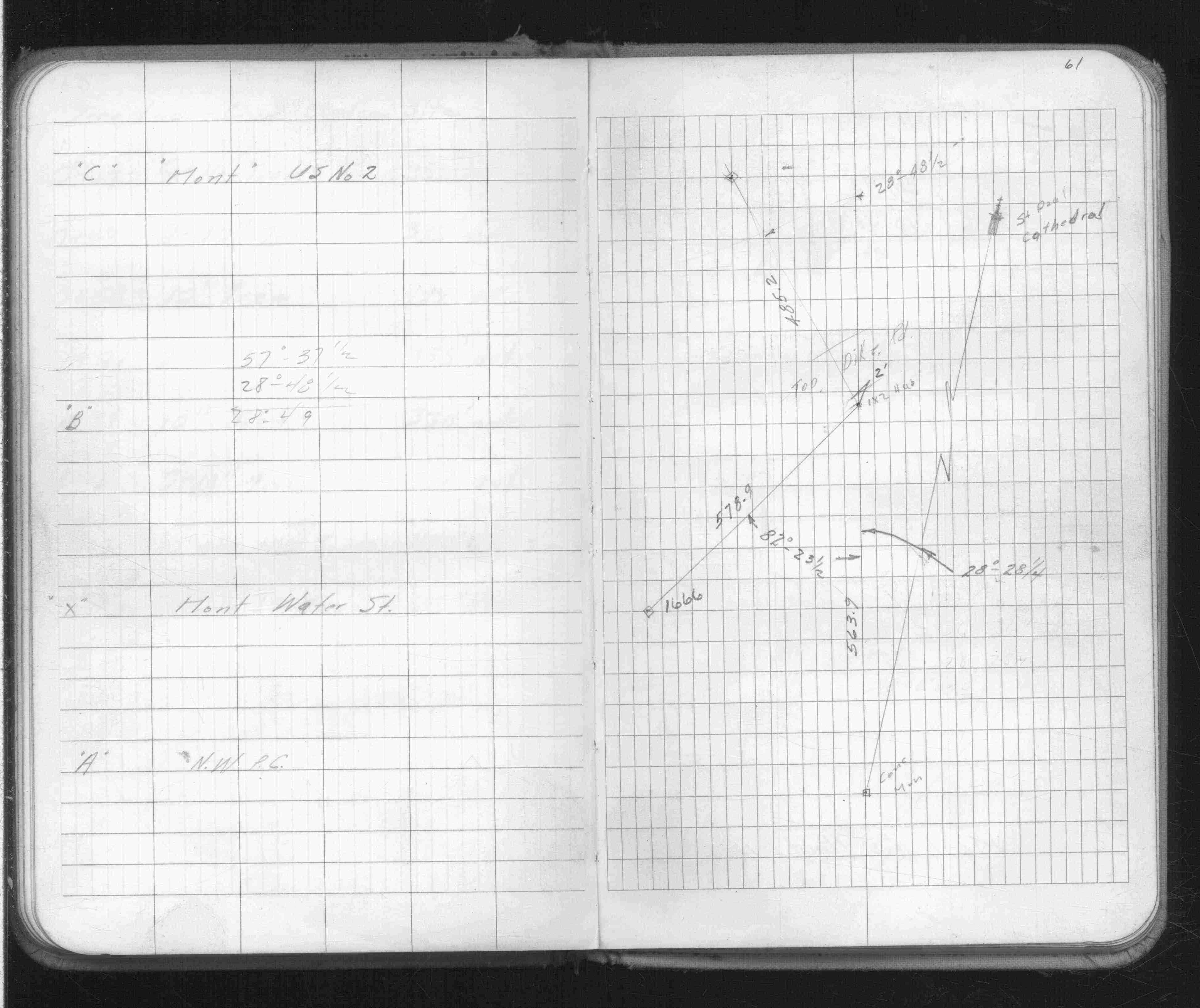
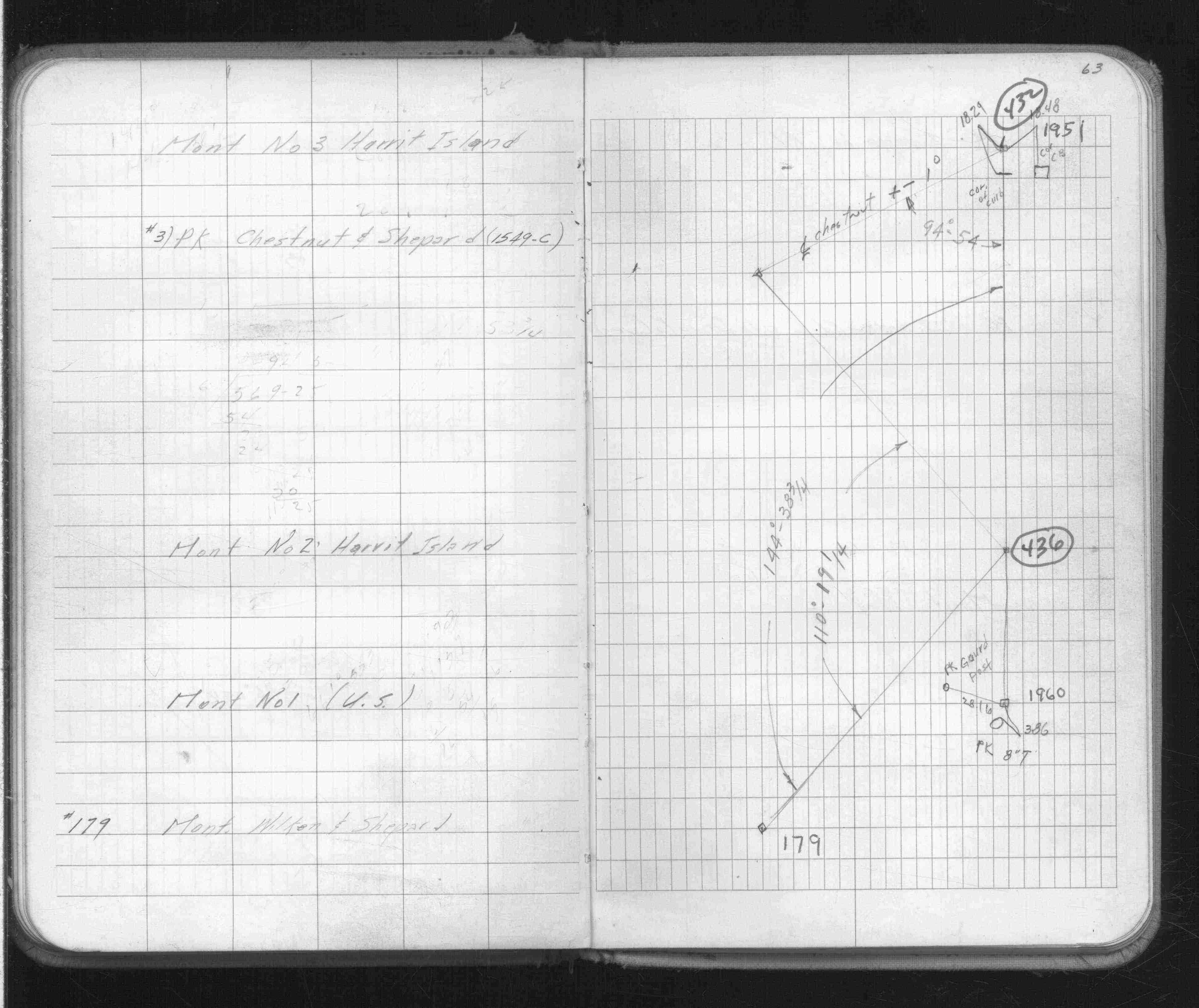
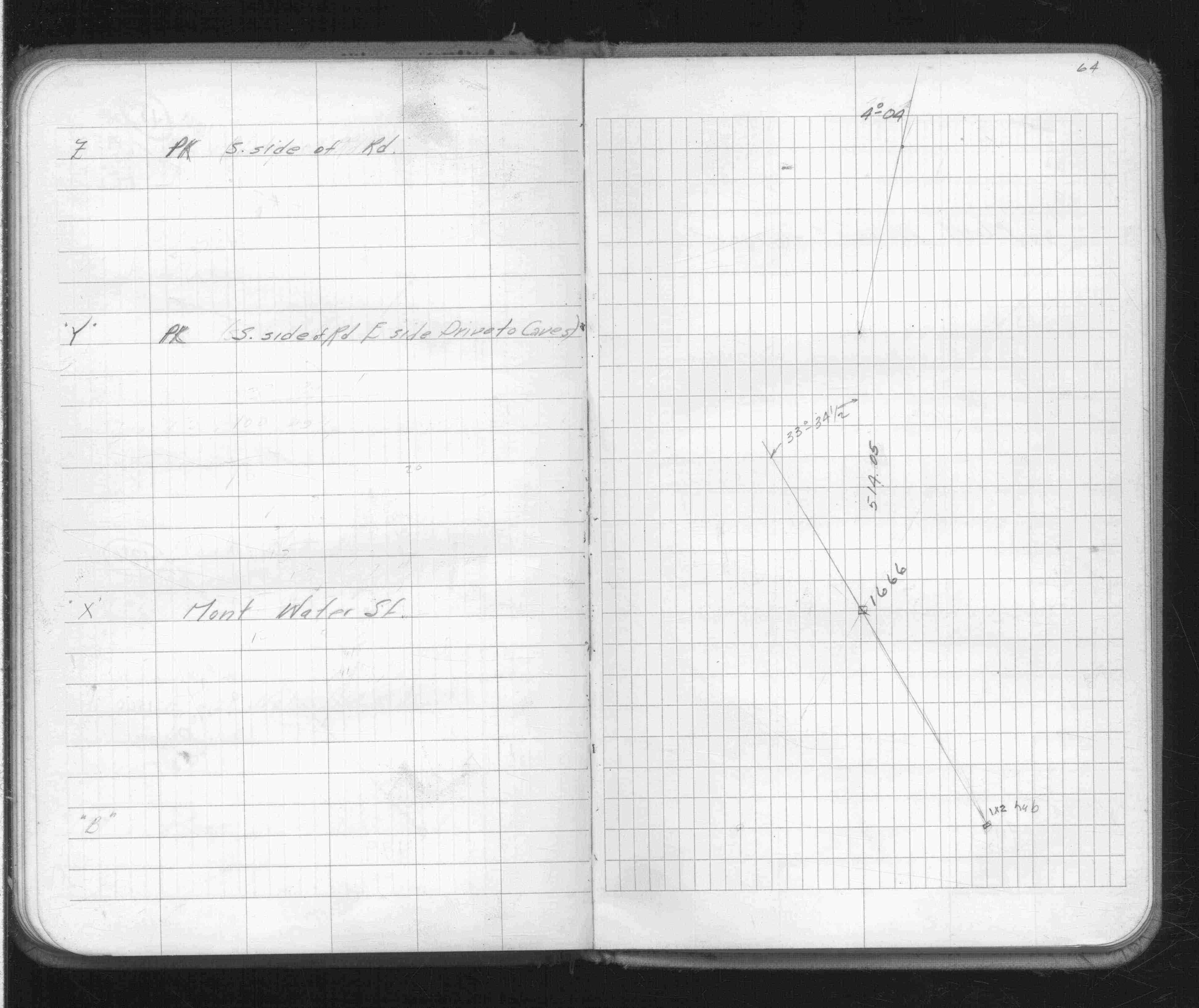
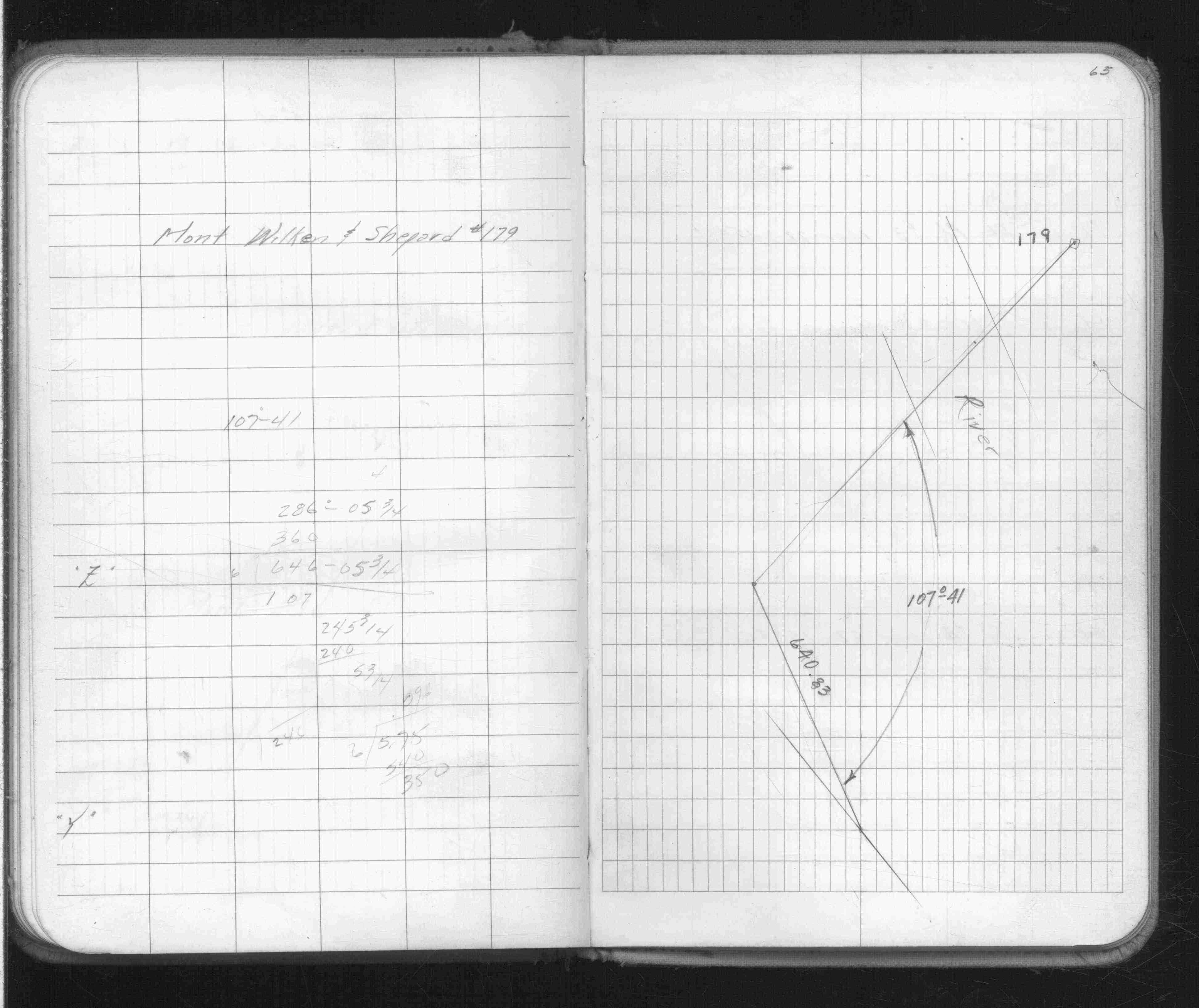
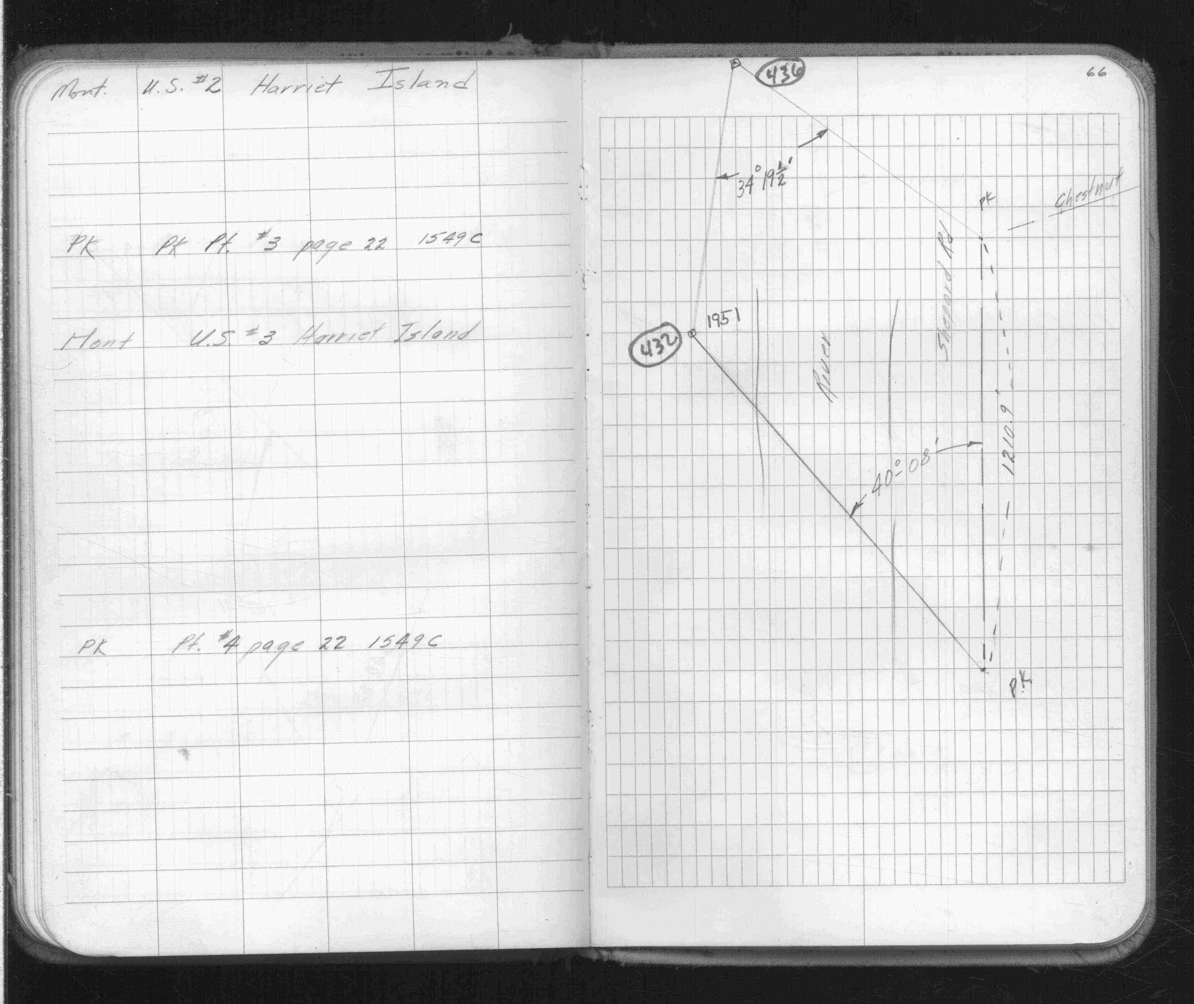
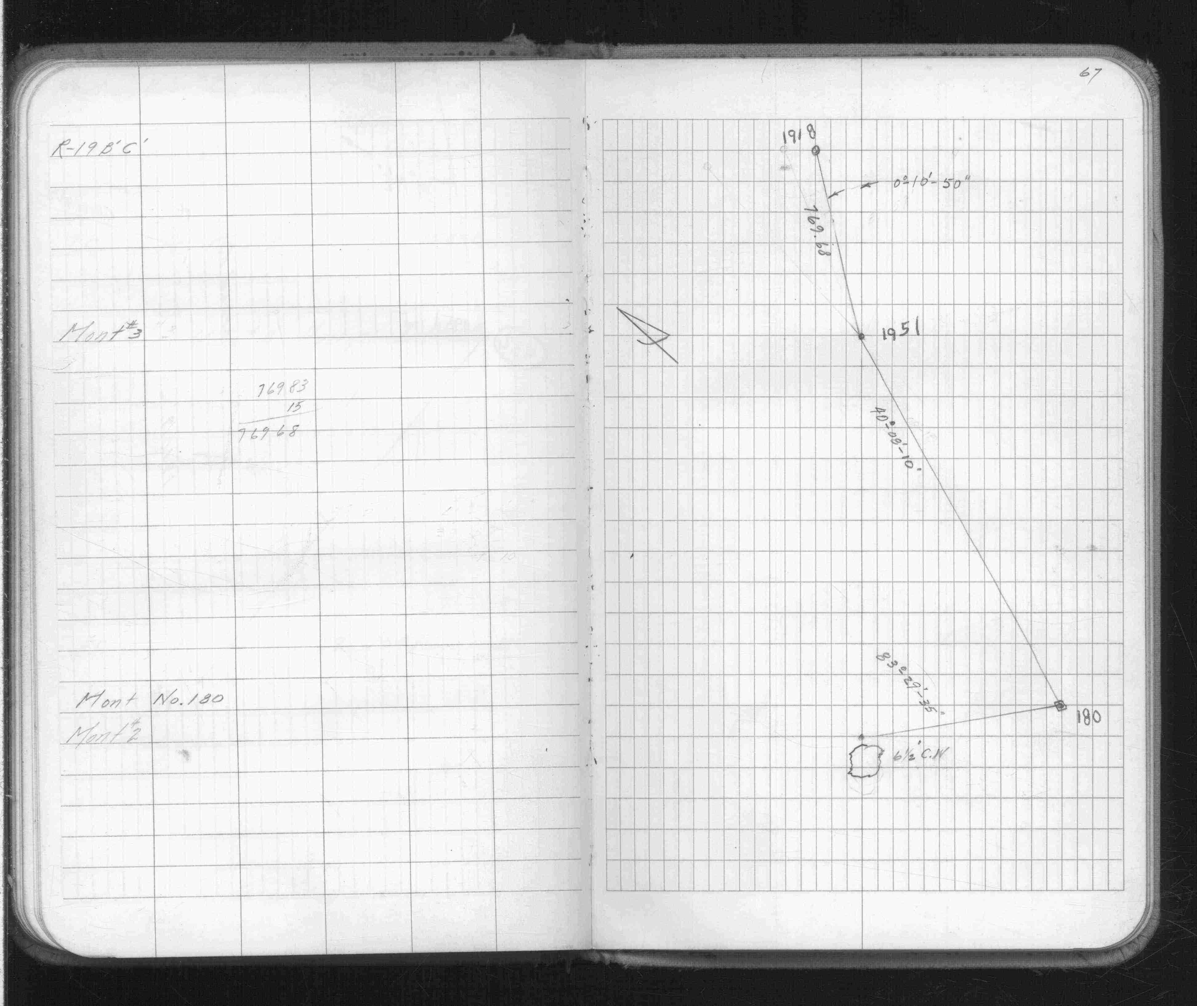
Page(s) 61-67
Harriet Island
| Monument Location | 0000-00-00
61
62
63
64
65
66
67
Page(s) 68-75
Blank Pages
FROM
Blank
TO
Blank
| Blank | 0000-00-00
Page(s) 76
Employee Calculations
FROM
Calculations
TO
Calculations
| Calculations | 0000-00-00
76
Page(s) 77
Short Line Rd
| Surveyor Note | 0000-00-00
77
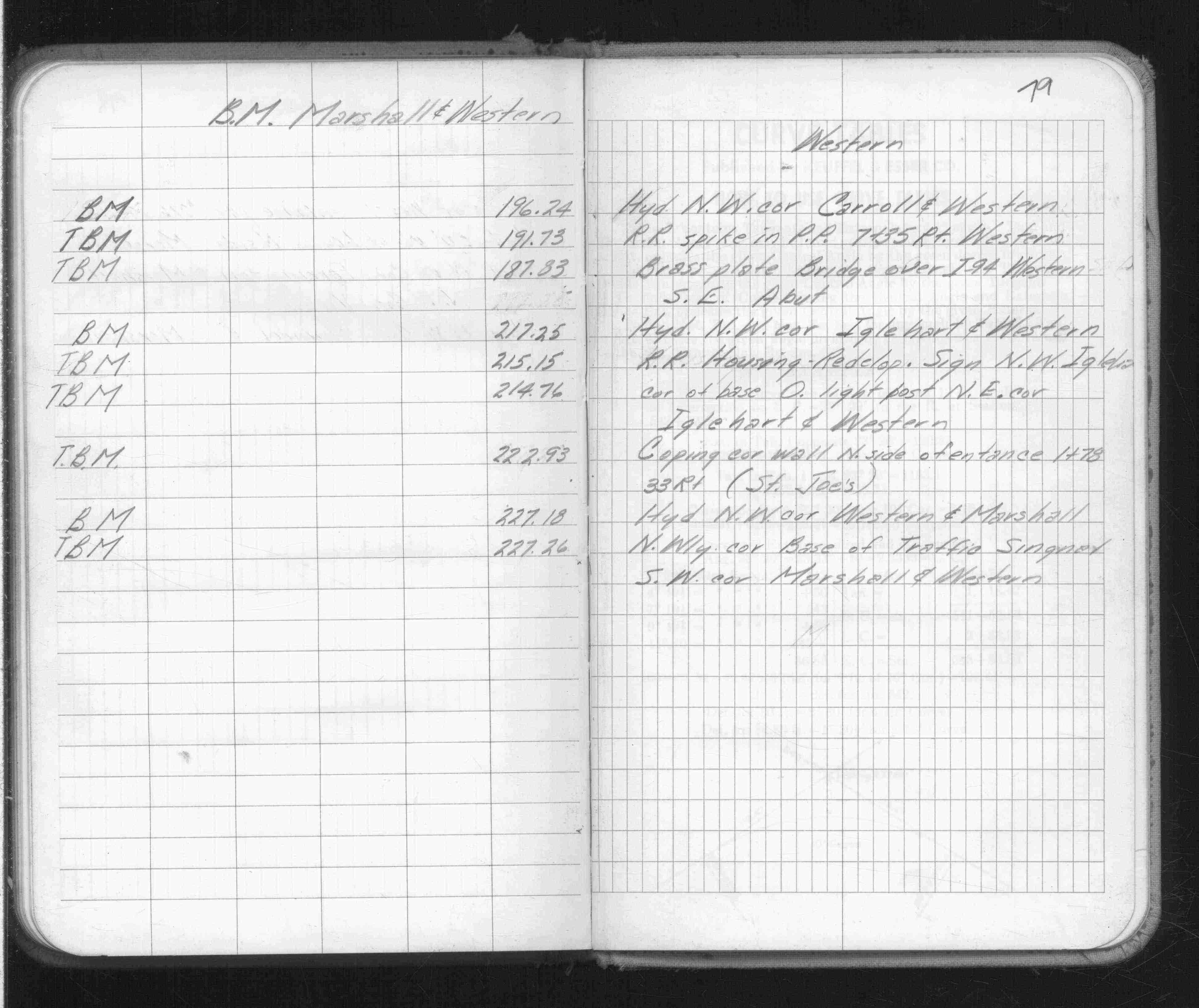
Page(s) 78-79
Marshall & Western Aves
| Bench Marks | 0000-00-00
78
79
Page(s) 80
Blank Page
FROM
Blank
TO
Blank
| Blank | 0000-00-00