| NAD83 COORDINATES (1986 adj.): |
|---|
| * X= 566505.03 Y= 168015.19 Z= 0 LSQ 12/6/1991 S FIX |
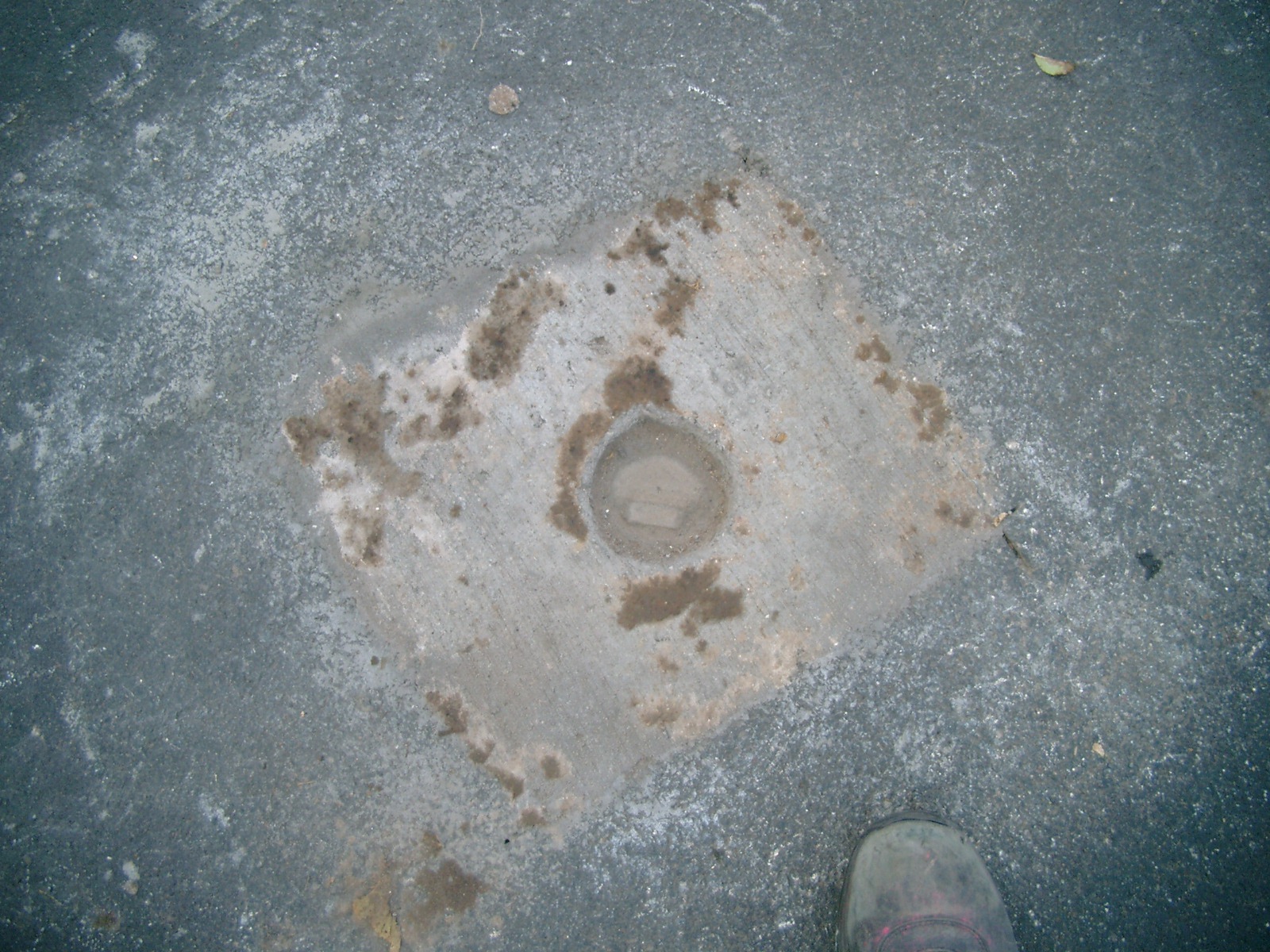
| 11/1/2011 | CIM damaged by milling machine. New CIM set to grade. Photos taken and EDM ties placed using Sokkia Set 5. |
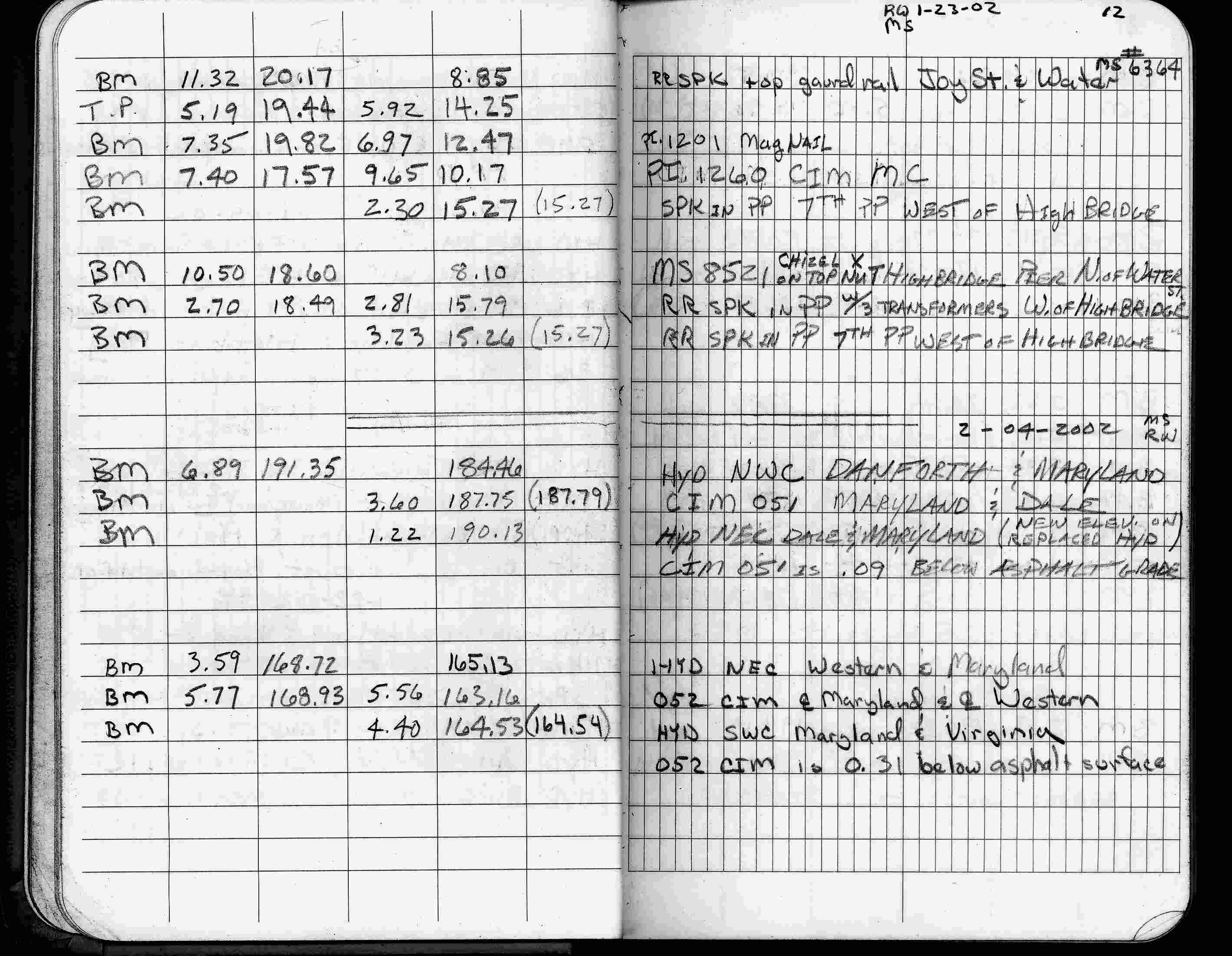
| 2/4/2002 | Elev 187.75 ft on CIM 0.09 ft below asphalt surface. See FB 1736 p.12 |
| 3/17/2000 | Fd CIM 0.10 ft below grade, found 2 ft straddles (marked for painting target for 2000 aerial) |
| 7/14/1997 | Fd CIM and retied See CofL 0051-0013-B |
| 3/29/1996 | Elev 187.79 ft on CIM. See 97adj.pts, 1996/bmdale3.org/bmdale3.sdr (loop 112) Digital-Adj |
| 9/21/1995 | Fd CIM (marked for painting target for 1995 aerial) |
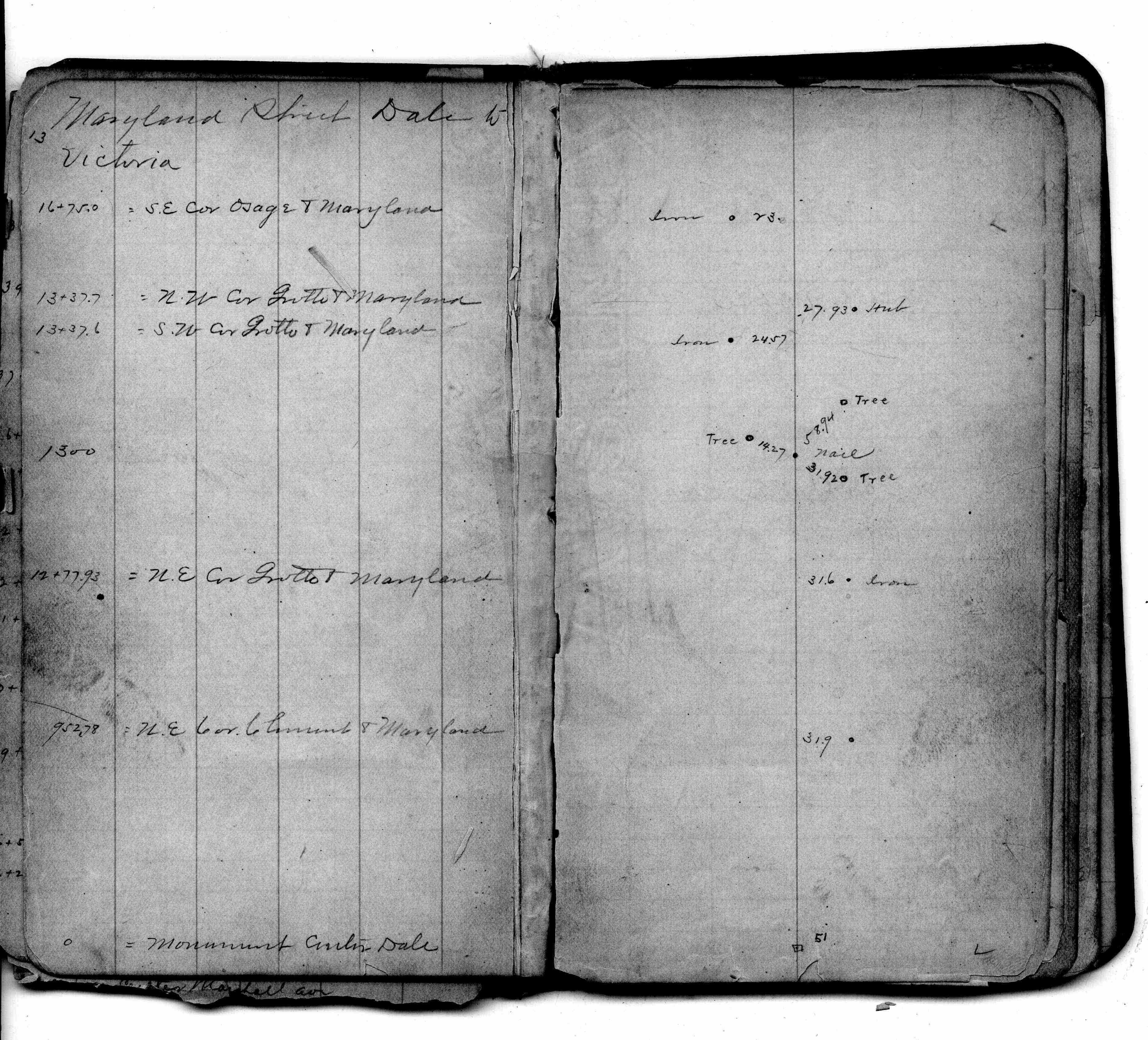
| 5/1/1992 | (Unknown date May __, 1992 ) Set CIM by Bart Ahrens Minnesota license 19162. See CofL 0051-0013-A |
| 4/1/1991 | (Unknown date Apr __, 1991 ) Placed transit ties, CIM removed for construction. See CofL 0051-0013-A |
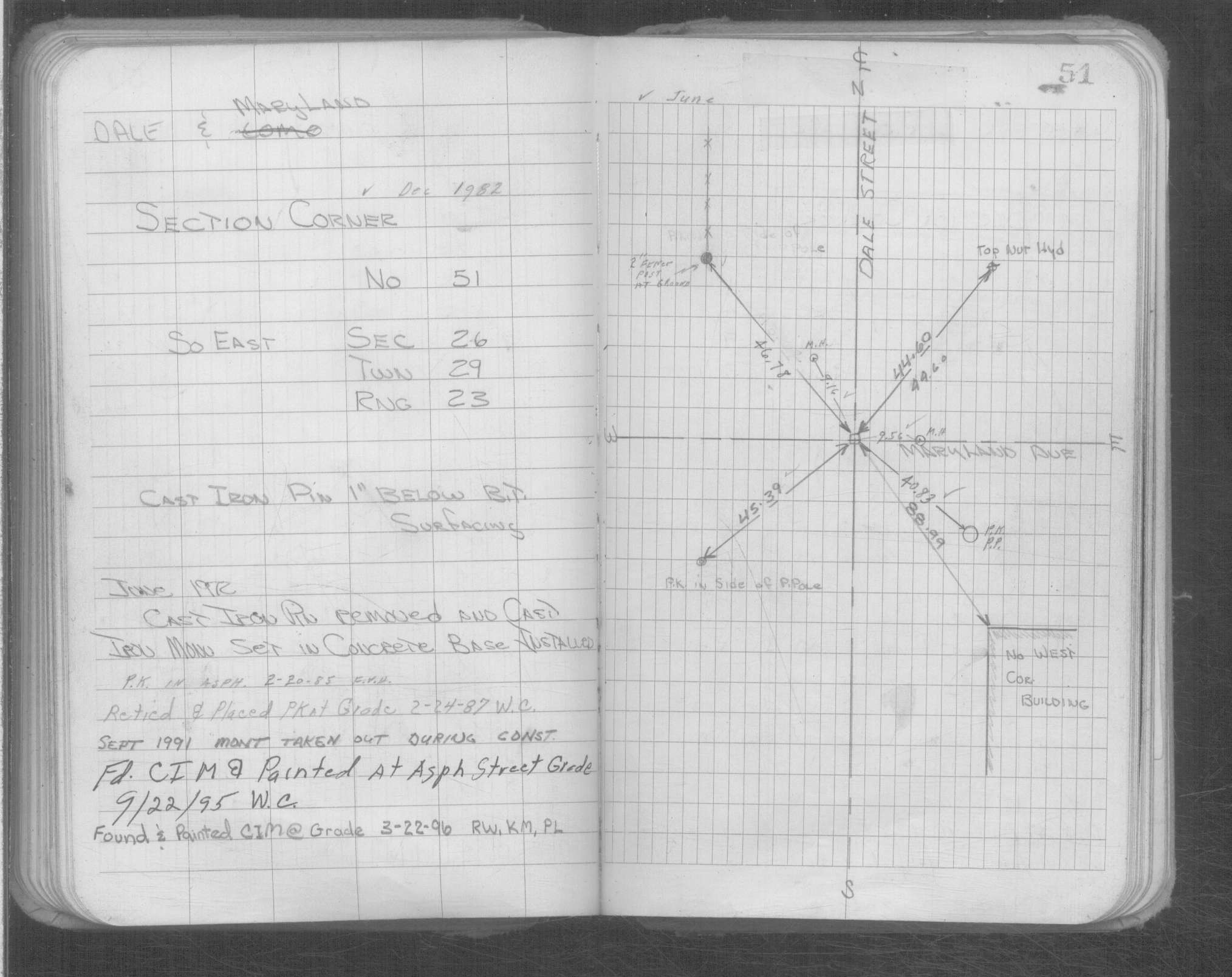
| 2/24/1987 | PK placed at grade & retied. See Yellow Tie Book. |
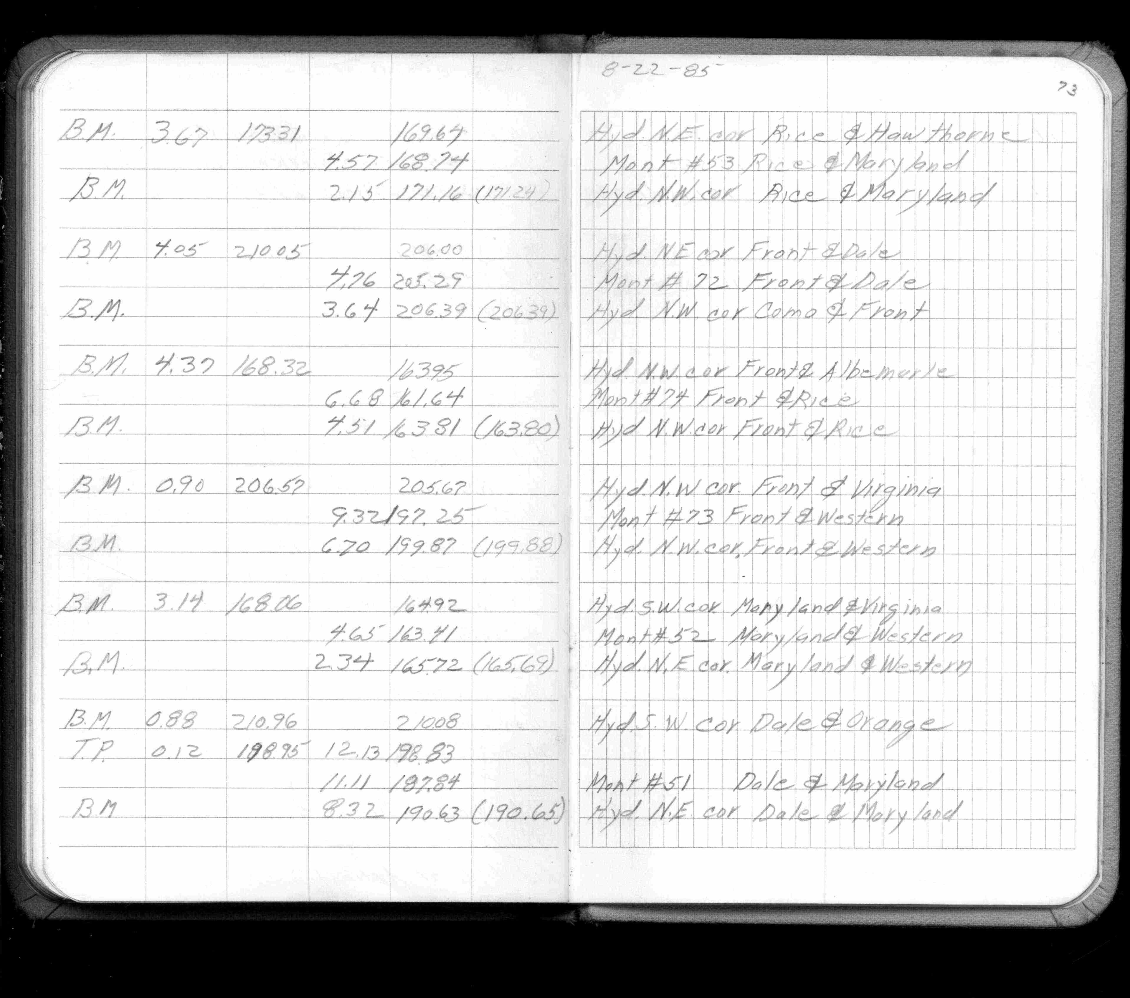
| 8/1/1985 | (Unknown date Aug __, 1985 ) Elev 187.84 ft on ?. See FB 1421A p.73 |
| 2/20/1985 | Fd PK. See Yellow Tie Book. |
| 1/1/1985 | (Unknown date ___ __,1985 ) Historic, one time only GPS survey = S125 |
| 5/11/1972 | Removed cast iron pin and set CIM in concrete base. See Yellow Tie Book & FB 1689A p.14 |
| 9/1/1958 | (Unknown date Sep __, 1958 ) Placed ties. See FB 1481 p.11 |
| 7/20/1885 | Placed new guards (ties) |
| 11/1/1847 | (Unknown date Nov __, 1847 ) Isaac N Higbee deputy surveyor set post. Tied to 1 BT. See IH p.070-071 2923 |
Above is NOT an all inclusive history of this point. Please review all the links below. Yellow Tie Books are 'ST' in the Monument category.
| PLS NOTES | Field | Cross Section | Sewer | J.B. Irvine | Monument | River Survey |
|---|---|---|---|---|---|---|
| IH p.070-071 | FB 0169p.13 | ST 001-078 p.051 | ||||
| FB 0301p. 04 ,18 | ||||||
| FB 0311p.18 | ||||||
| FB 0313p.01 | ||||||
| FB 0636p. 11 ,41 | ||||||
| FB 0819p.01 | ||||||
| FB 1155p.42 | ||||||
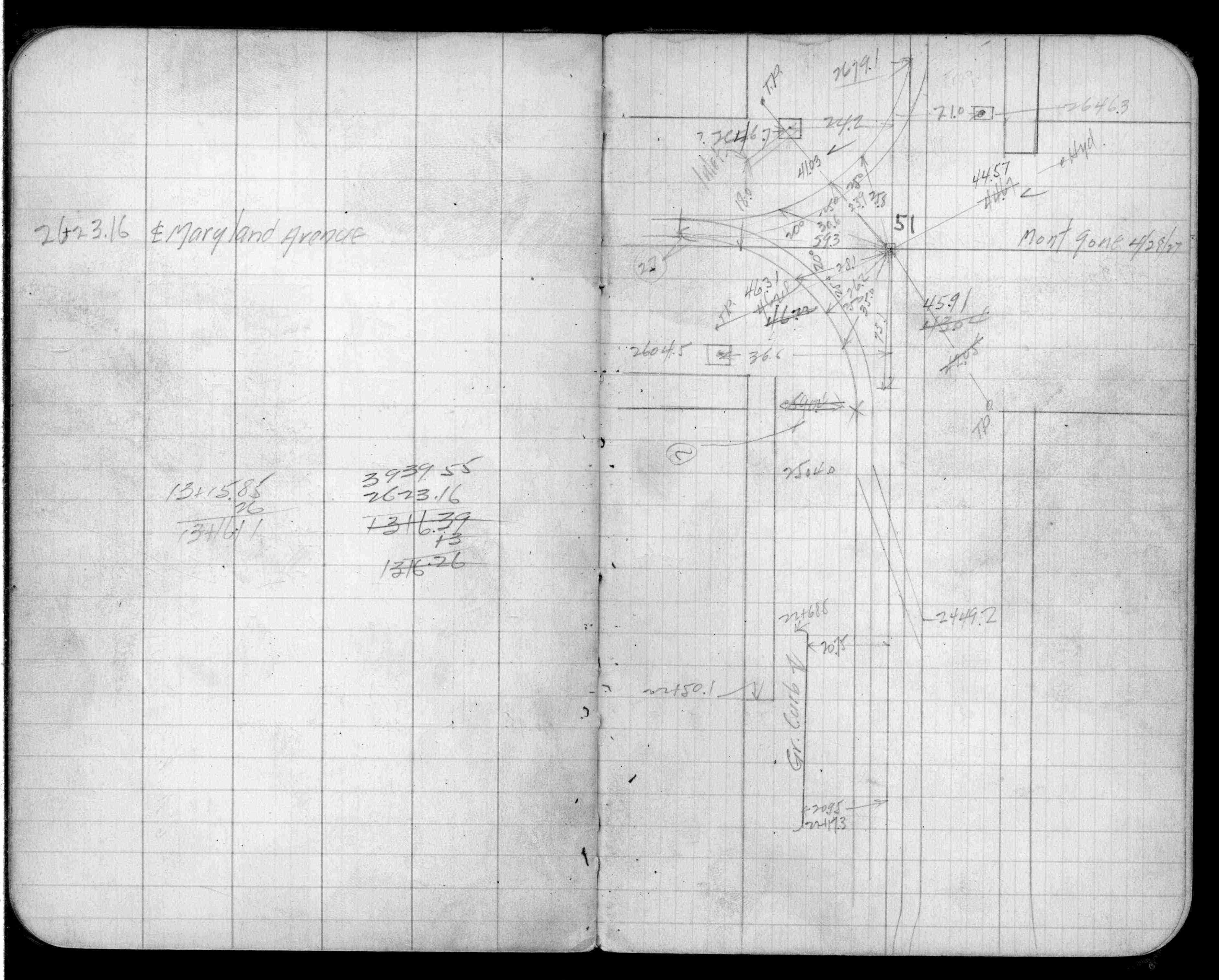
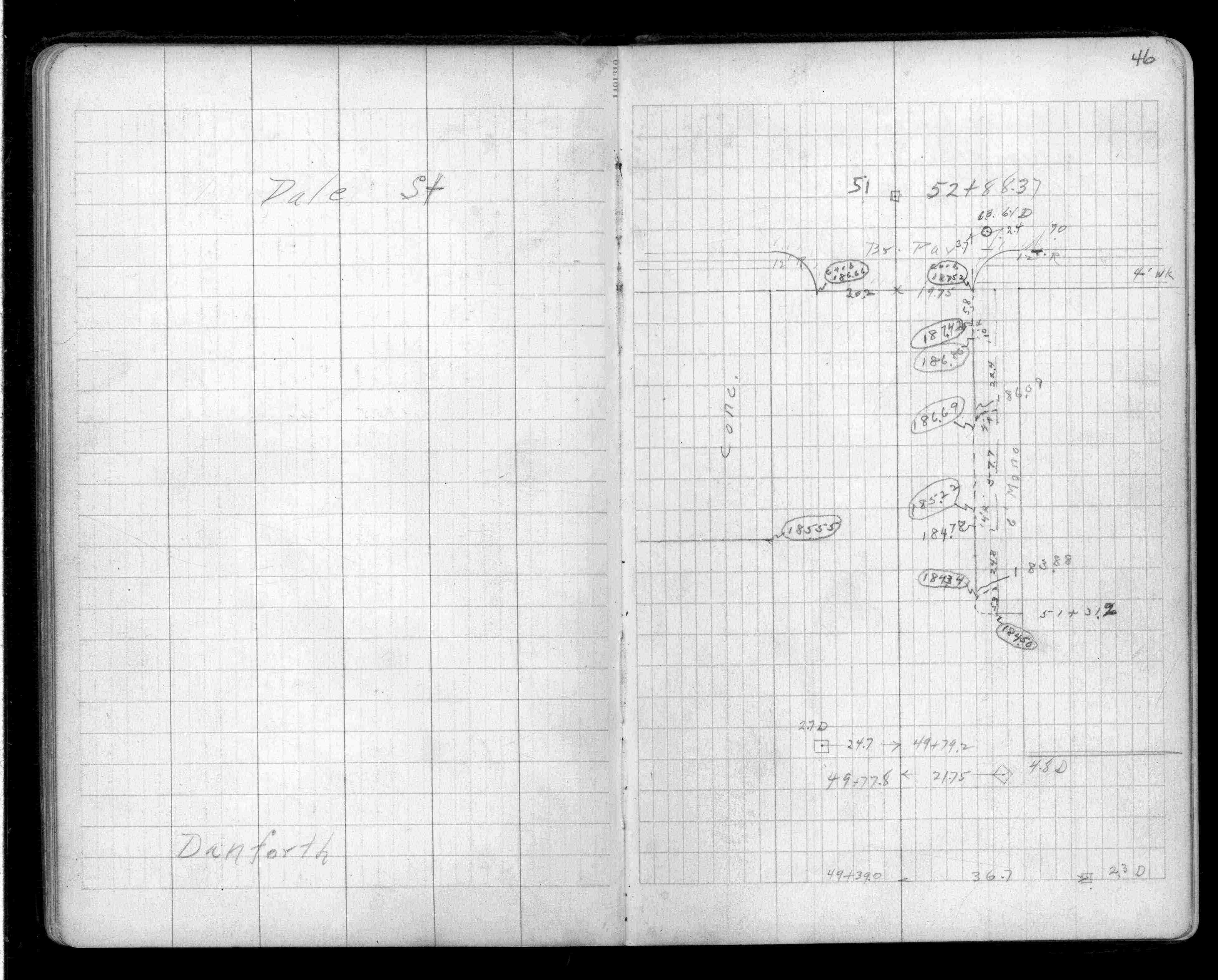
| FB 1341p.46 | ||||||
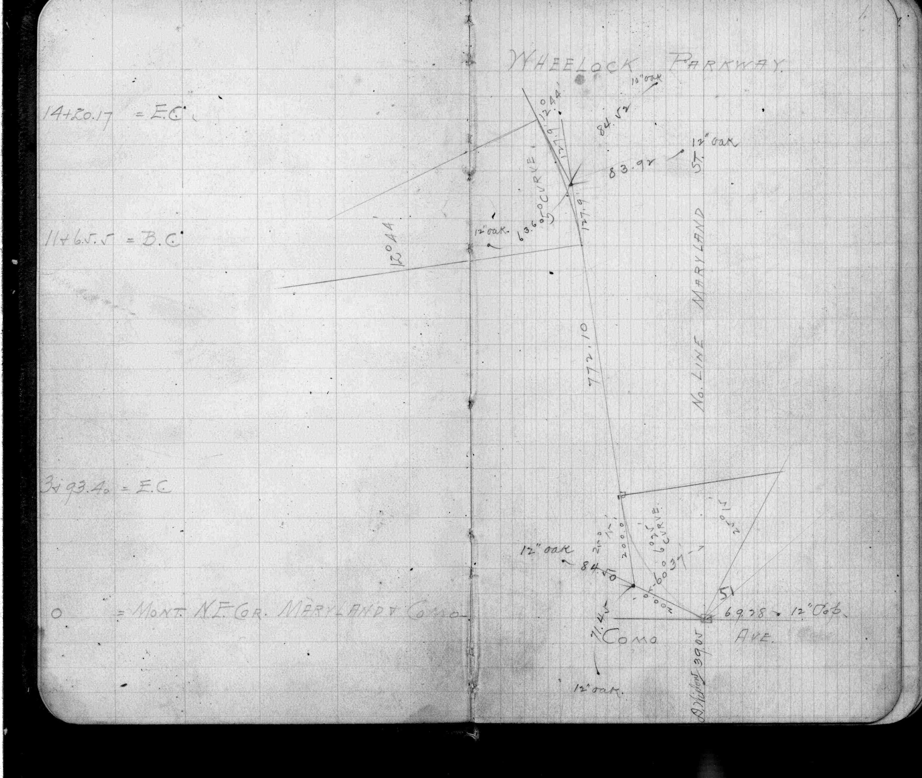
| FB 1421Ap.73 | ||||||
| FB 1481p.11 | ||||||
| FB 1549Fp.74 | ||||||
| FB 1549Hp. 21 ,24 | ||||||
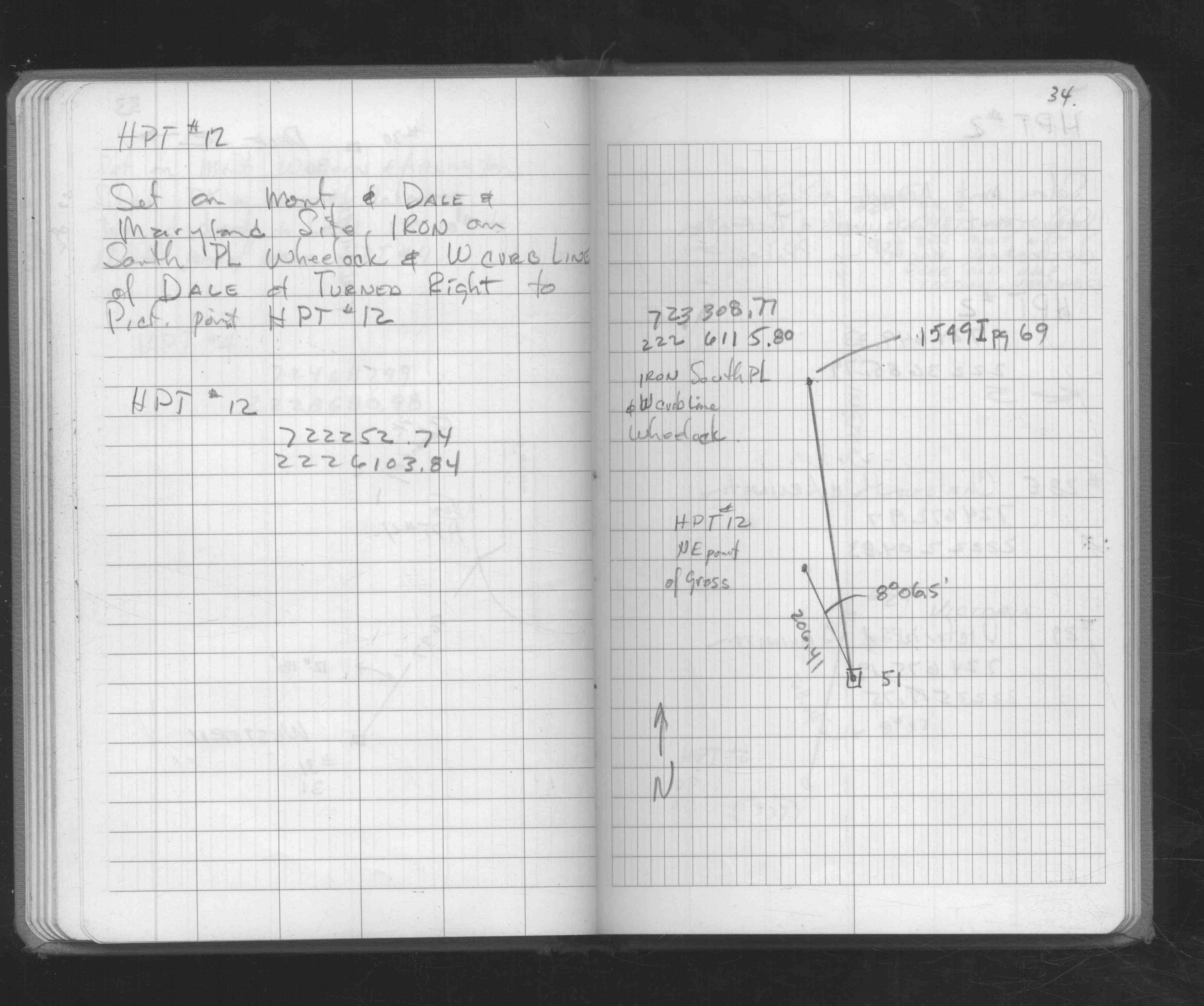
| FB 1549Ip.16 | ||||||
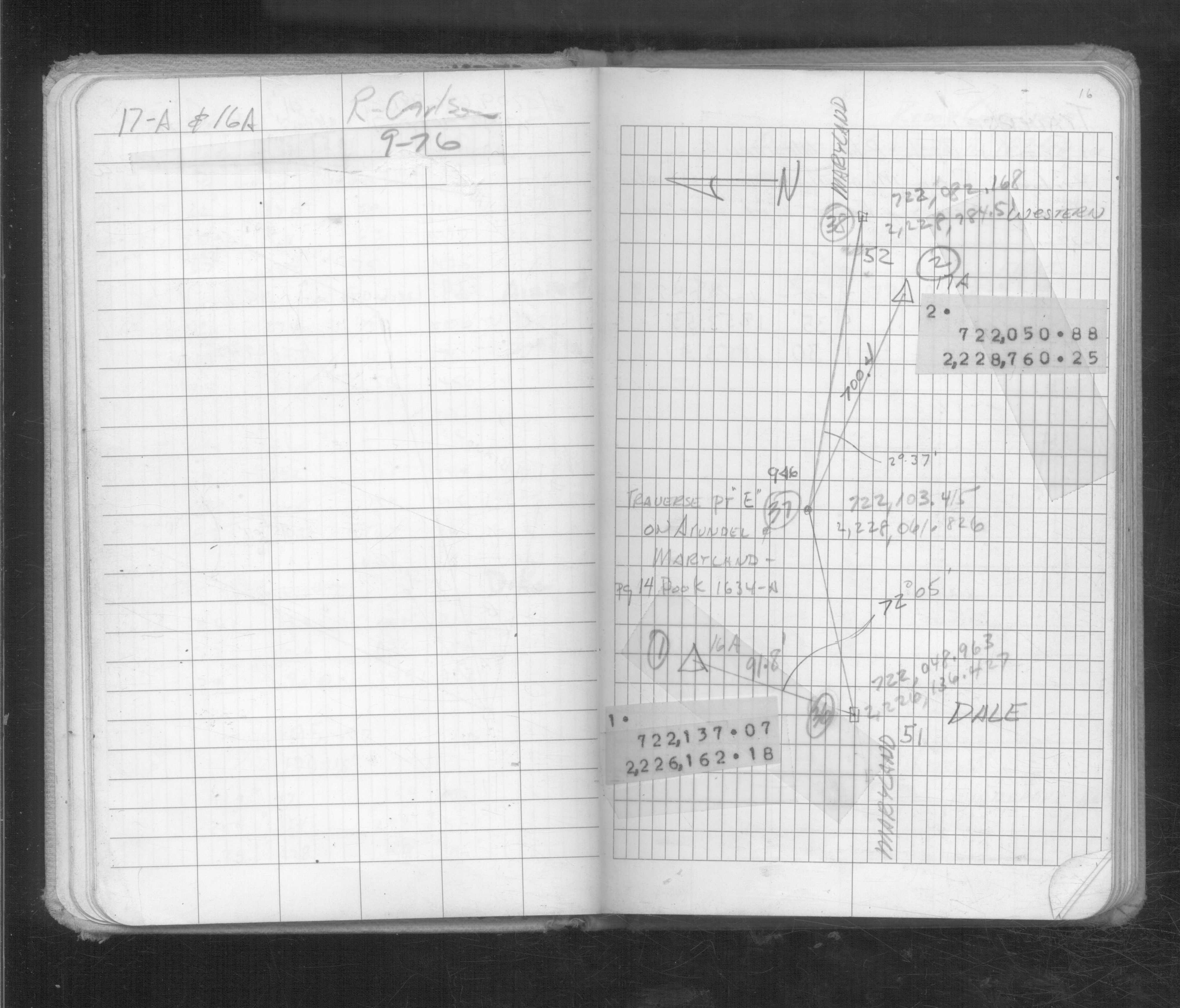
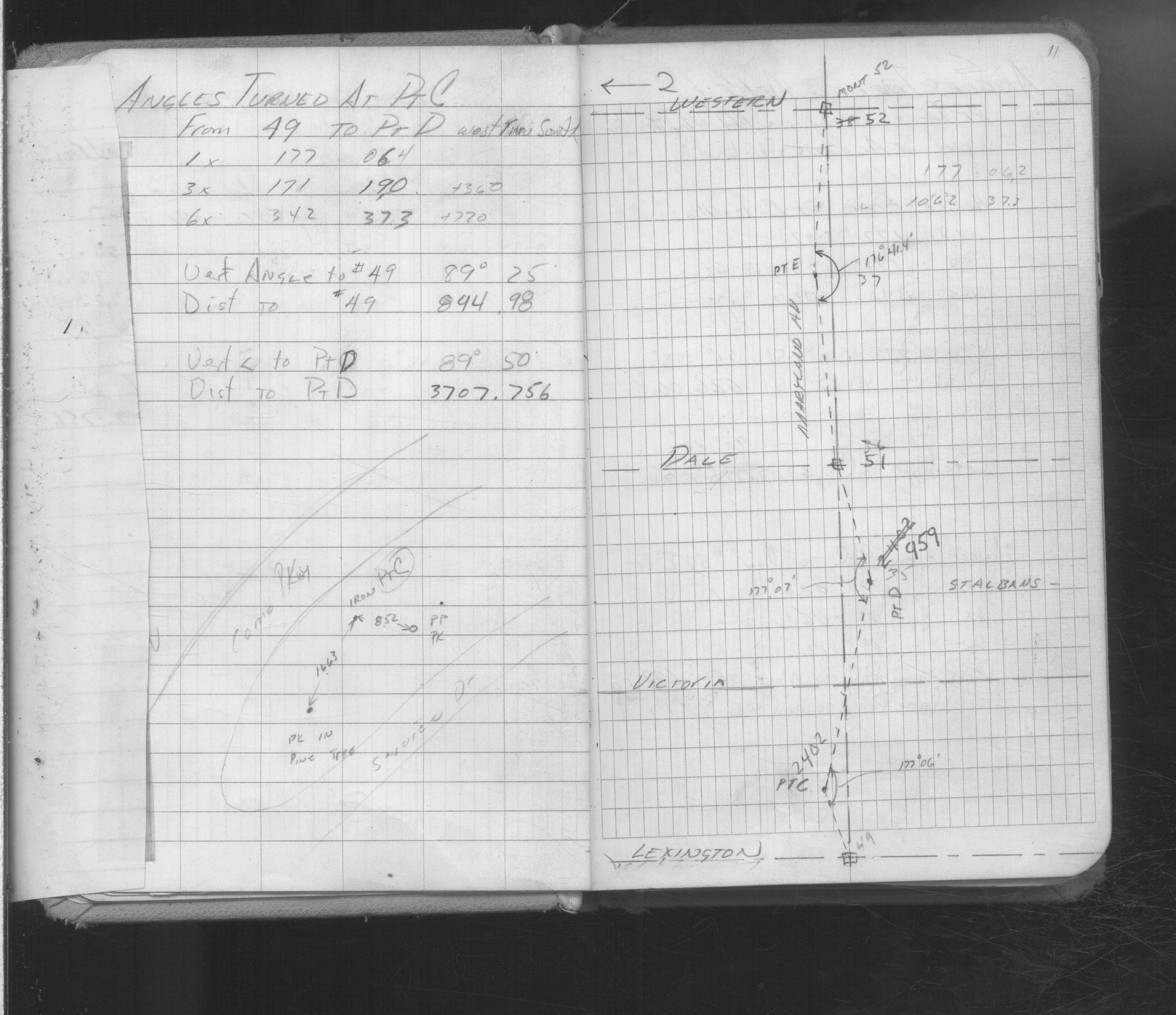
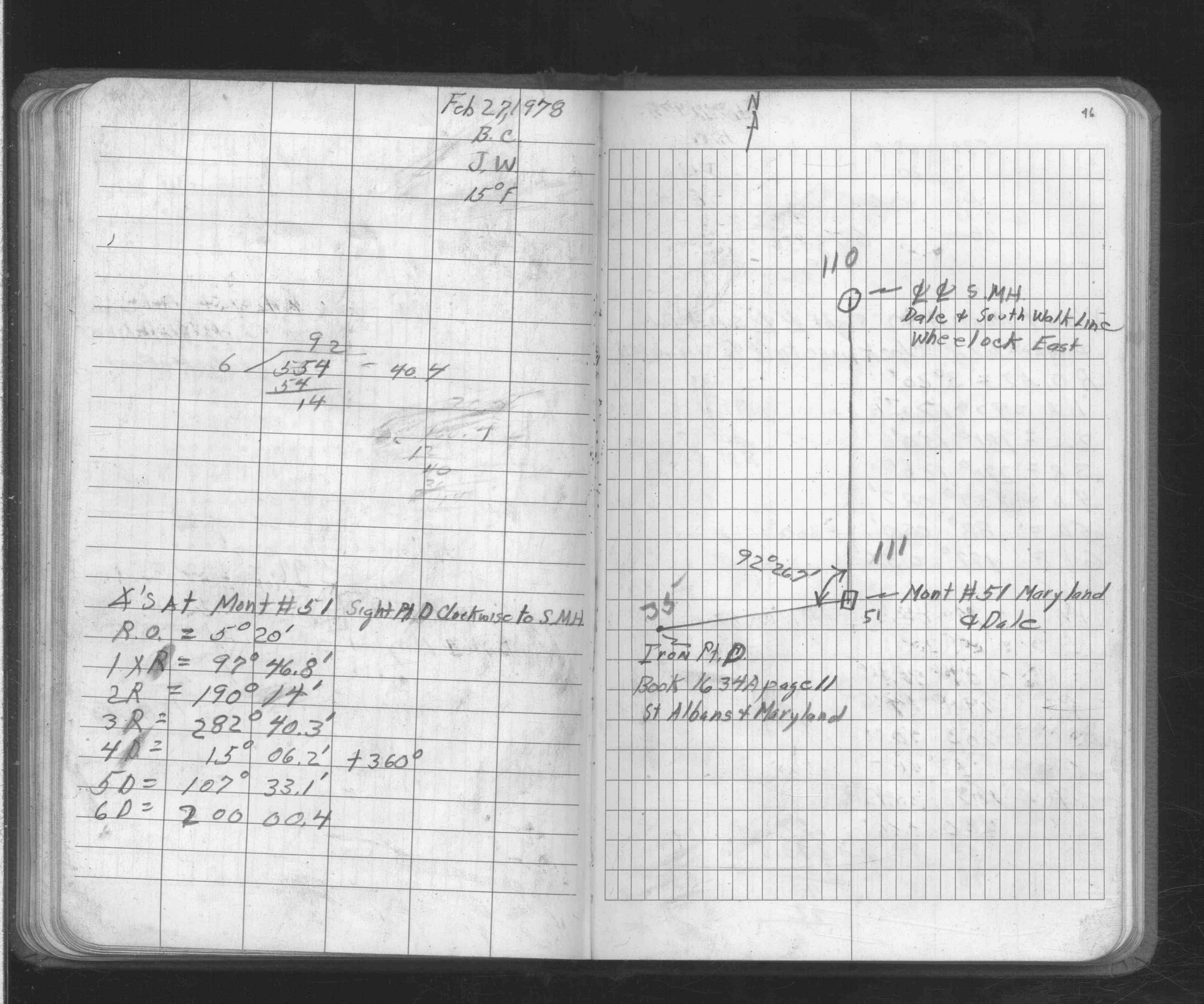
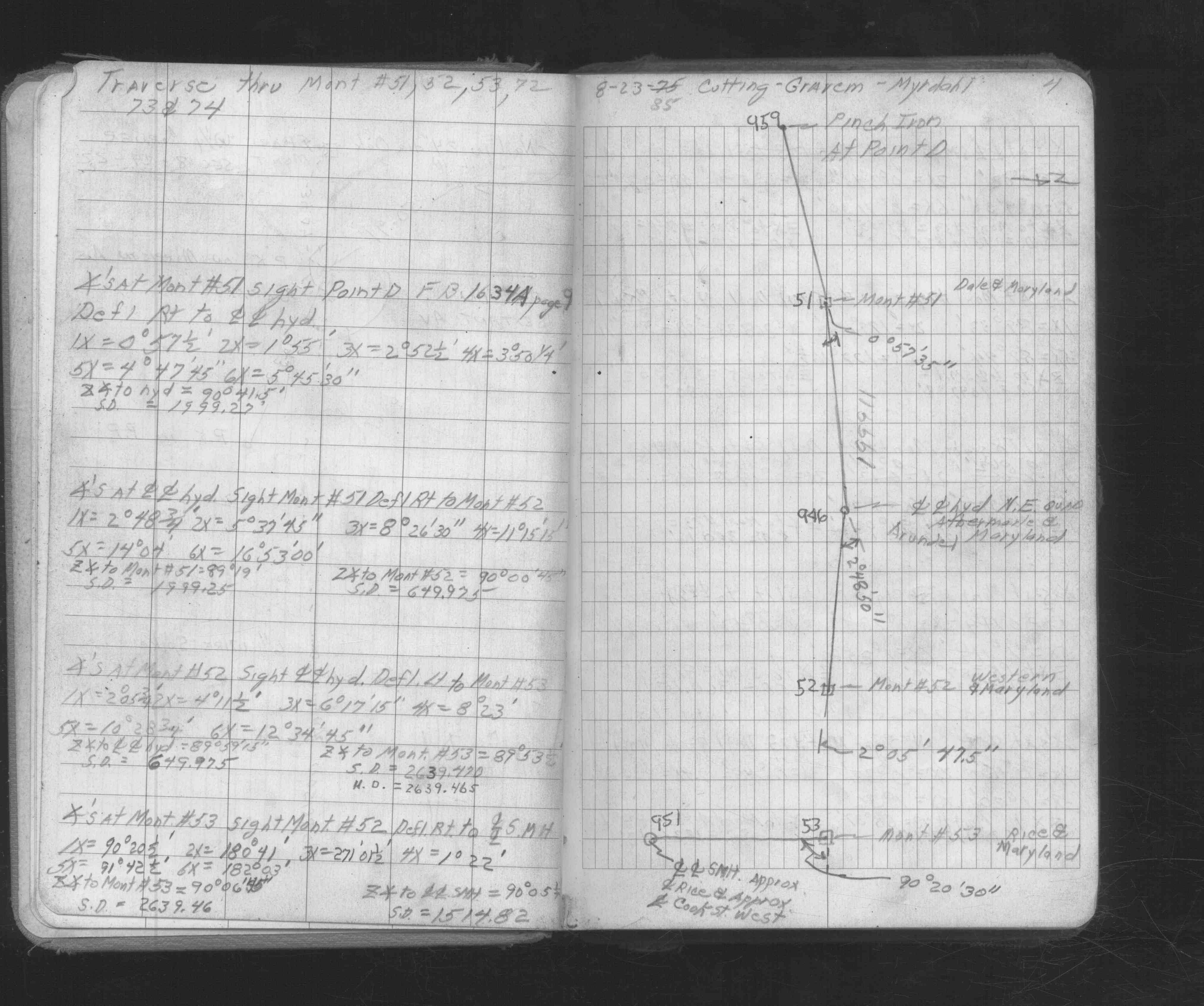
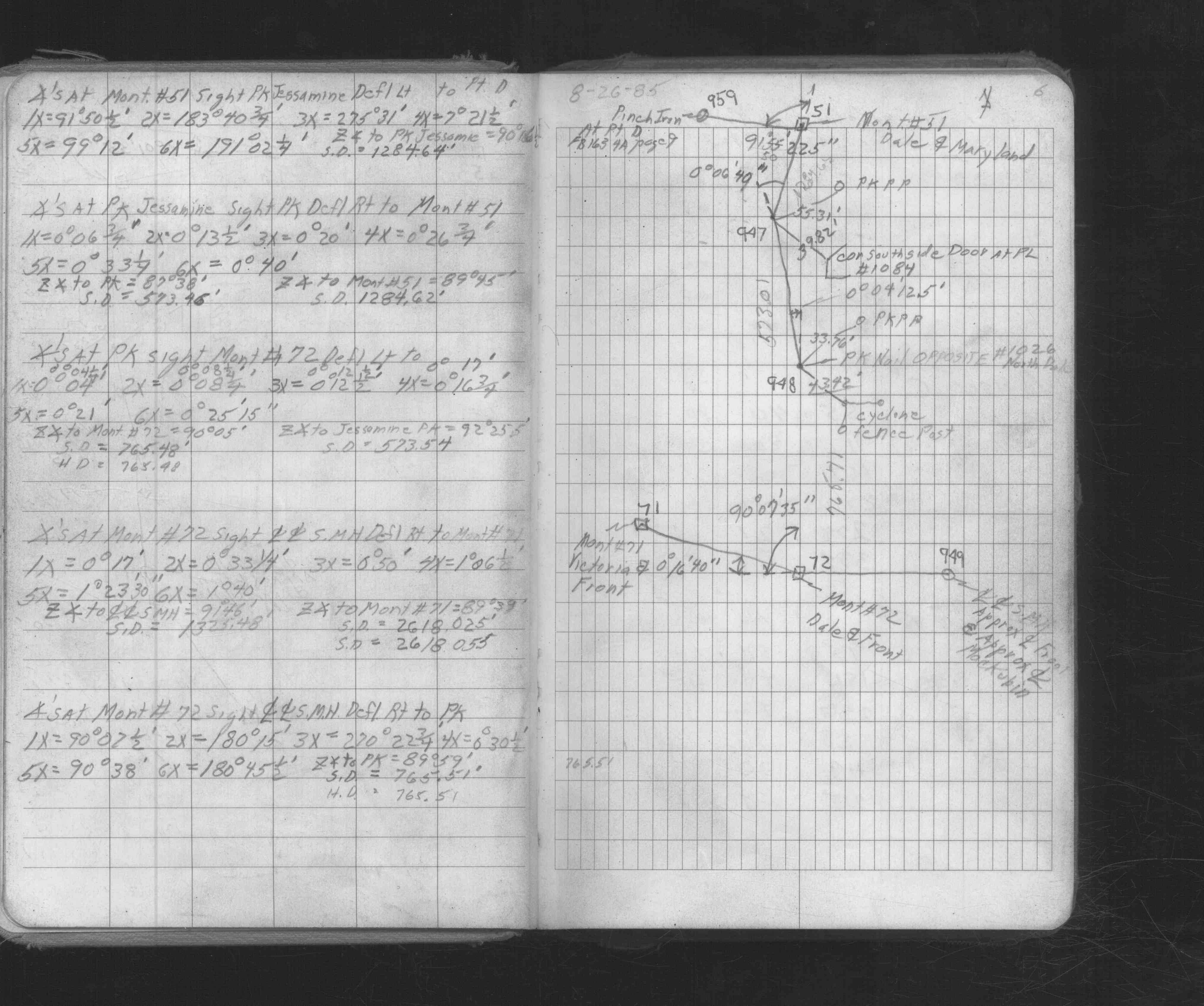
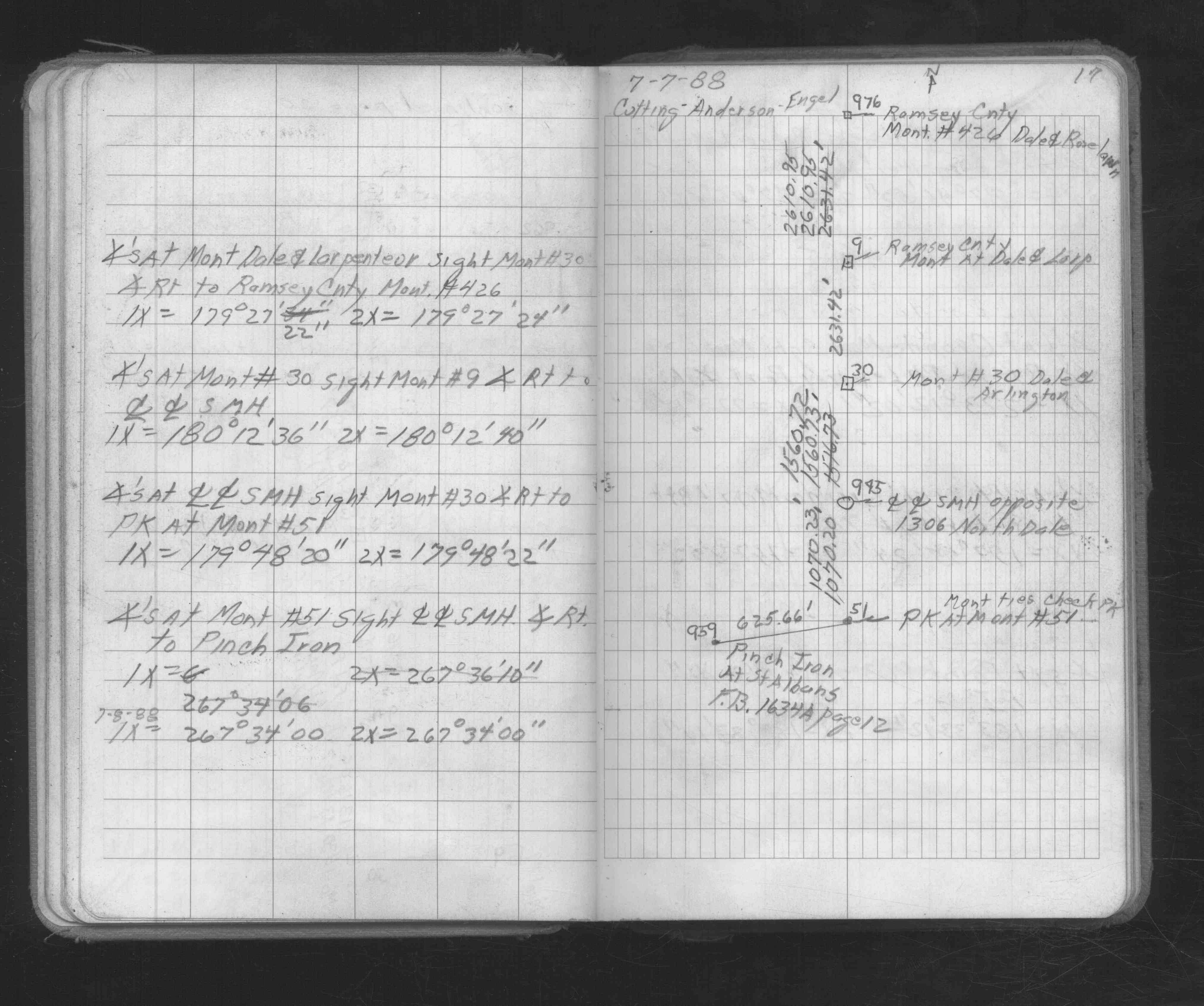
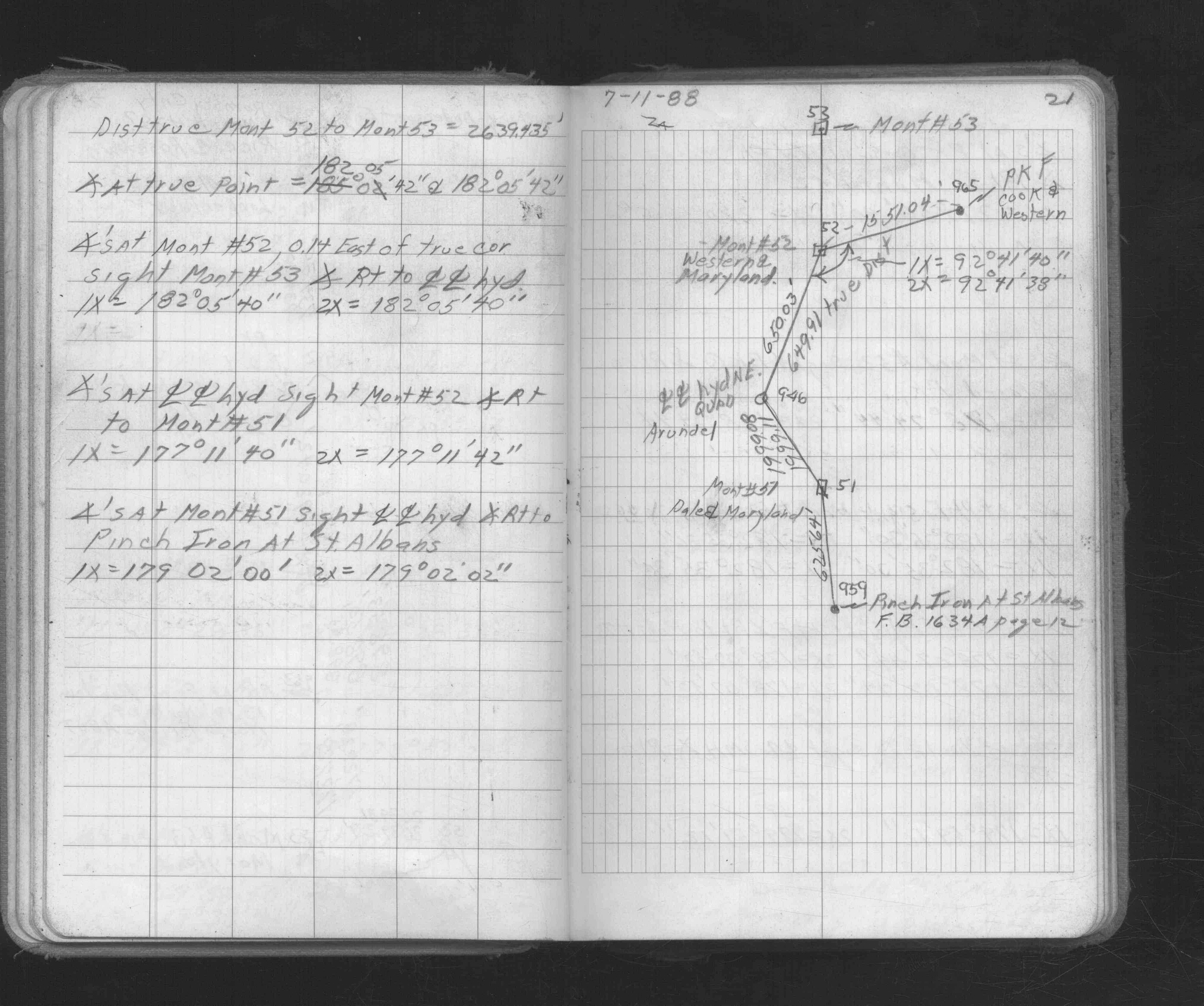
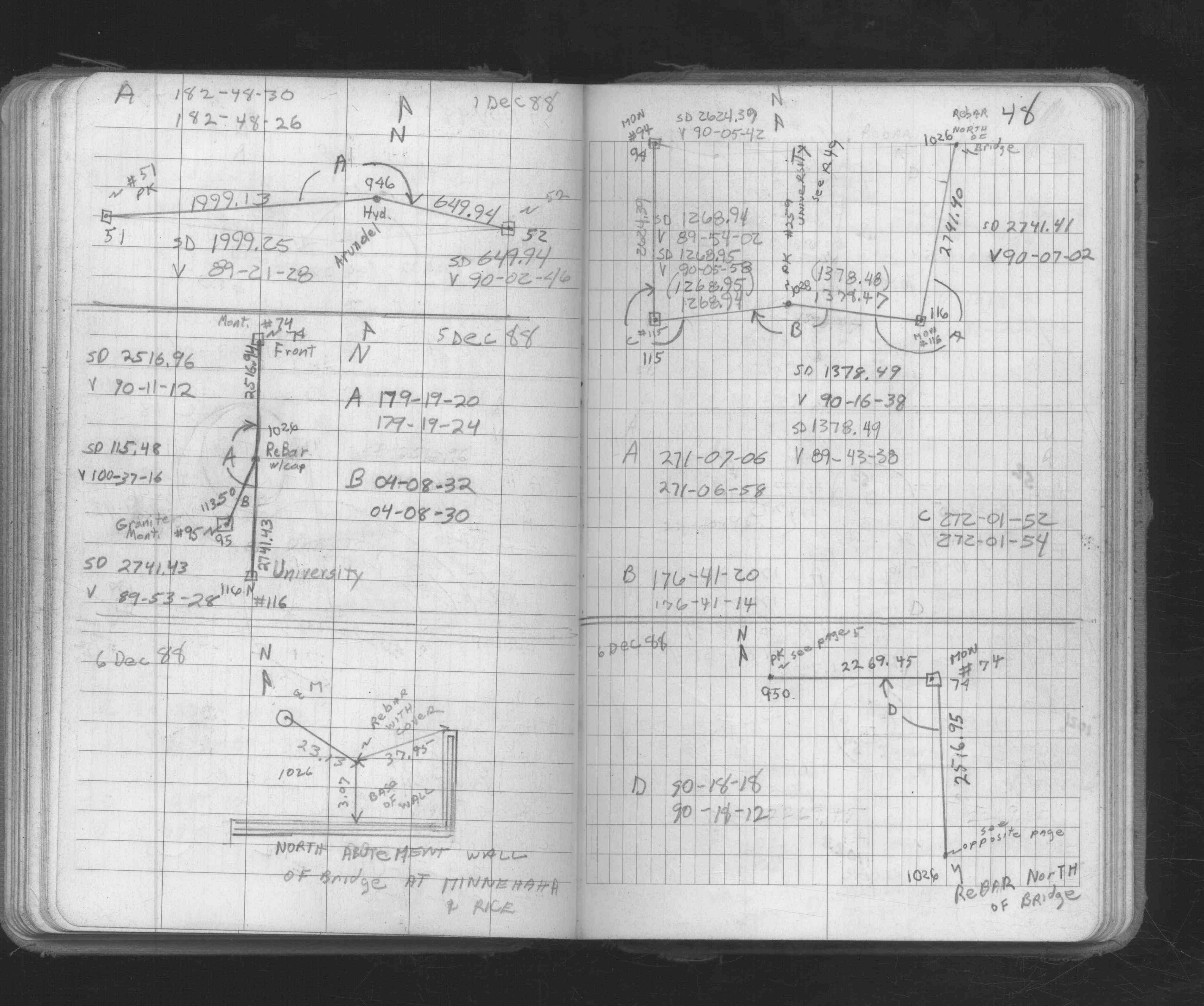
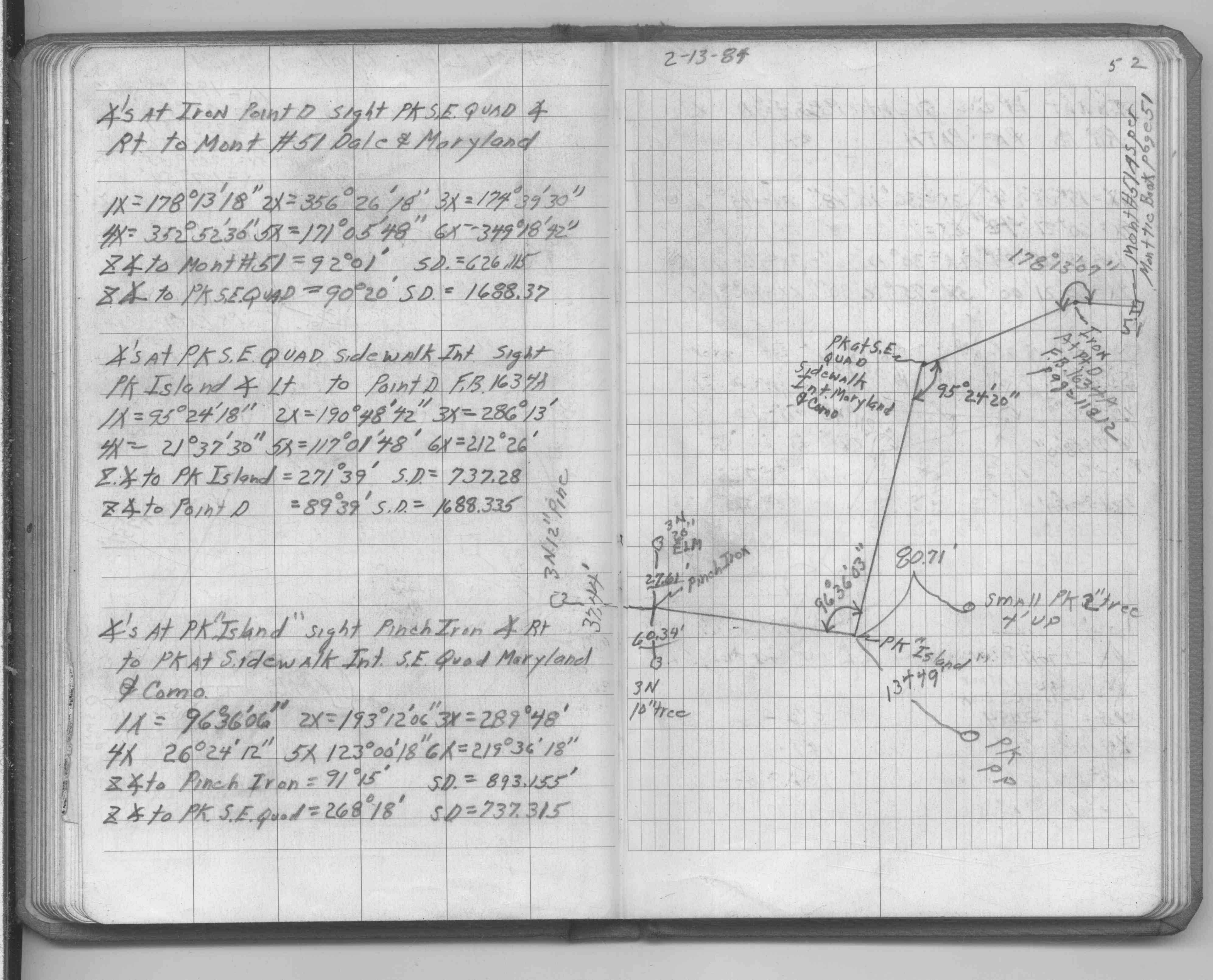
| FB 1634Ap.11 | ||||||
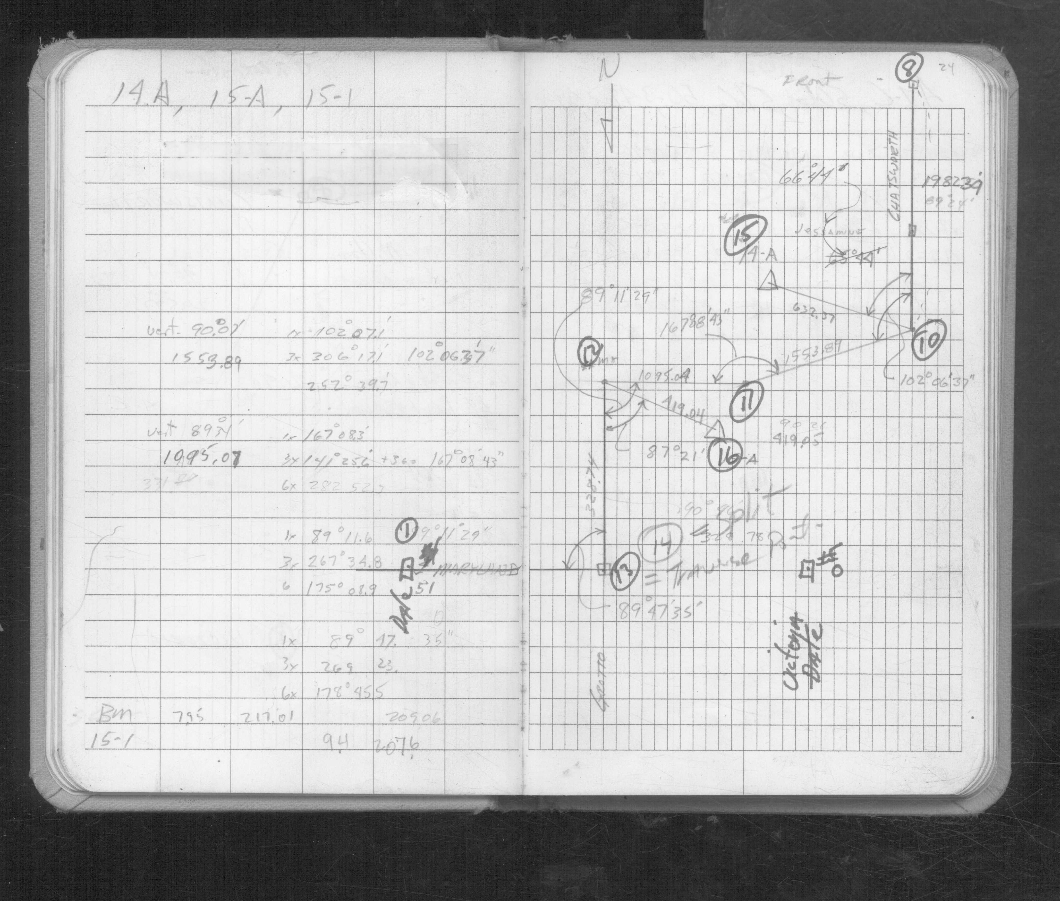
| FB 1671p. 44 ,45 ,46 | ||||||
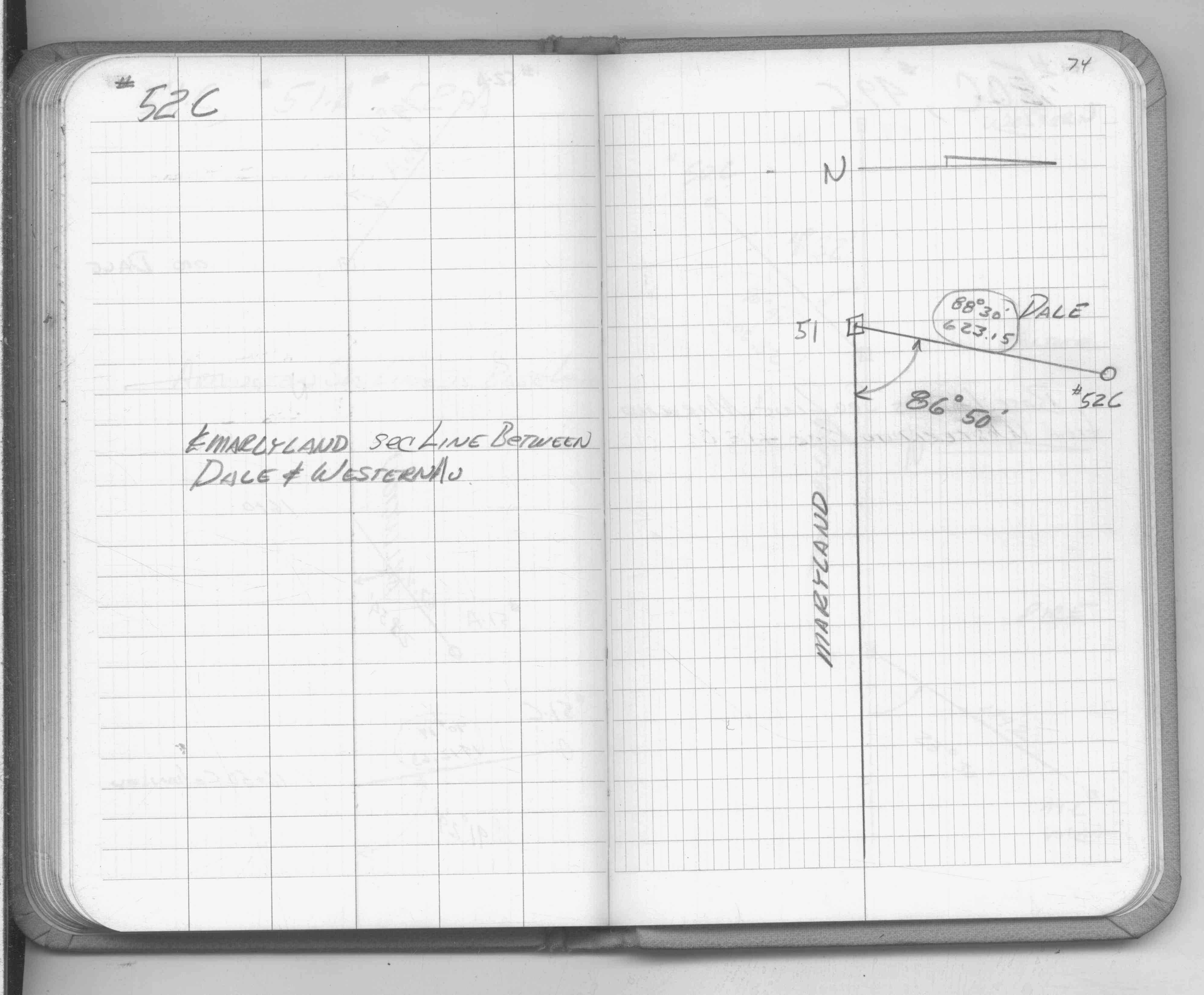
| FB 1673Ap. 04 ,06 ,17 ,21 ,48 | ||||||
| FB 1676Ap.34 | ||||||
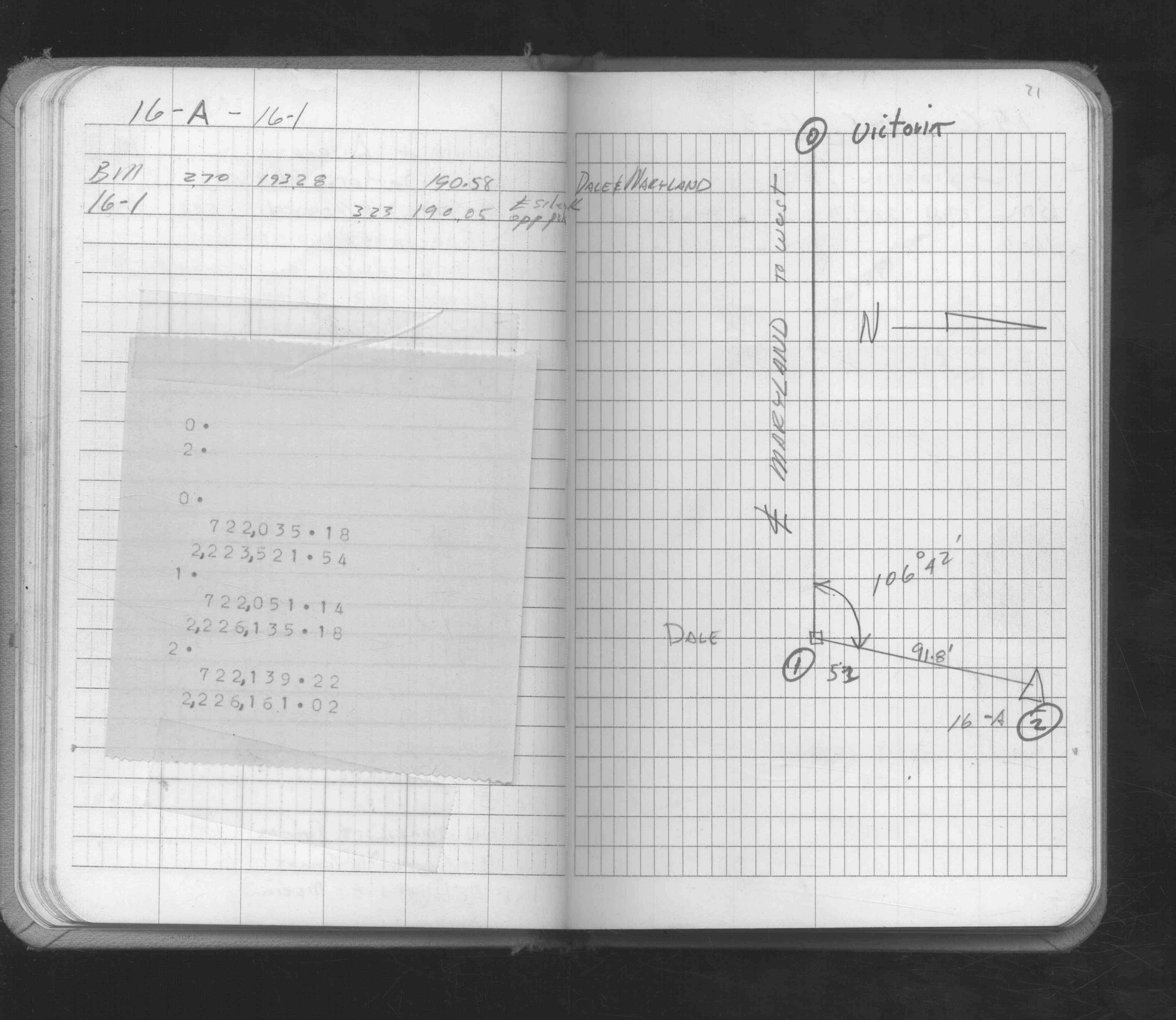
| FB 1690Ap. 52 ,53 | ||||||
| FB 1706Ap.18 | ||||||
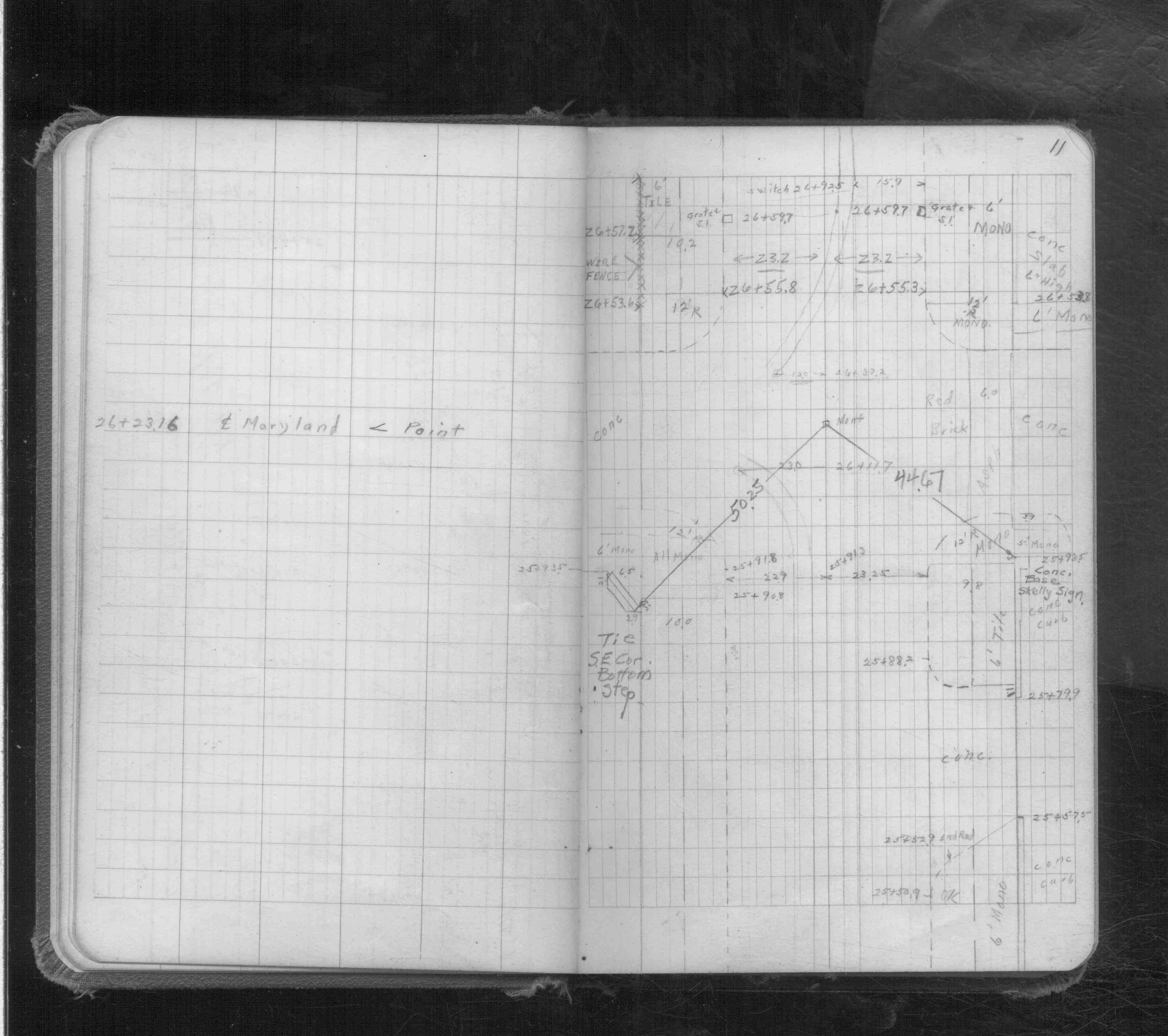
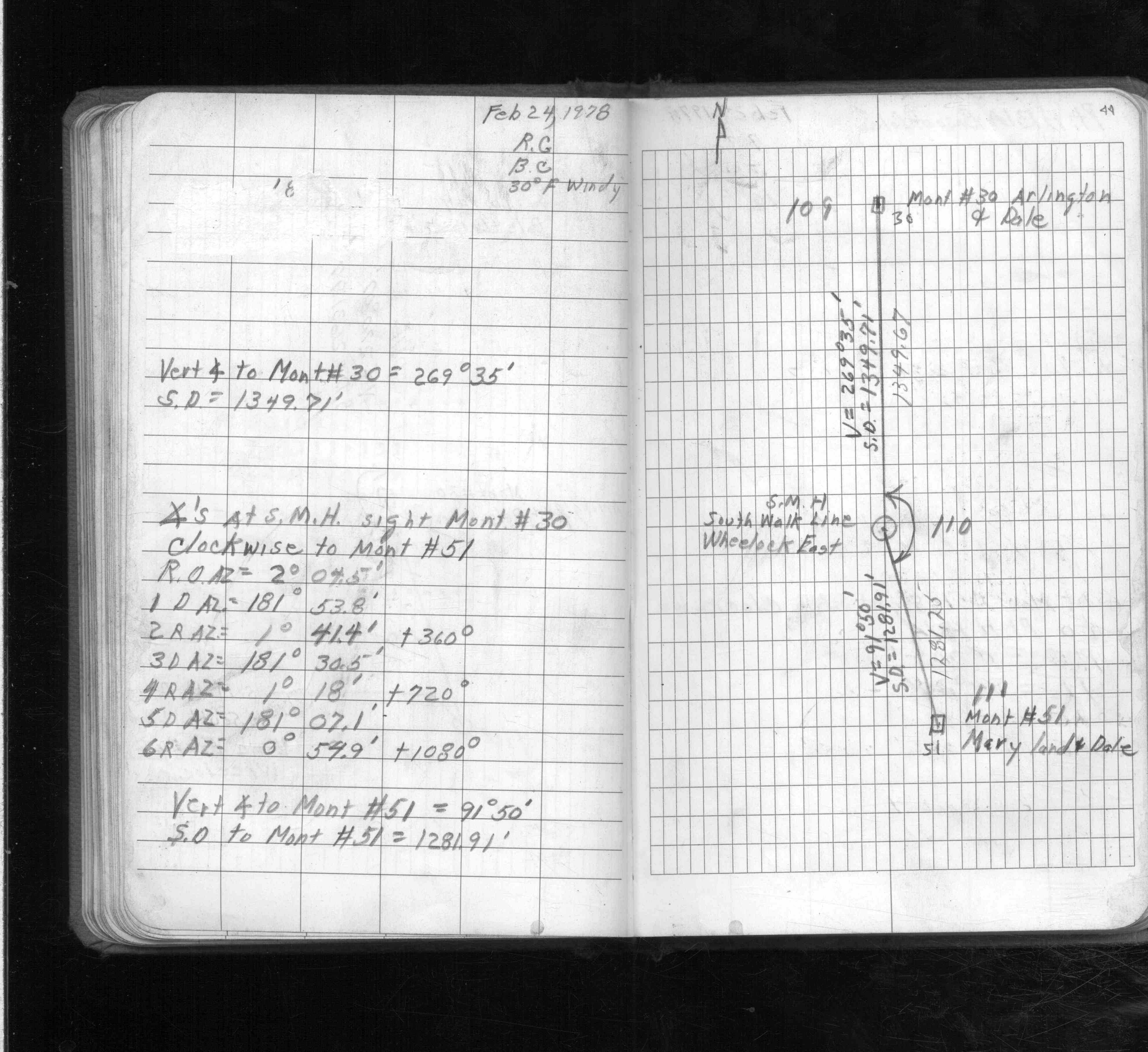
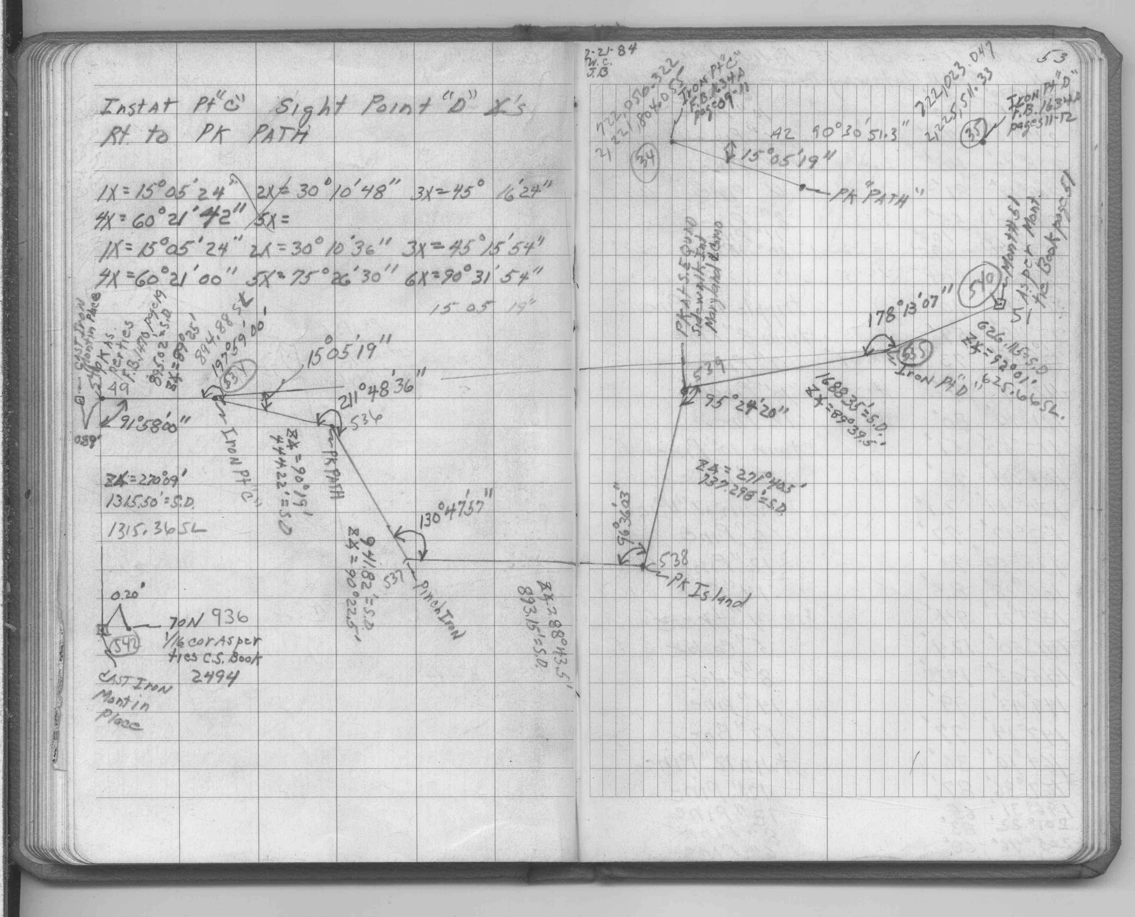
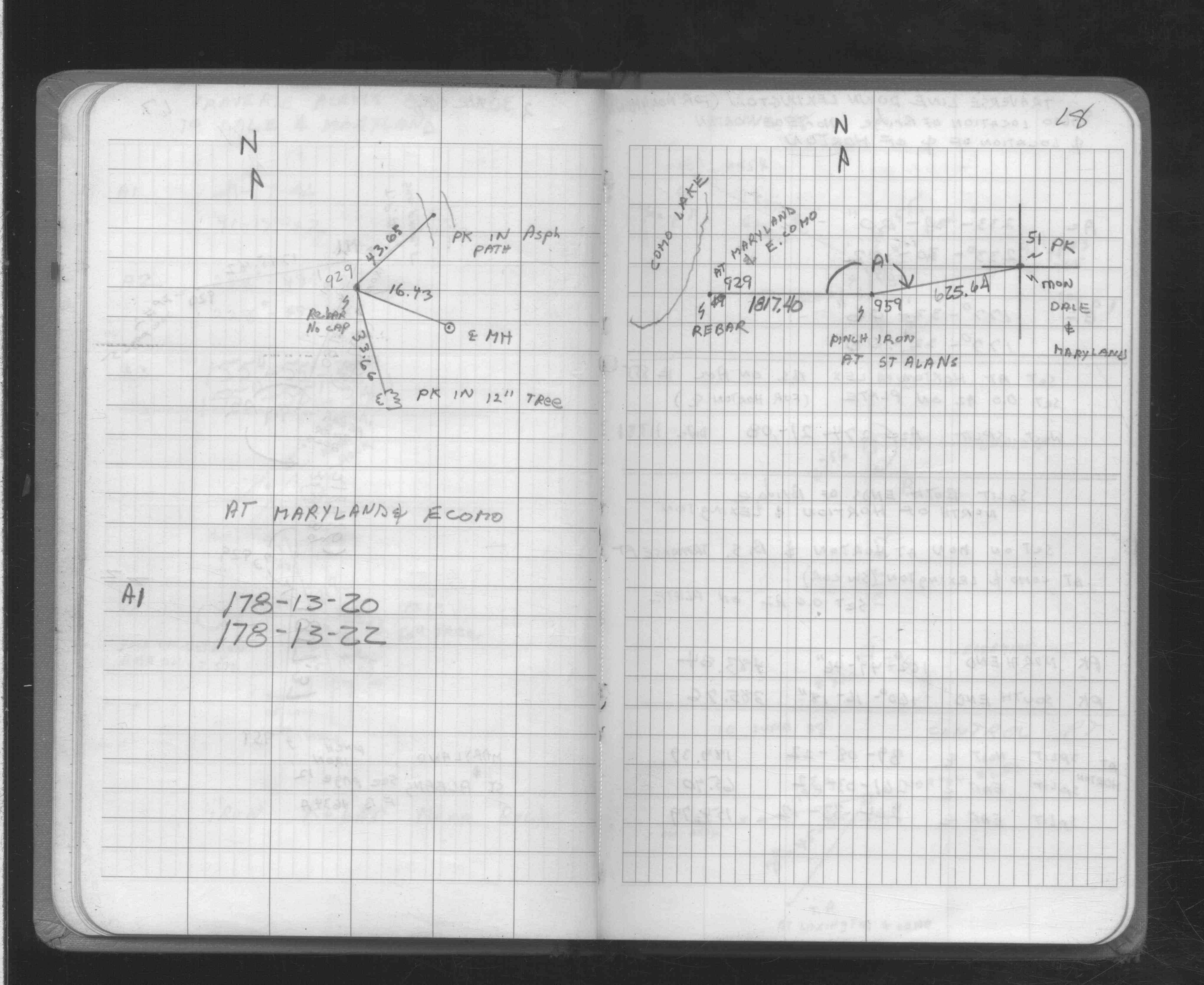
| FB 1736p.12 |
| FILE | SURVEYOR | LIC. NO. | DATE SIGNED | DATE TIED |
|---|---|---|---|---|
| 0051-0013-C.pdf | Samuel D. Gibson | 44880 | August 17, 2012 | October 24, 2011 |
| 0051-0013-A.tif | Barton G. Ahrens | 19162 | June 8, 1992 | May 1, 1992 |
| ST_001-078p051.jpg | none | none | none | none |
| 0051-0013-B.tif | none | none | none | none |
| 0051-0013-A.dwf | none | none | none | none |
| FILE | PHOTO DATE | COMMENTS |
|---|---|---|
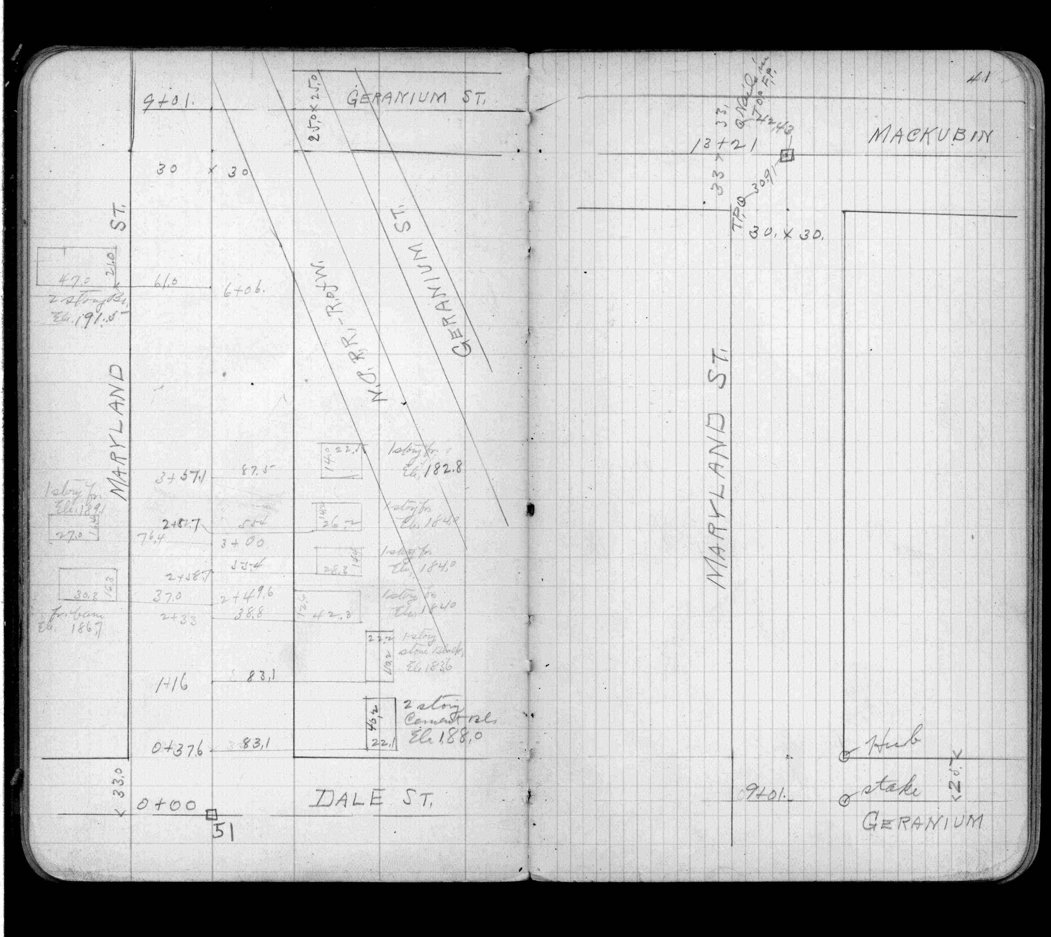
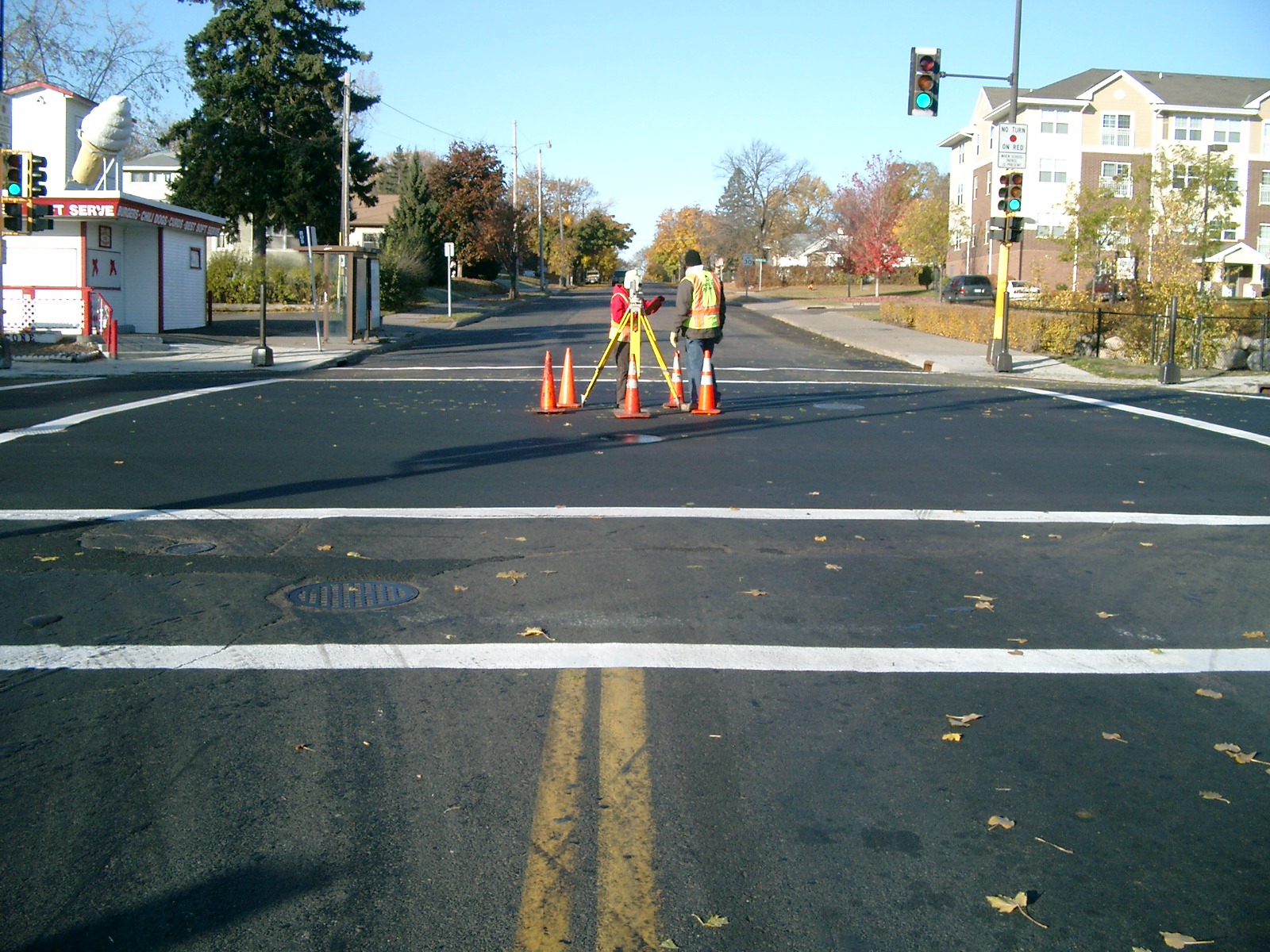
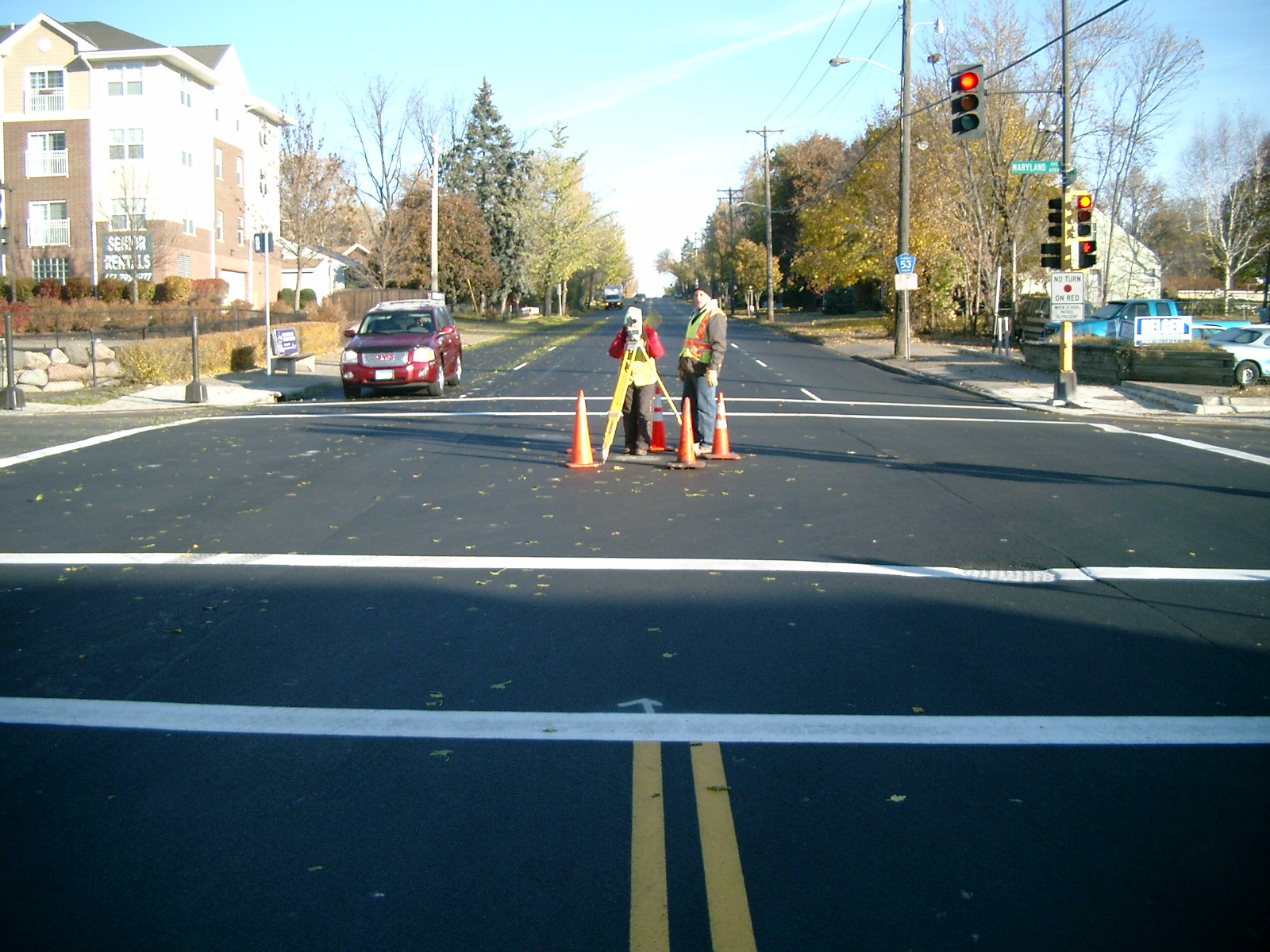
| 0051-0013-5.jpg | November 1, 2011 | Looking south along Maryland Ave. |
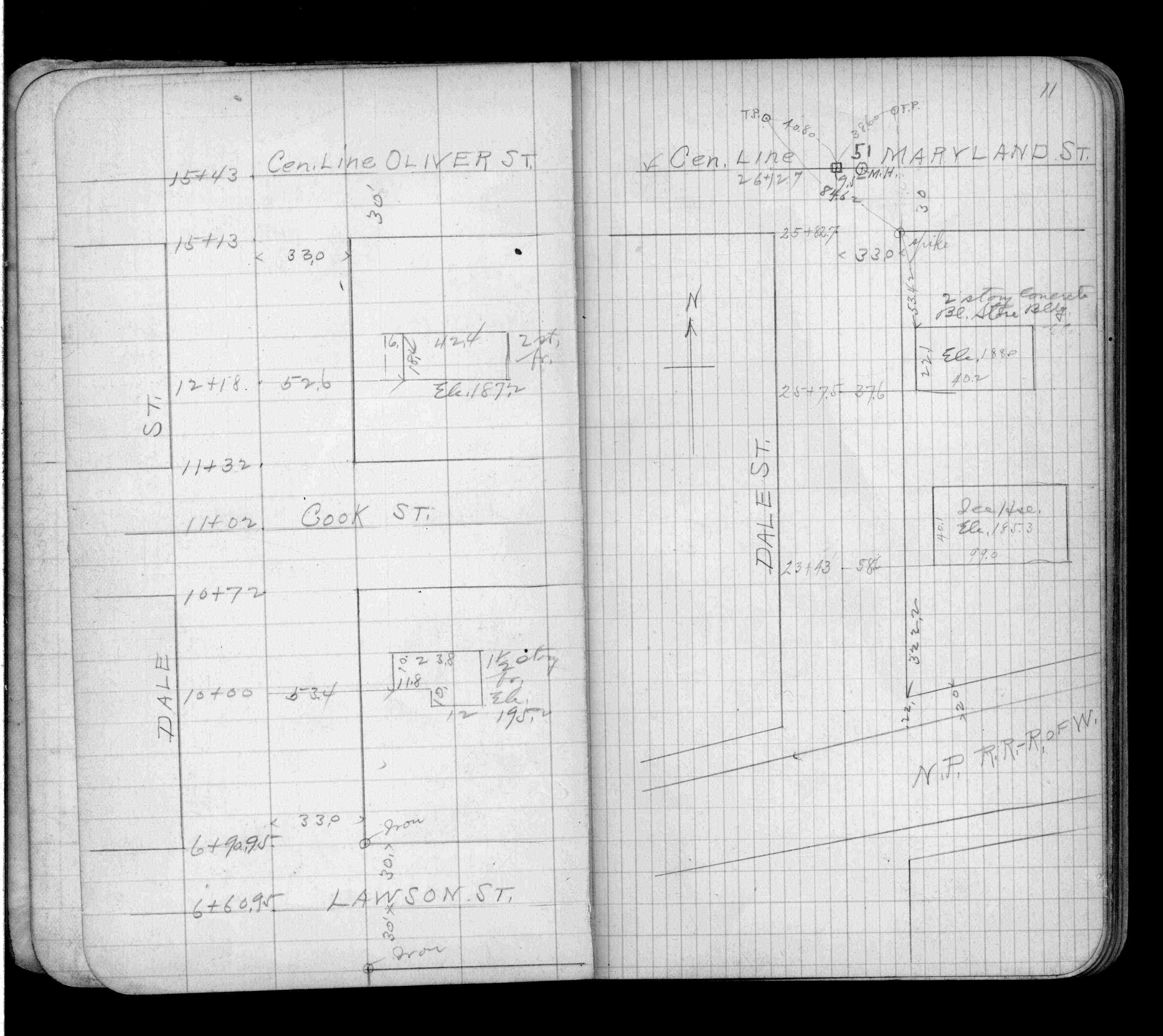
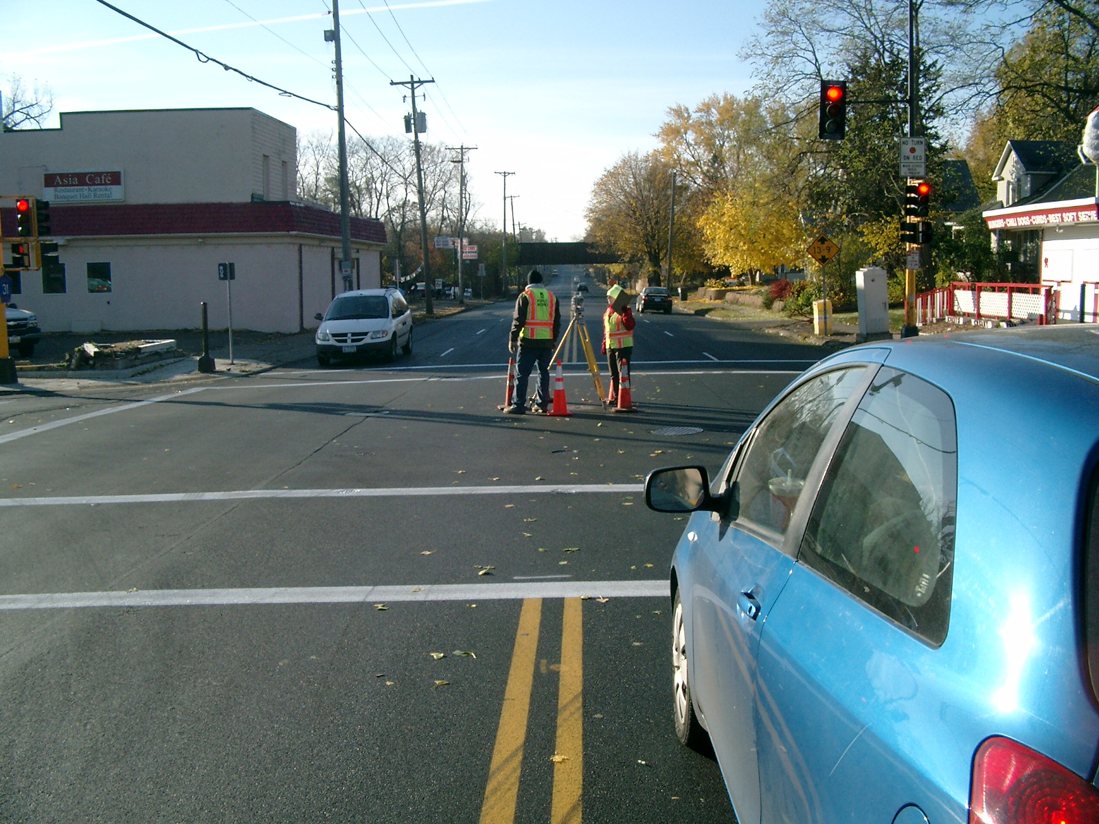
| 0051-0013-4.jpg | November 1, 2011 | Looking south along Dale St. |
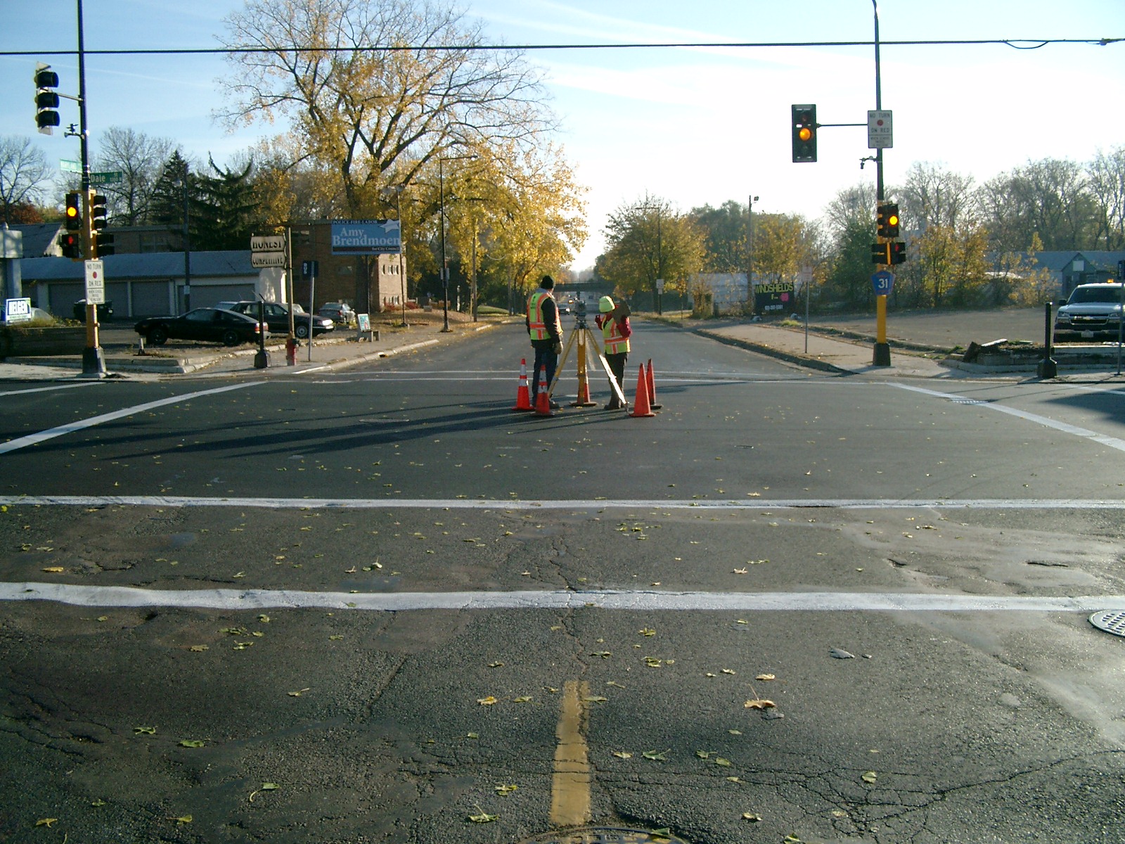
| 0051-0013-3.jpg | November 1, 2011 | Looking east along Maryland Ave. |
| 0051-0013-2.jpg | November 1, 2011 | Looking north along Dale St. |
| 0051-0013-1.jpg | November 1, 2011 | Close up of monument. |