| NAD83 COORDINATES (1986 adj.): |
|---|
| X= 547900.74 Y= 164637.09 Z= 898.9 04/13/2007 RTK-VRS |
| X= 547900.75 Y= 164637.03 Z= 899.0 03/09/2009 RTK-VRS |
| 9/25/2013 | CIM replaced after street reconstruction project. |
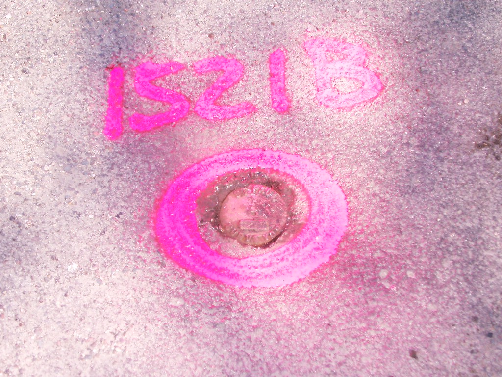
| 3/23/2009 | Set ties on CIM See CofL 3847-1521B-B |
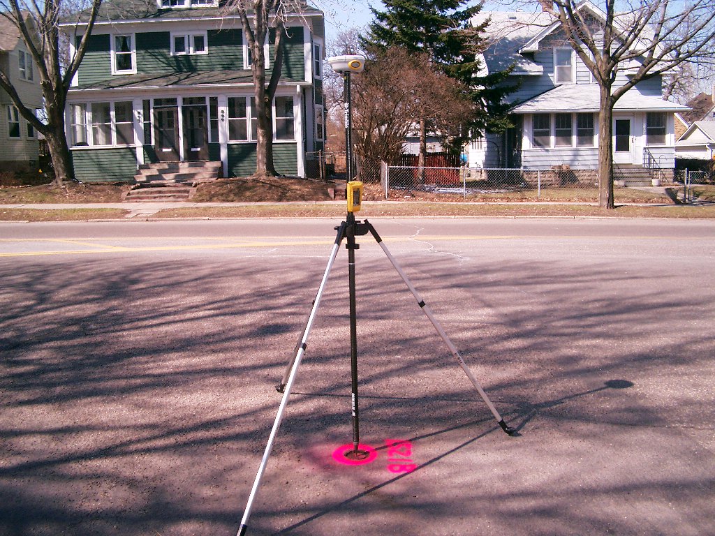
| 3/9/2009 | Position on CIM established by RTK-VRS GPS Elev 899.0 ft. |
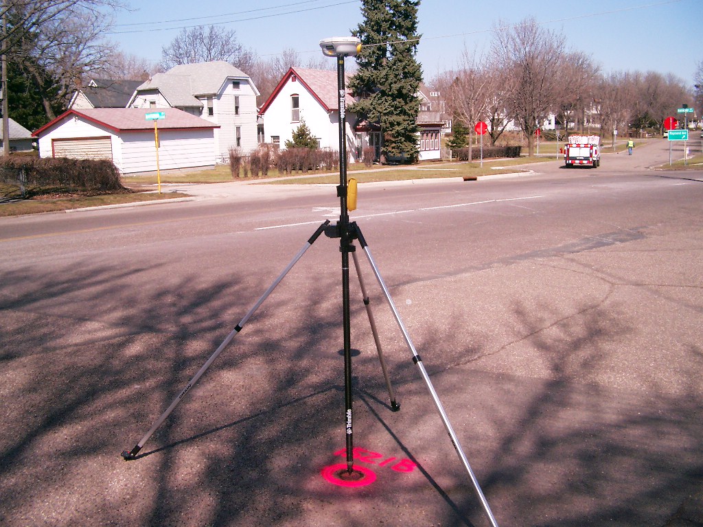
| 4/13/2007 | Position on CIM established by RTK-VRS GPS Elev 898.9 ft. |
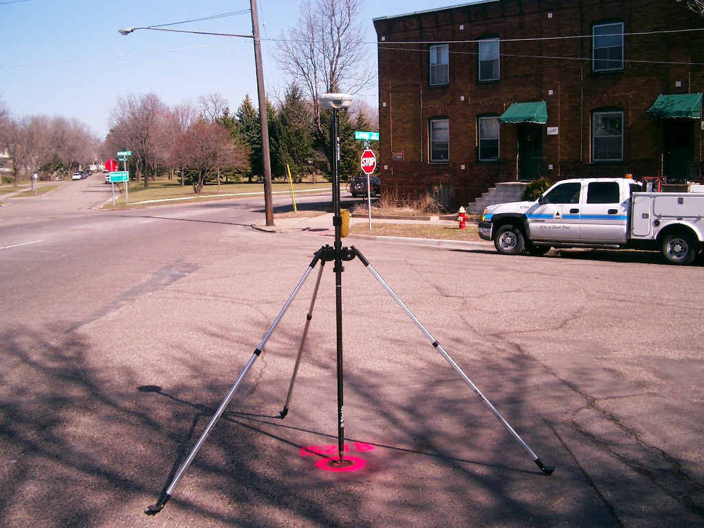
| 4/13/2007 | Fd CIM at grade. Photos taken. |
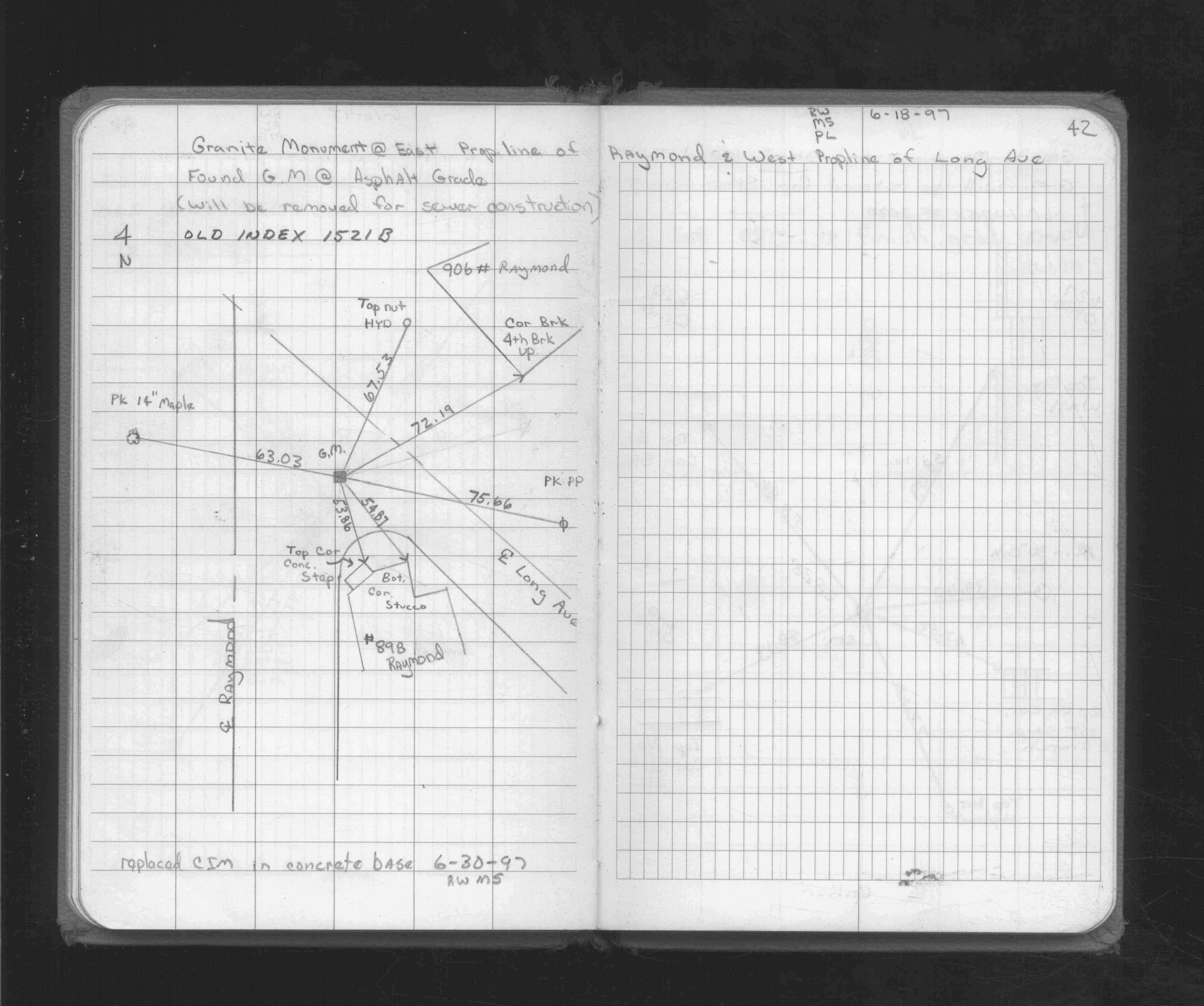
| 6/30/1997 | CIM set in concrete base See CofL 3847-1521B-A & See FB 1716 p.42 |
| 6/18/1997 | Placed ties on GM. GM will be removed for storm sewer construction. See FB 1716 p.42 |
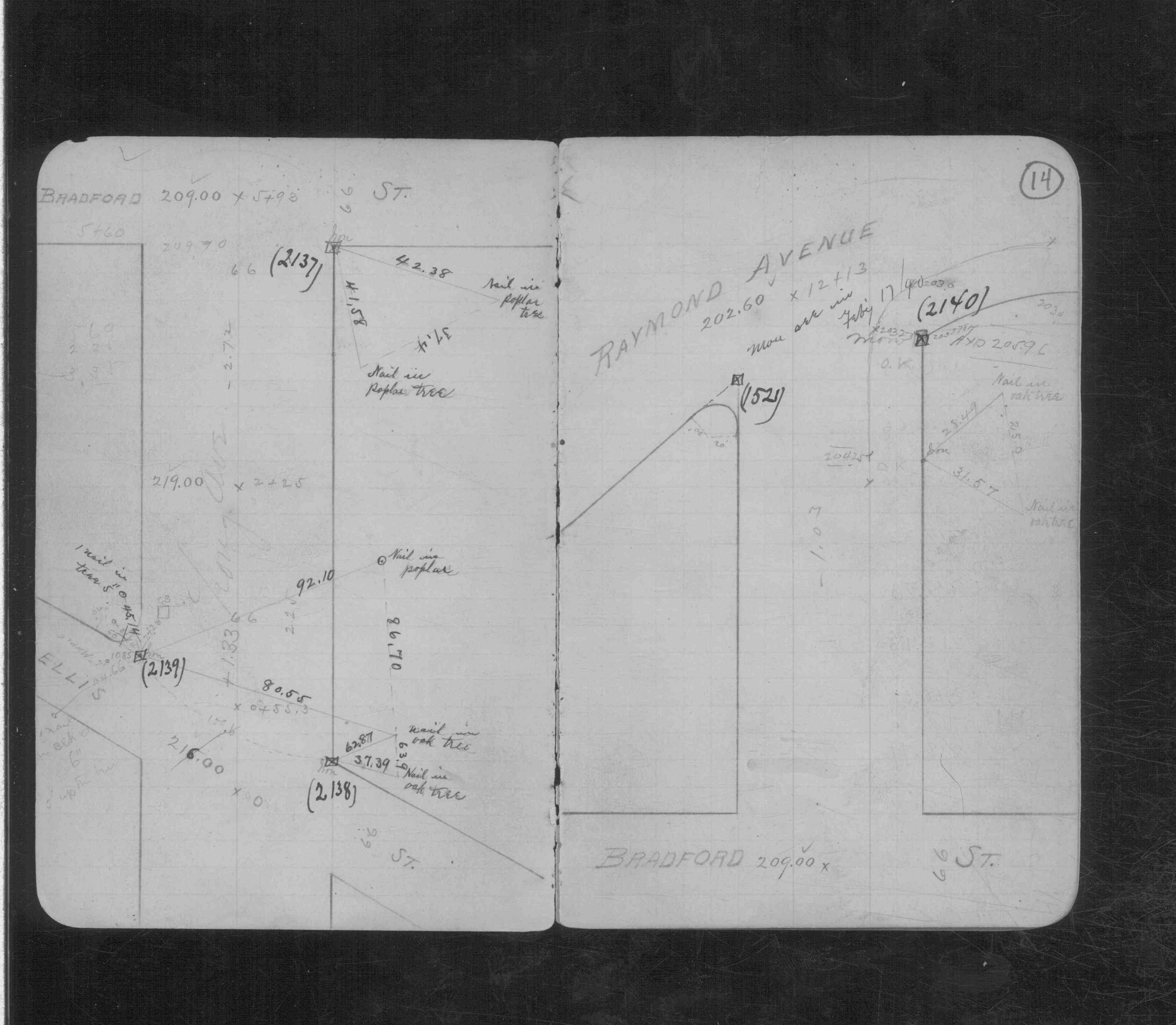
| 2/17/1890 | Monument reset by Chas Hunt See CS 844 p.14 |
| 2/19/1889 | Monument set at E line Raymond Ave & S line Long Ave by Chas Hunt |
Above is NOT an all inclusive history of this point. Please review all the links below.
| PLS NOTES | Field | Cross Section | Sewer | J.B. Irvine | Monument | River Survey |
|---|---|---|---|---|---|---|
| FB 1716p.42 | CS 0844p.14 |
| FILE | SURVEYOR | LIC. NO. | DATE SIGNED | DATE TIED |
|---|---|---|---|---|
| 3847-1521B-A.pdf | Samuel D. Gibson | 44880 | October 9, 2009 | March 23, 2009 |
| 3847-1521B-A.tif | David D. Claypool | 13298 | October 10, 1997 | June 30, 1997 |
| FILE | PHOTO DATE | COMMENTS |
|---|---|---|
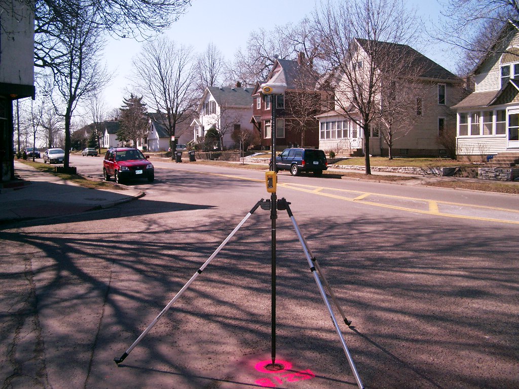
| 3847-1521B-8.jpg | April 13, 2007 | Looking Northwest across Raymond Ave. at Raymond Pl. & Bayless Ave. |
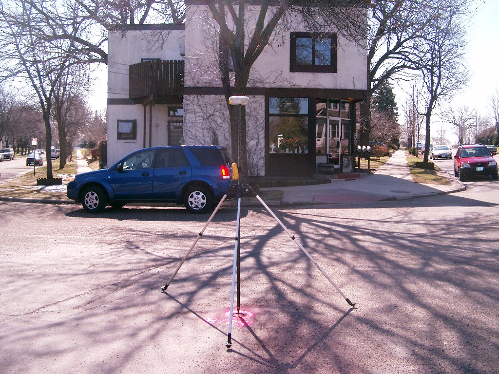
| 3847-1521B-7.jpg | April 13, 2007 | Looking Southwest across Raymond Ave. |
| 3847-1521B-6.jpg | April 13, 2007 | Looking South at Raymond Ave. |
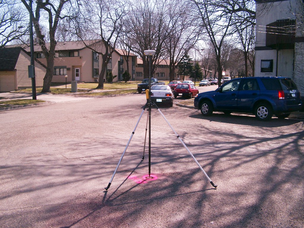
| 3847-1521B-5.jpg | April 13, 2007 | Looking Southeast at block bounded by Long and Raymond. |
| 3847-1521B-4.jpg | April 13, 2007 | Looking Southeast down Long Ave. |
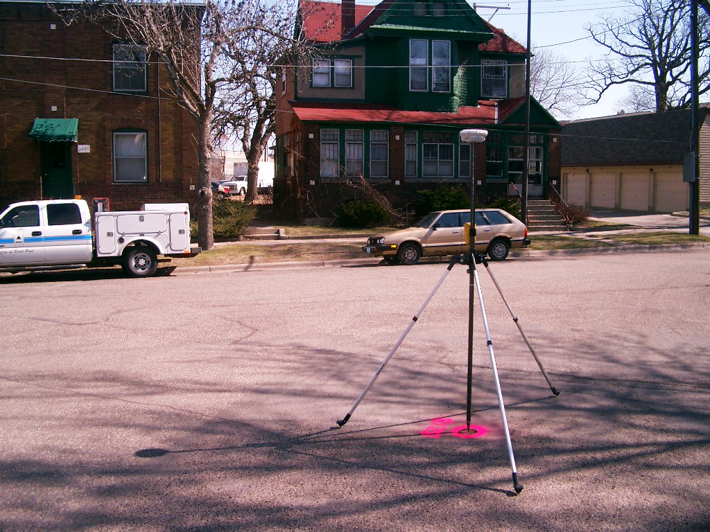
| 3847-1521B-3.jpg | April 13, 2007 | Looking Northeast across Long Ave. |
| 3847-1521B-2.jpg | April 13, 2007 | Looking North across Raymond Ave., along center of Bayless Ave. |
| 3847-1521B-1.jpg | April 13, 2007 | Close-up of CIM at street grade. |